Afghanistan (Summer
1970)
![]()
Return to my
mountaineering-trekking-travel page
[Page created in July 2015, revised in June
2020.]
In the summer of 1970, I traveled
to Afghanistan with one of my brothers and a friend. We drove through part of
Europe, then Turkey,
Iran,
and Pakistan.
We entered
Our car, a Renault 4L,
made the long roundtrip without any serious mechanical problems, despite many
bad roads and intense heat especially in the southern part of Iran.
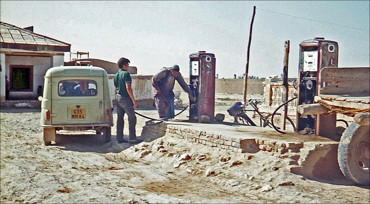
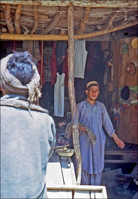
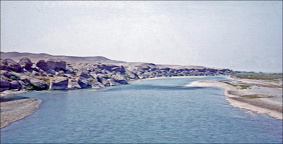
Between Khyber Pass and Kabul:
Left:
artificial lake on the Kabul river near Surobi. Right: shop along the road.
|
|
|
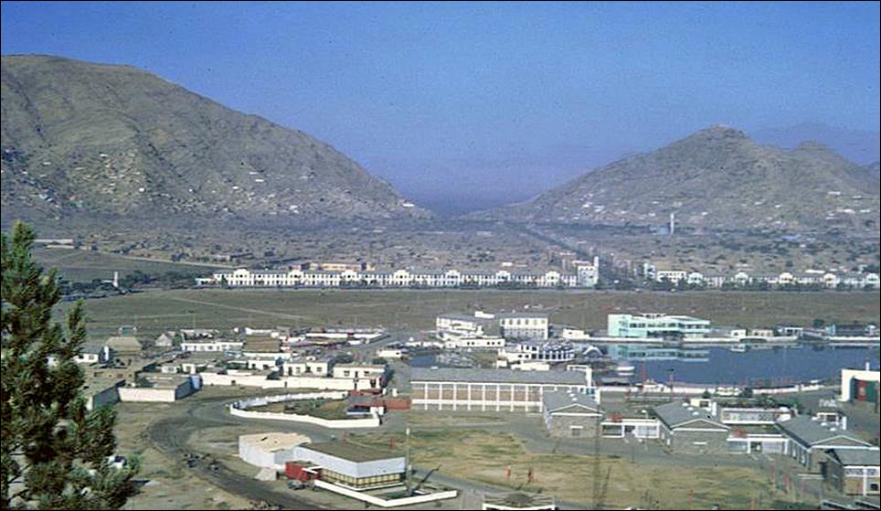
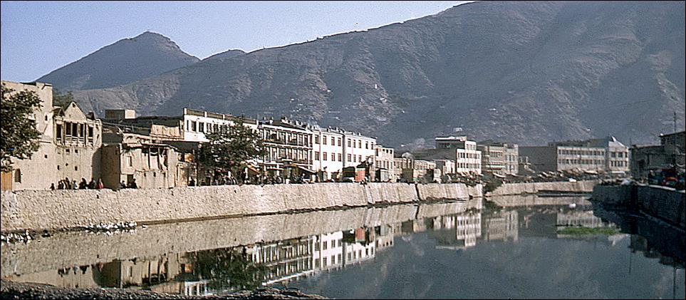
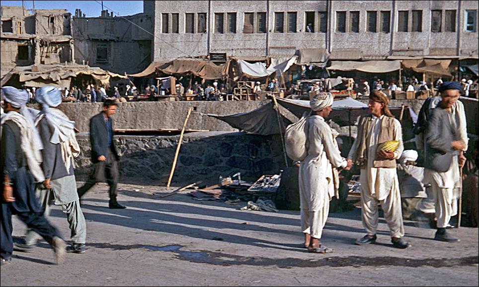
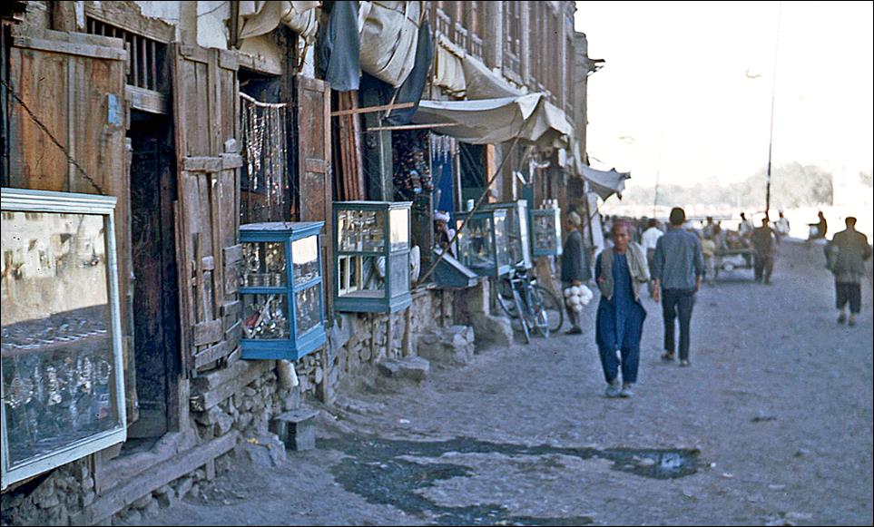
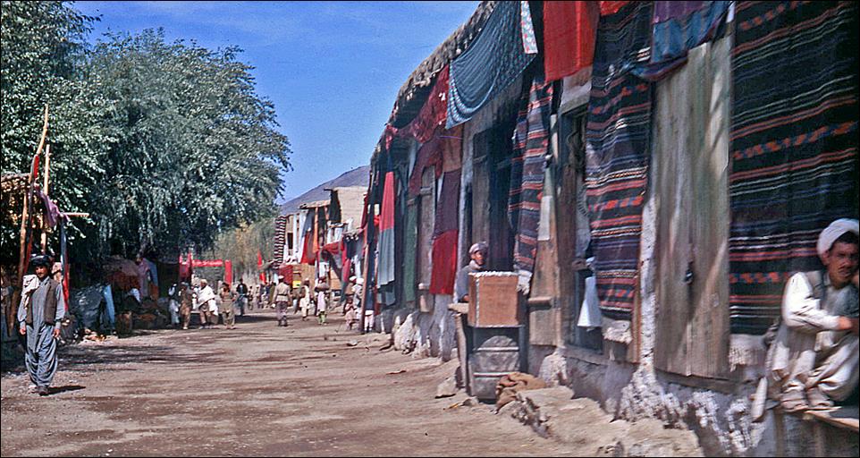
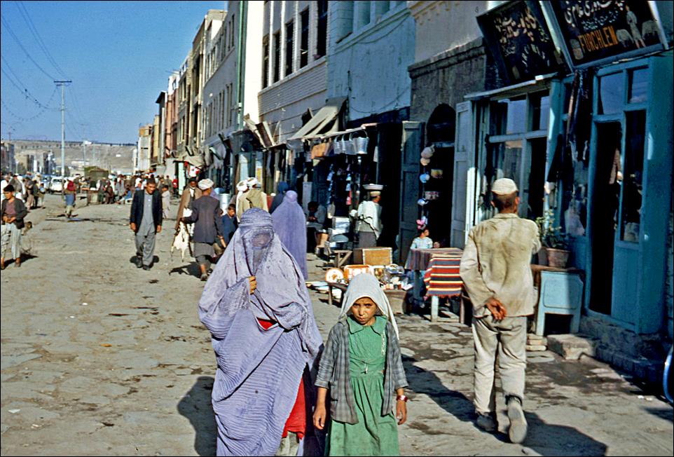
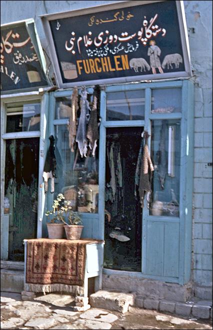
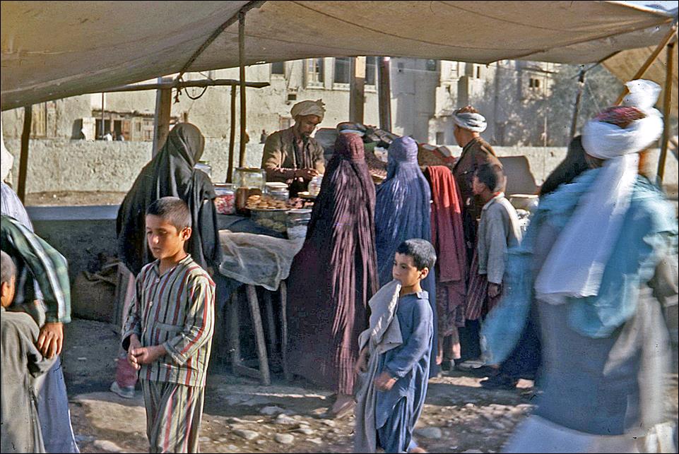
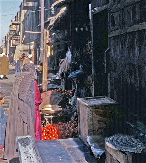
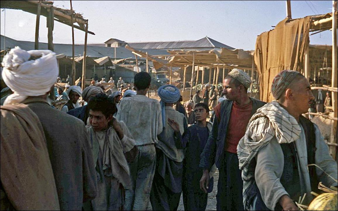
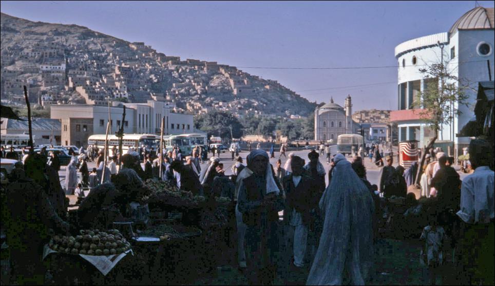
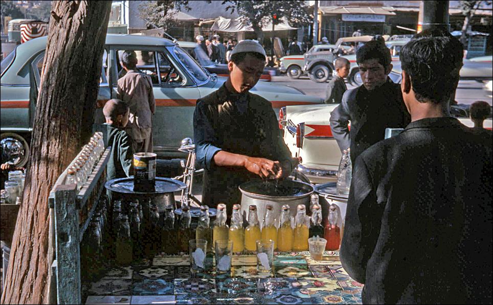
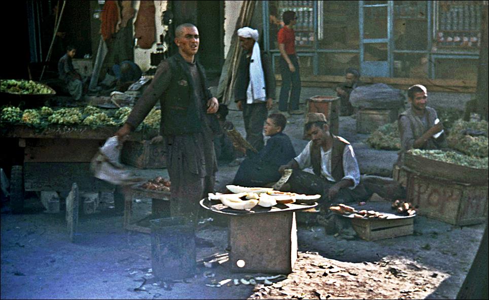
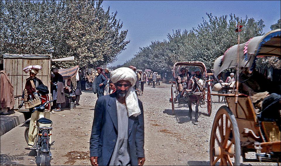
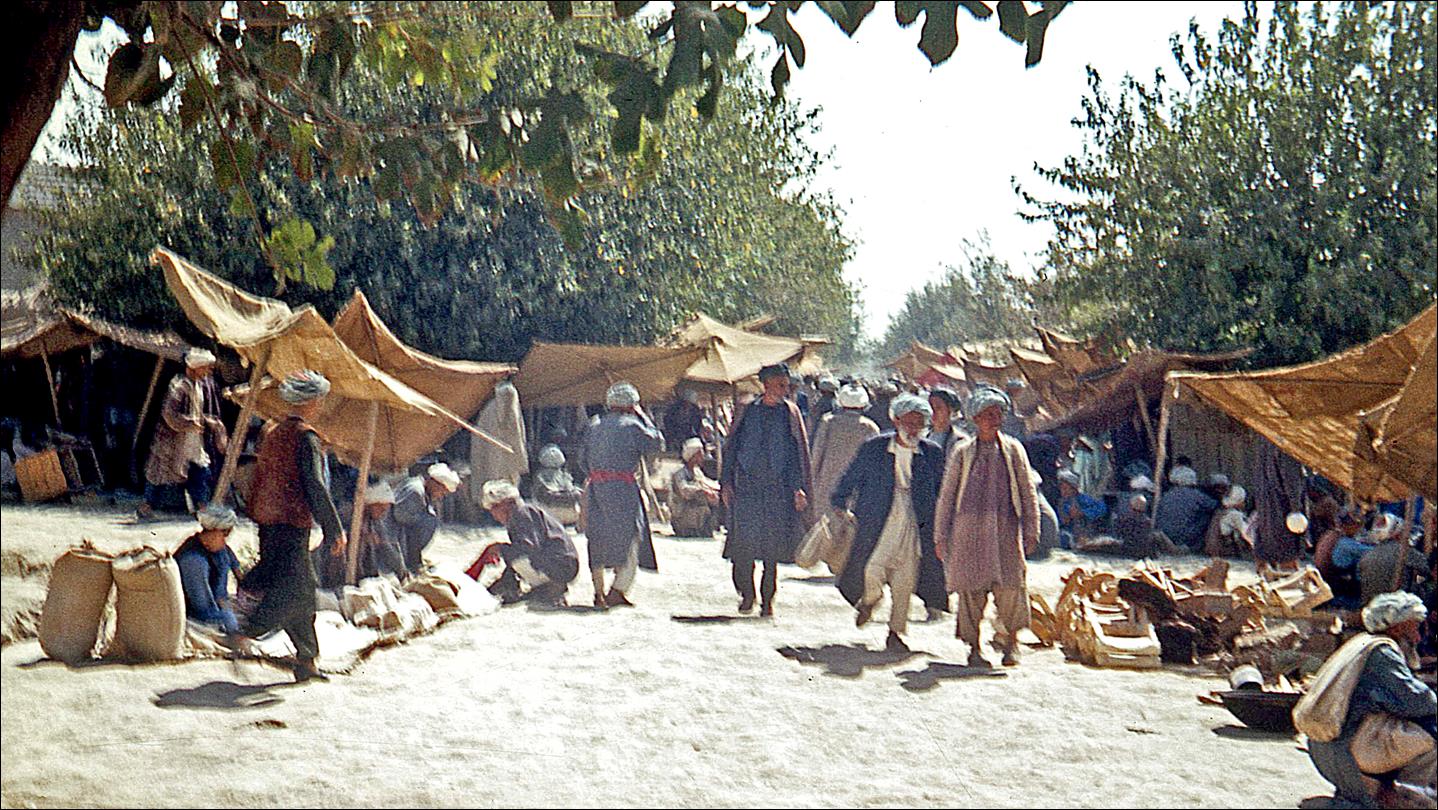
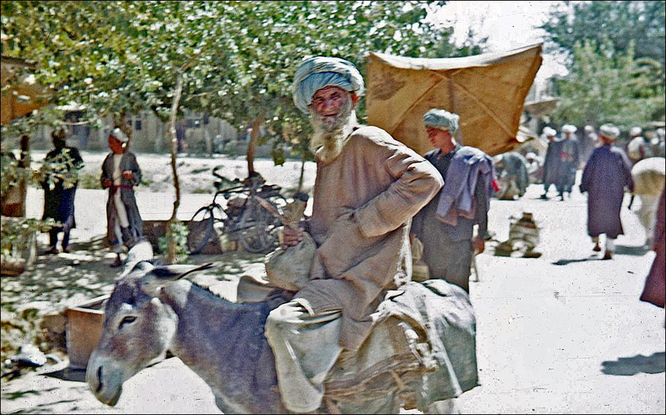
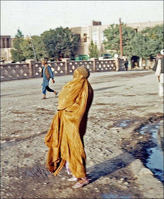
Kabul:
General view.
Kabul river.
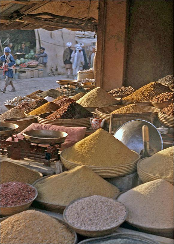
Street and market scenes.
|
|
|
|
|
|
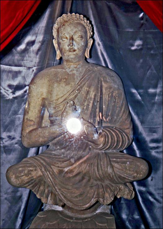
Buddha statue in the
National Museum.
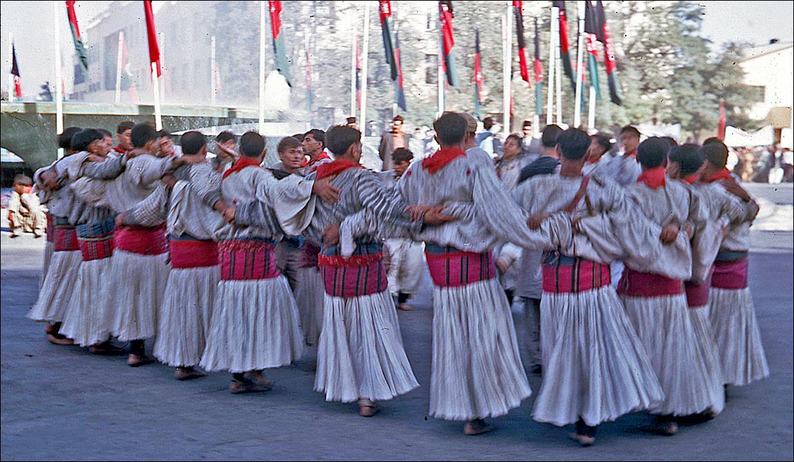
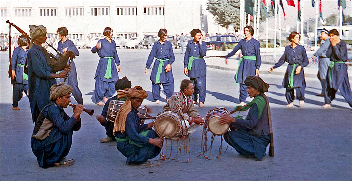
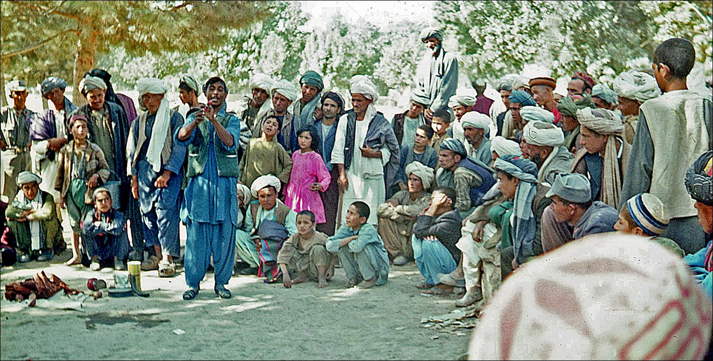
Celebration of Afghan
Independence Day commemorating the Anglo-Afghan Treaty of 1919 ending the
British protectorate.
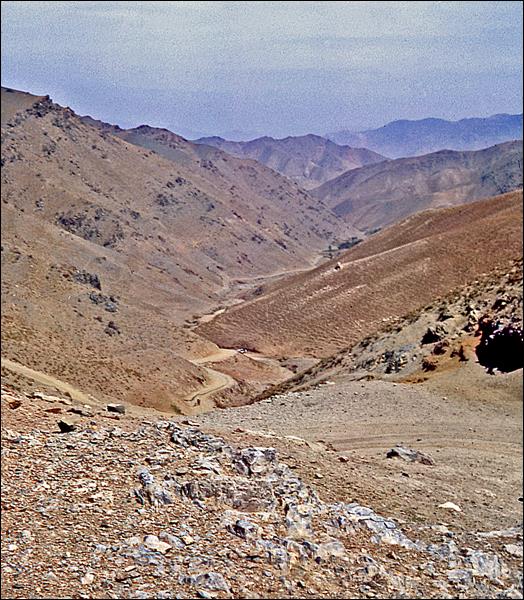
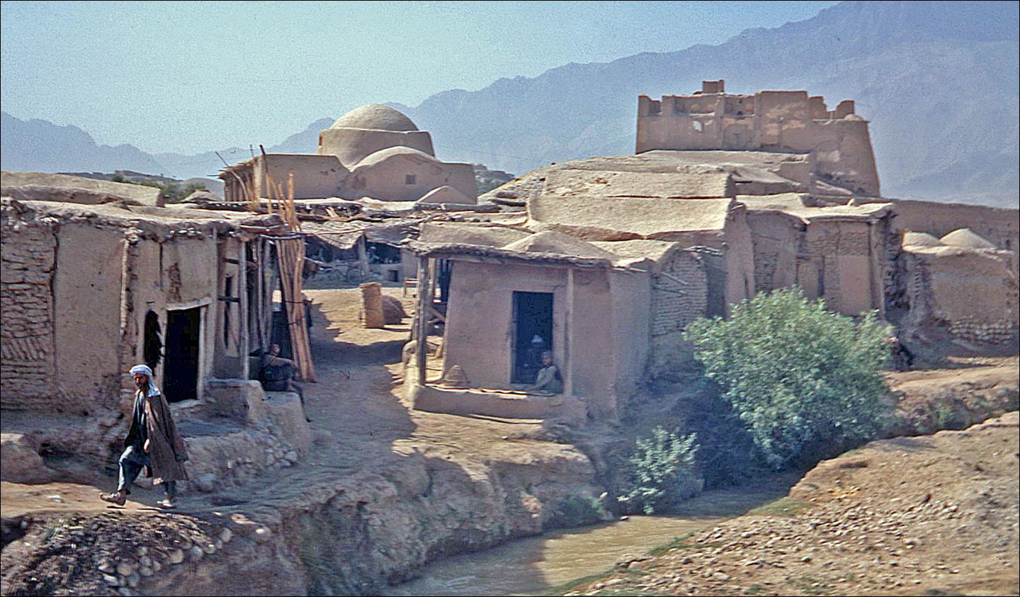
Between Kabul and Bamiyan:
The road from Kabul to Bamiyan crosses two high passes, Unai
(3300m) and Hajigak (3700m), which give access to Hazarajat, the home of the Hazara
people, whose ′′capital′′ is Bamiyan.
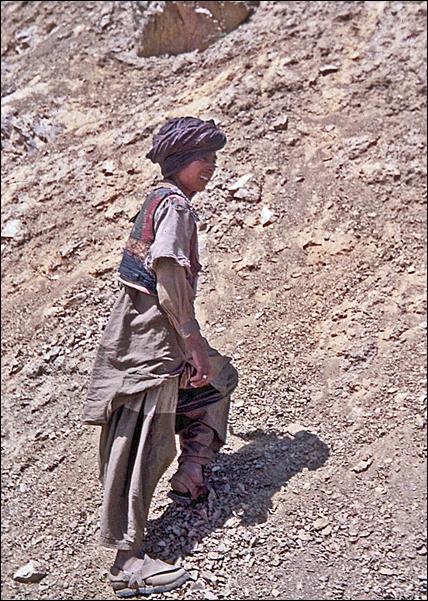
Left: view of the road
near the passes. Right: local boy.
|
|
|
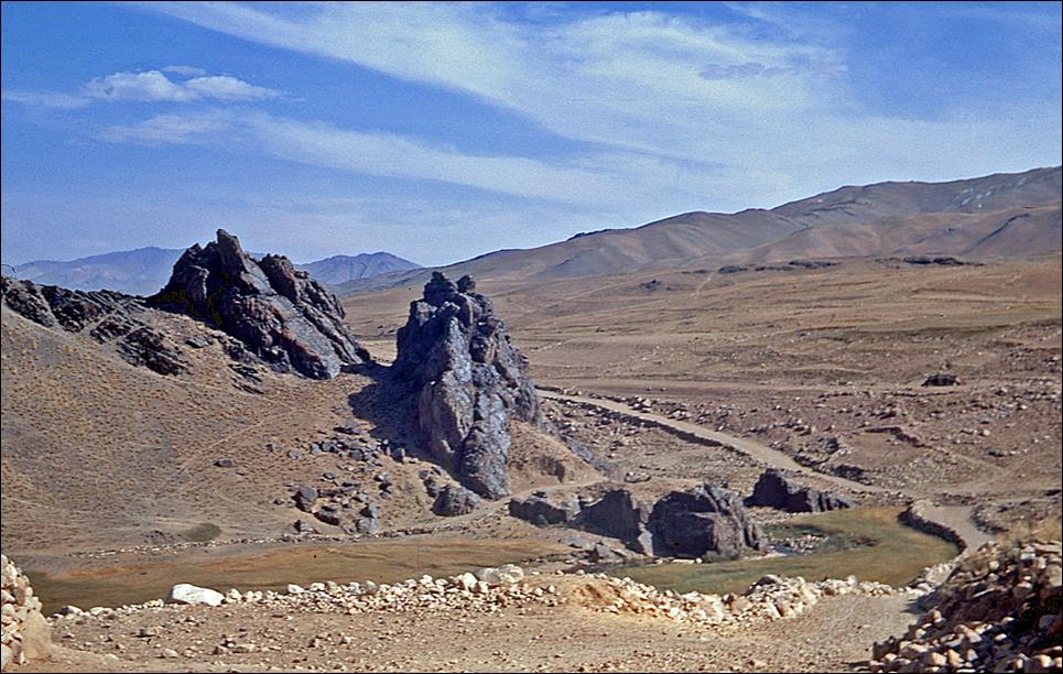
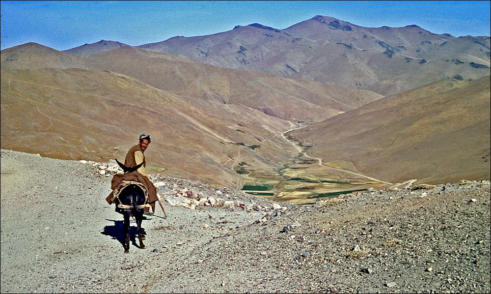
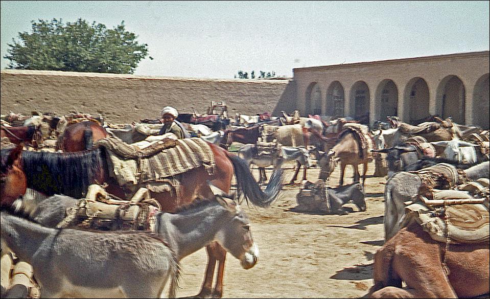
Other views of the road
near the passes.

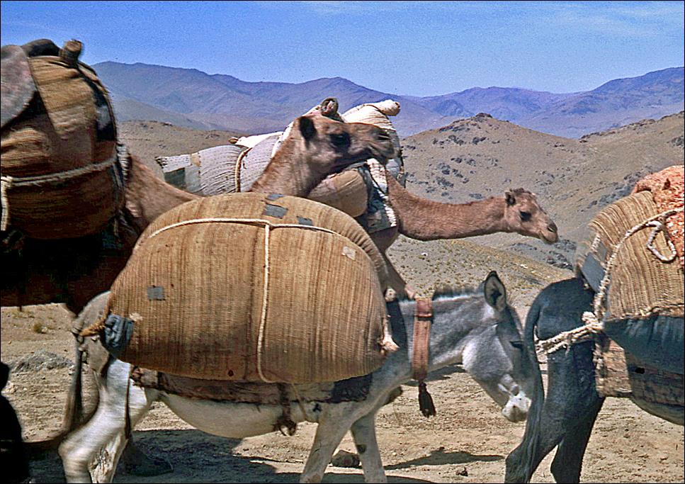
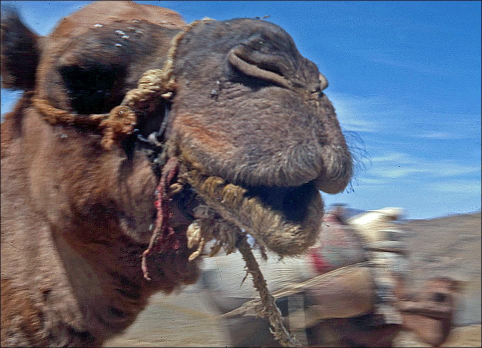
Camels and donkeys in a
caravan of traders.
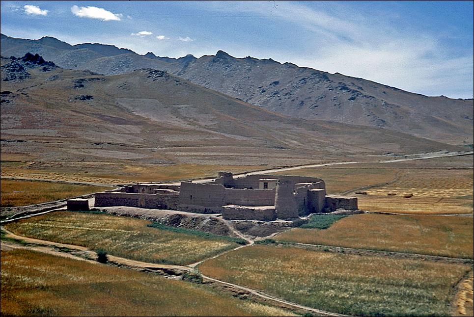
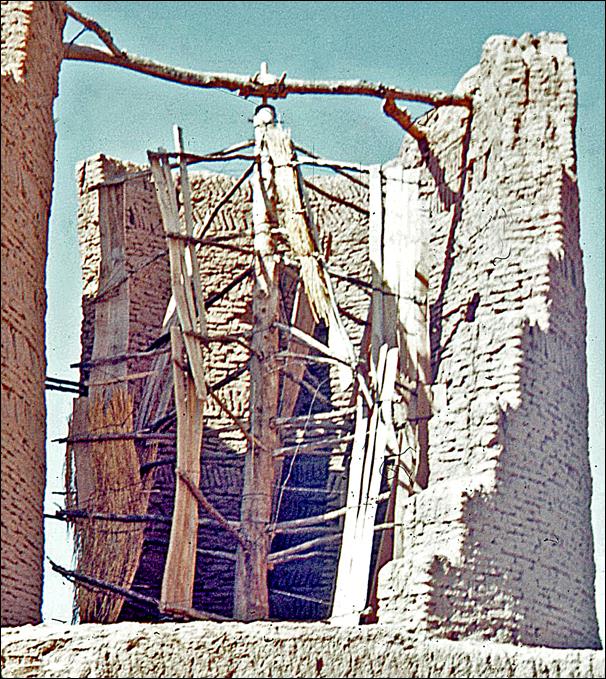
Fortified farm.
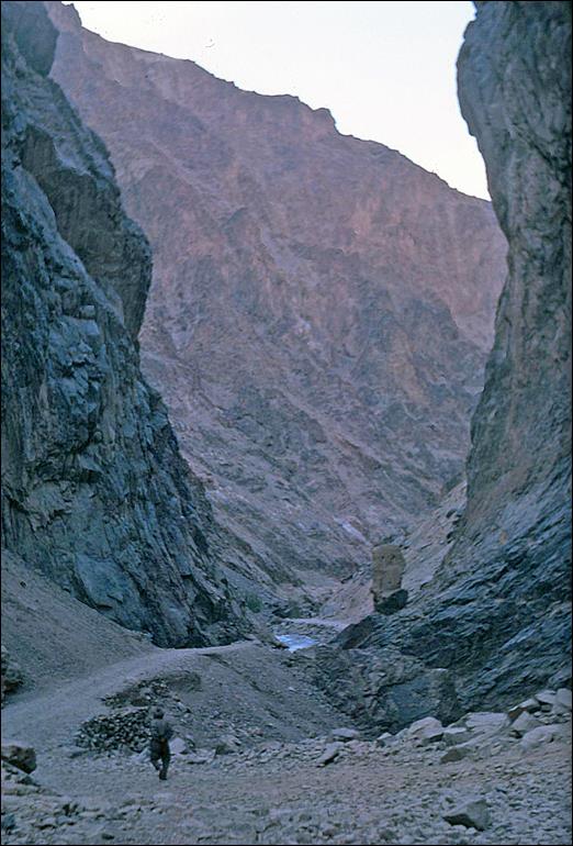
Deep narrow gorge beyond
the two passes.
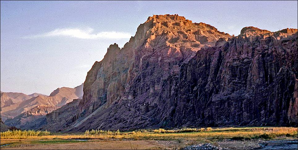
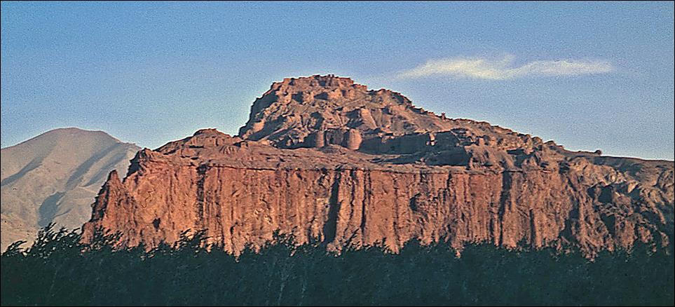
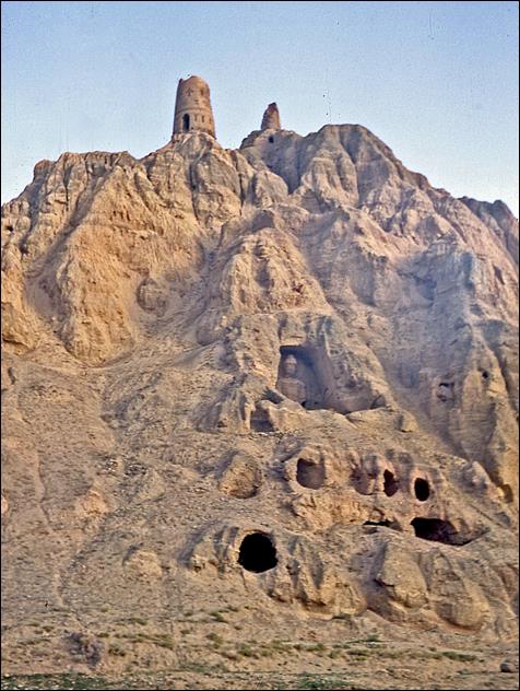
Shahr-e Zuhak,
also called Zuhak City or the Red City. Despite the poor
quality of the photos, walls and turrets of this old fortified city are visible
at the top of the red bluff. Overlooking the junction of the Bamiyan, Hajigak, and Shikari rivers, 15km east of Bamiyan,
this city guarded the eastern entrance of the Bamiyan
valley. It was destroyed by Genghis Khan in 1221.
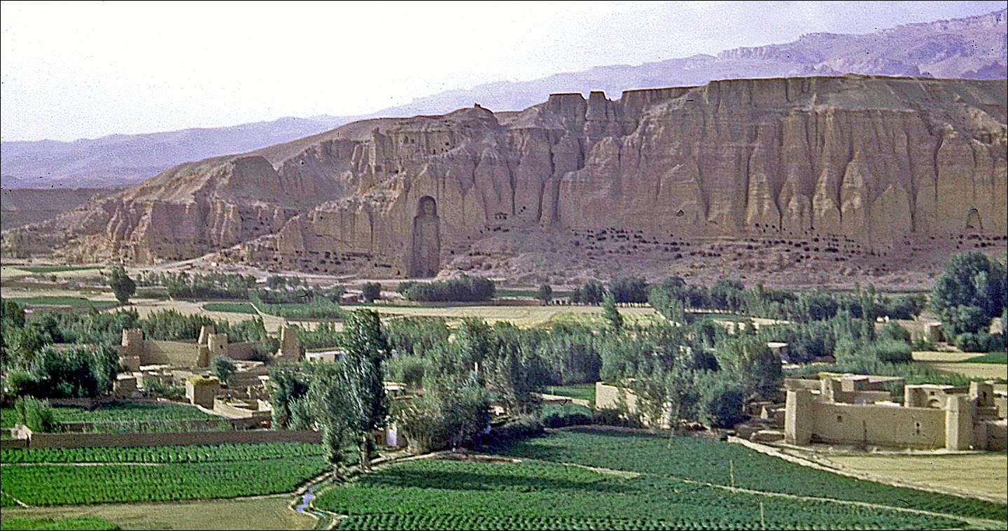
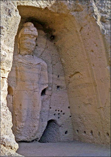
Bamiyan valley and around:
View of the valley, the heart
Hazarajat. The sandstone cliff in the background was
home to large Buddha statues carved in the 6th century before Islam had reached
this region. They were destroyed by the Talibans in
March 2001. (Note the fortified farms on the left and right of the photos.)
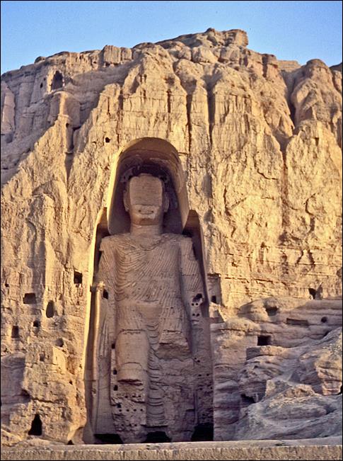
Left and center: the
tallest Buddha statue (53m). Right: a smaller statue.
|
|
|
|
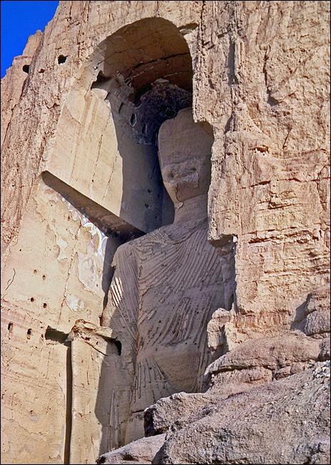
′′I had always expected I would
see our Buddha again. But the storm of ignorance that has been raging in
Afghanistan for so many decades smashed him into bits before I could return. I
once lived inside his head. Now he lives in mine.′′
From ′A Fort of Nine Towers′,
by Qais Akbar Omar.
The tall statue seen from
its base.
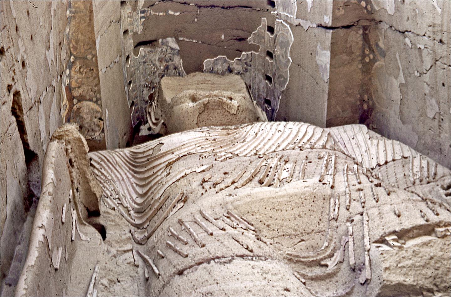
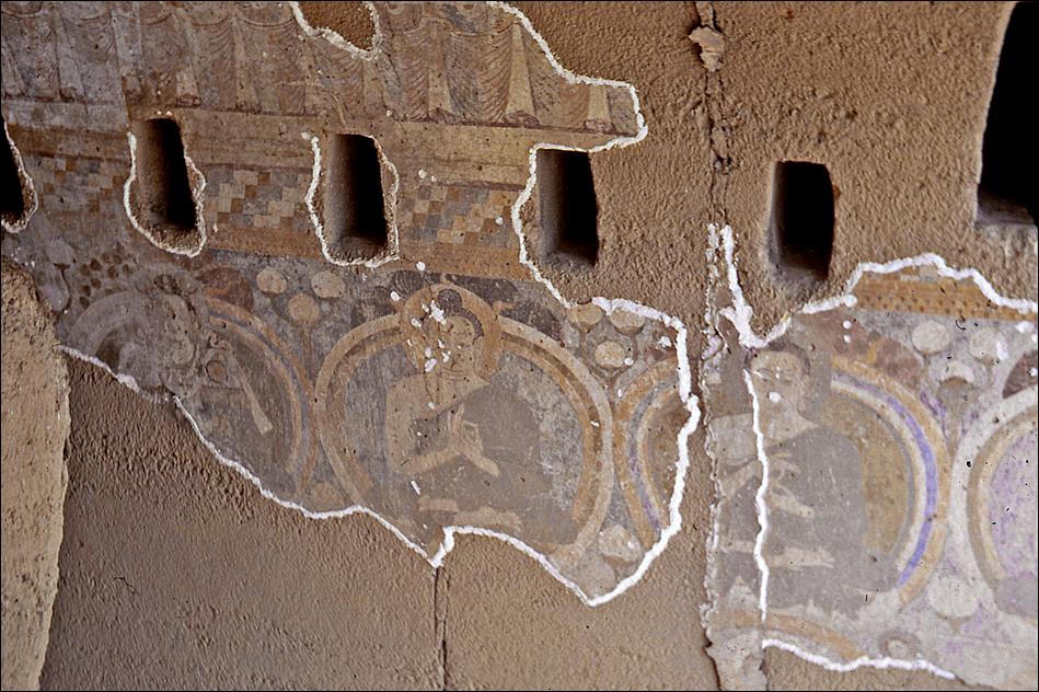
Left: frescos on the vault
above the statue′s head. Right: smaller Buddha statue in a cave.
|
|
|
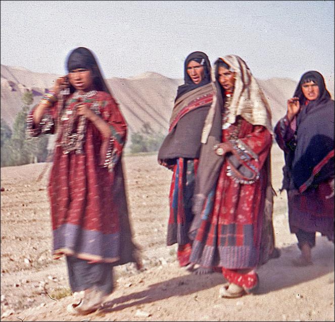
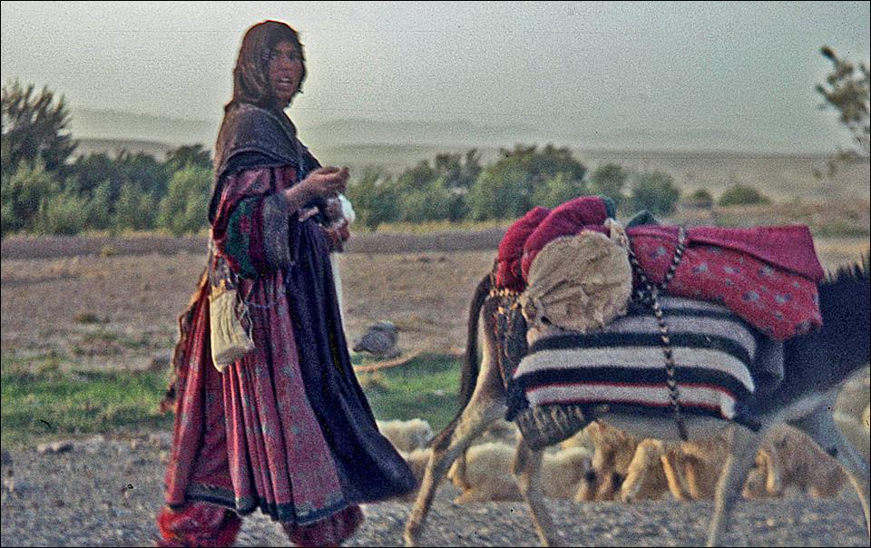
Hazara women.
|
|
|
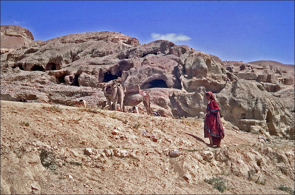
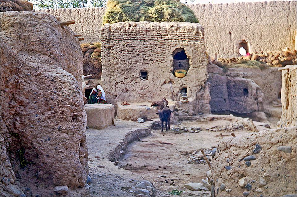
In
a fortified farm.
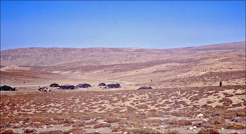
Nomad camp between Bamiyan and the Bandi-Amir lakes.
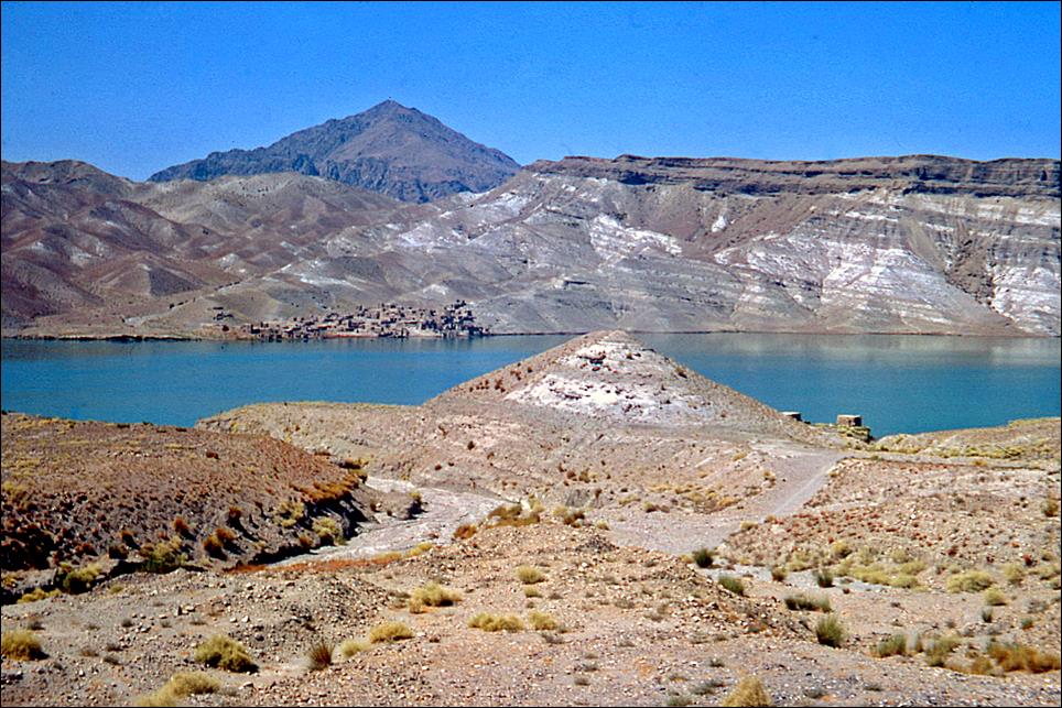
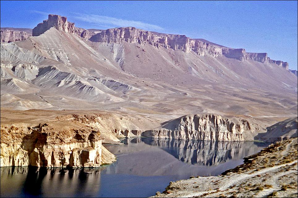
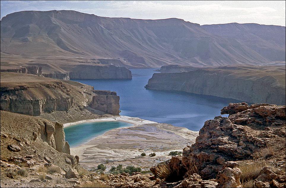
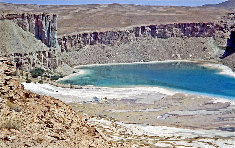
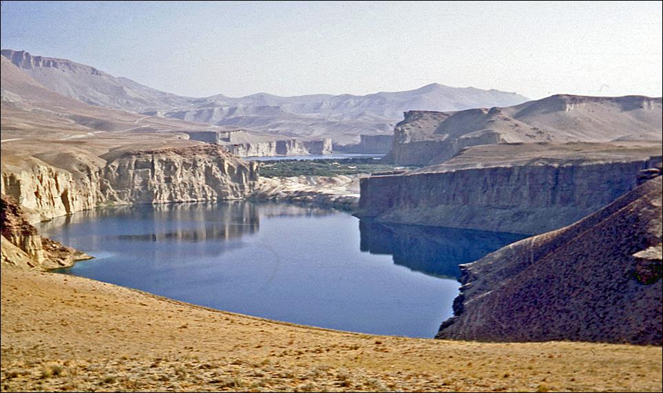
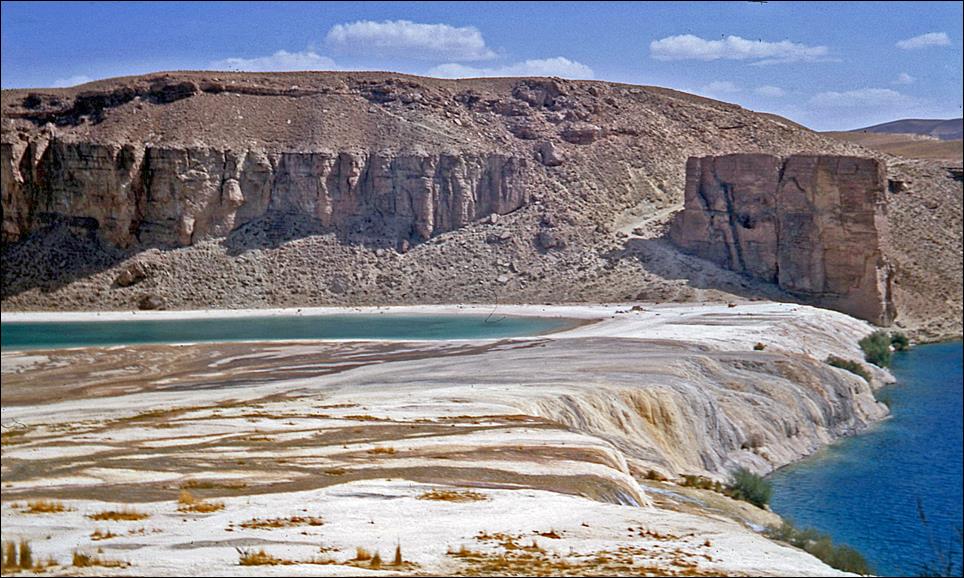
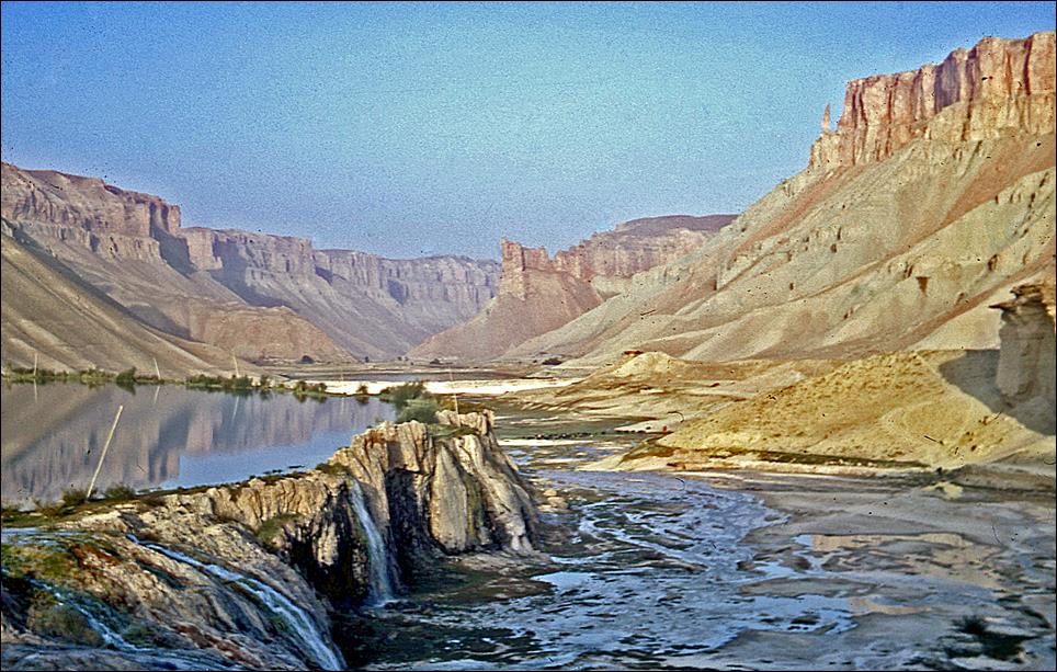
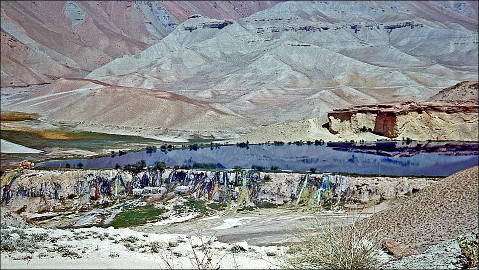
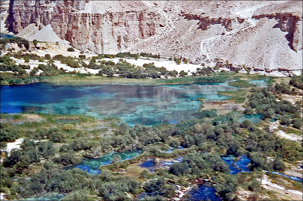
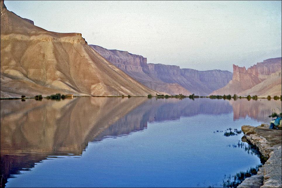
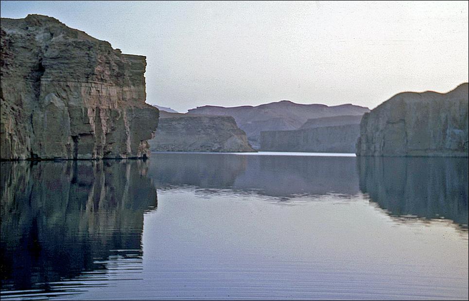
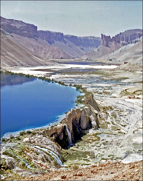
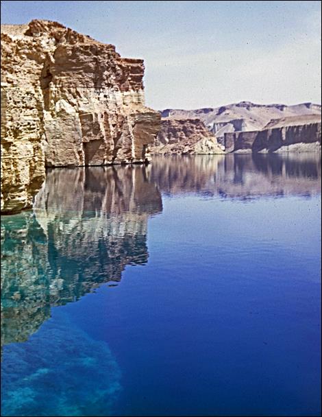
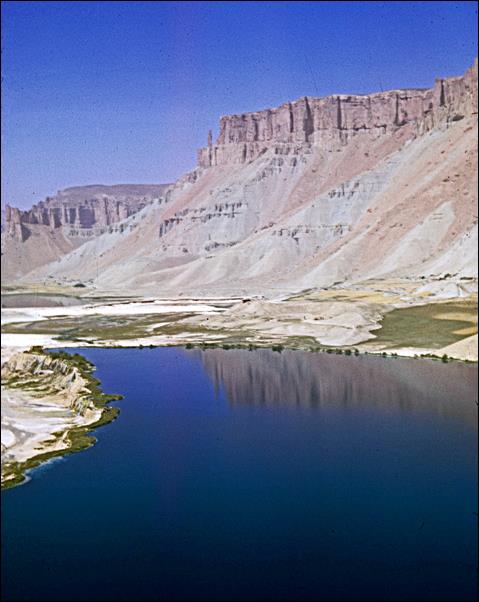
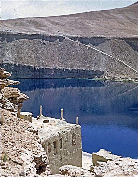
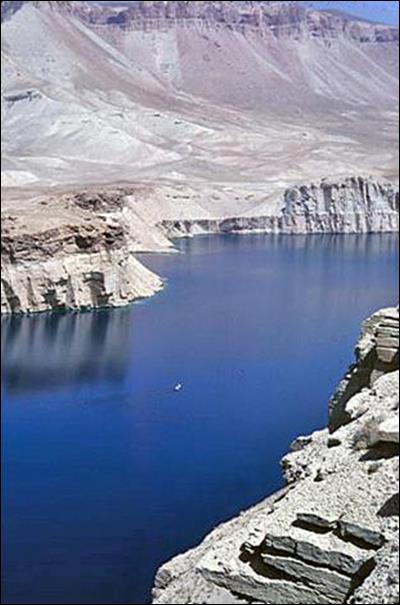
Bandi-Amir lakes:
These six awesome lakes
are located some 55km west of Bamiyan at an elevation
of 3000m. Surrounded by vertical cliffs and barren desert, they form one of the
most stunning landscapes in the world.
|
|
|
|
|
|
|
Balkh province:
This
province is located in the north of Afghanistan and shares borders with
Turkmenistan, Uzbekistan, and Tajikistan (all of them Republics of the Soviet
Union in 1970). It is named after the village of Balkh, which used to be the capital of the ancient
Central Asian region of Bactria and is said to have been visited by Alexander
the Great. The village of Balkh is located 22km west of the
present-day province′s capital, Mazar-i-Sharif.
Tashkurgan, a particularly
picturesque ancient caravan city, located 50+km east of Mazar-i-Sharif.
|
|
|
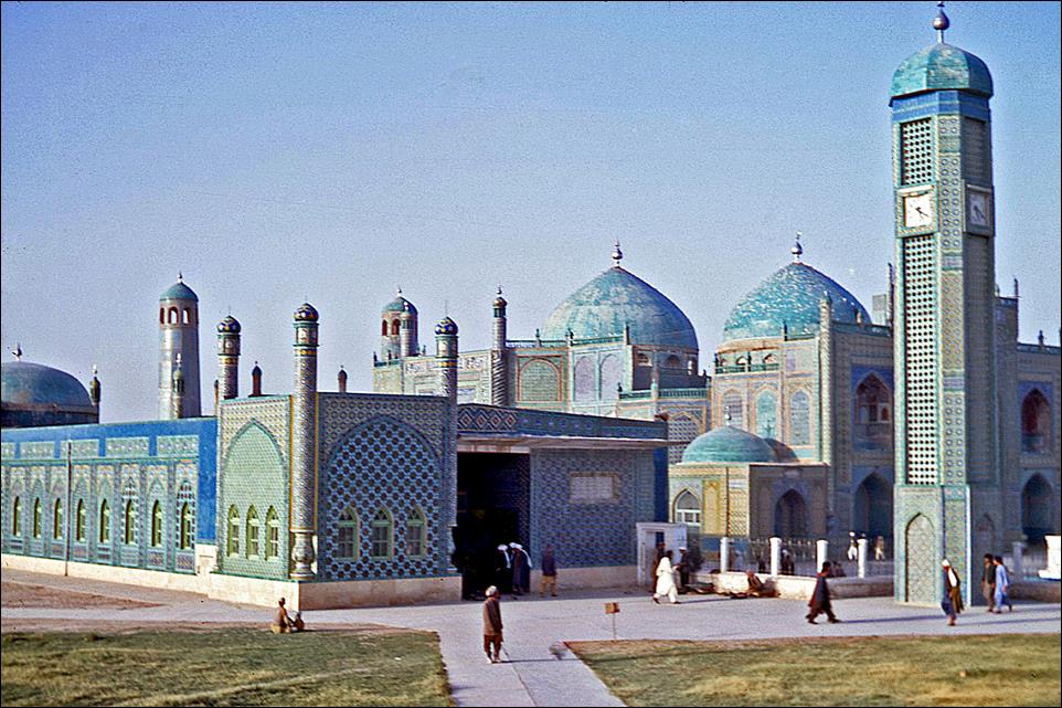
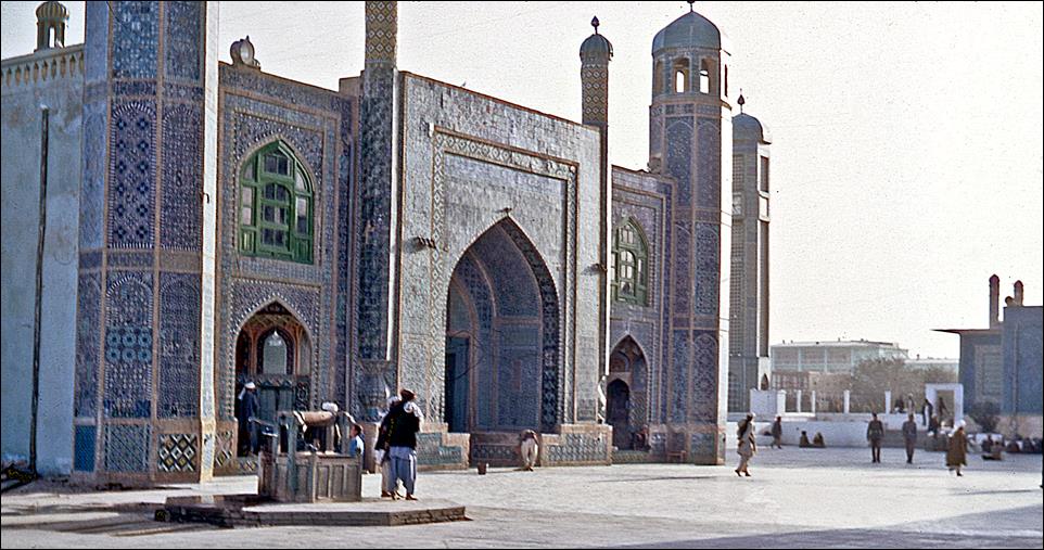
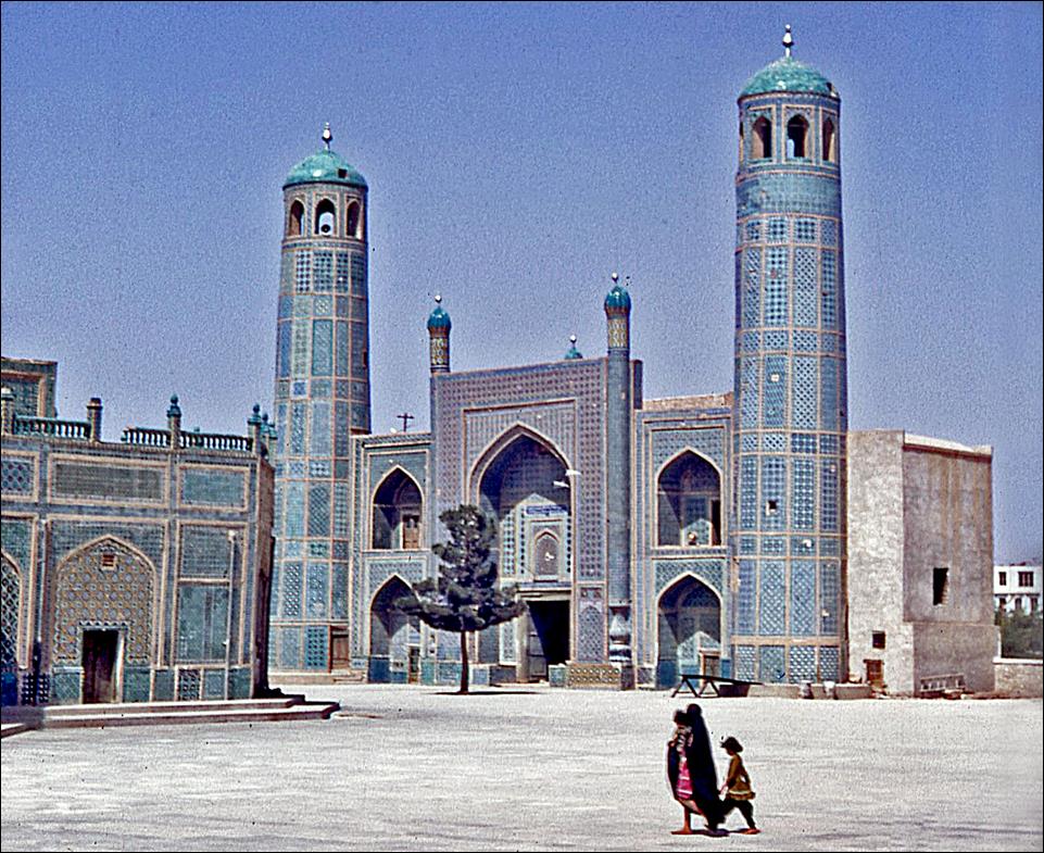
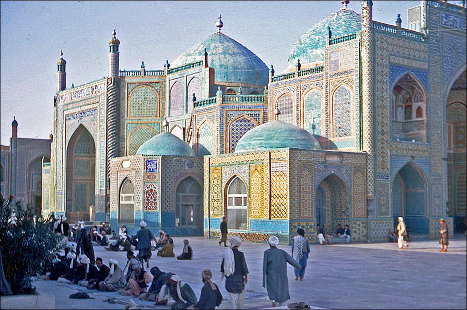
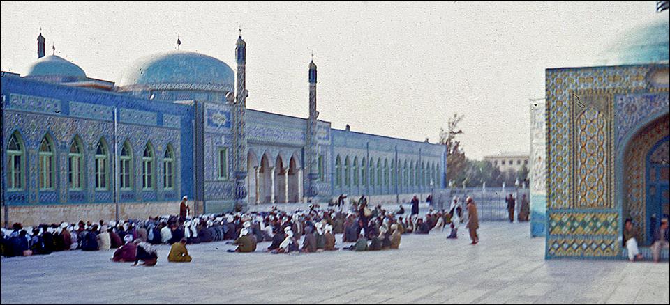
Blue
Mosque, also known as the Shrine of Hazrat Ali, in Mazar-i-Sharif. It was built in the 15th century on the site of a
previous shrine that had been destroyed by Genghis Khan around 1220. Each year,
it attracts pilgrims celebrating Nowruz, the Persian New Year. (About half of
the population of Mazar-i-Sharif
consists of ethnic Tajiks, who speak a variation of Persian language.)
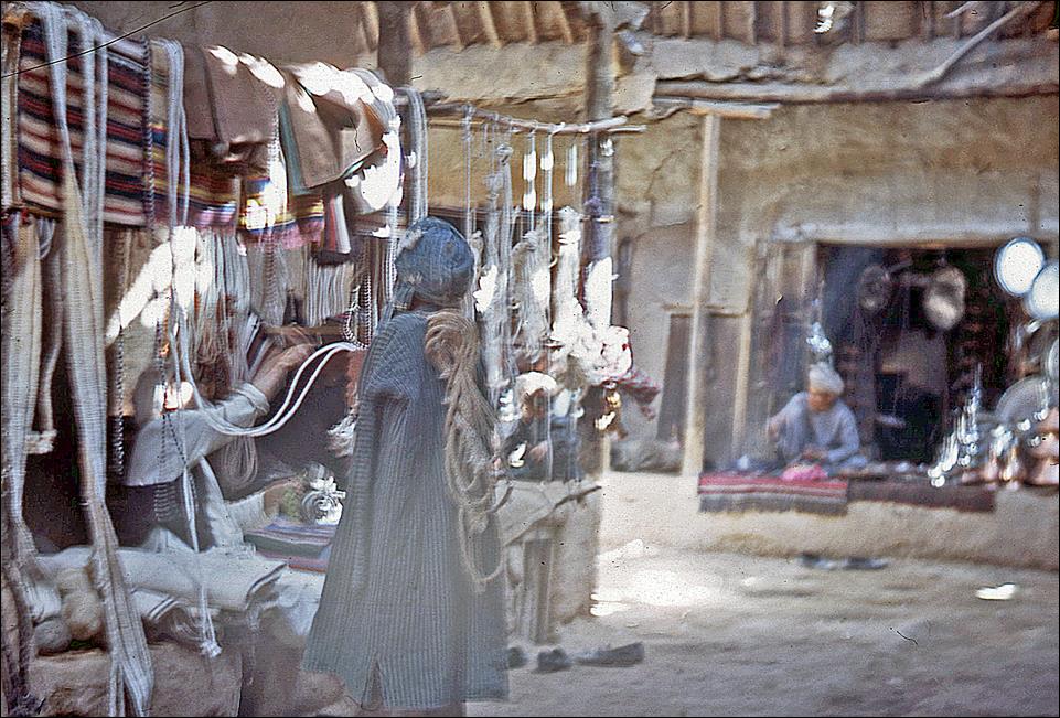
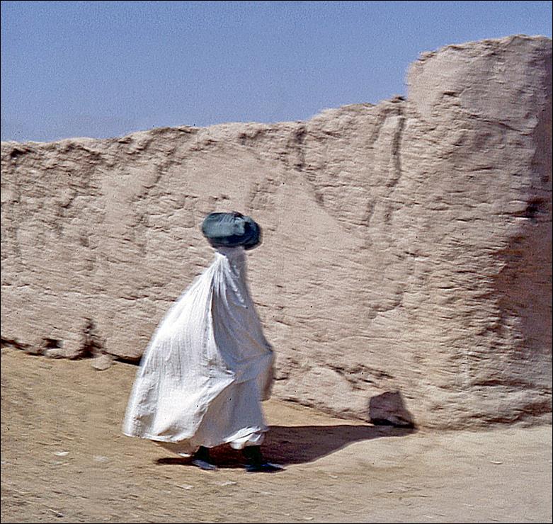
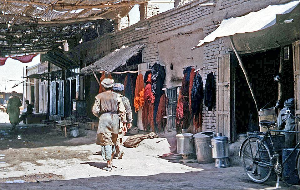
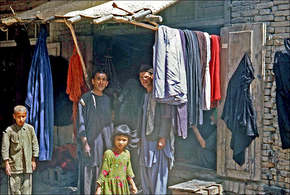
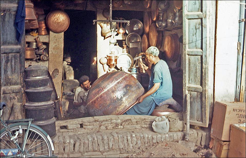
Streets and shops in Mazar-i-Sharif.
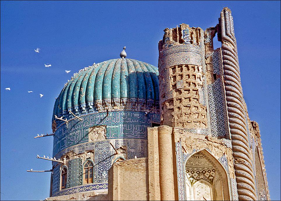
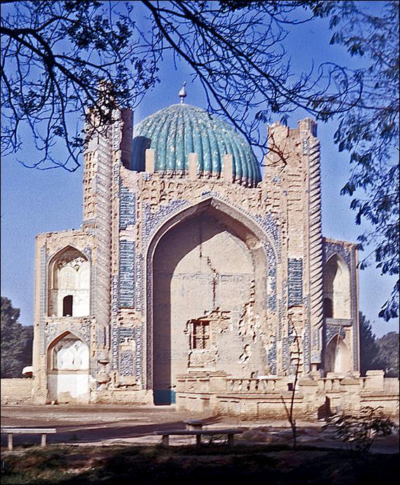
Shrine of Khwaja Abu Nasr-i-Parsa in Balkh. Abu Nasr-i-Parsa was a spiritual leader of
a branch of Sufism in the 15th century. Balkh is also the birthplace of Jalal
ad-Din Mohammad Balkhi (1207-1273), now better known
as Mevlana (″Our Master″) or
Rumi, who founded the whirling dervish sect that flourished in Konya, Turkey
(see here).
|
|
|
Scenes and landscapes along
the southern road from Kabul to Herat:
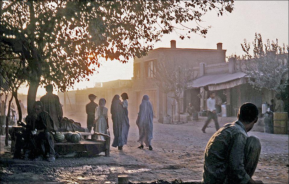
Herat:
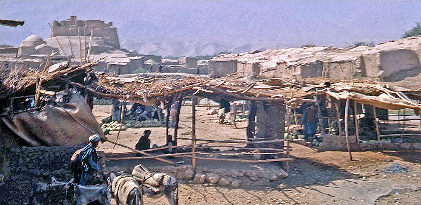
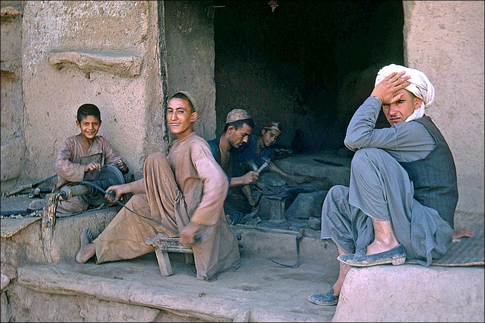
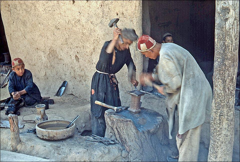
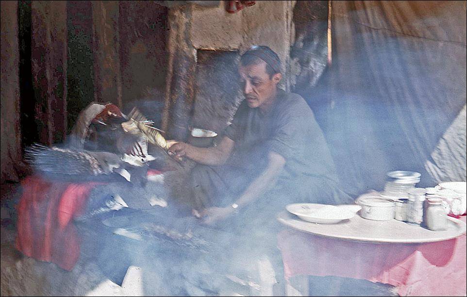
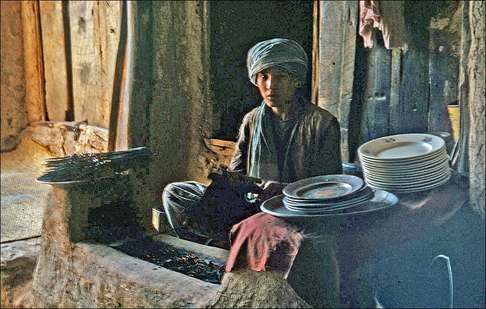
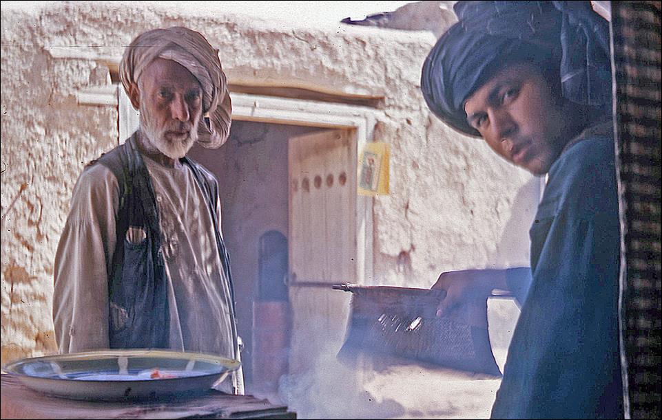
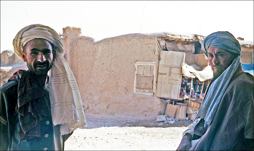
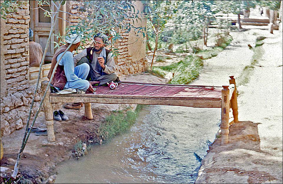
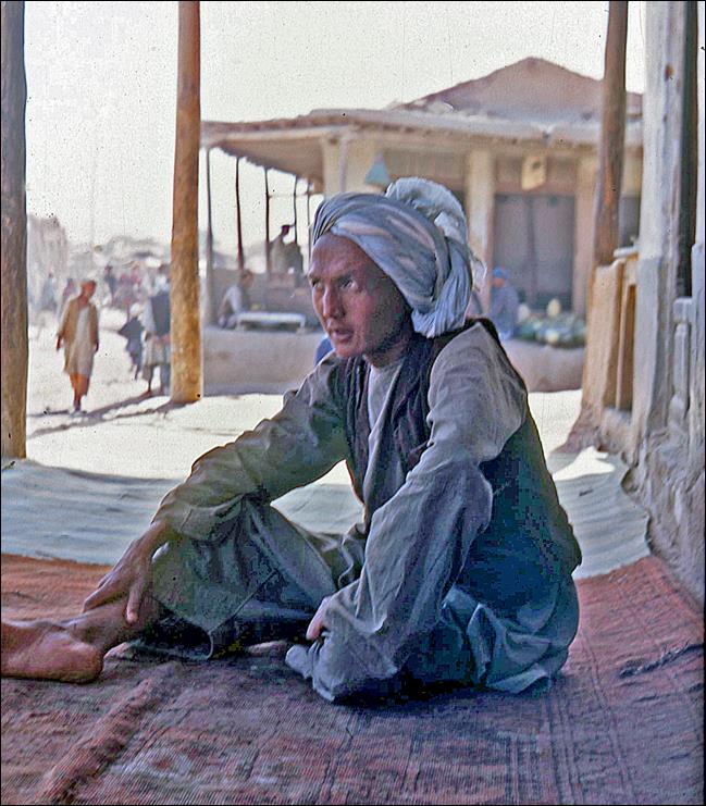
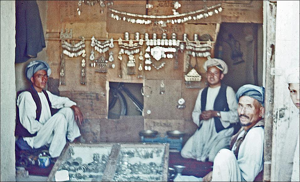
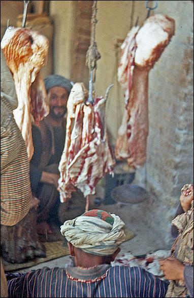
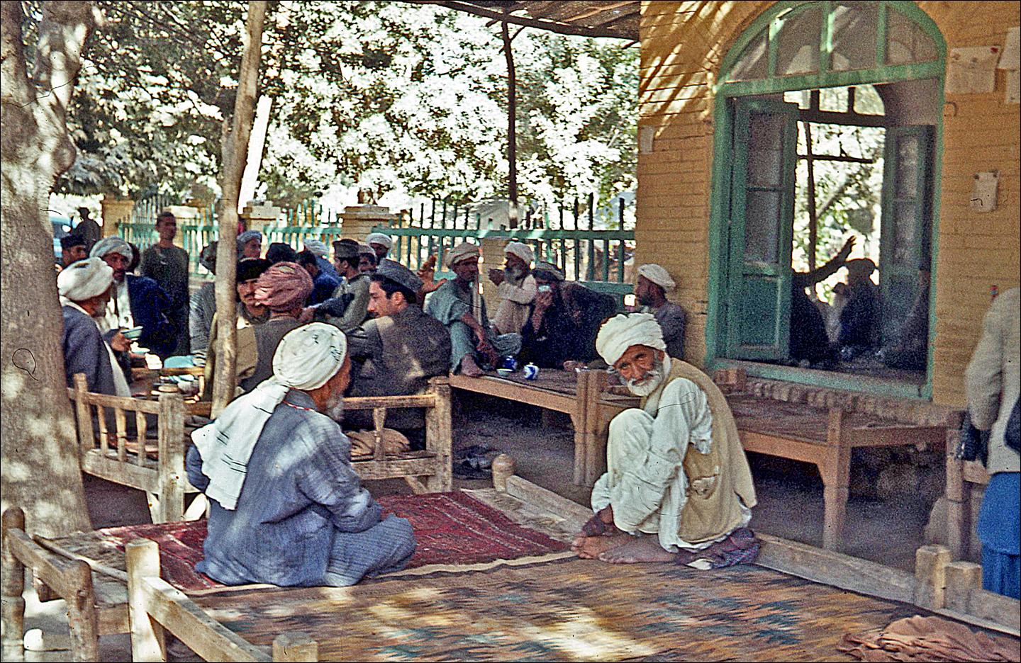
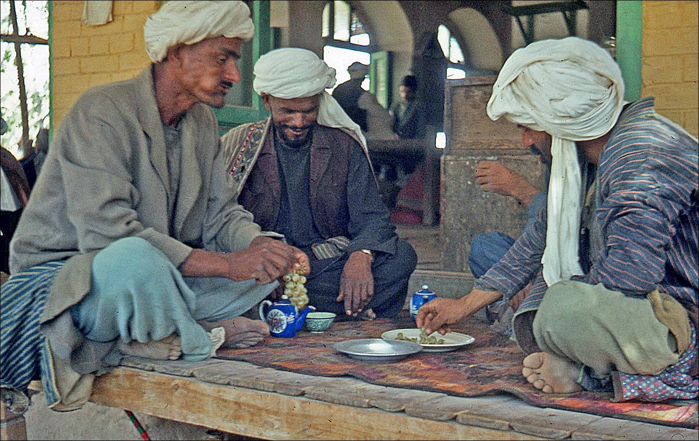
City life: people, streets, markets, shops, and tea-houses.

|
|
|
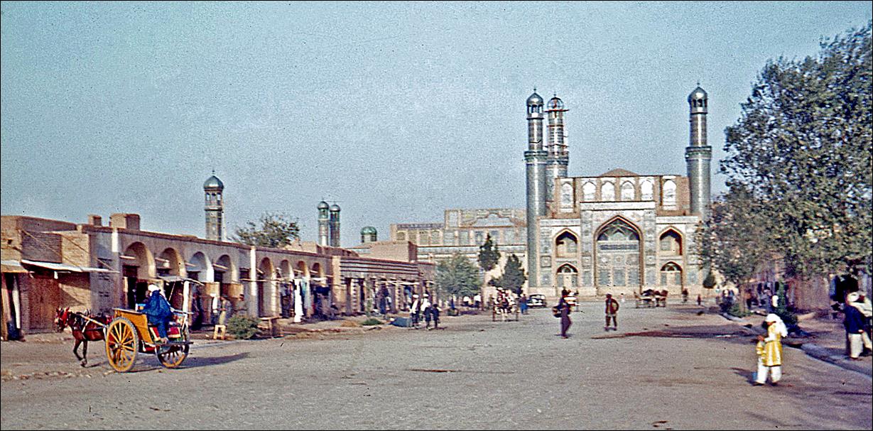
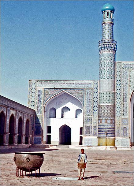
Masjid-e-Jami, or Friday Mosque (15th-century).
|
|
|
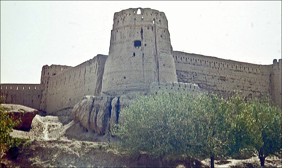
Citadel.
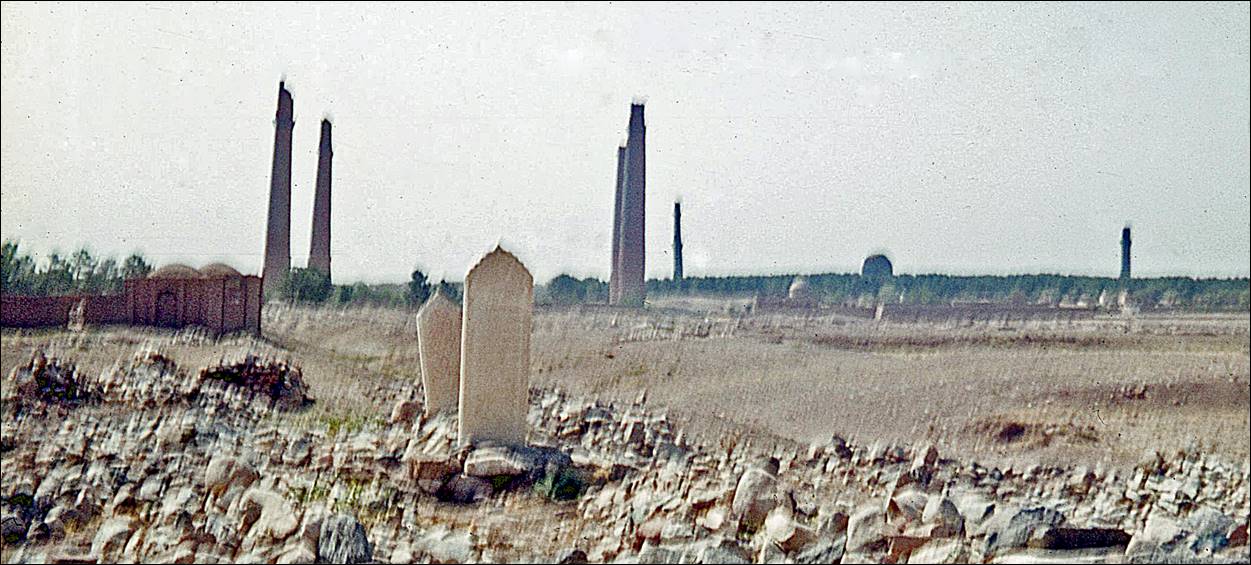
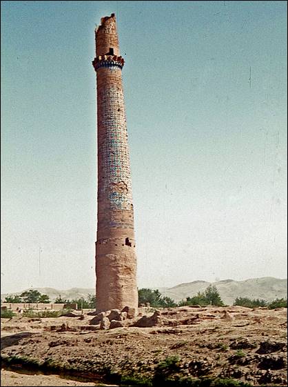
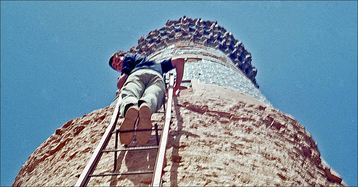
Tall,
but crumbling minarets (~55m) of the 15th-century Musalla
complex of Gawhar Shad, located on Shahzadegan Road.
|
|
|
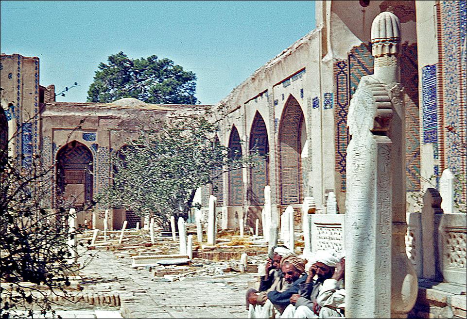
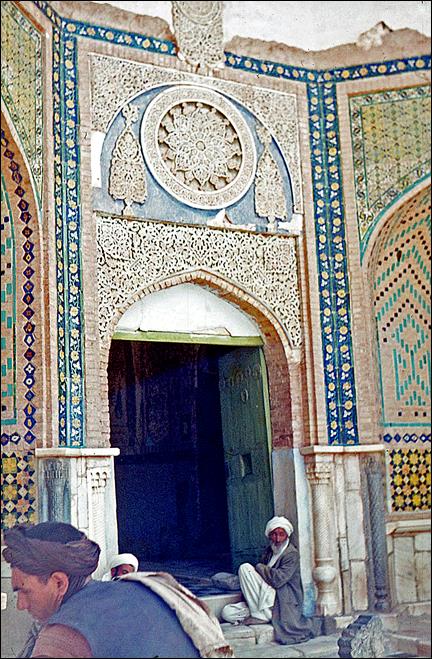
Shrine
of Khwaja Abdullah Ansari (15th century) in Gazargah, north-east of Herat. It houses the tomb of Sufi
mystic Khwaja Abdullah Ansari.
|
|
|
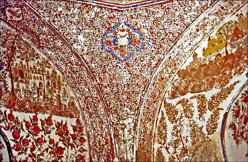
Portion
of the ceiling in the entrance hall of the Ansari shrine.
Windmills with vertical
shafts and sails made of reeds near Herat.
|
|
|

![]()