High Atlas of Morocco:
From Arous to Anmiter (April
2013)
![]()
Return to my mountaineering webpage
|
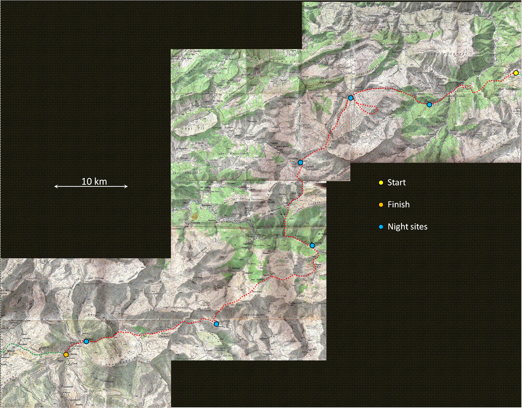
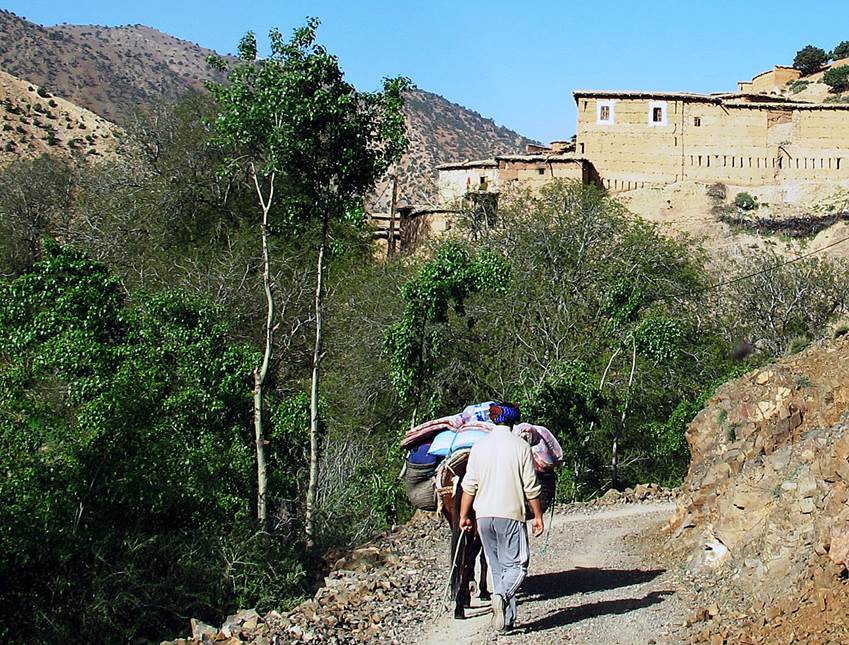
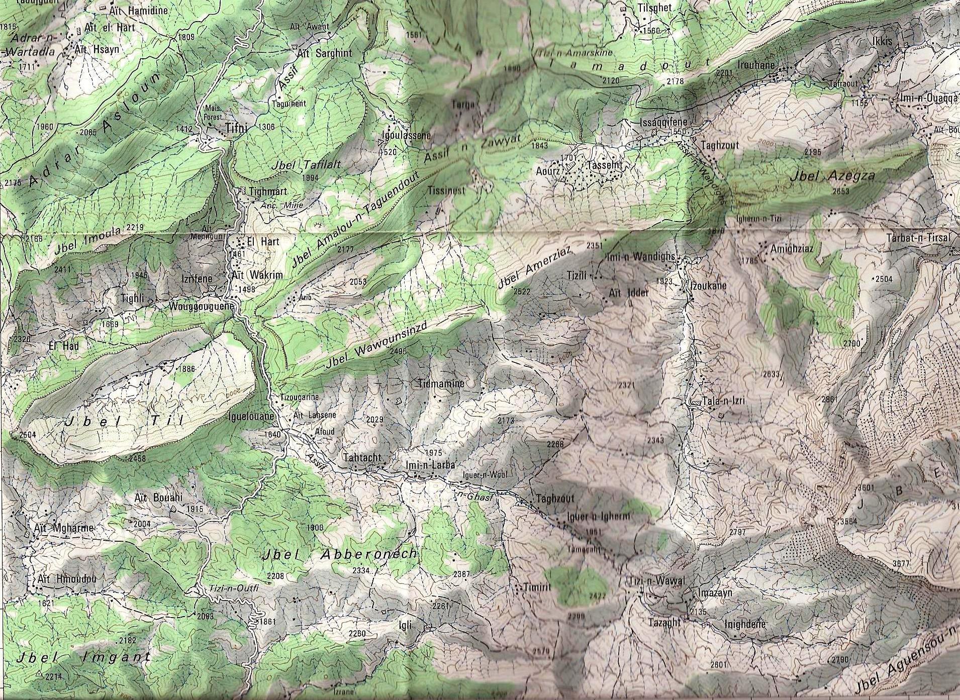
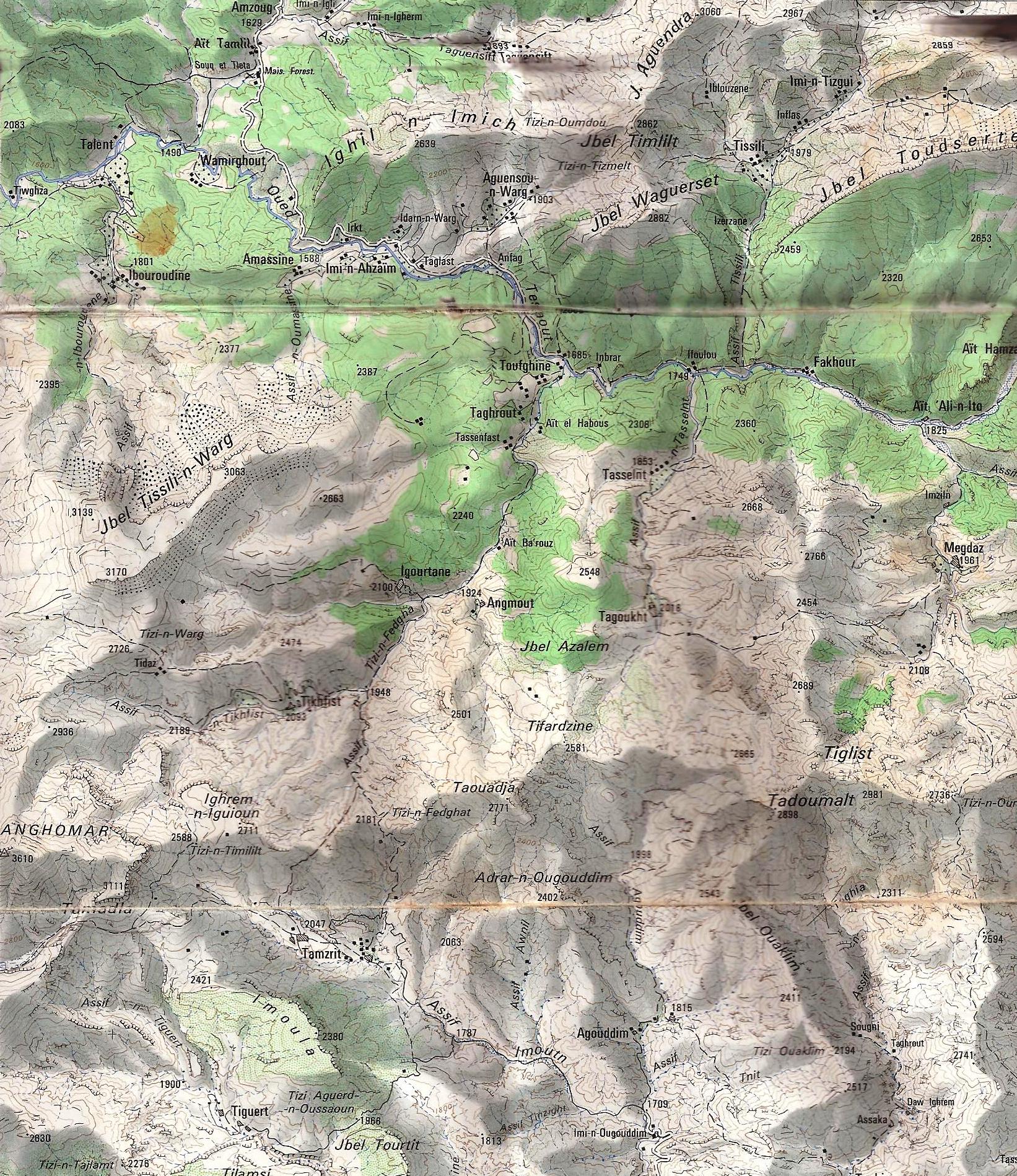
This
seven-day trek (itinerary in dotted red line in the map below) connects the
small village of Arous (yellow dot at the top-right of the map) in the Ait
Bou-Guemez Valley to Anmiter (orange dot at the bottom-left) near Telouet. My
friend Oumar
Oulaїdi (a CFAMM certified
guide) arranged for me a muleteer and his mule from the Ait Bou-Guemez Valley
to come with me. I did this trek mid-April 2013. The weather was almost
perfect, though the air was often hazier than I had expected for that time of
the year.
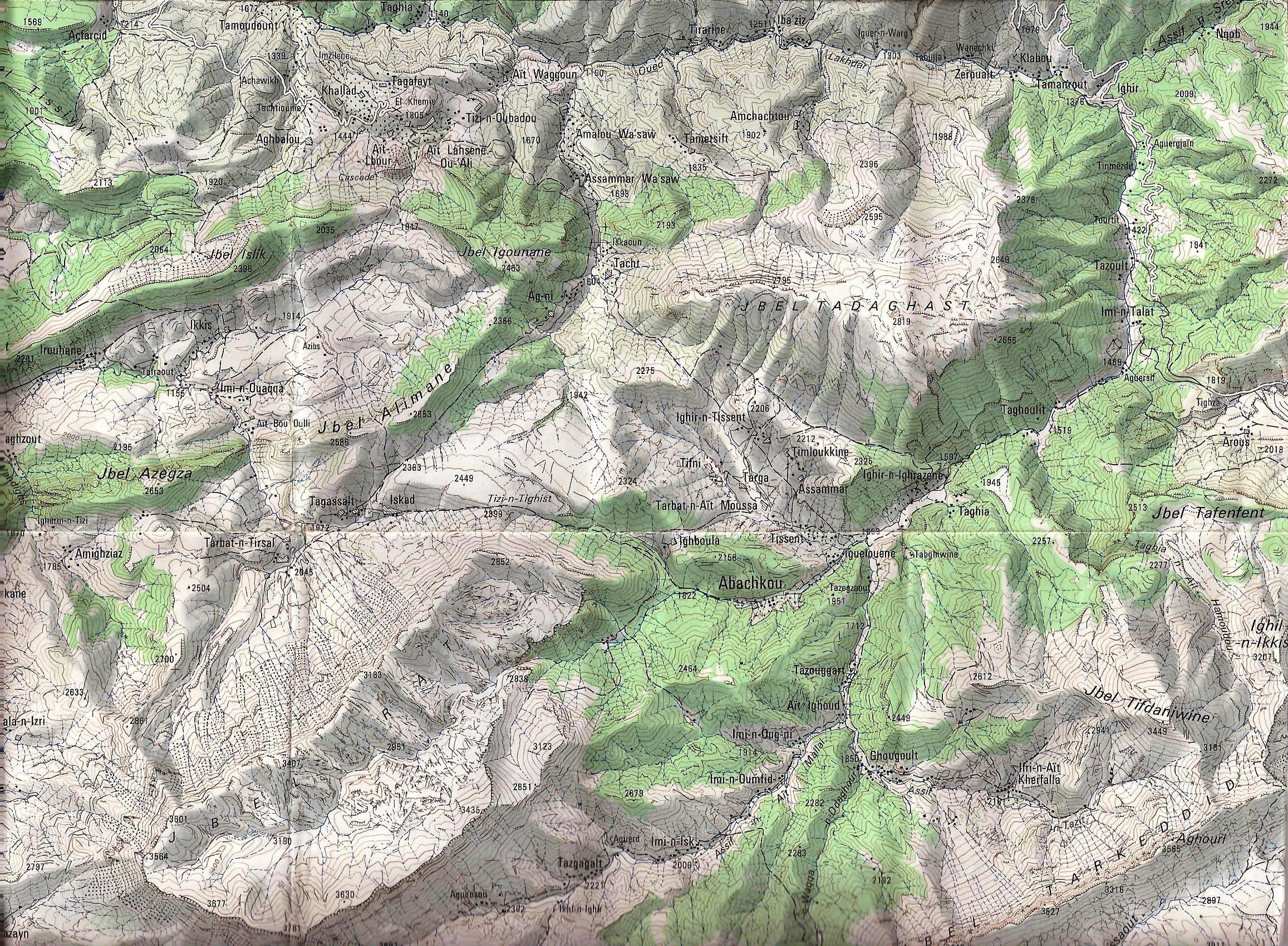
(Click the
following links to get the map coverage at full resolution: map1,
map2,
map3,
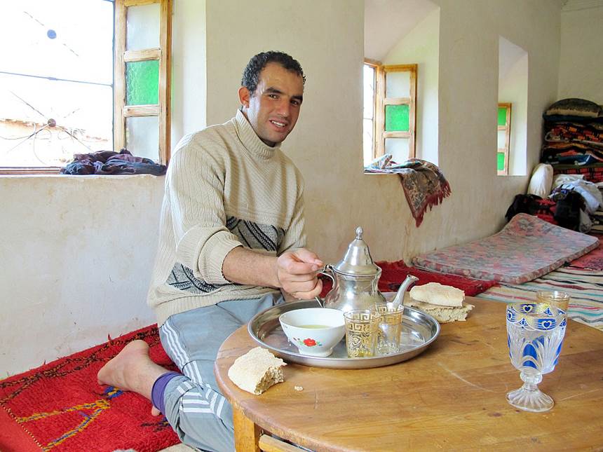
map4.) Mohamed, the
muleteer selected for me by Oumar Oulaidi, was also an excellent cook and
guide. In addition, he speaks very good French.
Click the links
below to see photos of this trek: -
Section
1: Arous to Abachkou -
Section
2: Abachkou to
Tarbat-n-Tirsal -
Section
3: Tarbat-n-Tirsal
to Ait Ali-n-Ito (Oued Tessaout) -
Section
4: Ait Ali-n-Ito to Tagoukht -
Section
5: Tagoukht to Anmiter
|
