Chile (July-August 2015): Arica and the Azapa and Lluta Valleys
![]()
Return to main Chile 2015 webpage
|
Map of the Arica y Parinacota Region: |
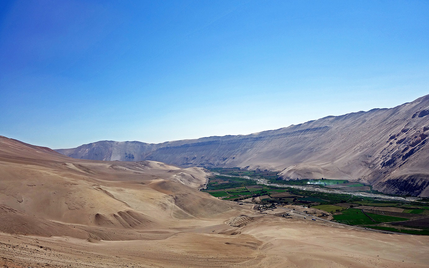
Aerial view of Arica and the Azapa and Lluta Valleys: |
|
|
|
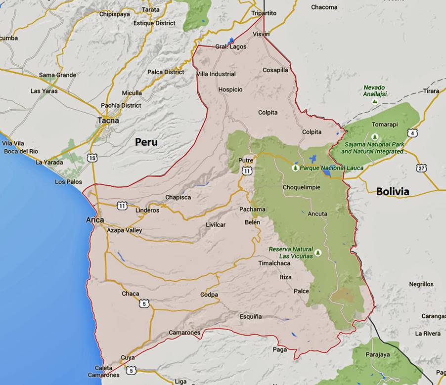
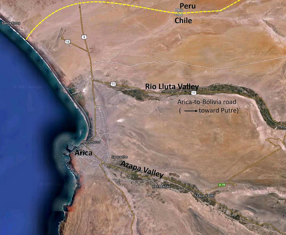
I spent two days in Arica on my way to and from Putre. Located 18 km from the border with Peru (see maps above), it is Chile‛s northernmost city and the capital of the Arica y Parinacota Region (shown in pink in the map on the left). It also serves as the main port of Bolivia, to which it is connected by a major road. Back 10,000 years the site of Arica and its surrounding valleys (Azapa and Lluta) were inhabited by sedentary fishing people, known today as the Chinchorros, famous for their sophisticated mummification practices. Much later, during colonial time the port of Arica was used to export silver mined from Potosi (now in Bolivia) and transported to Arica by caravans along the ″Ruta de Plata″. In 1868 Arica (then a Peruvian city) was hit by an earthquake of estimated magnitude between 8.5 and 9.0. This earthquake generated a tsunami with two successive waves of 12m and 16m. More than 25,000 people died from this event. A repeat is considered likely in a non-distant future. Arica was seized by Chile from Peru in 1880 following the War of Pacific.
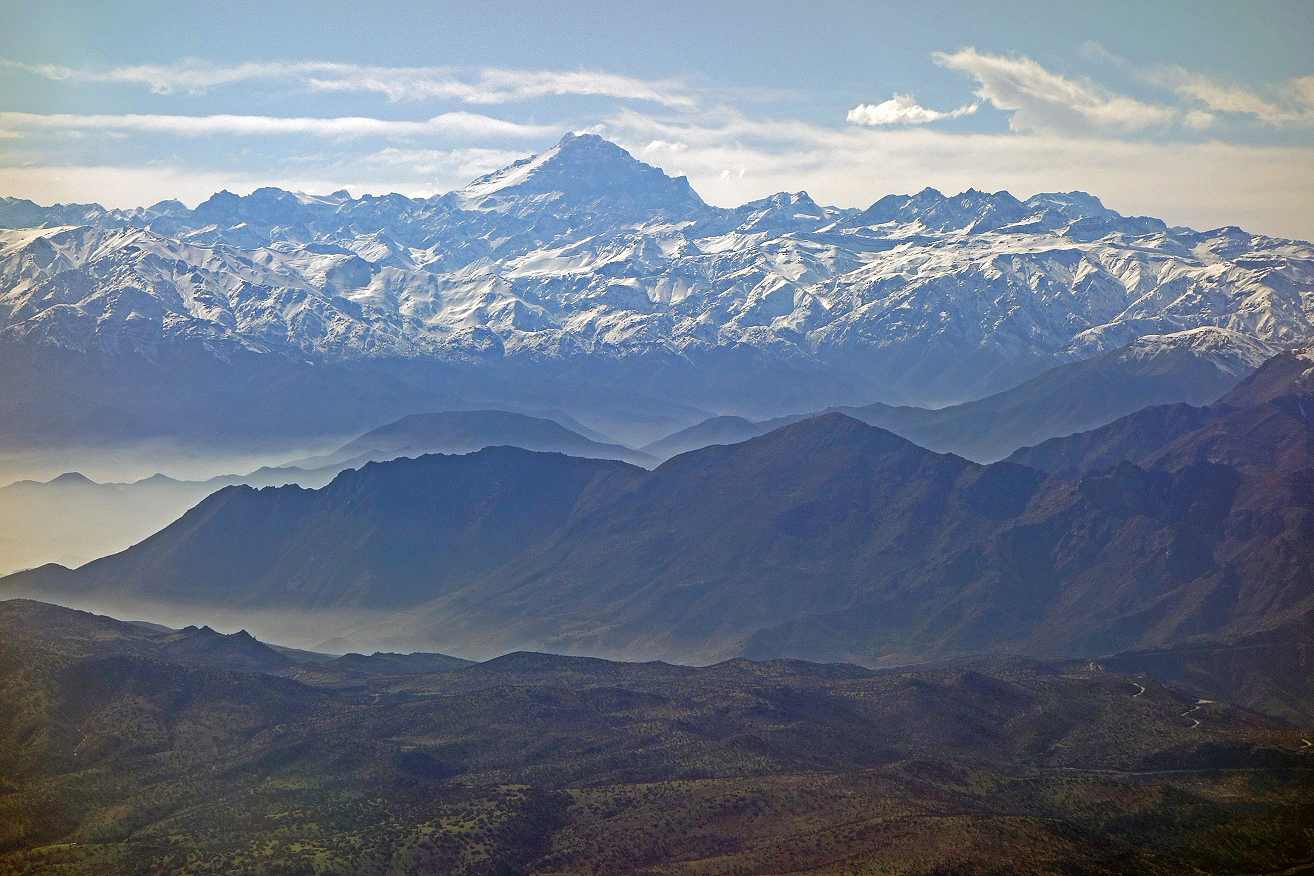
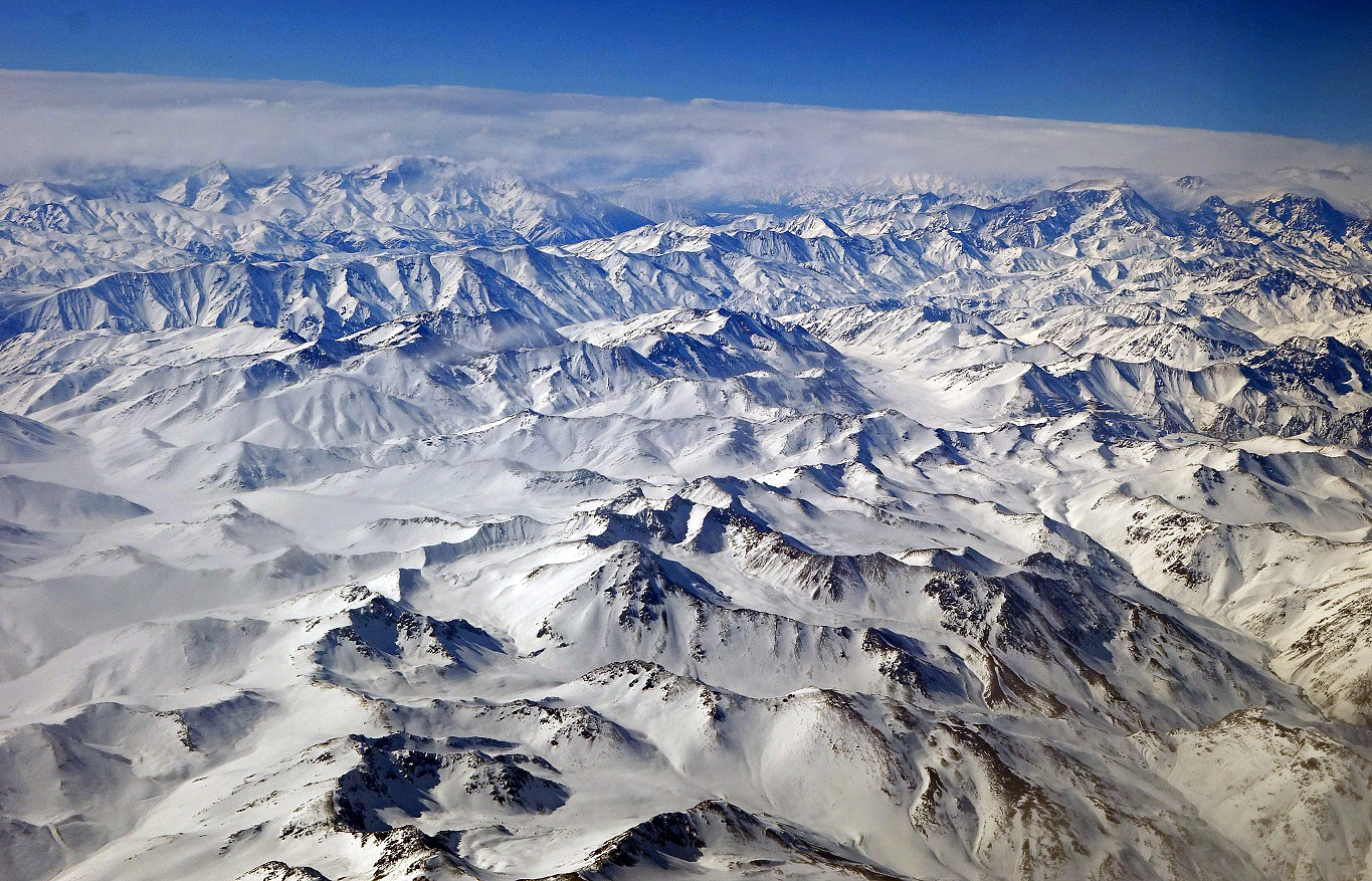
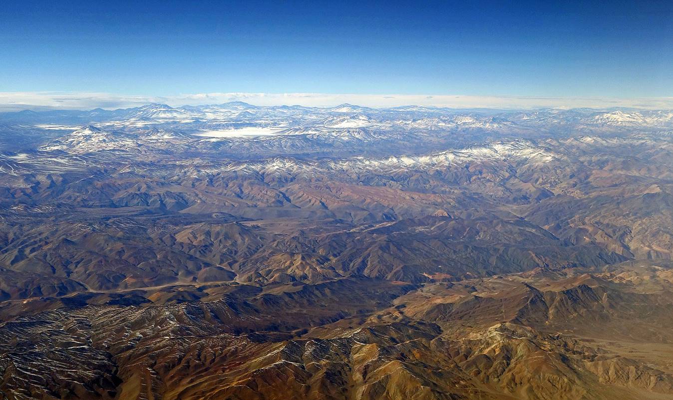
Successive photos of the Andes taken during the flight from Santiago to Arica.
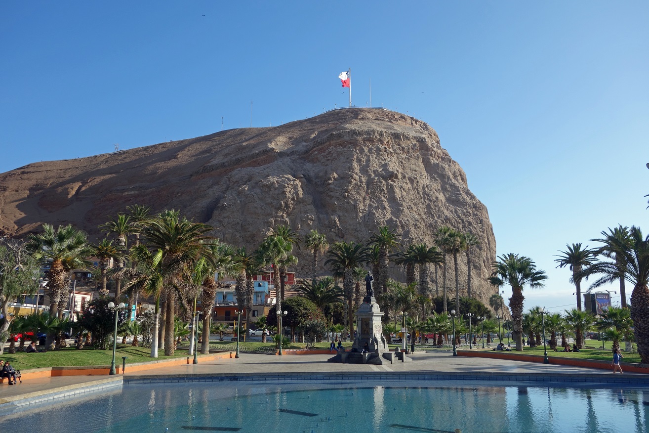
El Morro de Arica, a 139m-high rocky hill located near the center of the city, seen from Plaza Vicuna MacKenna.
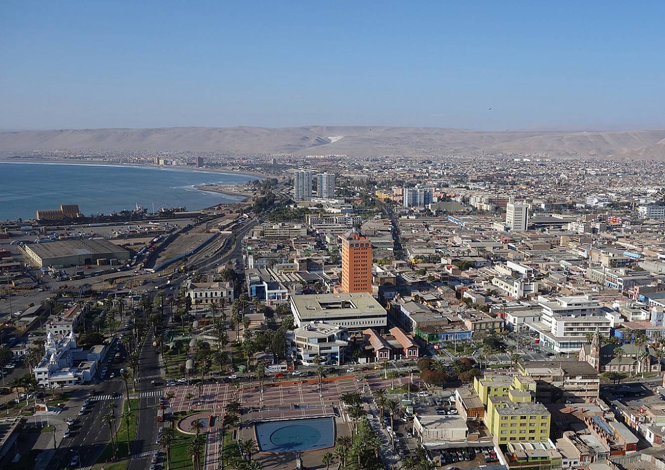
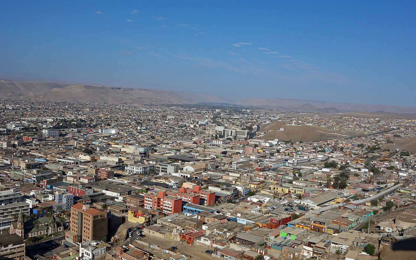
Views over Arica from the top of El Morro. Arica is bordered on one side by the Pacific Ocean and on the other by the desert. In the first photo below, on the center-right, the snowcaps of Volcans Parinacota and Pomerape are slightly visible on the horizon (if you have a good display monitor).
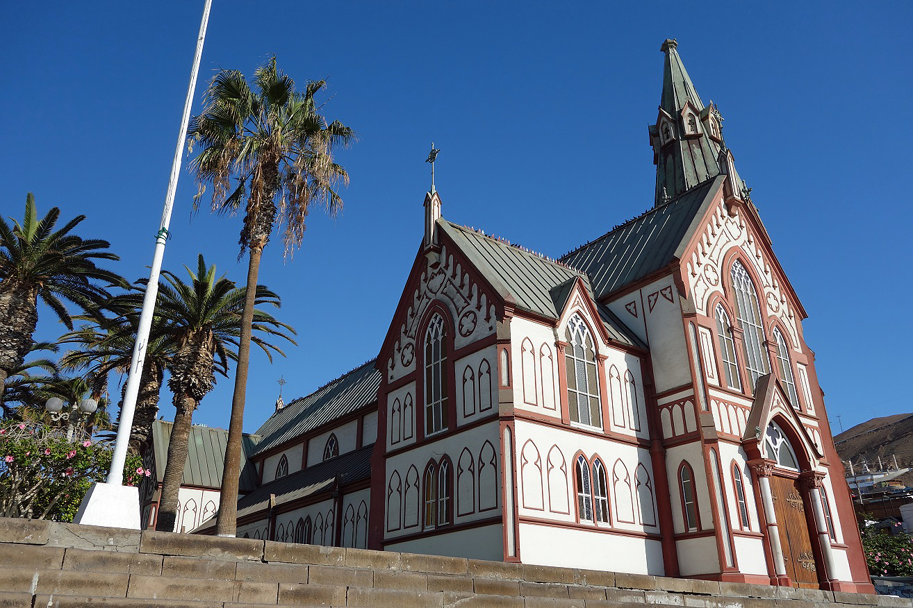
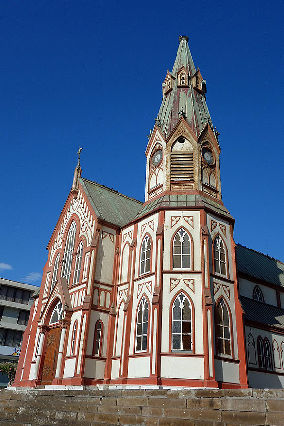
Cathedral San Marcos. The entire building is made of iron. It was designed by Gustave Eiffel, prefabricated in Eiffel‛s shop in Paris, shipped to Arica, and assembled there.
|
|
|
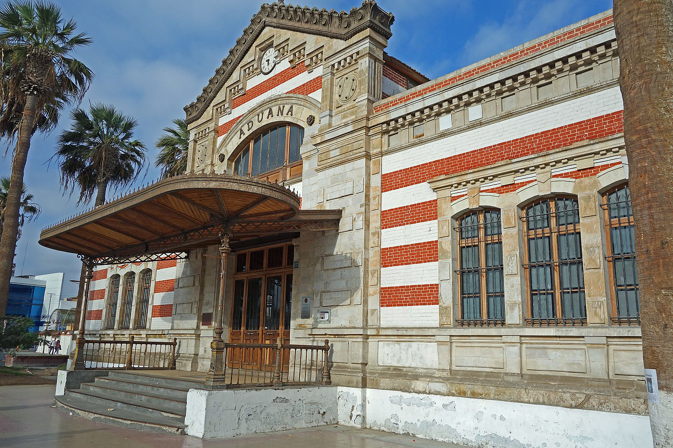
The former customs house, also designed by Eiffel.
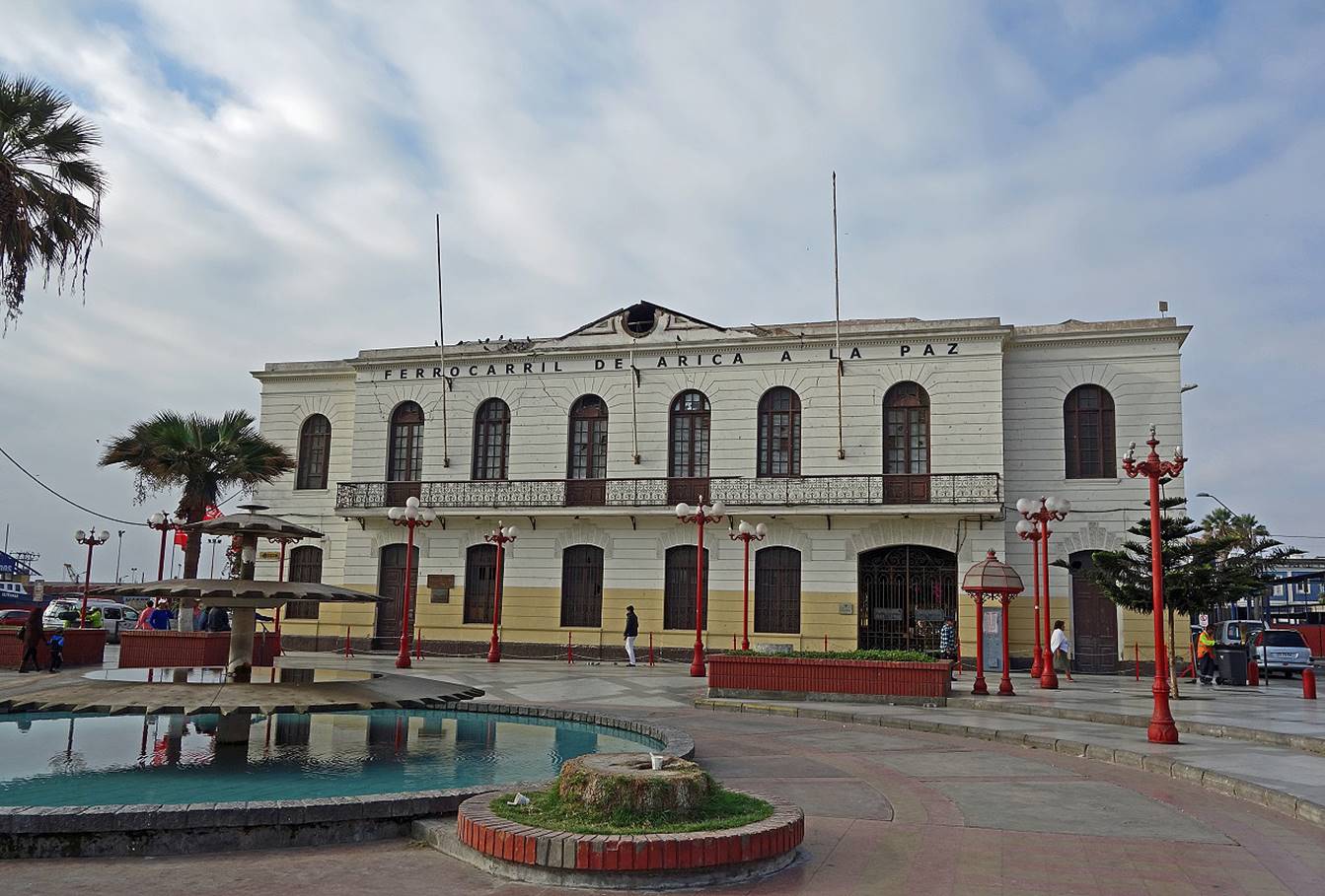
The Arica to La Paz train station. The railway was in service until 2005.
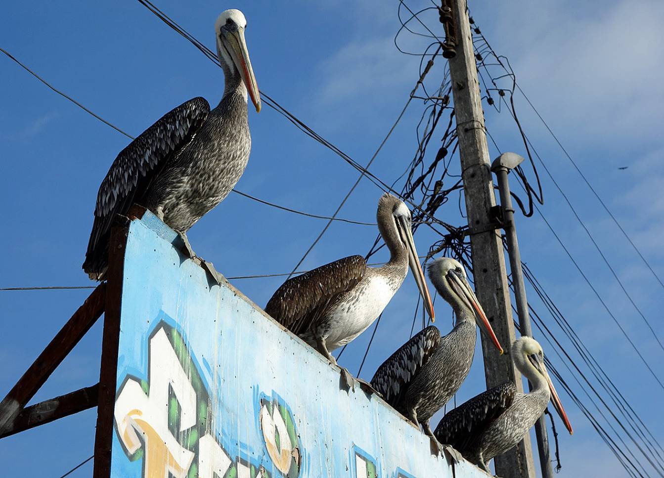
Pelicans near the port.
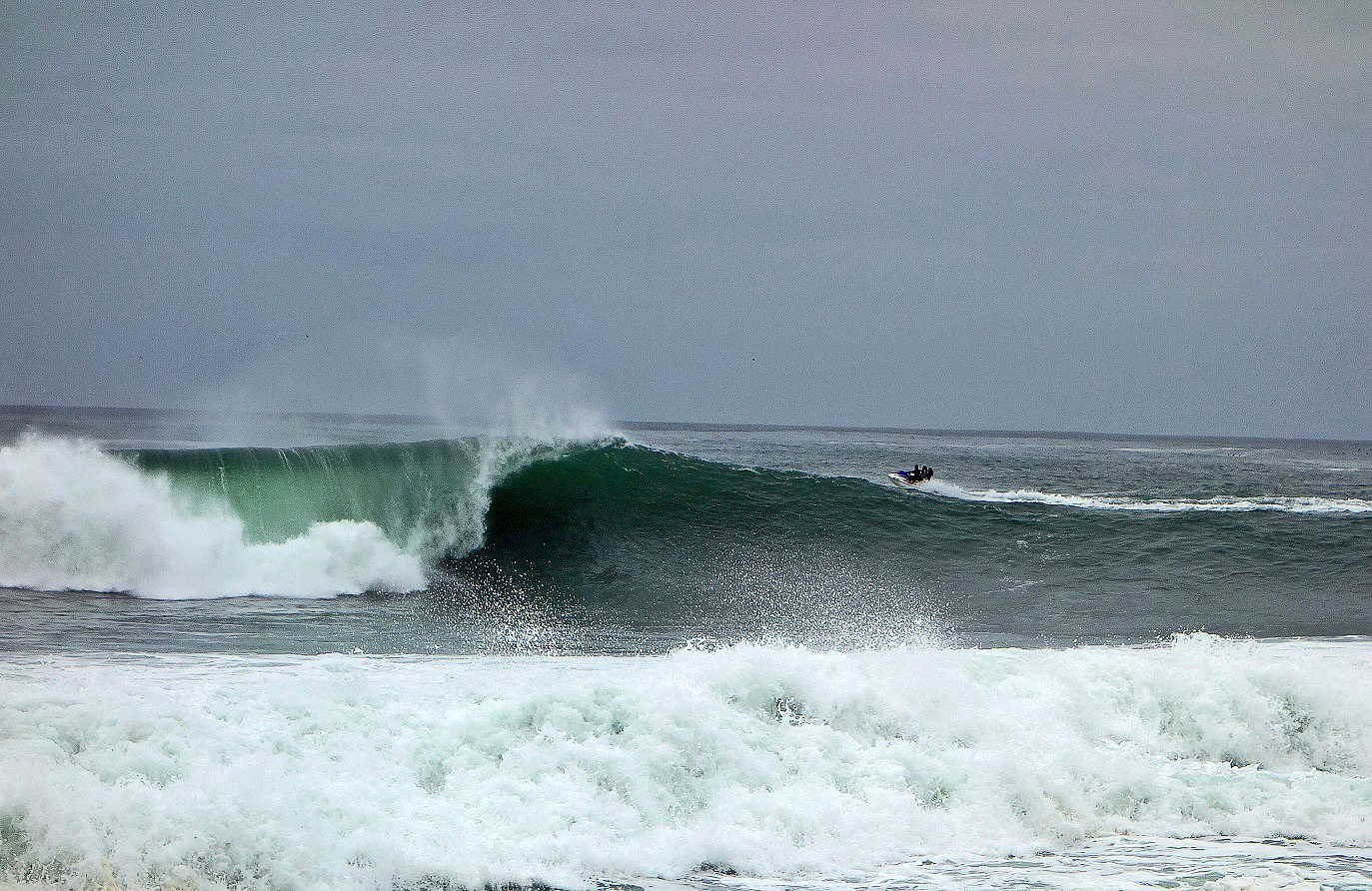
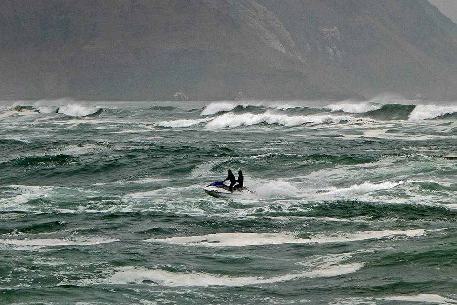
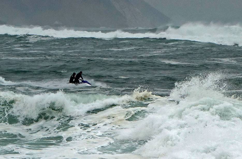
Riding waves on a water scooter.
|
|
|
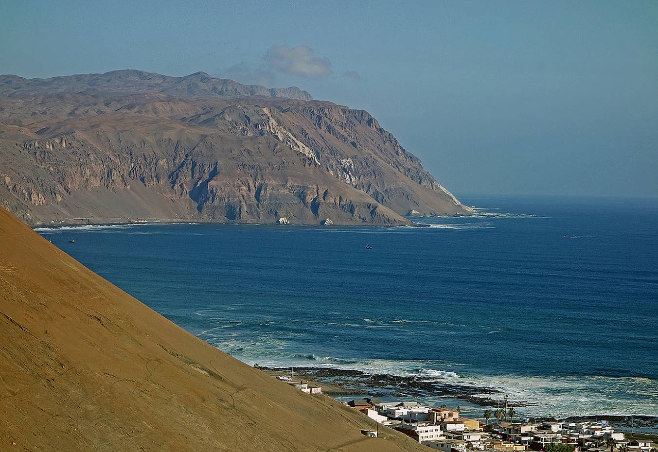
Coast near Arica.
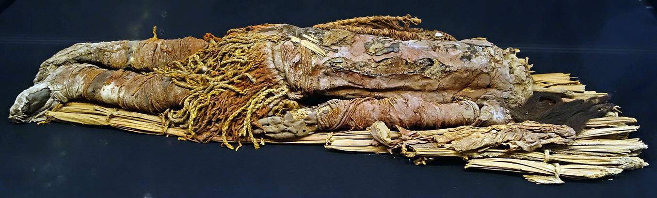
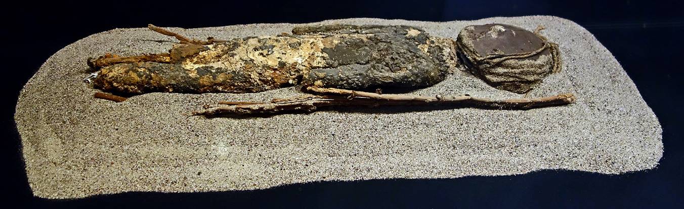
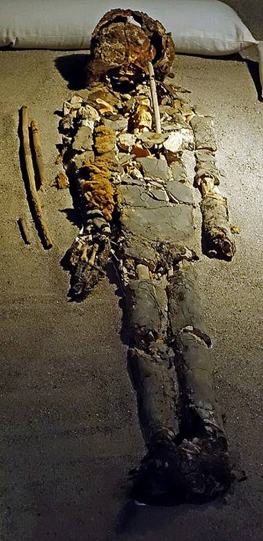
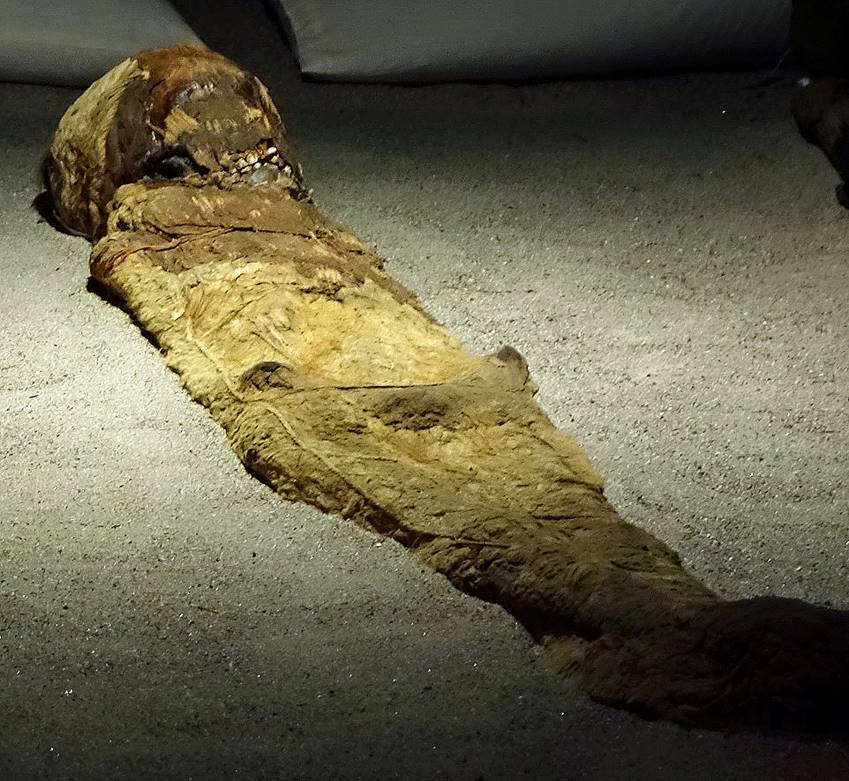
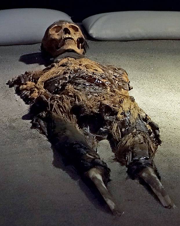
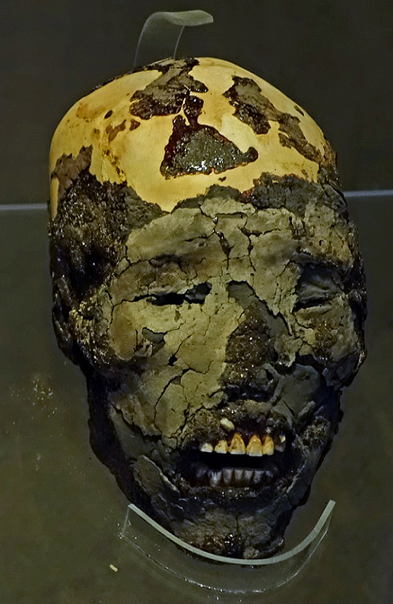
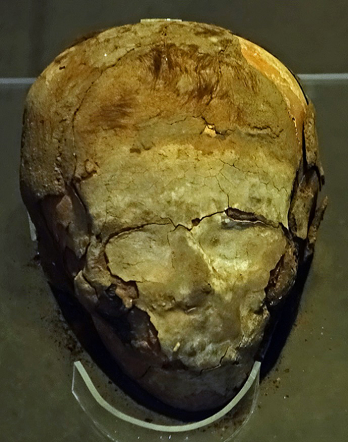
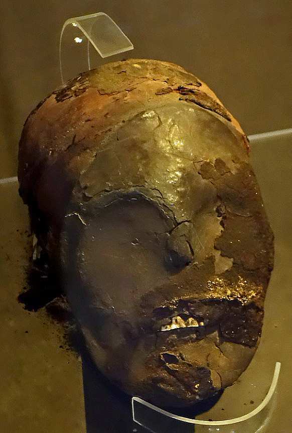
Chinchorro mummies in the excellent Archeological Museum of San Miguel de Azapa. Some date back to 7000 BC.
|
|
|
|
|
|
|
|
|
|
|
|
|
|
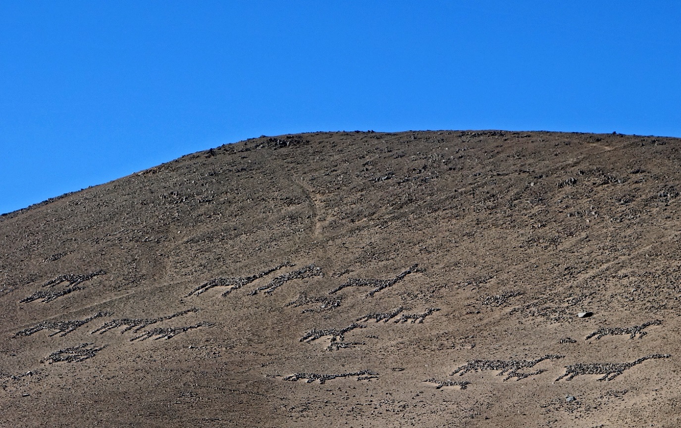
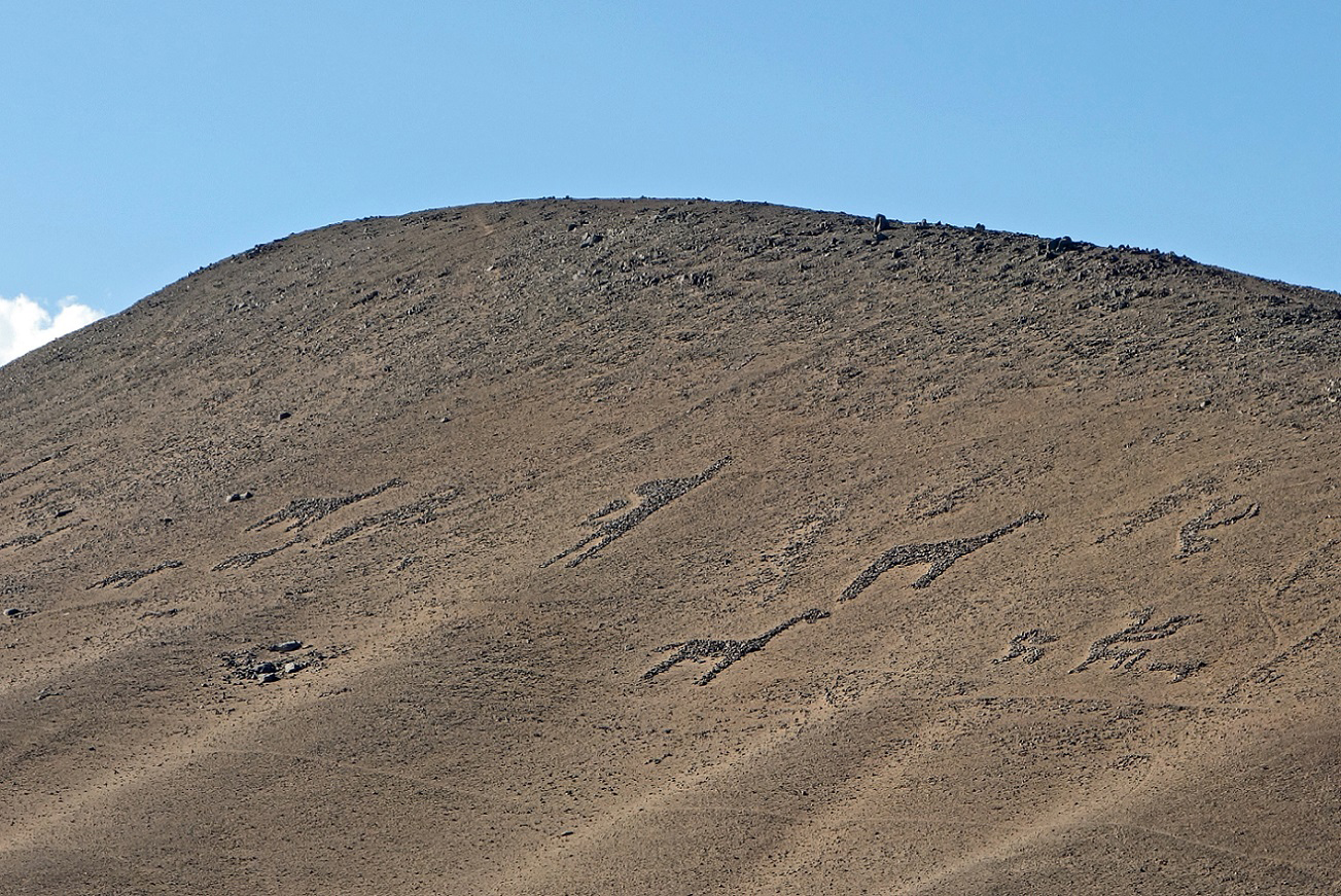
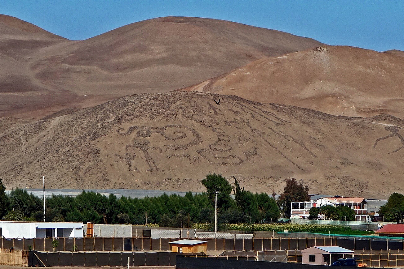
Geoglyphs in the Azapa Valley.
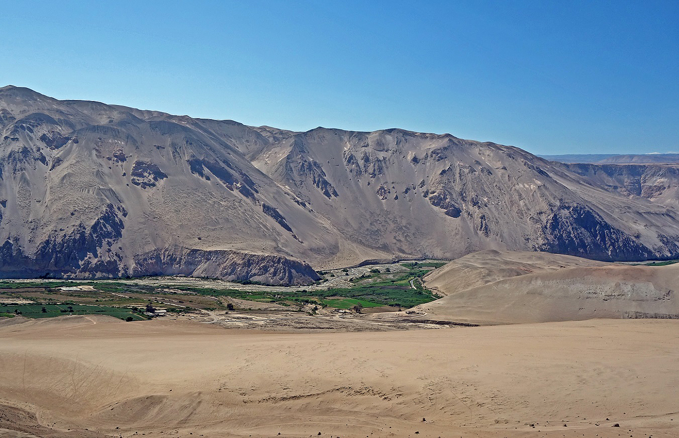
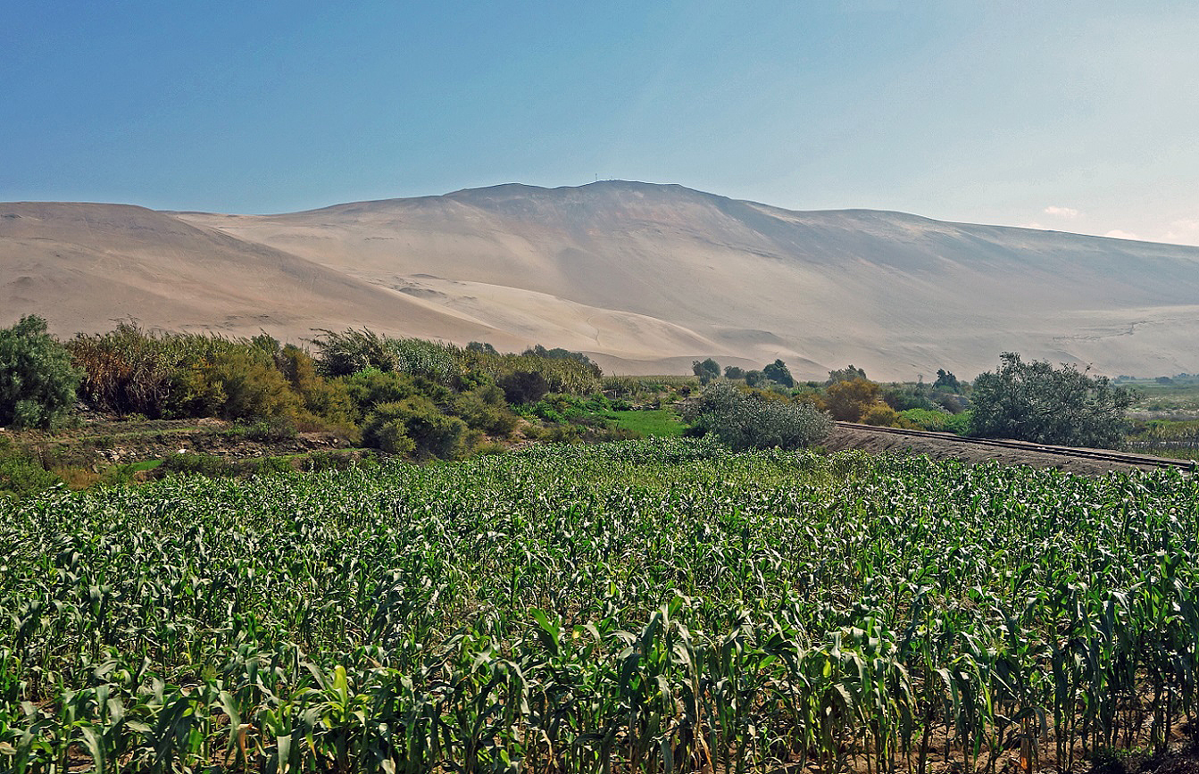
Views of the Lluta valley. Both Azapa and LLuta valleys form narrow oasis bordered by desert hills. However, the poor quality of the water in the Rio Lluta (elevated levels in salt, arsenic, borax, sulfate...) restricts agricultural activities.
![]()