Chile (July-August 2015): Guallatiri
![]()
Return to main Chile 2015 webpage
|
Satellite view of the region around Putre: |
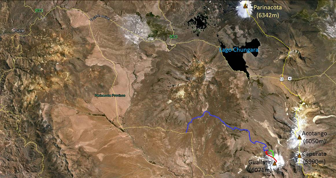
4WD access road (in blue) to Guallatiri from the ″main″ road (in yellow): |
|
|
|
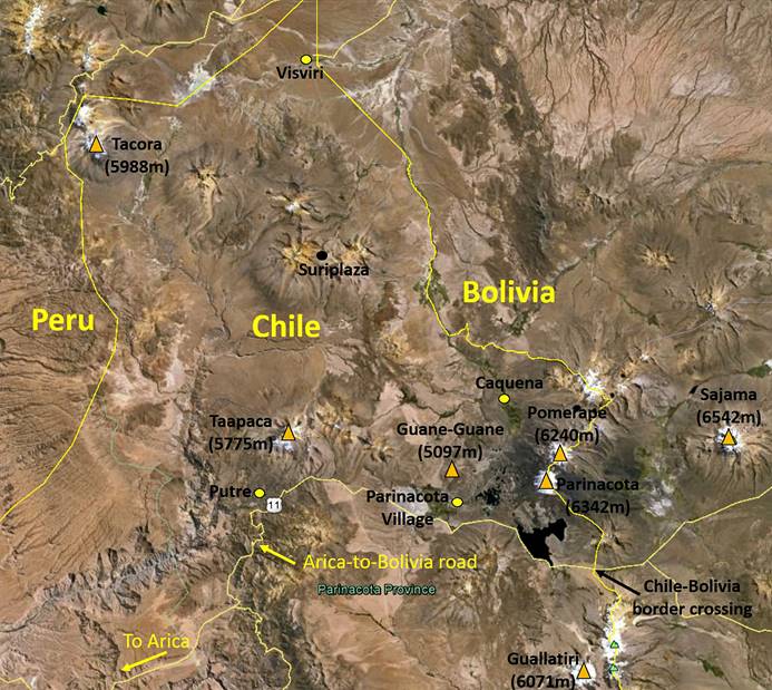
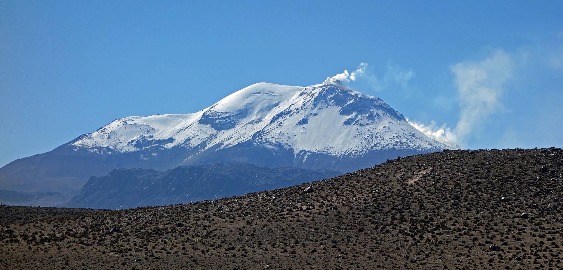
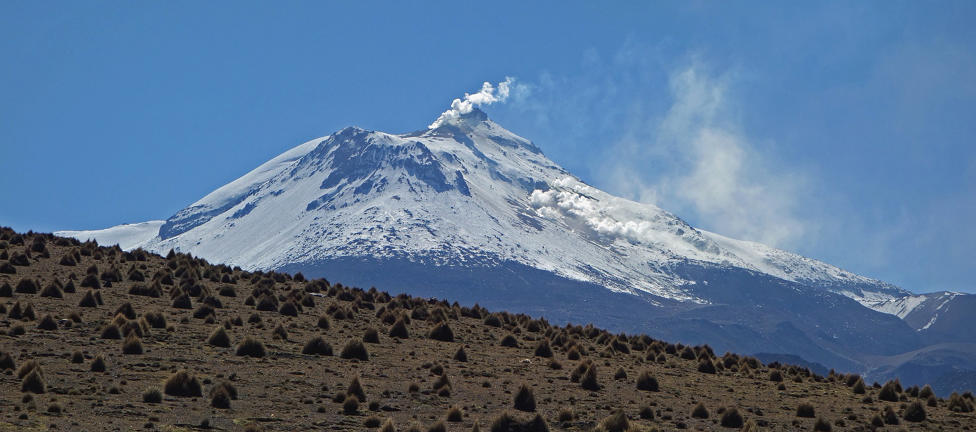
Guallatiri (6071m) is an active volcano located south of the Arica-to-Bolivia road, 4.5 km west of the border with Bolivia. It has erupted at least 4 times since 1825, most recently in 1985. Fumes and vapor are expelled from a main vent located slightly west from the summit and from smaller vents on its southern face. It has a permanent glaciated summit.
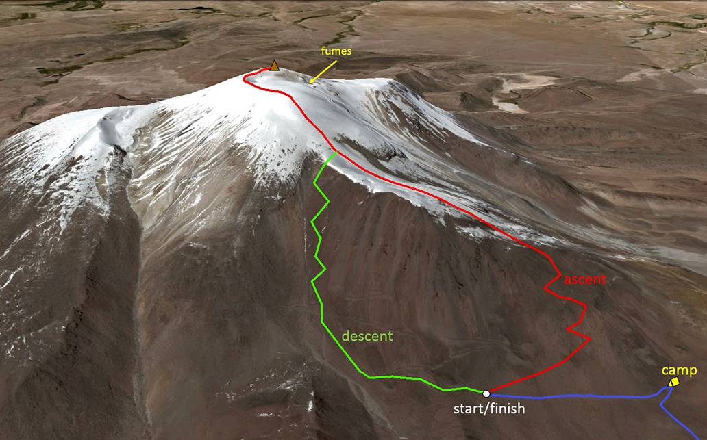
I climbed Guallatiri on July 29 with Justino Jiron, a guide based in Putre. On the eve of the climb we drove to approximately 5000m, where we set up our camp for the night. We started climbing at 4am and were back at the car at 1pm. We enjoyed perfect weather with almost no wind. The slight wind at the top was blowing the fumes away from us toward the west. Moreover, the penitentes (snow/ice formations created by wind and sun) were small. The drive to base camp from Putre takes close to 3 hours (each way) and requires a 4WD vehicle with high clearance.
|
Ascent and descent routes (view of Guallatiri from the north). |
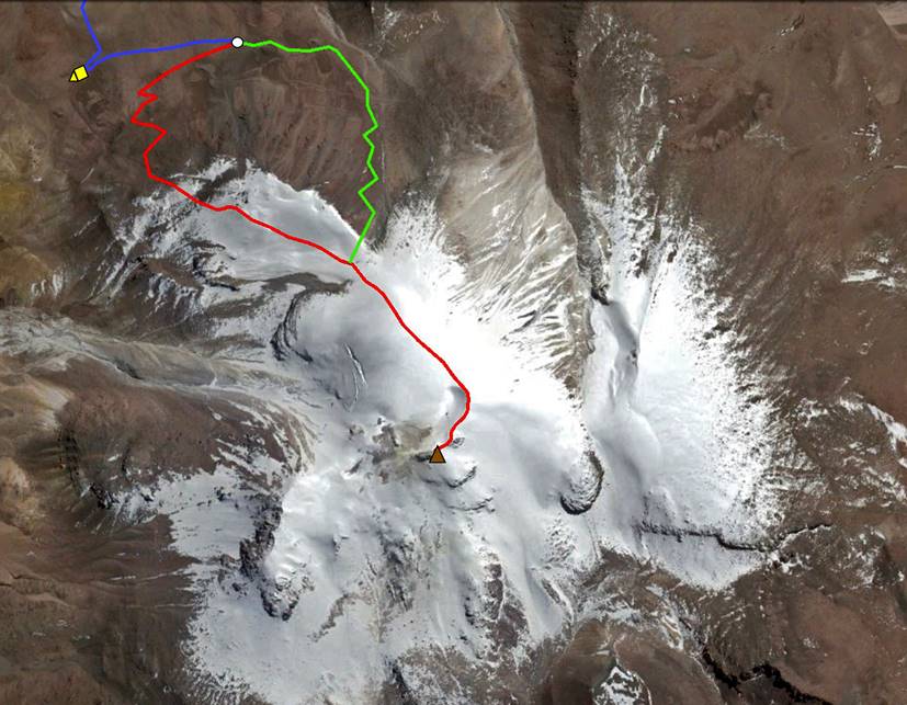
Ascent and descent routes seen from above (here north points upward): |
|
|
|
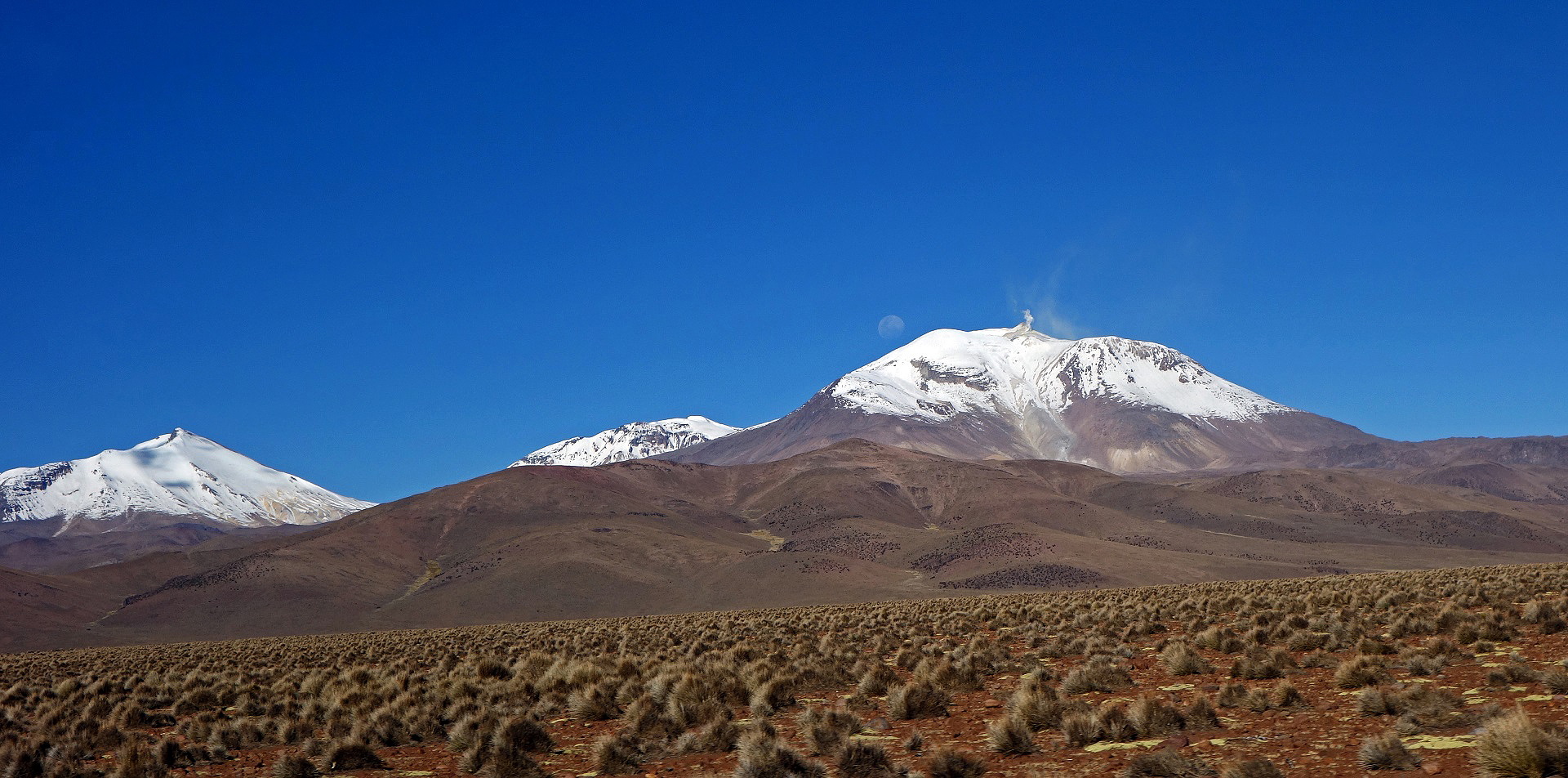
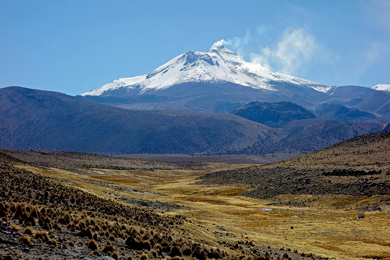
Guallatiri (on the right) seen from the 4WD access road with Acotango and Capurata on its left.
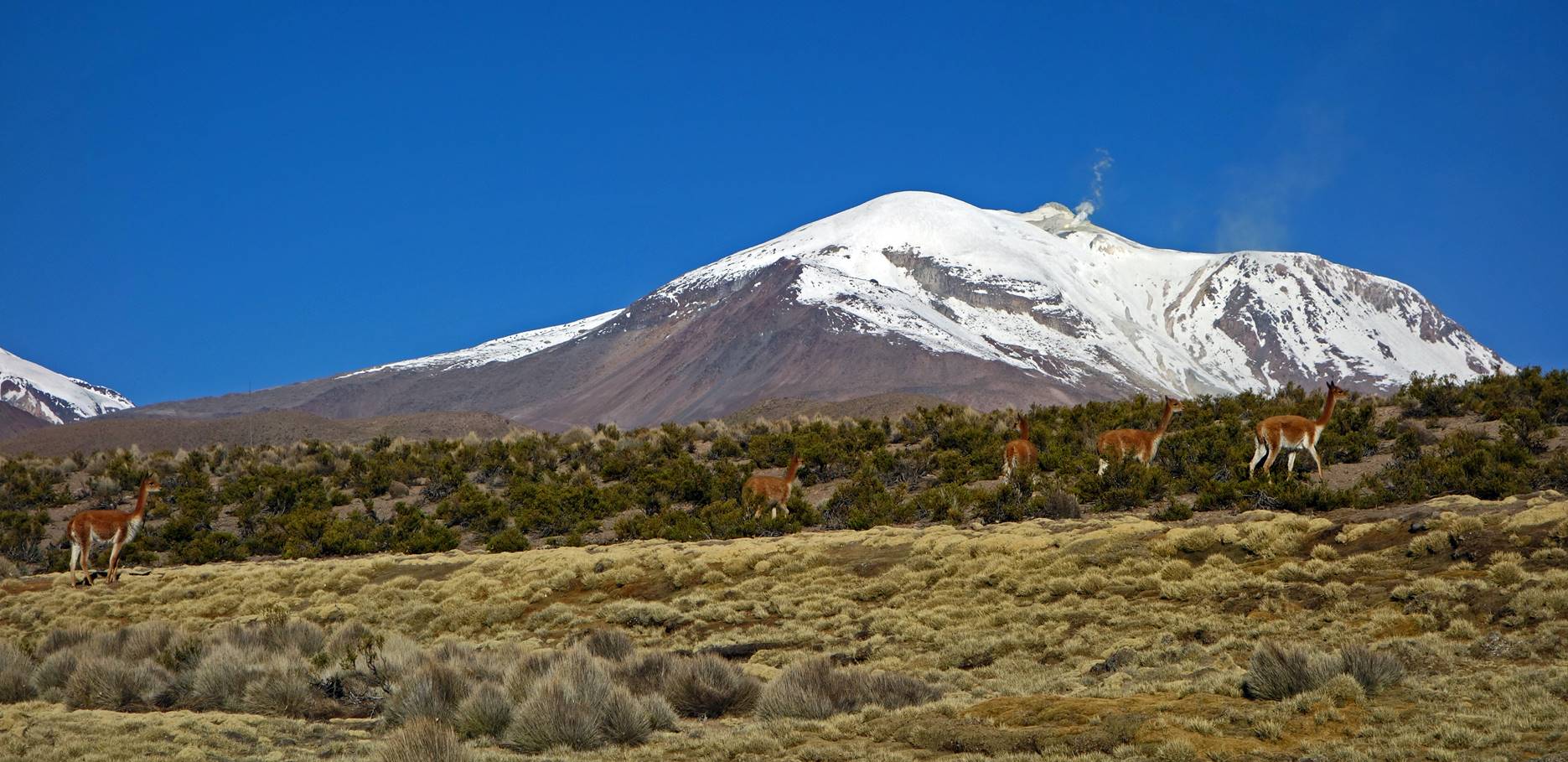
Other views of Guallatiri from the access road.
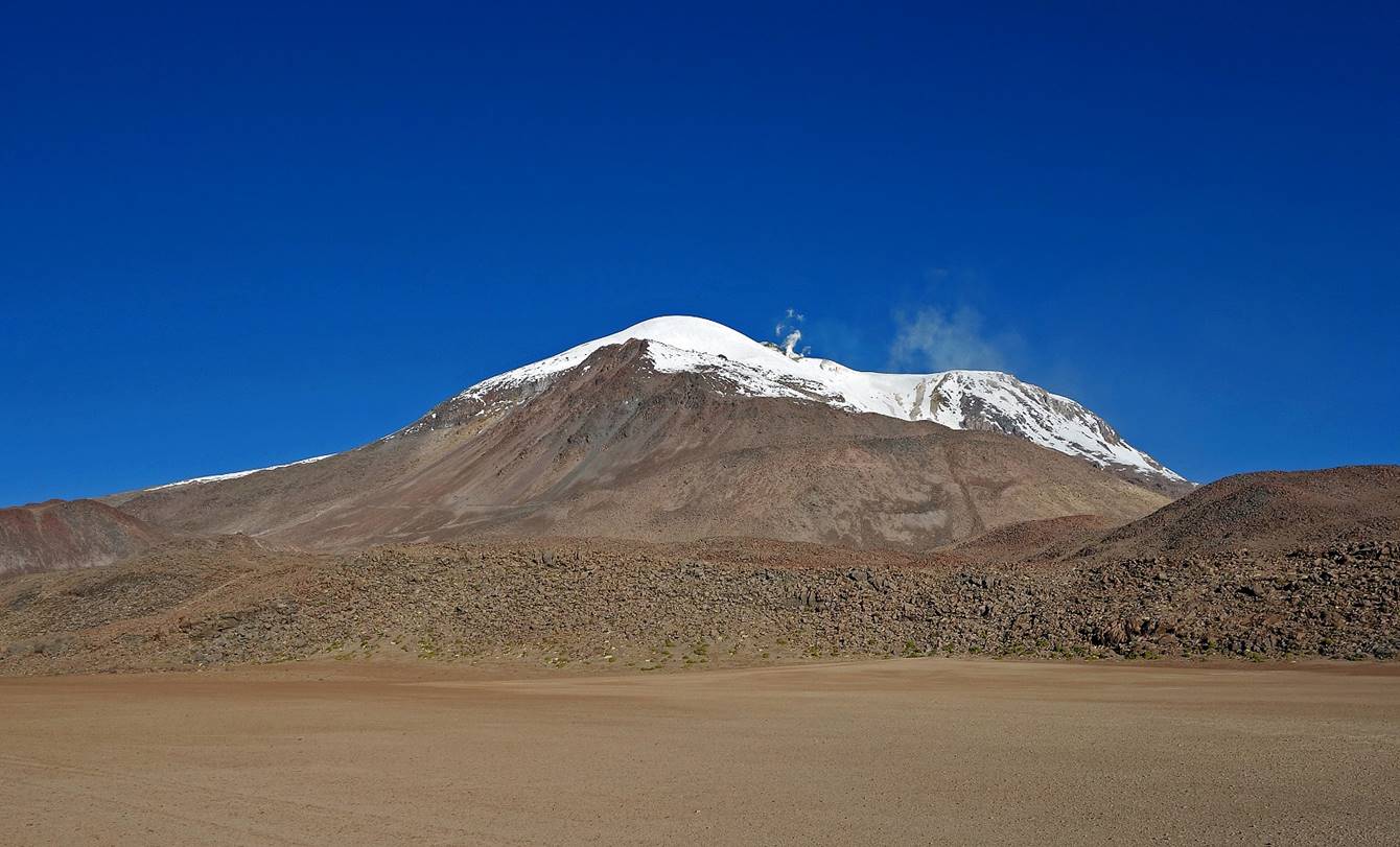
Guallatiri seen from different viewpoints (I took these photos on another day while on my way to Salar de Surire.)
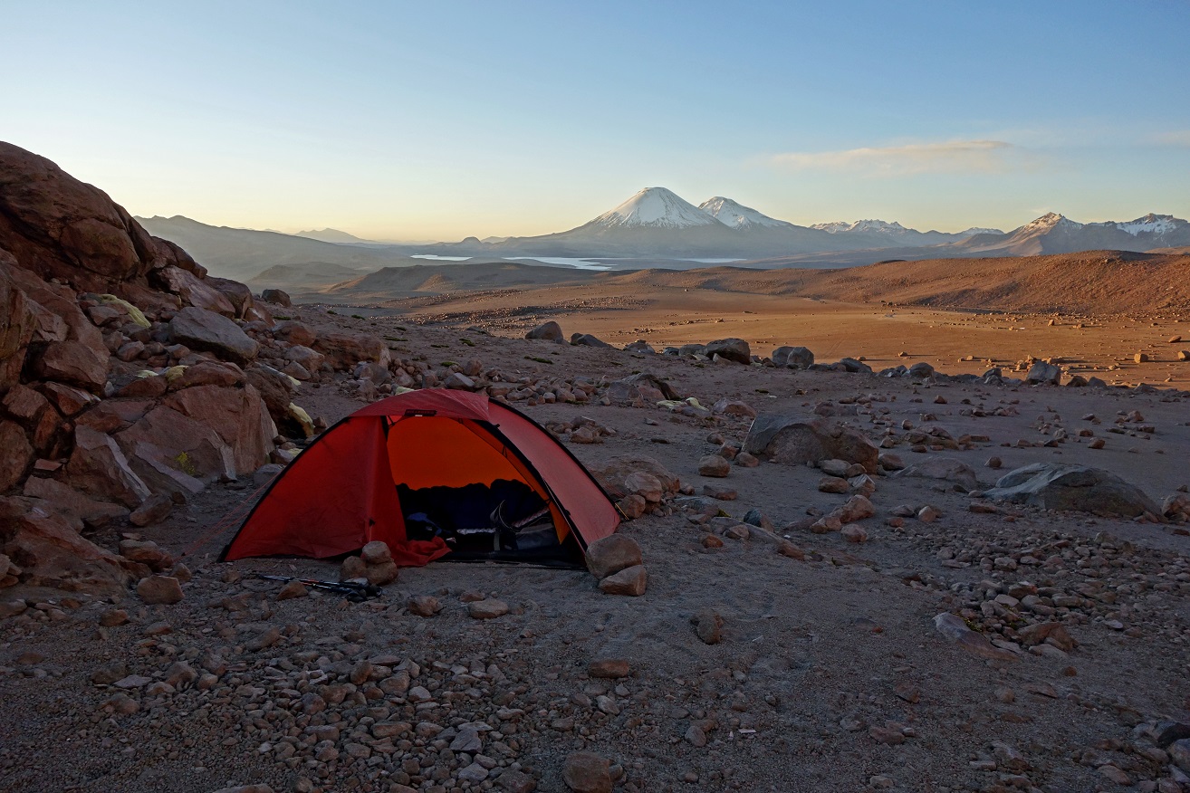
My camp at 5000m in the evening.
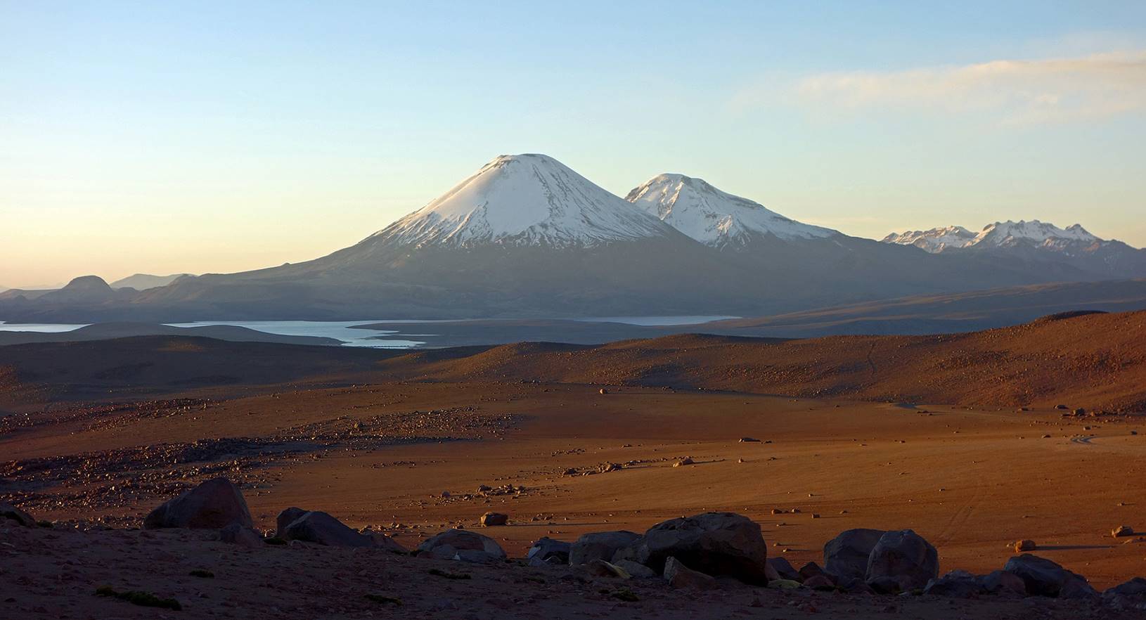
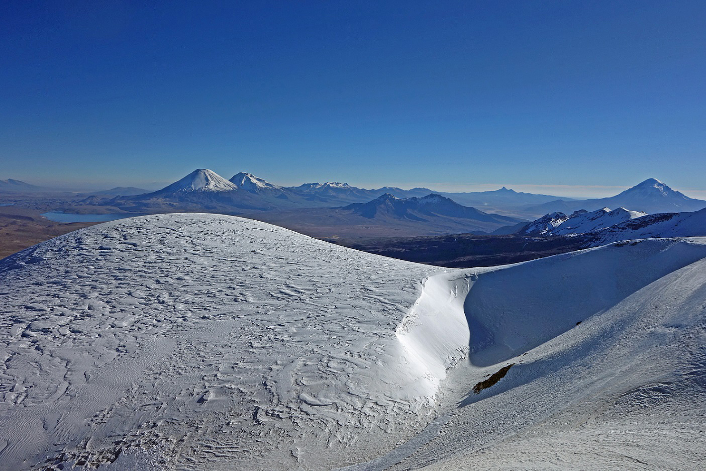
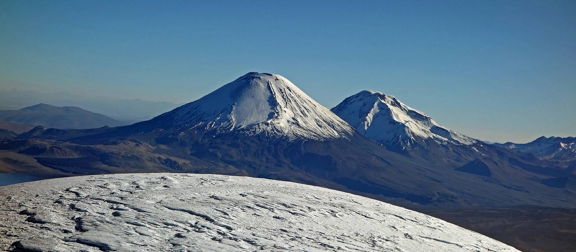
View of Lago Chungara and Volcans Parinacota and Pomerape from the camp.
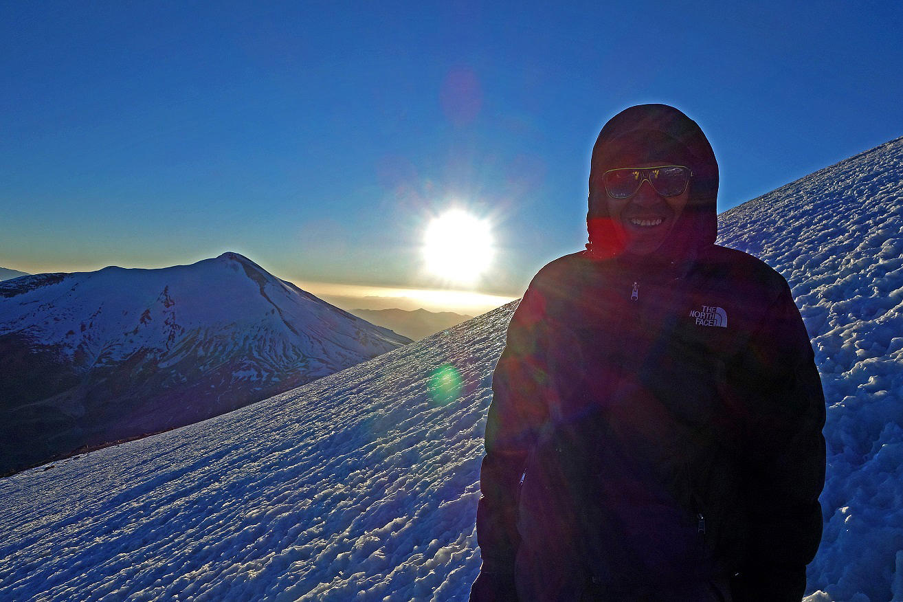
First light in the morning on Guallatiri:
- Here Justino smiling, with Volcan Acotango behind on the left.
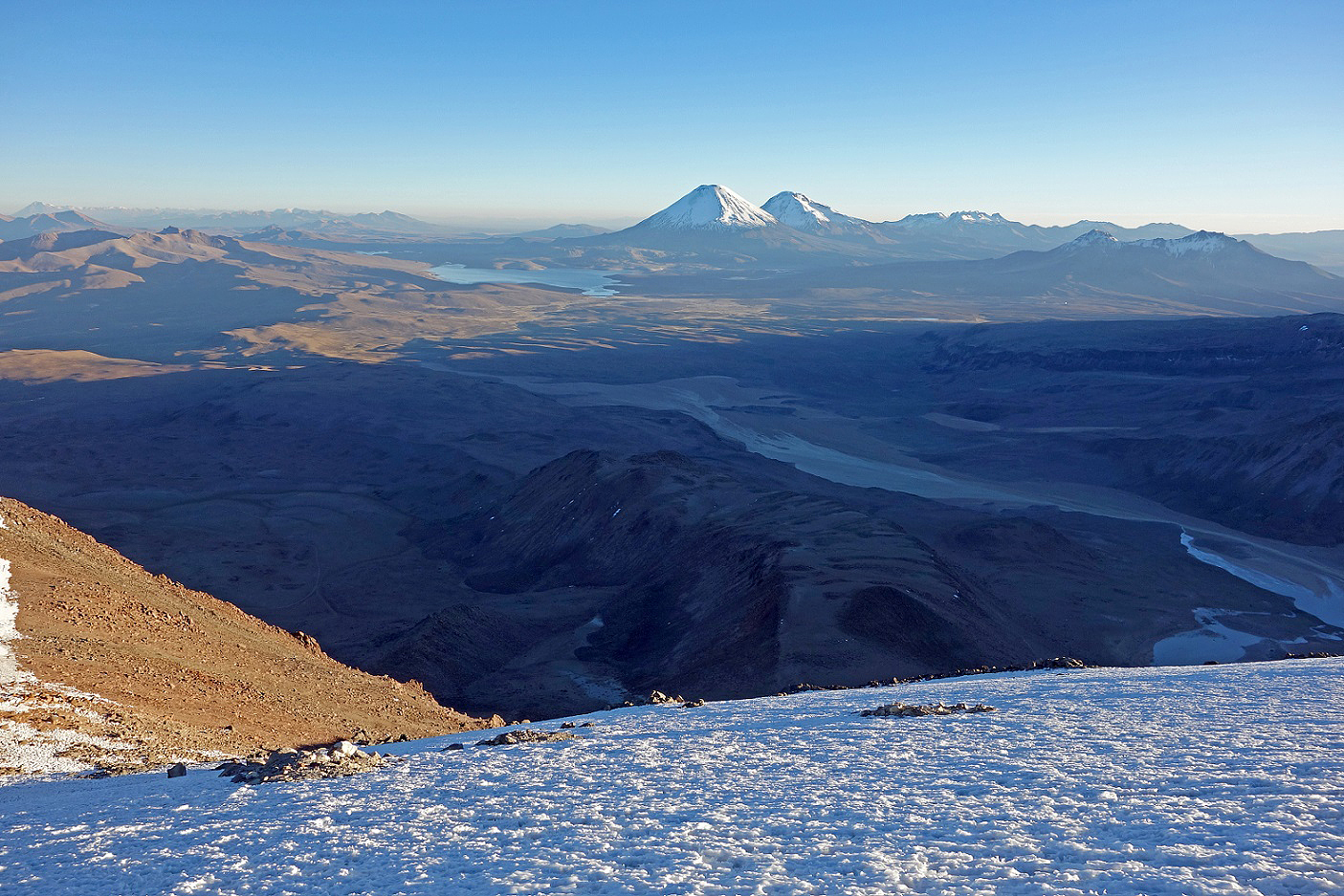
- Toward the north, with Lago Chungara and Volcans Parinacota and Pomerape.
- Toward the north-west, with Volcan Taapaca in the background.

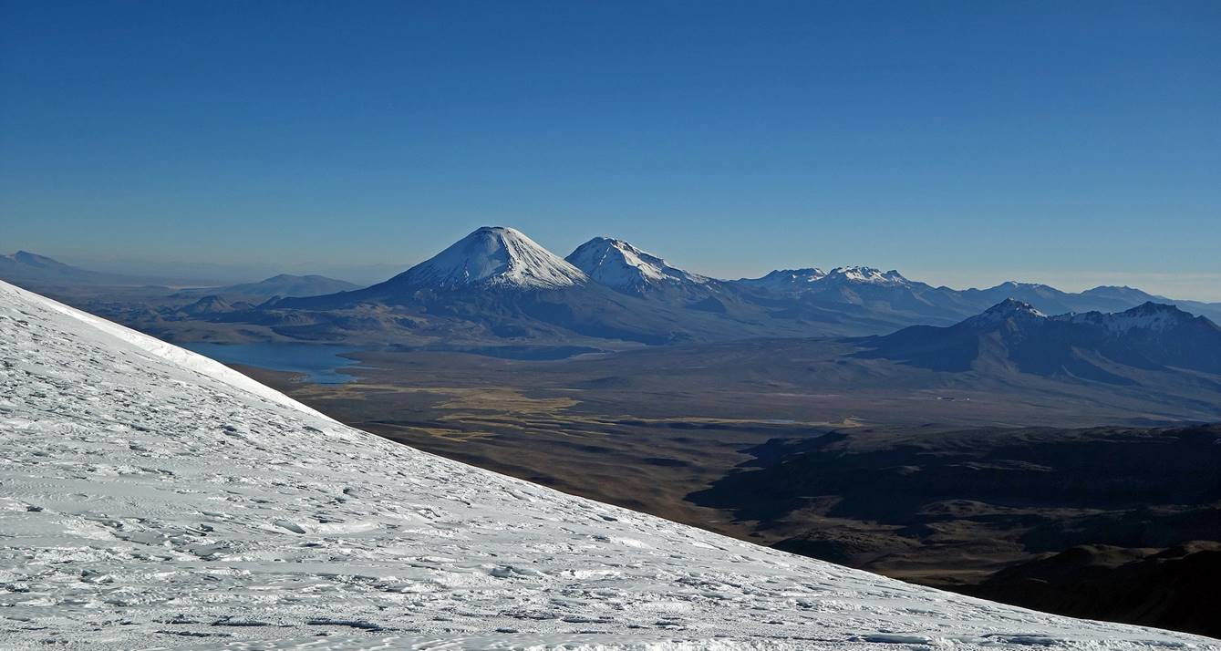
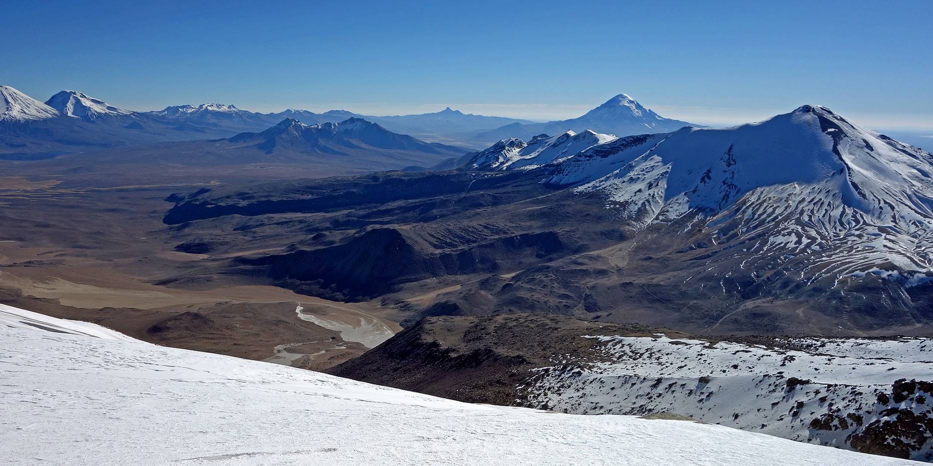
Other views from further up.
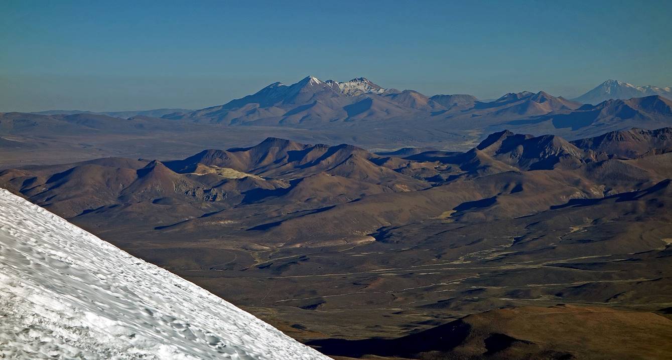
Here, Acotango is on the right and Sajama is on its left behind.
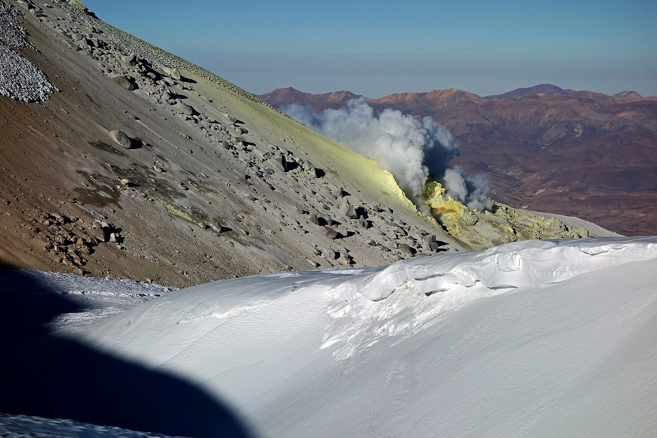
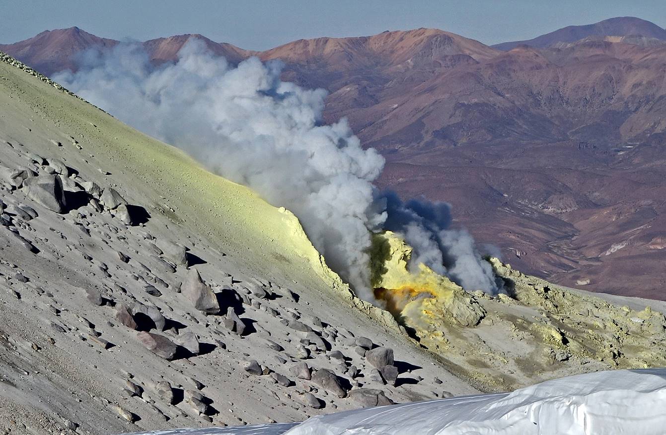
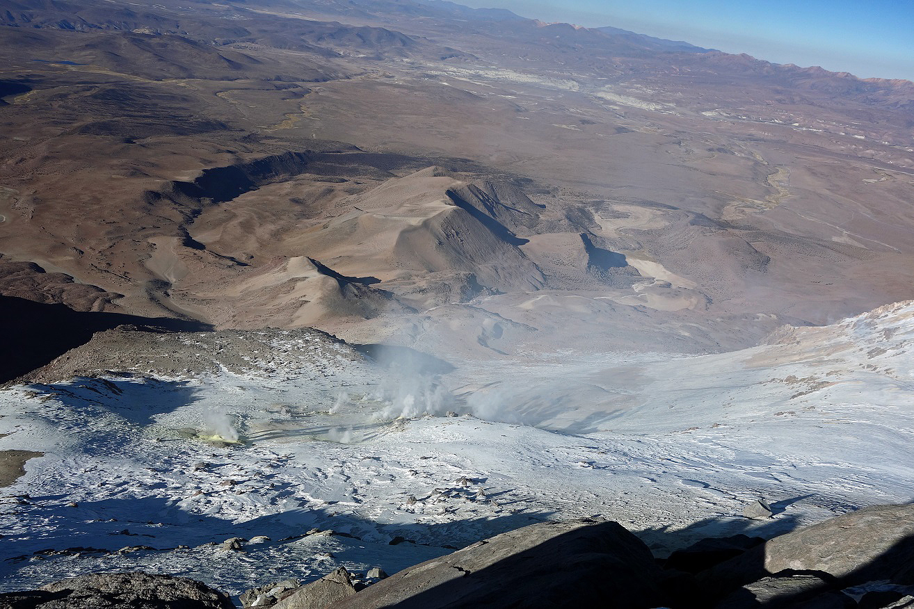
Main vent continuously expelling fumes below the summit.
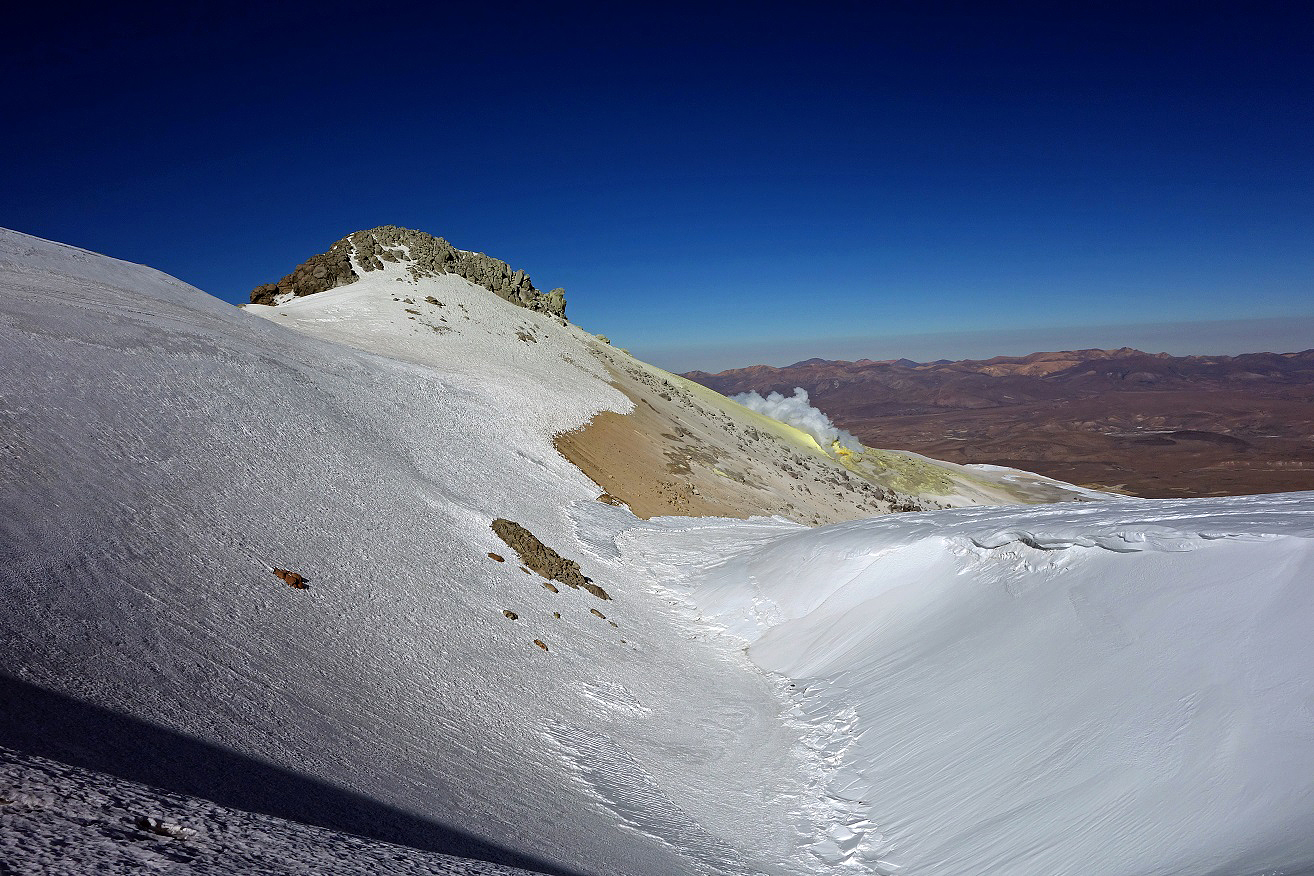
View of the summit (at the top of the rock outcrop).
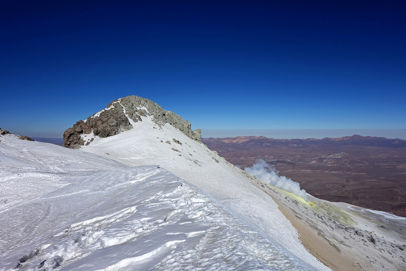
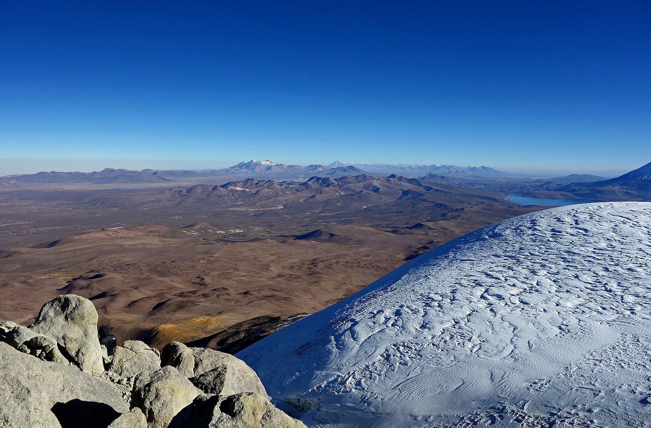
Views from the summit:
- Toward the west.
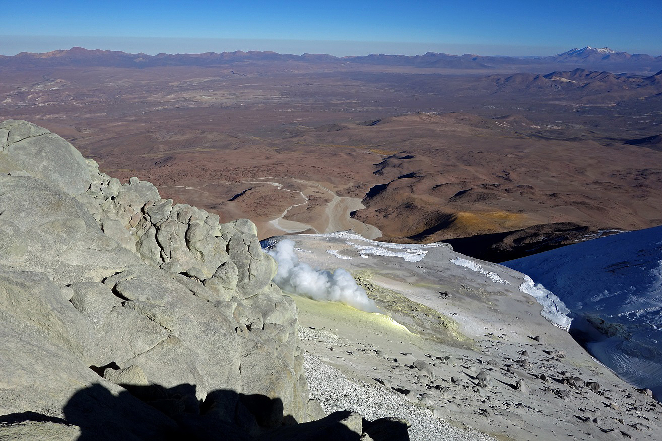
- Down toward the south, showing smaller vents.
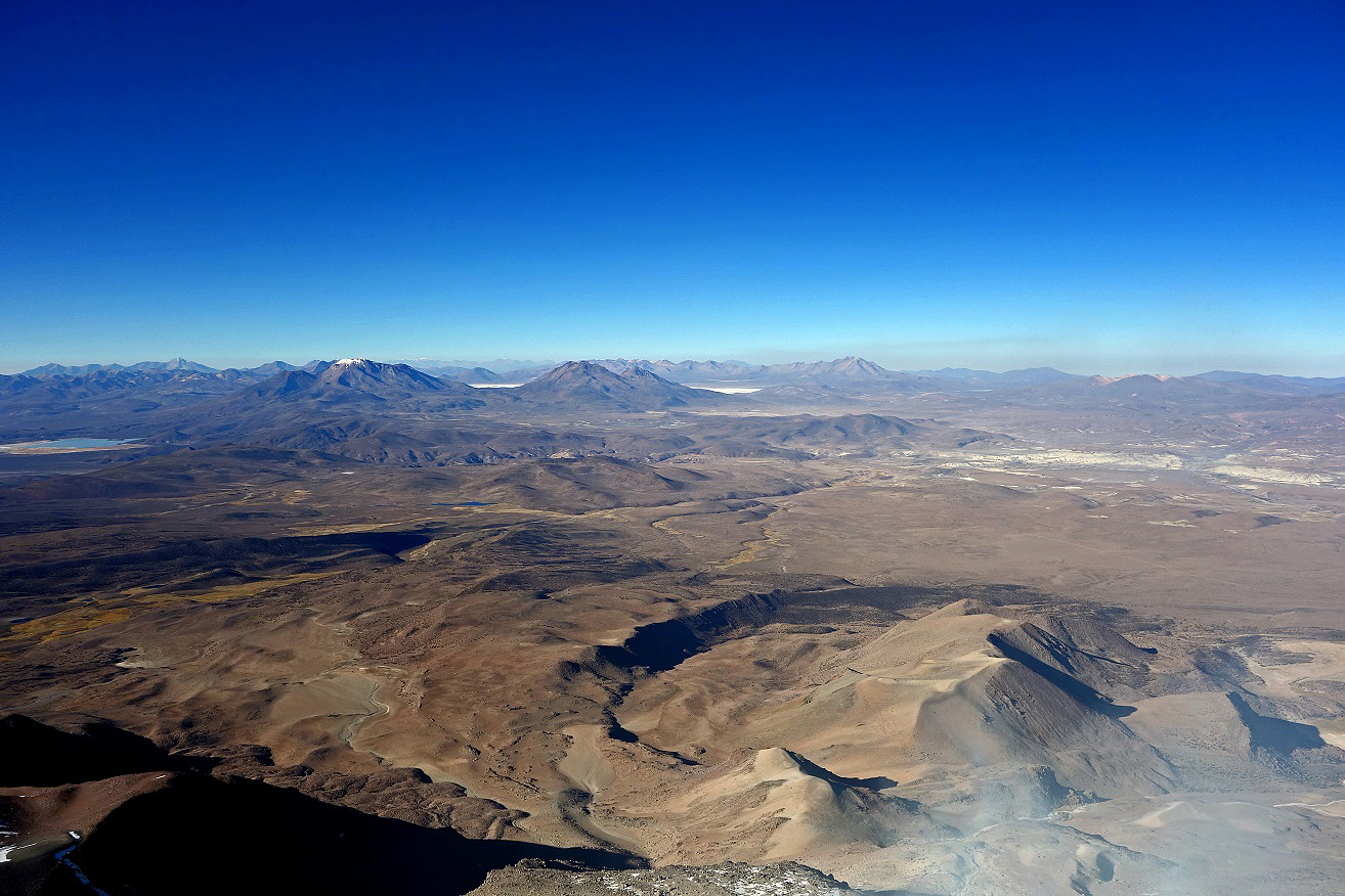
- Toward the south, with Salar de Surire visible in the background (center).
- Toward the north.
![]()