Chile (July-August 2015): Lagunas Cotacotani and Cerro Guane-Guane
![]()
Return to main Chile 2015 webpage
|
Satellite view of the region around Putre: |
Satellite view of Lagunas Cotacotani and Cerro Guane-Guane: |
|
|
|
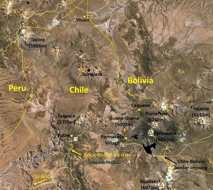
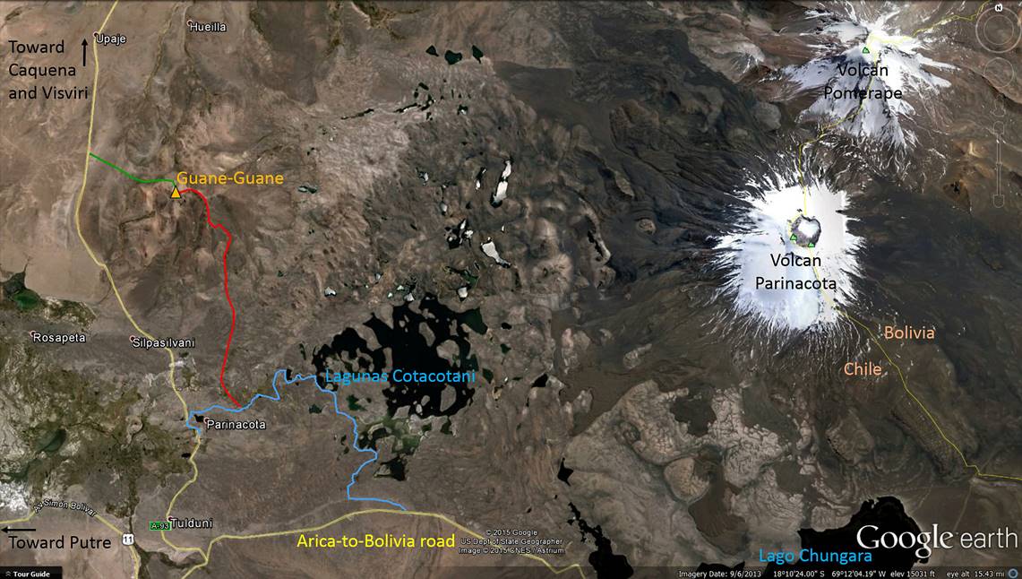
At 4300m and higher, the region located east of Putre between the village of Parinacota and the Bolivian border, and north of the Arica-to-Bolivia road (see annotated satellite views above), is a somewhat unusual part of the Altiplano because of its many lakes. It is dominated by two volcanos, Parinacota (6342m) and Pomerape (6240m), which both lie on the border with Bolivia, and to a smaller degree by Guane-Guane (5097m). The largest lake is Lago Chungara (21 sq.km) south of Volcan Parinacota. The other, much smaller lakes are the Lagunas Cotacotani. From Putre I did two separate trips to this region: a hike along Lagunas Cotacotani (blue path in the satellite map on the right) and an ascent of Guane-Guane (red and green paths, respectively for the ascent and the descent). The ascent of Guane-Guane provides great views over the entire region. I did it with Alvaro Mamani, a guide from Putre.
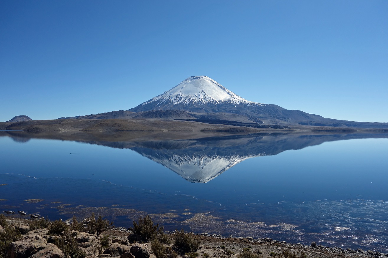
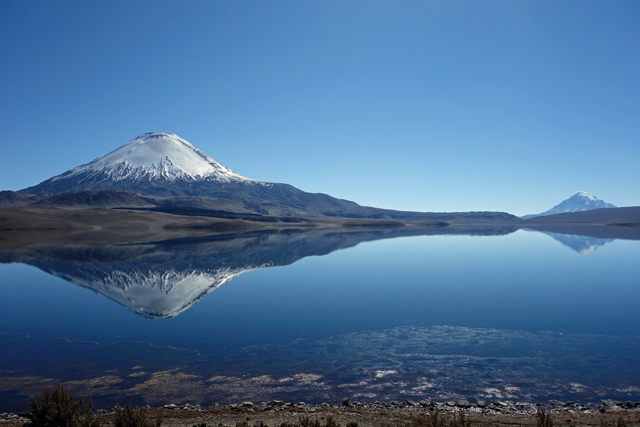
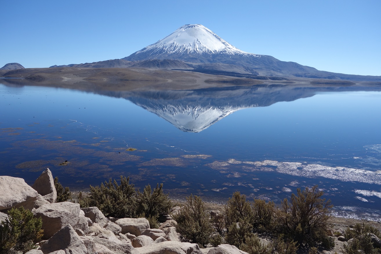
Lago Chungara:
Before doing the Lagunas Cotacotani hike, I stopped at Lago Chungara, which lies along the road to Bolivia.
Reflections of Volcan Parinacota on Lake Chungara on a windless morning.
|
|
Here the volcan on the right is Sajama. At 6542m, it is the highest peak in Bolivia. |
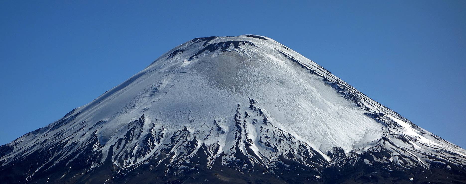
Close-up on Parinacota snow-and-ice cap.
Southern shore of Lago Chungara, with active Volcan Guallatiri (6071m) on the right emitting white vapor. In the middle of the photo a long line of trucks is waiting at the Chilean border post to cross into Bolivia.
Lagunas Cotacotani:
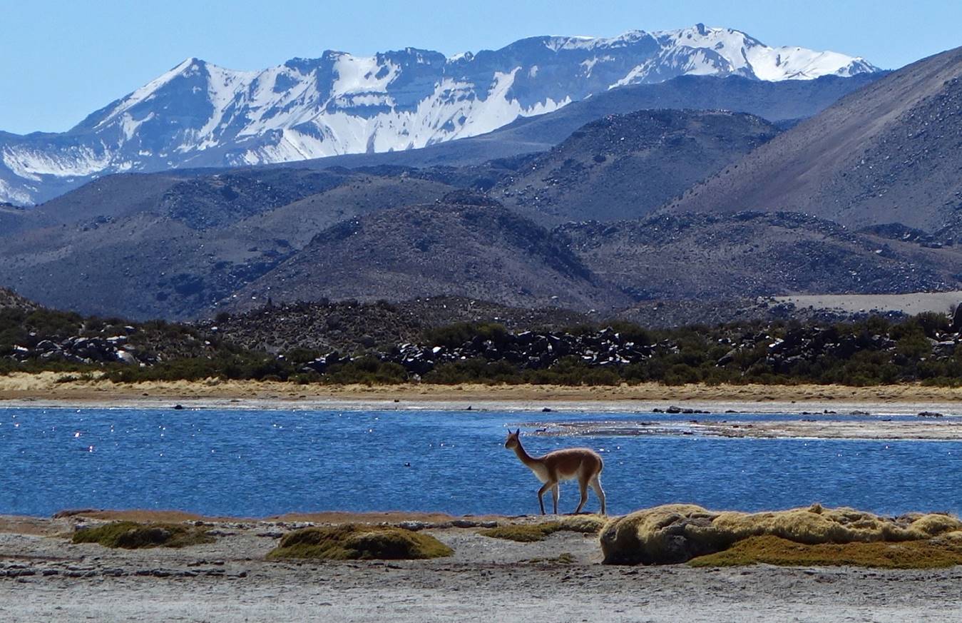
The Lagunas Cotacotani are a large collection of small lakes that are fed by melting snow and ice from Volcans Parinacota and Pomerape and by infiltration from Lago Chungura. This easy 10.5 km hike starts from the Arica-to-Bolivia road and ends at Parinacota village after passing by several lakes. Many taguas gigantes (coots) and vicunas can be seen along the way.
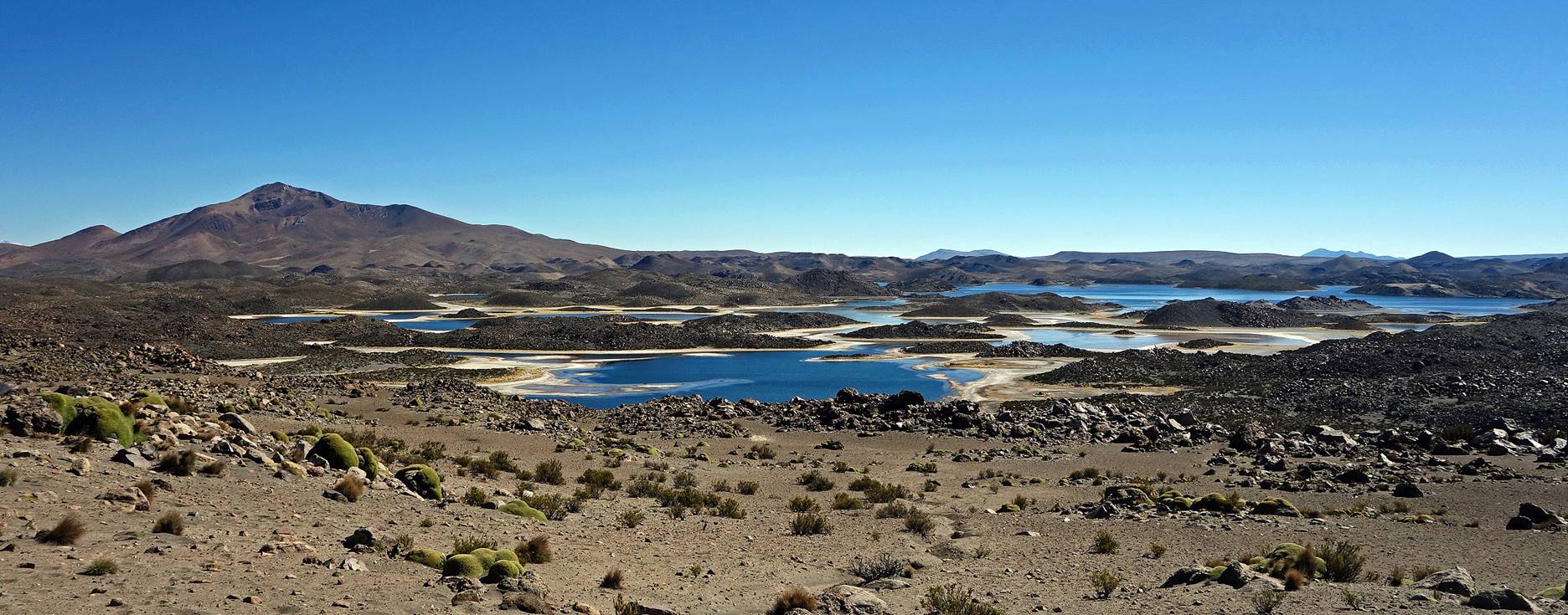
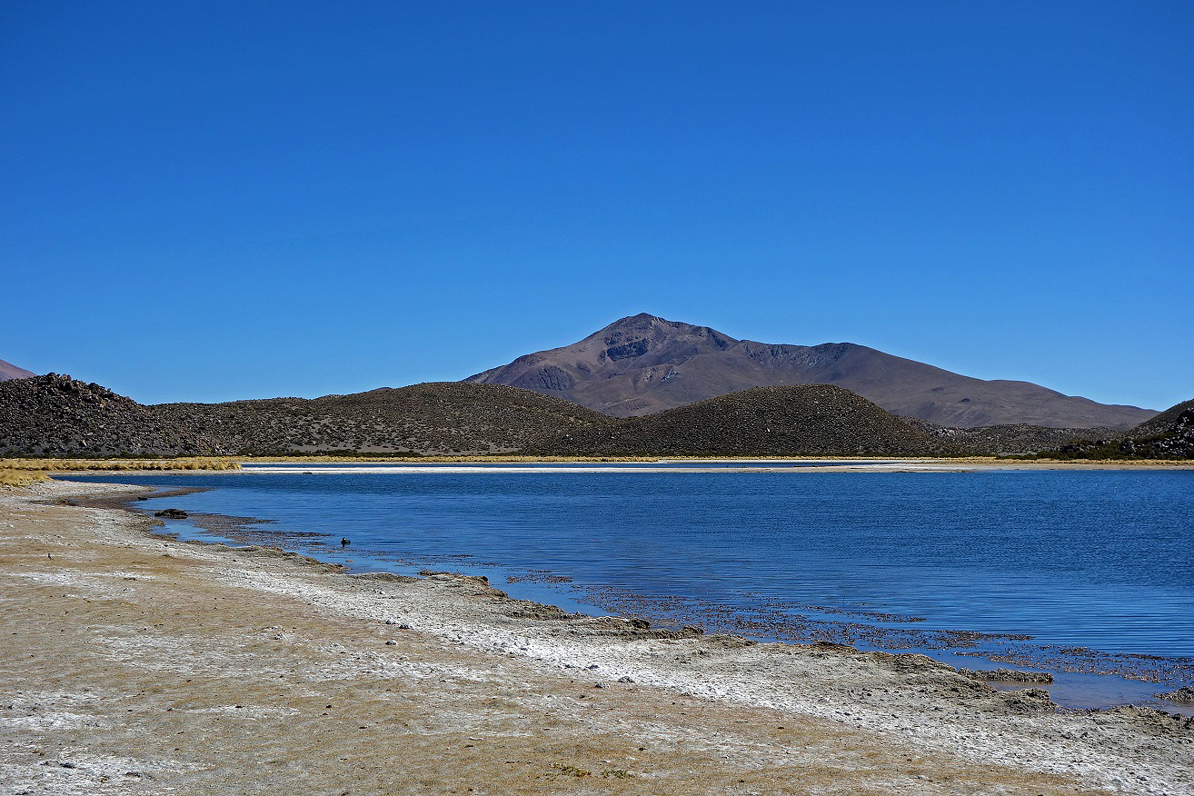
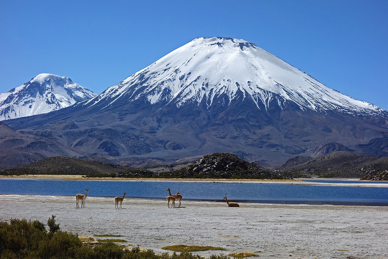
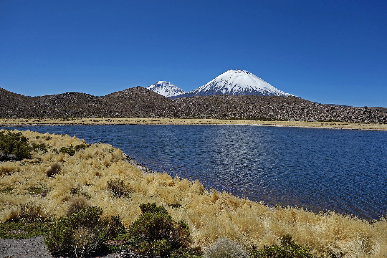
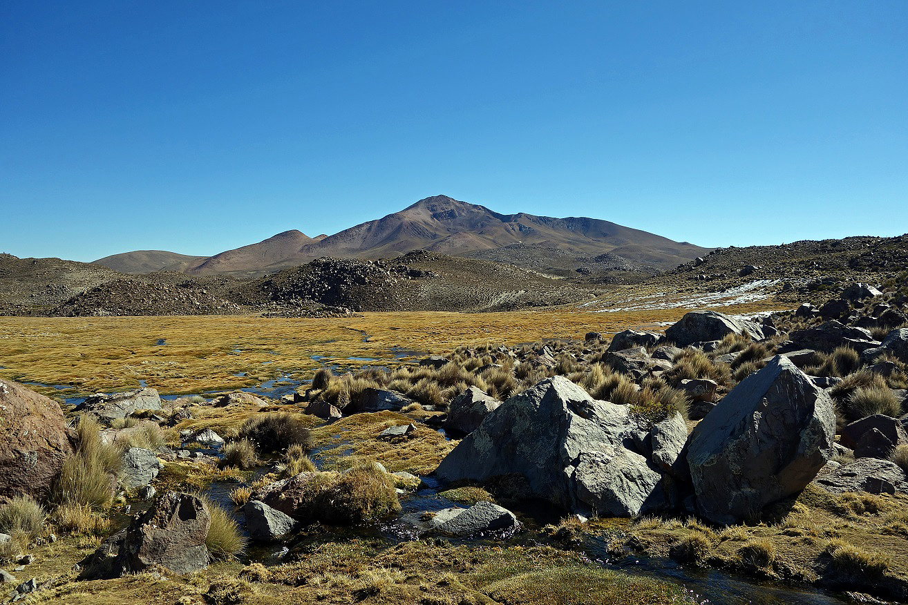
Views over the Cotacotani Lagunas at the beginning of the hike, with Cerro Guane-Guane visible on the left in the first photo.
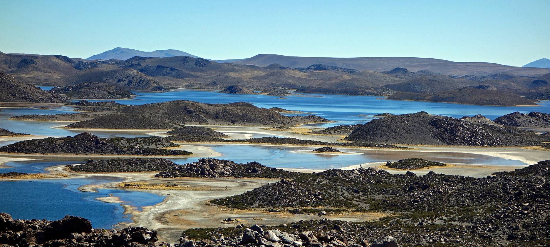
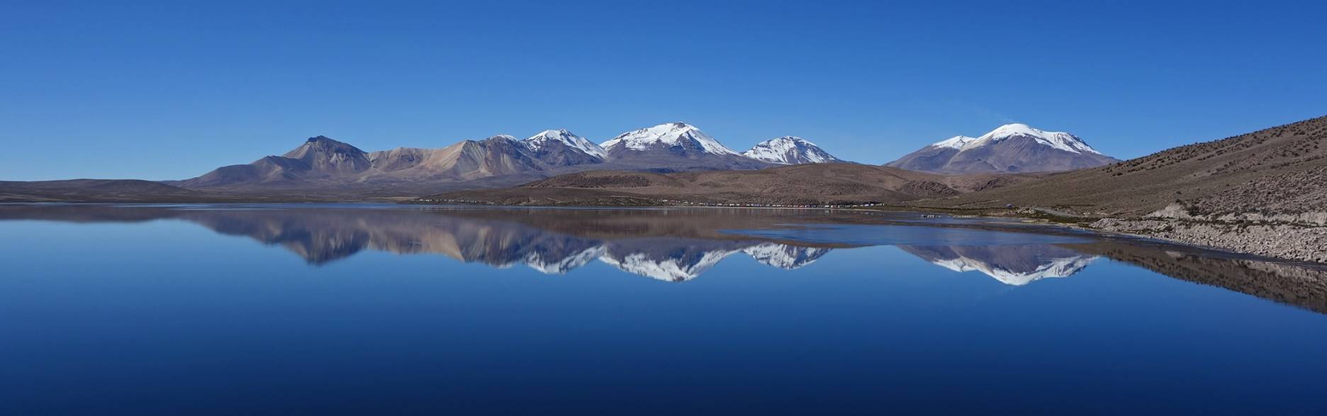
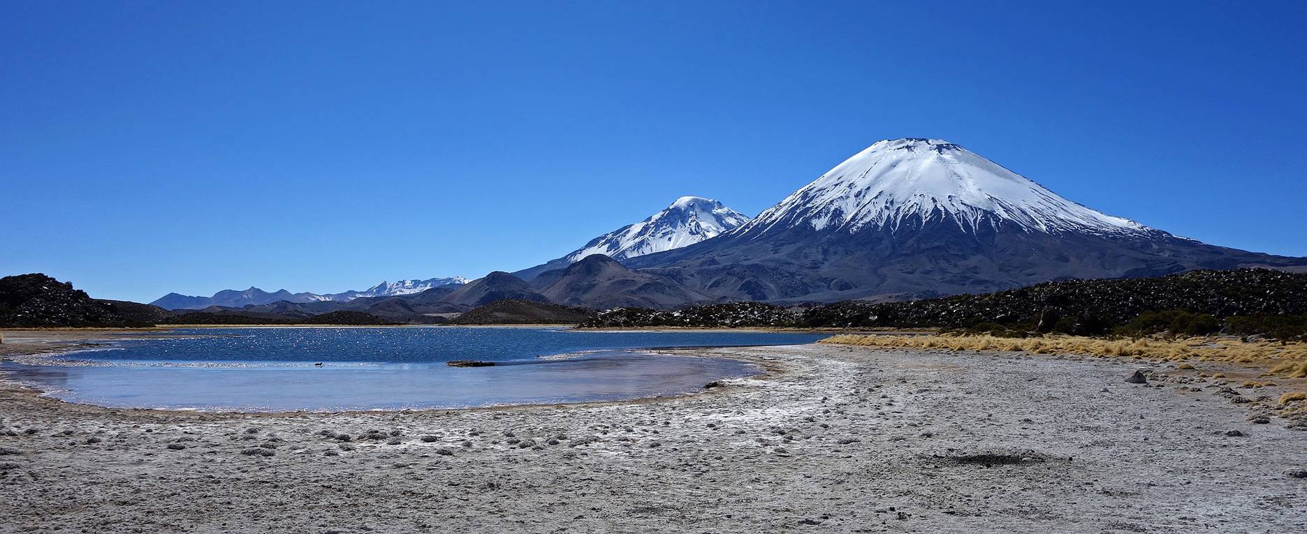
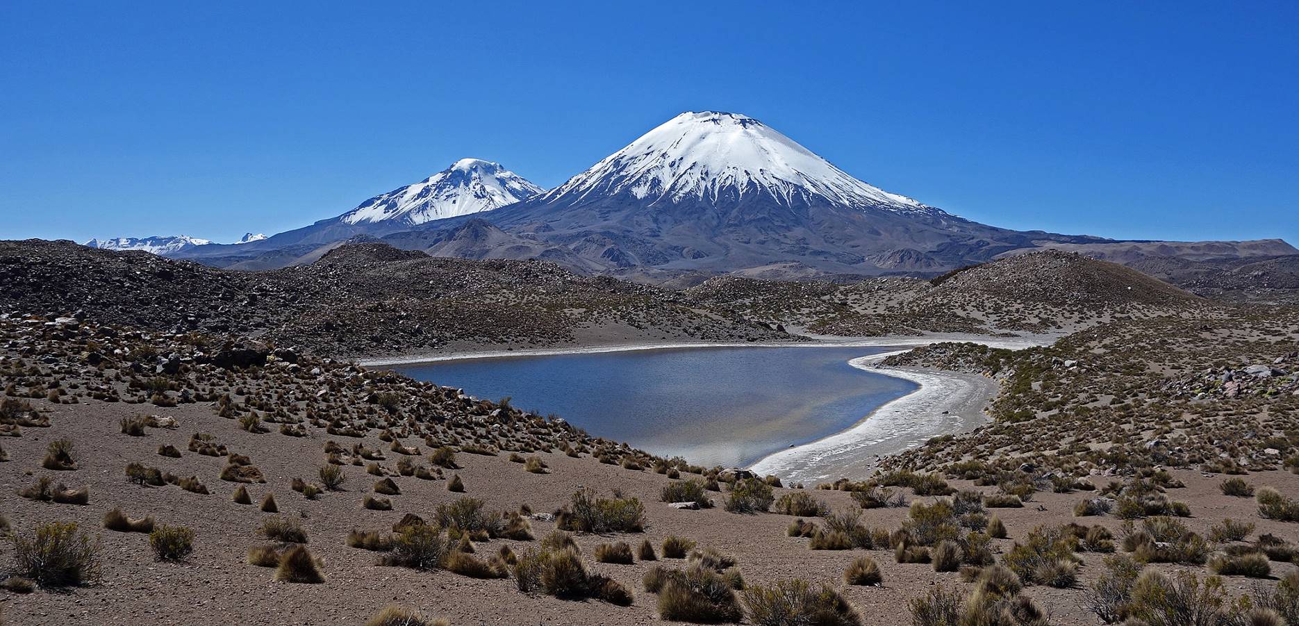
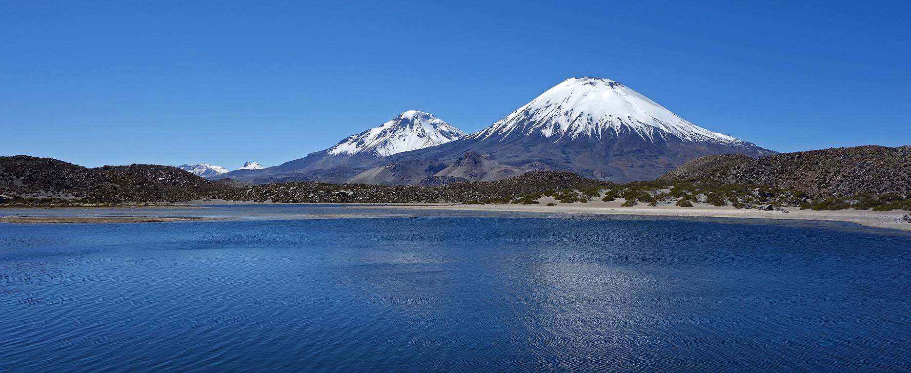
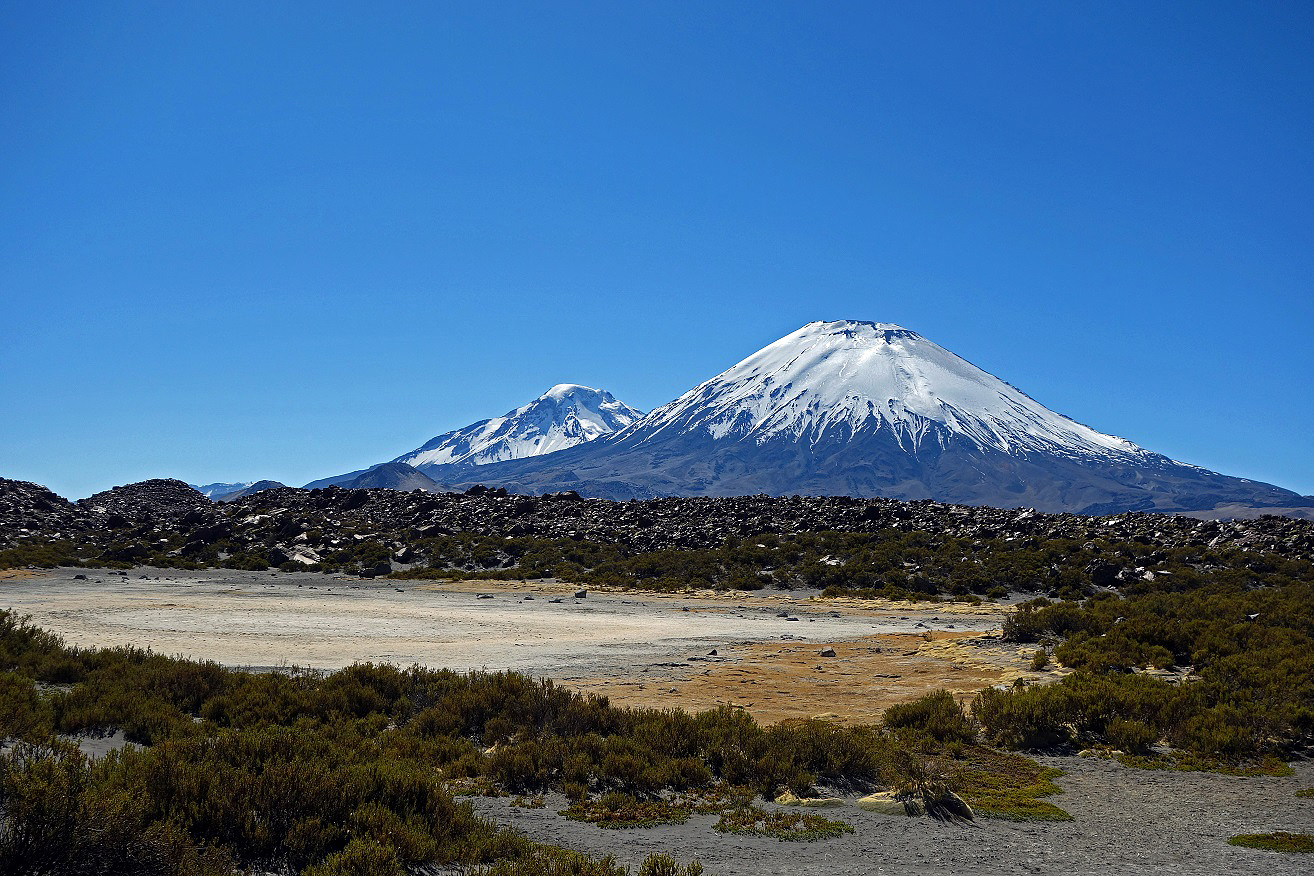
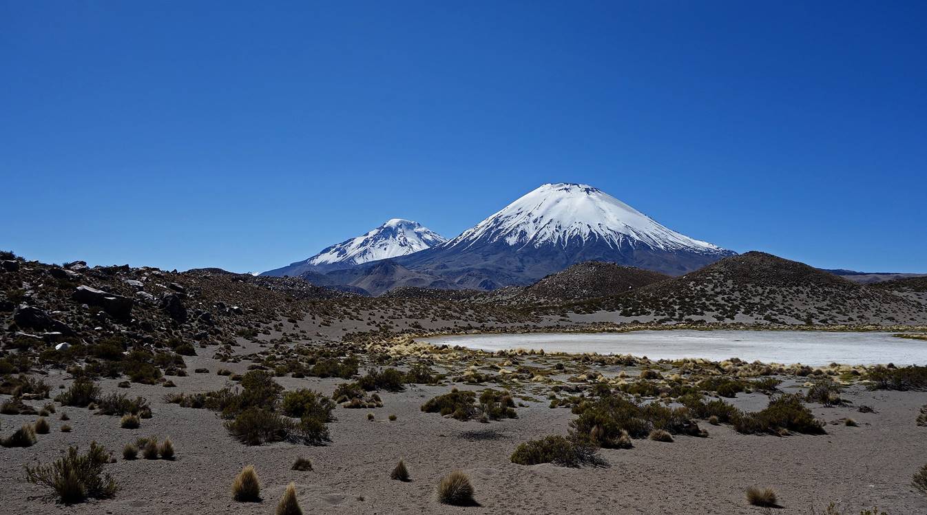
Volcans Pomerape (left) and Parinacota (right) stand in the background of the lakes.
Another lake with Guane-Guane in the background.
During the winter season some lakes have dried up.
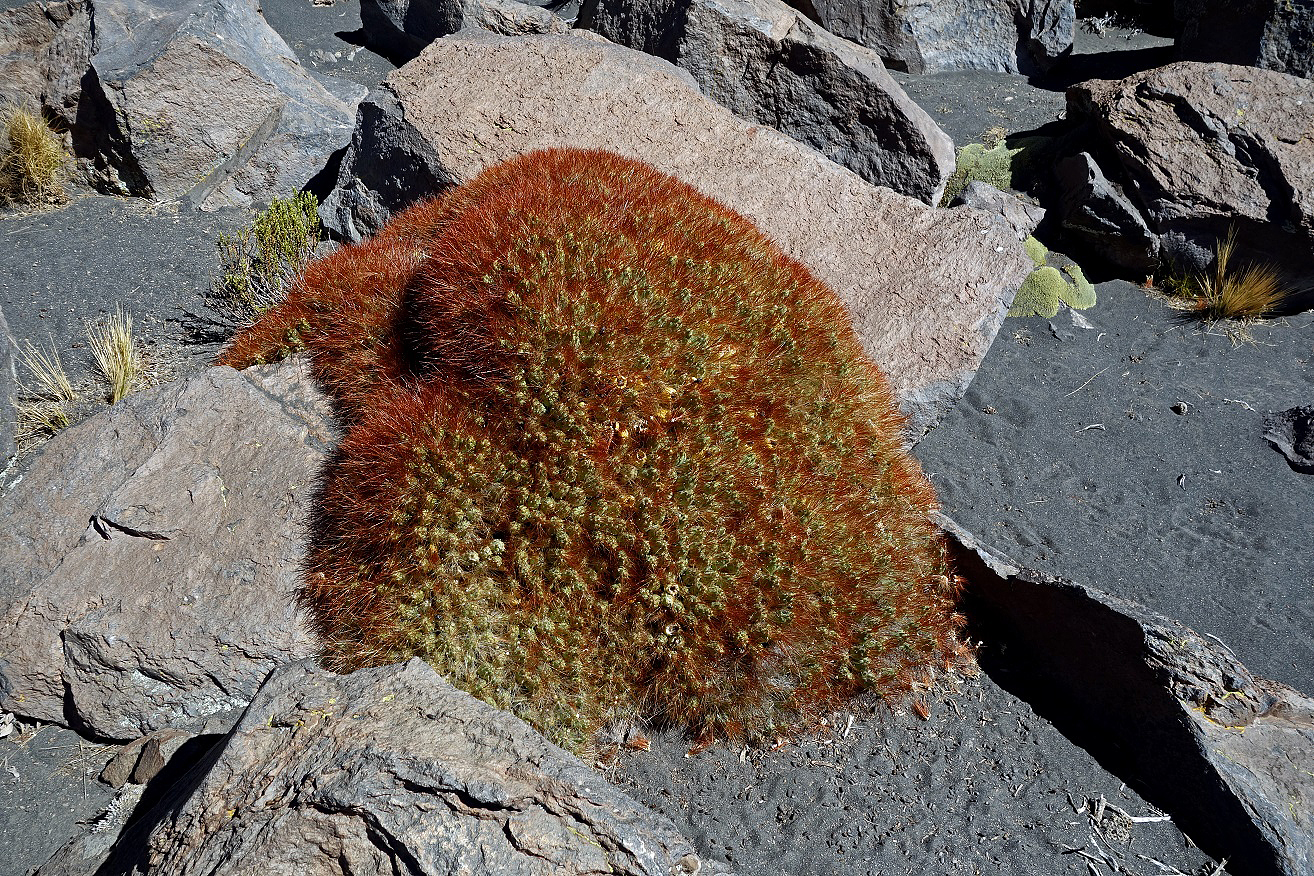
Cactus Jala Jala (Cumulopuntia boliviana), locally called ″cojin de la suegra″ (cushion of the mother-in-law).
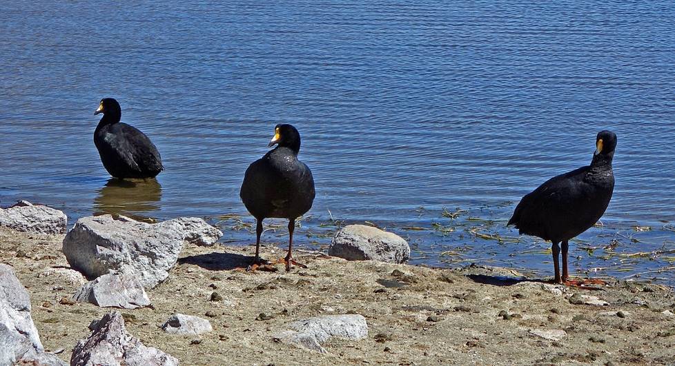
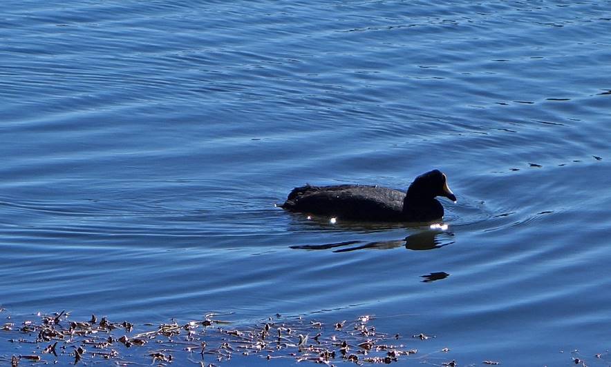
Taguas gigantes (giant coots).
|
|
|
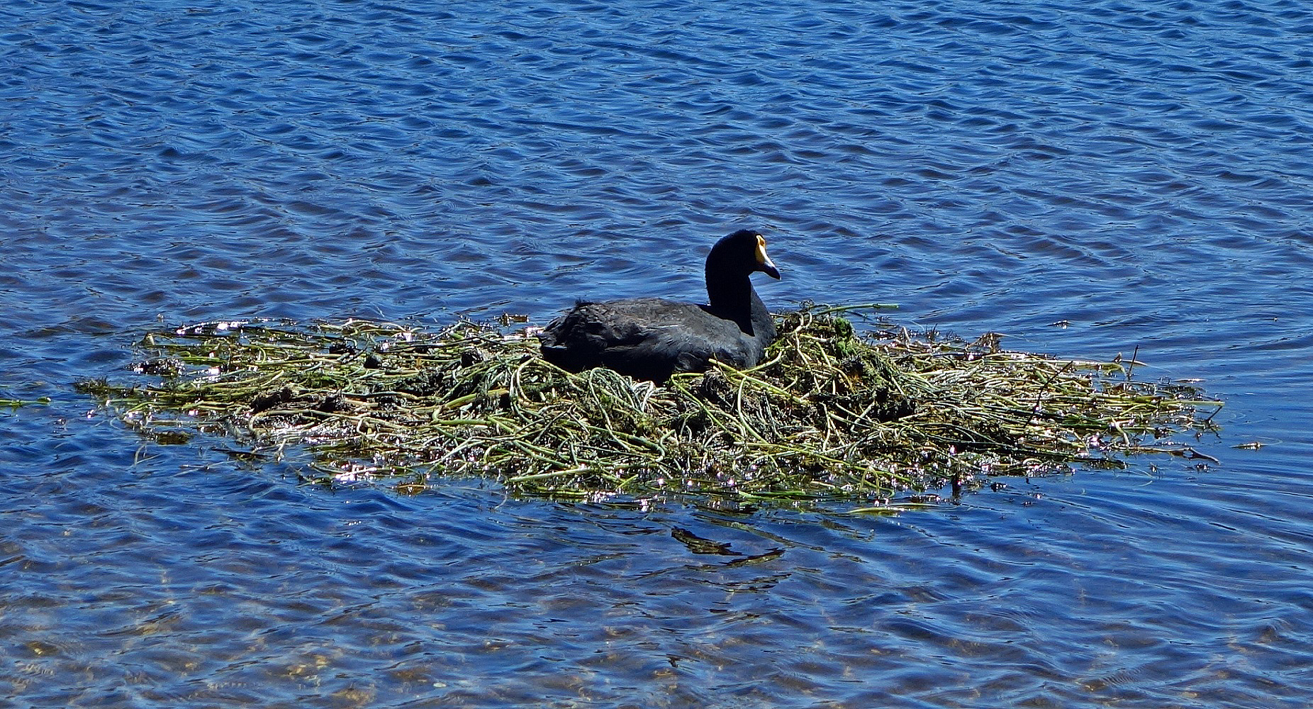
Tagua gigante in its nest.
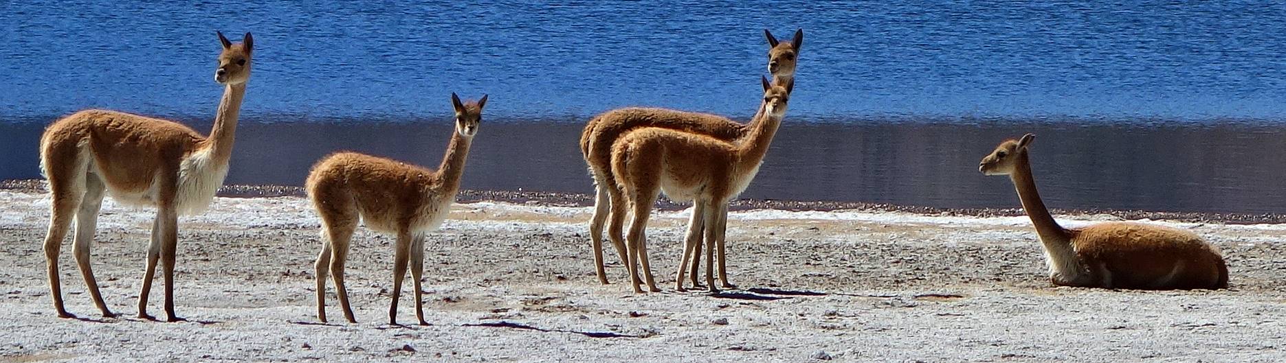
Graceful vicunas.
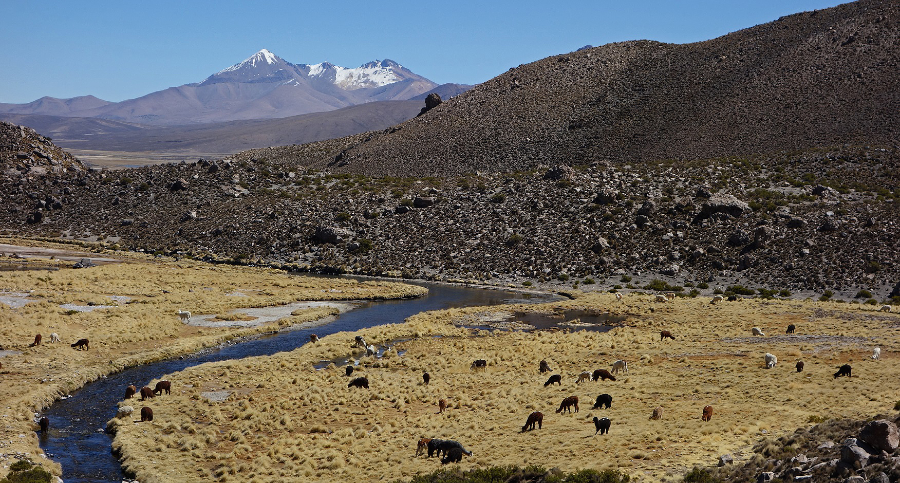
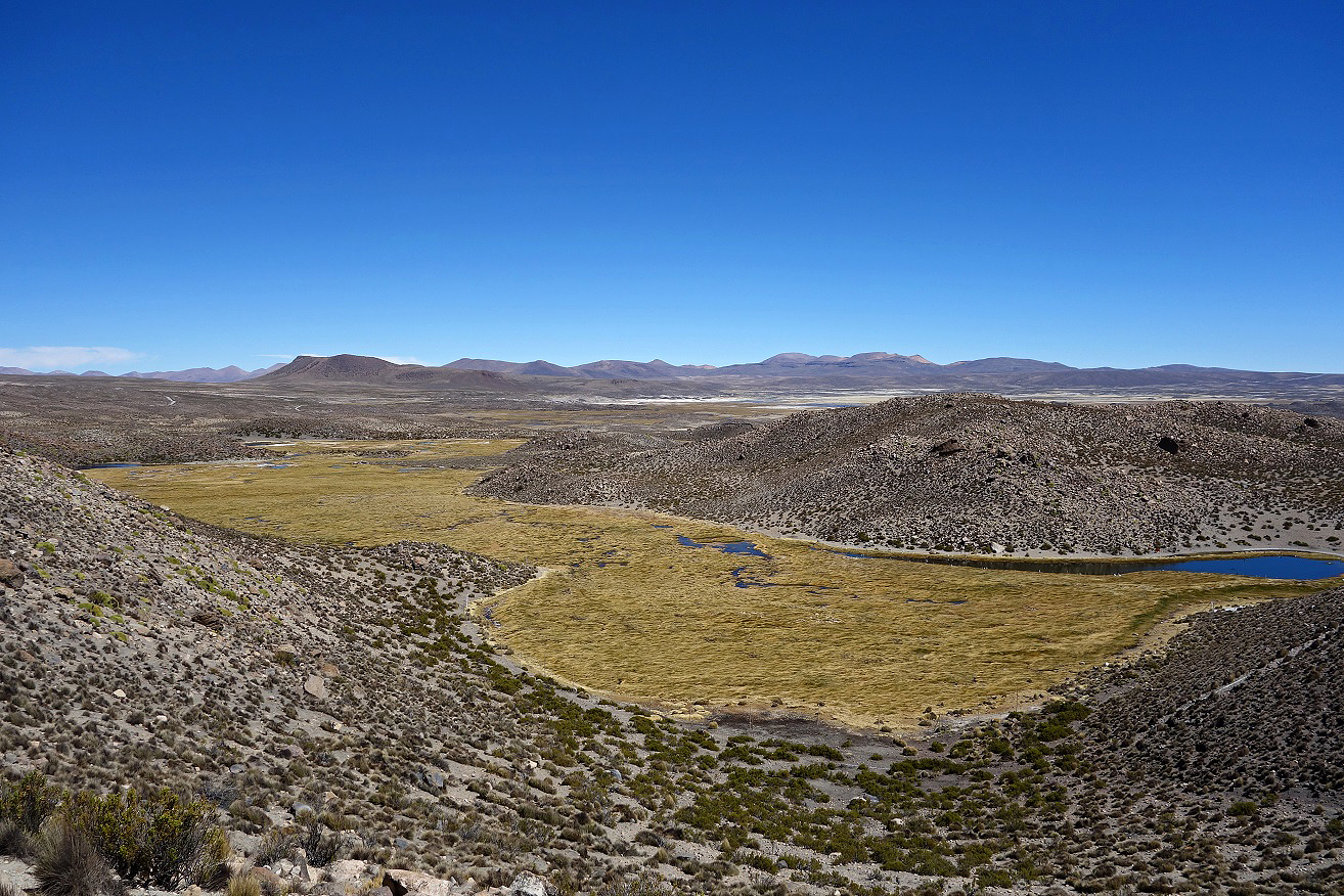
Bofedal hosting a group of llamas and alpacas, with snowcapped Cerro Taapaca in the background. Bofedals are areas of wetland vegetation typical of the high Andes of Peru. Bolivia, and Chile. Formed by networks of small water streams they are important sources of water and forage for wildlife and domesticated livestock. They also provide edible food for humans, including an alga called llaita used in a dish known as ″el picante de llaita″.
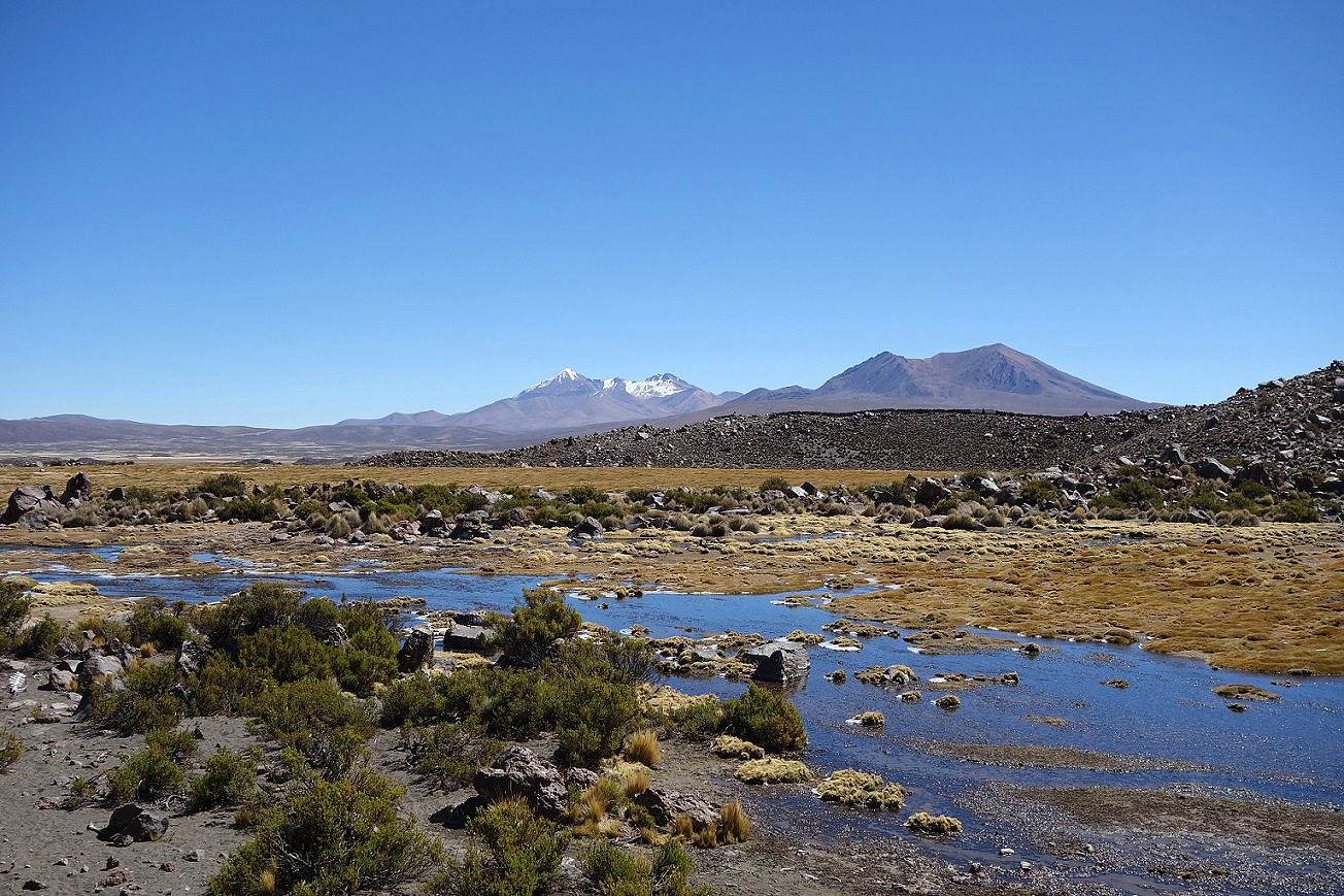
Yet another lake.
Other bofedals.
Arriving at Parinacota village.
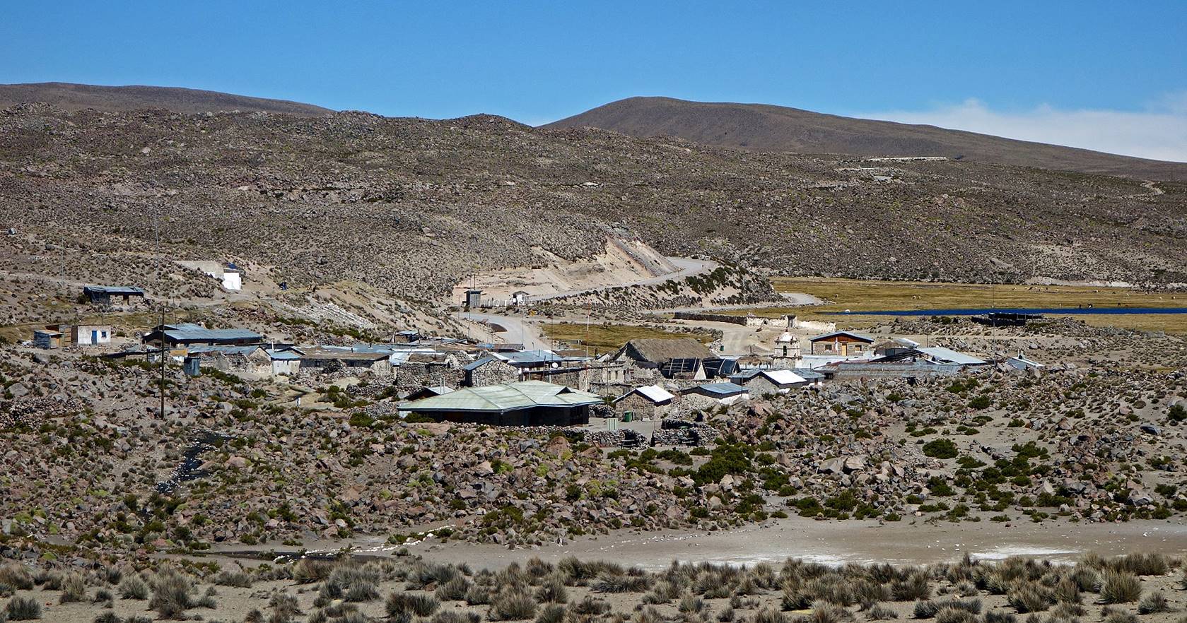
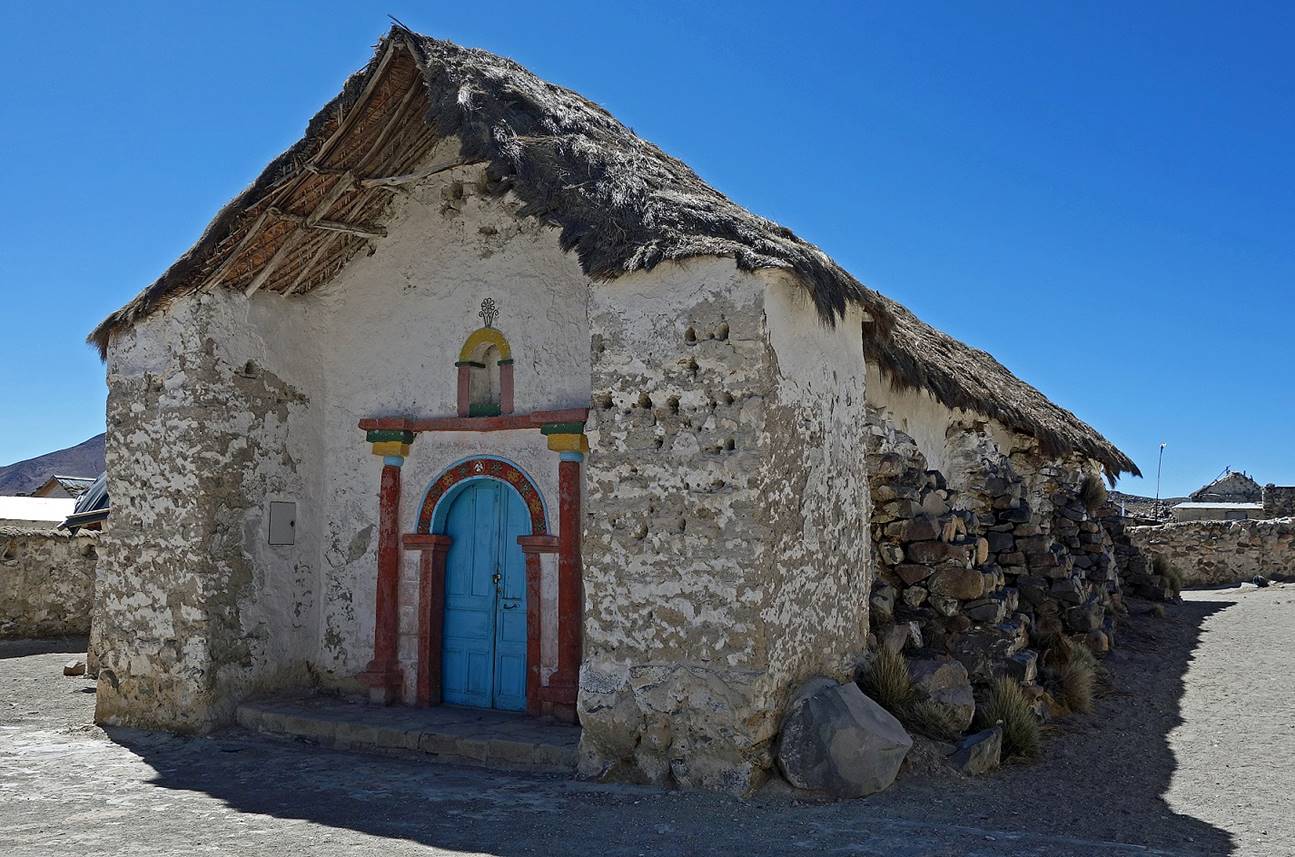
Parinacota village (4420m):
The small village of Parinacota (less than 30 inhabitants) grew in colonial time as a supply point on the ″Ruta de la Plata″ between Potosi and Arica. The name ″Parinacota″ comes from ″Parina Quta″ in Aymara, which means ″Lake of Flamingo″.
Cerro Taapaca viewed from Parinacota village.
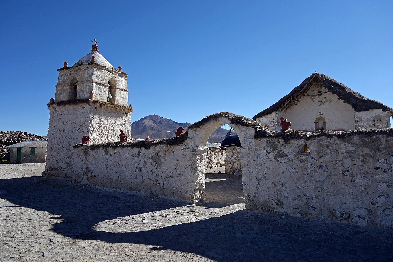
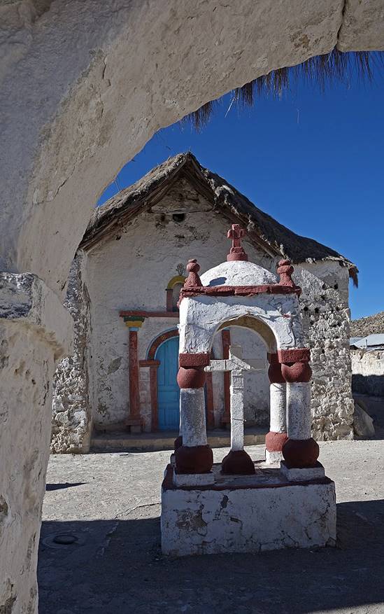
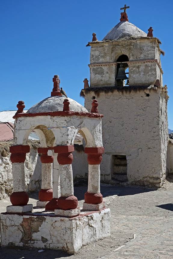
The Virgen de la Natividad church in Parinacota, originally built in the 17th century and reconstructed in the 18th century.
|
|
|
|
|
|
Guane-Guane:
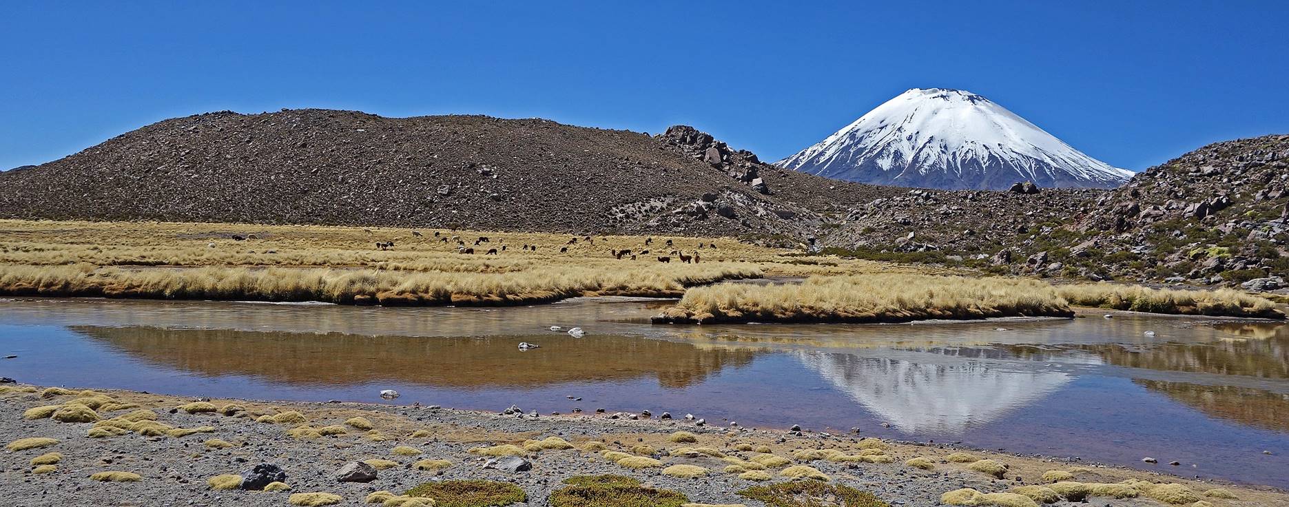
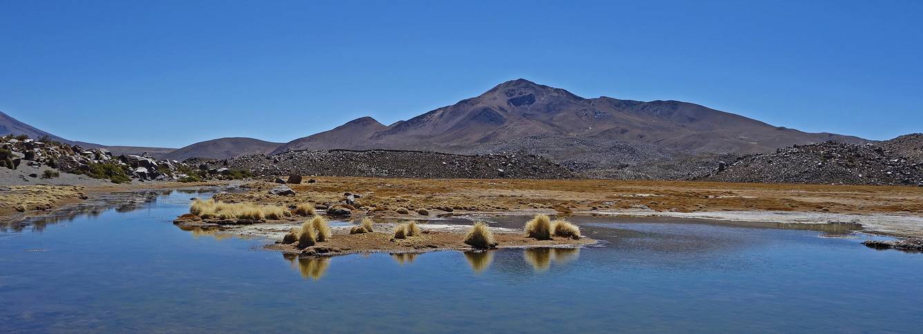
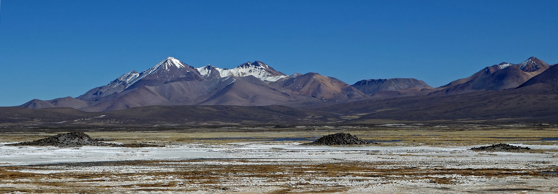
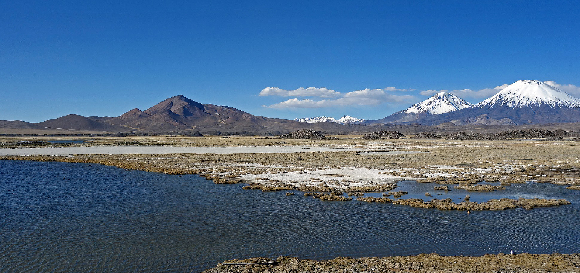
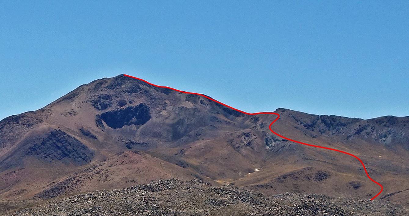
Volcan Guane-Guane (5097m) and its two taller neighbors, Volcans Pomerape (6240m) and Parinacota (6330m).
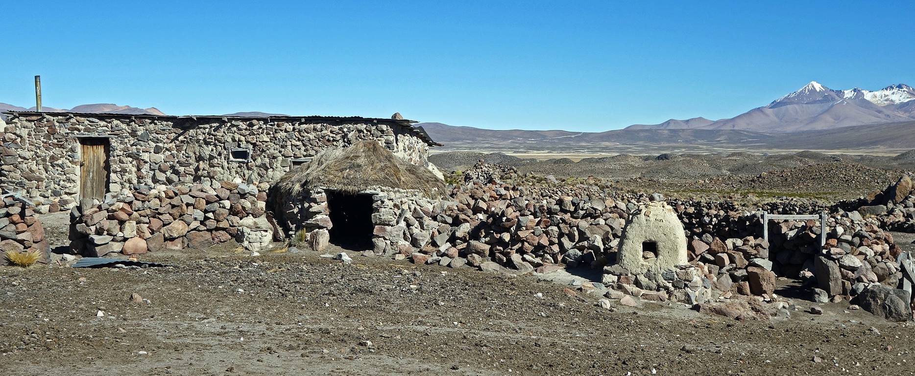
Traditional stone house at the beginning of the ascent (~4500m).
Bofedal near the stone house, with Guane-Guane in the background.
Approximate route of the ascent.
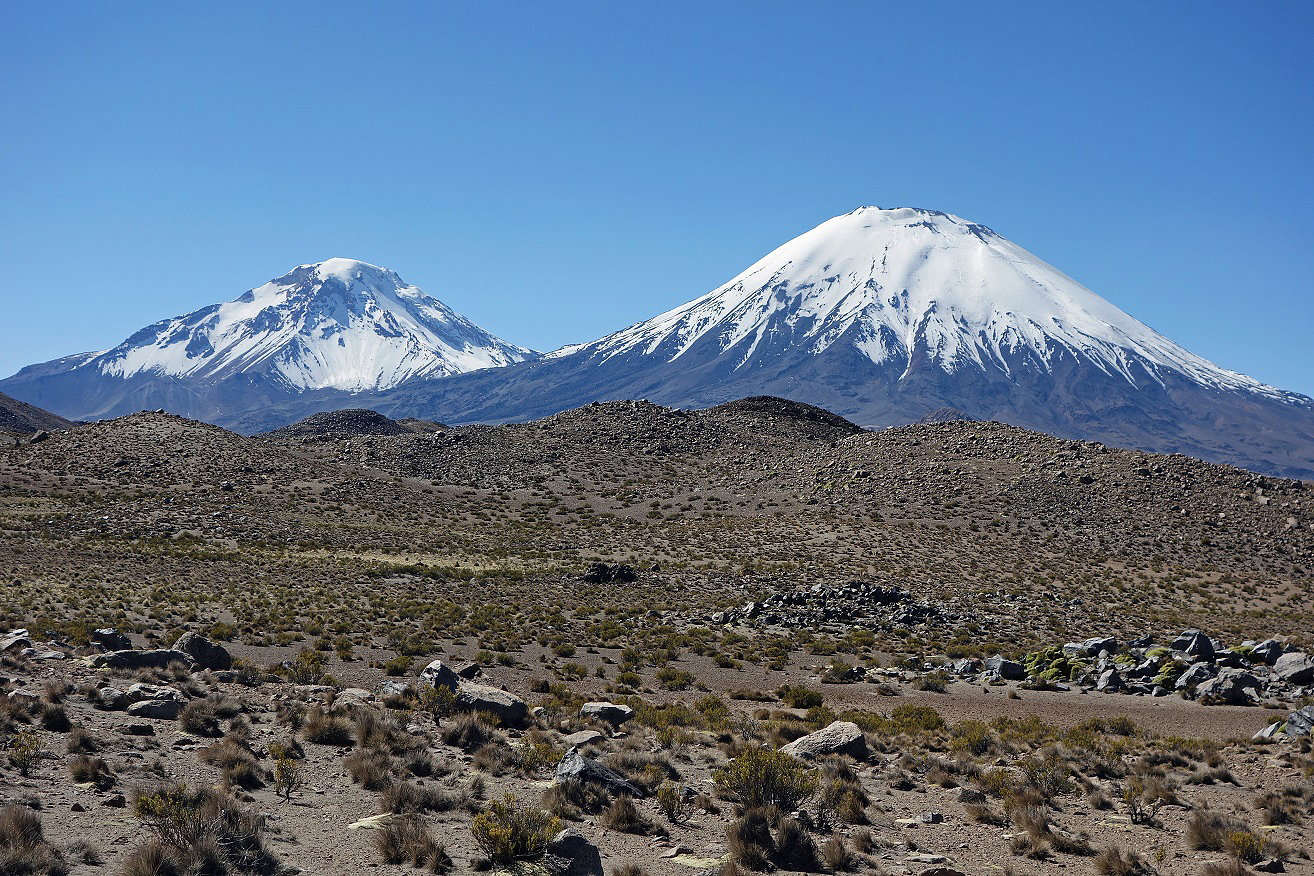
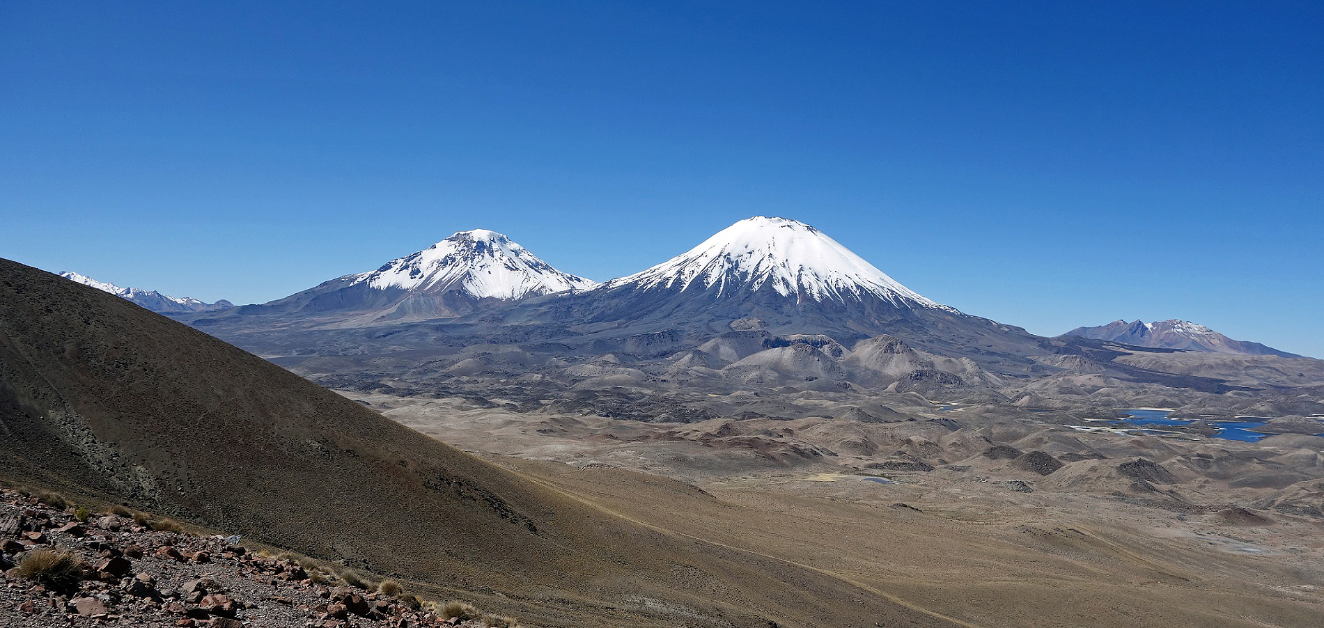
Volcan Pomerape (left) and Paranicota (right) seen at the beginning of the climb and further up (second photo below).
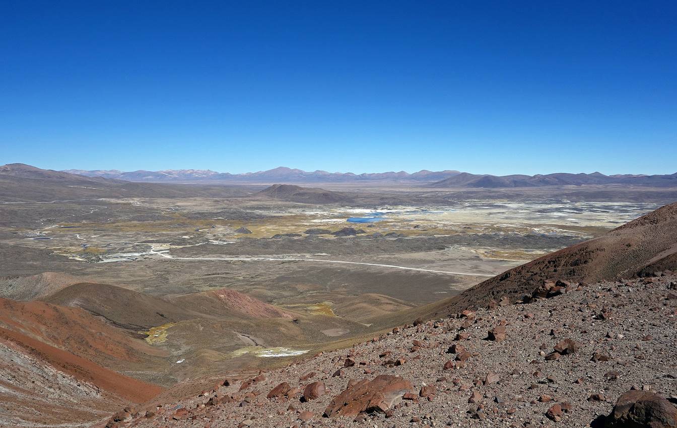
View toward the south at about mid-course. The dust road visible in the picture connects Parinacota village (on the very left) to Caquena and Visviri further north.
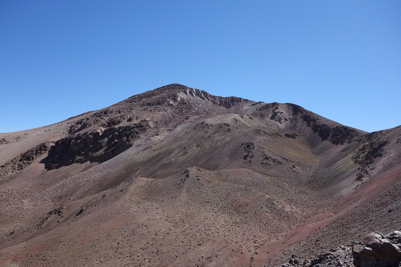
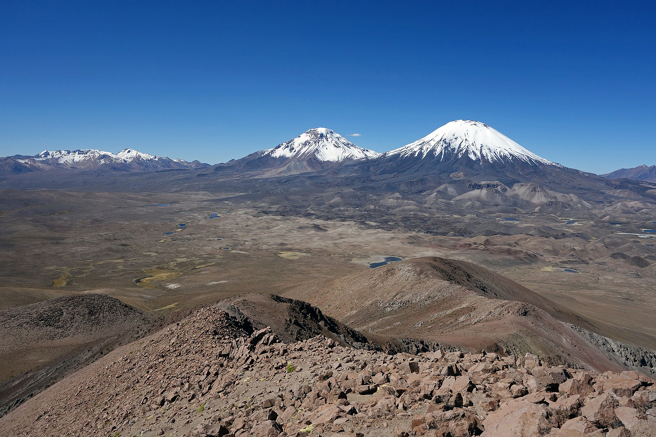
Summit ridge.
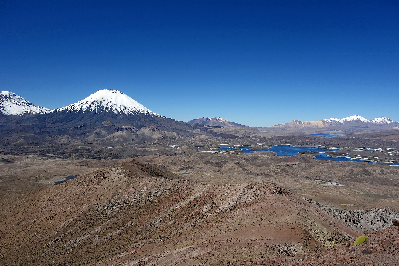
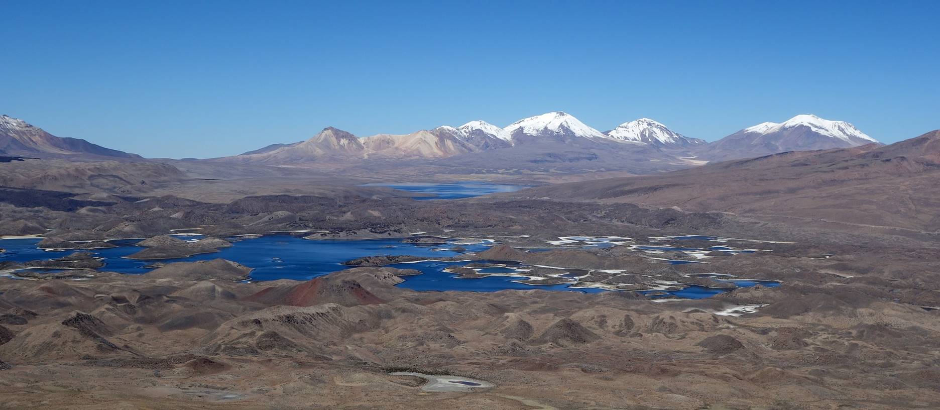
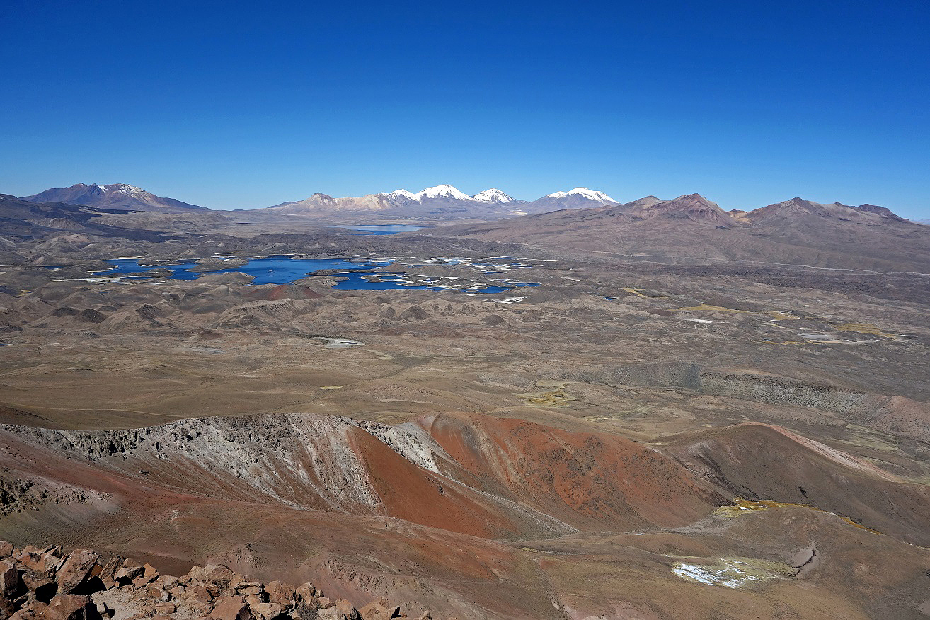
Views over Lagunas Cotacotani from the summit ridge. The rightmost volcano in the second photo is Volcan Guallatiri.
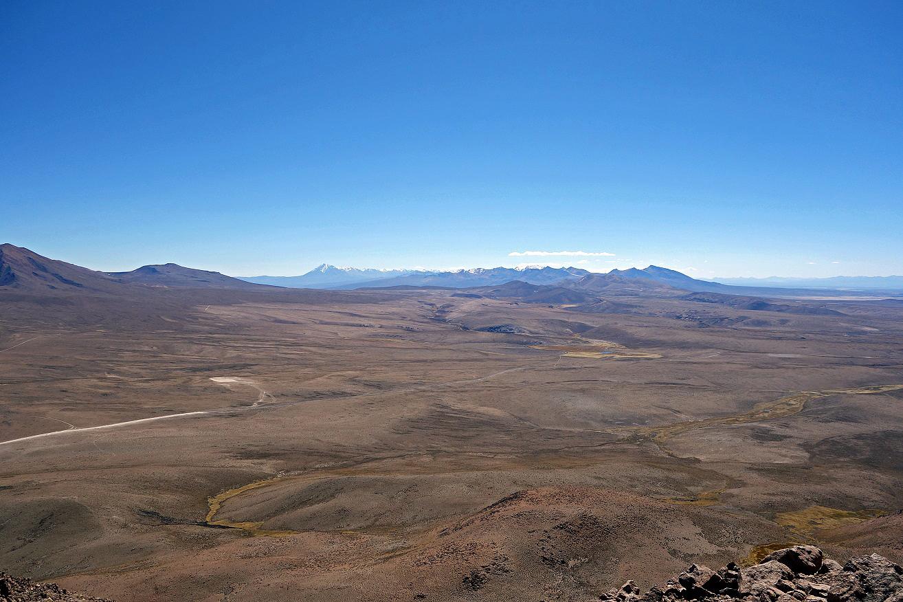
Three views from the summit of Guane-Guane, respectively, toward the east, the south-east, and the north-west. In the third photo, the volcanos on the horizon are the collection of volcanos that surround Suriplaza and the (taller) leftmost volcano is Tacora (5988m), which lies further away beyond Suriplaza, near the border with Peru. See annotated satellite image at the top of this page.
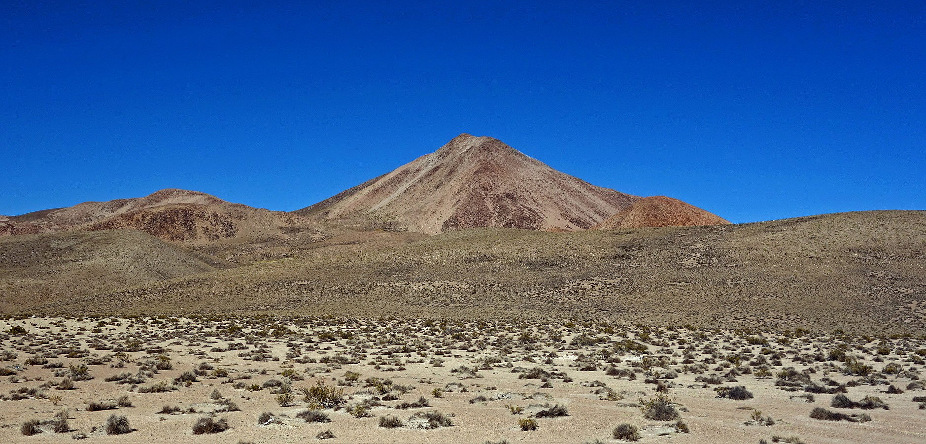
View of Guane-Guane from the Parinacota-to-Visviri road where a car was waiting to drive Alvaro and me back to Putre. Most of the descent was on soft ash deposit on the north face of the volcano (left side of the mountain in the photo).
![]()
Return to main Chile 2015 webpage