Chile (July-August 2015): Suriplaza
![]()
Return to main Chile 2015 webpage
|
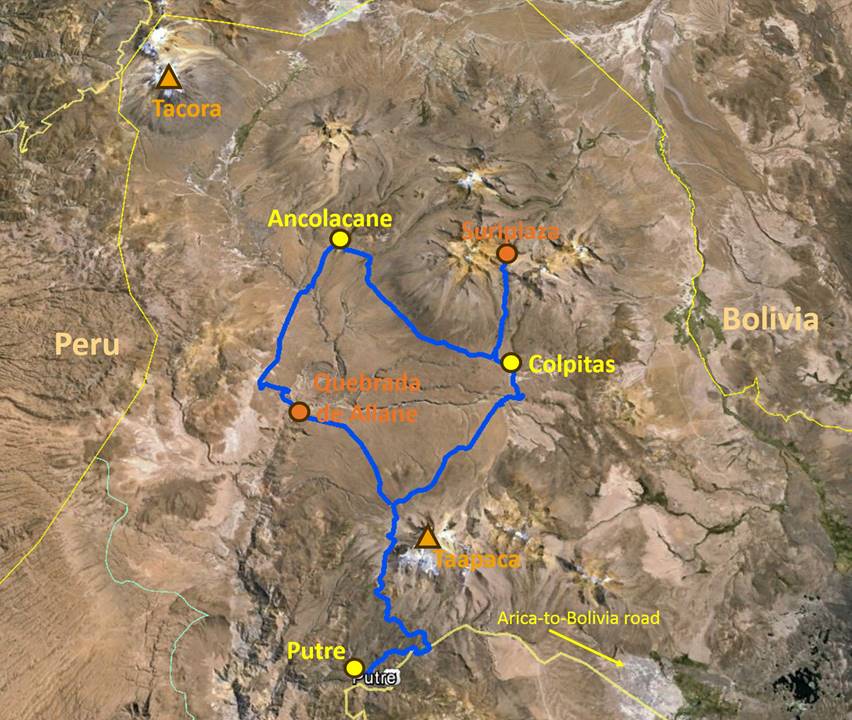
Roads from Putre to Suriplaza (in blue): |
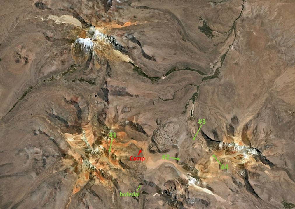
Satellite view of Suriplaza showing some locations mentioned in comments below: |
|
|
|
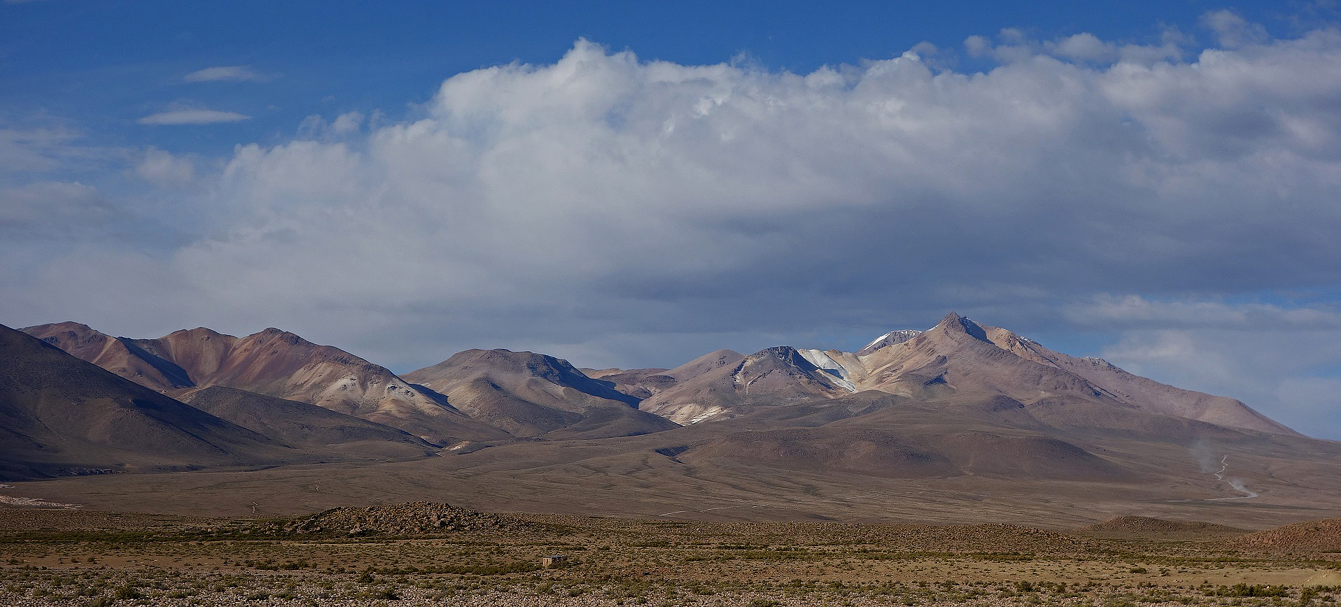
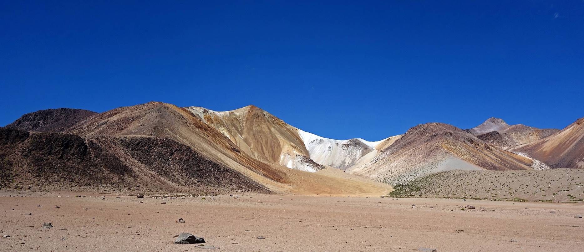
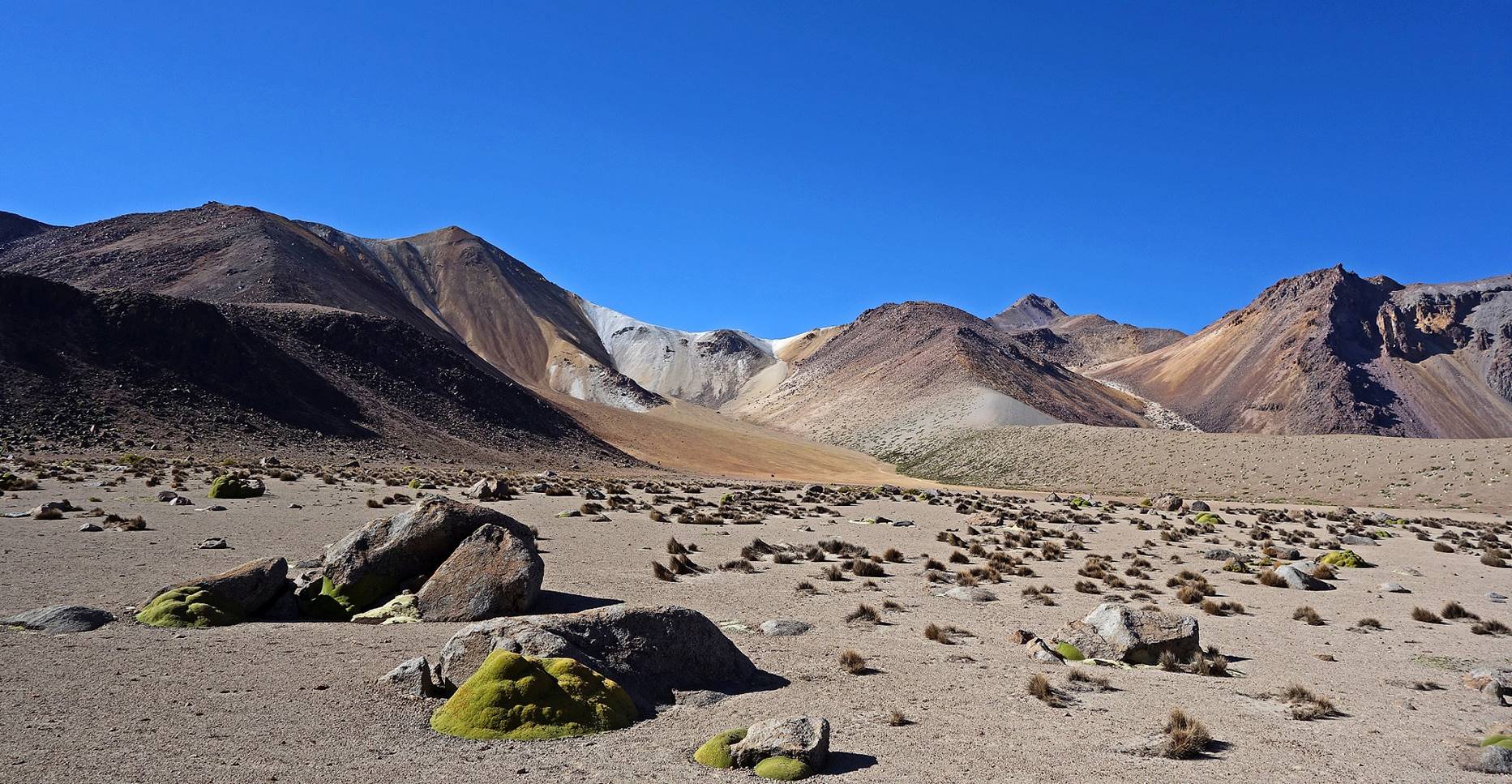
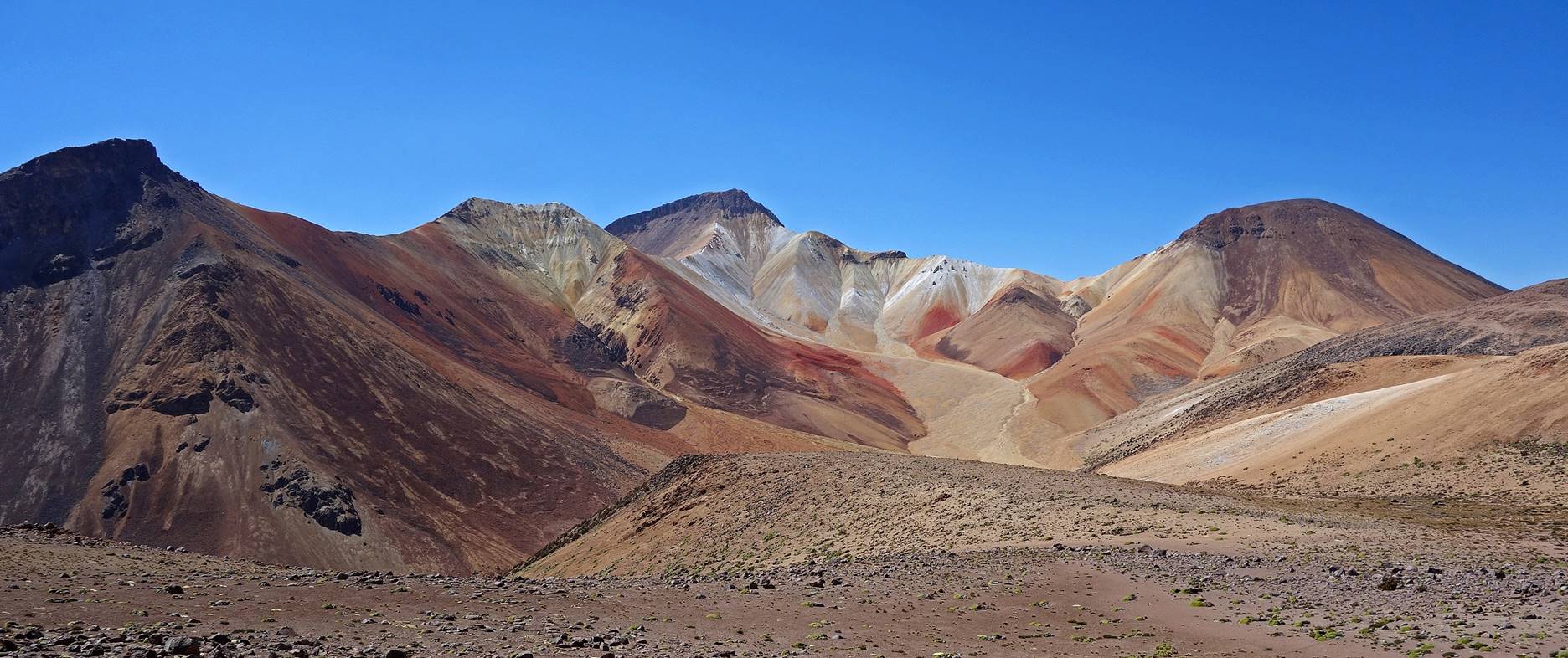
Suriplaza is a very special place located 70 km north of Putre. It is the name given to a small flat area lying at about 4500m and framed by four volcanos whose elevation range between 5234m and 5497m. The place‛s name suggests that it might be the habitat for suris (birds also known as rheas and nandas), but I saw none of them. On the other hand, hiking to ridges between volcanos is as close as one may get to a dream trip to different planets. Volcanos have bright colors and the views are stunning. So, rather than calling the four volcanos by their actual names (Iquilla, Chuquiananta, Cosapilla, and Copatanca), I will use this analogy to name them (see image below): the red planet for the red volcano at the south-west corner (Iquilla), the black planet for the dark volcano at the north-west corner (Chuquiananta), the white planets #1 (Copatanca) and #2 (Cosapilla) for the white/yellowish volcanoes on the east side (south and north corners, respectively), and asteroids #1 and #2 for two smaller dark gray hills. (This terminology was in part suggested by Flavio D‛Inca, the owner of Travel Lodge in Putre.)
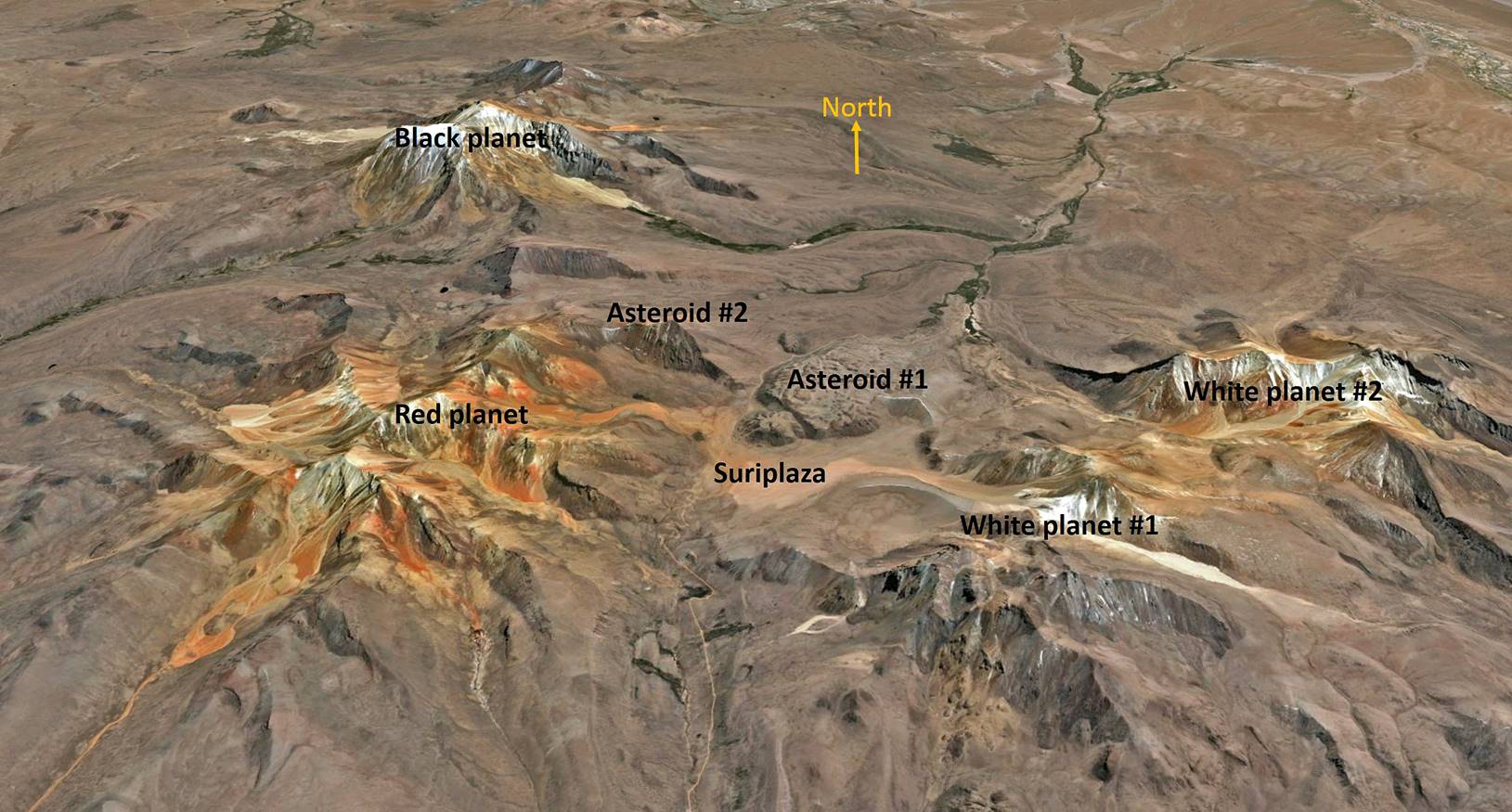
The whole area is relatively small. The summits of the black and white #2 planets are approximately 12 km apart, whereas the summits between the red and black planets are distant by 7.6 km.
Suriplaza is easily reachable by car, at least during the dry season, but then the best way to appreciate the place is to take time wandering around on foot. So, I spent two days and two nights there. I set my camp at the base of the red planet. I hiked in the red planet on the first day and in the white planets on the second. Flavio drove me to Suriplaza via Quebrada de Allane and Eugenio (the same friendly driver who took me to Guane-Guane and Salar de Surire) drove me back to Putre via the village of Colpitas (see satellite view at the top-left of this page).
Along the road toward Suriplaza:
Llaretas (green plants) on the north flank of Cerro Taapaca.
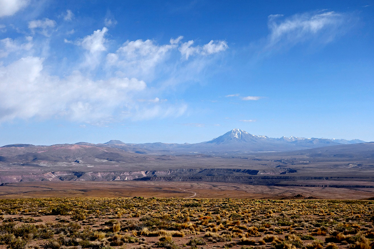
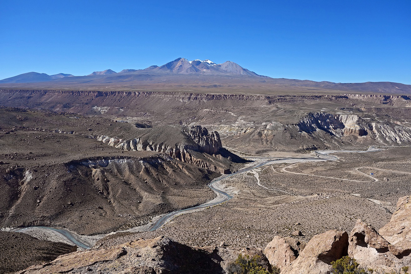
View over the Altiplano toward Volcan Tacora (5988m) near the border with Peru.
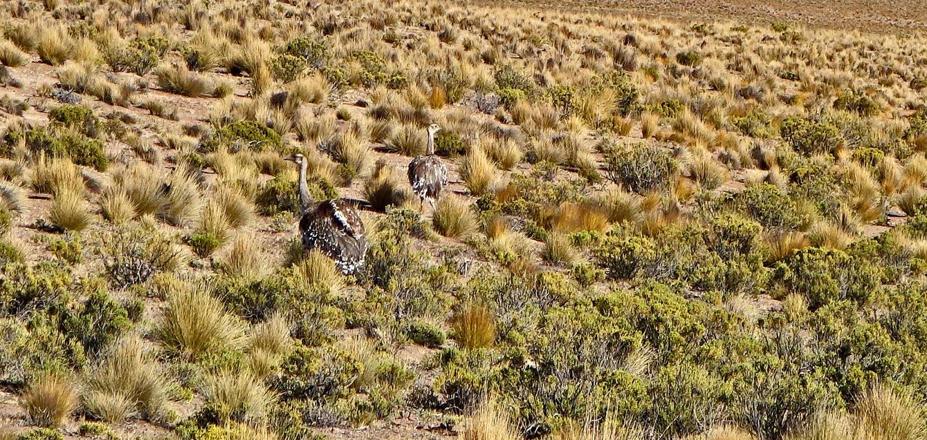
Couple of suri (rhea pennata).
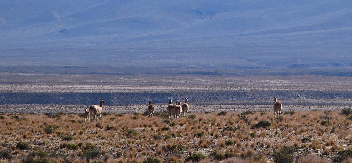
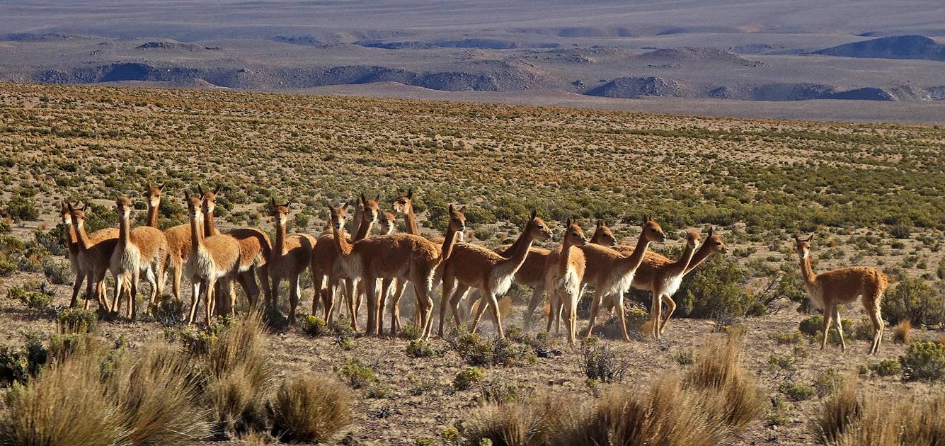
Vicunas.
Cerro Taapaca seen from Colpitas.
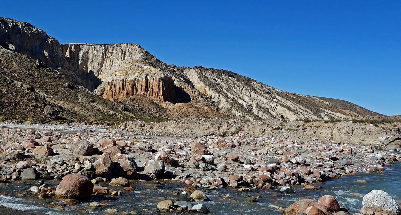
Quebrada de Allane.
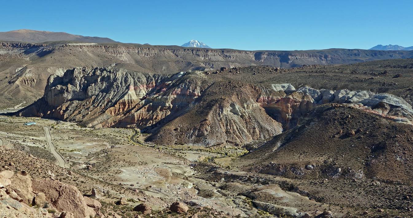
Suriplaza:
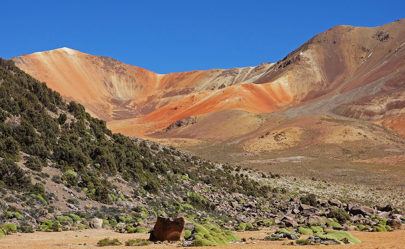
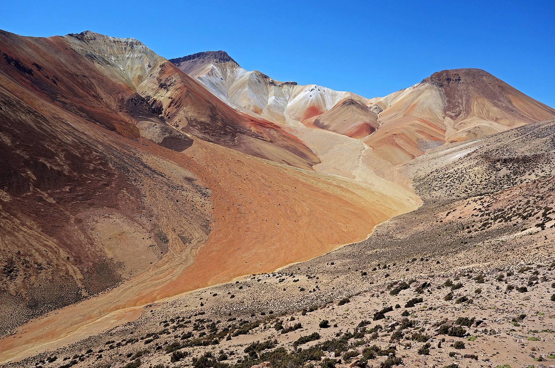
Bofedal below Suriplaza with a portion of the red planet in the background (location marked in satellite view at the top-right of this page).
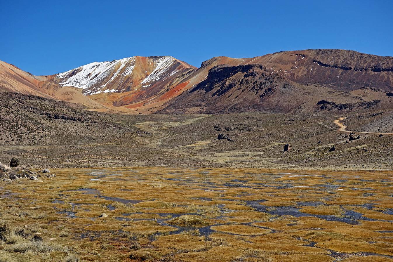
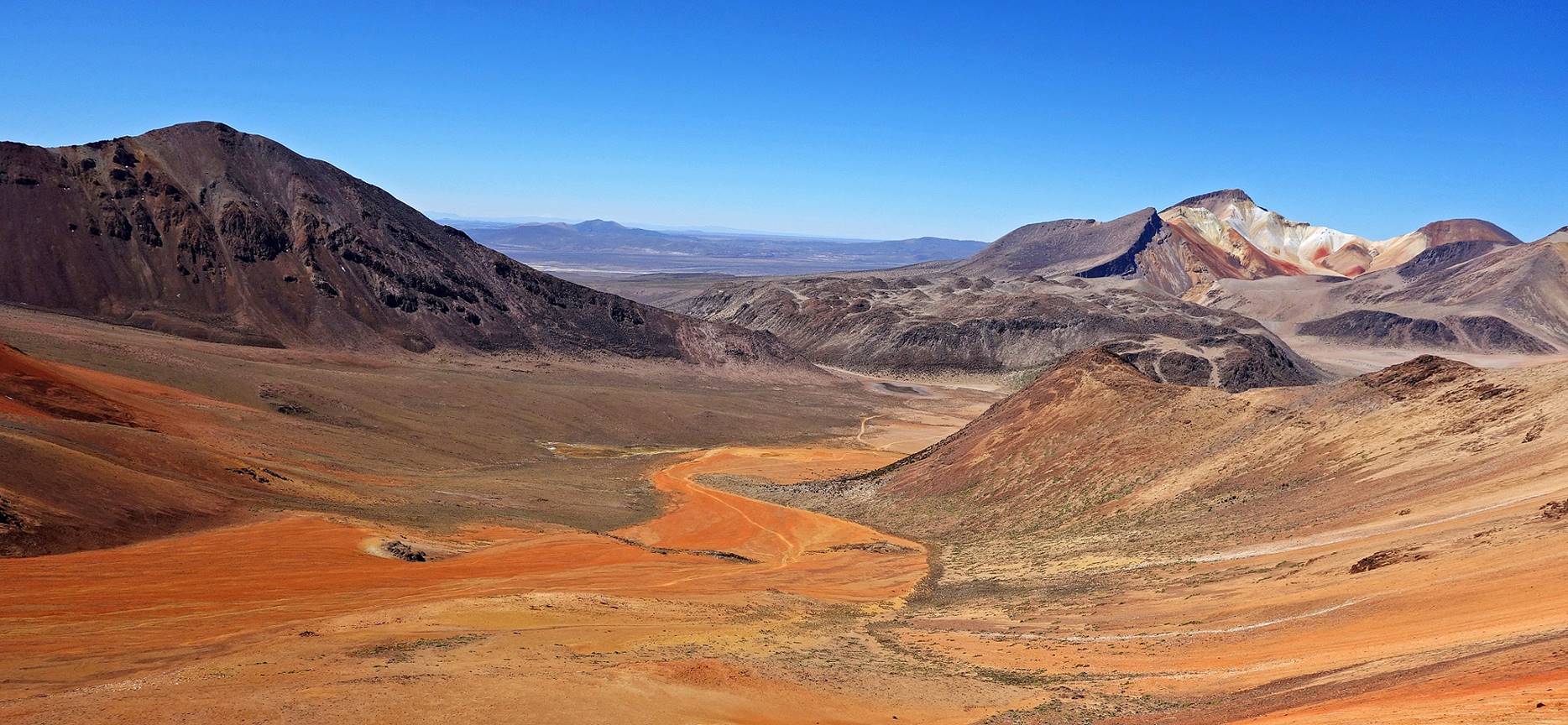
Suriplaza seen from the east, with the red planet on the left, the black planet on the right (the one with the snowcap), and asteroid #2 in between.
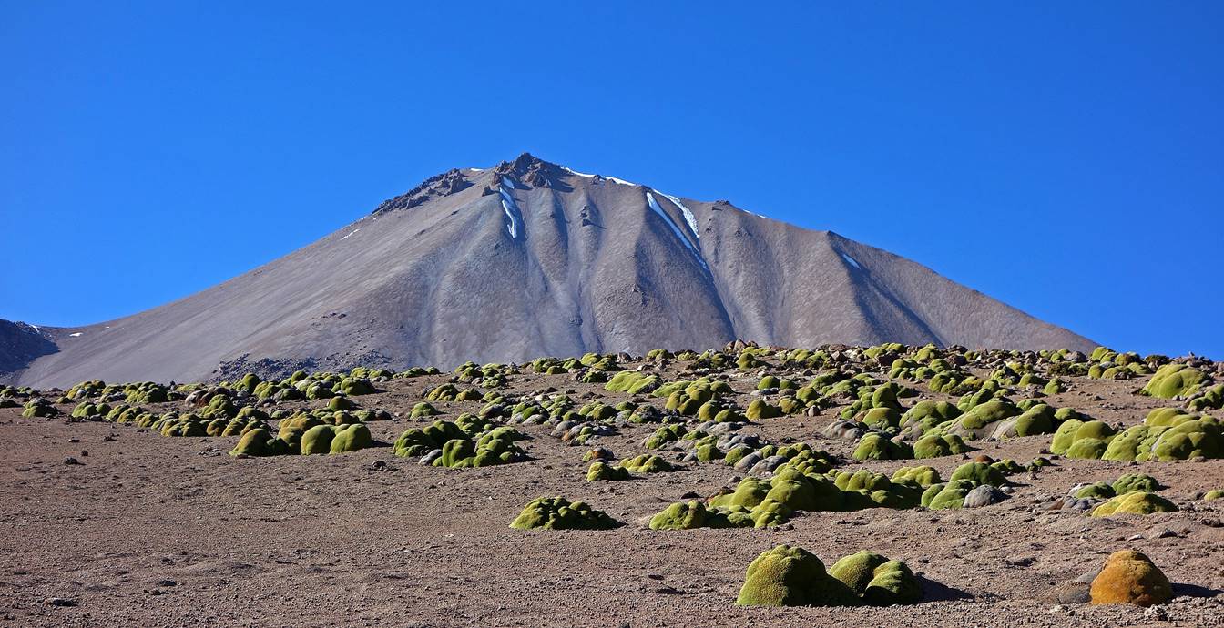
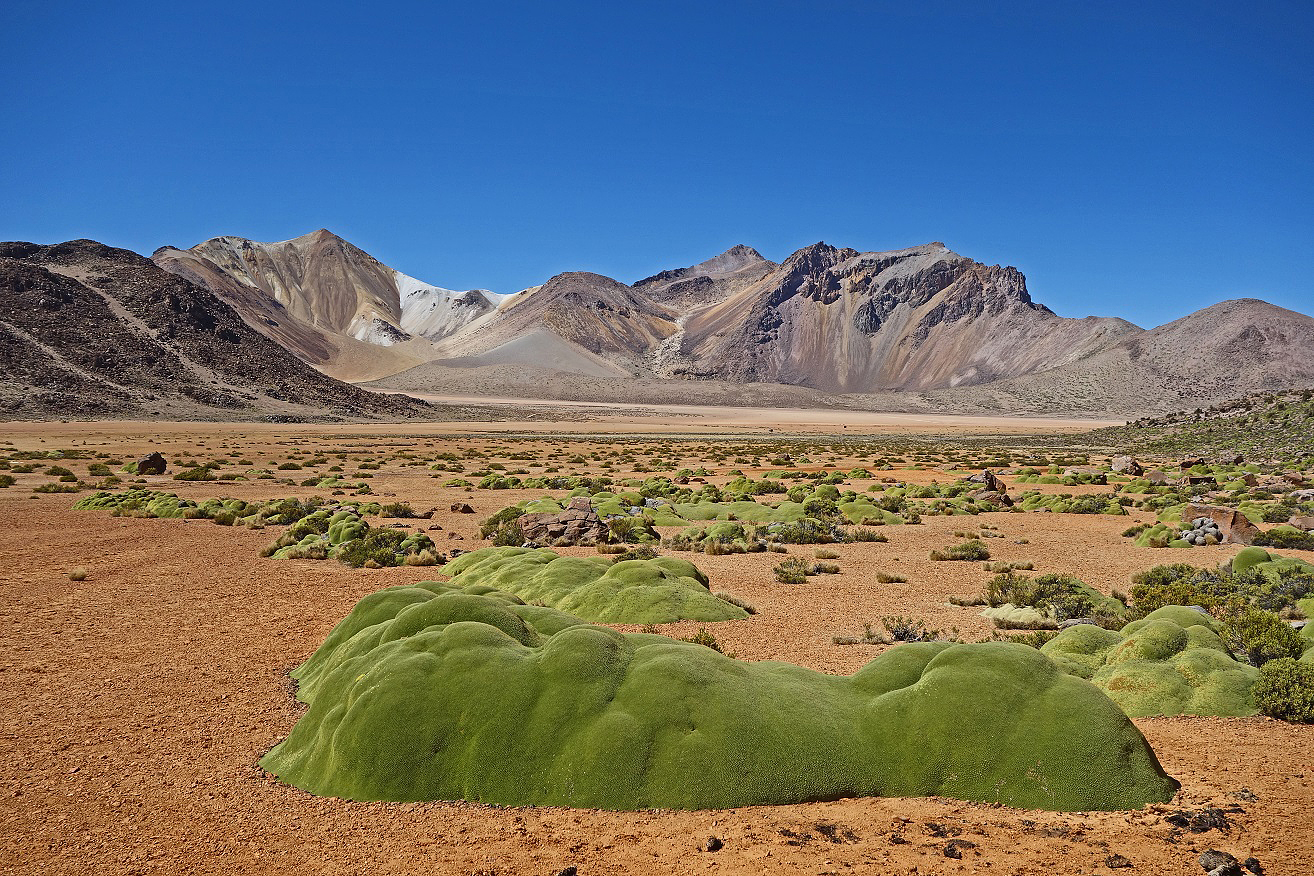
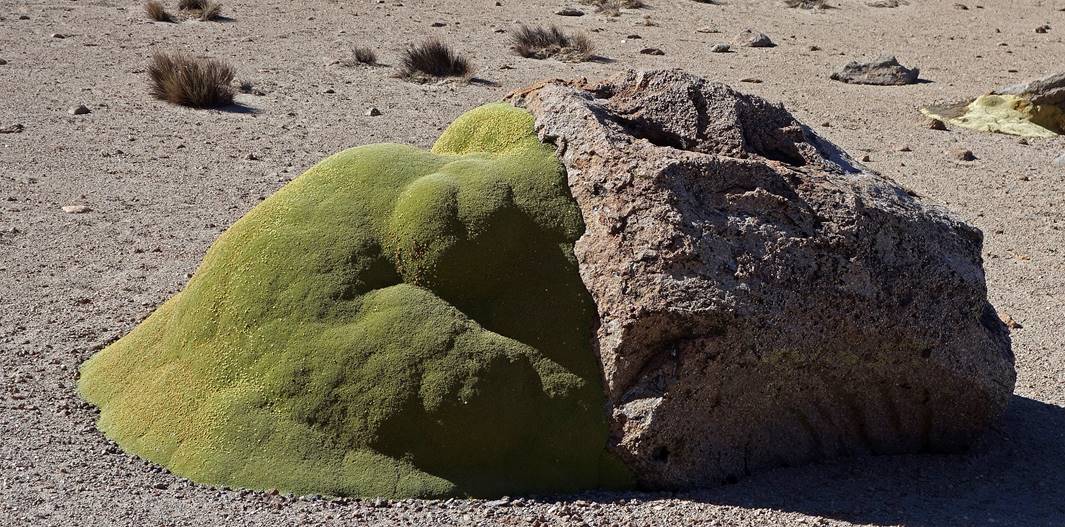
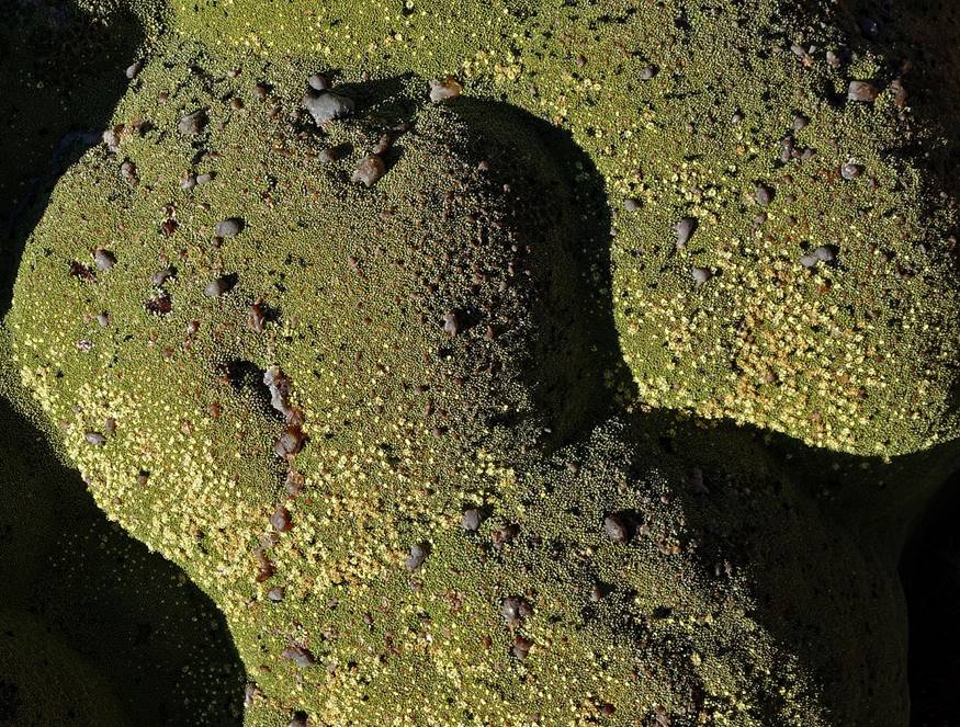
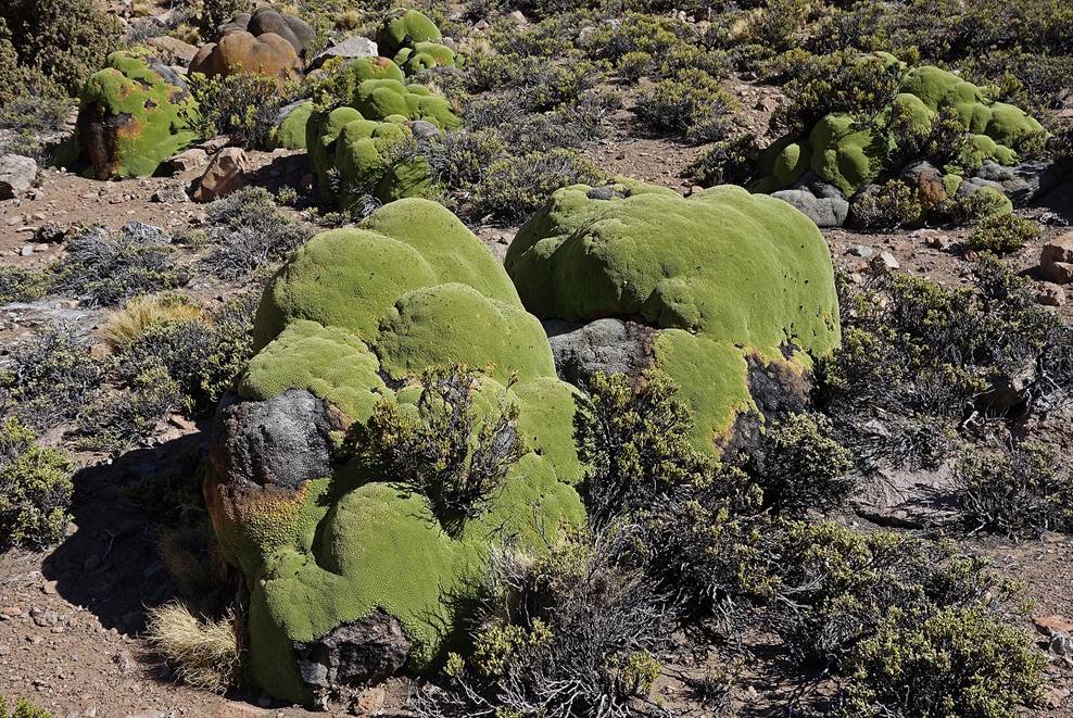
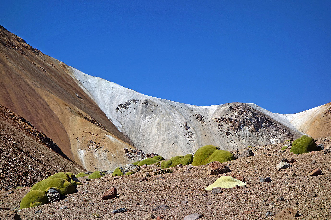
Large llaretas in Suriplaza. These fascinating plants grow (extremely slowly) between 3200 and 5000m near to the ground and on north faces where temperatures are slightly higher. They like sandy soils. Some are estimated to be over 3000 years old. They are extremely compact and can cover 30 sq.m of ground. Dead llaretas are excellent fuel thanks to their high calorific value. In the past, alive llaretas were also harvested for fuel (after being left to dry for about a year), especially in remote mining areas. They are now (successfully) protected by law.
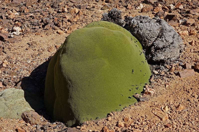
Left: Llareta with a dead part. Right: Llareta growing on both sand and rock.
|
|
|
|
|
|
Left: Llareta with small yellowish flowers and brown sticky sap drops (that locals often add to hot drinks for medicinal purposes). Right: Llaretas growing among quenoas de altura (polypepis tarapacana) shrubs. Thanks to their multi-layer bark (the meaning of the Greek word ″polypepis″) that protects them against cold, these are the highest-living shrubs.
|
|
|
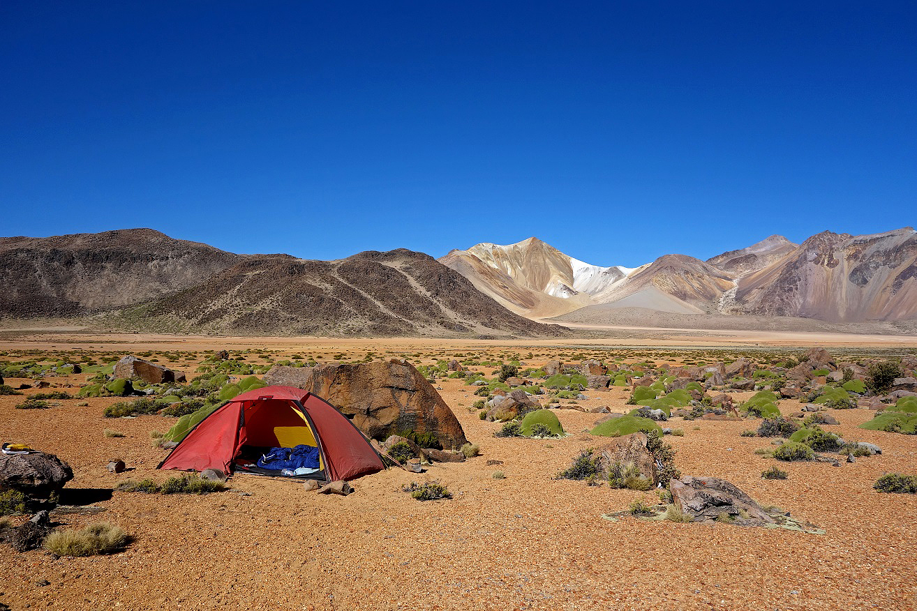
My camp among llaretas at the base of the red planet (location marked in top-right satellite view), with the white planet #1 in the background.
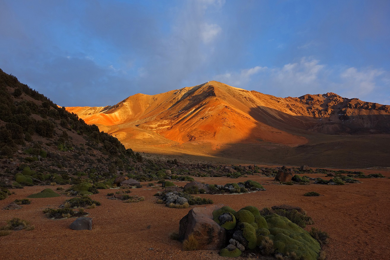
Red planet:
View from the campsite.
View from my tent in the early morning.
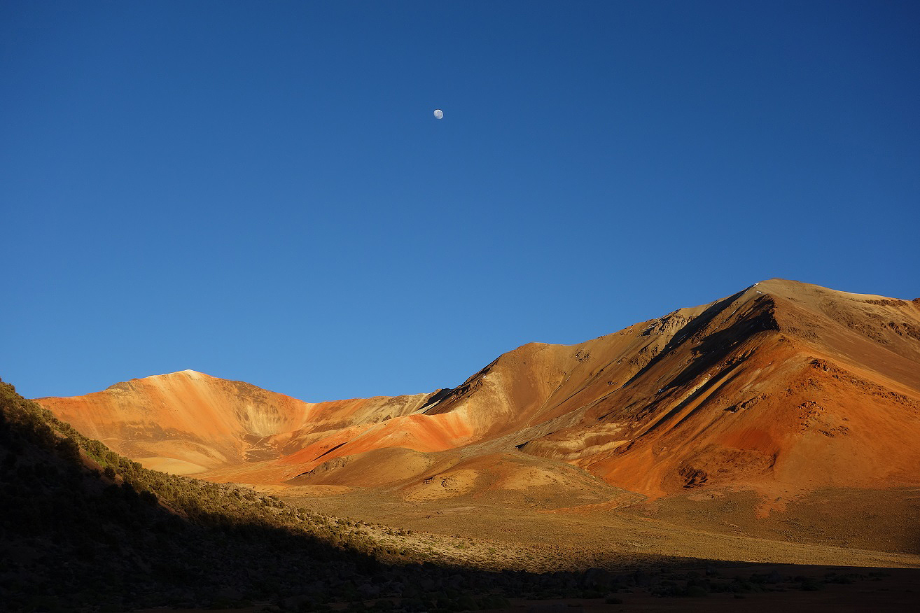
The red planet and the real moon.
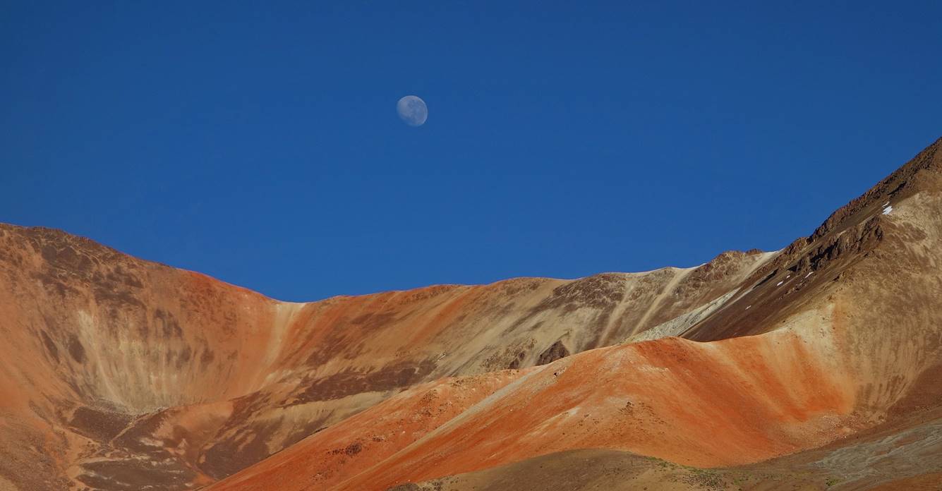
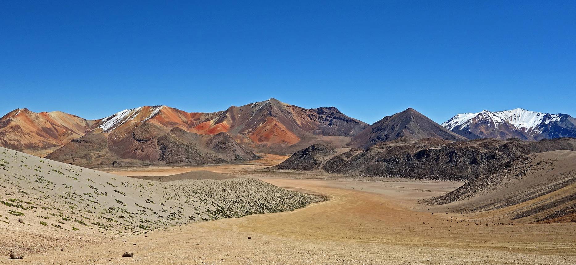
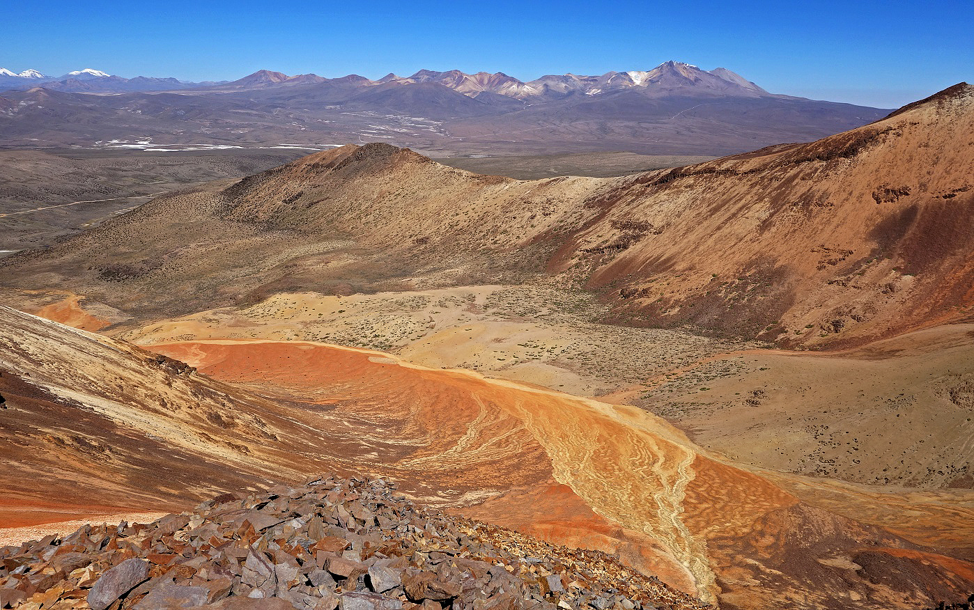
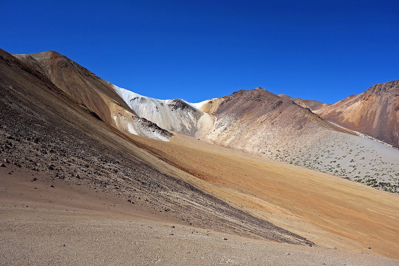
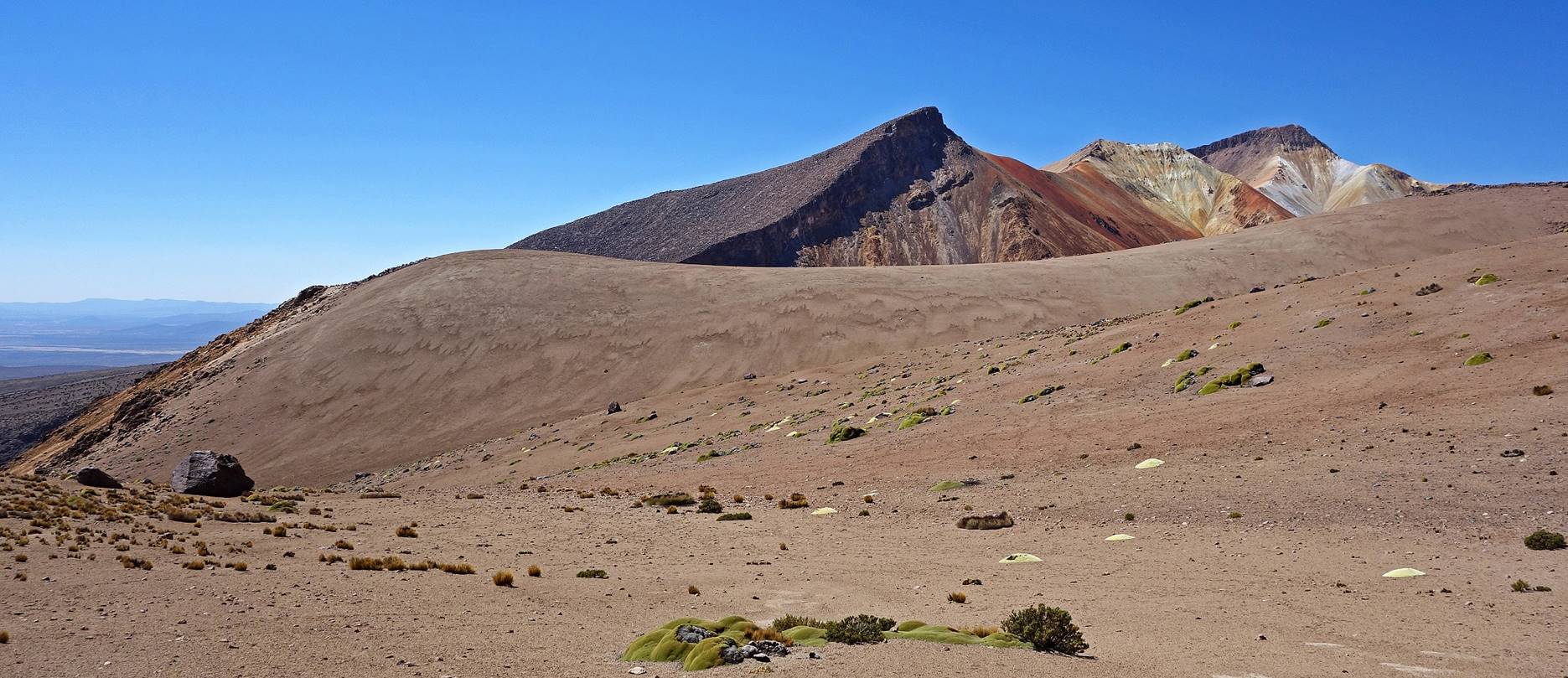
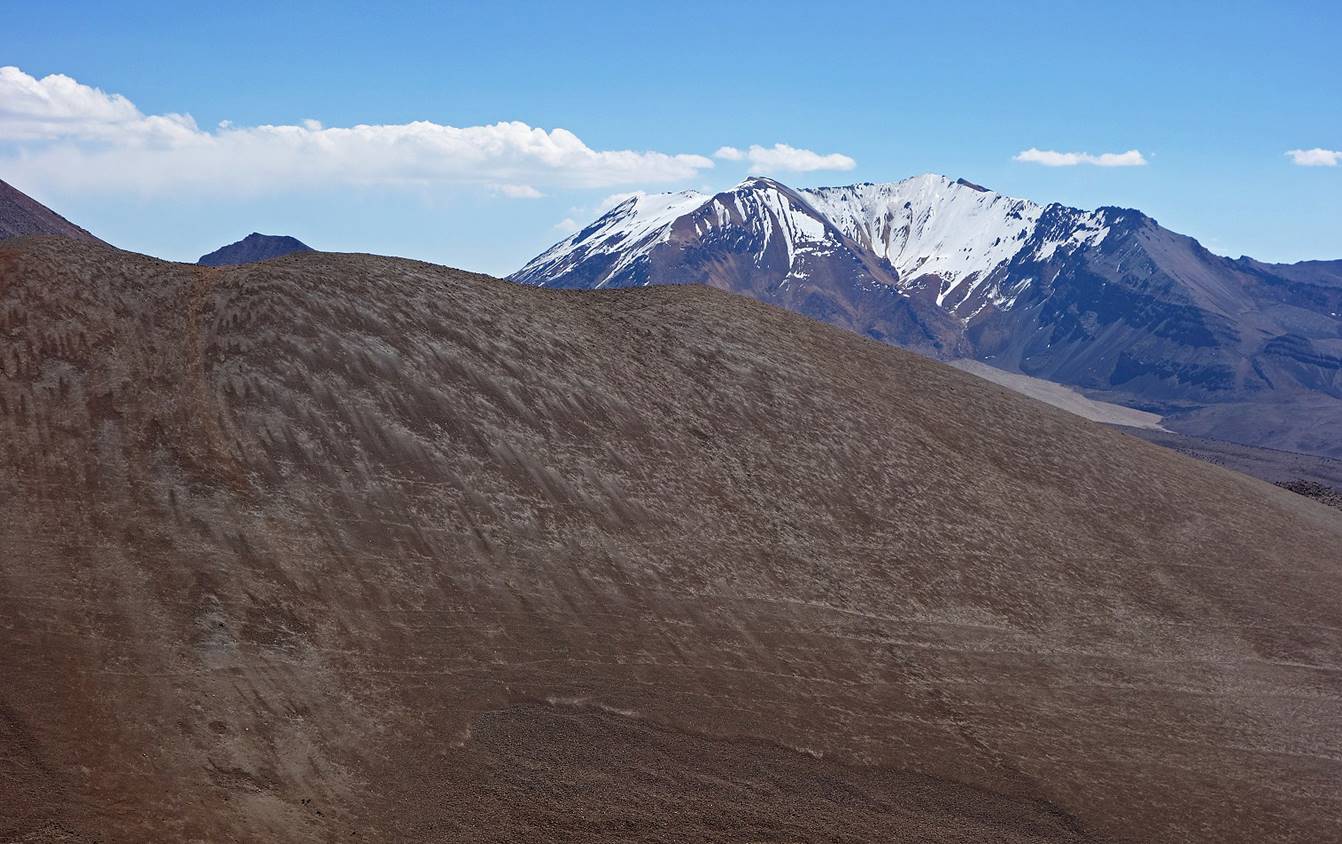
Views from higher up. In the second photo below, asteroids #2 and #1 and white planet #2 can be seen on the left, center, and right, respectively.
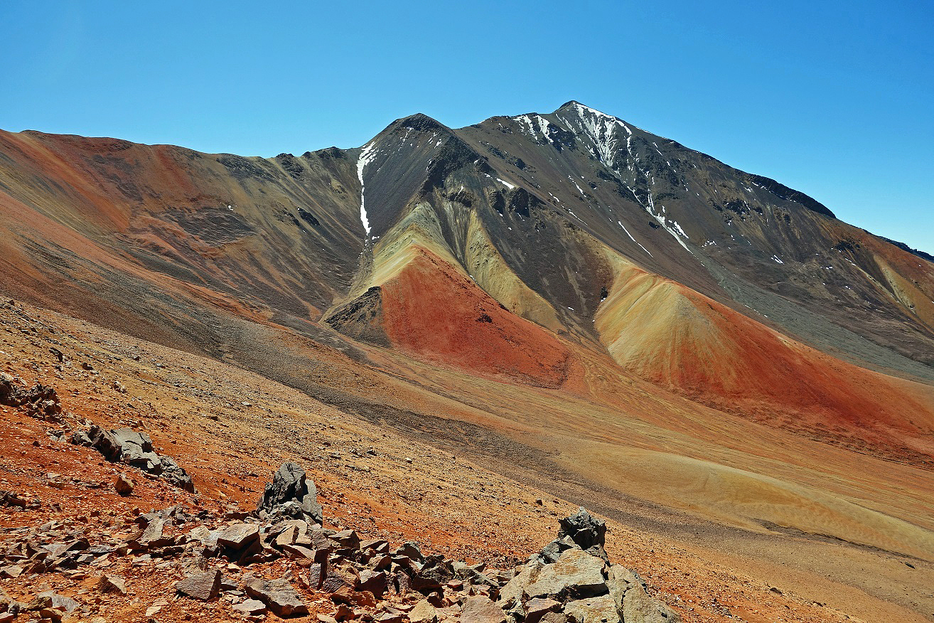
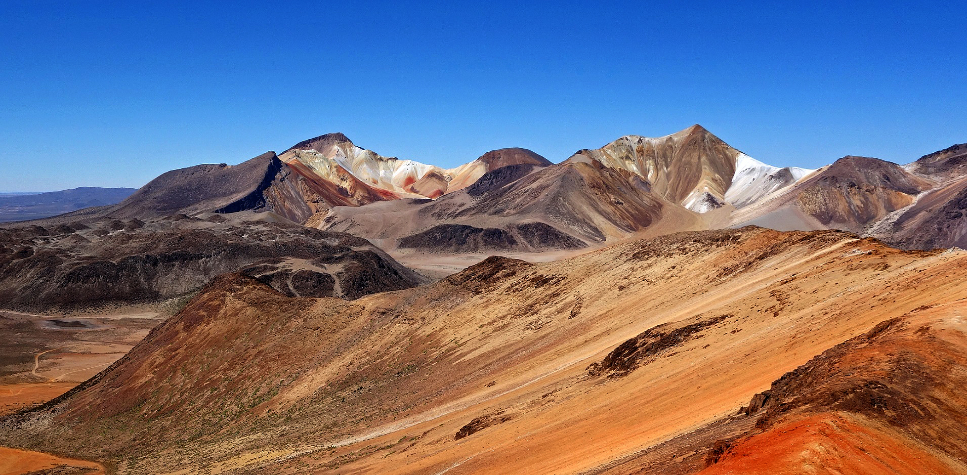
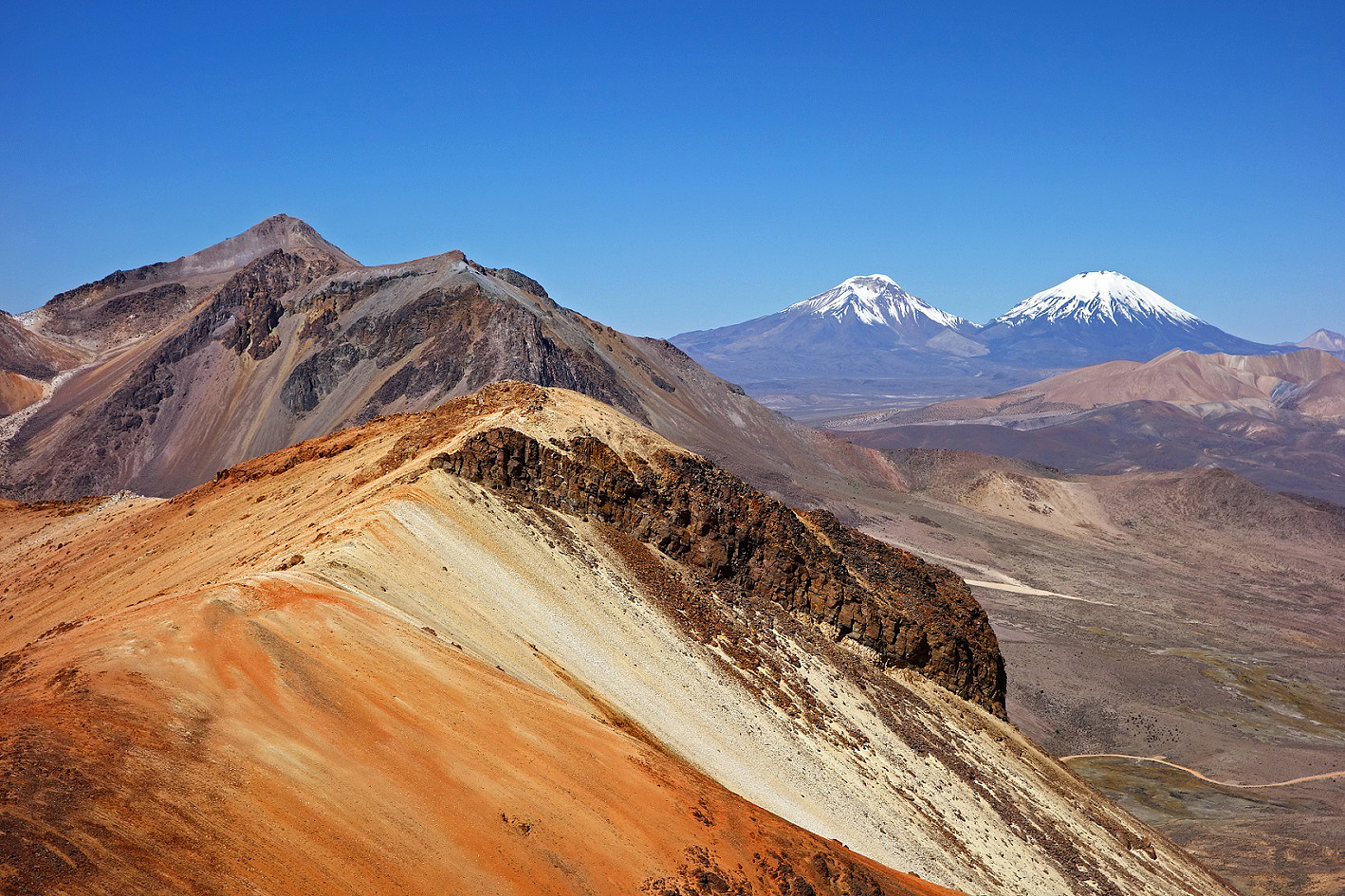
View from the ridge (marked #1 in top-right satellite view). From left to right in the background: white planet #2, white planet #1, and volcans Pomerape and Parinacota (with snowcaps).
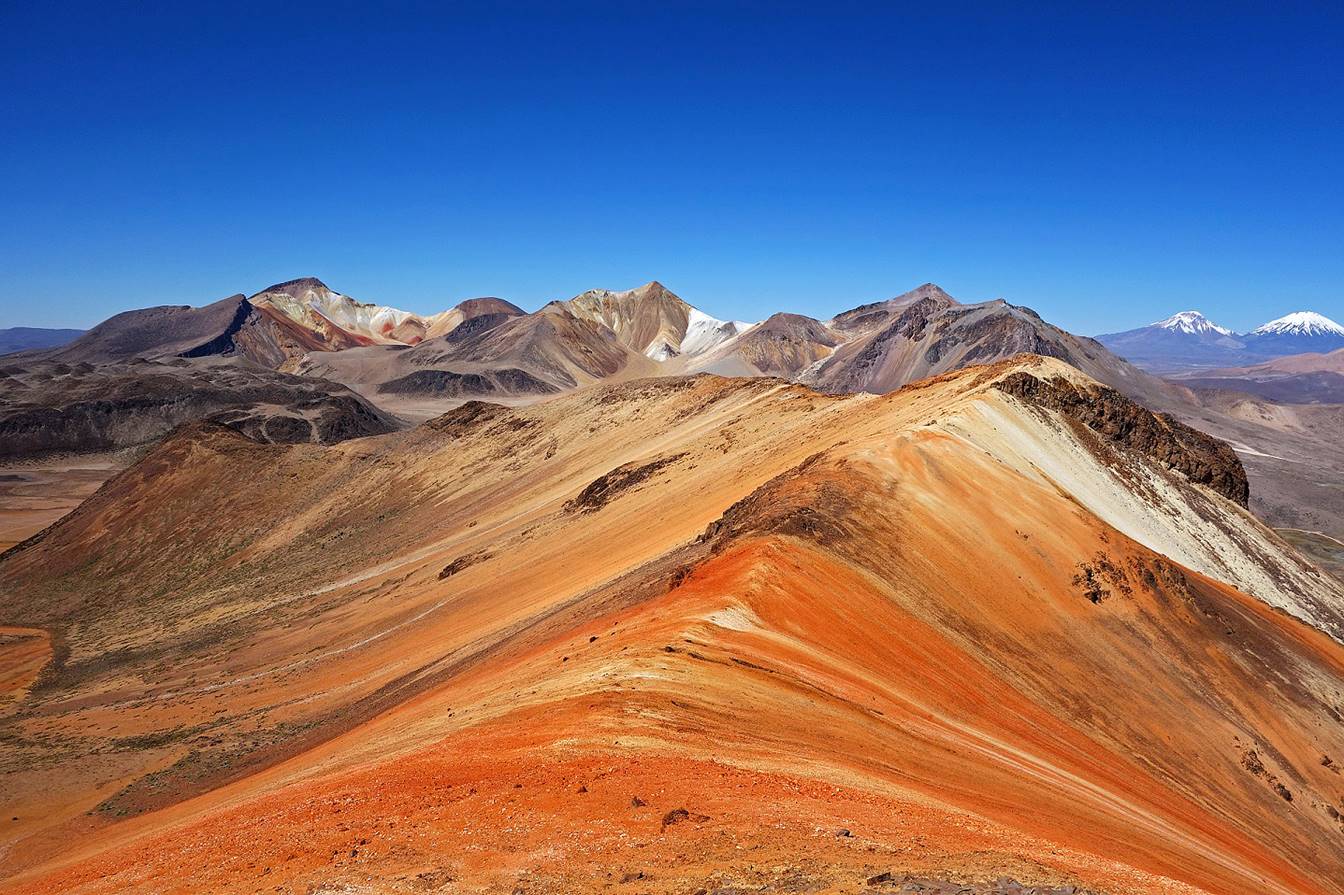
Another view from the same ridge with asteroid #1 and white planets #2 and #1 visible from left to right.
The same ridge again with volcans Pomerape and Parinacota on its right.
View toward Cerro Taapaca (in the background) from the ridge.
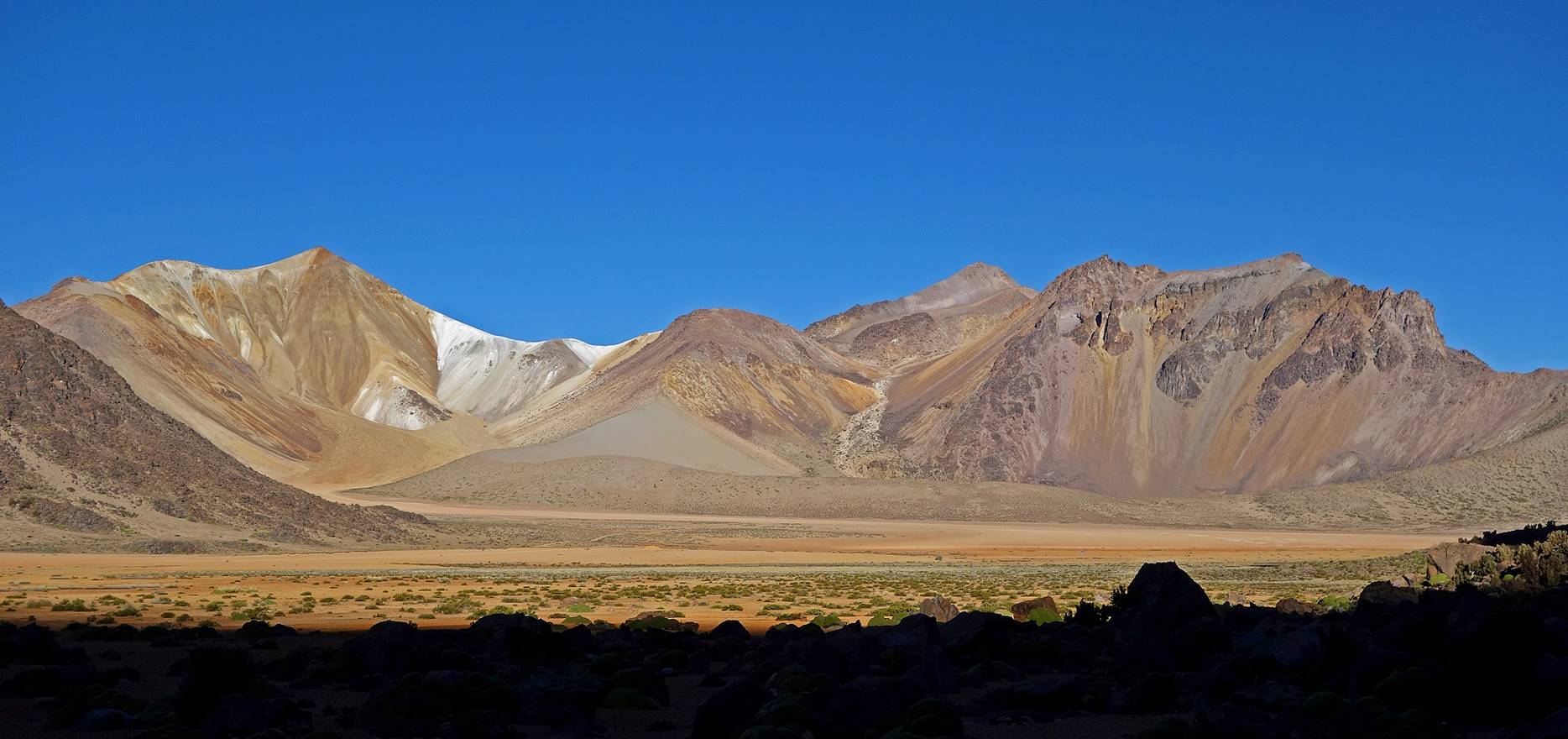
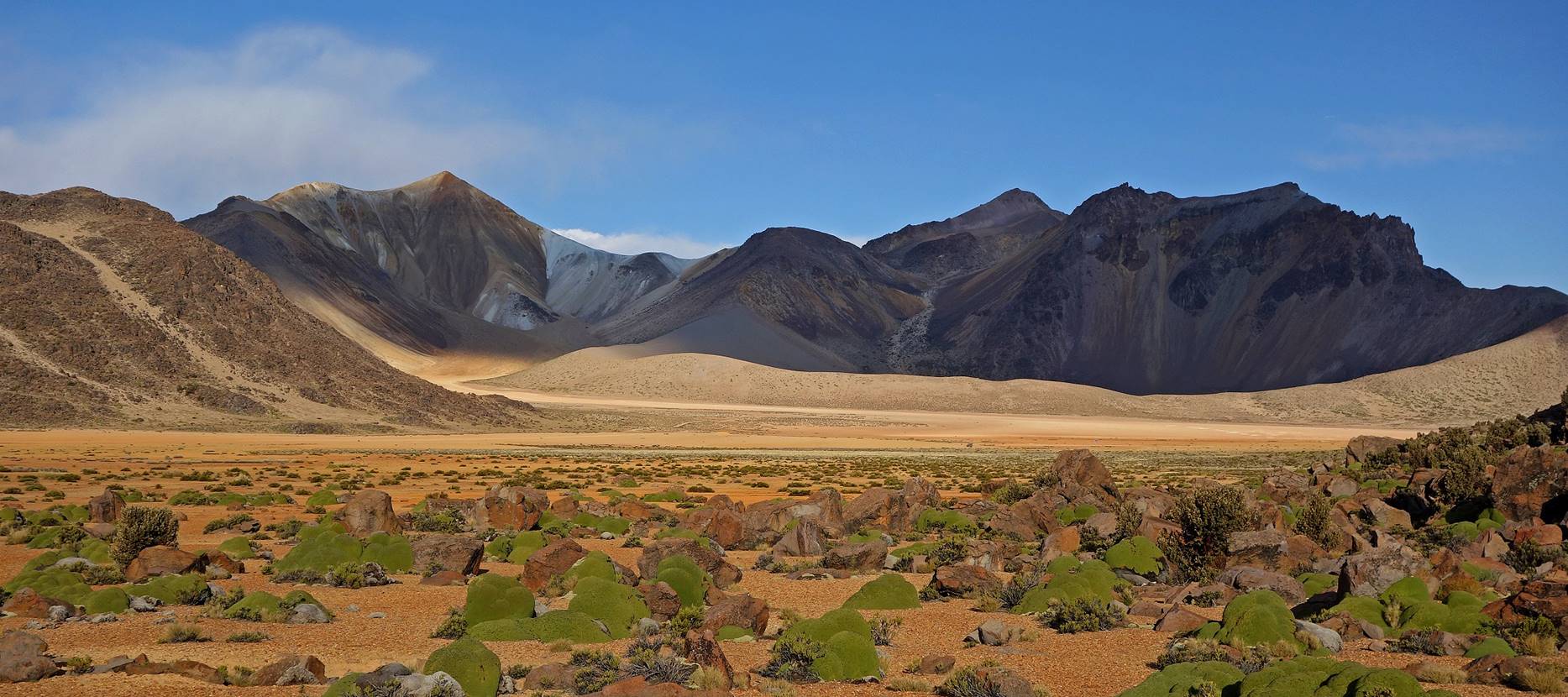
White planet #1:
Views from my campsite.
Views from other locations in Suriplaza.
Views from ridge marked #2 in top-right satellite view.
White planet #2:
View from location #3.
Views from location #4.
Black planet:
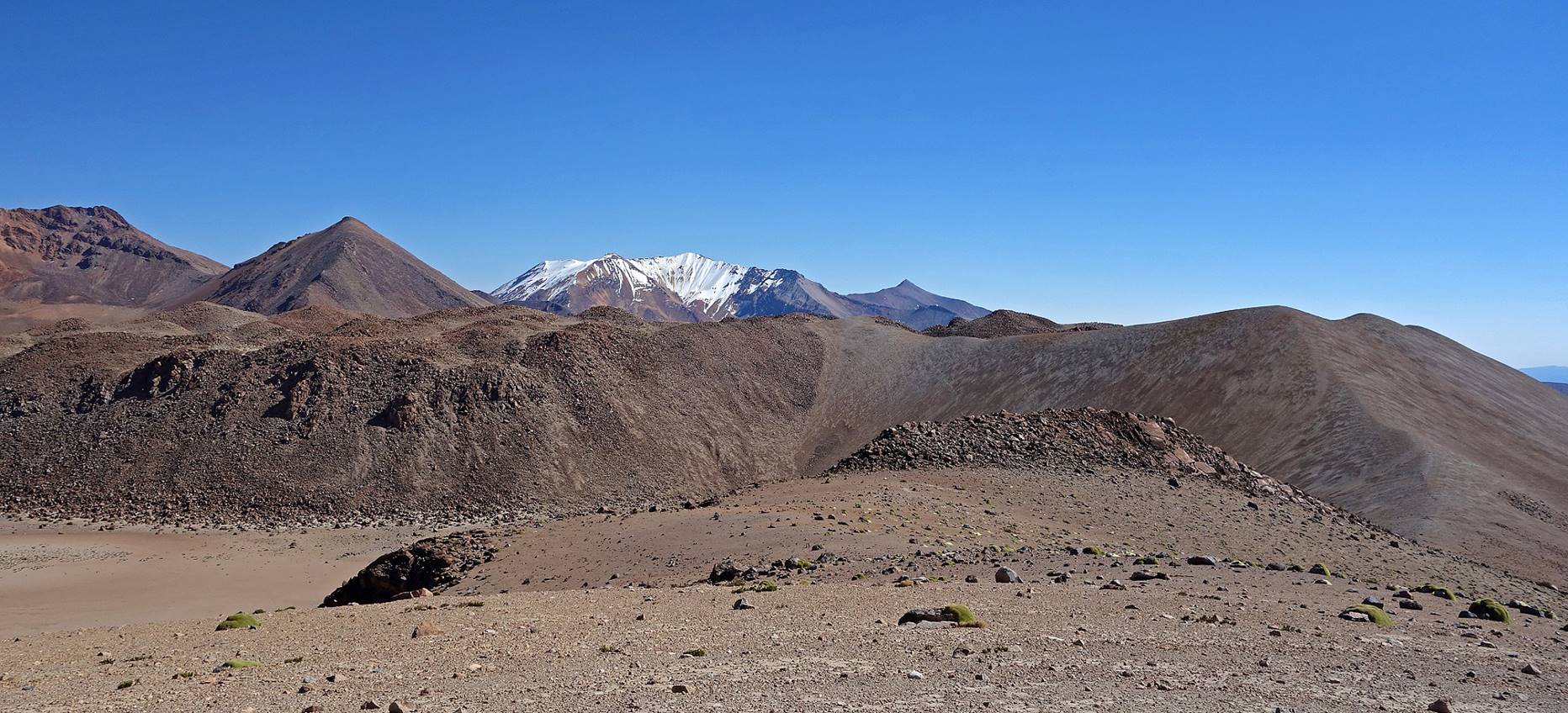
View from a location between #2 and #3, with asteroid #1 in the foreground and asteroid #2 on the left.
Another view from further up, with a small portion of asteroid #1 in the foreground.
![]()
Return to main Chile 2015 webpage