Chile (February-March 2016): Dientes, Lagunas, and Turbales de Navarino
![]()
Return to main Chile 2016 webpage
|
|
|
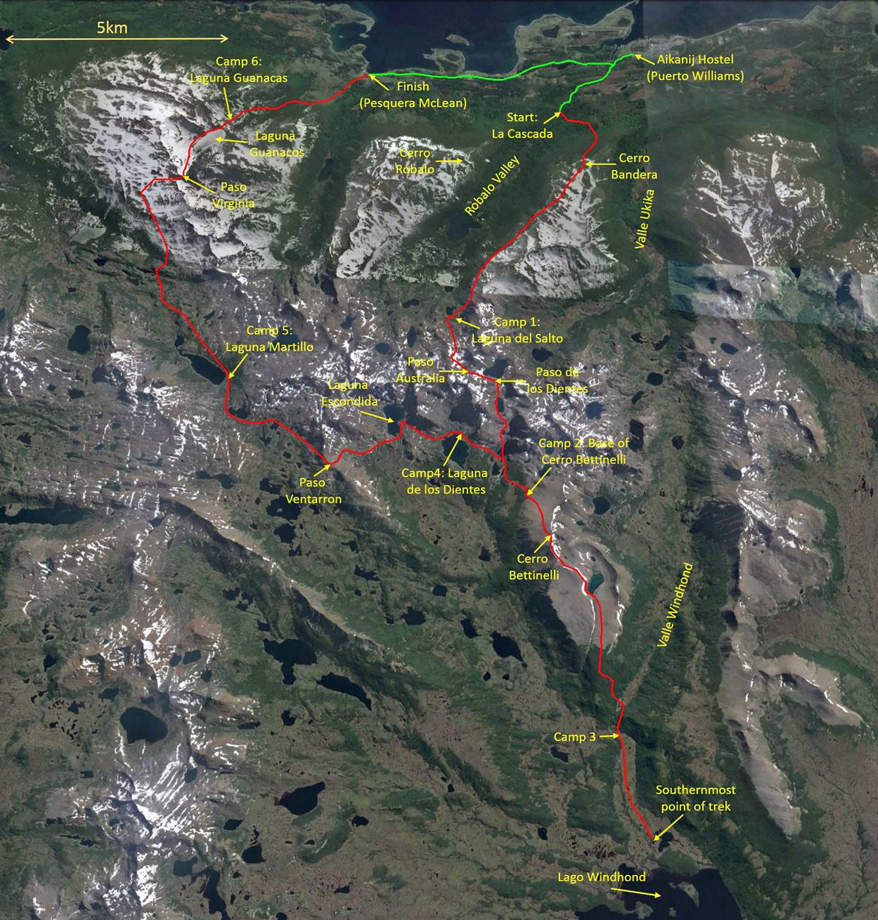
The itinerary of this trek (shown in red below) combines the Dientes Circuit around the Dientes of Navarino mountain range and a side-trip to Lake Windhound in the south of the island. It begins at a place called La Cascada reachable by car, where there is a small dam over the Robalo River. It ends at an abandoned crab cannery (Pesquera McLean) on the road connecting Puerto Williams to Puerto Navarino at the northwest end of the island.
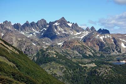
View of the Dientes (right) and Cerro Bandera (left) from a location close to the airport of Puerto Williams.
Maurice Van de Maele Bello (left) was my guide for this trek. One of his friends, Christian (right), also joined us. Both were very strong and provided excellent company.
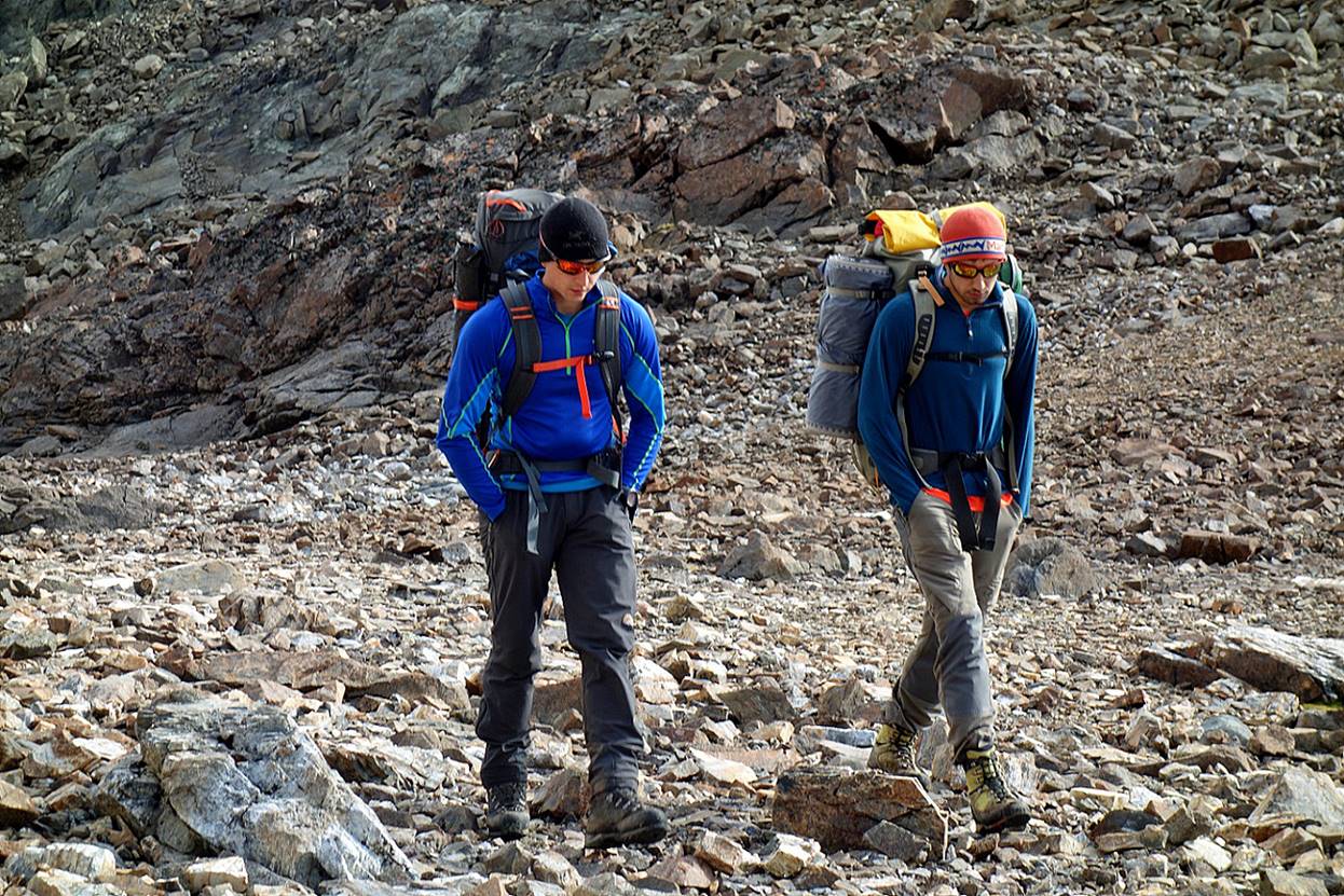
Maurice is an ideal guide: competent, friendly, and knowledgeable about the Navarino natural environment. He works in close partnership with his father, also called Maurice. Maurice Senior can be contacted at navarinotravel@gmail.com and Maurice Junior at siempredelsur@hotmail.com. They both speak excellent English and answer emails quickly. They know the island extremely well. Maurice Senior is an anthropologist who has lived in Puerto Williams for 30 years. He also leads groups to Antarctica. Maurice Junior has studied Expeditions & Ecotourism Engineering at the university in Santiago. He has participated in several expeditions on other remote islands of southern Chile. He has equipped rock climbing routes in the Dientes Mountains (perhaps the southernmost ones in the world). His experience also includes being a kayak instructor in Greenland. Together Maurice Senior and Junior form an excellent team. I have been very fortunate to find their contact on the Internet and arrange this trek with them.
We did this trek on March 3-9. Even during the southern hemisphere summer, the island is usually subject to furious weather with much rain and very strong winds, as well as some snow. But we were quite lucky and we had relatively little of those. Most of the rain felt at night, wind was strong only in a few places, and it snowed (not much) just once.
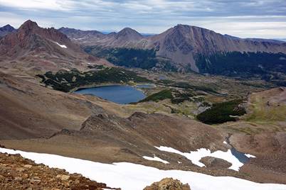
The highest points of the trek are successively Cerro Bandera (610m), Paso Primero (705m, located a short distance before Paso Australia), Paso Australia (787m), Paso de los Dientes (743m), Cerro Bettinelli (883m), Paso Ventarron (696m) and Paso Virginia (849m). There are no very long climbs or descents. The longest ascent (about 850m) is between Lago Windhond and Cerro Bettinelli (Day 4). But on each day there are many ups and downs.
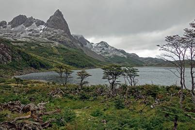
The trek traverses various types of terrain (forests, bare rocky terrain, turbales...) and passes by many lakes. Perhaps the turbales (Chilean word for peat bogs) are the most fascinating ones, especially near Lago Windhond. They are formed by dense layers of spongy vegetation retaining large amounts of water creating amazing mosaics of shapes and colors.
While Puerto Williams is never very far away, the trek feels remote and isolated. During the entire trek, I only saw 10 trekkers (5 pairs) and nobody else. I saw nobody on days 4 and 5.
Overall, I did not find the trek to be very strenuous. However, my experience could have been quite different had the weather been less clement.
Click on the links below to see pictures of the successive sections of the trek:
|
|
|
|
![]()