Ethiopia (April-May 2012): Lake Tana and around
|
|
Return to main Ethiopia 2012 webpage
Lake Tana, the largest lake in Ethiopia, covers a surface area of
more than 3,600sq.km. It was known to both the ancient Egyptians and the
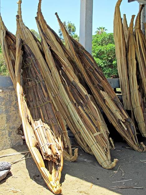
ancient Greeks. In the 2nd century BC Ptolemy called it Pseboe (″hollow swamps″). Boats made from
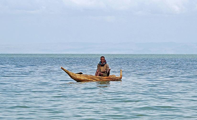
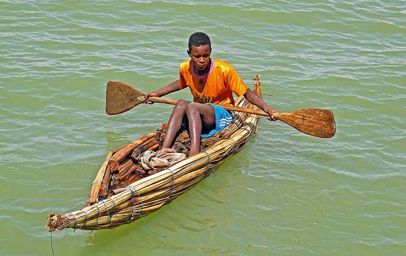
papyrus, called tankwas, are still used for
fishing and carrying loads. The lake is now famed for the more than 20 monastic
churches built on its shores and islands between the 14th and 18th centuries.
These churches have provided sanctuaries for religious relics and royal
treasures. They contain amazingly well preserved murals. I particular
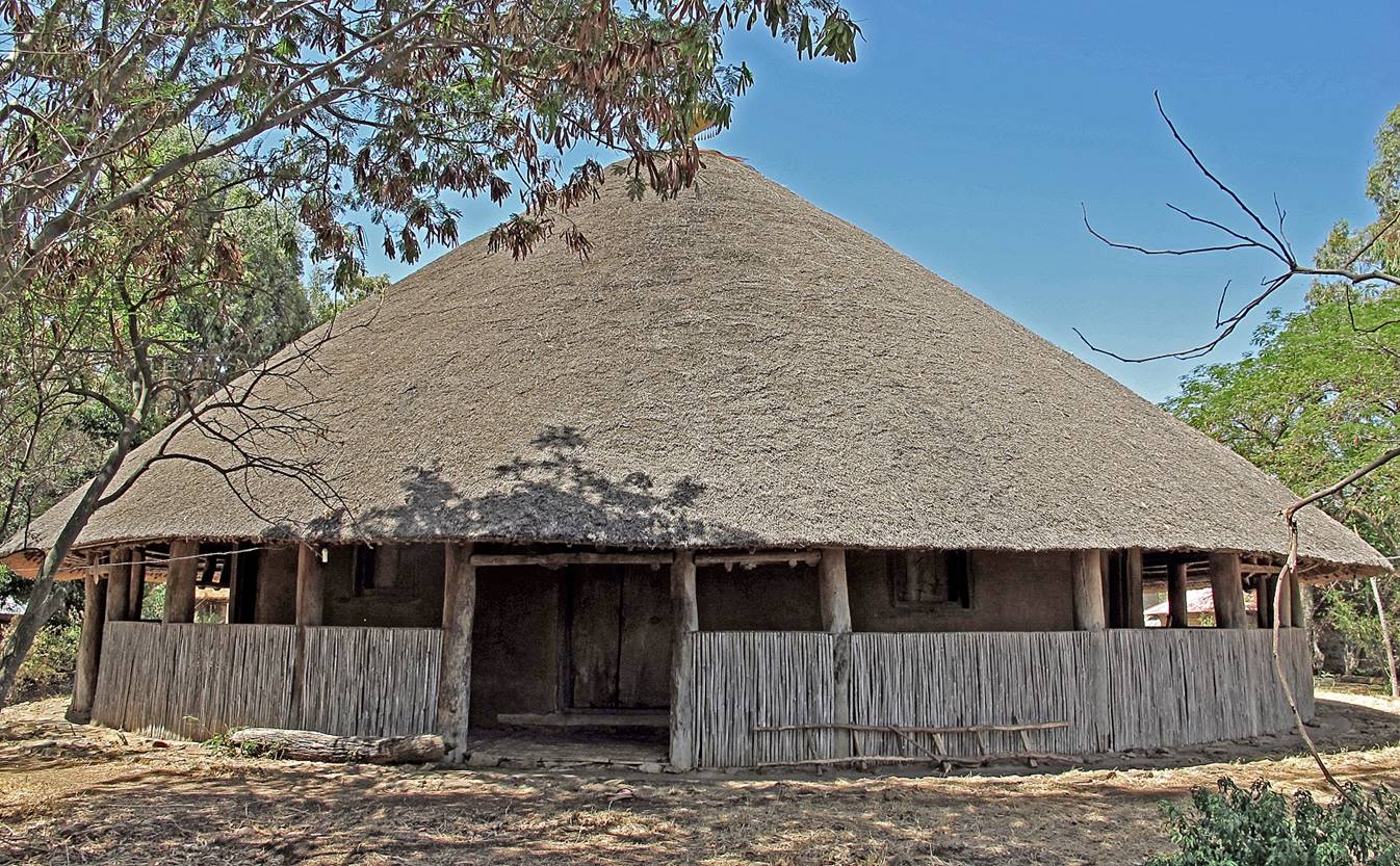
liked Debre Sina Maryam
church in Gorgora (north
shore of Lake Tana, 70km south of Gondar), with
its traditional thatched roof and adobe walls. On its southern shore,
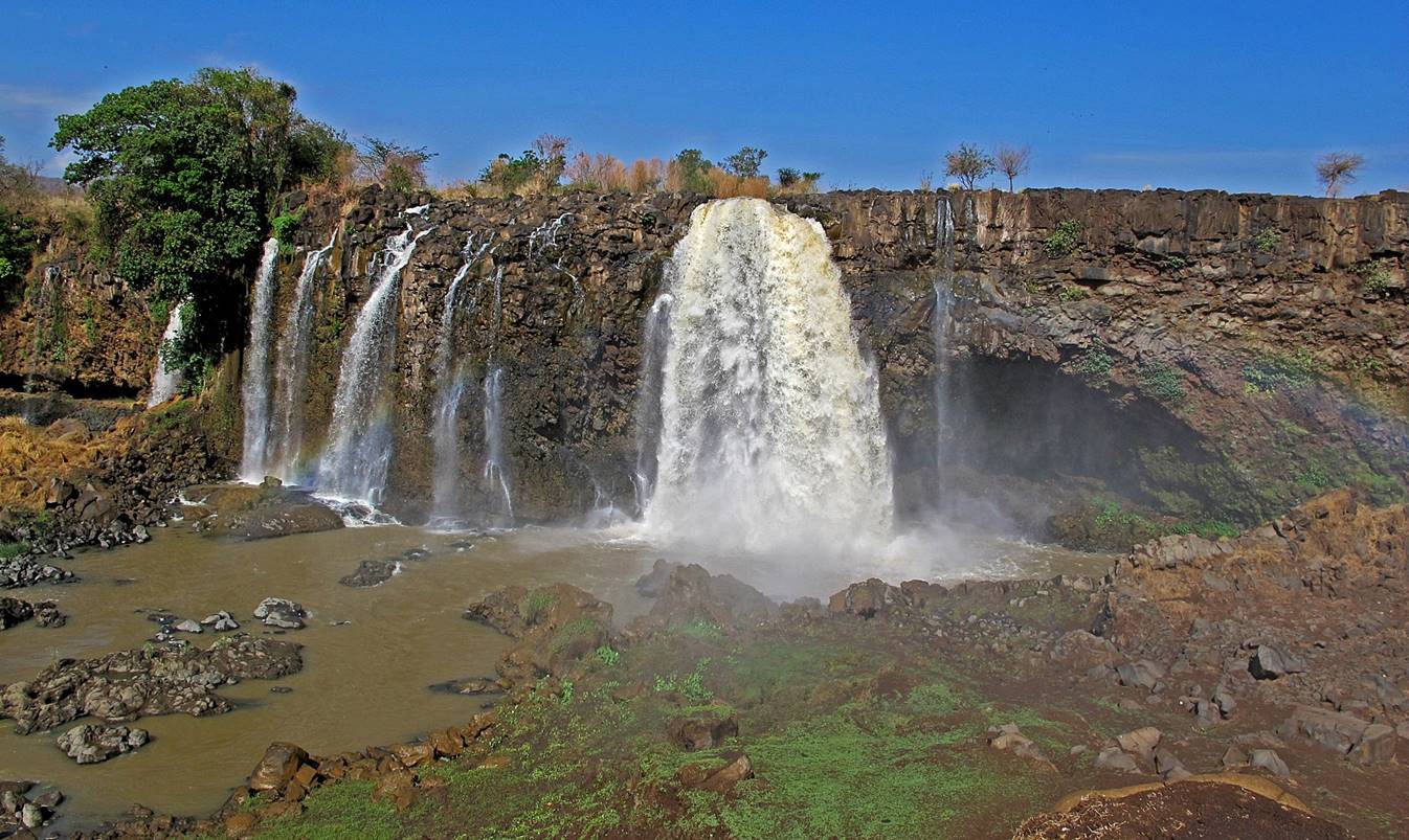
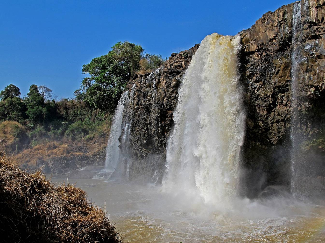
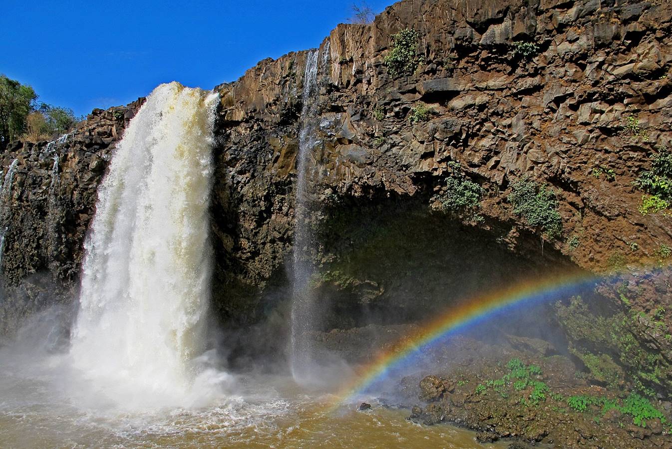
Lake Tana is the source of the Blue Nile,
which forms a 45m-high waterfall 30km after exiting the lake.
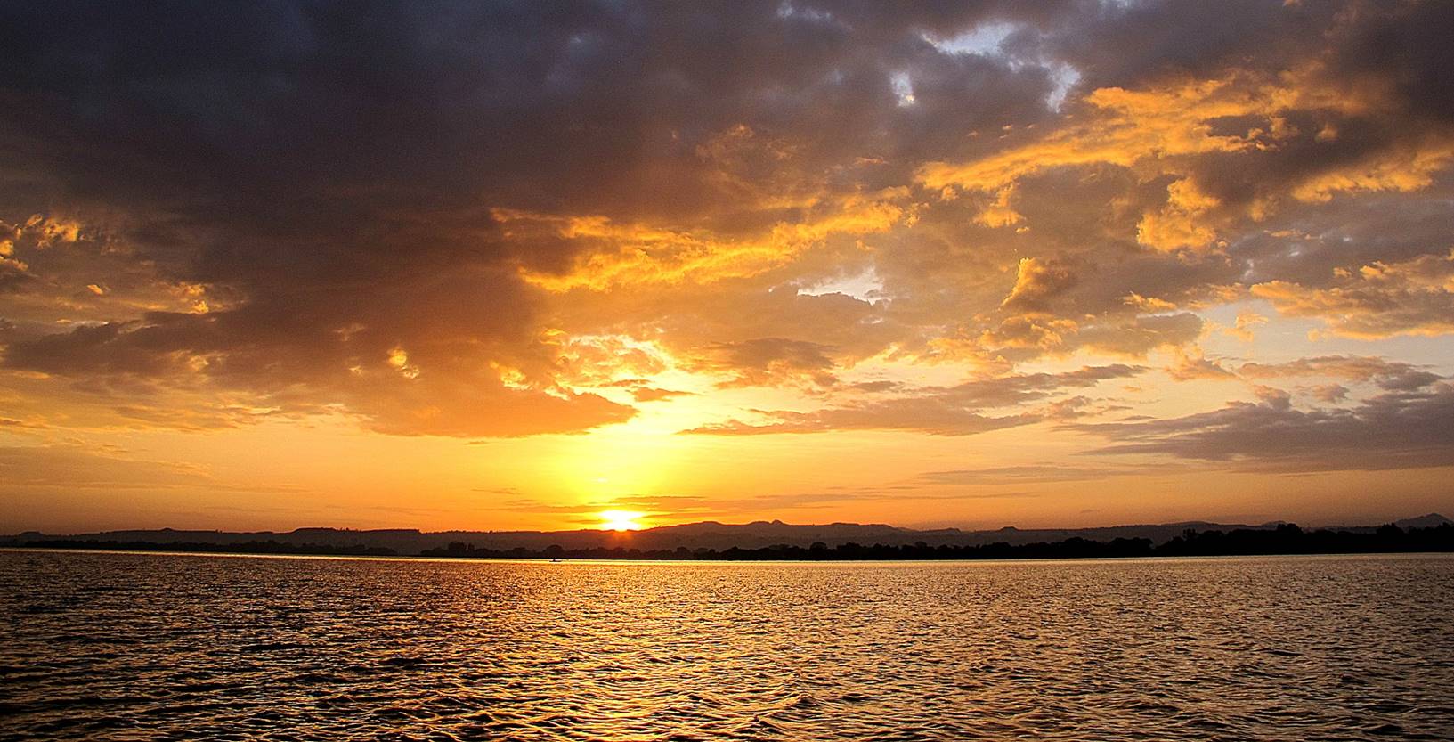
Lake Tana:
Sunset
over Lake Tana.
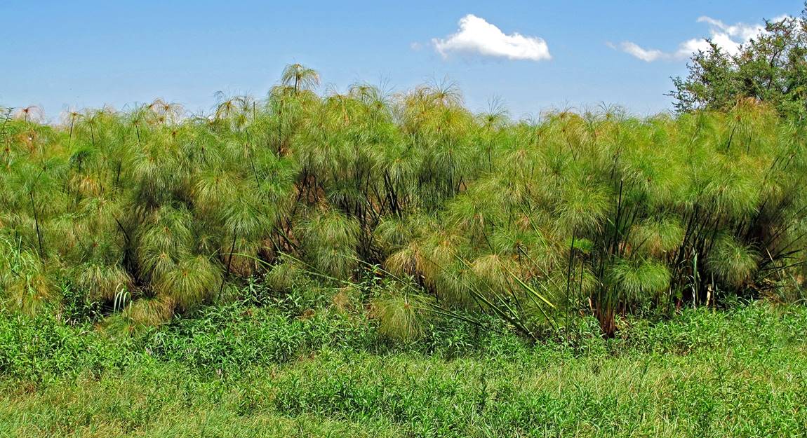
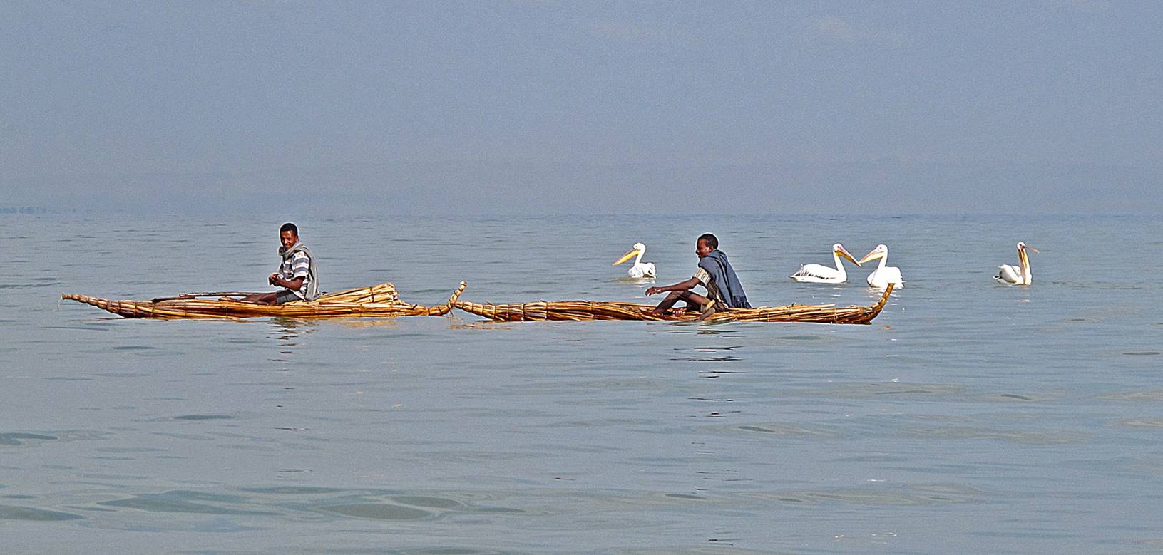
Left:
tankwas (boats made with stems of papyrus). Right:
papyrus on the shore of Lake Tana.
|
|
|
Tankwas on the lake.
|
|
|
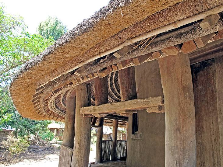
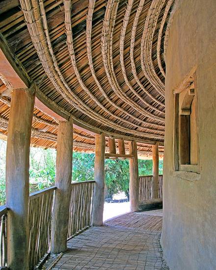
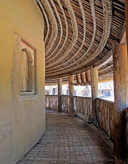
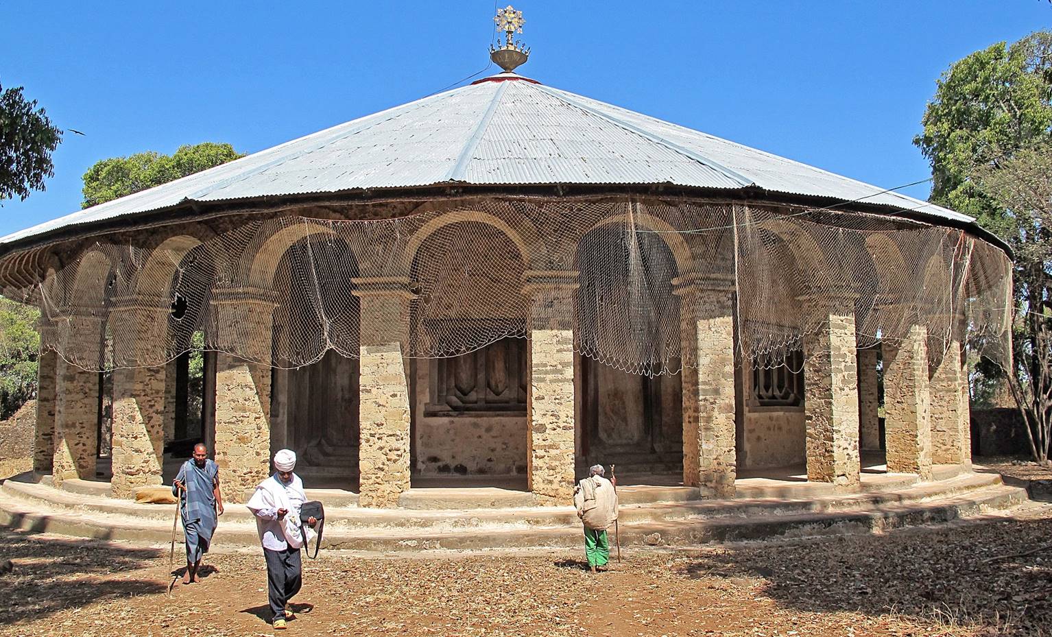
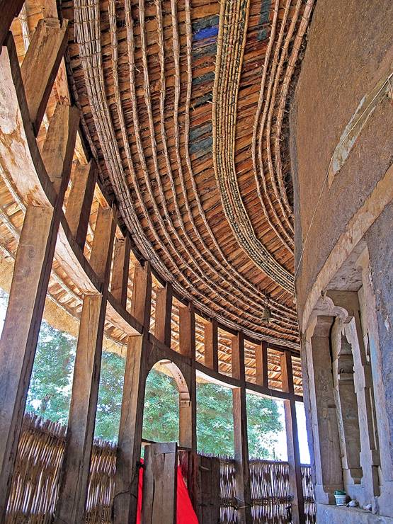
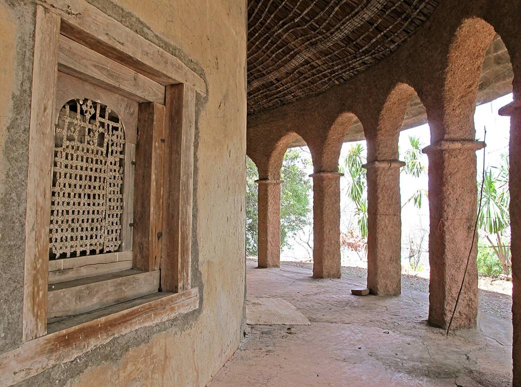
Church of Debre Sina in Gorgora:
Located on the northern shore of Lake Tana, this
church is believed to have been built in the late 16th or early 17th century on
the site of a 14th-century monastery that had been founded by a monk from the
town of Debre Sina. The
church is circular in shape and surrounded by a peristyle bordered by wooden
pillars. It is beautifully maintained with a thatched roof, adobe walls, and
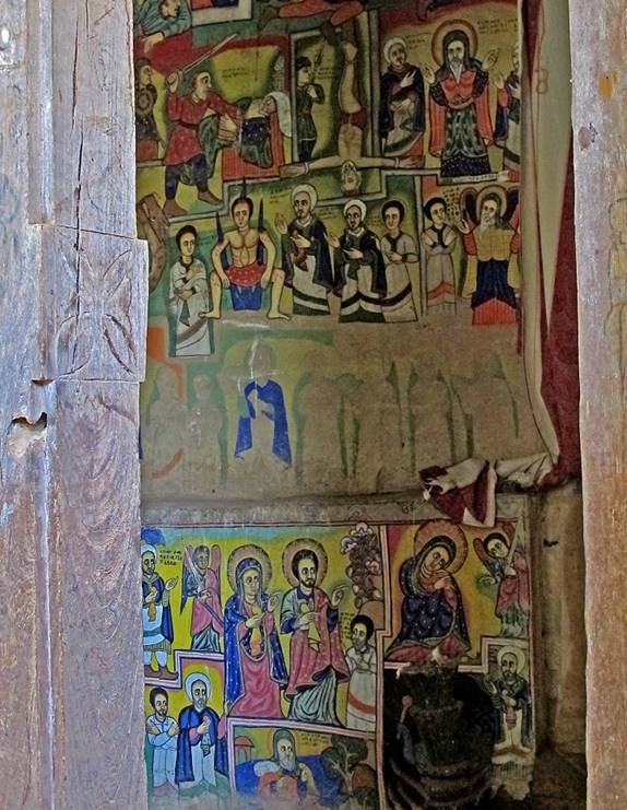
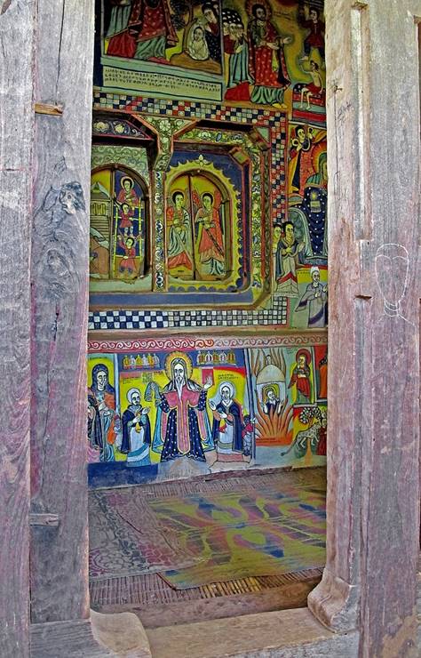
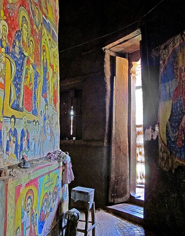
old timber carpentry. It contains some of the most beautiful and evocative
church paintings in the Lake Tana area.
View of the church.
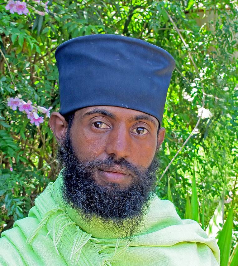
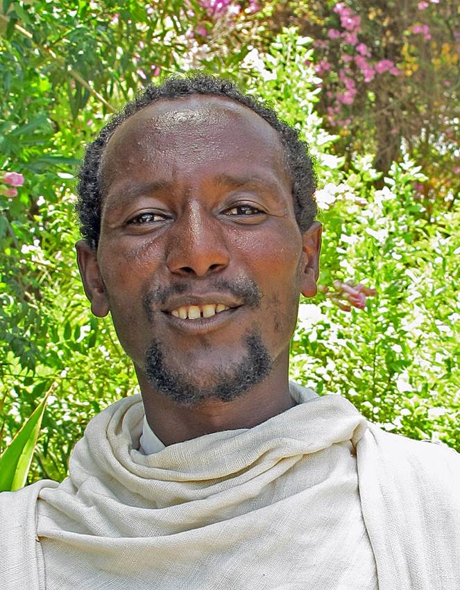
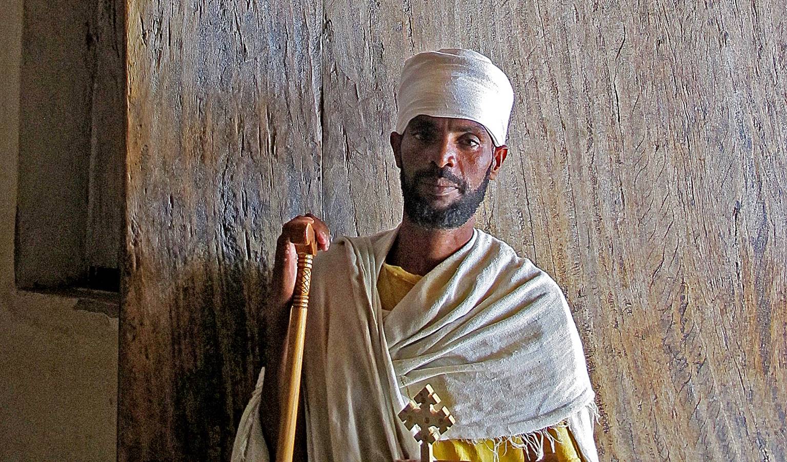
Two friendly priests at the church.
|
|
|
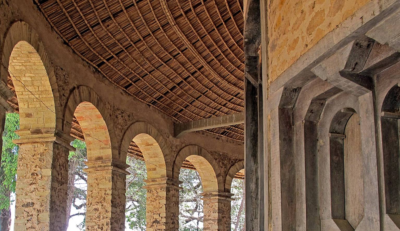
Views of the circular peristyle showing great craftsmanship.
|
|
|
|
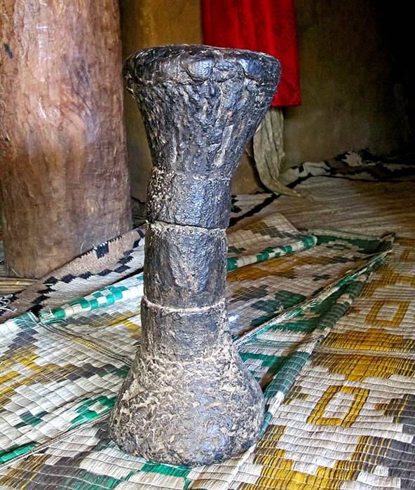
Left: a visitor on the edge of the peristyle. Right: an old wooden stool
inside the church.
|
|
|
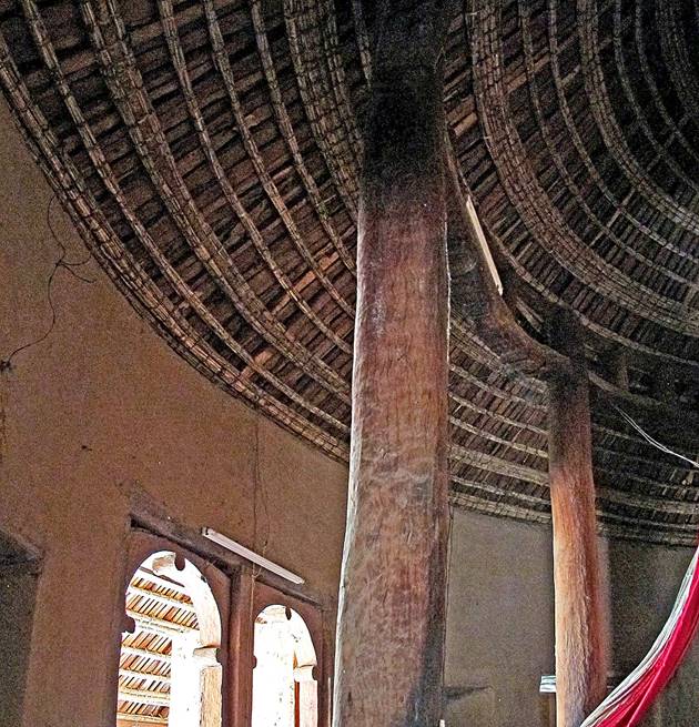
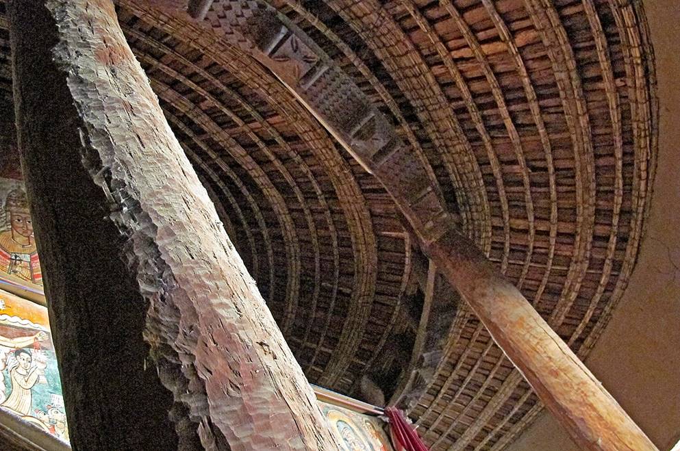
Supporting columns and ceiling inside the church.
|
|
|
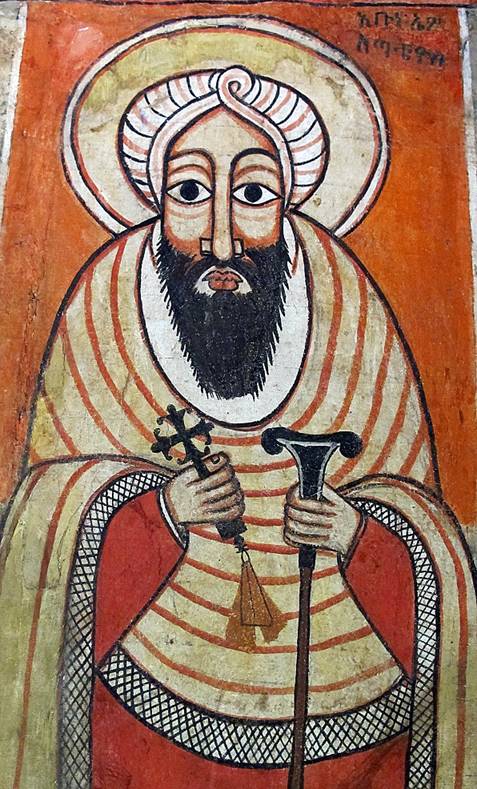
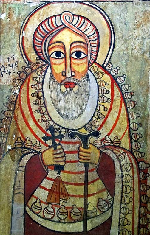
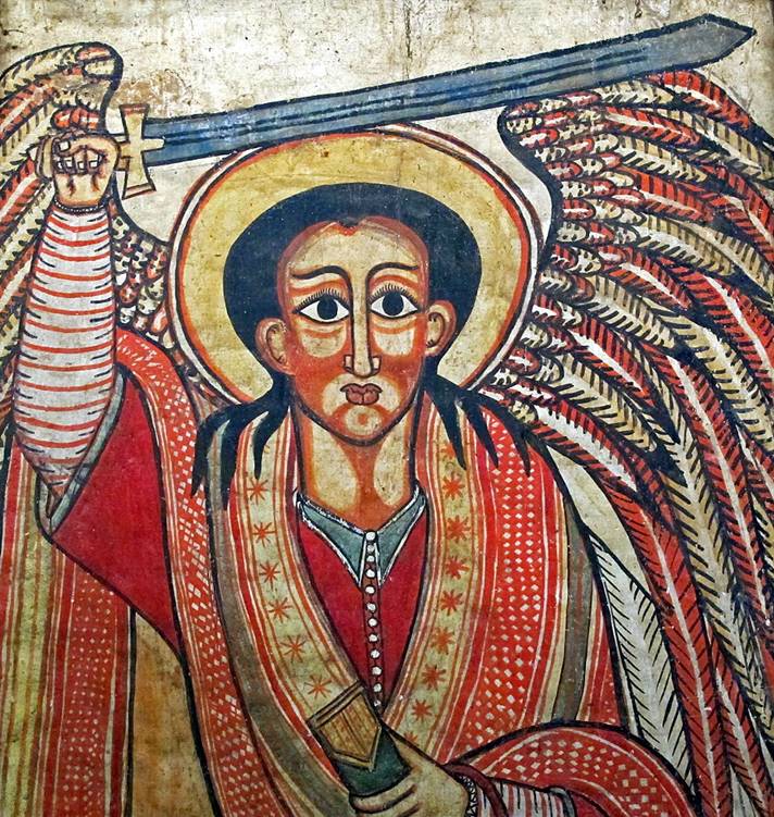
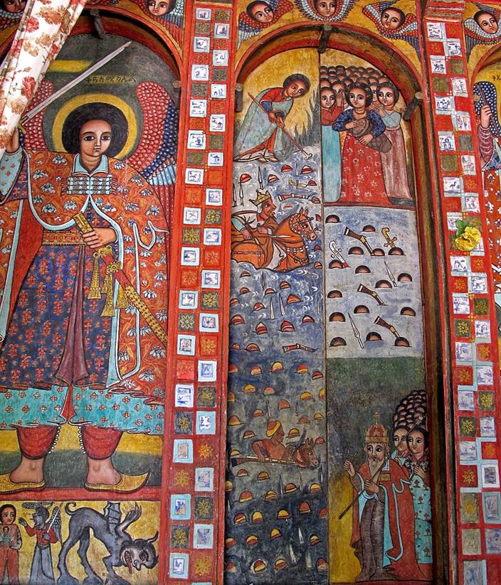
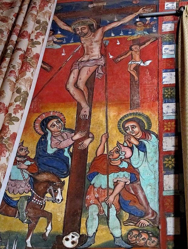
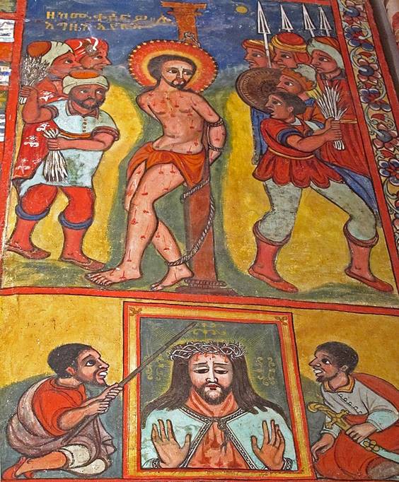
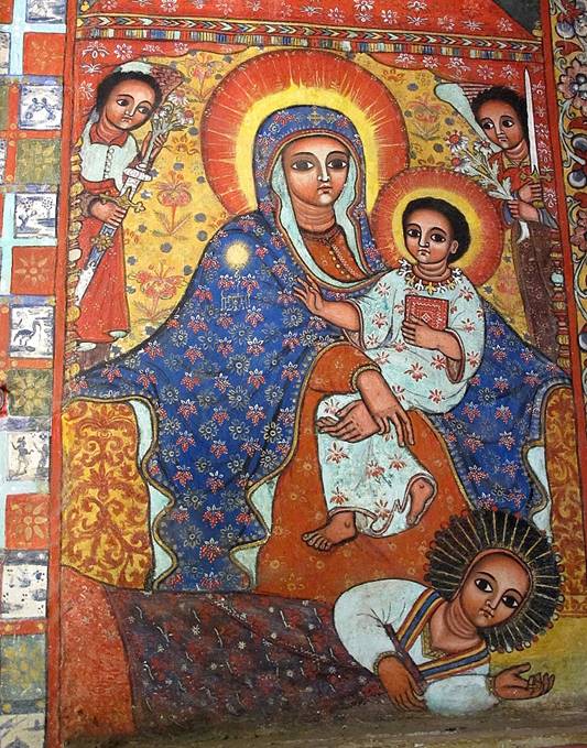
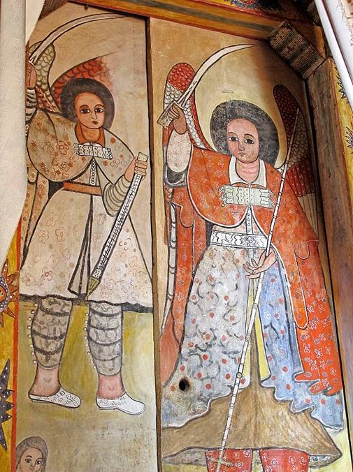
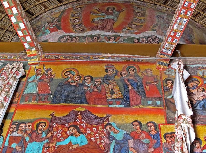
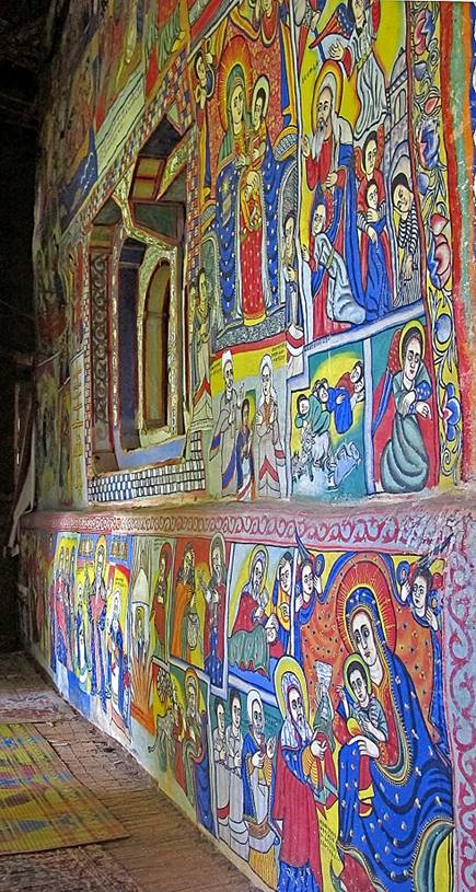
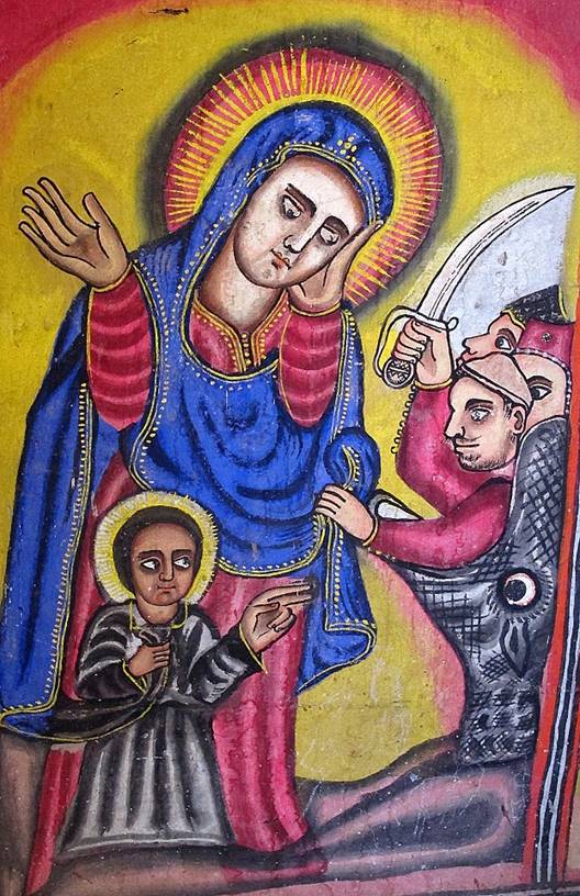
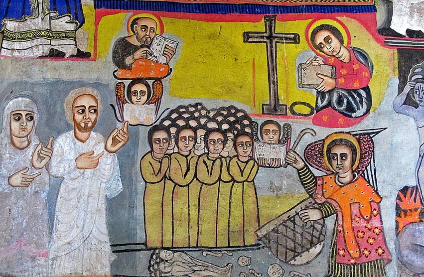
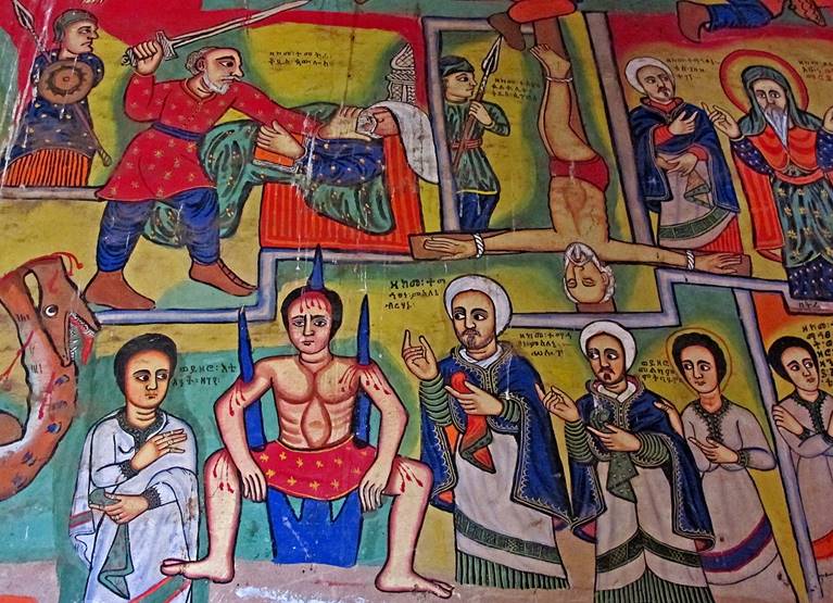
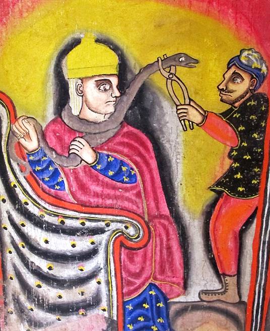
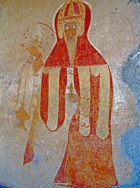
Paintings inside the church.
|
|
|
|
|
|
|
|
|
|

Two of the most vivid paintings in the church.
|
|
|

Church of Narga Selassie:
This church is located on the western shore of the Dek island, the largest island
on Lake Tana. Built in the 18th century it is
one of the most decorated churches around Lake Tana.
Like Debre Sina it is
circular in shape with a surrounding peristyle. But, unlike Debre
Sina, the inner walls and the columns bordering the
peristyle are made of stone (instead of adobe and wood) and the overall
structure is covered by a tin roof (instead of thatch).
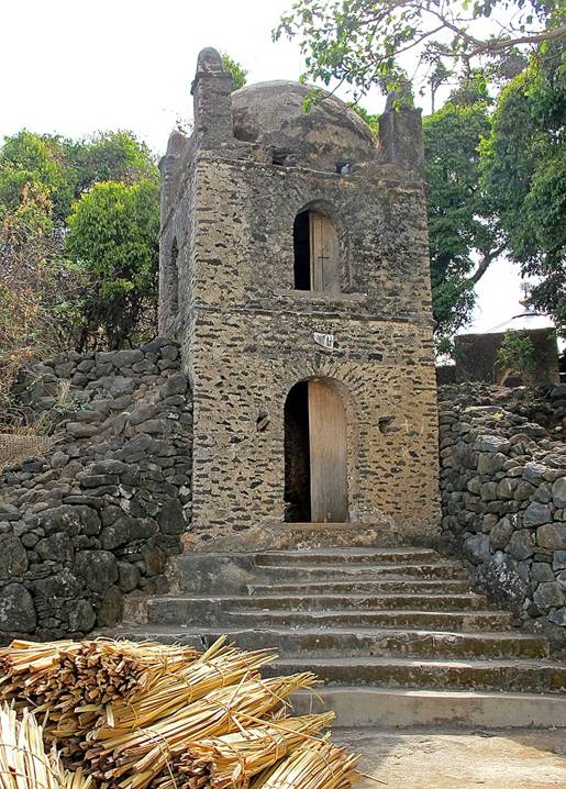
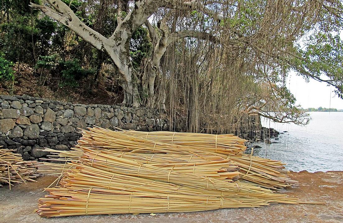
Jetty at the base of the stairway leading to the church. Papyrus stems
are stacked on the jetty.
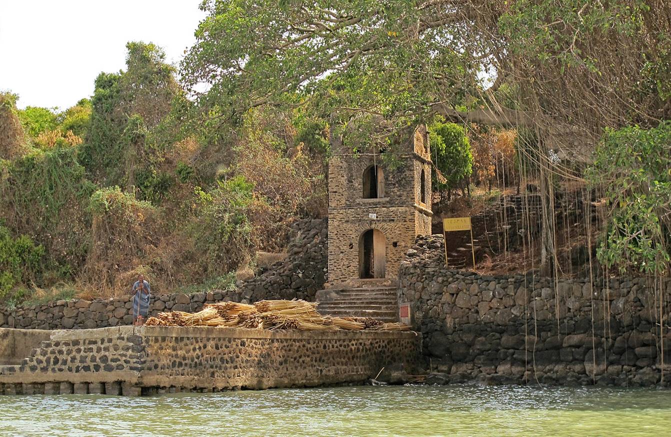
Left: Another view of the (Gondar-style) two-storied tower at the base of
the stairs. Right: Large fig tree on the right of the tower.
|
|
|
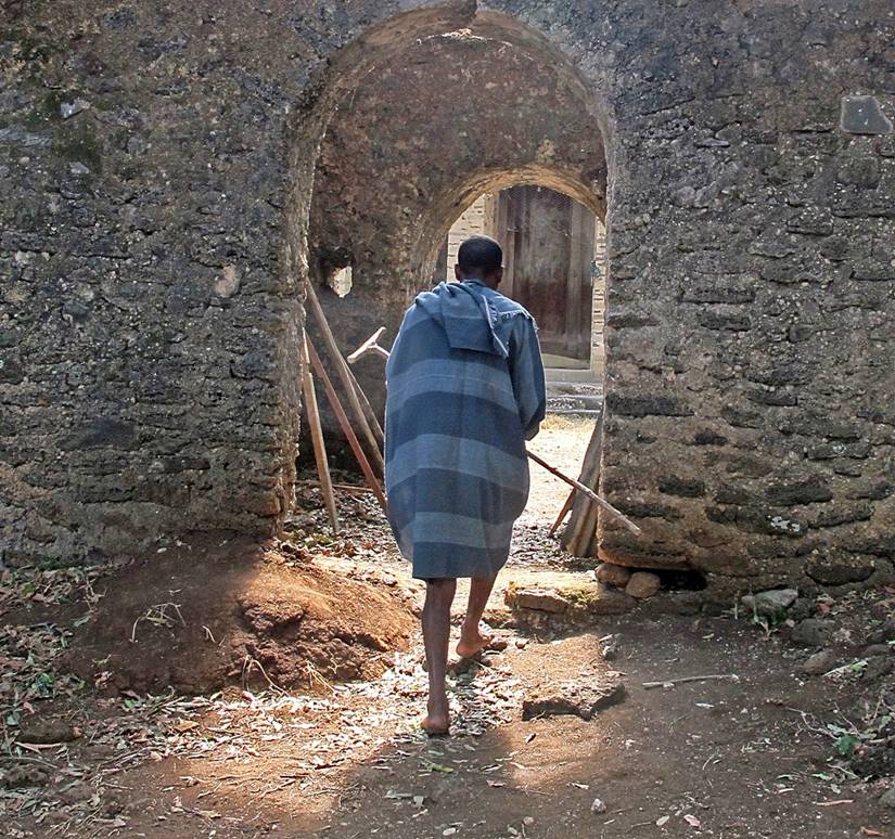
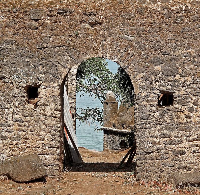
Double arched gate before reaching the church. Right: Going to the
church. Right: Returning to the jetty.
|
|
|
View of the church.
In the peristyle.
Priest at the church′s door.
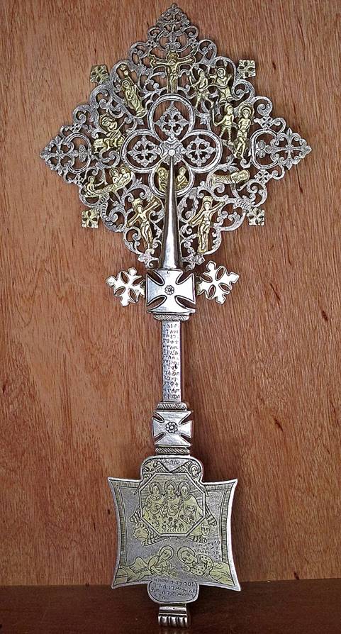
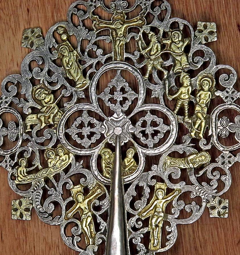
Precious cross in the church.
|
|
|
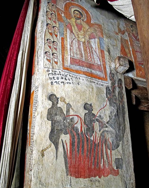
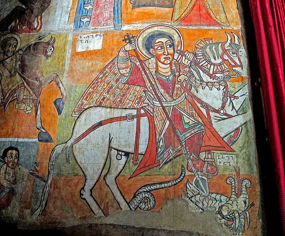
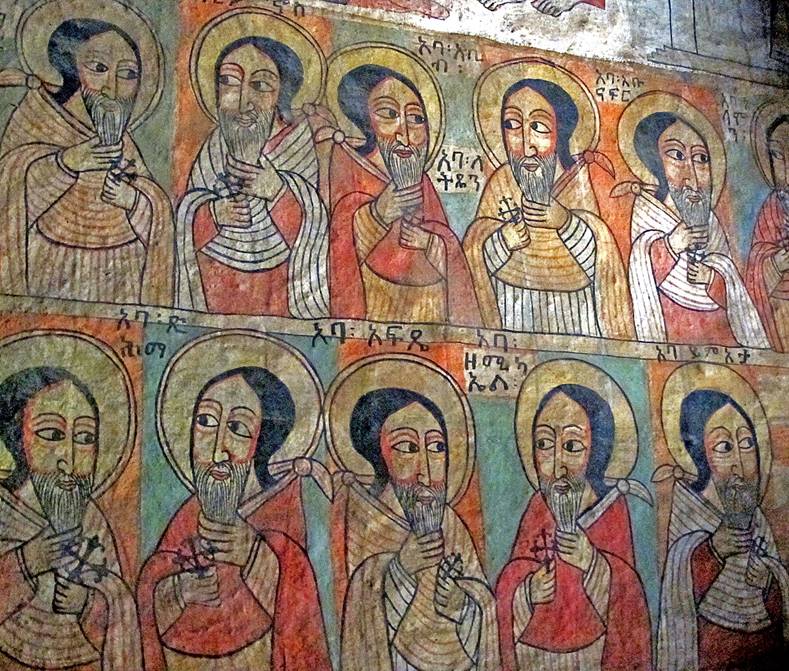
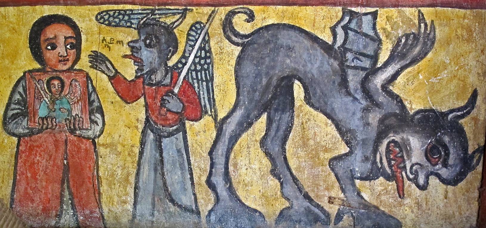
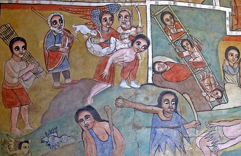
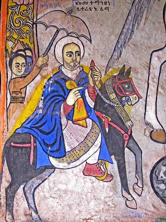
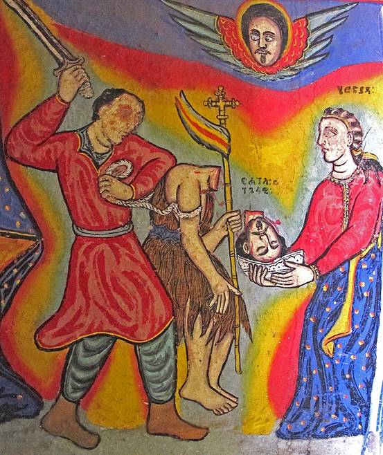
Paintings in the church.
|
|
|
|
|
|
|
|
|
|
|
|
|
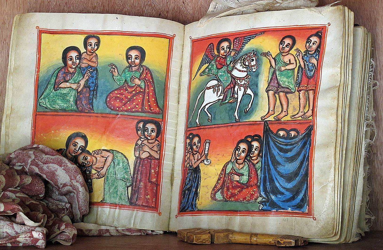
Religious book.
Monastery of Bete
Maryam:
Founded in the 13th century, it is the oldest monastery of the Zege peninsula near the southern end of Lake Tana. Some of the paintings inside the church are said to
date from the 16th century, but others seem to be much more recent.
Left: ceiling and columns of the church′s peristyle. Center and
right: wall paintings inside the church seen from the peristyle.
|
|
|
|
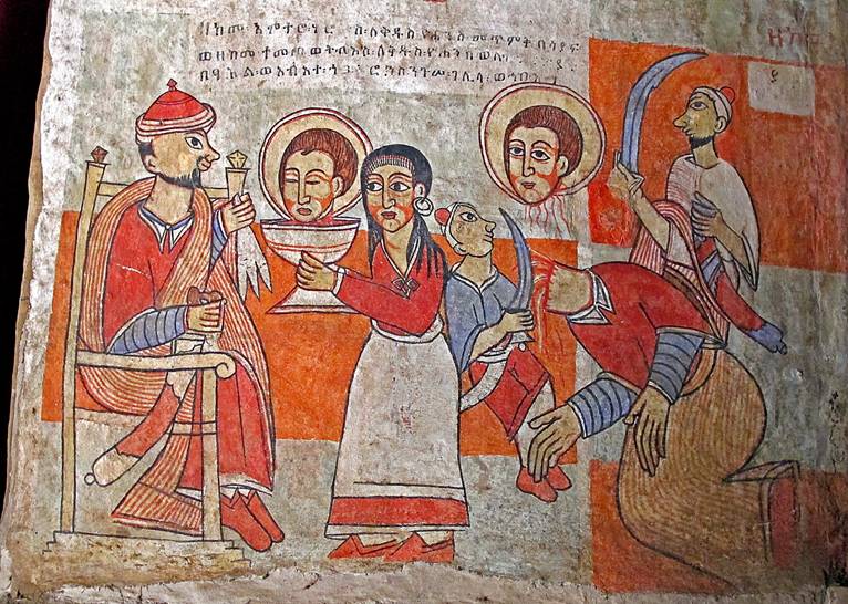
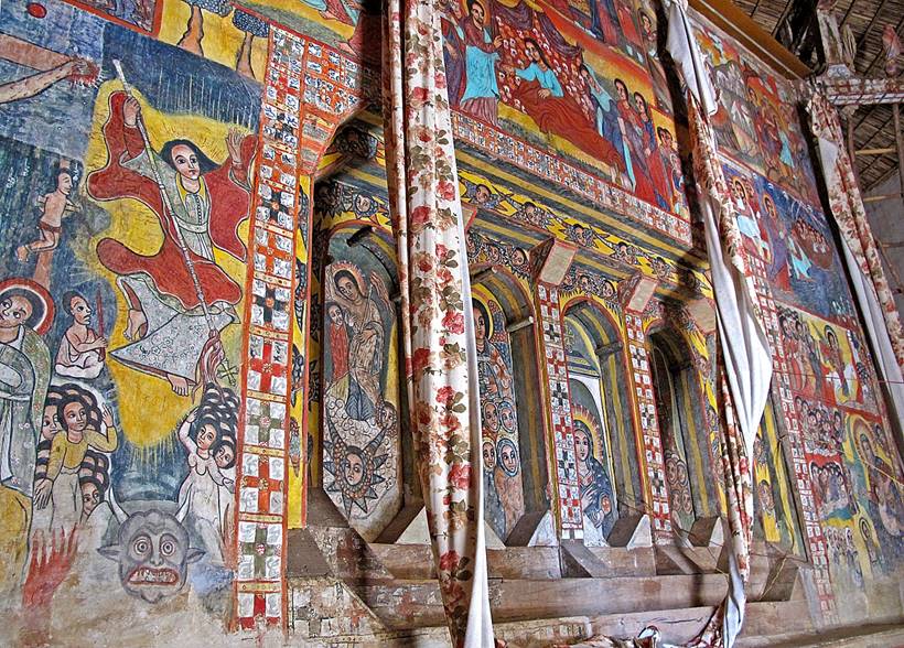
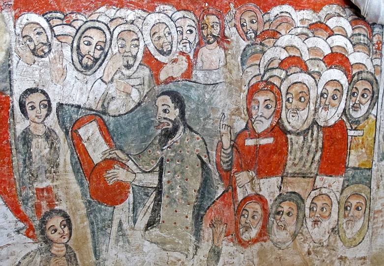
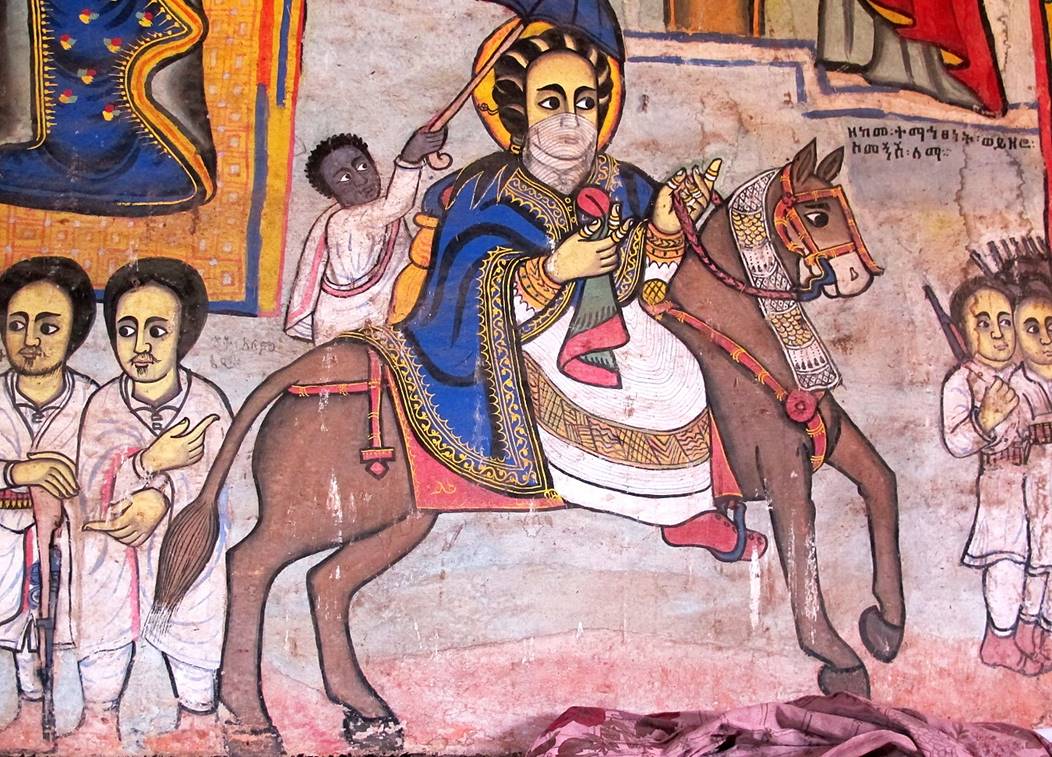
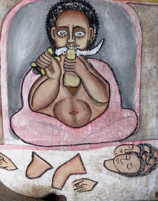
Other paintings inside the church.
|
|
|
|
|
|
|
|
|
|
|
|
|
|
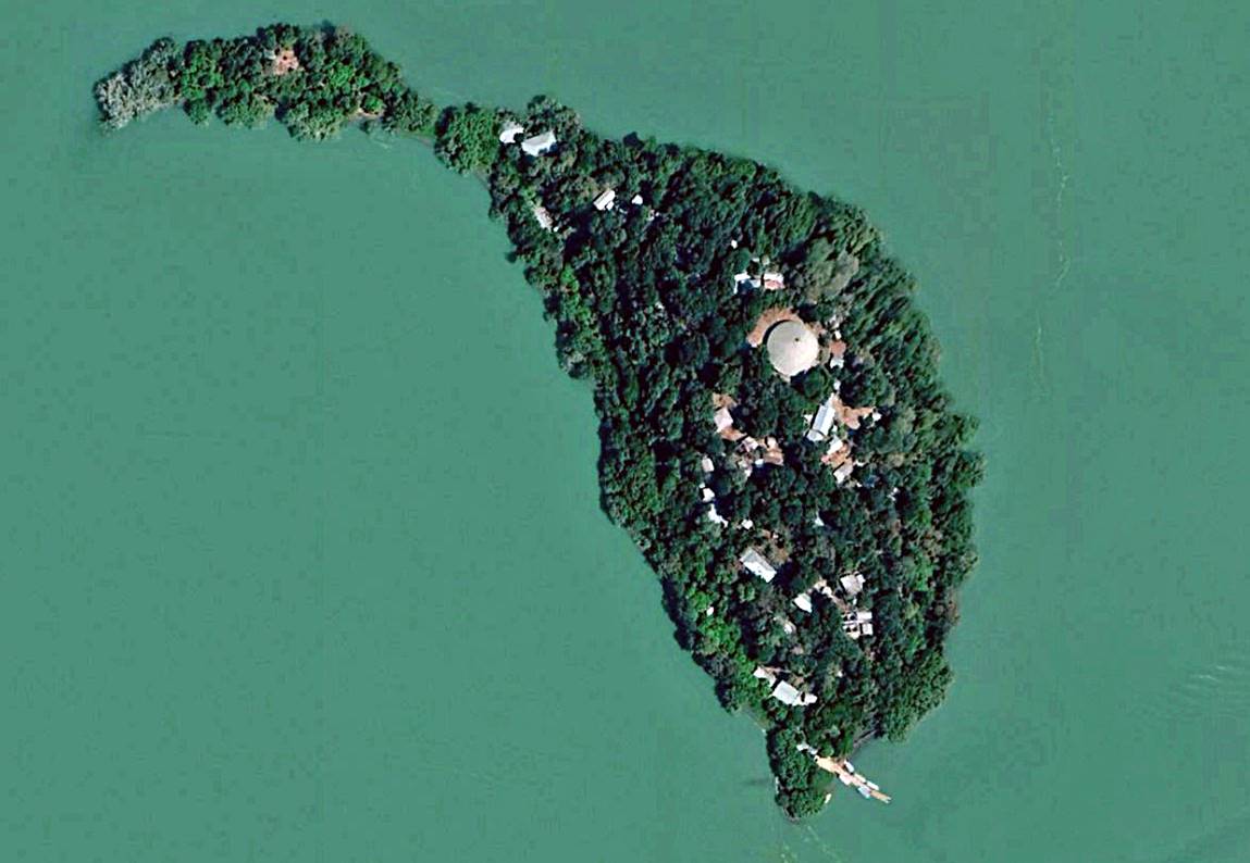
Kibran Gabriel monastery:
It is located on a tiny island about half-way between the Zege peninsula and the city of Bahir Dar on the southern
shore of Lake Tana. It is said to have been founded
in the 13th century. Its church lies on the highest point of the island.
Aerial photo of the Kibran Gabriel island, with the circular church visible in the middle. [Source: Google Earth.]
Left: in the peristyle. Right: painting on the church wall in the
peristyle. (Unlike other churches in the area, this church has almost no
paintings.)
|
|
|
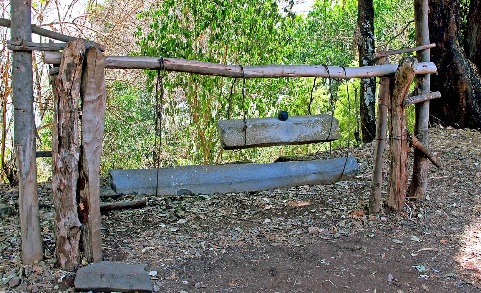
Lithophones outside the church.
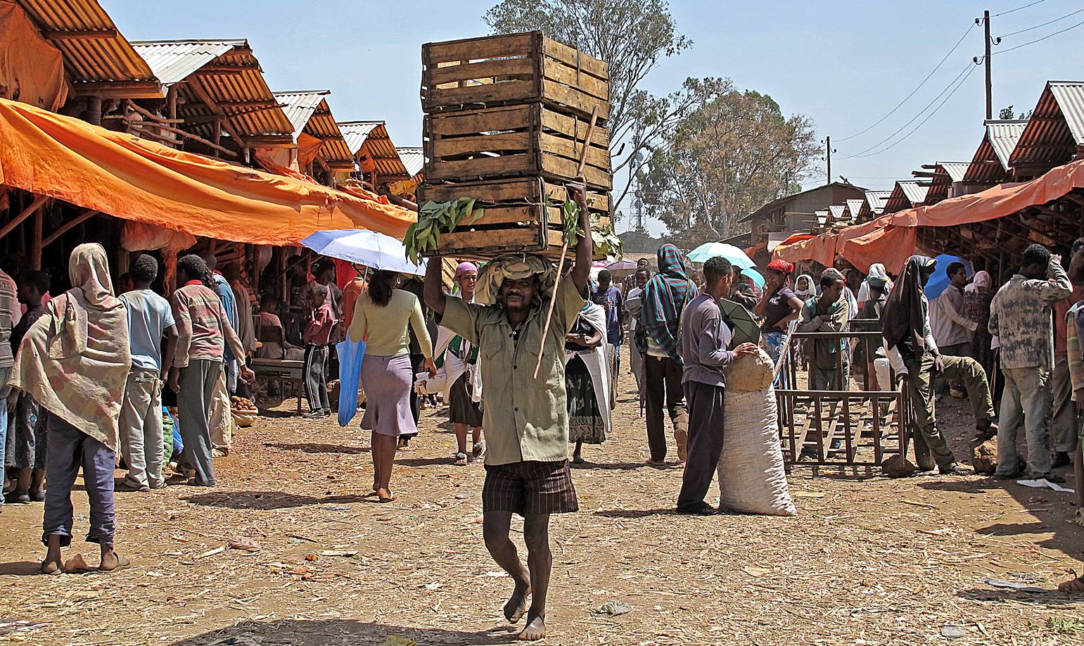
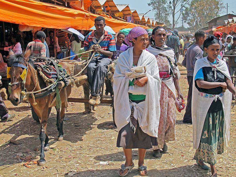
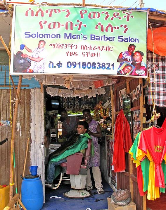
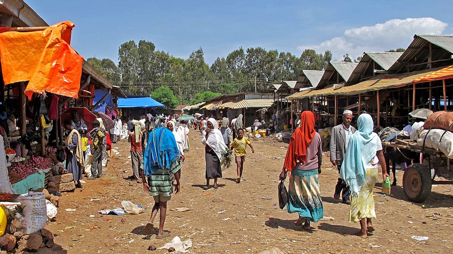
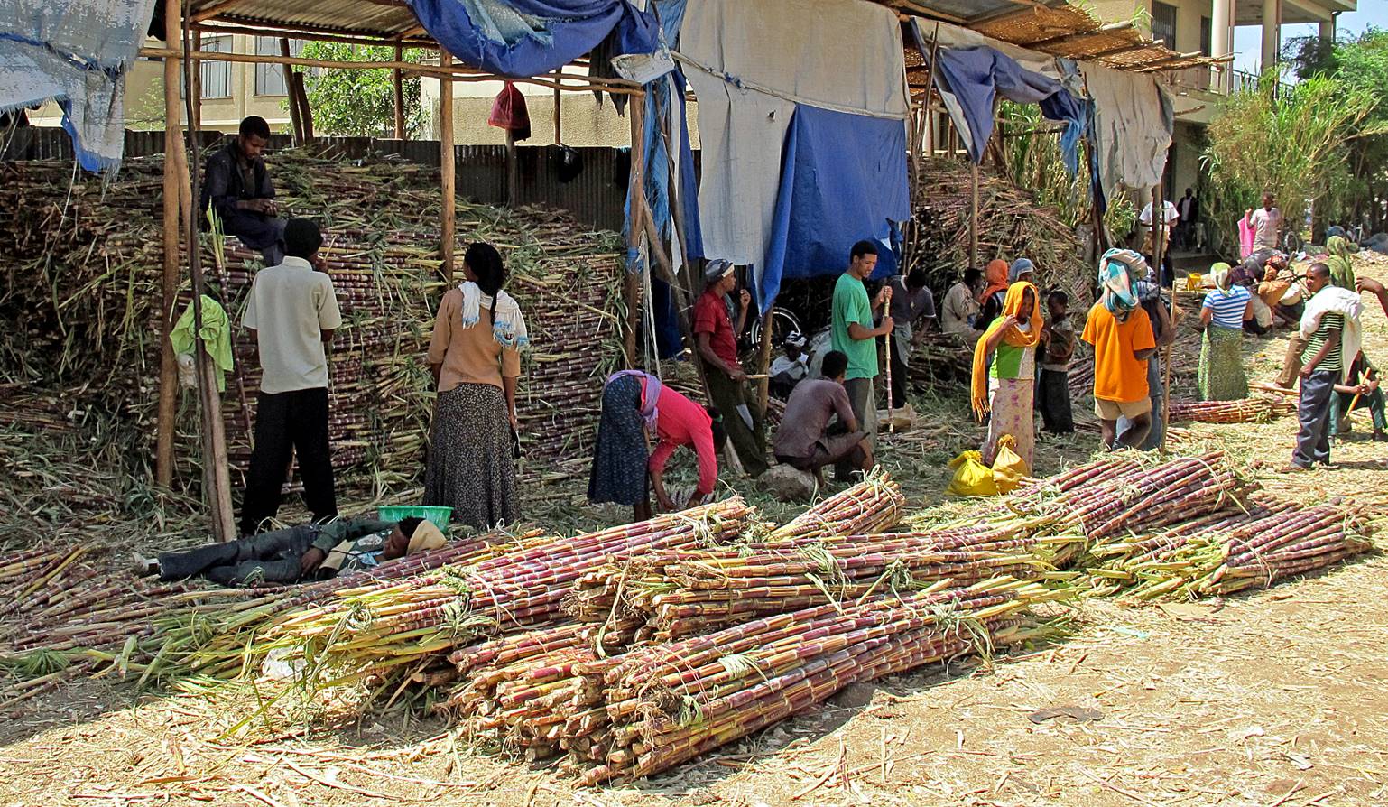
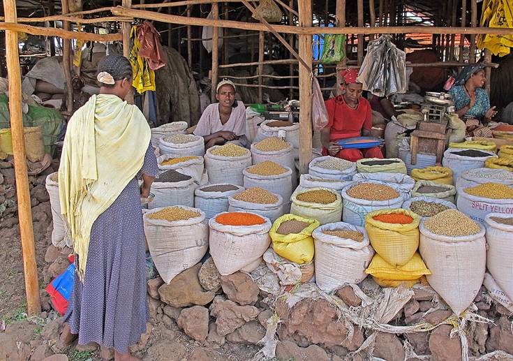
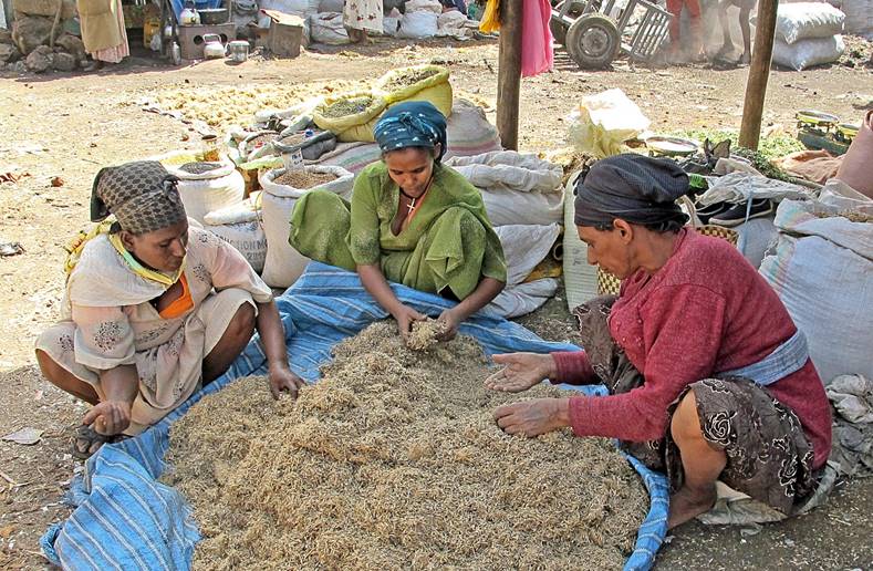
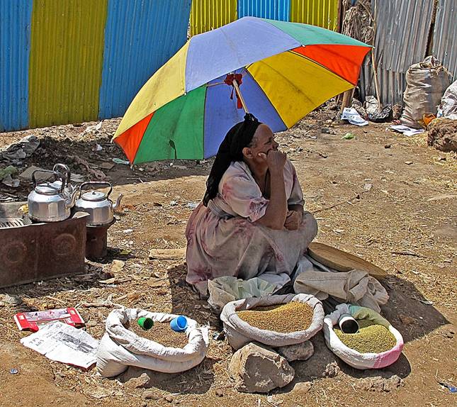
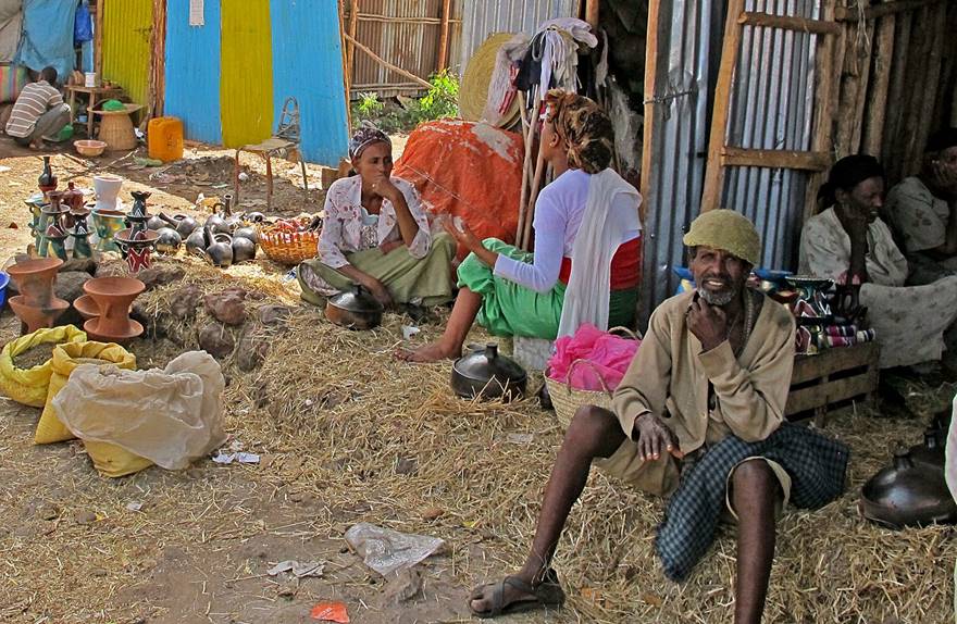
Market in Bahir Dar
(on the southern shore of Lake Tana):
|
|
|
|
|
|
|
|
|
The Blue Nile falls
and around:
These 45m-high falls are located 30km southeast of Bahir Dar.

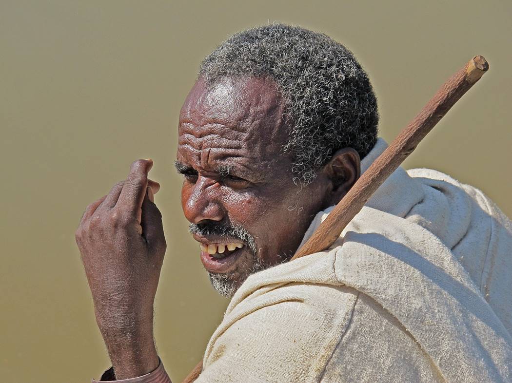
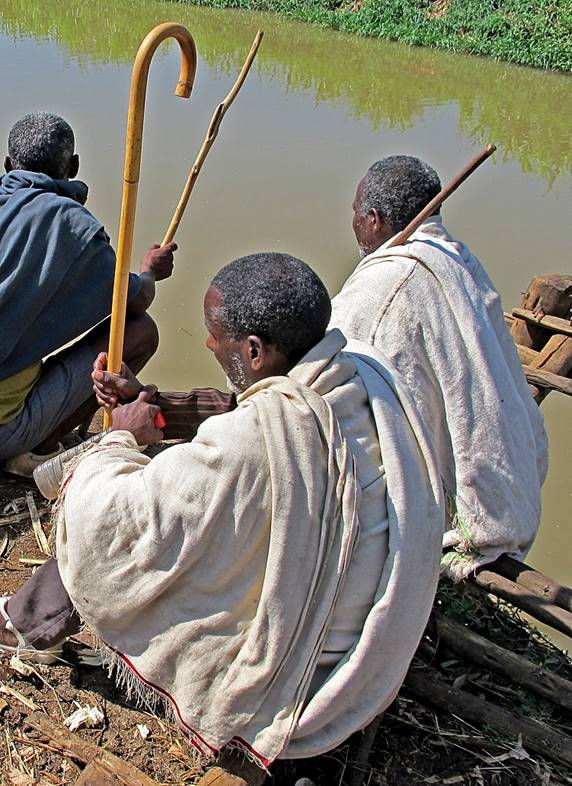
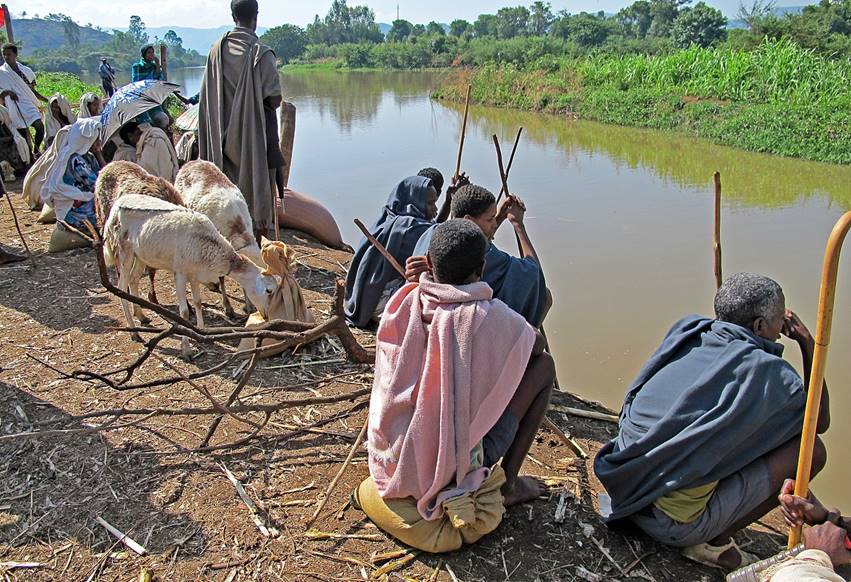
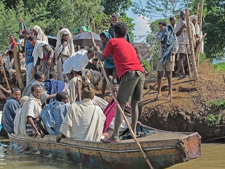
Local farmers waiting for a small boat to cross a branch the Blue Nile (near
the falls) on their way to the Saturday market in the village of Tis Abay.
|
|
|
|
|
|
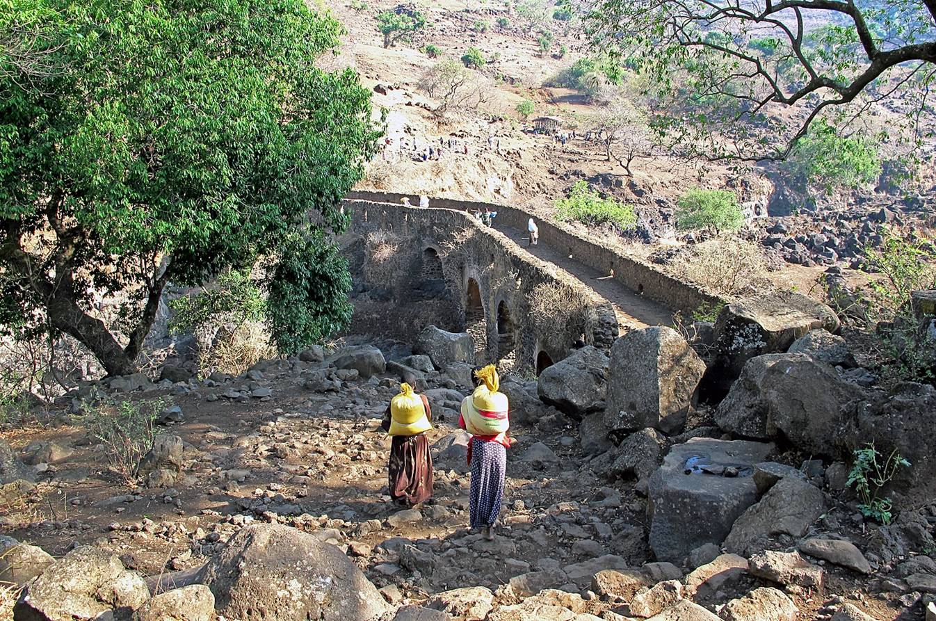
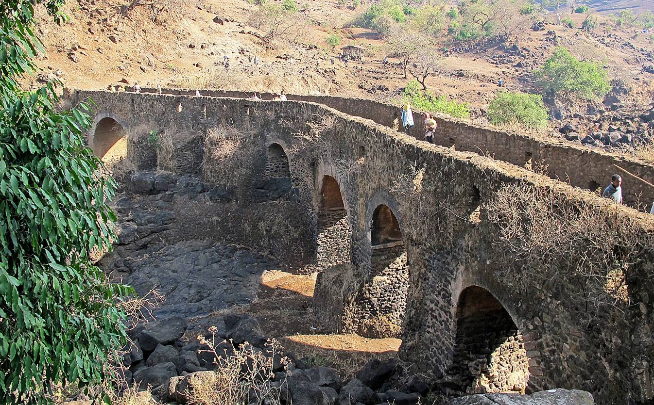
Portuguese bridge (early 17th century) over a branch of the Blue Nile,
below the falls.
![]()