Ethiopia (April-May
2015): Around North-Eastern Tigray in 21 Days
|
|
Return to my mountaineering/trekking webpage
|
|
|
|
|
|
Bits of History:
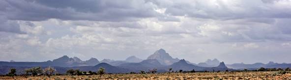
Tigray is
Ethiopia′s northernmost Region, coined between Sudan to the west, Eritrea
to the north, and the Afar Region to the east. It is a land of ancient history
and culture. More than 2500 years ago, Yeha (in what
is today northern Tigray) was a center of Sabaean
culture, a culture that initially developed in the south west of the Arabian
Peninsula. For several centuries, it was the capital of the Damot
empire, which predated the Axumite empire. Today Yeha is only a small hamlet, but a large temple and stone
tombs are still visible.
Later,
between the 1st and 7th centuries AD, the Axumite empire was one of the most powerful empires and
technologically advanced civilizations of its time, along with the Roman,
Persian, and Chinese empires. Tall granite stelae and impressive underground
tombs made of huge slabs of stone are still visible today outside the modern
city of Axum. Several archeological findings have recently been made and more
sites are now being excavated or waiting excavation.
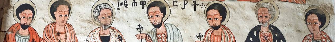
Christianity
was introduced to Tigray in the 4th century AD. Over 150 rock-hewn
churches were dug between the 7th century (when the nine saints
spread monasticism in Ethiopia) and the 15th century. The local
tradition even says that some churches were dug as early as the 4th
century. So, most of these churches predate the famous 13th-century
churches of Lalibela. Many are located in spectacular
landscape settings, like remote and difficult-to-access cliff locations. Some
contain stunningly beautiful paintings that have remained untouched since their
creation centuries ago.
In the early
6th century, in Prophet Mohammed′s lifetime, a group of his
first followers fled to Tigray from the persecution of the ruling Quraysh tribe
in Mecca. They were offered protection by the Christian Axumite king and
settled in Negash, 60km north of Mekele
(now Tigray′s capital). Negash became the site
of the earliest mosque in Ethiopia, but little of it remains besides a recently
excavated cemetery. This good deed did not prevent the Muslim military leader
Ahmad ibn Ibrahim al-Ghazi to conquer most of Abyssinia in the 16th
century and damage several rock-hewn churches.
Recently,
between 1974 and 1991, Tigray suffered much from the Derg
dictatorial regime that had overthrown Emperor Haile Selassie in 1974,
especially during the famine of 1983-85. On 22 June 1988, the Derg-controlled Ethiopian Air Force bombed Hawzen′s marketplace killing 2,500 people. The Tigraian People′s Liberation Front (TPLF) was a
leading participant in the rebellion that eventually led to the fall of the Derg regime.
My previous trips
to Tigray:
My first
trip was during the summer of 1973. My initial goal had been to go to the
Danakil Desert (now in the Afar Region and better known as the Afar
Depression). But I had to spend sometimes in Mekele
to secure a permit from the governor of the region, Ras
Mengesha Seyoum. This is
when I first became aware of the Tigray′s rock-hewn churches (in fact,
until 1966 they were mostly unknown outside Tigray). So, immediately after
returning from the Danakil Desert, I decided to visit a few of these churches.
Much later, in April 2012, I briefly returned to Mekele
from where I started a
trek that took me to Lalibela and Debark. In
November 2013, I did another
trip and visited a few churches before going on another trek in the Amhara
Region south of Tigray.
A sense of ″unfinished
business″ regarding Tigray led me to return there in April-May 2015 and
trek around northeastern Tigray. While many culturally interesting sites can
now be reached or approached by vehicles, reaching them on foot as part of a
much larger trek makes it possible to better appreciate their natural
environments.
Itinerary:
|
|
|
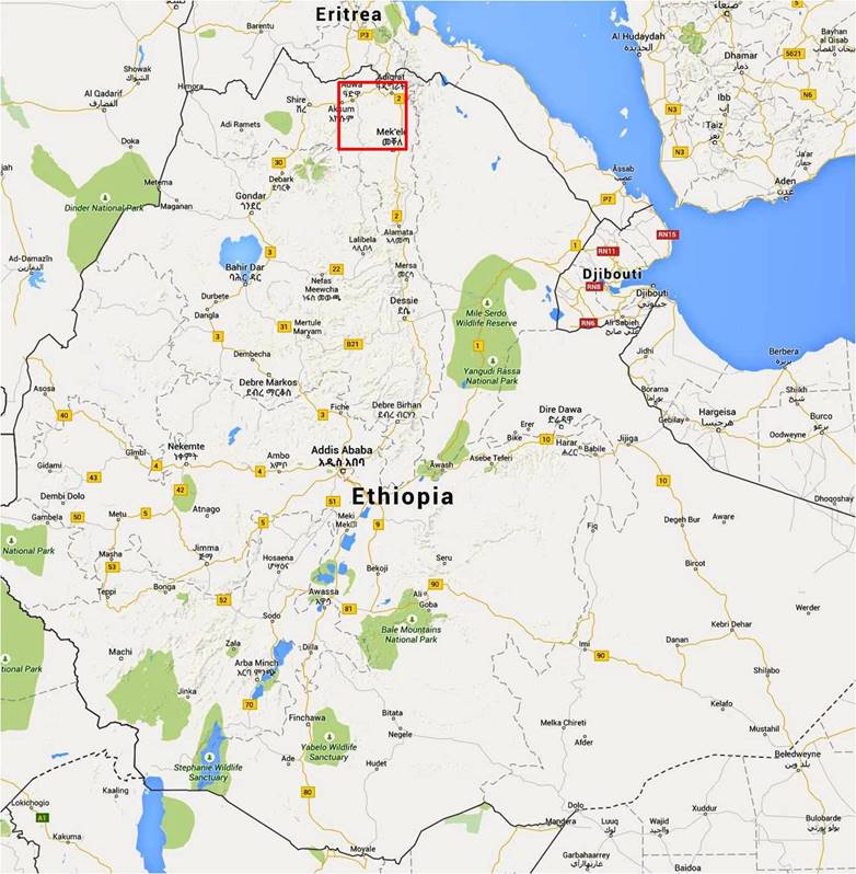
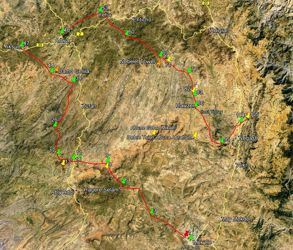
The area of the
trek is delineated in red in the Google map of Ethiopia shown above (left
image). The detailed itinerary is the red path in the satellite photo on the
right (click here or on the
satellite image to bring a higher resolution image). From Mekele,
I first trekked to Axum. After visiting Axum I took a bus to Adwa (25km east of
Axum). I then trekked from Adwa to the rock-hewn church of Medhane
Alem Adi Kasho (waypoint
#105 in the image), via Yeha and Hawzen.
From Medhane Alem Adi Kasho I returned to Mekele by
bus caught on the nearby road connecting the towns of Adigrat
and Mekele. The trekking portion (red path) of the
trip is approximately 300km-long.
Click here (.kmz file) to access
the waypoints in Google Earth. The waypoints along the red path of the trek are
numbered 1 (start, in the outskirts of Mekele) to 105
(church of Medhane Alem Adi Kasho). The waypoint pins are red, yellow, or green.
The green ones mark the places where I spent nights (outdoor camps, except in Mekele, Axum, Adwa, and Hawzen,
where I stayed in hotels or lodges). The yellow pins mark the locations of
rock-hewn churches. Two yellow pins not on the red path are labeled by church′s
names (Abuna Gebre Mikael
and Debre Tsion Abuna Abraham). I visited those two churches, but I
approached them by car from Hawzen. Finally, two
orange pins mark the locations of two major rock formations (Damo Gellila and Nebelet Tower), which
are both visible from far away; they are not waypoints. They will appear in
several photos that I have posted on this site. The image above shows all the
green and orange pins, and most of the yellow pins. It does not show the red
pins, except waypoint 1 (start of the trek).
During this
trek I visited 9 rock-hewn churches: Maryam Hibeti
(waypoint 9), Gebriel Wukien
(waypoint 12, not shown in the above map because it is too close to camp
waypoint 14), Abba Yohanni (waypoint 13), Maryam Wukro (waypoint 71), Giyorgis Maikado
(waypoint 82), Abuna Gebre
Mikael, Debre Tsion Abuna Abraham, Abreha we Atsbeha (waypoint 95b, not shown on the above map because
it is too close to camp waypoint 95), and Medhane Alem Adi Kasho (waypoint 105). To
visit each church one must first find the priest who carries the key. This
priest may be a farmer who lives several kilometers away from the church. On
any particular day, he may be at a market selling or buying products, or he may
not be willing to go to the church. For most churches we hired a local boy to
fetch the priest, which turned out to be a good strategy. I was quite fortunate
overall, as I was able to enter 8 of the 9 churches. Maryam Hibeti
was the only church for which we could not find the priest; so, I saw it only
from the outside. Surprisingly, I did not encounter any tourist at any of these
9 churches.
Logistics:
|
|
Like in my three recent trips to
Ethiopia (April-May 2012, March 2013, and November-December
2013), Solomon Berhe arranged the logistics for this trip
(transportation, support team, group gear, hotel reservations, some local
arrangement...). As a native of Tigray, where he often returns, he also
provided valuable advice about the trek itinerary. As a bird watcher himself,
he travels extensively across all regions of Ethiopia, where he has developed
numerous relations. He has first-hand experience of the joy and sometimes
hardship of outdoor adventures. |
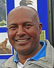
My two companions
during the entire trek were Gebru and Gebrehiwet (photos below), who both live
in Adwa. They had already trekked with me in April 2012 and November-December
2013. During those trips we have learned to understand each other quite
well, despite the fact that I do not speak Amharic or Tigraian
and that they do not speak English or French. Gebru
is a tall, incredibly strong man; he is also Solomon′s brother. Gebrehiwet is shorter and slimmer, but his endurance
seems unlimited. Gebru was in charge of collecting information daily about our
near-term itinerary and of finding mules or porters that we hired on a
day-by-day basis to carry loads. Gebrehiwet was our cook; he was able to get
injera (spongy crepe-like flatbread made from farmented teff and other cereals)
almost daily from local farms and cooked delicious spicy wat (stew) every
evening to go along with it. Gebru and Gebrehiwet were also my body guards!
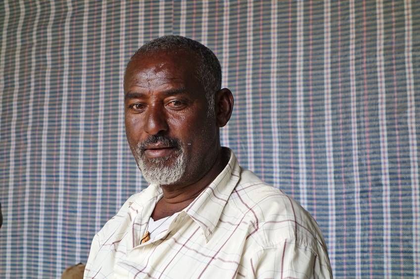
Gebru:
|
|
|
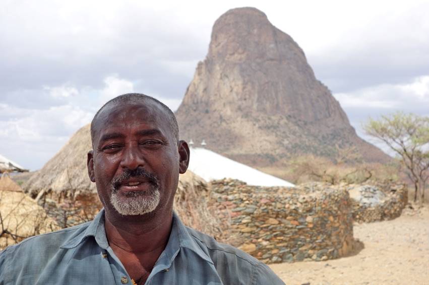
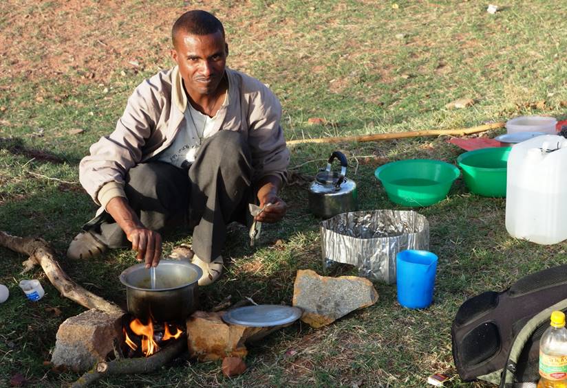
Gebrehiwet:
|
|
|
Sections of the
trip (click on the
links below to access the corresponding webpages):
-
2.
Maryam Hibeti to Abba Yohanni
and Gabriel Wukien
-
3. Gabriel Wukien
to Axum via Damo Gellila
-
6. Abuna Gebre
Mikael and Debre Tsion Abuna Abraham
-
7.
Hawzen to Medhane Alem Adi Kasho via Abreha we Atsbeha
|
|