Ethiopia (January 2017):
Across
northeastern Oromia, from Sheikh Hussein to Harar
![]()
Return to my mountaineering/trekking/travel webpage

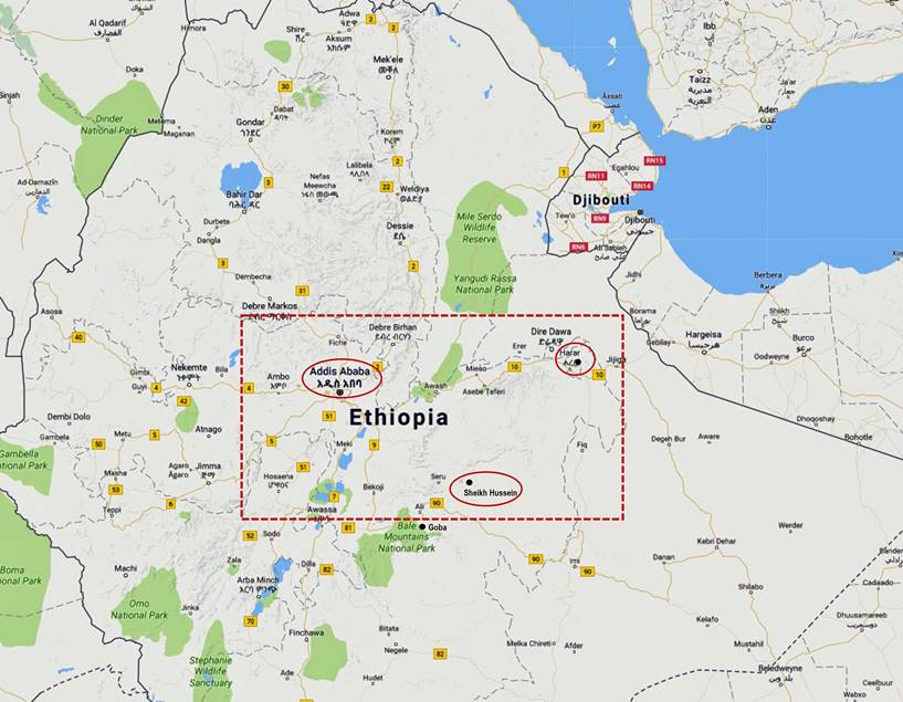
The purpose of this trip was to travel
from Sheikh Hussein to Harar, as much as possible on
foot, across the northeastern part of Oromia, the largest of the nine states of
Ethiopia. In the eyes of most Ethiopian Muslims Sheikh Hussein and Harar are two of the most sacred places in Ethiopia, along
with Negash in northern Tigray (which is the site of
the first Muslim settlement in Ethiopia):
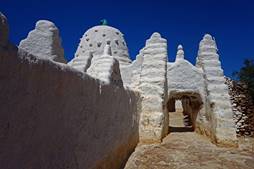
- Sheikh Hussein is a village named
after a 13th-century holy man who is credited for having introduced Islam in
the region and is buried in a sanctuary located in this village. For several
centuries, and still today, twice a year, this sanctuary has been the
destination of a major pilgrimage that attracts several 10,000 pilgrims.
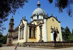
- Harar (which
I had already visited in May
2012) is considered by many Ethiopian Muslims as the 4th-holiest city, after
Mecca, Medina, and Jerusalem. The old walled city of Harar
(called Jugal) is said to be the largest
concentration of mosques in the world.
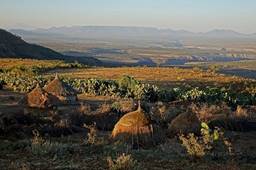
Between Sheikh Hussein and Harar lies a dry land of flat plateaus (elevation: between
1500 and 1800m) separated by canyons (elevation: between 800 and 900m) created
by the Wadi Shebelle and its tributaries. The Wadi Shebelle is a major river that has its source in
Ethiopian highlands (Bale mountains) and flows into
Somalia.
Logistics and support team:
Like for my four most recent trips to
Ethiopia (April-May
2012, March
2013, November-December
2013, and April-May
2015), Solomon Berhe arranged the logistics for this trip (permits,
transportation, support team, group gear, hotel reservations...). I am very
fortunate that he had been willing to arrange such a trip in a very remote
region of Ethiopia. During the trip I had some unpleasant encounters with
police. Without his prompt and effective intervention, I might have ended up
spending a few days (or more) in jail.
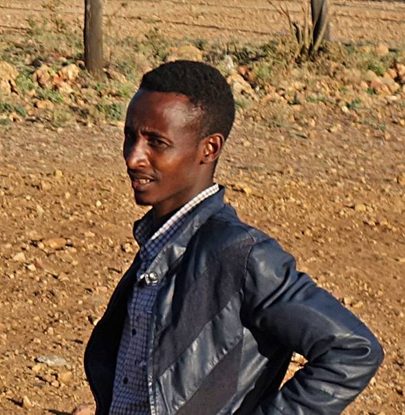
My companions during the trip were Gebru, Numan, and Mahmood (photos
below). Gebru lives in Adwa (northern Tigray) and is
Solomon′s brother. We had already done three trips together (April-May
2012, November-December
2013, and April-May
2015). I was glad and grateful that he came, as he was the only person I
could fully rely upon during the trip (even though we don‛t speak any
common language). Unfortunately, he only speaks Tigrinya and Amharic, while
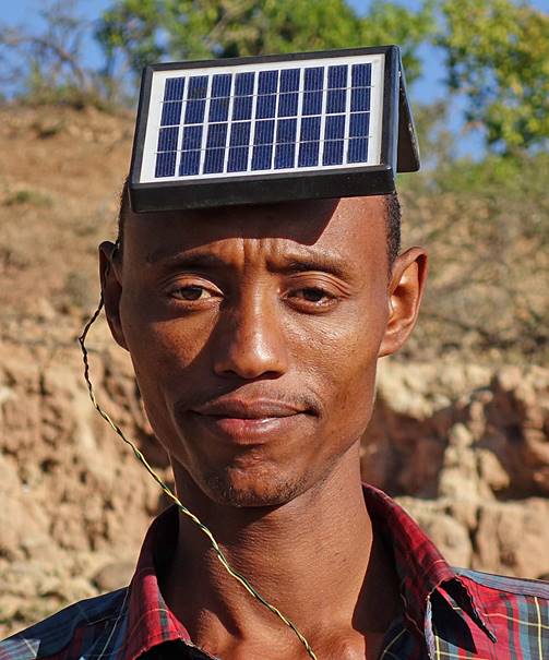
most people encountered during the trip only spoke Oromo. Numan
and Mahmood are Oromos from Sheikh Hussein. They
speak both Oromo and Amharic. Numan, who also speaks
good English, was the main interpreter within the group and with the local
people. Numan and Mahmood were fine companions, but
neither had previously visited the region between Sheikh Hussein and Harar, beyond a few kilometers from Sheikh Hussein. (In
fact, I doubt that anyone, even in Oromo, knows this entire region.)
|
Gebru |
Numan |
Mahmood |
|
|
|
|

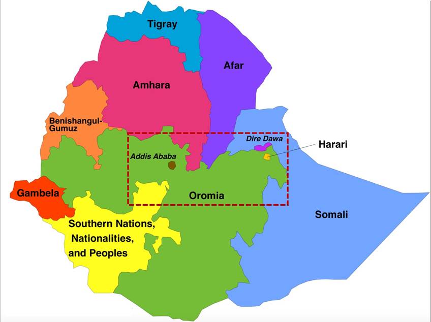
Map of Ethiopia and its 9 regional states:
Oromia is the largest of the 9 Ethiopian
states. In contrast, the town of Harar and its
surroundings form the smallest one, Harari, which is fully enclaved into
Oromia. The capital Addis Ababa and the city of Dire Dawa
in the east are chartered cities not included in any state.
|
|
|
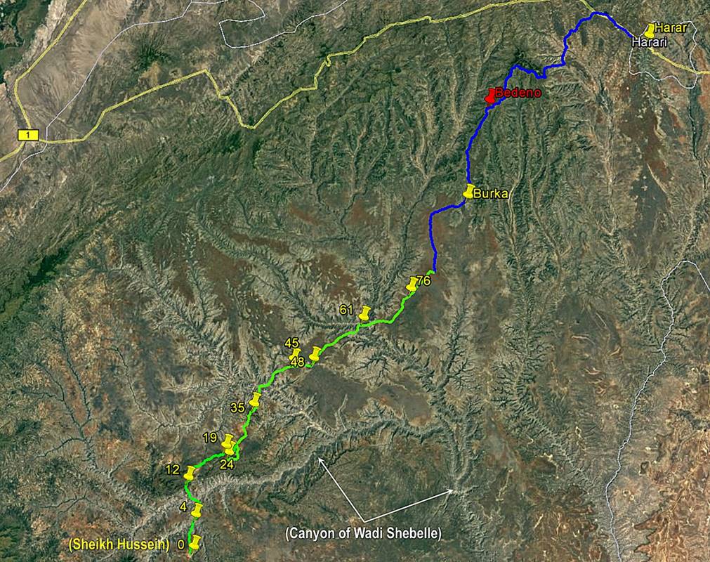
Itinerary in Google Map and
Google Earth:
The path in green line (approx. 180km)
in the two maps below was done on foot, whereas the path in blue line (approx.
160km) was done in a truck and a bus. Click here (.kmz file) to access all the waypoints and the paths in
Google Earth. The waypoints recorded with my GPS along the green path are
numbered 0 (start, in Sheikh Hussein) to 78 (end of the trek). The yellow pins
indicate the locations where we spent the nights. The red pins (not shown in
the images below) are intermediate positions. The paths in the .kmz file are not based on continuous GPS recording, hence
are approximate and subject to (minor) errors.

Schedule:
- Day 1: Landed in Addis
Ababa (early morning), drove to Goba.
- Day 2: Drove to Sheikh Hussein,
visited Sheikh Hussein sanctuary.
- Days 3-12: Trekked from
WP 0 (Sheikh Hussein) to WP 78, took a truck from WP 78 to the small town of
Burka.
- Day 13: Took bus from
Burka to Harar.
- Days 14-15: Spent days
in Harar.
- Day 16: Took bus from Harar to Addis Ababa.
- Days 17-18: Spent days
in Addis Ababa and around, flew back home.
General remarks:
The trip between Sheikh
Hussein and Harar took only 12 days, but it was quite
strenuous both physically and mentally:
- Heat combined with lack
of water along most of the way made the trip more physically demanding than I
had expected, despite the relatively small elevation gains/losses daily.
Available water (mostly from ponds) looked often so bad that I first filtered
it and then treated it with purification tablets. In general, I could not
filter more than 1/2 liter without having to clean the filter. So, filtering
the 3 to 4 liters I needed each day was time consuming. A few times I ended up
being very low on drinkable water.
- We did not have a pre-defined
itinerary. Instead, we created our itinerary on a day by day basis. Each day,
we relied on my GPS to set a general direction of travel toward Harar and we asked local people for information about
villages and water availability in that direction. Locals knew only their
immediate surroundings and had no knowledge of what was lying beyond 8 to 10
kilometers. For us it was like groping our way in a huge environment.
- We had a couple of very
unpleasant encounters with local police and militia (in particular, see section
2 of the trip below). In one case, I was treated as a prisoner for half a day.
Without Solomon‛s help in Addis Ababa, it would have been much worse.
Fortunately, thanks to strategically located communication towers on the
plateaus (used by the police and the army to control the region), we often had
cell phone connection. I also had my satellite phone. So, we were able to
contact Solomon when we needed help.
- Traveling in the Ethiopian
countryside is rarely relaxing. In most villages and small towns ″faranji″ hysteria (swarms of shouting people) is the
norm. But, on my previous trips, this type of manifestation did not last very
long. Here, it could last for many hours. In one village (Daffe,
WP 74) the police had to contain a large crowd during an entire afternoon.
Although ″faranji″ hysteria is not
hostile, I got increasingly allergic to it toward the end of the trek, with
people (who might have never seen a foreigner before) following me from
villages to villages.
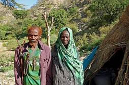
- In the most remote
places, we encountered people who were often reserved and sometimes not
friendly. In fact, most (all?) had never seen a white man and they were scared
by me. This is understandable in a land where fights between clans have been
the norm for centuries and the arrival of a foreigner has rarely meant good
news. In fact, we heard that Oromo and (Ethiopian) Somali clans had fought
recently in a region slightly to the south of our trekking itinerary, leaving
several people dead. Once local people realized that they had nothing to fear
from us, they were usually friendly and welcoming.
Despite such problems,
the trip offered several truly magic and somewhat relaxing moments, such as the
visit of the Sheikh Hussein sanctuary, the encounter with the Waradoube people in the Wadi
Shebelle valley, the welcoming village of Furdo, and
the beautiful valley of the Sakata river. Of course, the visit of Harar at the end of the trip was another highlight, even
for a second visit.
Sections of the trip (click on the links below to see pictures of the successive
sections of this trip):
[Since 1991, the
alphabet for the Oromo language is the Latin alphabet. During the trip, I noted
a number of Oromo names along the way (villages, rivers...). I often asked Numan to spell them down for me. Nevertheless, the spelling
of several of these names in my webpages may still be incorrect.]
|
|
|
|
|
|
|
![]()