Japan (April 2019): Nishinoshima
(Oki Islands)
![]()
The Oki islands form an archipelago
located in the Sea of Japan north of Matsue and Yonago
on Honshu. It was created 5 to 6 million years ago through volcanic activity
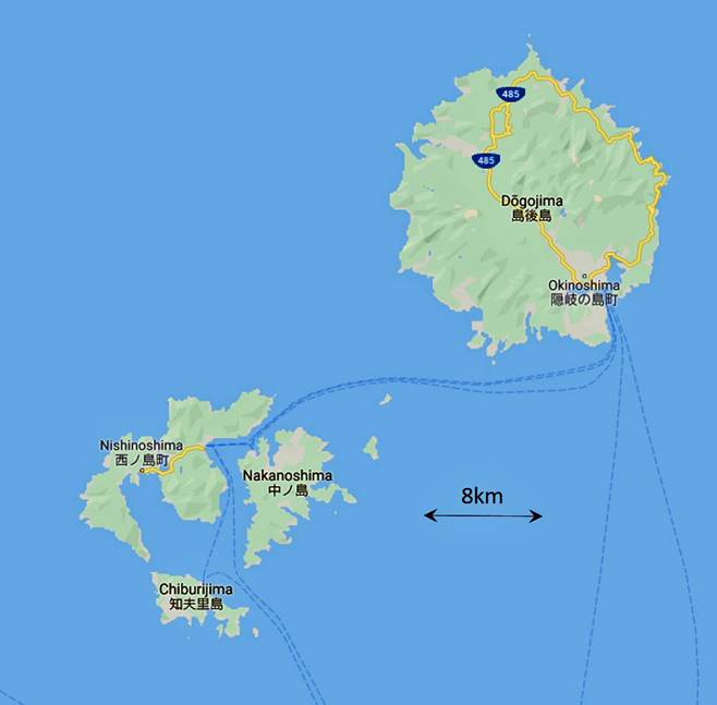
and tectonic movement. They are composed of 4 inhabited islands, Dogo, Nishinoshima, Nakanoshima, and Chiburijima, and
around 180 uninhabited islets. Nishinoshima, Nakanoshima, and Chiburijima,
known together as the Dozen group, are on the rim of
an ancient volcanic caldera that collapsed, protecting a small ″inner sea″
conducive to fishing.
The four inhabited islands are connected
with Honshu and with each other by regular daily ferries, but these ferries are
not very frequent. So, rather than spending too much time hopping between
islands, I chose to spend my three days in the archipelago in just one of them,
Nishinoshima (pop. ~3,400). Unlike Dogo, this island (the largest in the Dozen
group) is small enough to be explored on foot and, unlike the other two Dozen
islands, big enough to offer long walk opportunities.
Of all the Oki islands, Nishinoshima has the oddest shape, made of two main parts
almost separated by a narrow channel of water. In fact, a man-made canal, the Funabiki canal, was pierced in 1925 through the narrow
piece of land connecting these two parts to facilitate ship movements from the
inner sea to the Sea of Japan. More recently, a bridge has been built across
the southern extremity of the channel to create a shorter road between the two
parts of the island. The northwestern coast of Nishinoshima
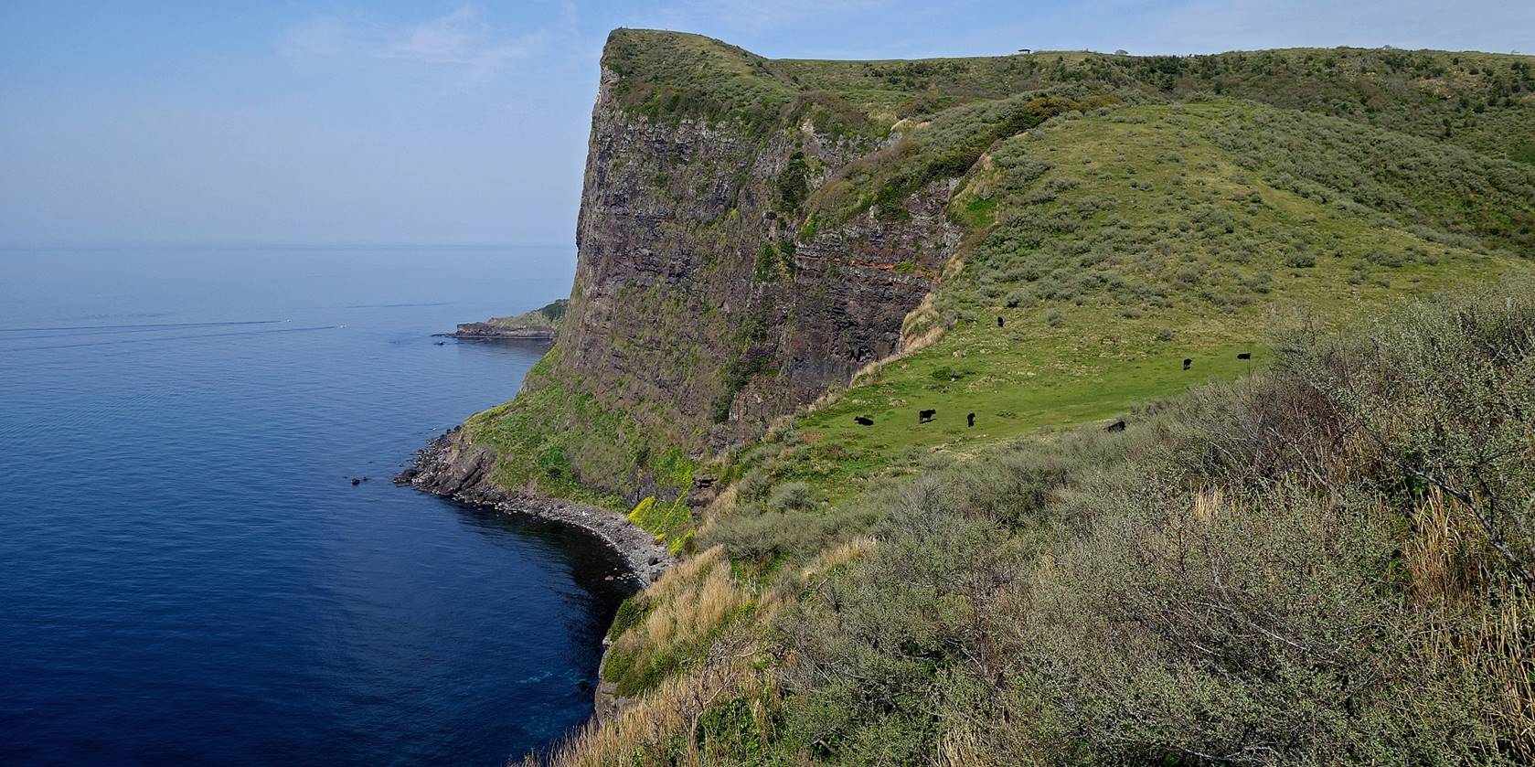
boasts impressive cliffs, most notably the Matengai
cliff, the highest in Japan (257m), on top of which lies an expansive farmland
area where cattle and horses graze. At the southeastern tip of the island, in
the middle of the inner sea, rises the highest summit in the Dozen
group, Mt. Takushi (452m). All three Dozen islands
are within a 10km radius from it. The mountain is home to the oldest shrine
(built in 1732) in the Oki Islands, whose god is, not surprisingly, related to
marine safety. Another old shrine, Yurahime, located
between the village of Urago and Yura,
worships another sea-related god, which is connected to squid harvesting. As
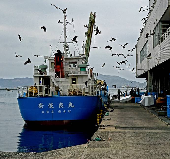
could be expected, most of the activity on Nishinoshima
is focused on fishing (thanks to the calm inner sea surrounded by the Dozen
group), but cattle farming, horse breeding, and tourism are also significant.
Overall the pace of life is very slow.
I stayed in Urago
village (at the excellent Kichimoto ryokan) that has
a relatively central position on the island. During the three days I spent
there I exclusively moved on foot. I did three long walks shown in red (walk
#1), orange (walk #2), and yellow (walk #3) in the third map below. Walks #1
and #3 share a short section between Urago and the Yura village. I did not visit the northeastern part of the
island. The weather was fair, but usually with high clouds and some haze reducing
long-distance visibility, rarely with bright sunshine.
|
|
|
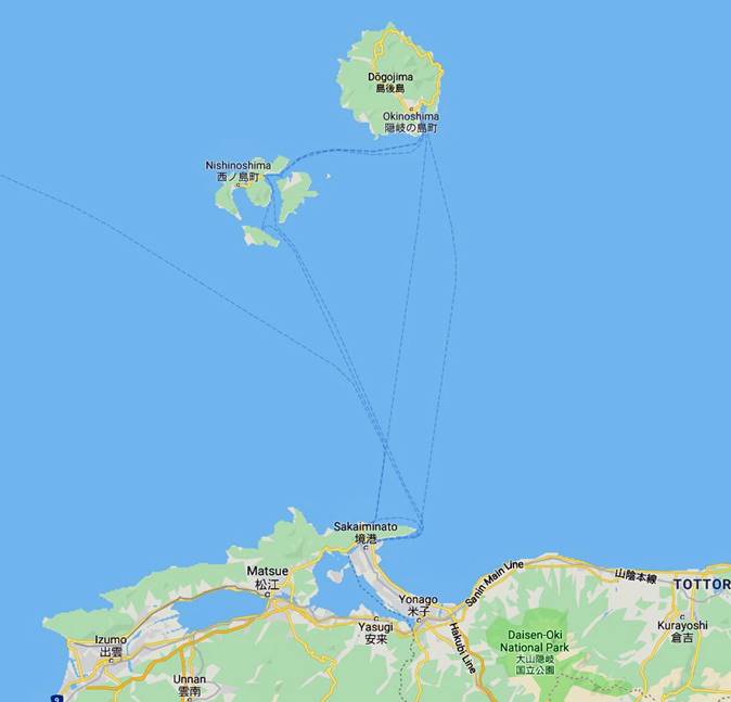
[The distance between the ferry port of Sakaiminato on Honshu and the ferry port of Beppu on Nishinoshima is
approximately 65km.]
[Walk #1 is in red, #2 in orange, and #3 in yellow.]
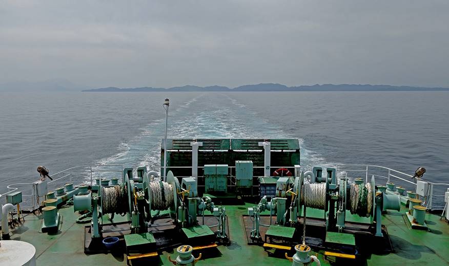
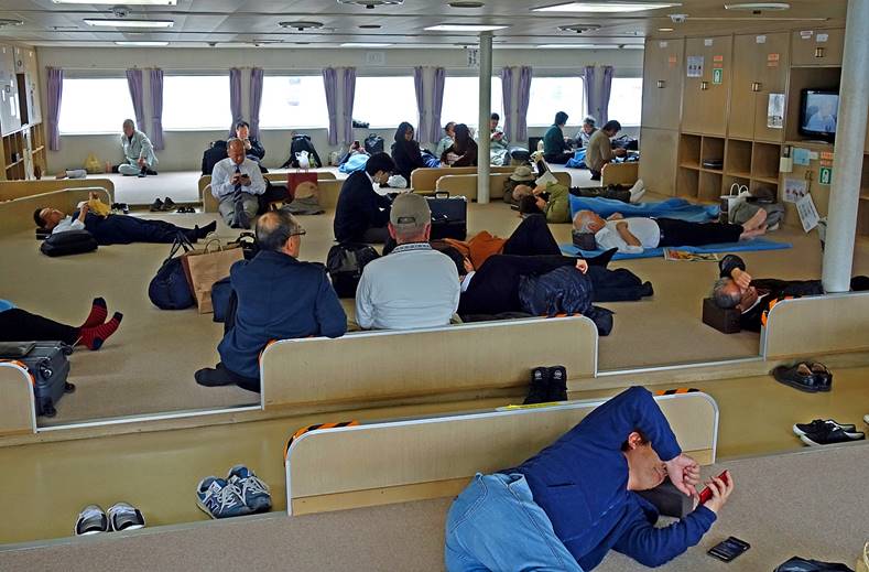
Arrival:
Left: leaving Honshu toward the Oki
islands, with Mount Daisen, which I will climb a few days
later, barely visible on the left of the photo. Right: passengers on the ferry.
|
|
|
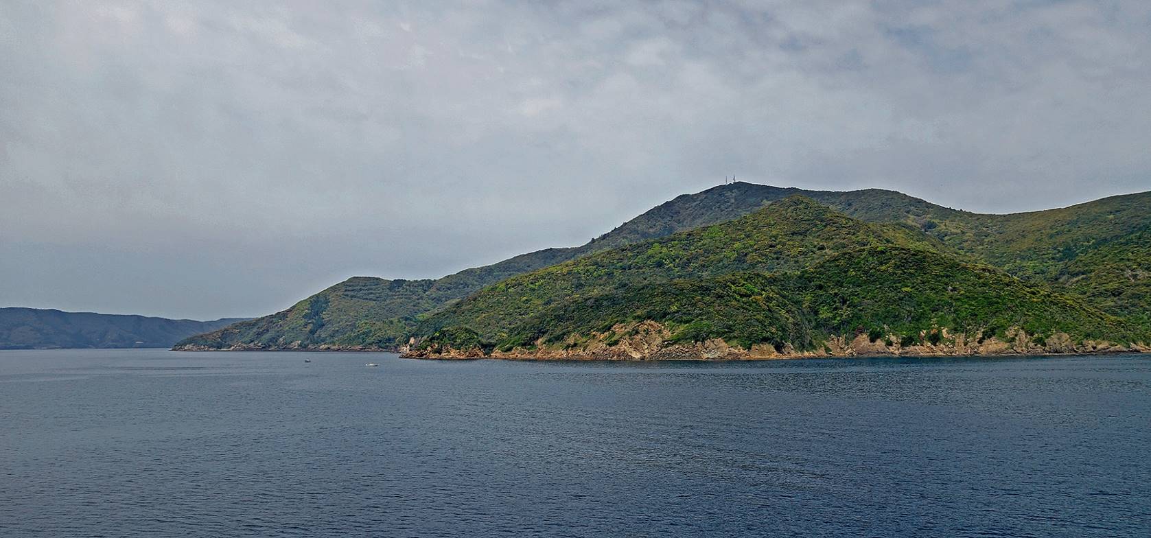
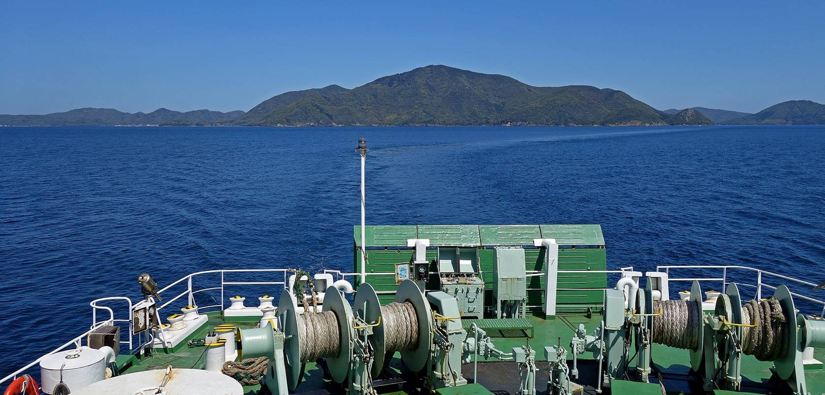
Reaching Nishinoshima.
The summit with the antennas is Mount Takuhi (452m)
the highest point in the Dozen group of islands.
Arrival in Beppu,
the ferry port of Nishinoshima.
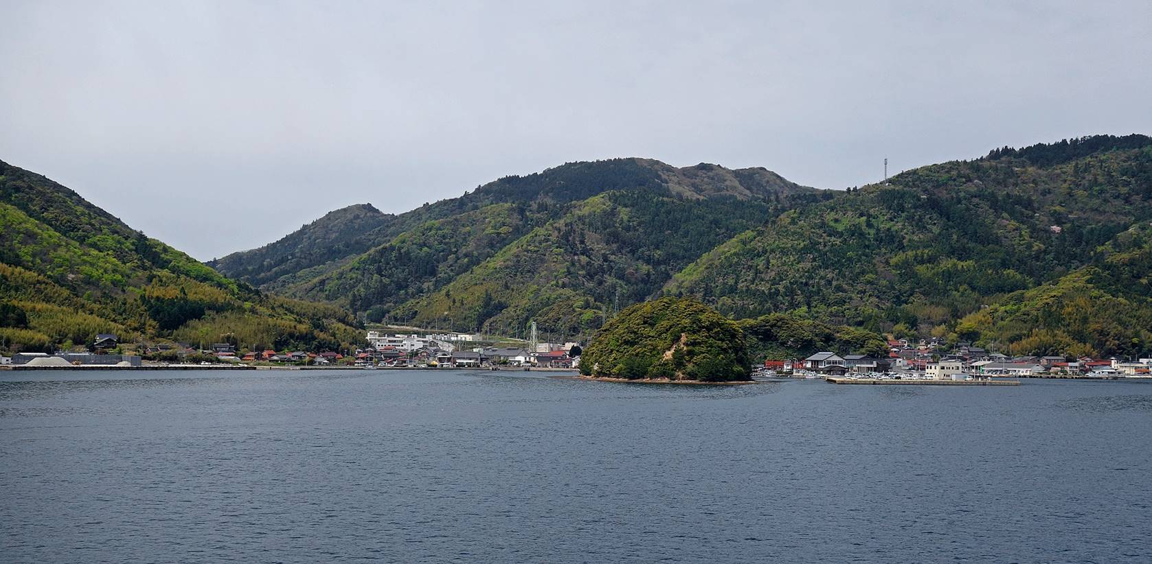
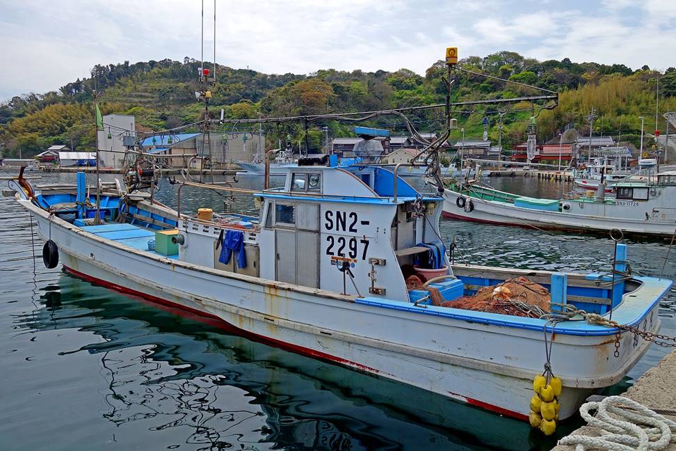
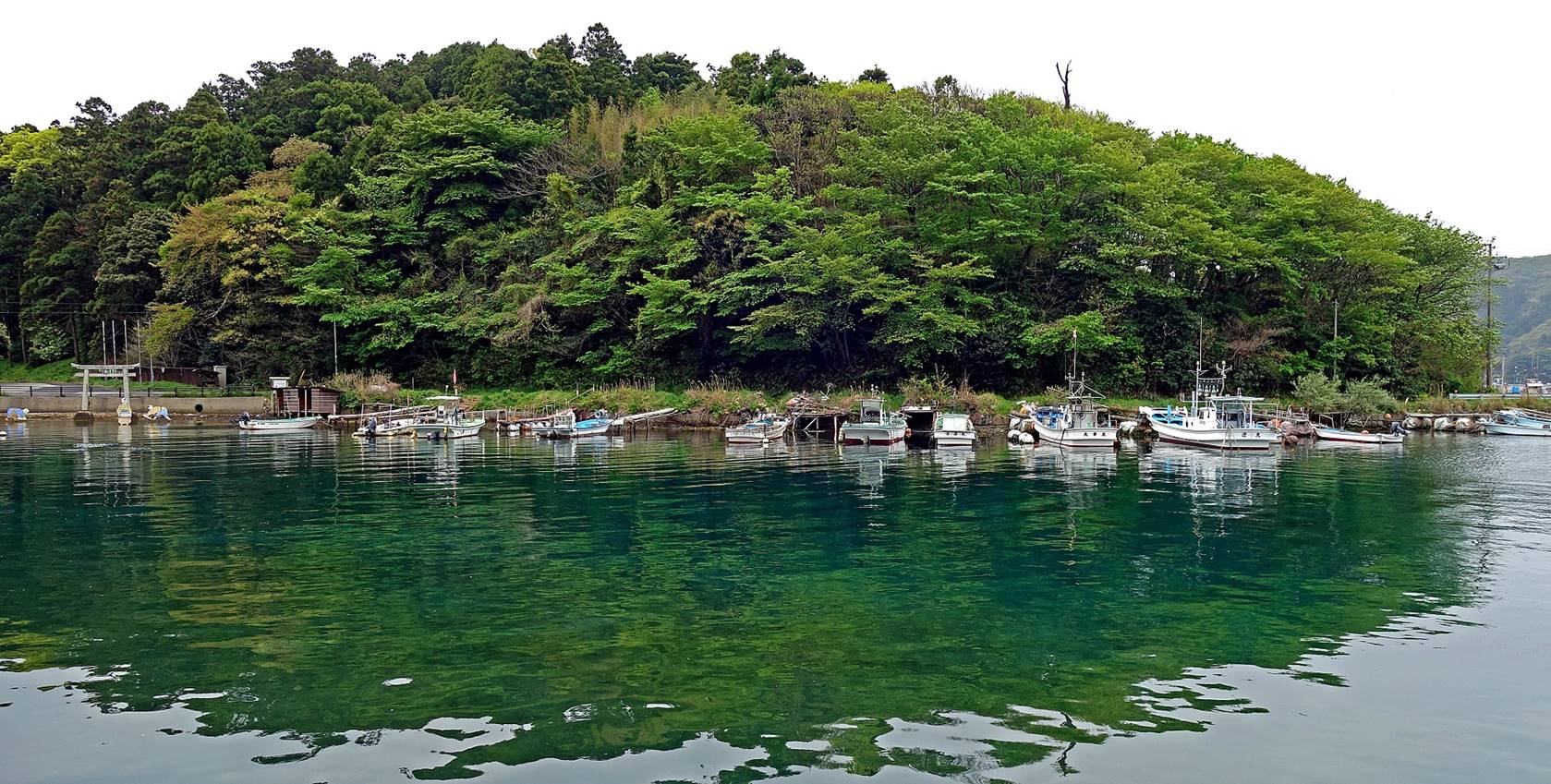
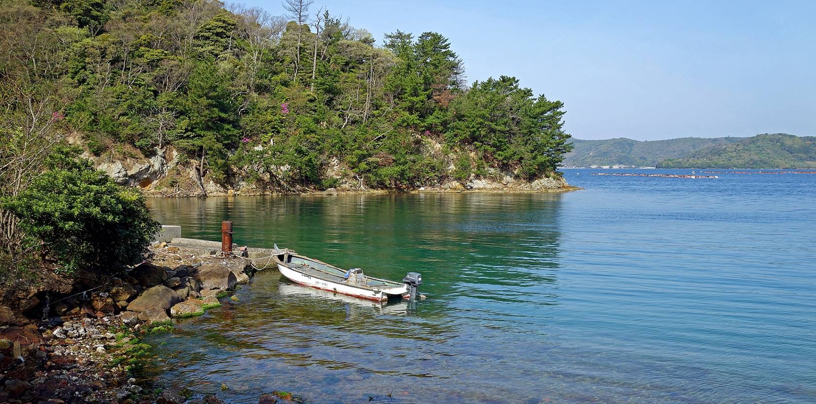
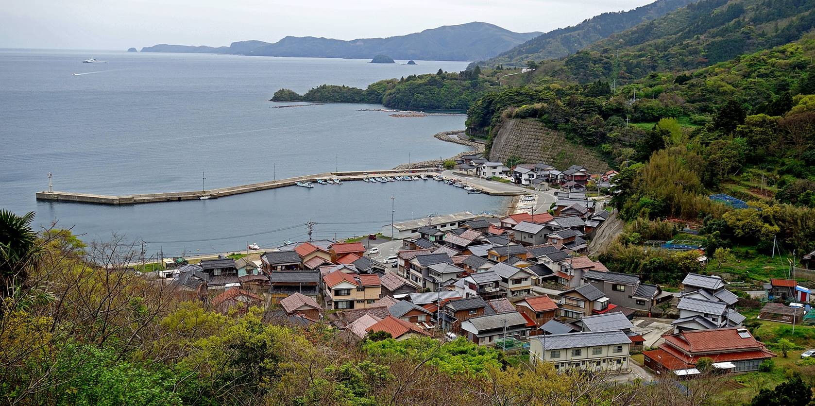
Almost all the major settlements on Nishinoshima face the inner sea. The village below is Urago, about 5km southwest of Beppu,
where the Kishimoto ryokan, my ″home″ on
the island, is located.
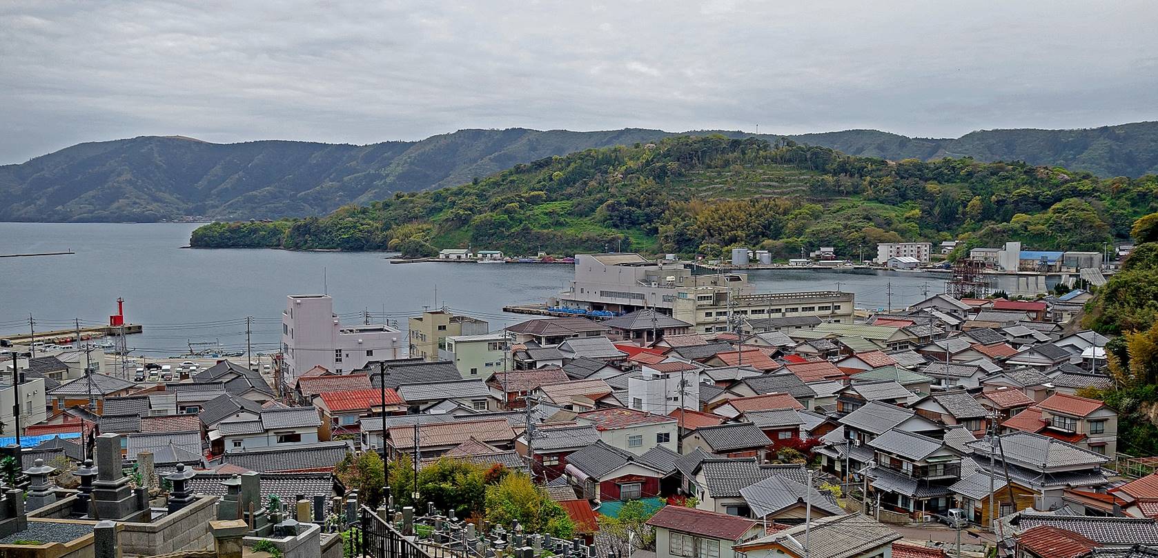
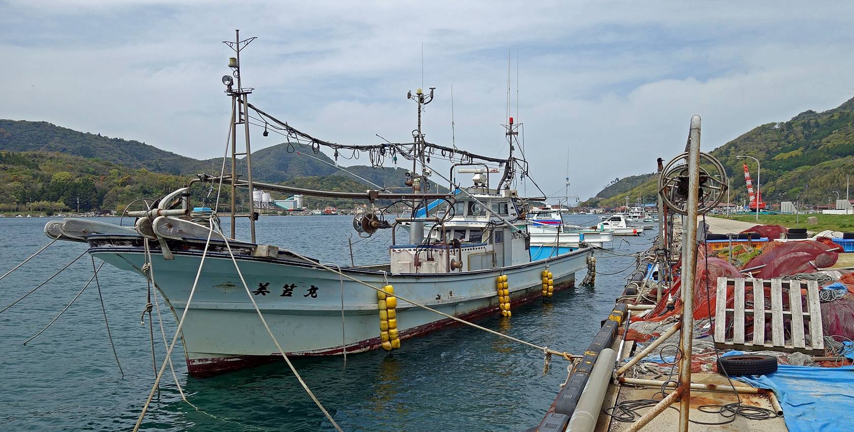
Like all settlements on the island, Urago is a fishing port.
|
|
|
Walk #1
(10.5km, itinerary shown in red at the top of this page):
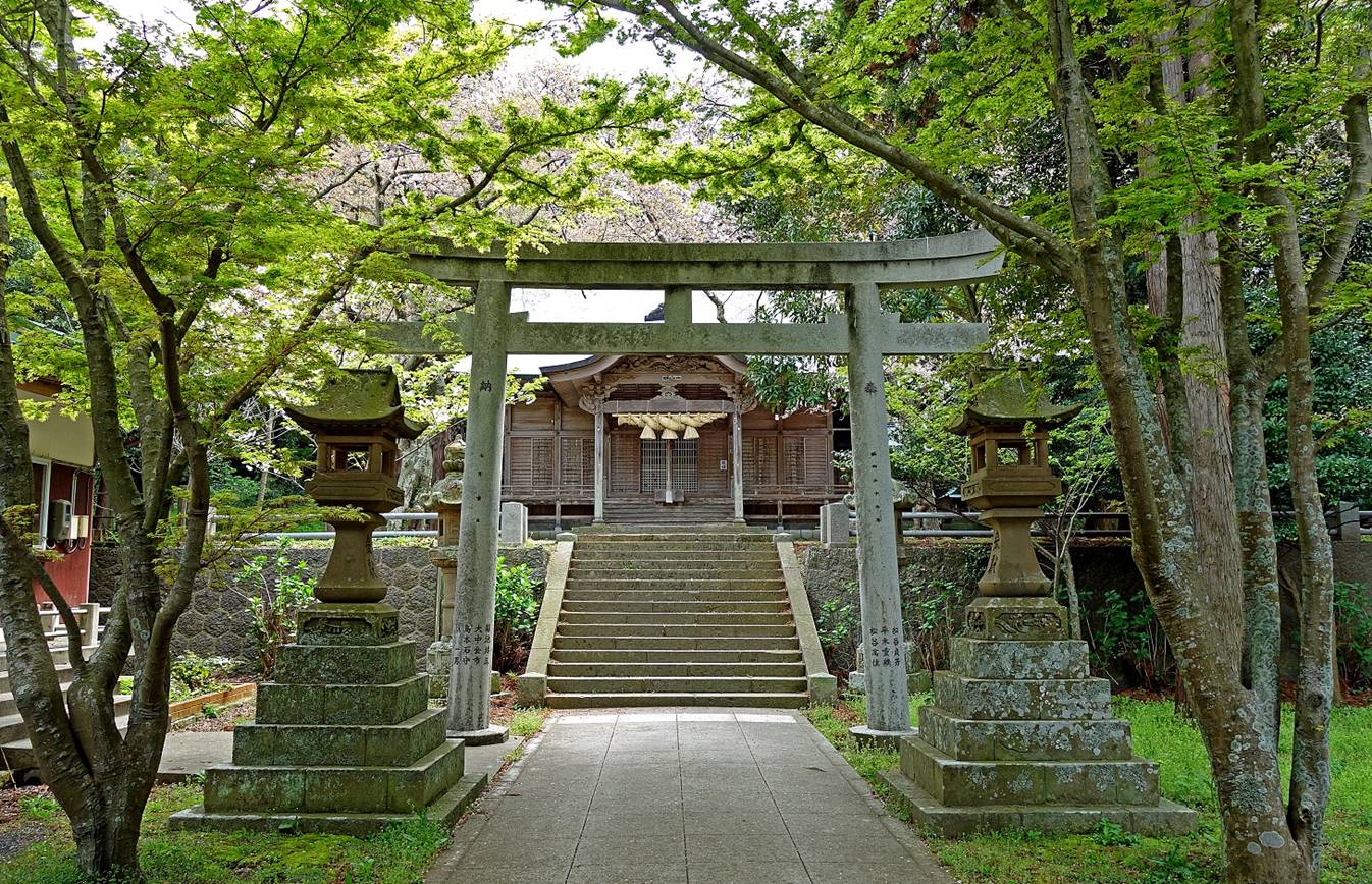
The Yurahime
shrine is a must-stop between Urago and Yura. This old shrine is one of the most important in the
Oki islands. Its deity, Yurashime-no-mikoto, which cannot be found anywhere else in Japan, is
connected to the bountiful harvests of squid that flock into the Yura bay every autumn-winter season.
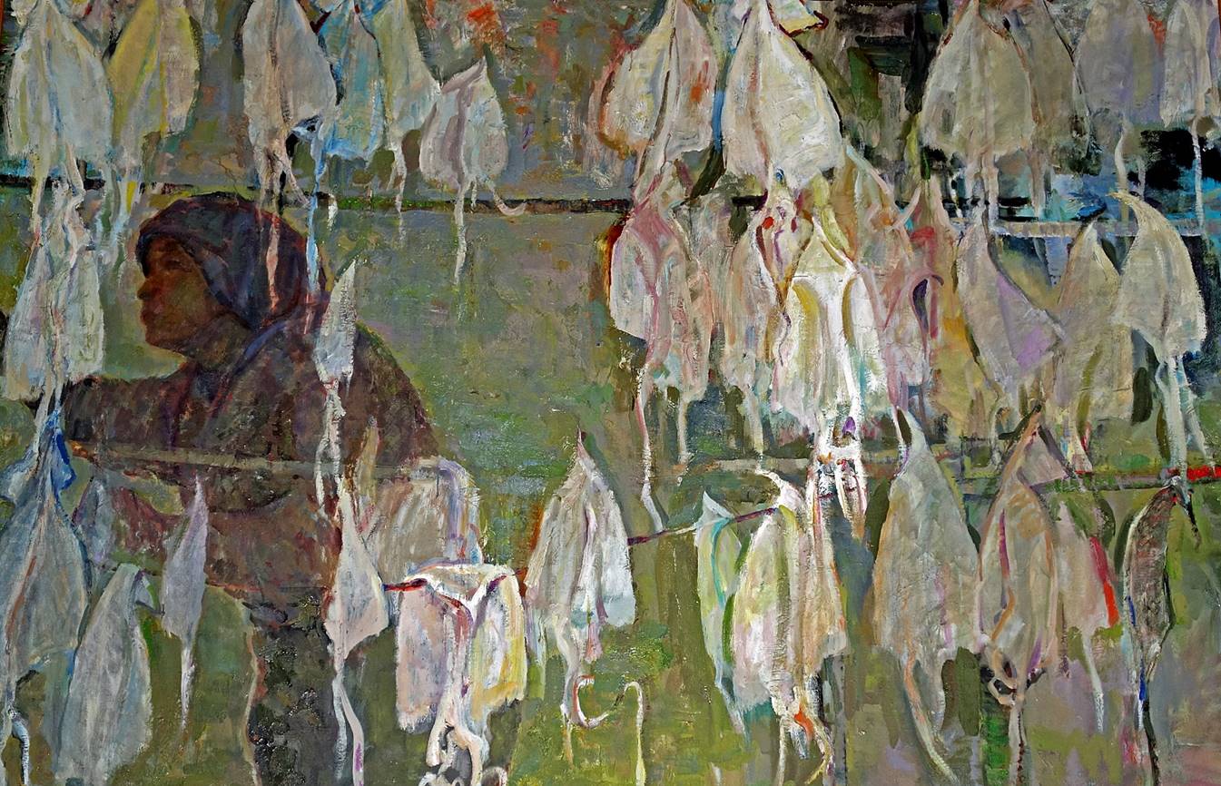
Painting inside the shrine depicting
squid drying after a good harvest from the bay.
Torii in front of the shrine, built in a
shallow inlet of the Yula bay (Yula
is the village visible in the photo). The human figures placed in the water
around the torii are another depiction of squid
harvesting.
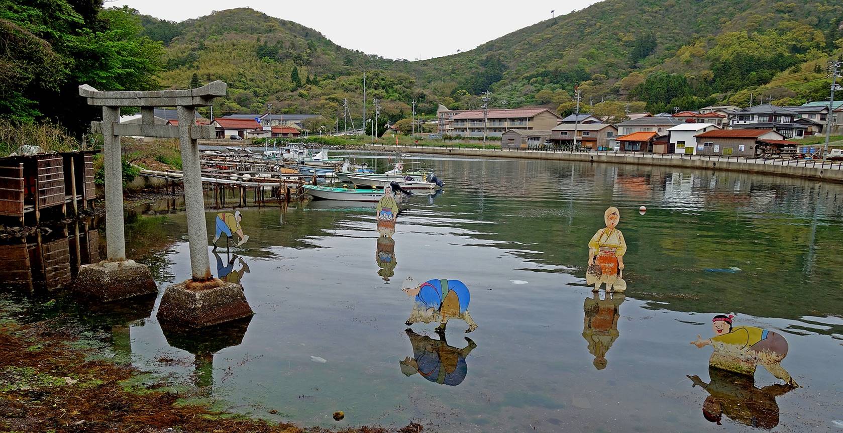
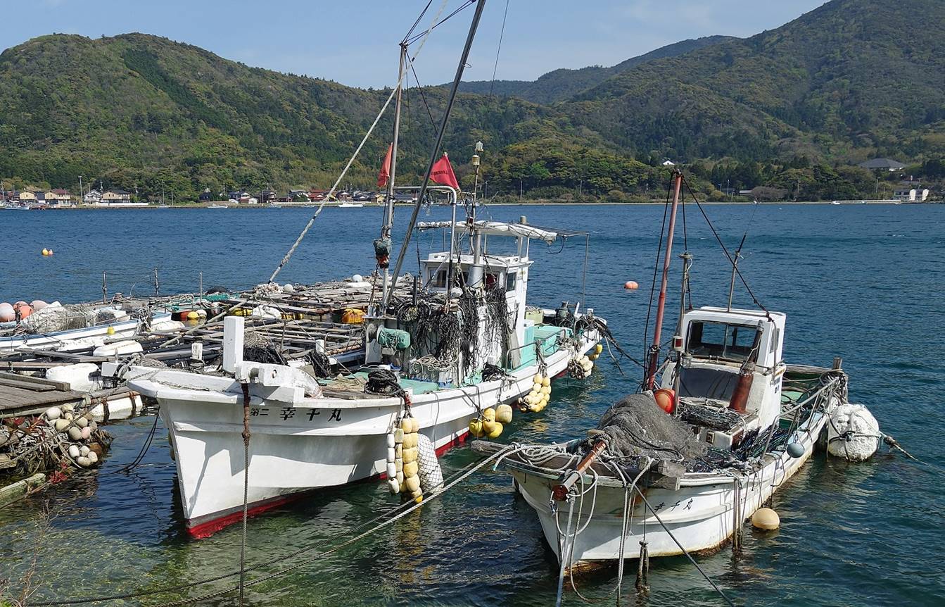
Fishing boats in the Yura
bay. The torii of the previous photo is visible on
the left of the first photo below.
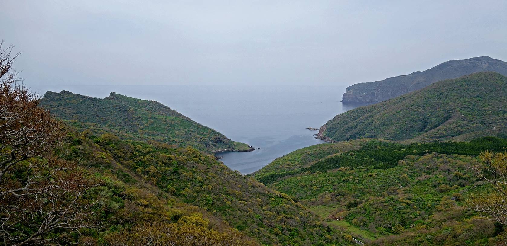
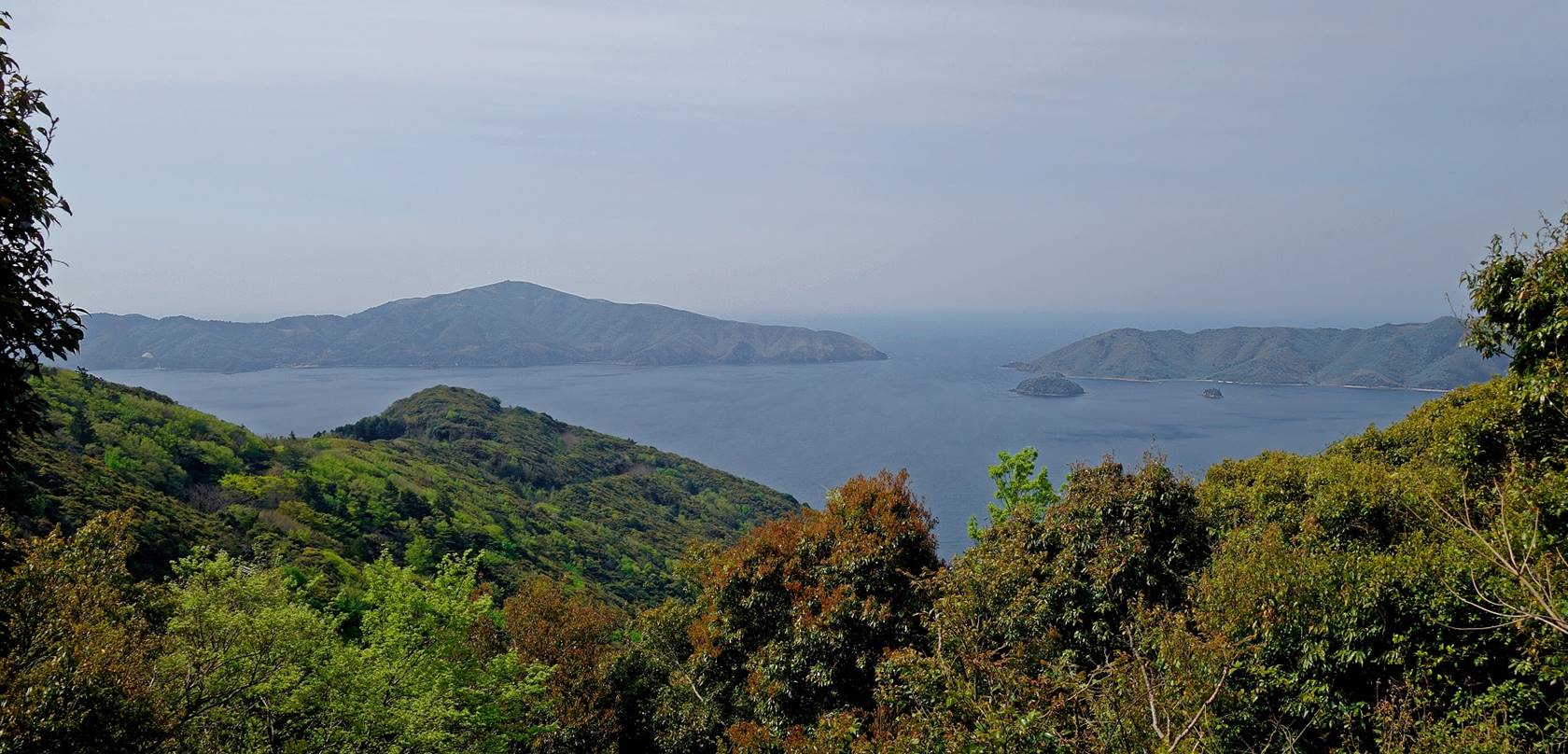
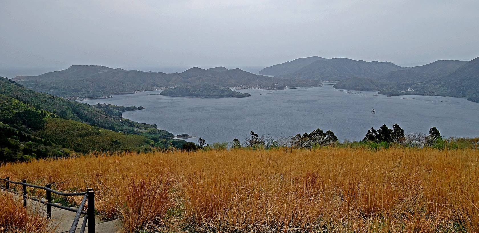
View from a location above Yura over the inner sea with the Chiburijima
island in the background, the Onimai
peninsula on the right, and the Yura bay partially
visible at the bottom of the photo.

Another view from the same location, but
in the opposite direction, over the cove located north of Yura
on the Sea of Japan.
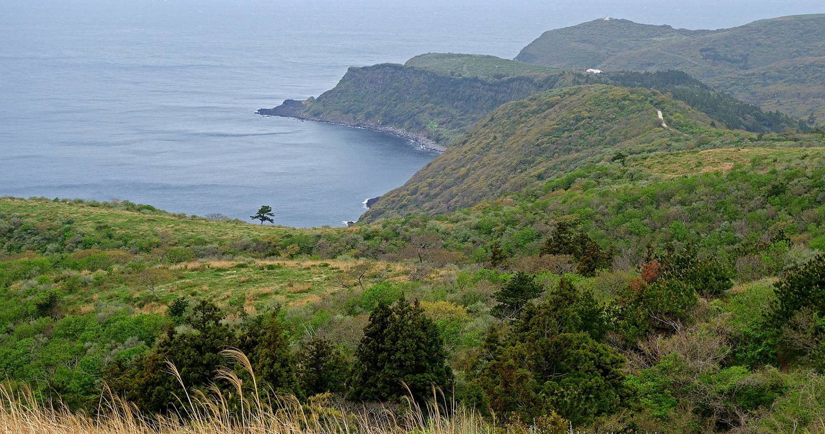
Horses roaming on a ridge near the top
of the Magentai cliff.
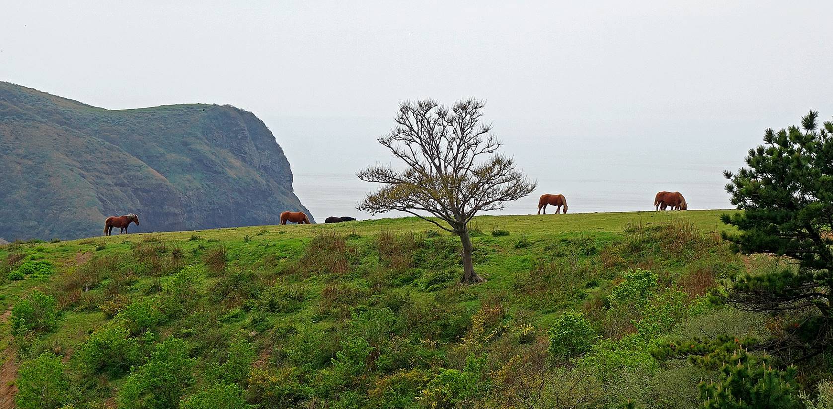
The stunning Kuniga
coast seen from the top of the Magentai cliff.
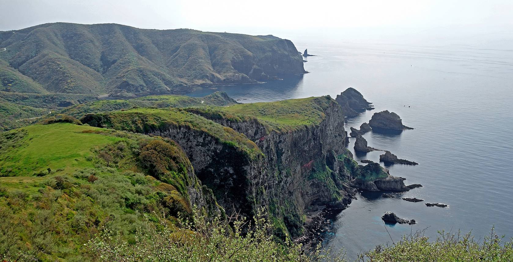
The 257m-high Matengai
cliff seen from the walking trail descending from the top of the cliff toward
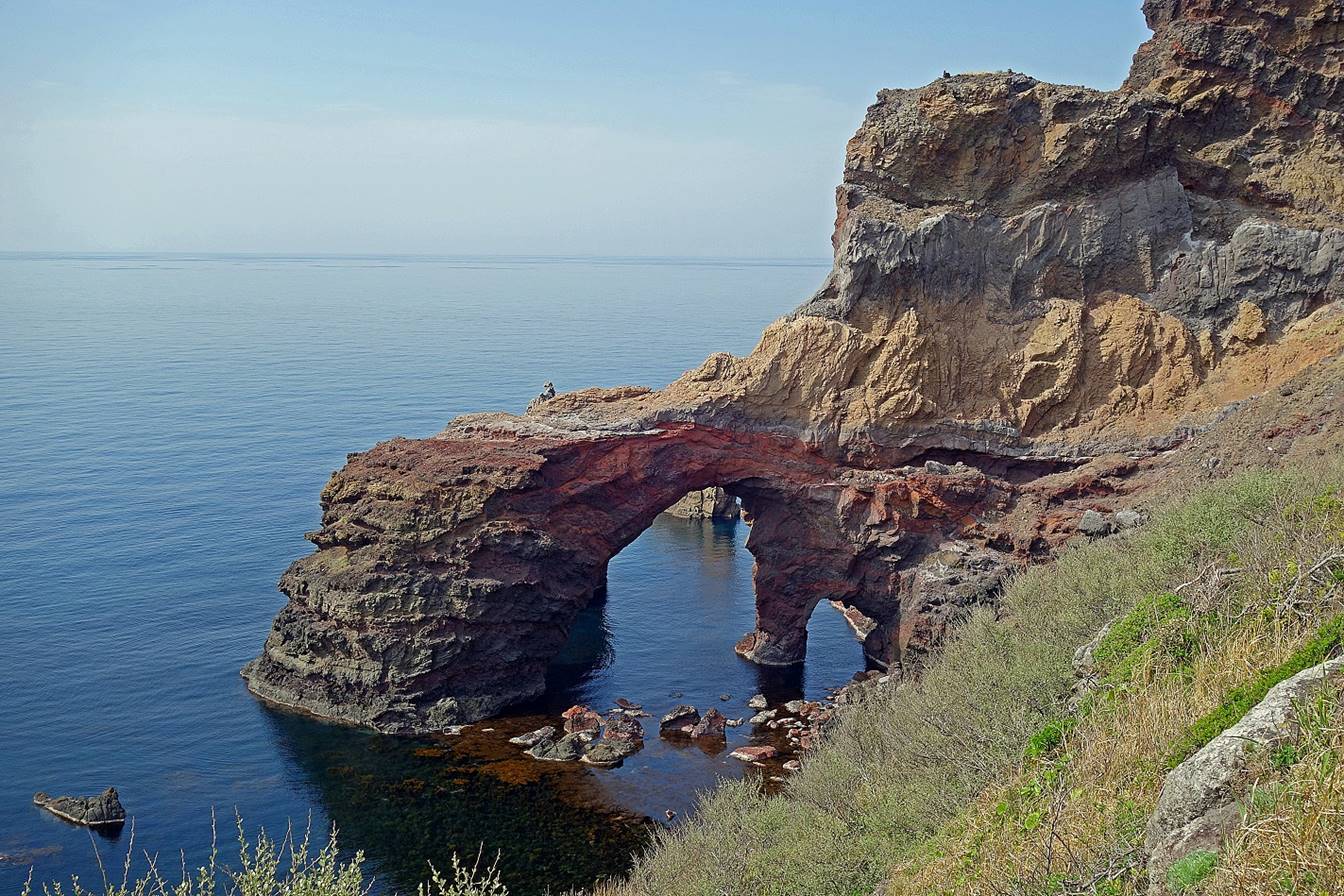
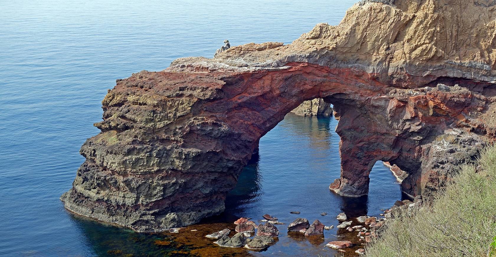
the Tsutenkyo arch.
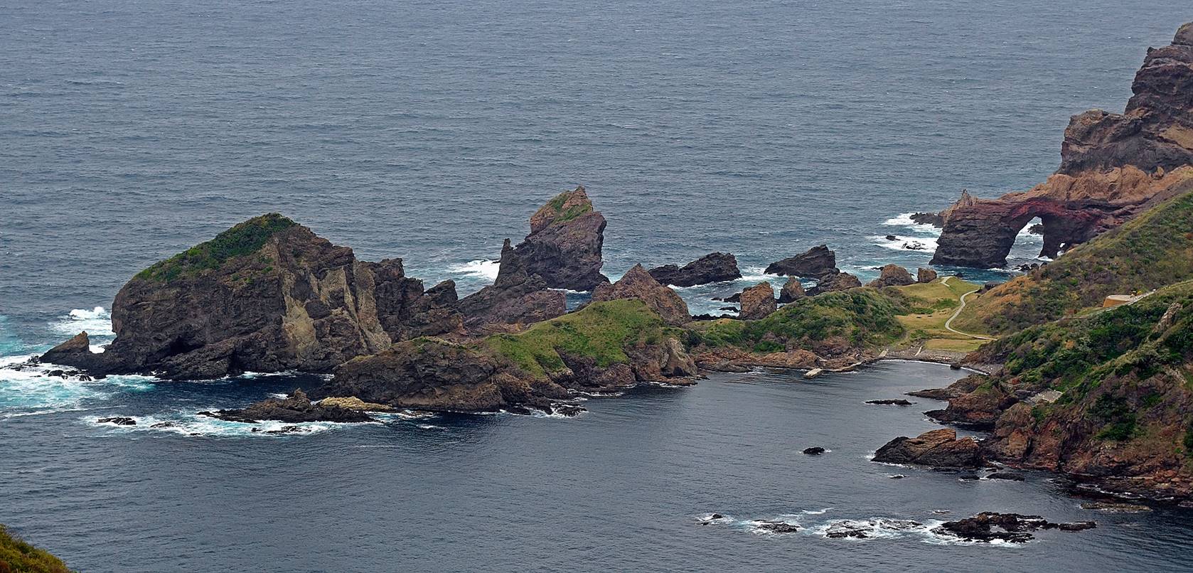
The Tsutenkyo
double arch at the southern end of the Kuniga coast.
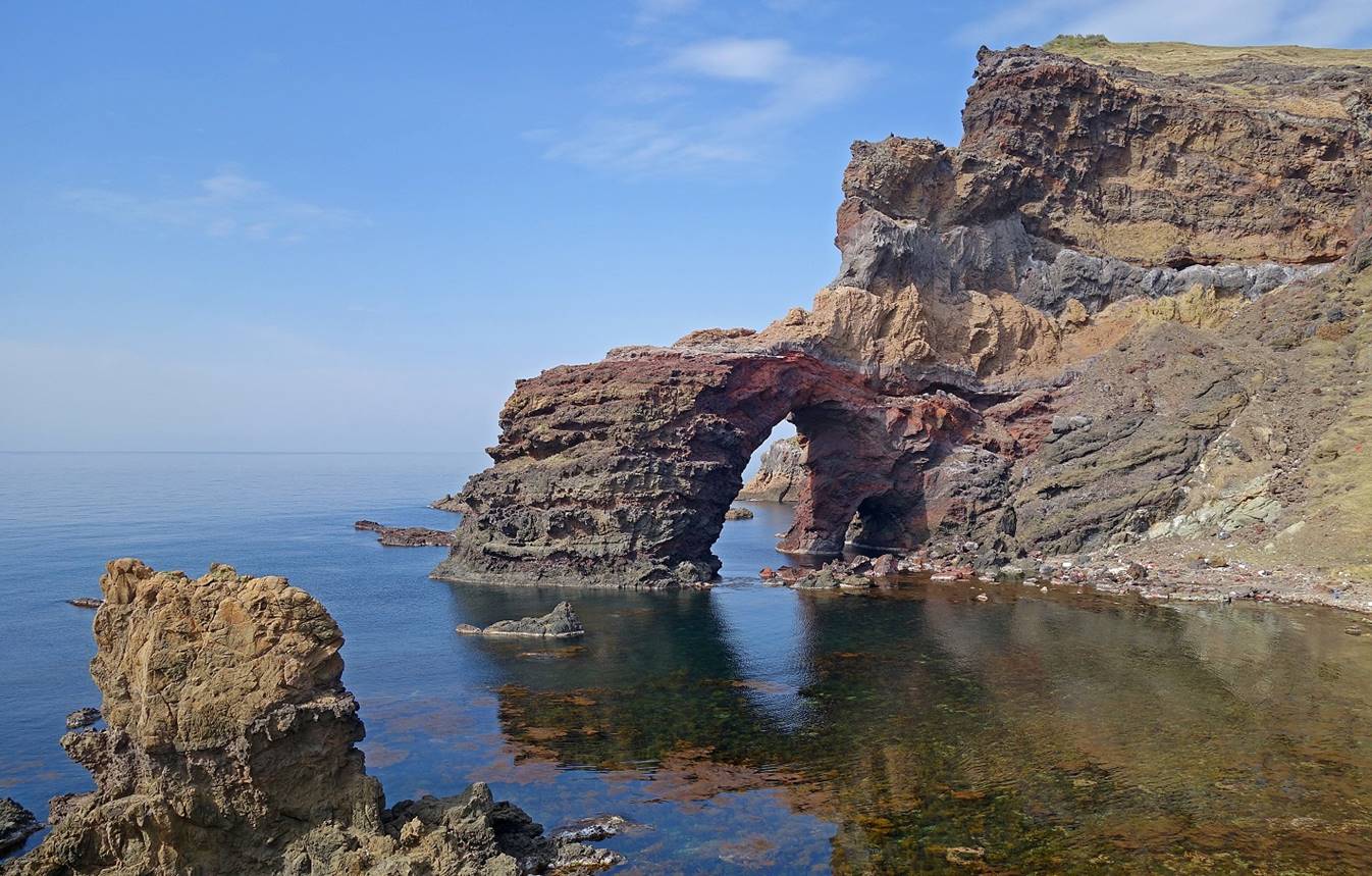
Other rock formations next to the Tsutenkyo arch. The sharp needle is called Kannon-iwa (″iwa″ means ″rock″)
due to the similarity of its shape with that of a statue of the Kannon deity.
Walk #2
(21km, itinerary shown in orange at the top of this page):
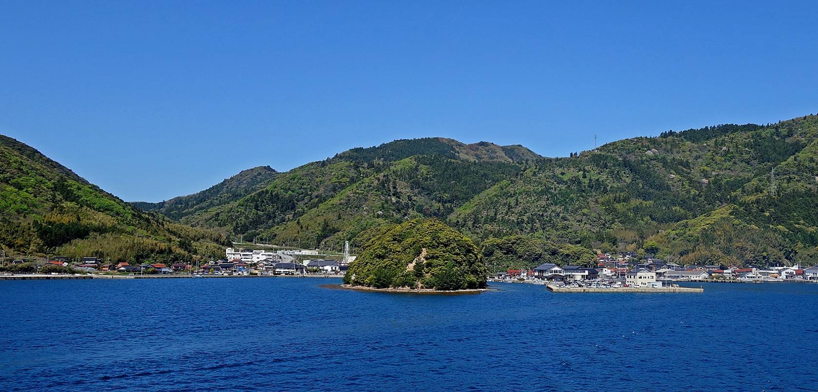
View toward the south from the
recently-built bridge east of Urago. Chiburijima island stands in the
background.
The rocky shore seen from the bridge.
Small bay north of Hashi,
just before starting the ascent toward Takuhi shrine.
View of the inner sea during the ascent,
with Chiburijima in the background on the left and
the Onimai peninsula on the right.
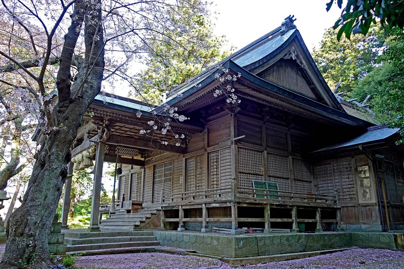
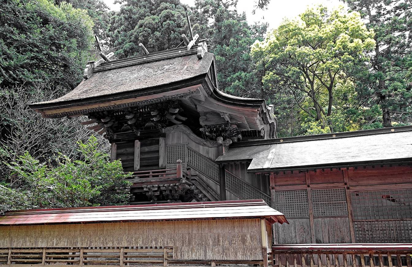
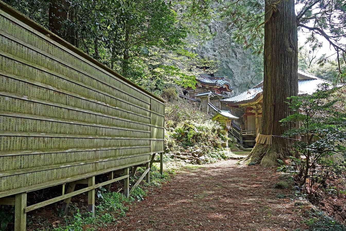
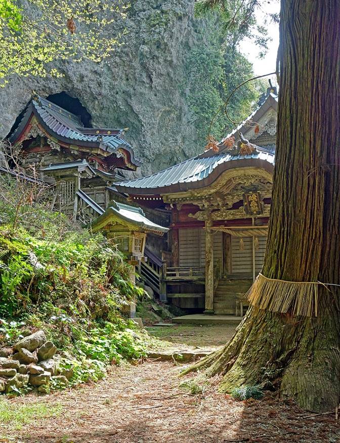
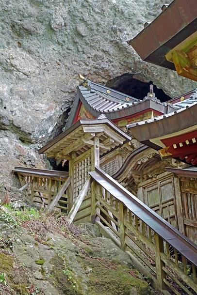
Arriving at the Takuhi
shrine built in 1732. There is a relation between the shrine′s deity of
marine safety and its location at the approximate center of the inner sea
protected by the Dozen islands: from the Sea of Japan
Mt. Takuhi has long been used as a beacon by mariners
to reach the safety of the calm inner sea during bad weather. In the past the
shrine′s lights also played the role of a lighthouse.
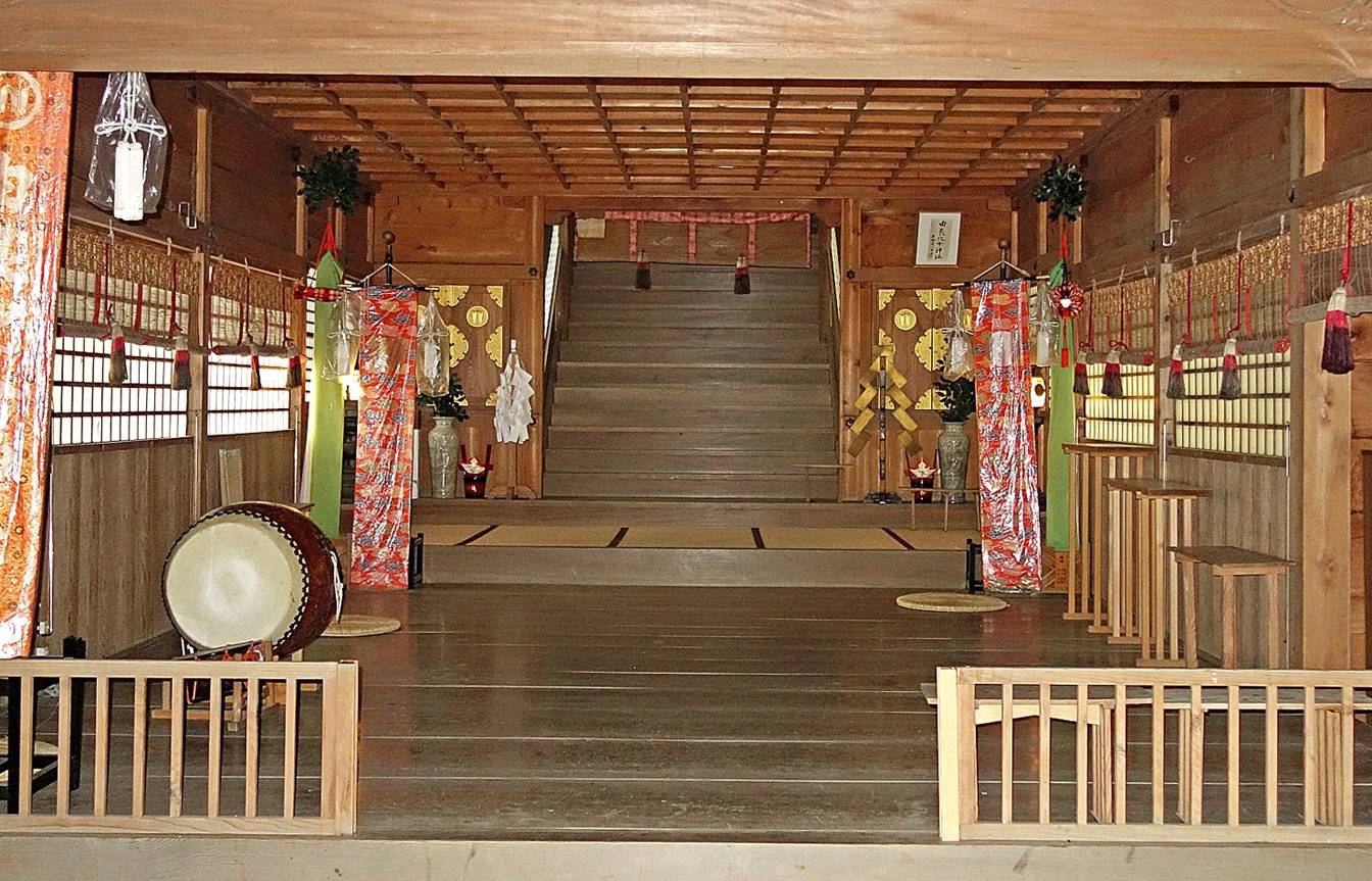
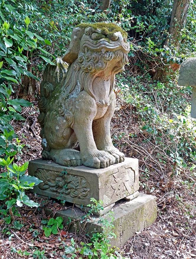
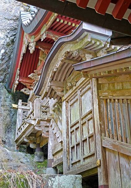
Left: One of the two lion statues
guarding the shrine. Right: the prayer hall (partially hidden by an old cedar
tree) and on its left the ″honden″, where
the god resides.
|
|
|
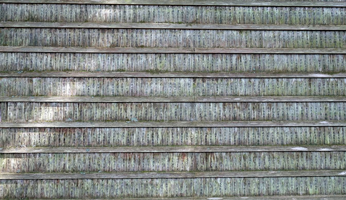
Ema (wooden prayer tablets) board next
to the shrine.
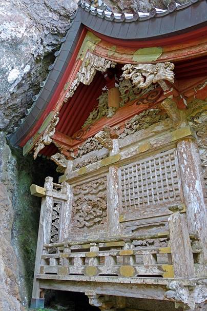
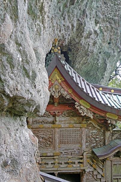
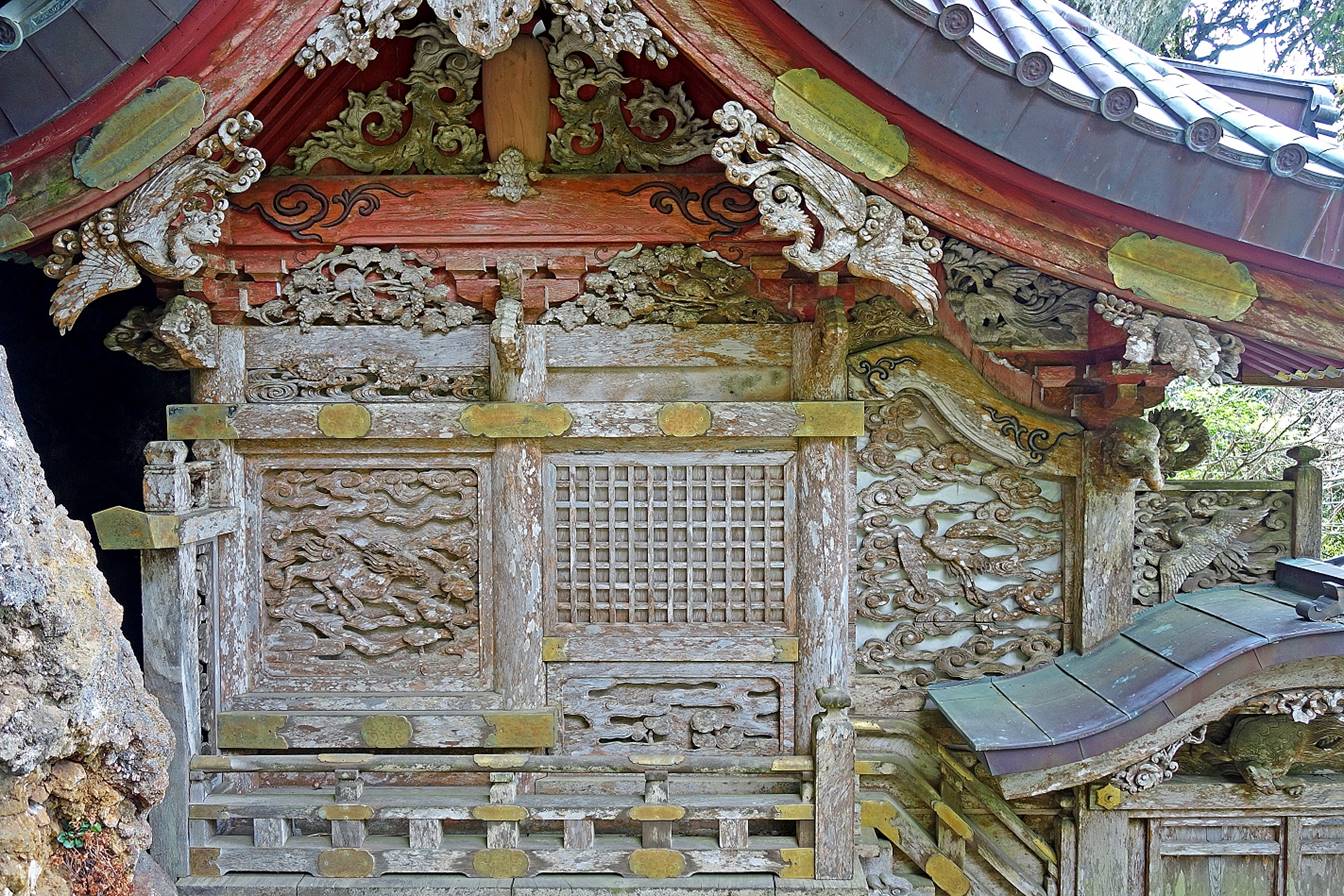
The highly decorated honden,
partially wedged into a cave.
|
|
|
|
|
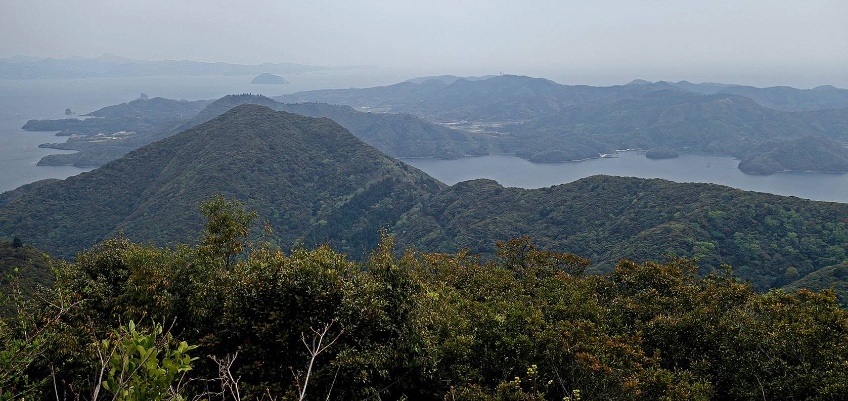
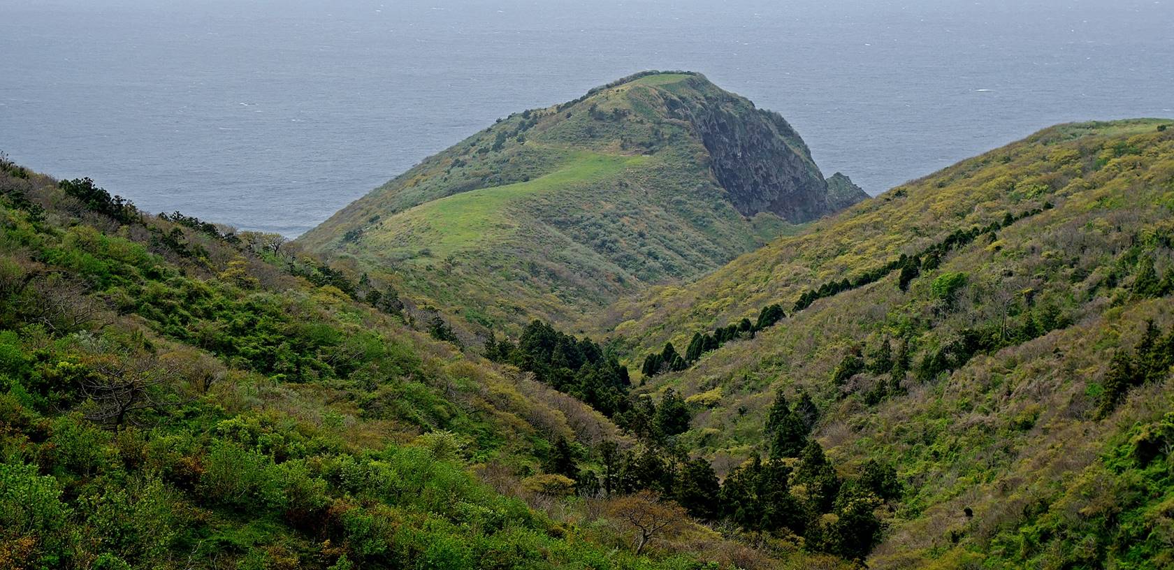
View from the summit of Mt. Takuhi (452m), about 120m higher than the shrine. The lower
summit on the left of the photo is also on Nishinoshima.
Behind it is the island of Nakanoshima and in the far
background on the left is the island of Dogo (barely
visible).
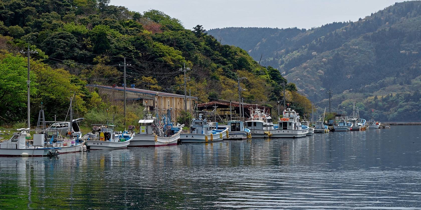
Fishing boats near Komukai
and Funakoshi.
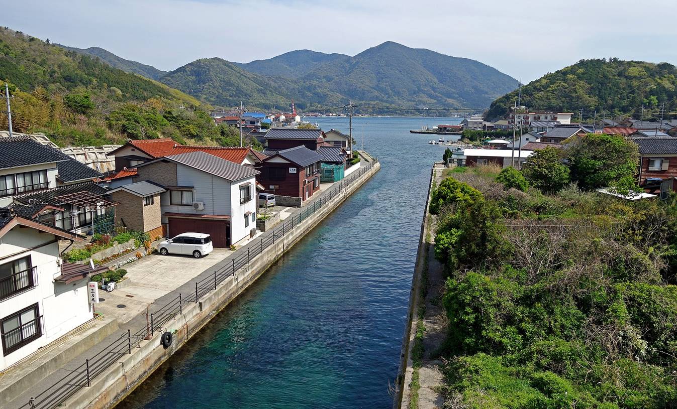
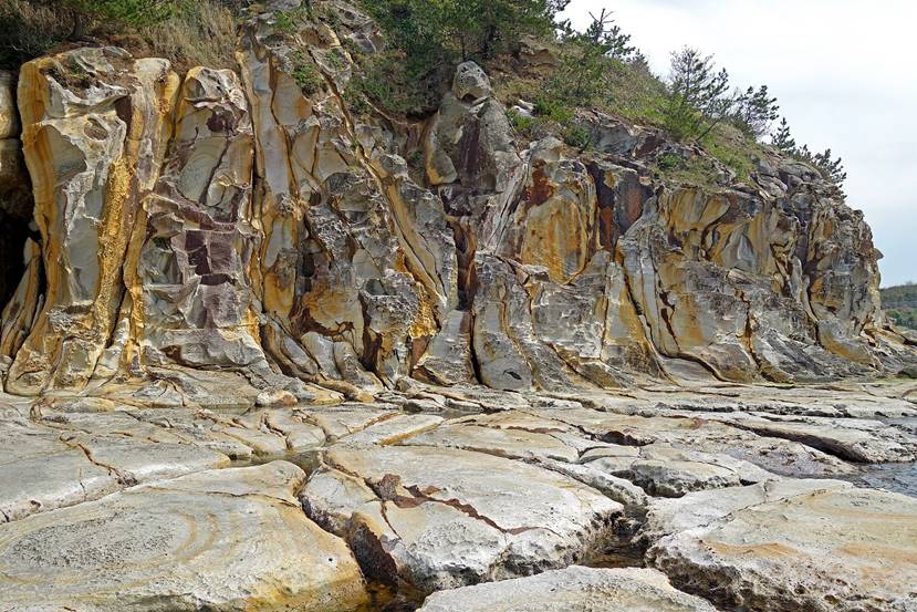
The Funabiki
canal built in 1915 by local people to facilitate the passage of fishing boats
between the inner sea and the Sea of Japan.
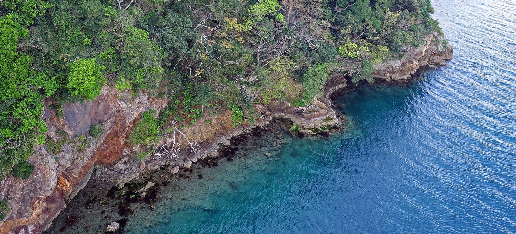
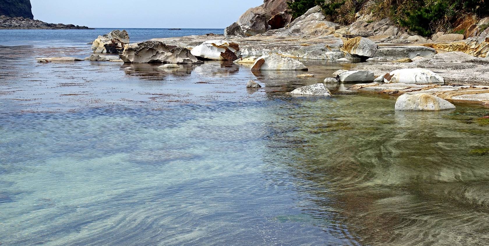
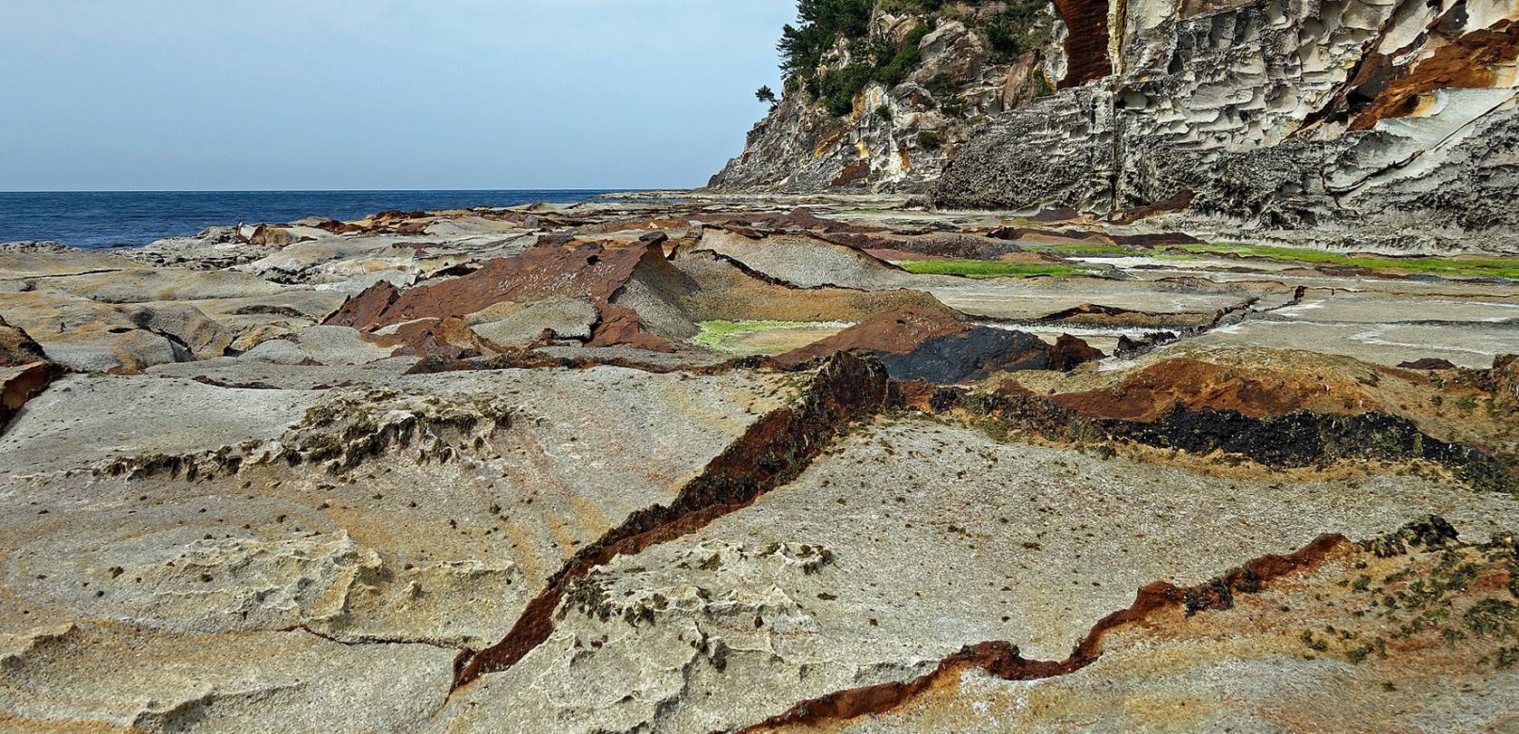
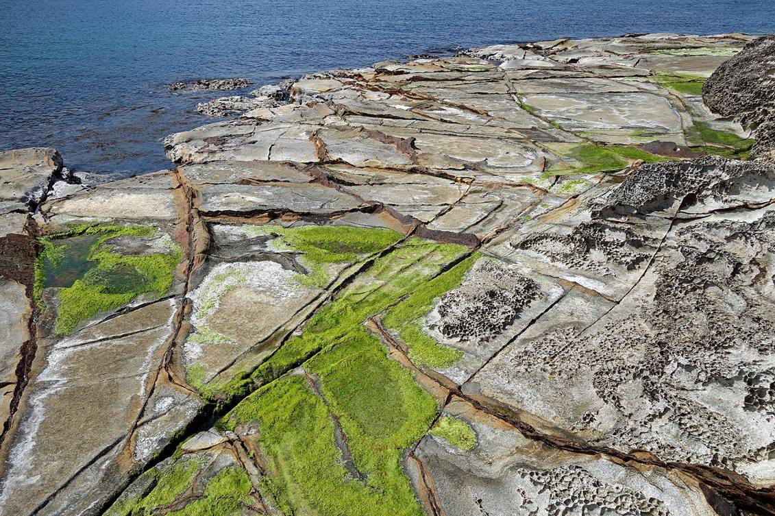
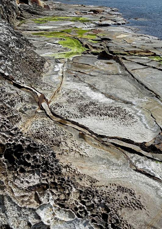
Surprising white-rock (comendite rock?) coast, on the eastern side of the Sotohama beach, on an island that is made almost
exclusively of dark lava rock.
|
|
|
|
|
|
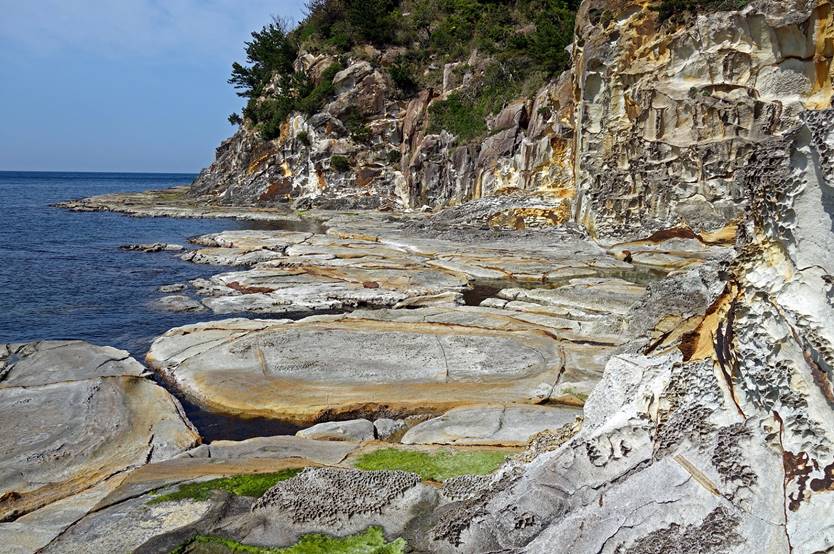
At the end of the white-rock coast, with
a dark-rock cliff in the background.
Walk #3
(16km, itinerary shown in yellow at the top of this page):
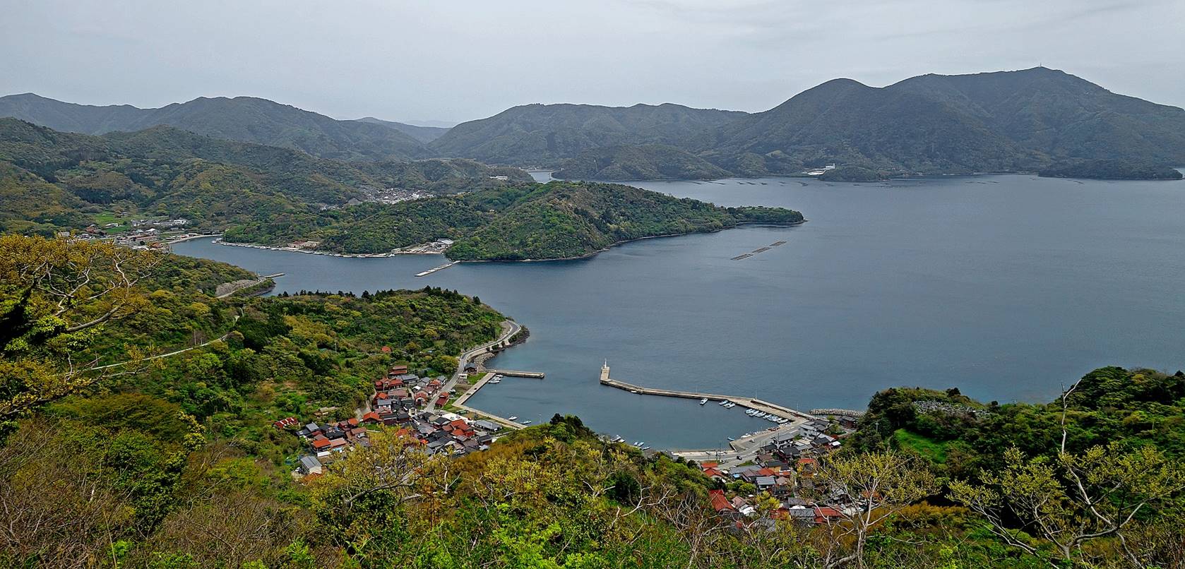
View over the port of Shakunoe. Yura is visible on the
left of the photo. Mt. Takuhi (with its antennas)
stands on the right.
Another view from the Onimai peninsula with, again, the Yura
village visible on the left.
The inner sea between the Onimai peninsula and the rest of the Nishinoshima
island seen from the Onimai lookout.
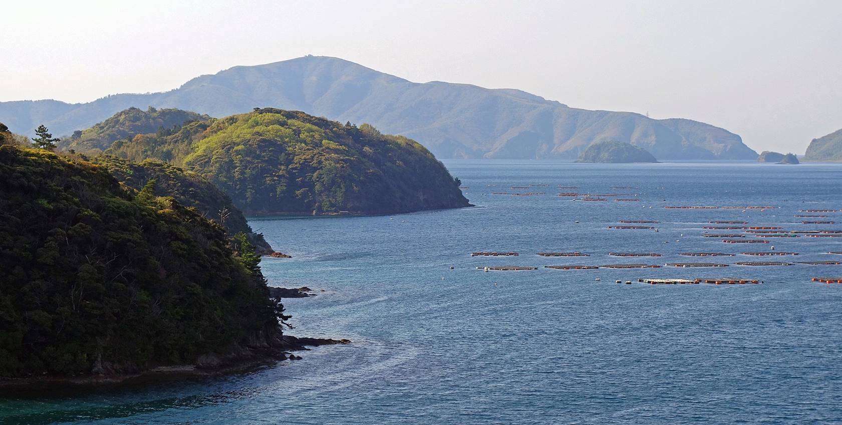
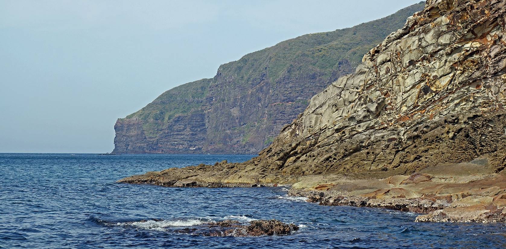
The southern tip of the Onimai peninsula and the island of Chiburijima,
almost aligned, seen from the Onimai lookout.

Views toward the Sea of Japan from the Onimai peninsula.
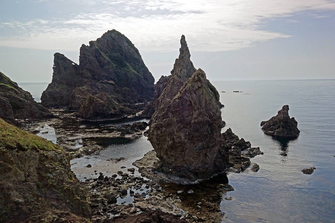
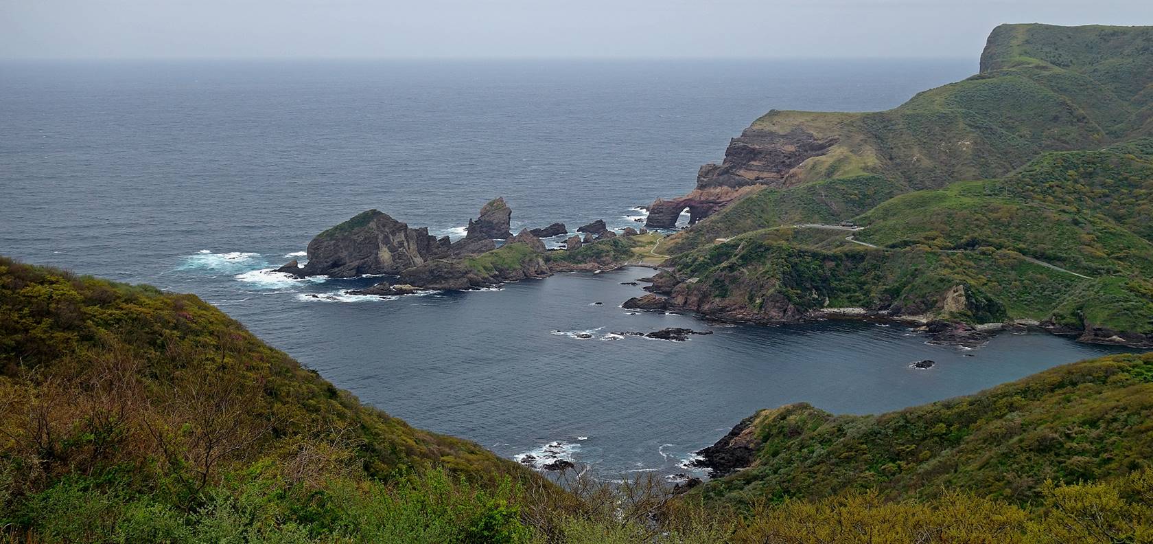
The rock formations on the Kuniga coast, including the Tsutenkyo
arch, seen from the Akao lookout.
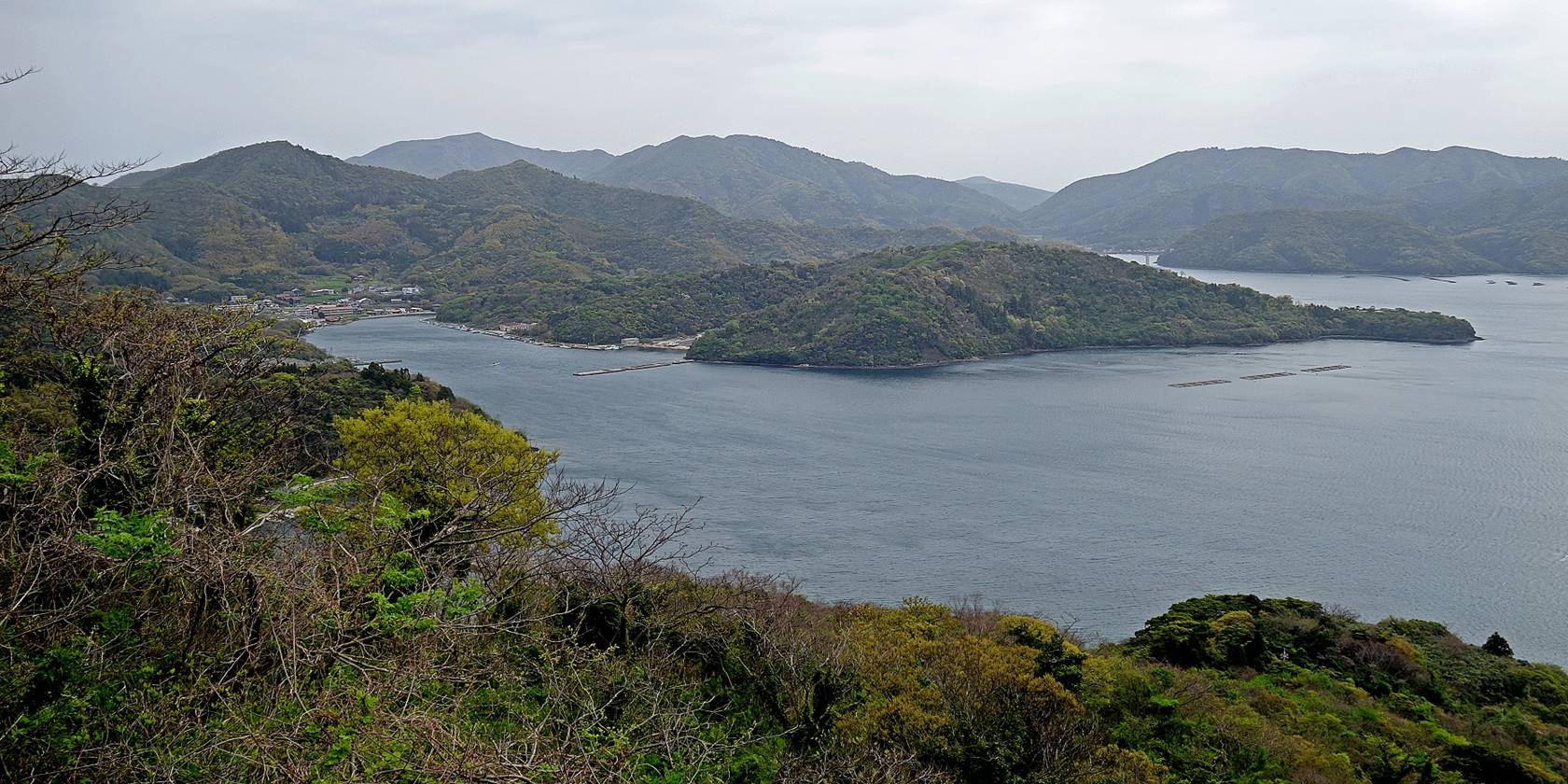
Another photo of Shakunoe
taken on the way back to Urago.
Departure:
Leaving Beppu
toward the ferry port of Sakaiminato on Honshu on a
bright sunny day such that I never had throughout my stay on the island.
Last photo of
Mt. Takuhi from the ferry.
![]()