Across Ladakh and Zanskar
(July-September 2013)
Back to my
mountaineering-trekking-travel webpage
I spent 7
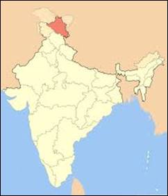
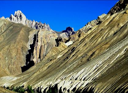
weeks in Ladakh and Zanskar
during the summer of 2013, doing two treks: a long one from Phyang
(a few kilometers west of Ladakh′s capital, Leh) to Padum (Zanskar′s small ″capital″) and a short
one from Murobok (a short distance from Phyang) to Hundar further north
in the Shyog valley.
The itinerary
of this trip is shown in the map below (click here or on the map to get a more readable larger version in
a separate tab):
- The itinerary of the long trek is
shown in yellow dotted line: it first goes toward the west to cross Kanji La
(mountain pass #8), then it heads in the south-east direction to reach the Zara
Chu river, before switching toward the north-west and ending in Padum. My initial plan was to cross Zara Chu and return to Leh by an itinerary on the east side of this map.
Unfortunately, due to bad weather during the preceding week, fording Zara Chu
was too dangerous and I decided to go to Padum
instead.
- The itinerary of the short trek is
shown in purple dotted line.
- The itinerary by car is in green
dotted lines: from Leh to Phyang/Murobok, from Padum to Leh via Rangdum and Kargil, and from Hundar to Leh.
- The itinerary in orange dotted line
(from Leh to Spituk, Stakna, Thikse, and back to Leh) is a one-day loop trip on bicycle along the Indus river.
|
|
|
The red dots
designate towns, villages, and named places. The blue lines show some important
rivers. The double yellow triangles indicate major passes along the itinerary.
These passes are numbered 1 to 21, in the order I have crossed them:
|
1. Lhalung
La (3550m) 2. Charatse La (3650m) 3. Tsarmangchan La (3870m) 4. Mebtak La (3820m) 5. Lago La (3820m) 6. Tar
La (4970m) 7. Yogmi
La (4720m) |
8. Kanji La (5250m) 9. Pudzong La (5020m) 10. Parpi
La (3900m) 11. Pandang La, also called Ningri
La (5150m) 12. Lar La (4850m) 13. Rotong
La, also called Gorteng La (5000m) 14. Nialo
Kontse La (4850m) |
15. Gotunda
La (5100m) 16. Gotunda
La (5100m) 17. Nialo
Kontse La (4850m) 18. Pentse
La (4400m) 19. Photu
La (4090m) 20. Lasermo
La (5550m) 21. Kardung
La (5340m) |
Nialo Kontse La (14 and 17) and Gotunda La (15 and 16) were crossed twice, first to reach
Zara Chu, then to backtrack toward Padum after
failing to cross Zara Chu. Pentse La (18), Photu La (19) and Kardung La (21)
were crossed by car. All the elevations given above are from the Ladakh & Zanskar trekking
maps published by Editions Olizane, Geneva,
Switzerland.
For this trip
I had a support team of 4 people and ponies provided by Adventure North.
Adventure North also arranged transportation, permits,
and food logistics.
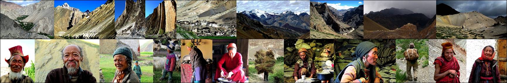
Click on the links below to see
photos of the treks:
|
|
|
|
|

|
|
|
|
|
I
also include some photos of Leh (and surroundings)
and from Delhi:
|
|
|
![]()