Mexico: State of Hidalgo (March 2019)
![]()
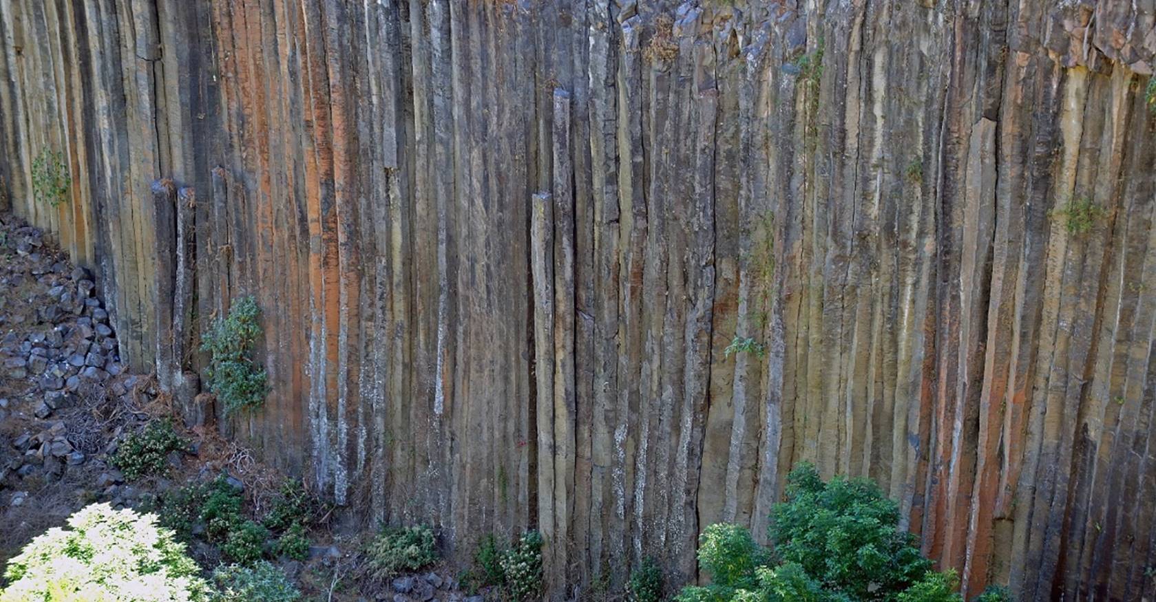
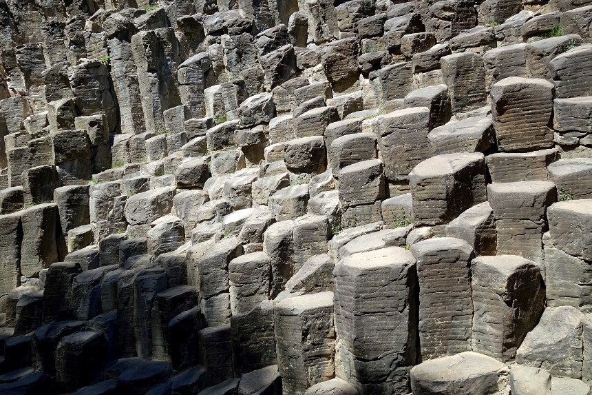
(This banner shows a
horizontal slice across a cliff of basaltic prisms near the Hacienda of Santa
Maria Regla, six kilometers outside the village of Huasca de Ocampo.)
Return
to main Mexico (2002...) page
The state of
Hidalgo is located north of Mexico City in east-central Mexico. During this
short trip I only visited the capital, Pachuca, and three small towns/villages
near Pachuca: Huasca de Ocampo,
Real de Monte, and Mineral de Chico, all located in the mountains north-east of
Pachuca. The region around Pachuca and these three villages has been a mining
area since the 16th century. It is estimated that 38 million kilograms of
silver and 200 tons of gold have been extracted since extraction began. In 1824
British mining companies were called to rebuild the mining industry, which had
been ruined by the Mexican War of Independence that ended in 1821. These
companies brought a large number of Cornish miners. These miners introduced a ″new″
team sport, the soccer (futbol), to the region, so
that today Pachuca is regarded throughout Mexico as the birthplace of soccer in
Mexico. It is said that the first game was played by Cornish miners at Pachuca
in 1900. The first soccer club in Mexico has been the Pachuca Athletic Club
also founded in 1900. The first soccer championship in Mexico happened in 1904
and the winner was El Pachuca. The Cornish miners have also introduced the
English pasty, which is now
locally called ″paste
ingles″. It is similar to the empanada, except that the filling
ingredients (potatoes, meat...) and the enclosing dough are cooked together.
Despite being
relatively close to Mexico City (about 1.5 hours by bus), Pachuca and its
surroundings get few non-Mexican visitors. Unlike some other parts of Mexico
(Guanajuato, Puebla, Yucatan, Oaxaca, Chiapas...), the region may not have
stunning colonial buildings and archeological sites, but their people,
landscapes, markets, streets, food, haciendas, and culture epitomize Mexico
better than most other areas in the country. However the entire state of
Hidalgo is much bigger and some of its other regions contain better known
sites, such as the famous Toltec archeological site of Tula in the south-west
that I visited in 1971 (see here).
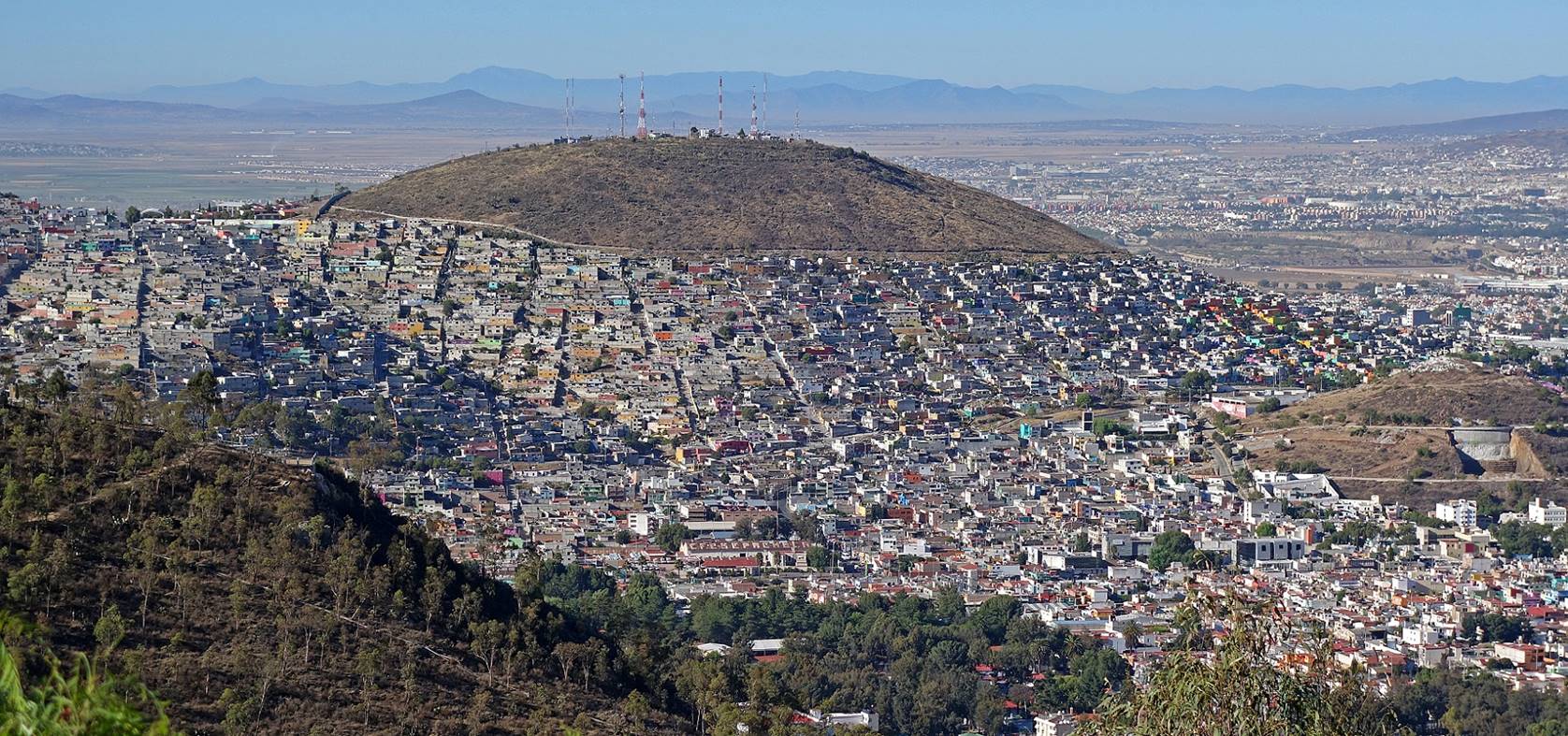
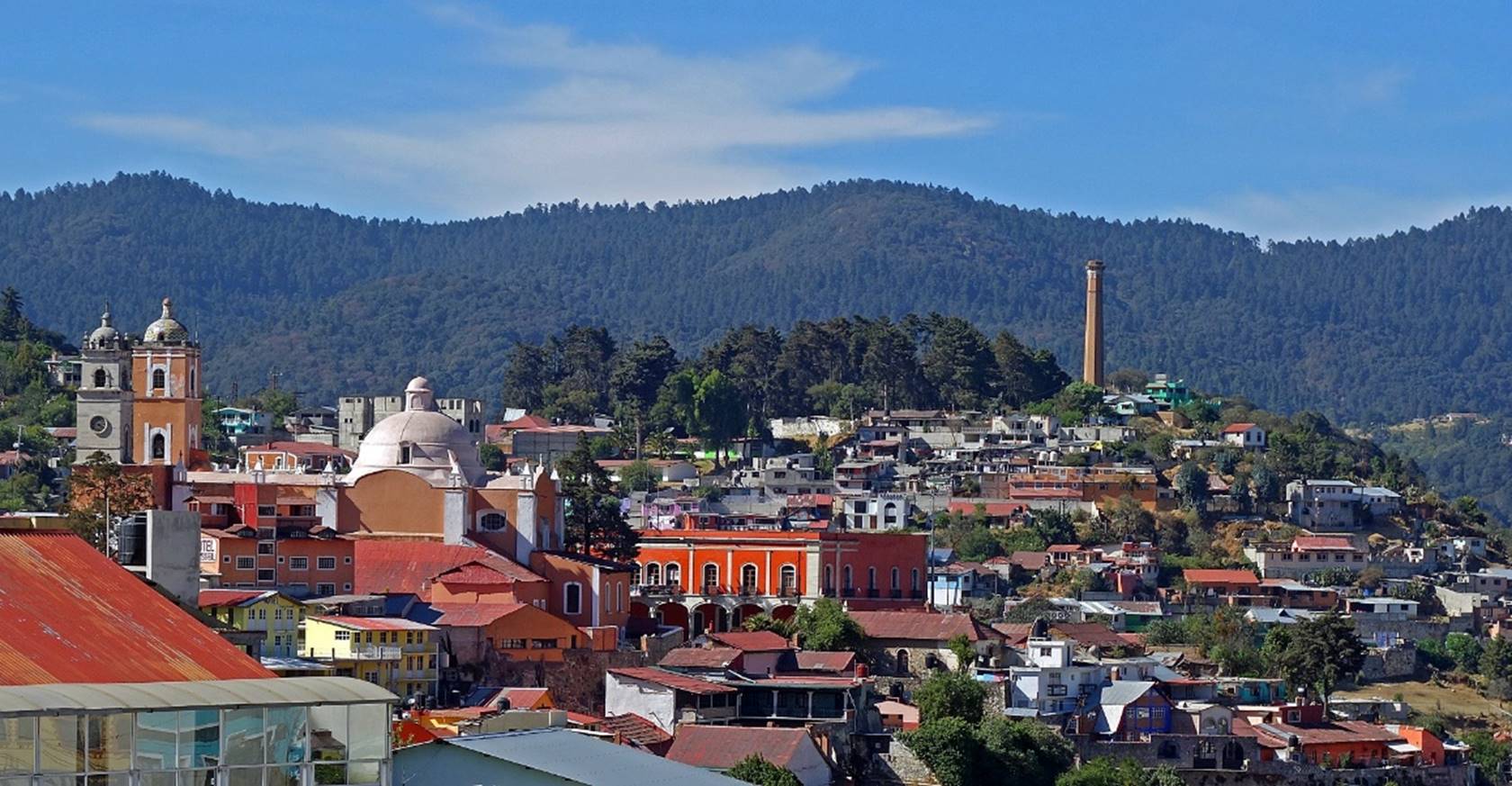
Pachuca:
Pachuca (pop. 280,000; elev. 2432m), the
capital of Hidalgo, is located in the south-central part of the state. Although
relatively small by Mexican standards, it is a sprawling city that has recently
expanded into the surrounding hills. Fortunately, the old center built during
the silver and gold mining period is relatively small and easily walkable.
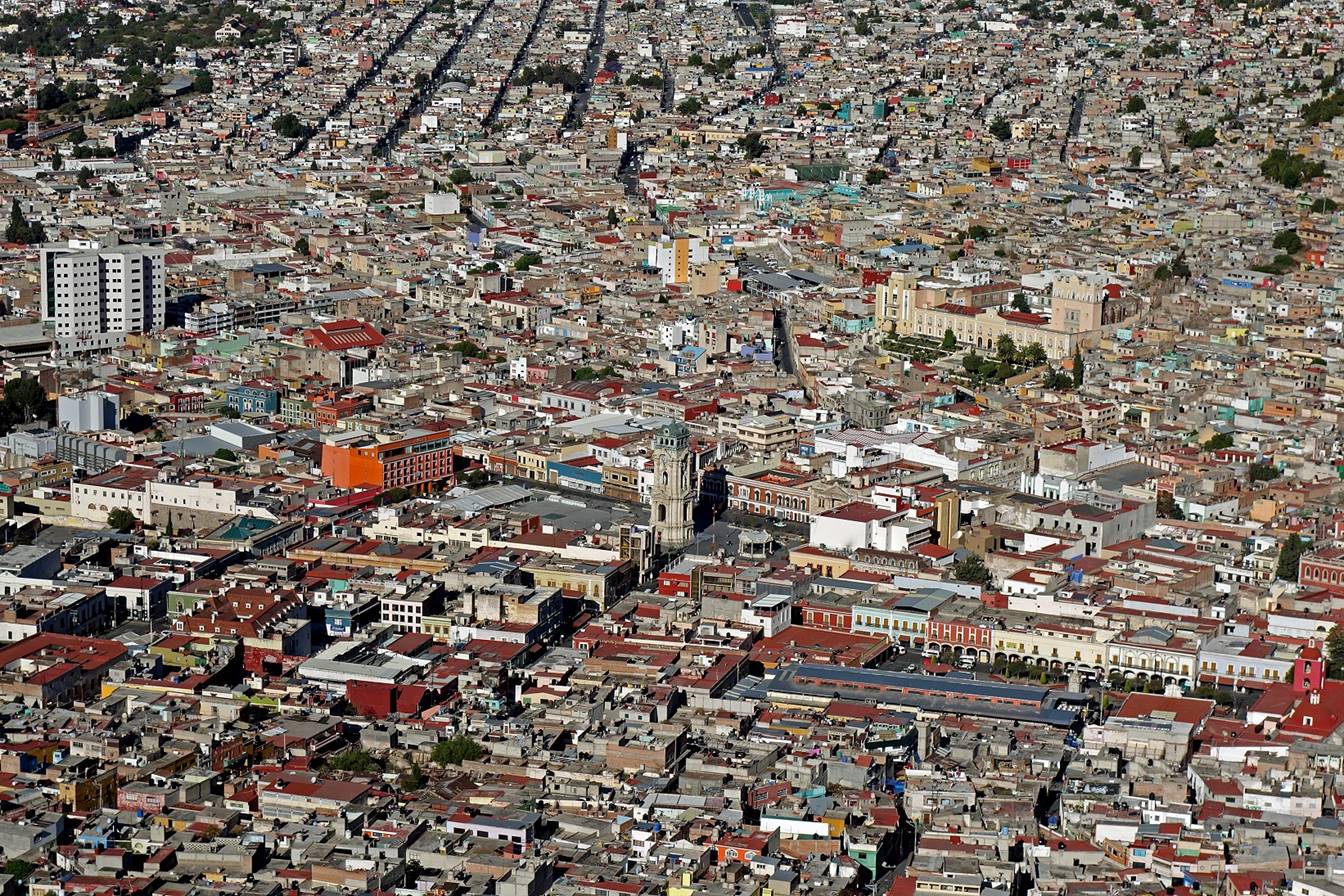
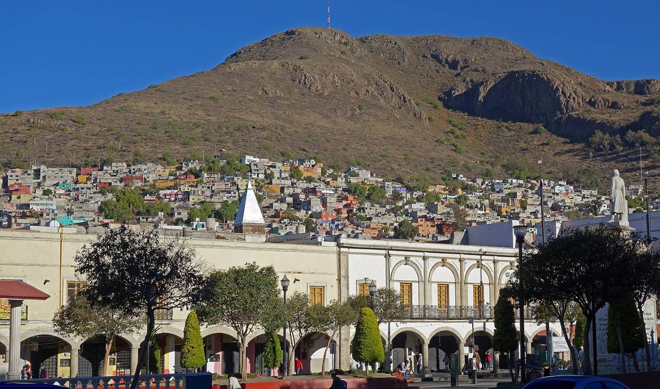
Views over the city from the Cristo Rey mirador located east of the old center:
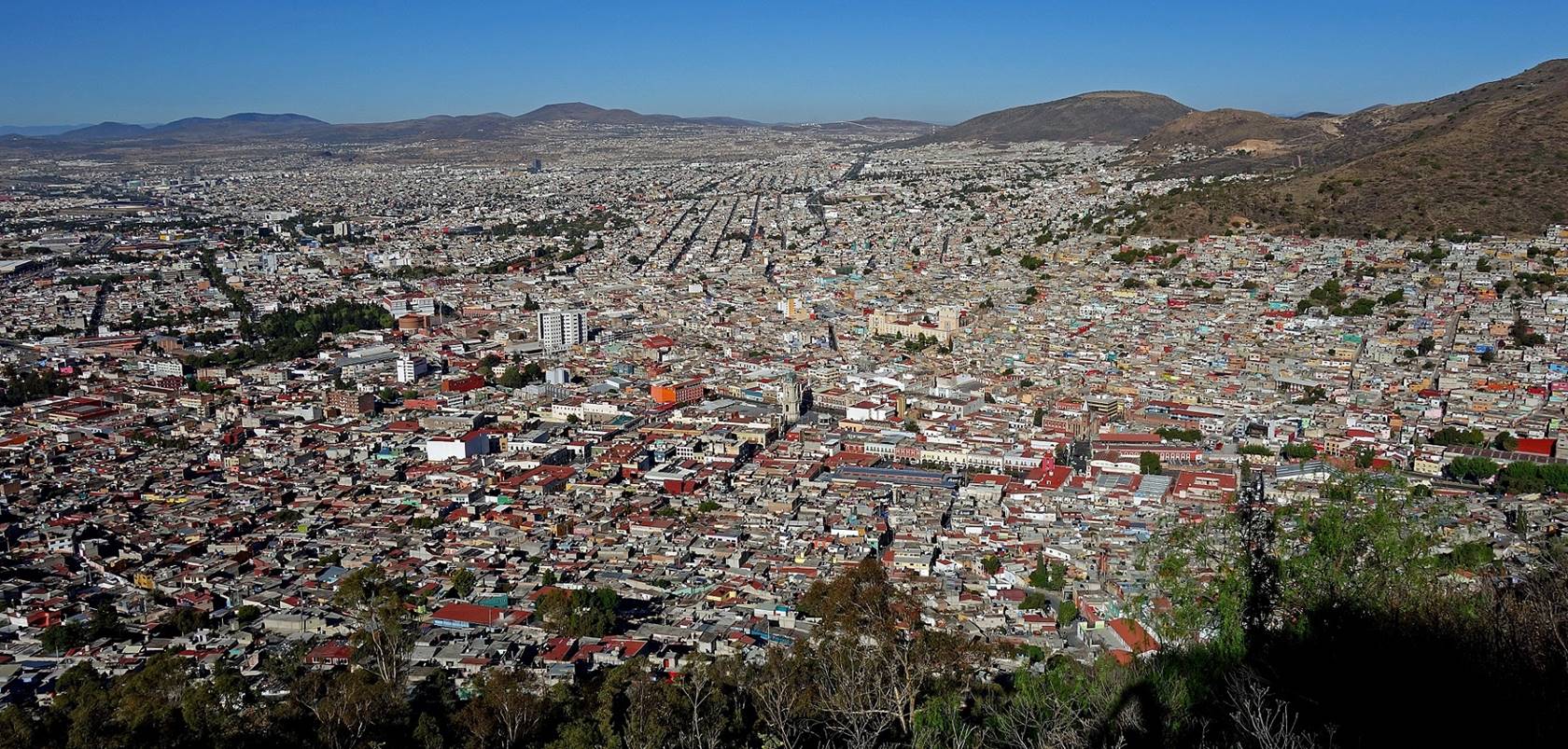
View over the old part of the city (also
from the Cristo Rey mirador). The tall clock tower (Reloj Monumental) is visible near the center of the photo.
The elongated Plaza Constitucion, which is bordered
on one side (west) by an arcade and on the other side by the Mercado Primero de
Mayo (grey roof) is visible at the bottom right of the photo. The red tower on
the right (north) of the plaza is the bell tower of the Asuncion de Maria
church.
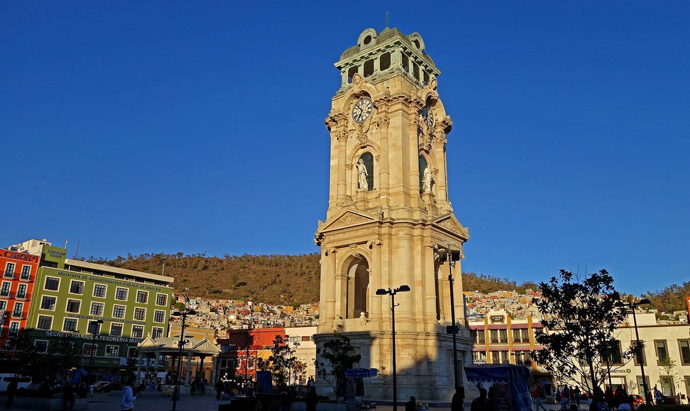
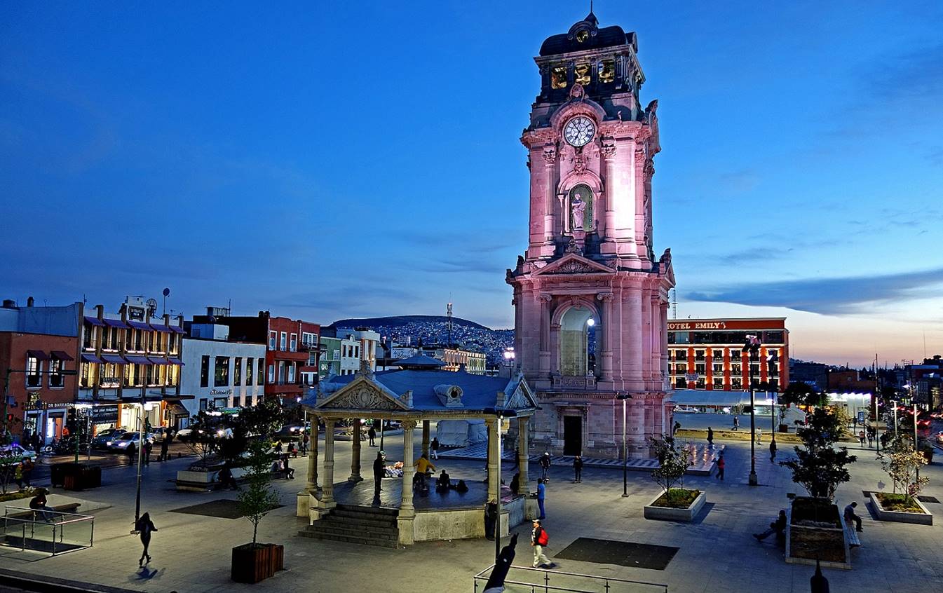
The Reloj
Monumental, the icon of the city, located on the Plaza Independencia.
Inaugurated in 1910, it was donated by a Cornish man to commemorate the
centennial of the independence of Mexico. The Cristo Rey mirador
is located on the hill in the background of the first photo below, hidden by
the clock tower.
The arcade bordering the Plaza Constitucion. The statue of Miguel Hidalgo (a leader of the
Mexican War of Independence, after whom the state is named) is visible on the
right of the photo (and on the left of the next photo). The bright pyramidal
cone at the center-left is the top of the bell tower of the Methodist church
(see below).
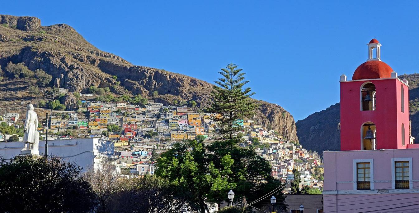
View toward the north from the Plaza Constitucion: houses sprawling on a steep slope on the left
and bell tower of the Asuncion de Maria church on the right.
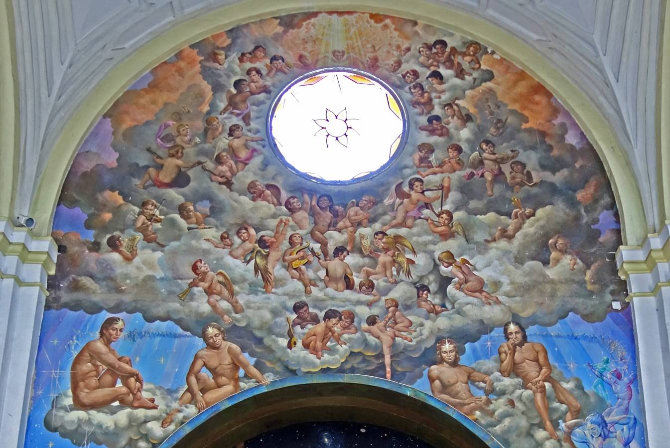
Unusual painting inside the Asuncion de
Maria church.
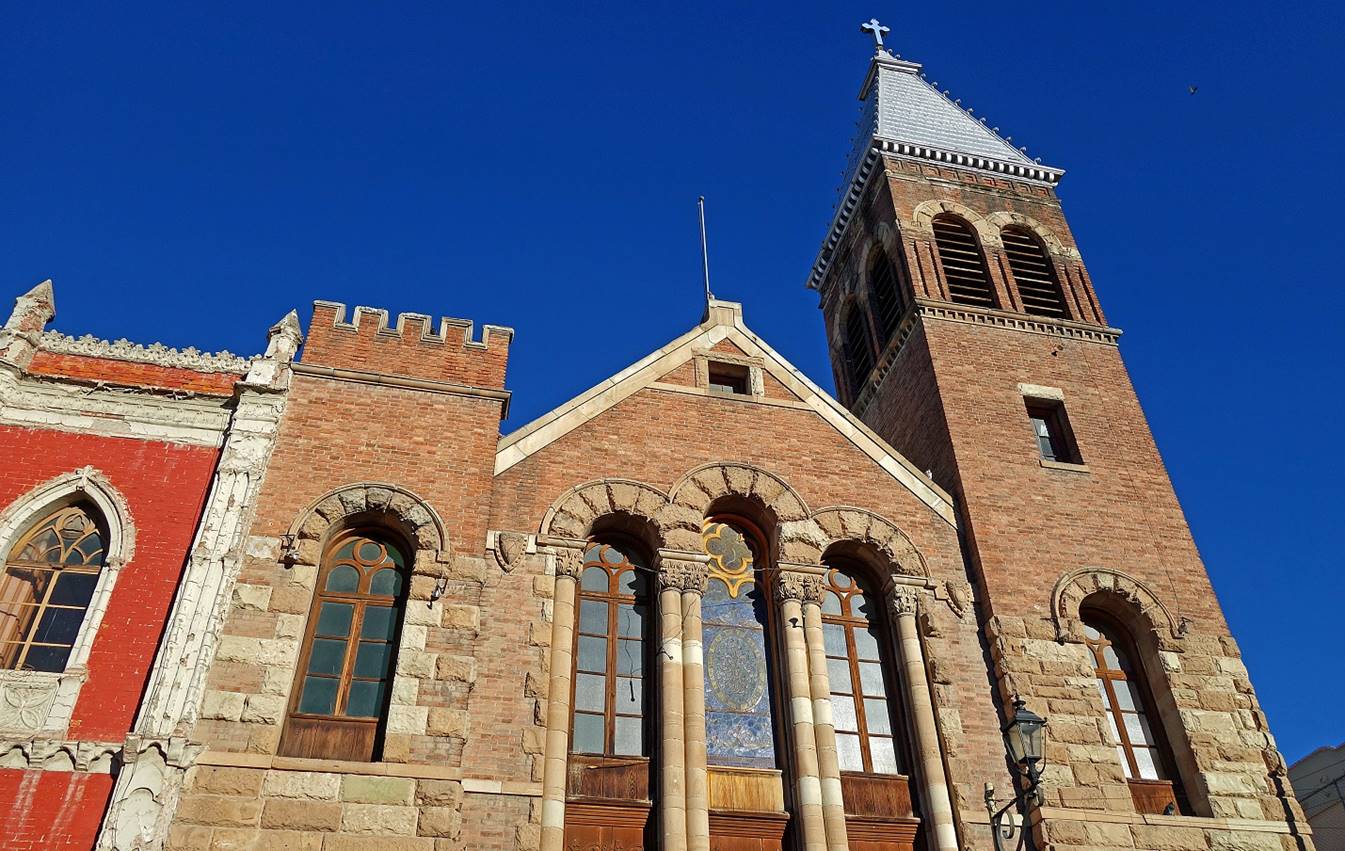
Methodist church built in the early 20th
century, an important Cornish building in the city.
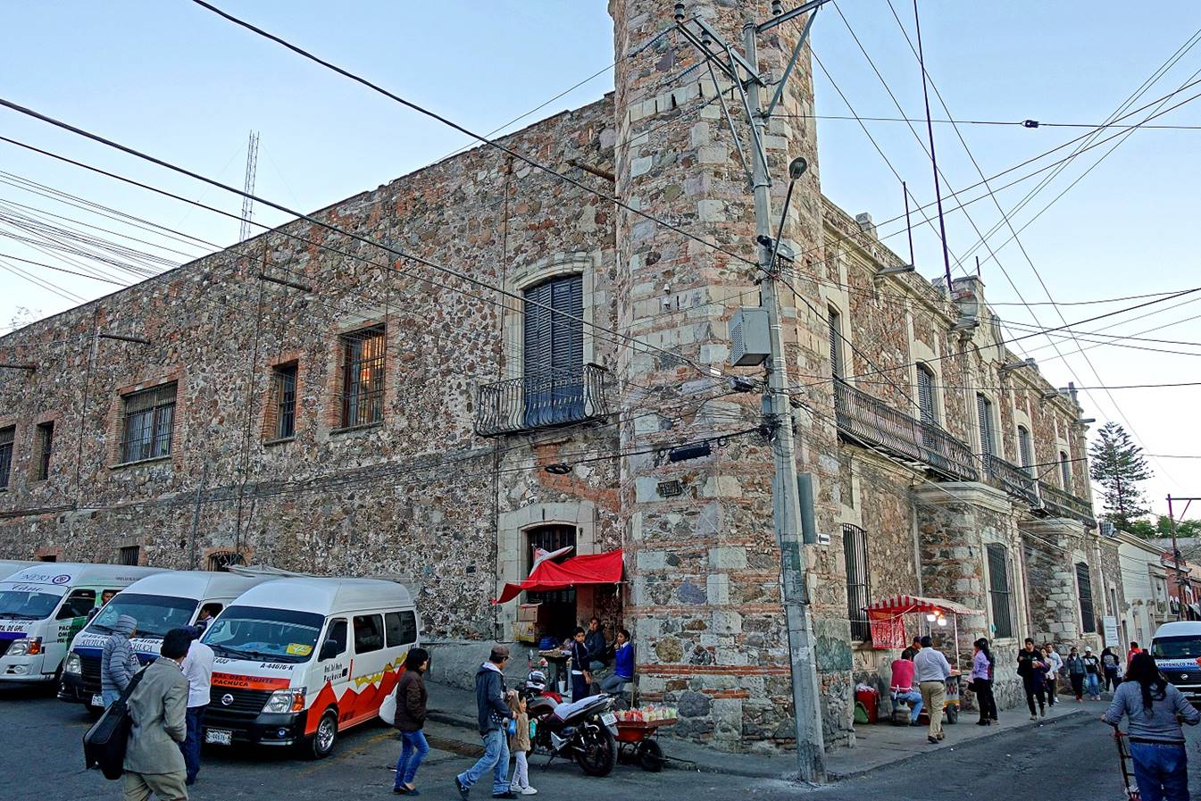
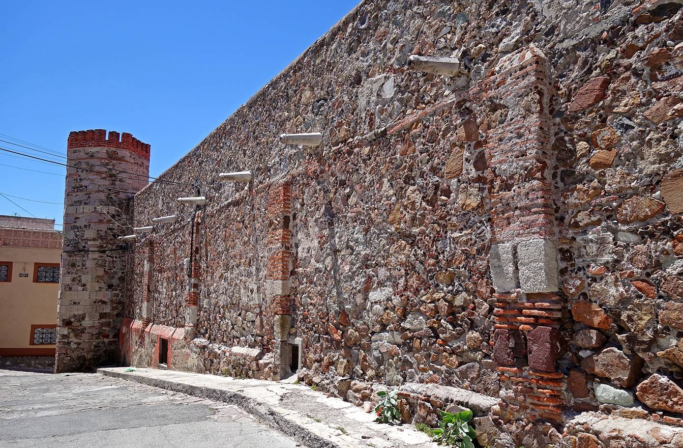
Cajas Reales built
in the 17th century and used during the colonial period to store silver and
gold bars. Towers served for the surveillance and protection of the building.
Unfortunately, the building was closed and seemed almost forgotten by the city.
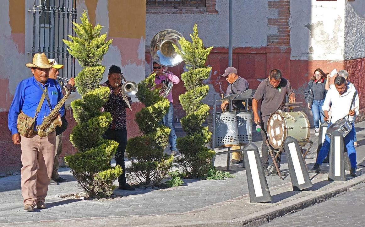
Left: Man warming up in the early
morning sun on Plaza Constitucion (due to the
elevation, nights in Pachuca are quite cool). Right: Group of performing
musicians in a street.
|
|
|

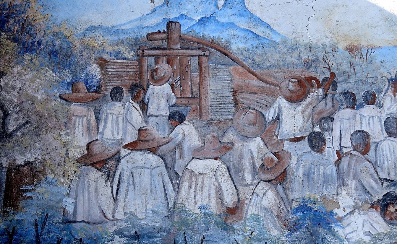
Mural celebrating the indigenous roots
of the state of Hidalgo.
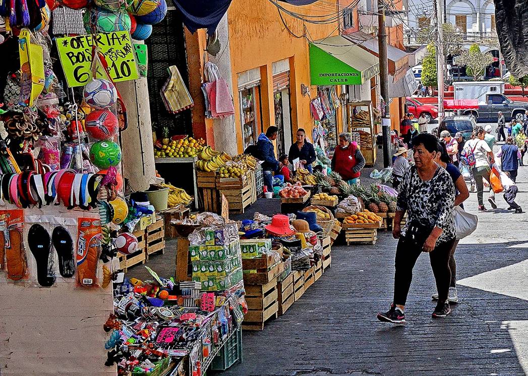
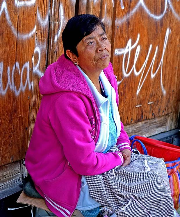
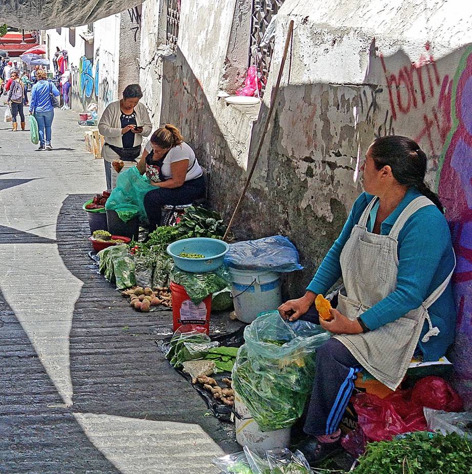
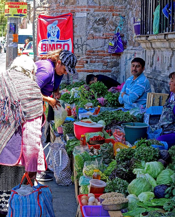
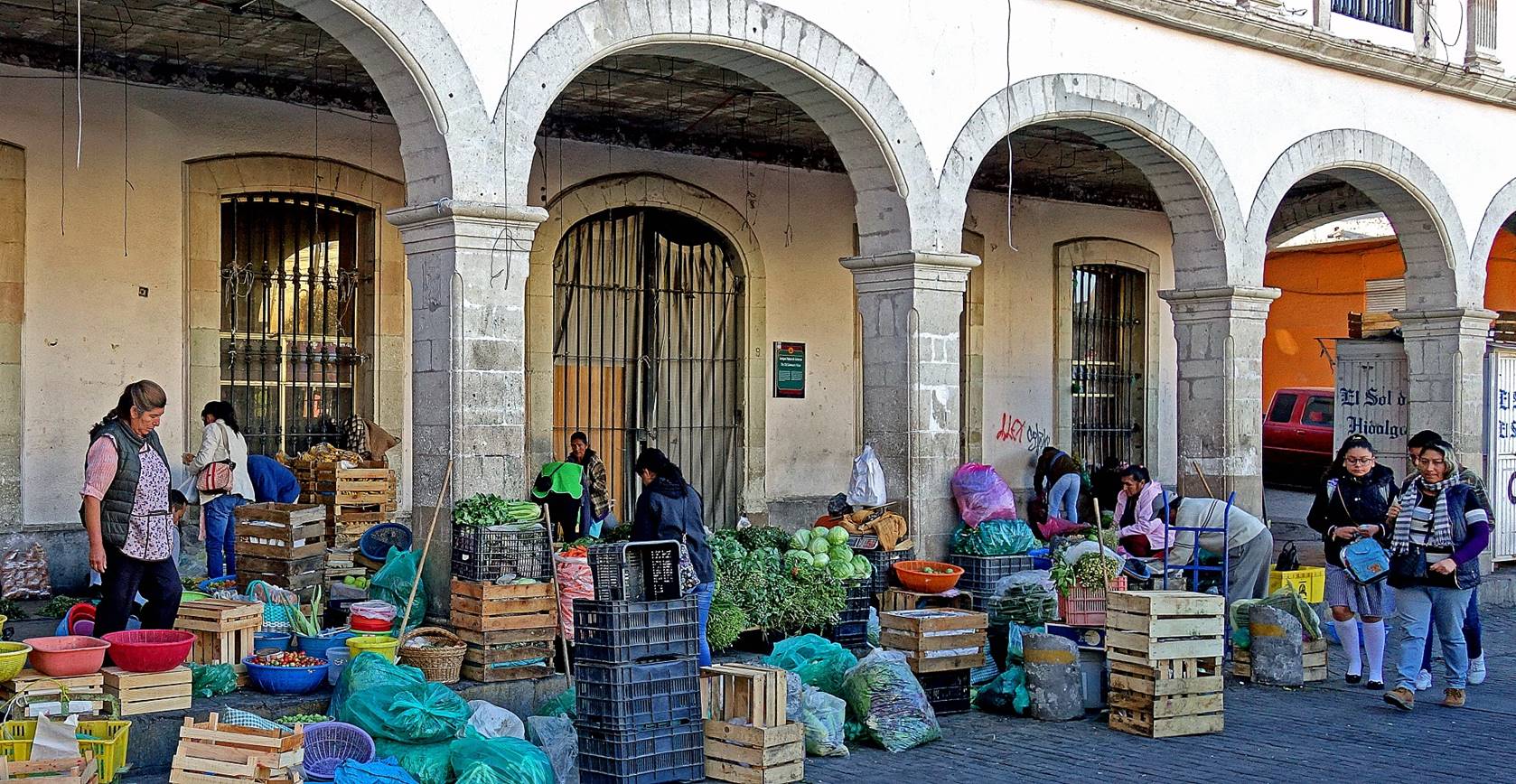
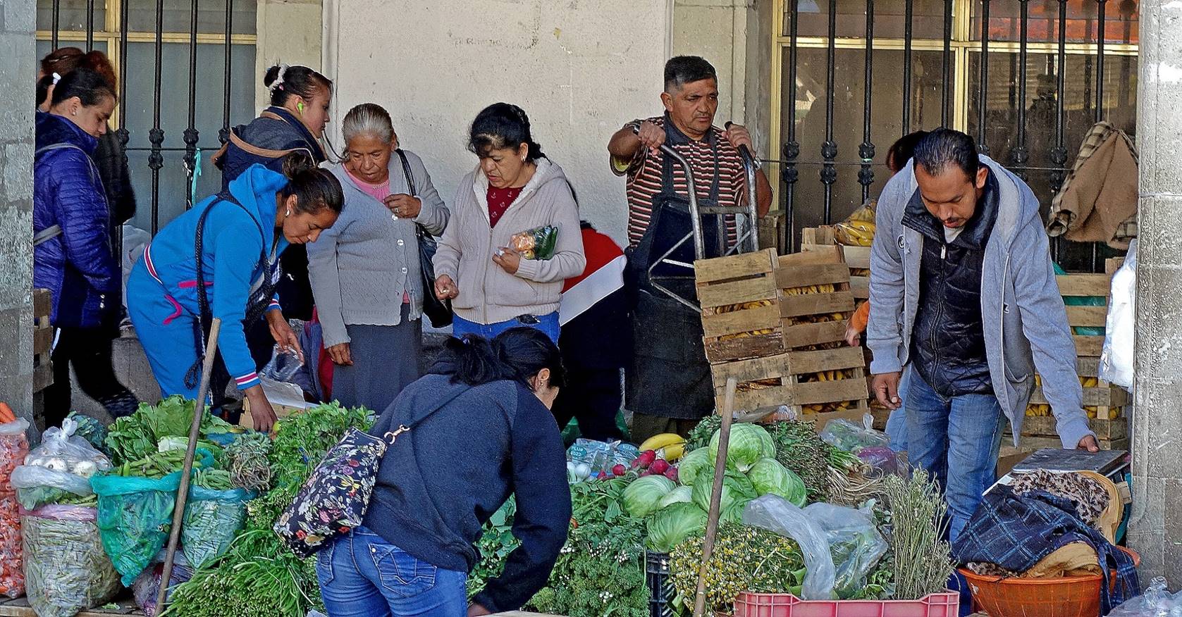
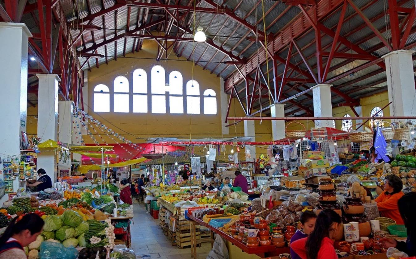
The old center of Pachuca is dotted with
several busy covered and street markets: Mercado Benito Juarez, Mercado Miguel
Hidalgo, Mercado Primero de Mayo, Mercado de Barreteros...
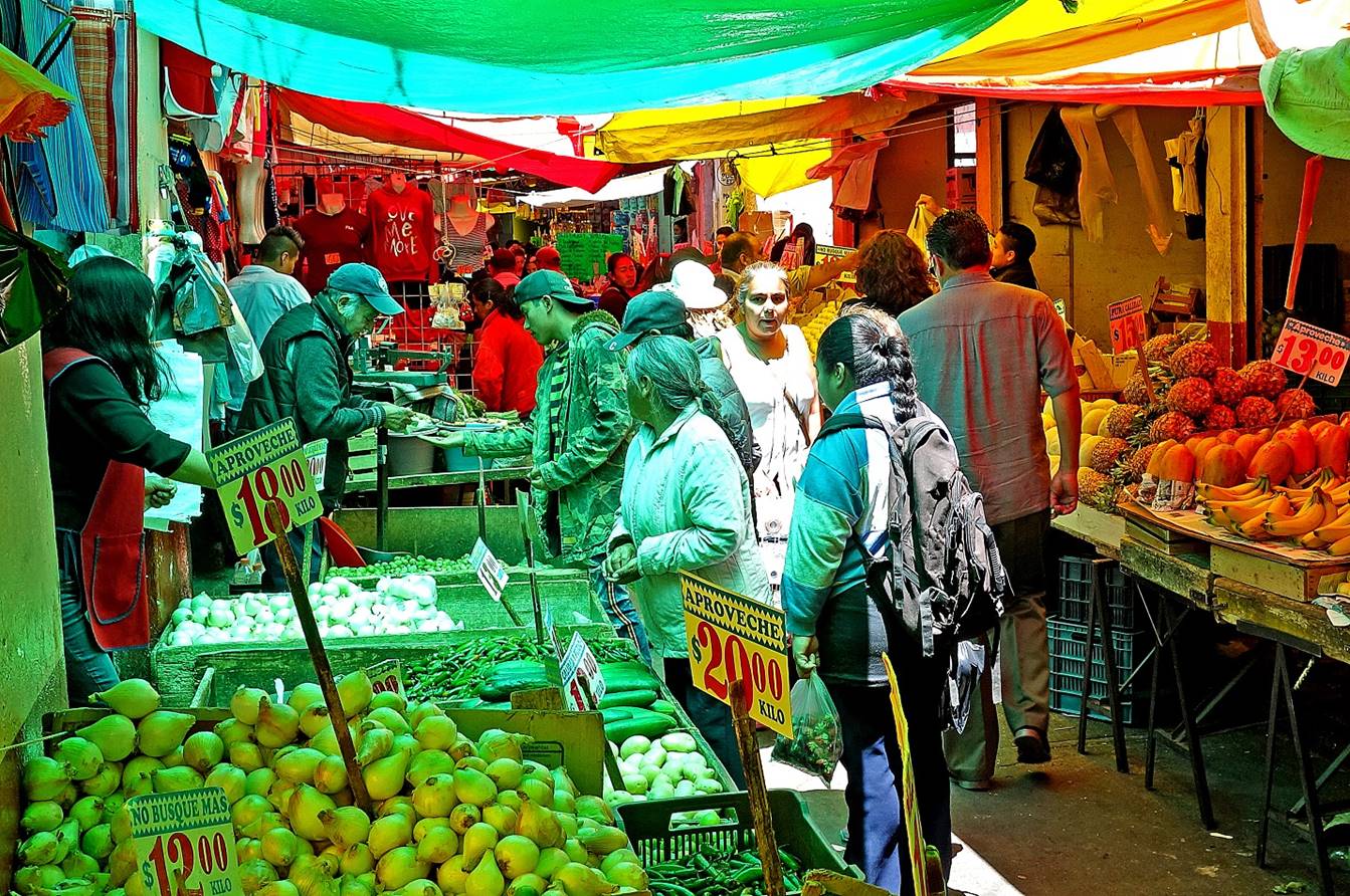
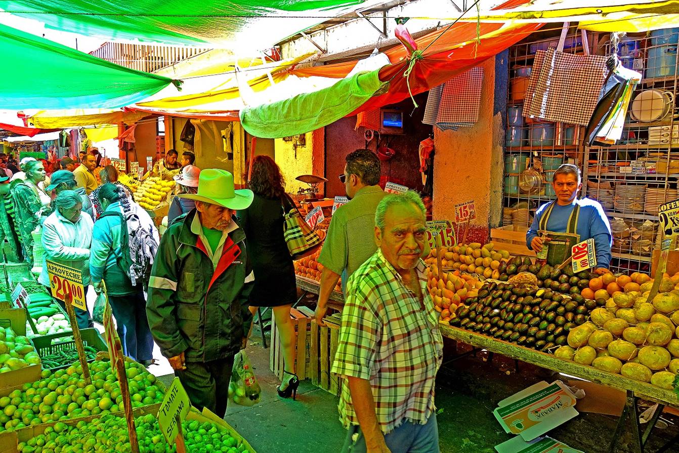
- Entrance of the Mercado de Barreteros.
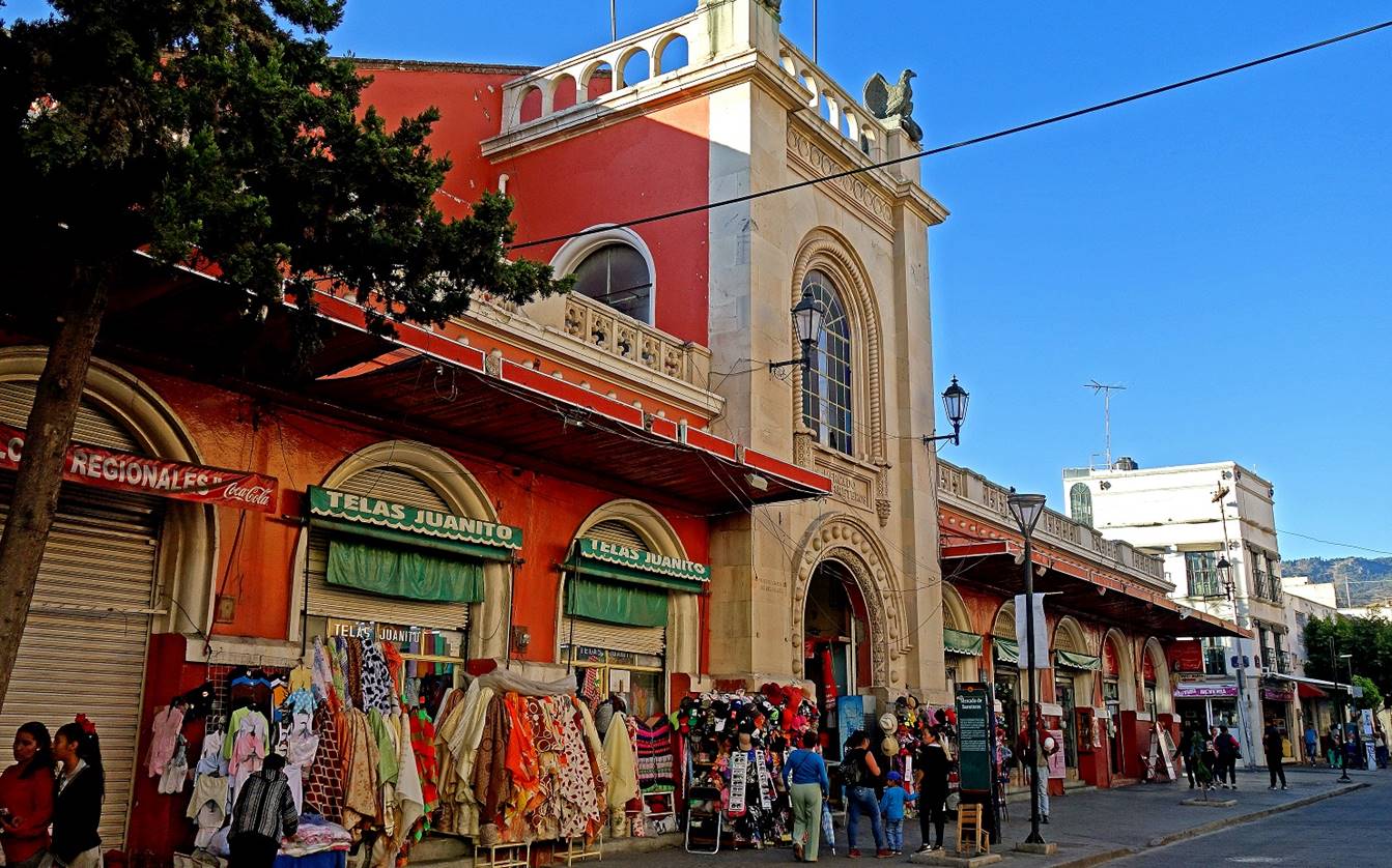
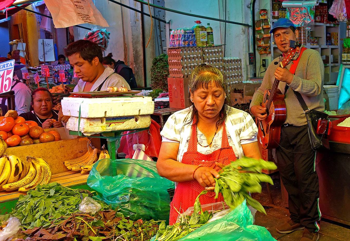
- Market scenes.

|
|
|
|
|
|
|
|
|
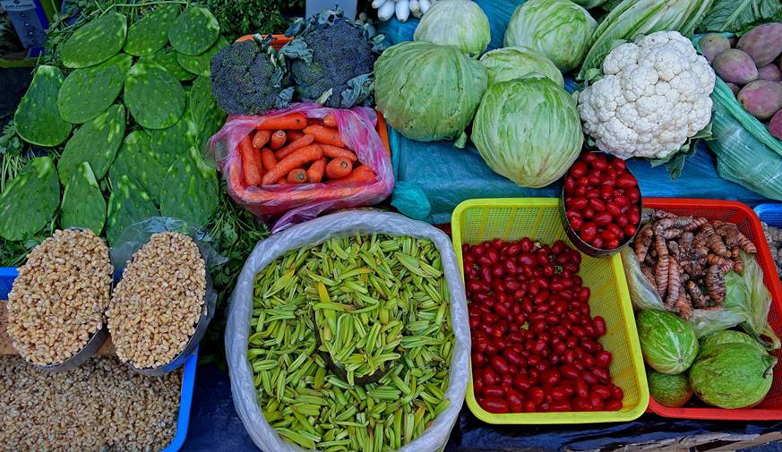

[The yellowish ″grains″ at the bottom-left
of the above photo on the left are edible ant larvae collected from the roots
of agave plants. They are called ″escamoles″
and have been a popular Mexican delicacy at least since the Aztecs.]
The Hidalgo Theater Bartolome de Medina
inaugurated in 1957, located on the southern edge of the old city center.
Bartolome de Medina was born in Spain in the early 16th century. At the age of
50 he moved to present-day Mexico, where he eventually settled in Pachuca. He
is recognized as the inventor of the ″patio process″, a process for
extracting silver from ore.

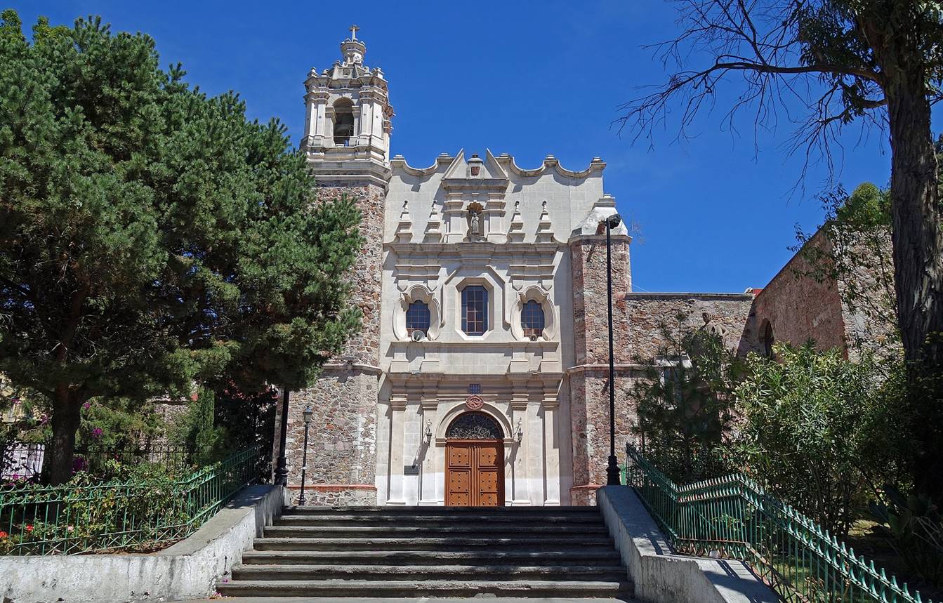
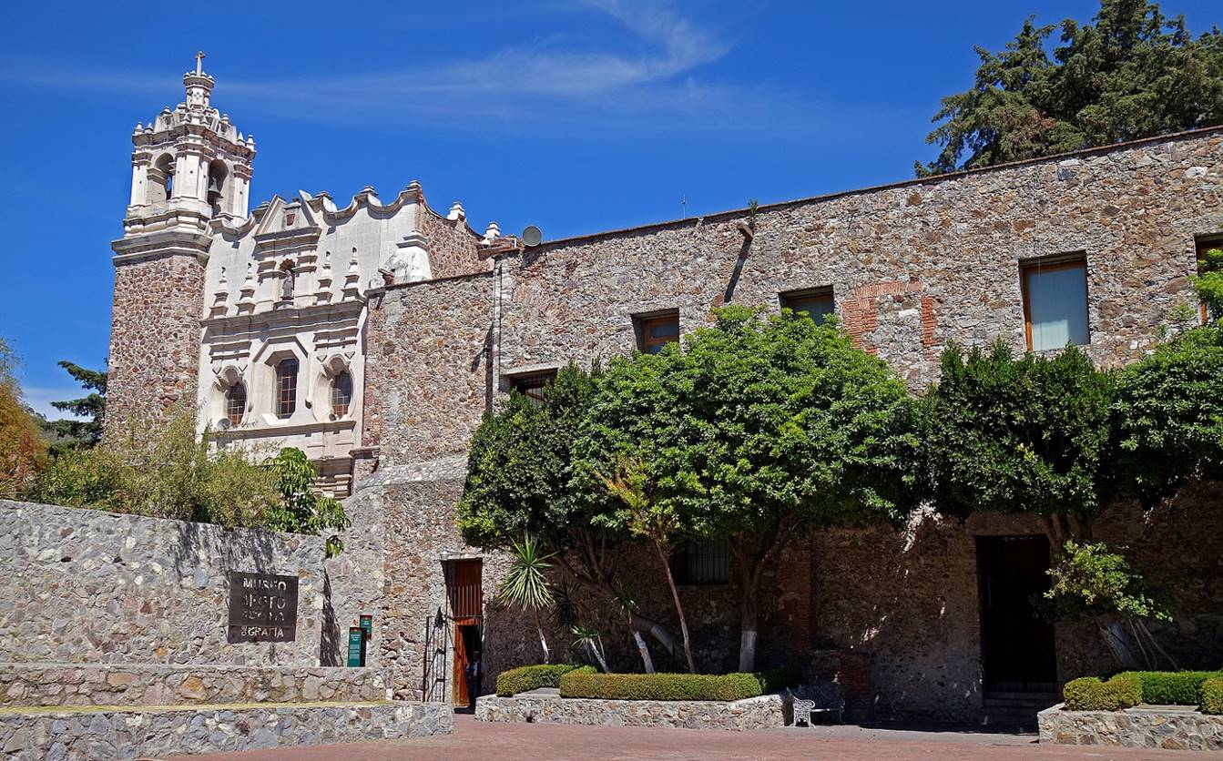
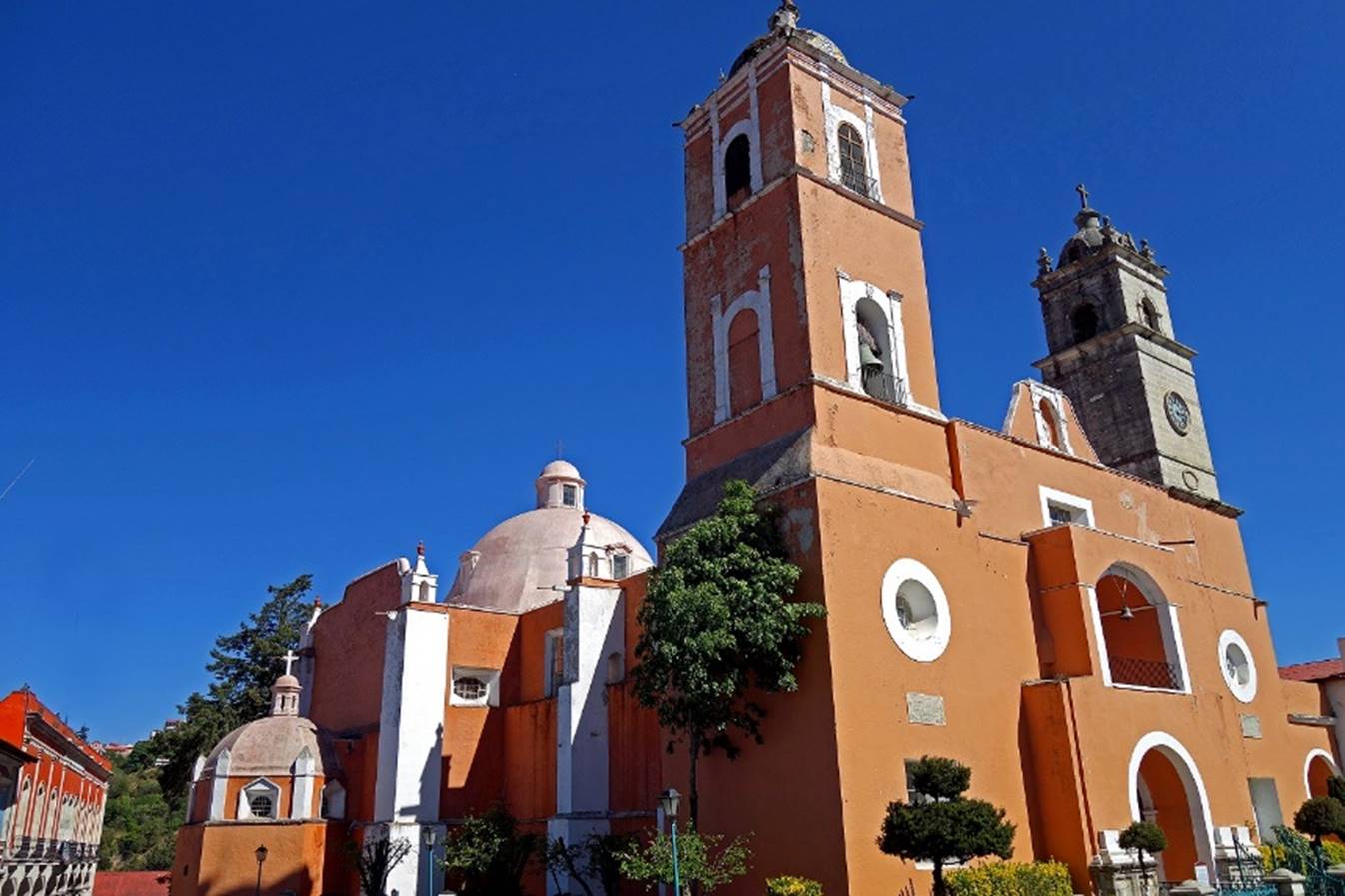
The San Francisco church and ex-convent
is a large complex of several buildings built in the 16th and 17th centuries.
Today the church is still active and the ex-convent hosts several exhibition
halls and a school of arts.
- San Francisco church.

- Another view of the church, with a
portion of the ex-convent on the right.
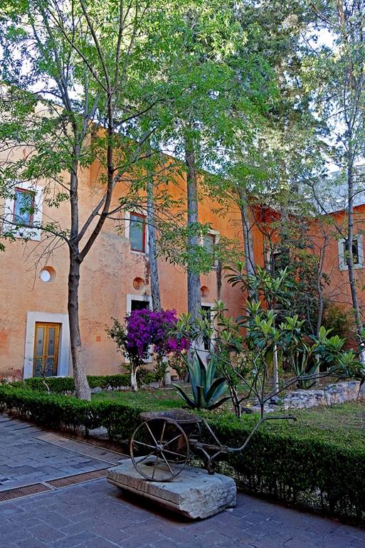
- Inner courtyard in the ex-convent.
|
|
|

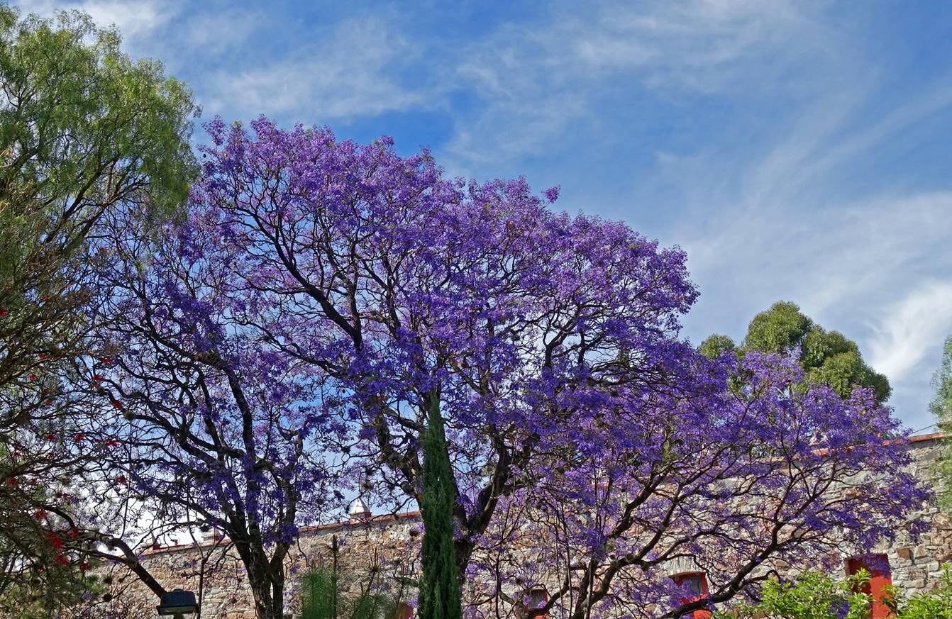
- Jaracanda in
bloom next to the ex-convent.
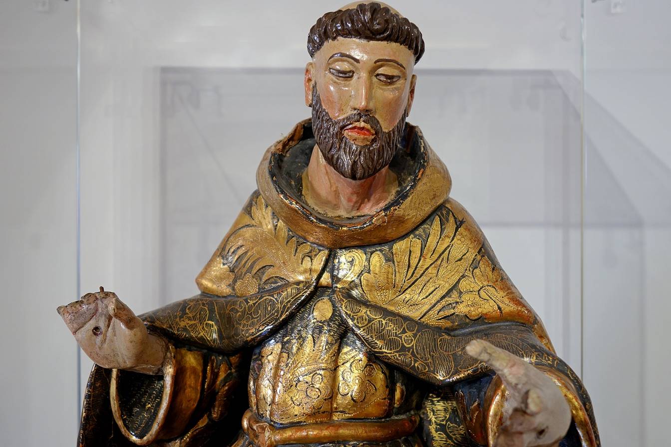
- Polychrome wood statue exposed in a
room of the ex-convent.
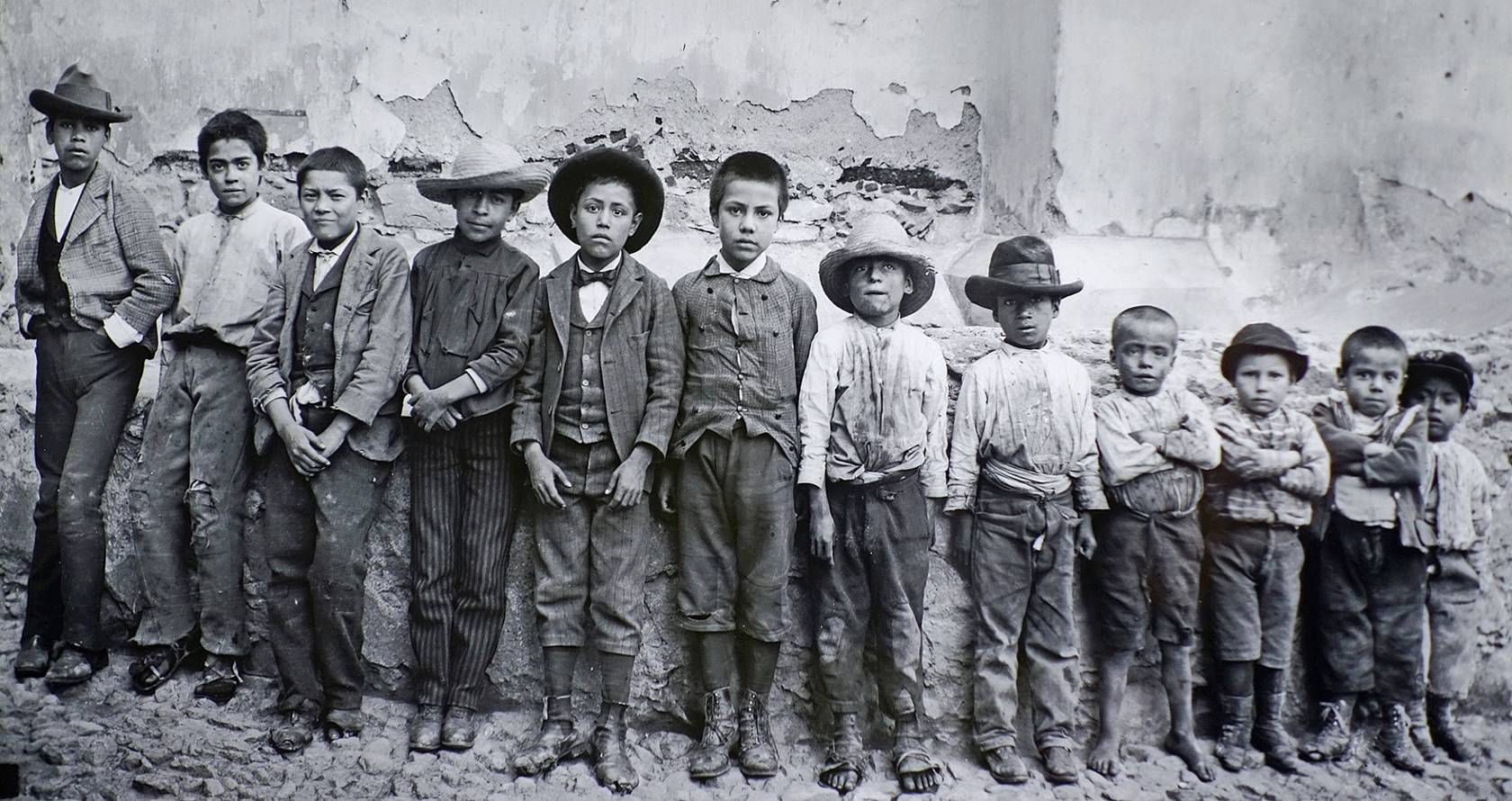
- Photo (called ″Los Ninos″) exposed in the Museo
de la Fotografia located in the ex-convent. This
museum stores many photographic works, but only a few are exposed at any given
time. I found this photo (dated 1908) particularly expressive.
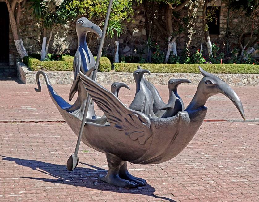
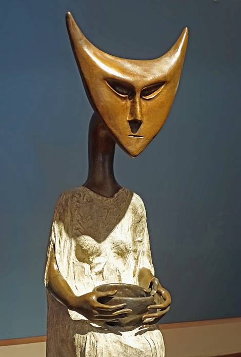
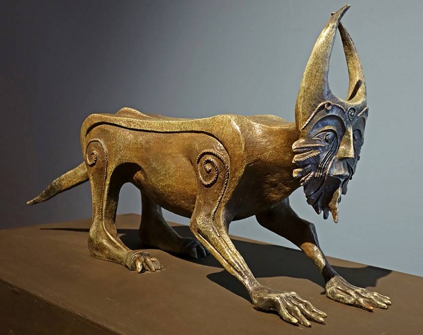
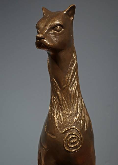
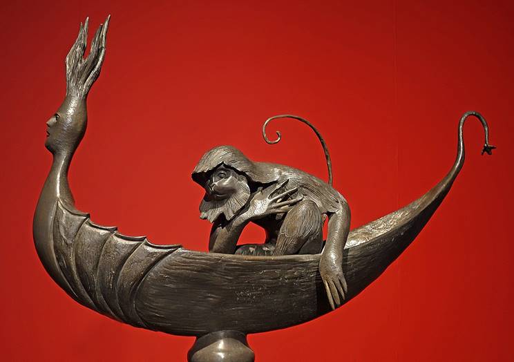
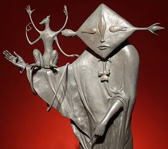
- At the time of my visit, the
ex-convent was also hosting an exposition of sculptures of British-born Mexican
artist Leonora
Carrington (1917-2011). Although Leonora Carrington might be better known
for her paintings, this collection of ″magical creatures″ was
particularly stunning. Such an exposition is yet another demonstration of the
love affair of many Mexicans with arts.
|
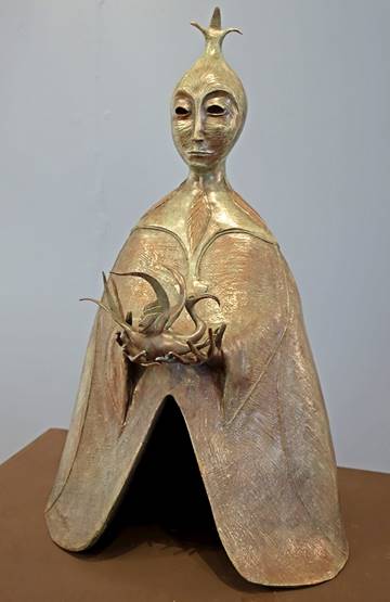
The Ship of
Cranes. |
|

|
Horse Ride. |
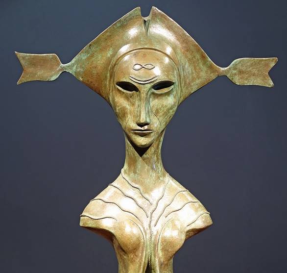
La Dragoneza. |
Mute Singer. |
|
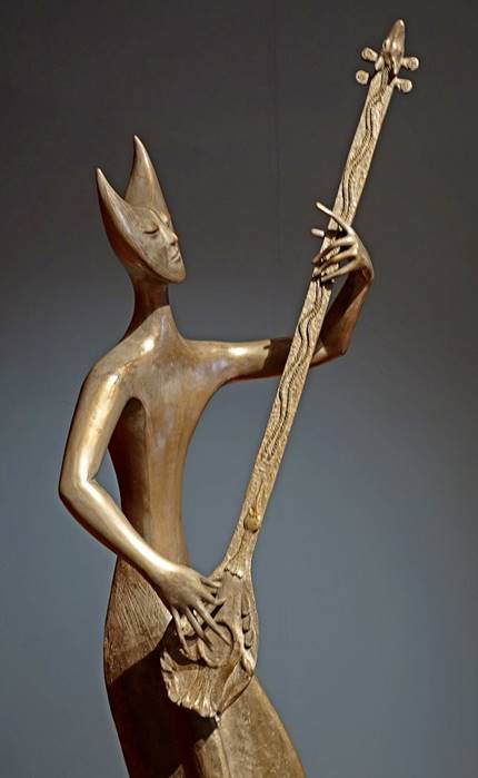
The Bandolonista. |
The Tamborilera. |
The Inventor of the Atole. |

|
Night
Jaguar. |
Cat without Boots. |
|
Boat with
Monkey. |
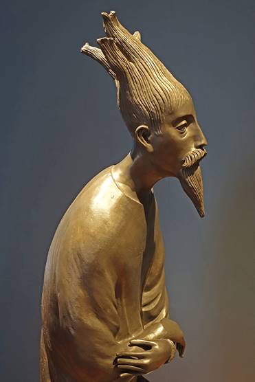
The Necromancer. |
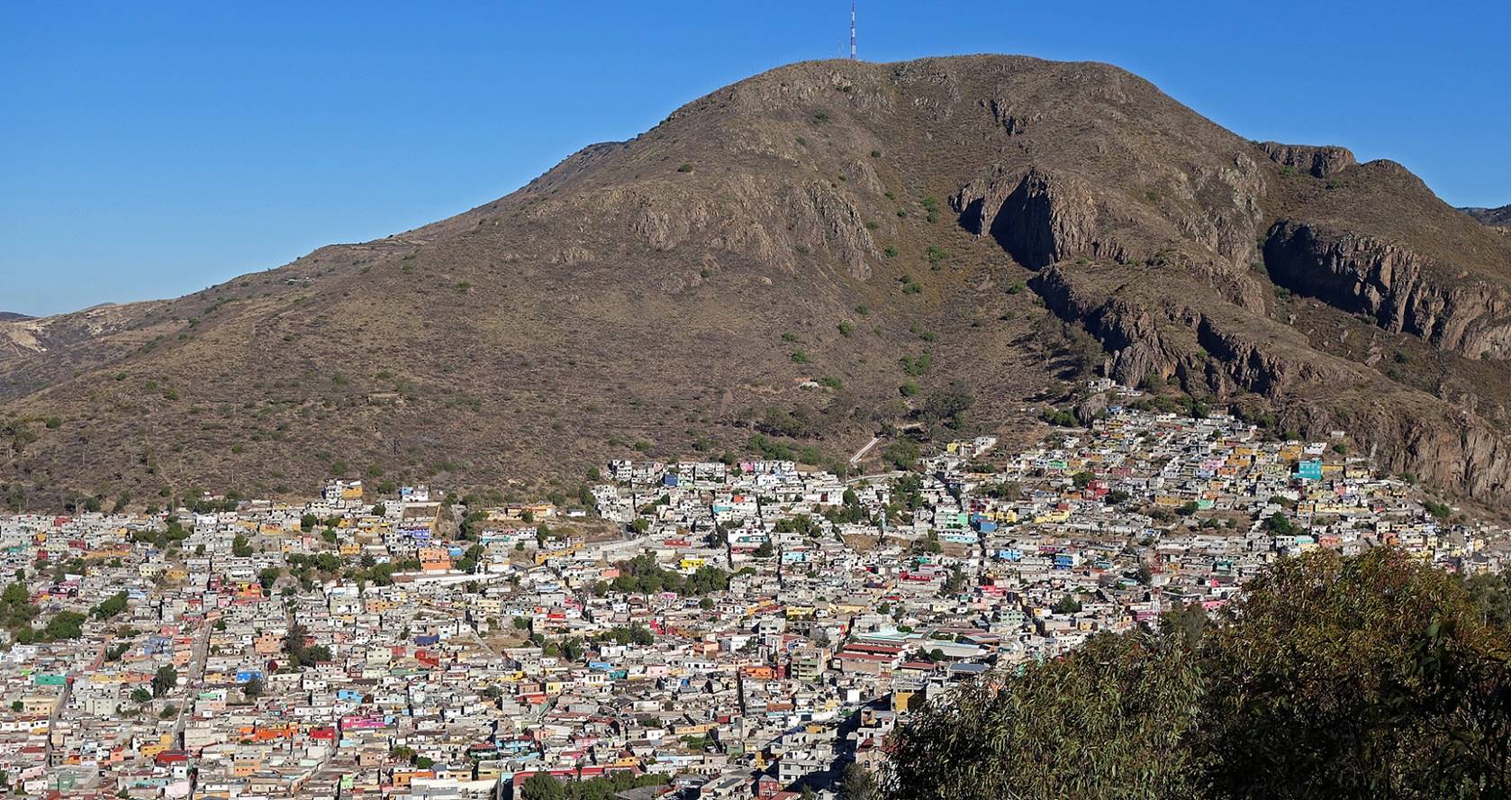
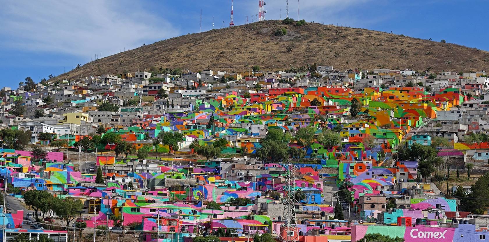
Las Palmitas
is a poor neighborhood that used to be plagued by petty crime. In 2015 a group
of graffiti artists led by a former gang member tried to change that by painting
hundreds of houses to create a macromural, hoping that it would engender a
better community spririt. Viewed from a distance, the macromural form
multi-color swirling patterns (inspired by the fact that Pachuca lies in a
windy area and is nicknamed the Airy Beauty). But portraits of residents are
also painted on the walls of the narrow alleys and stairways of the
neighborhood.


Huasca de Ocampo:
This large village (pop. 15,200; elev.
2100m) is located some 35 km from Pachuca. The village itself, although quite
pretty, is not especially interesting as it caters mostly to weekend visitors
from Mexico City. But it is surrounded by remarkable former haciendas. In
addition, the Barranca de Alcholoya,
a small canyon bordered by cliffs made of basaltic columns, near the Hacienda
Santa Maria Regla, is an impressive sight.
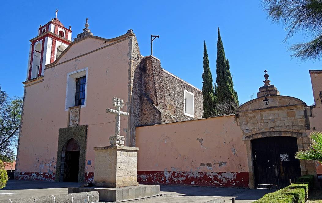
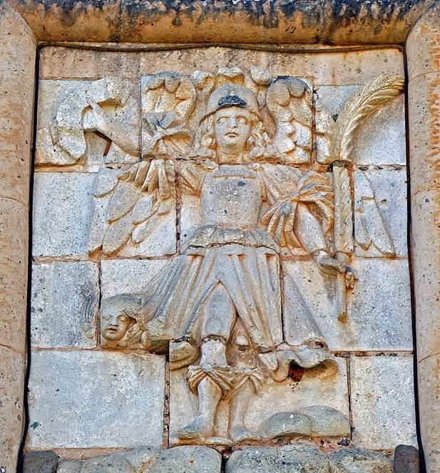
In the town of Huasca
de Ocampo:
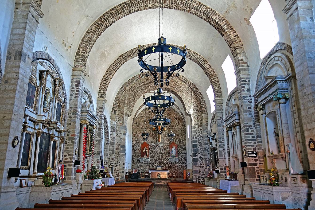
- San Juan Bautista church (16th
century) and the stone relief carving above the entrance portal.
|
|
|
- Inside the church.
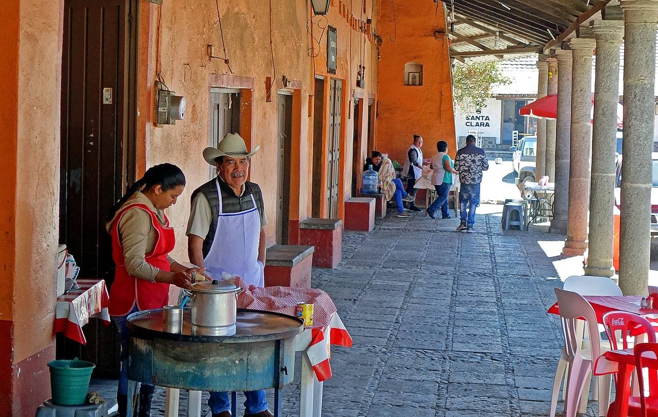
- Small restaurants serving breakfast in
the main street of the village.
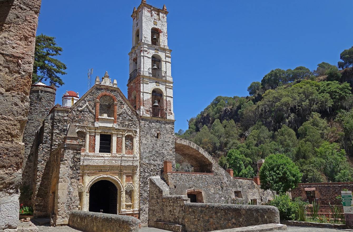
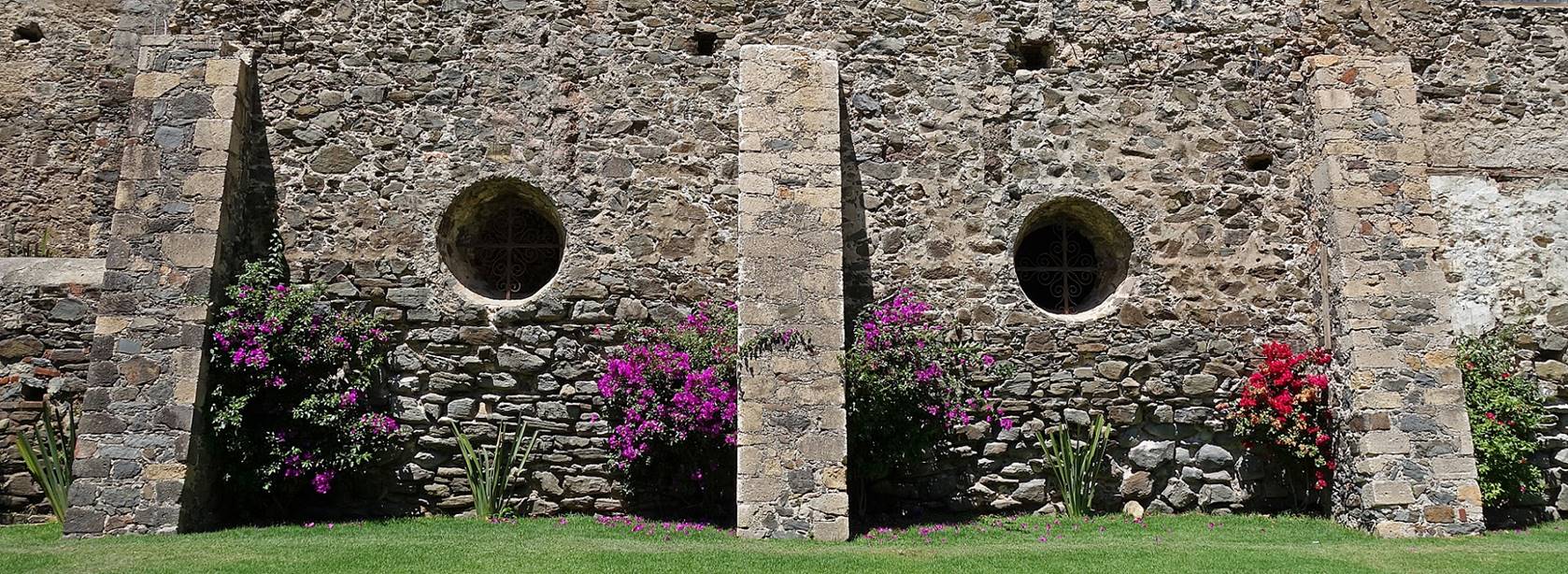
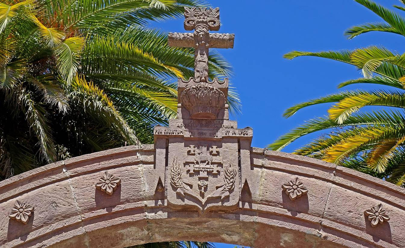
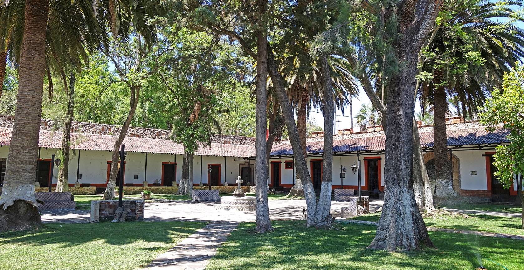
Hacienda Santa Maria Regla.
This amazing former mining hacienda was built in the 18th century by Don Pedro
Romero de Terreros, the first Count of Regla to extract and process silver and gold in the area.
It has been beautifully restored and is now exploited as a hotel. Fortunately,
the hotel occupies only a fraction of the large complex and is not too
conspicuous. The scale and beauty of the structures reflect the economic wealth
of the former mining activities.
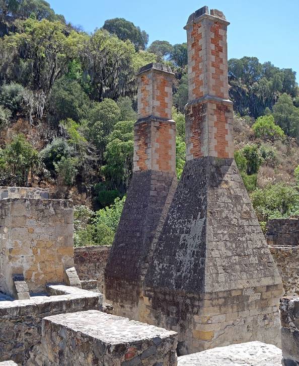
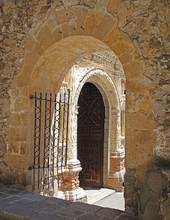
- Left: Entrance portal of the hacienda.
Right: English furnaces (located near the entrance portal).
|
|
|

- View from the entrance portal.

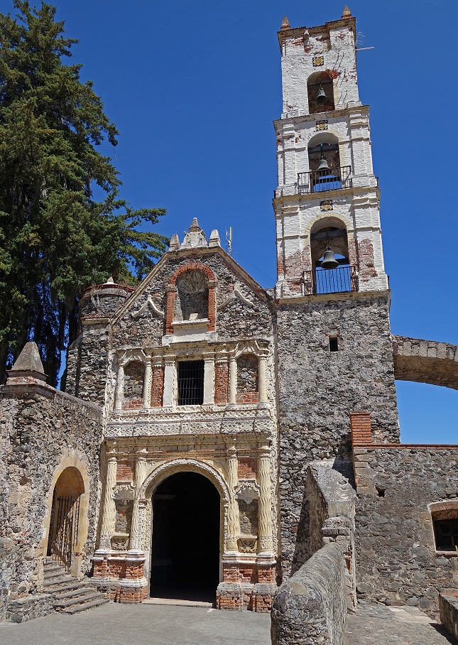
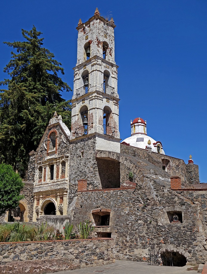
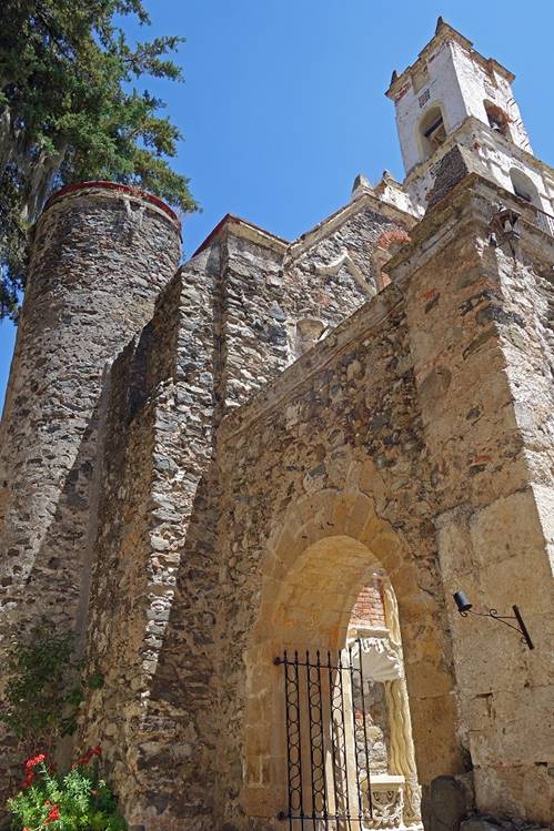
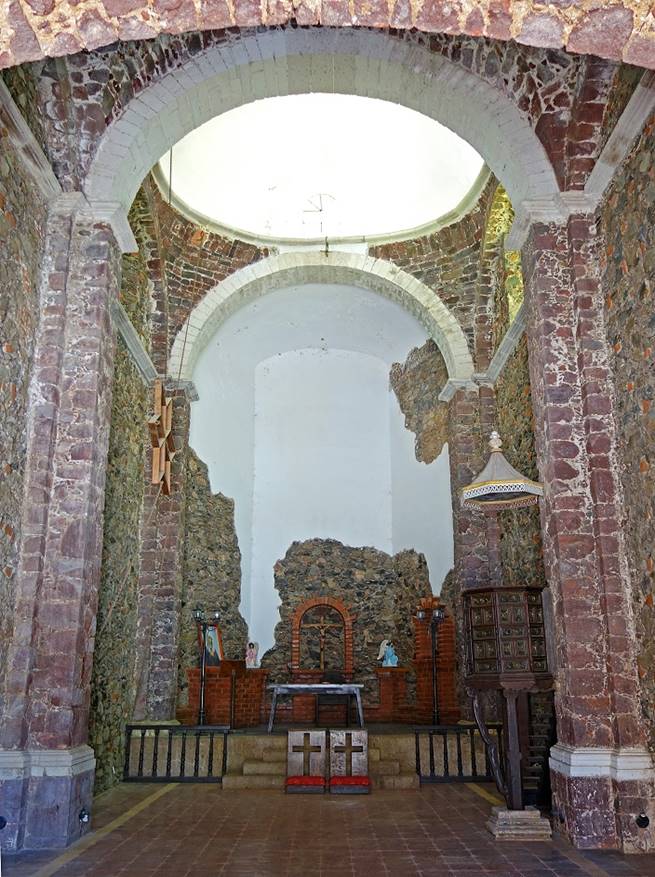
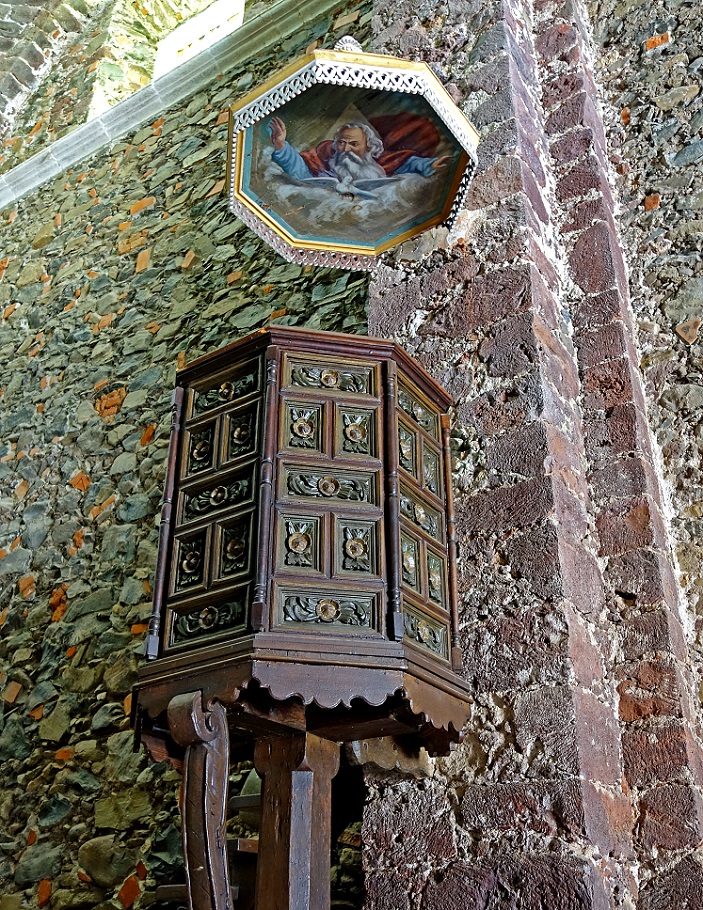
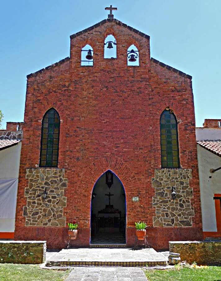
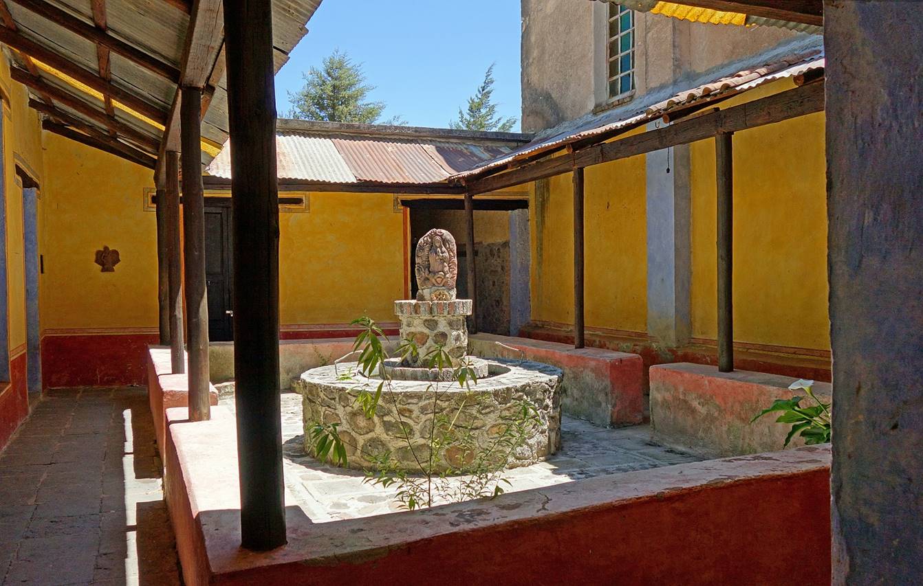
- The chapel of the hacienda (Parish of
Our Lady of Loreto).
|
|
|
|
|
|
|

|
|
|
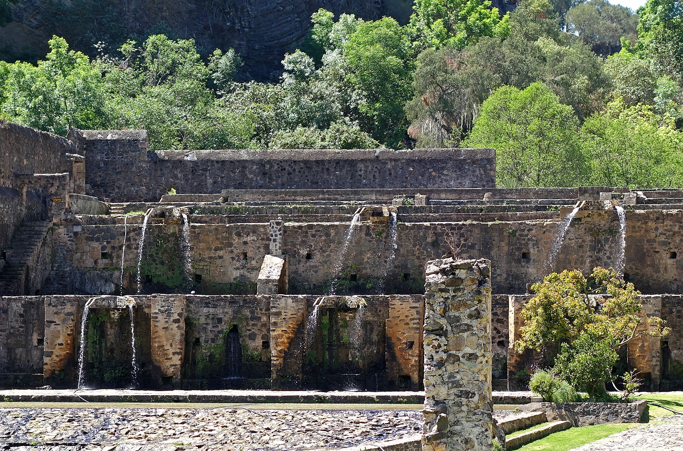
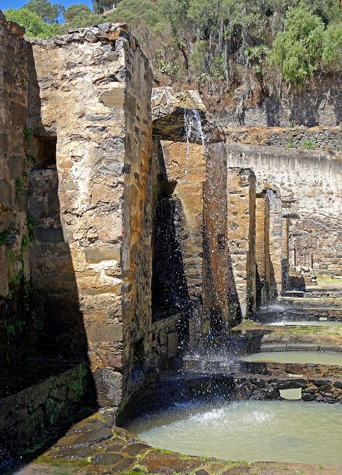
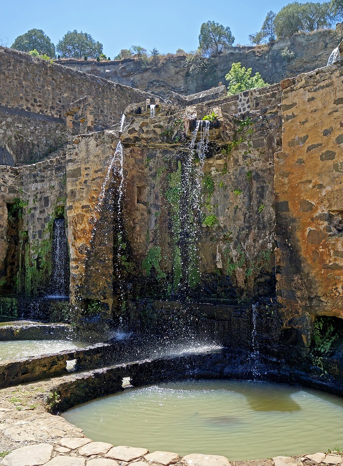
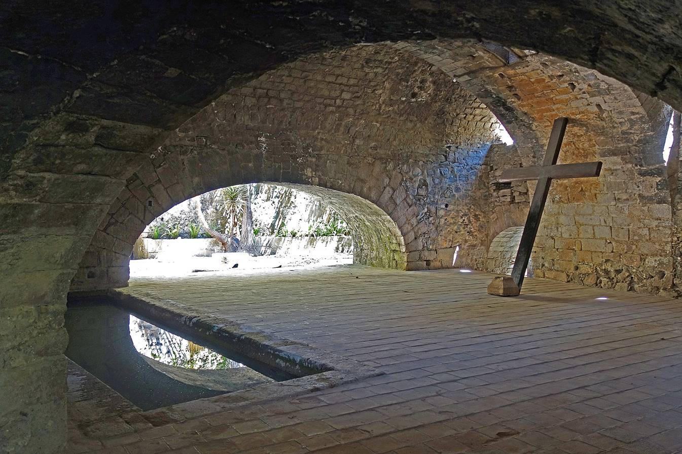
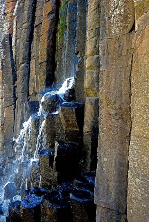
- Fountains bringing water from the Barranca de Alcholoya.

|
|
|
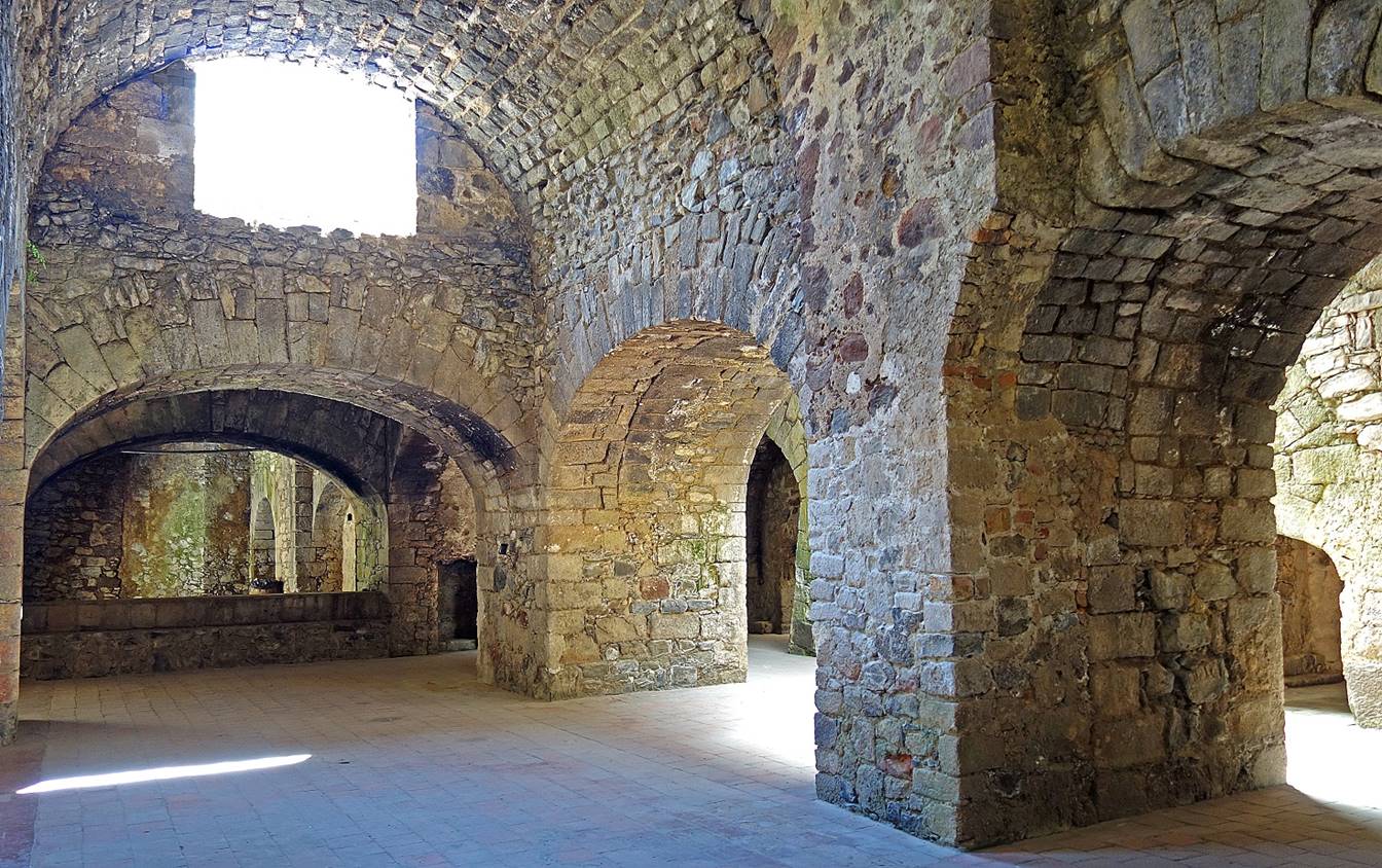
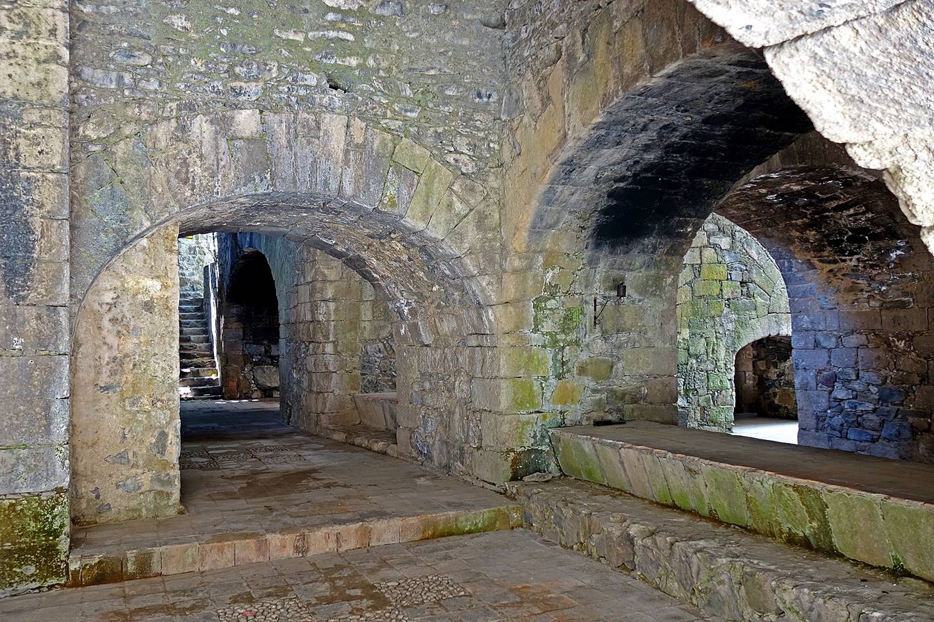
- Corridor leading to the ore and tailings
storage buildings behind the fountains.
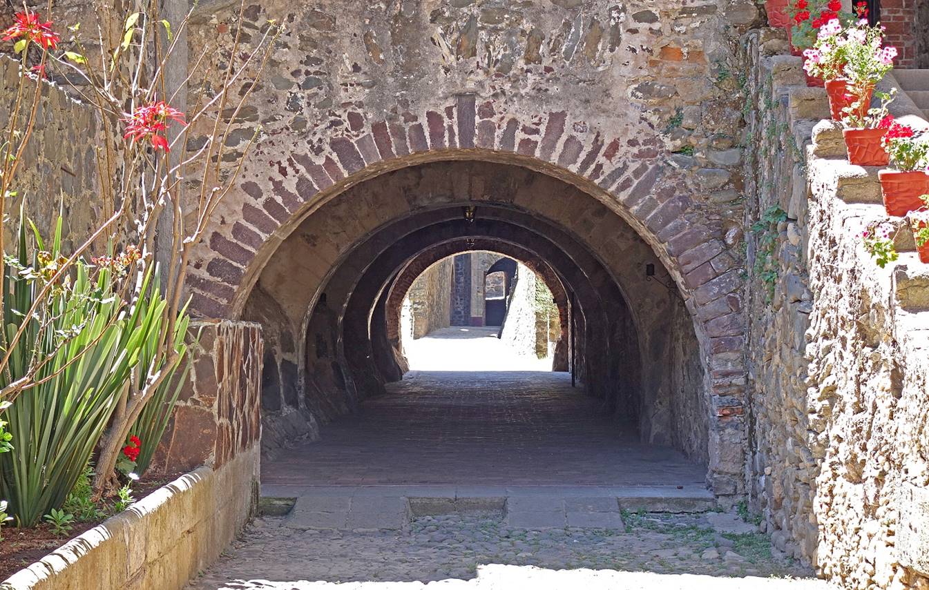
- The wall of the same corridor seen
from outside.
- The ore and tailings storage vaulted
facilities.
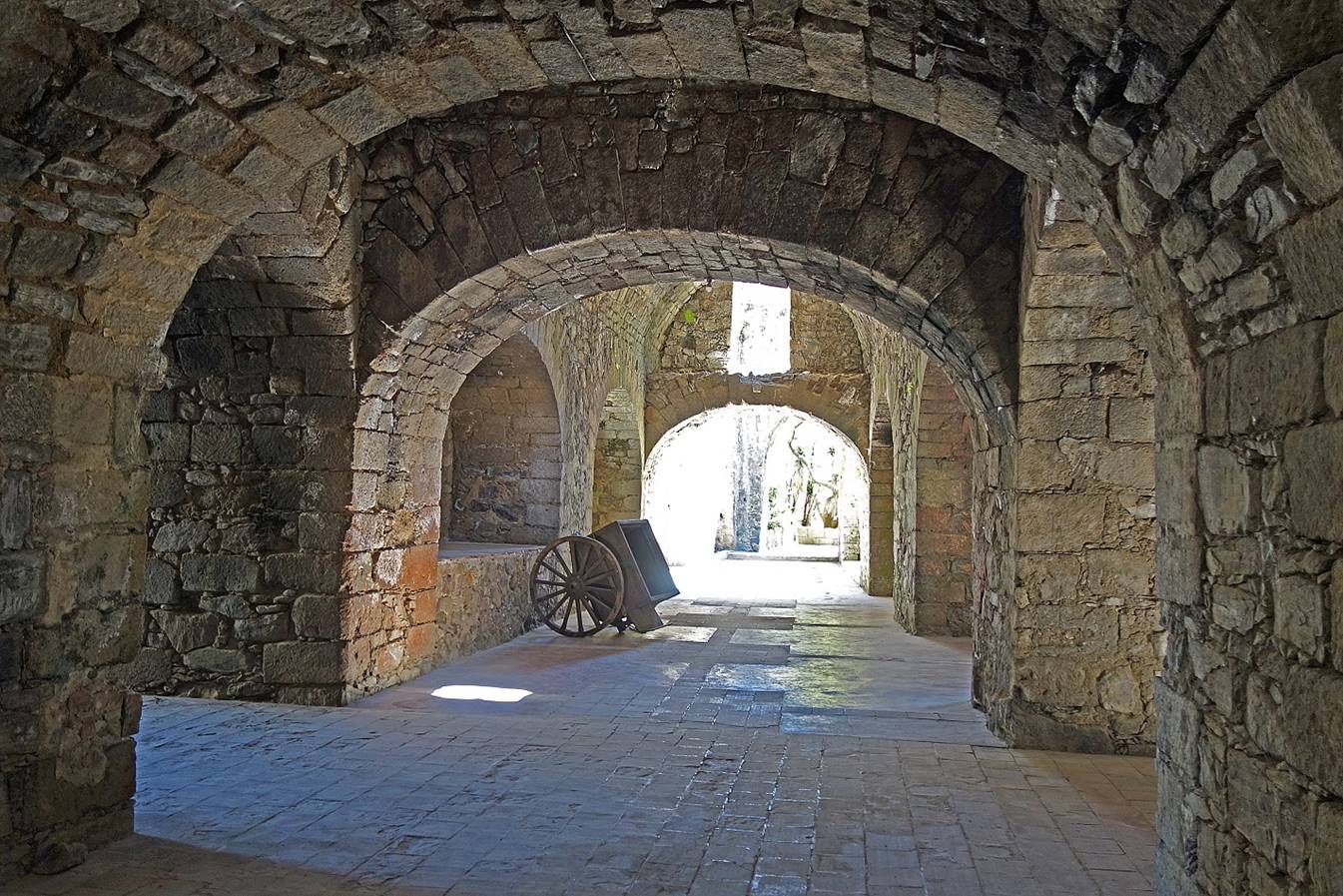
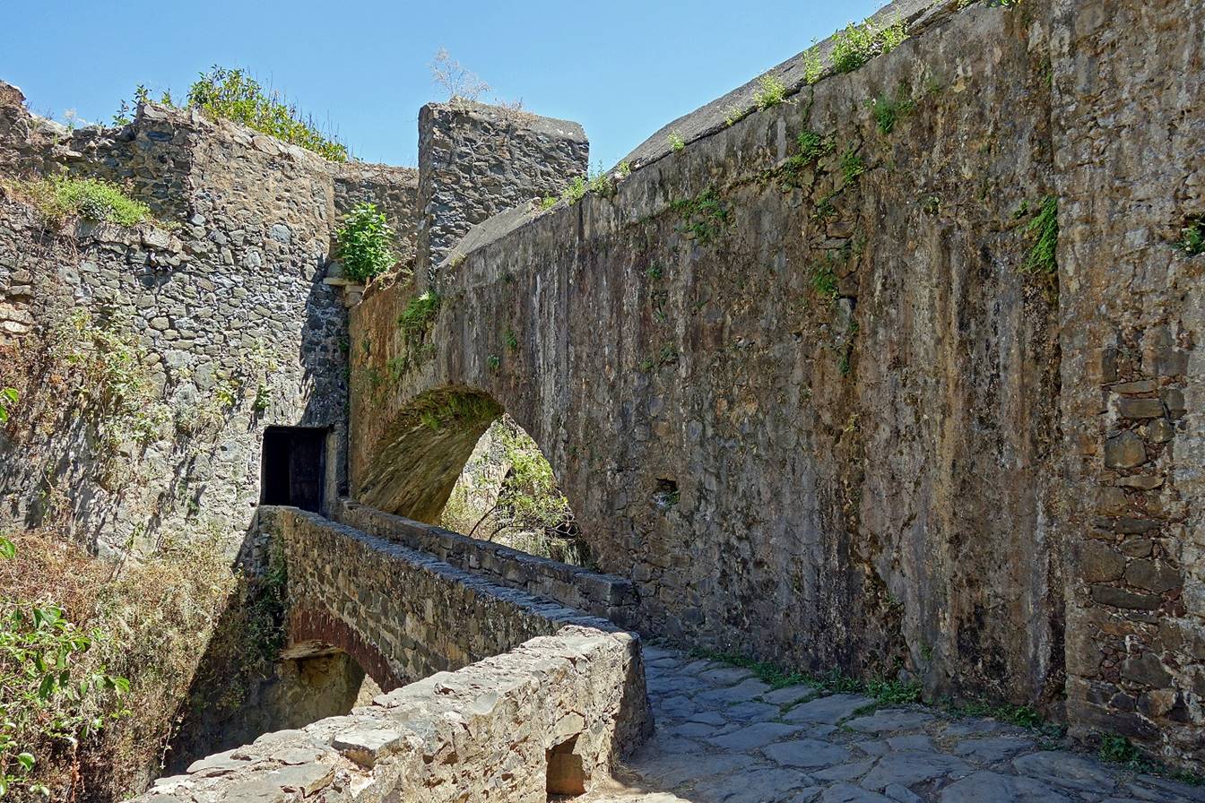
- Behind the storage facilities the
aqueduct that brings water from the Barranca de Alcholoya.
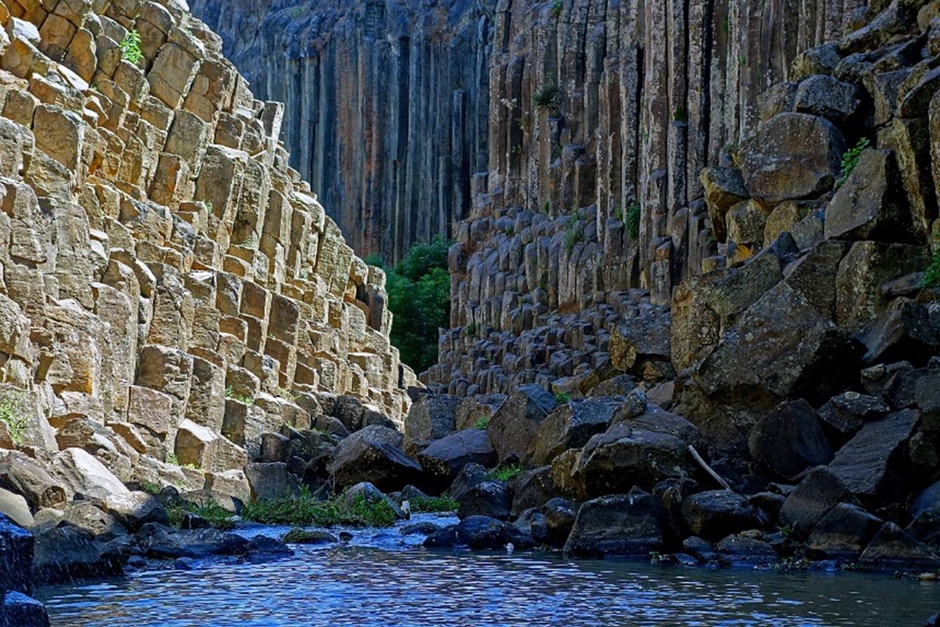
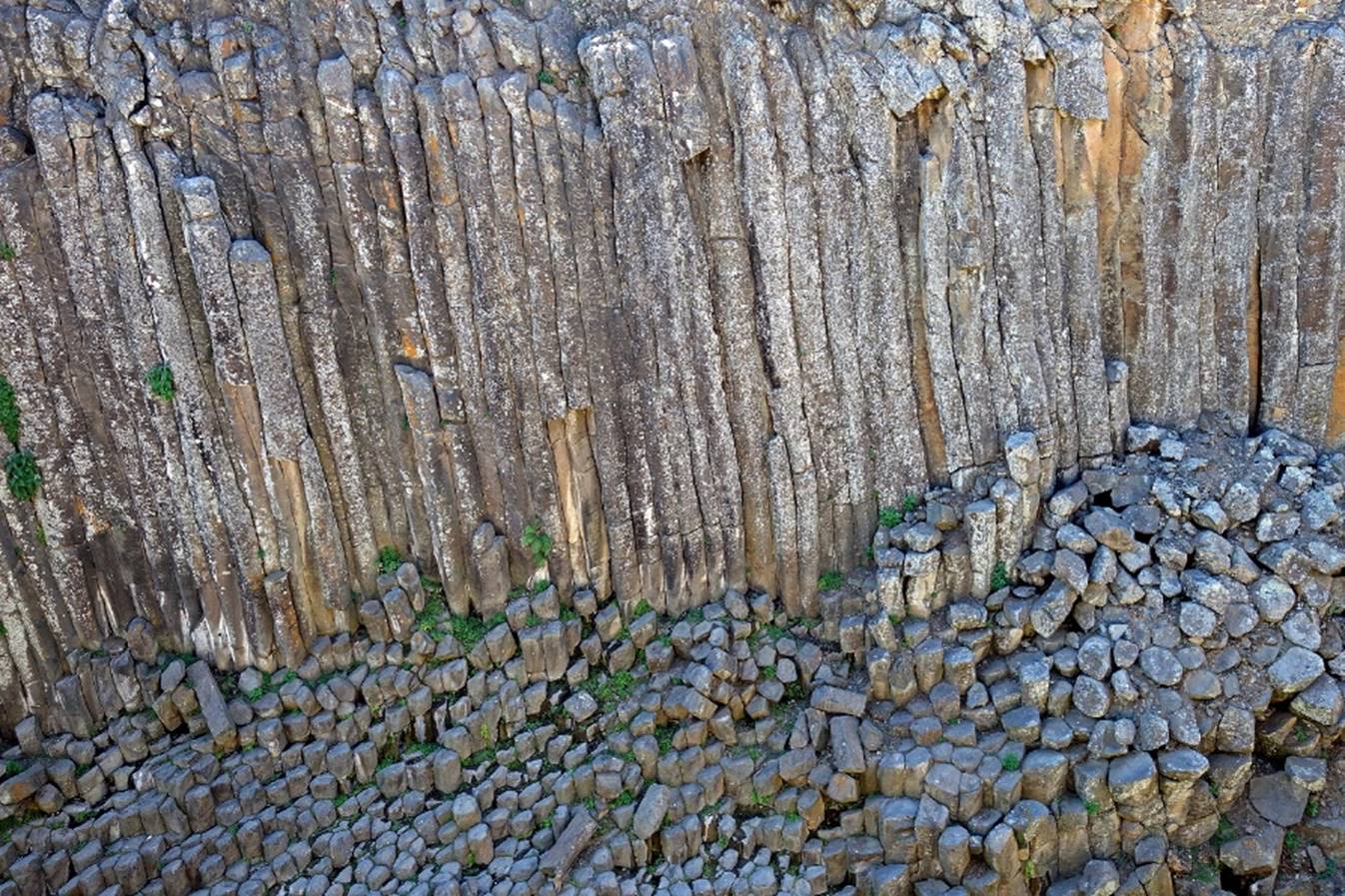
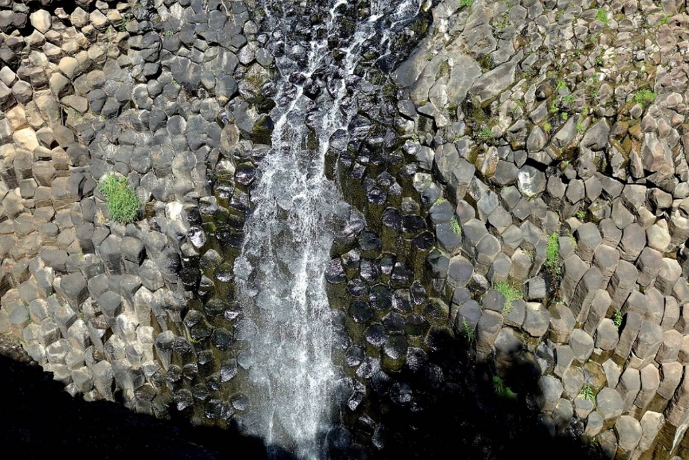
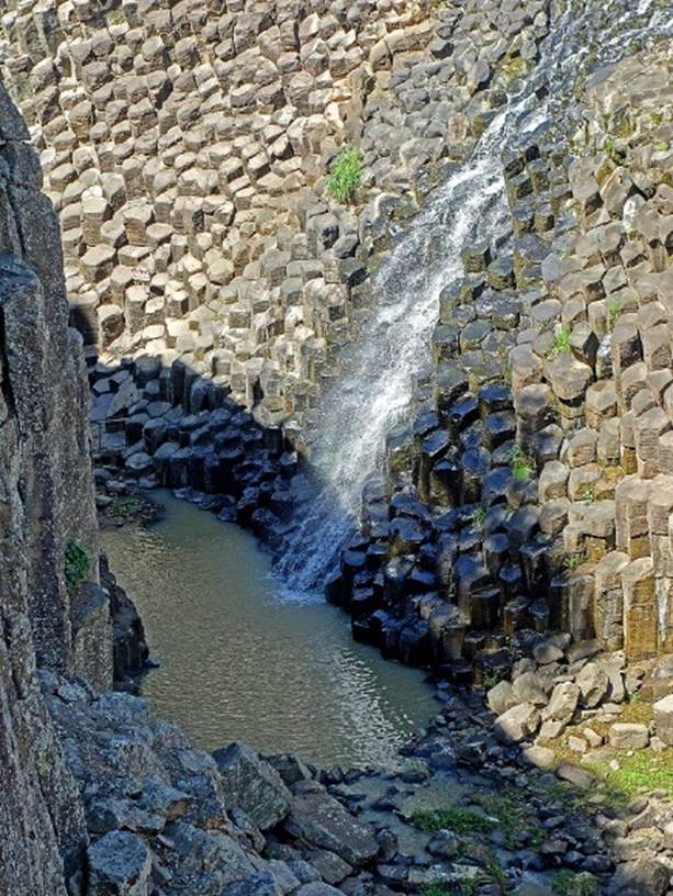
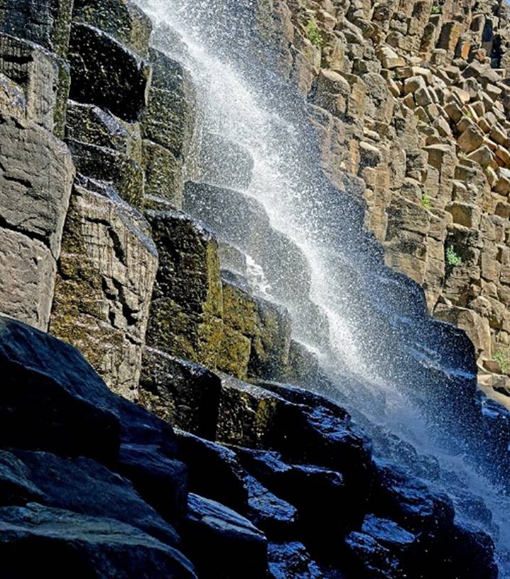
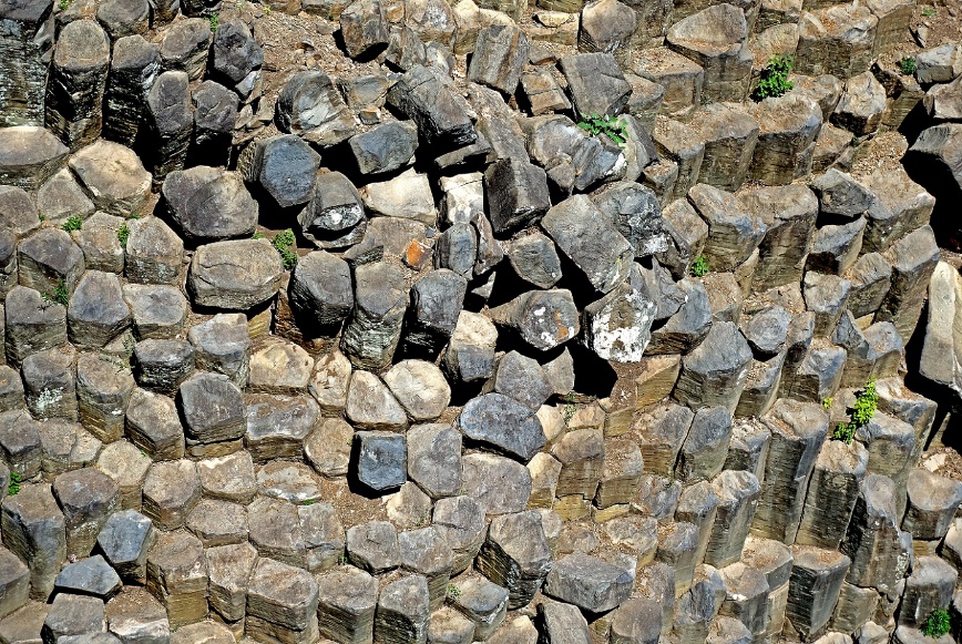
Basaltic prisms of Santa Maria Regla. They form the walls of the Barranca
de Alcholoya (canyon) located above the Hacienda
Santa Maria Regla. The prisms (polygonal columns)
were created by the slow cooling of volcanic lava. They have 5 or 6 sides and
the tallest are between 30 and 50 meters high.
|
|
|


|
|
|

|
|
|
|
|
|
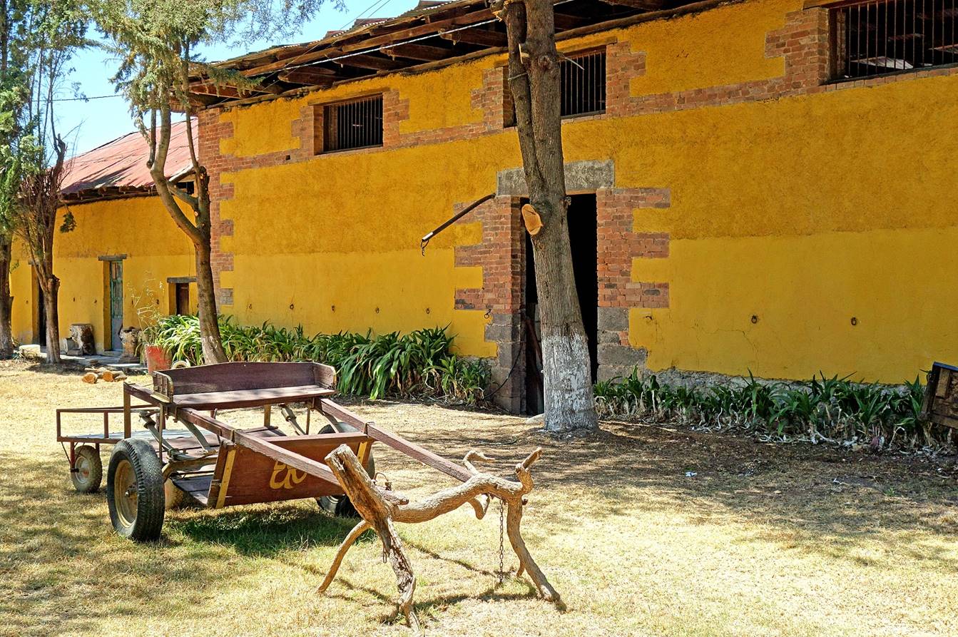
Hacienda Juan Hueyapan.
This former hacienda completed in 1550 by Don Pedro de Paz, a cousin of Hernan
Cortes, is the oldest in the region and one of the oldest in Mexico. It is a farming
hacienda based on agriculture and livestock.
- Top of entrance arch.
Main courtyard.

- Chapel opening on the main courtyard.
|
|
|

Small inner courtyard.
- Farming building.
Real (a.k.a.
Mineral) del Monte:
This small town (pop. 12,000; elev.
2700m) was one of the main mining sites in the area. Some mines have continued
production until the present time.
View over a portion of the town.
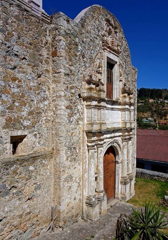
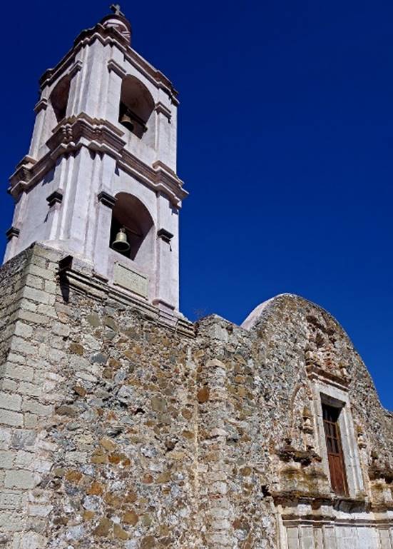
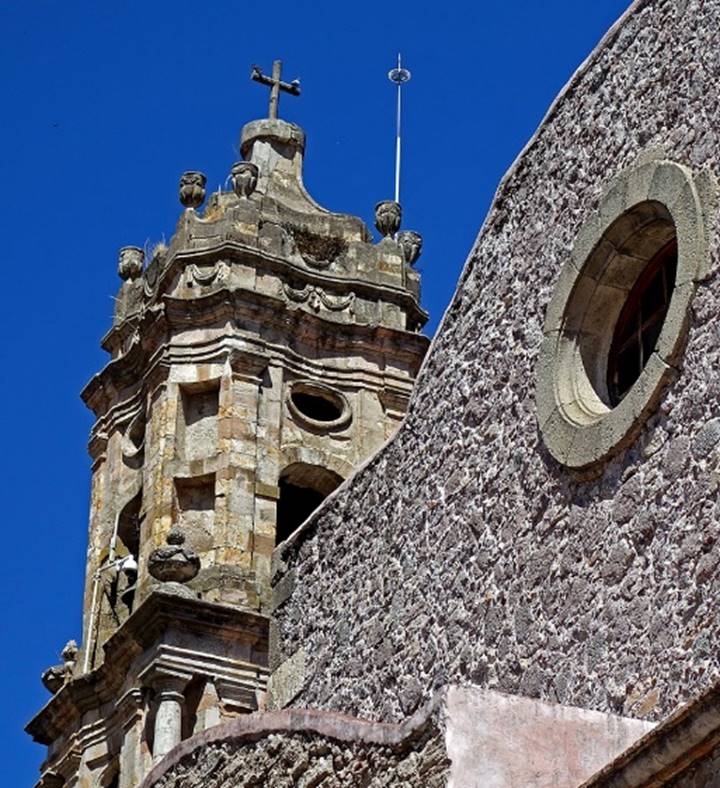
Church of Our Lady of the Ascension
(16th century), also known as Our Lady of the Rosary, standing on the eastern
side of the Plaza Principal.

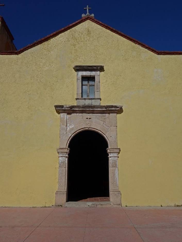
The Holy Cross Church (17th century), a
couple of blocks south-west of Plaza Principal.
|
|
|
|

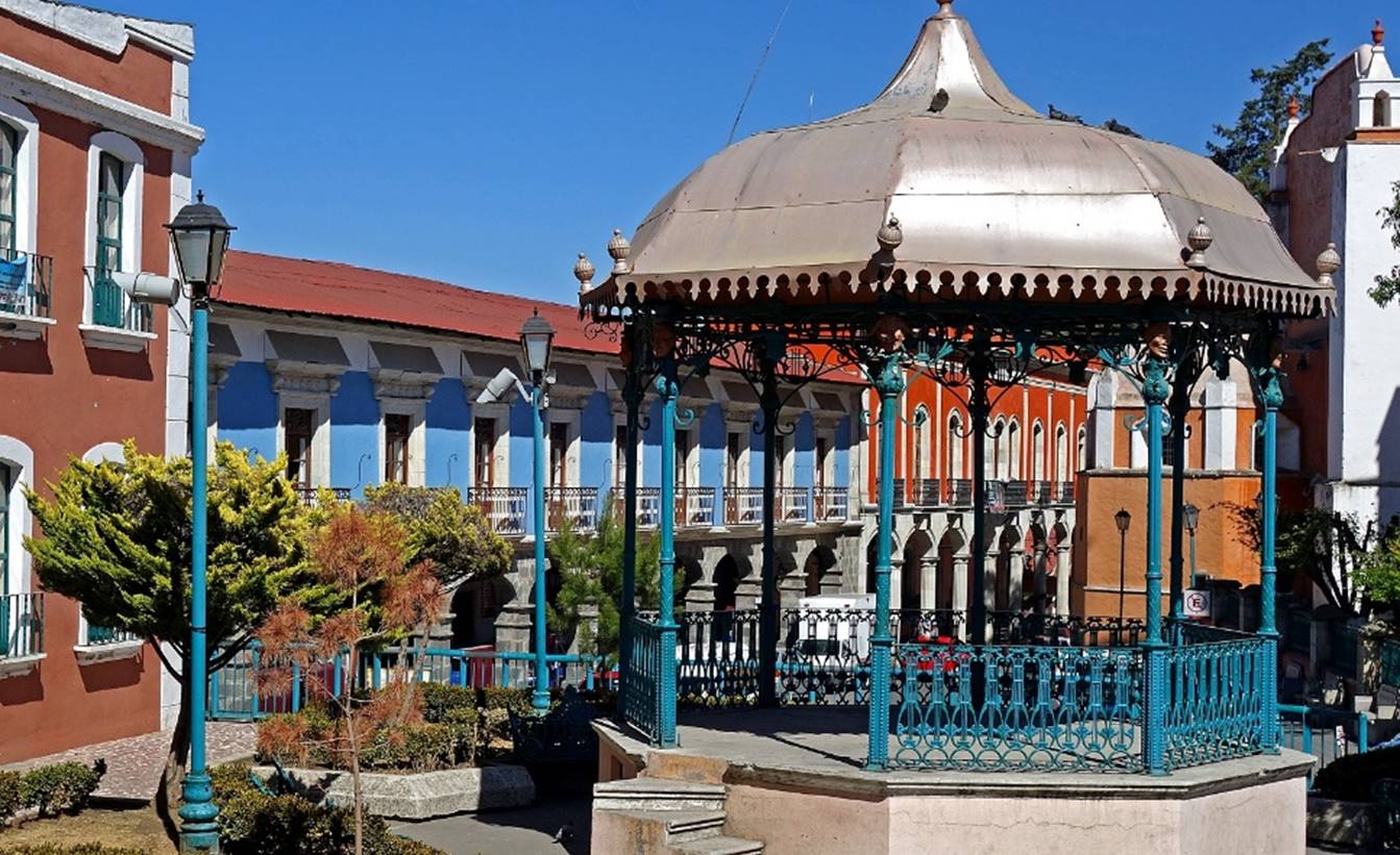
Music kiosk on the Plaza Principal, with
the shopping arcade of the Calle Lic.
Ruben Lincona Ruiz in the background.
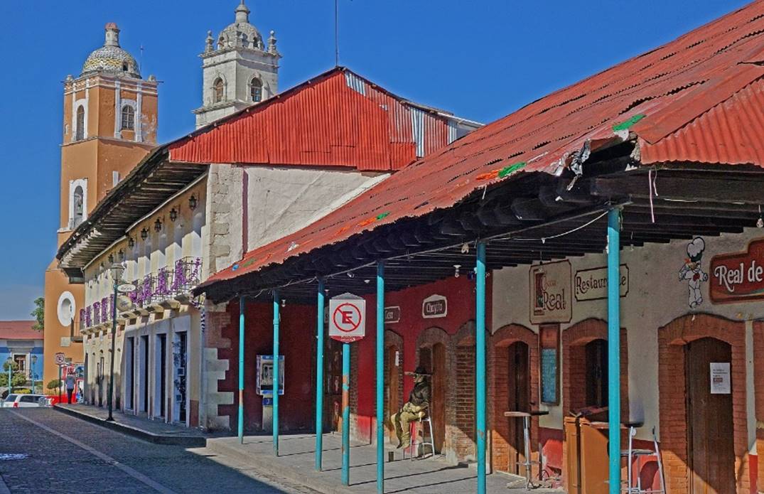
In the Avenida
Hidalgo, one of the main avenues in the town center (with a mural on the
right).
|
|
|

One of the many (hundreds?) shops making
and selling paste ingles. Every October a three-day festival held in Real de
Monte celebrates the paste.

In the Mercado Camerino
Z. Mendoza, named after a Mexican soldier that participated in the Mexican
Revolution, who was born to a miner in Real del Monte in 1879.
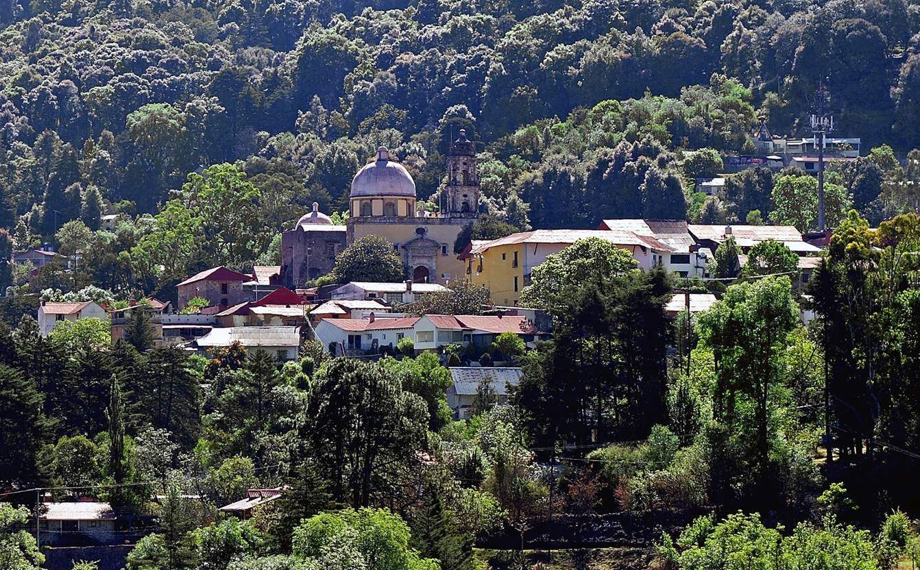
Mineral del Chico:
View of the village nested in the
surrounding forest.
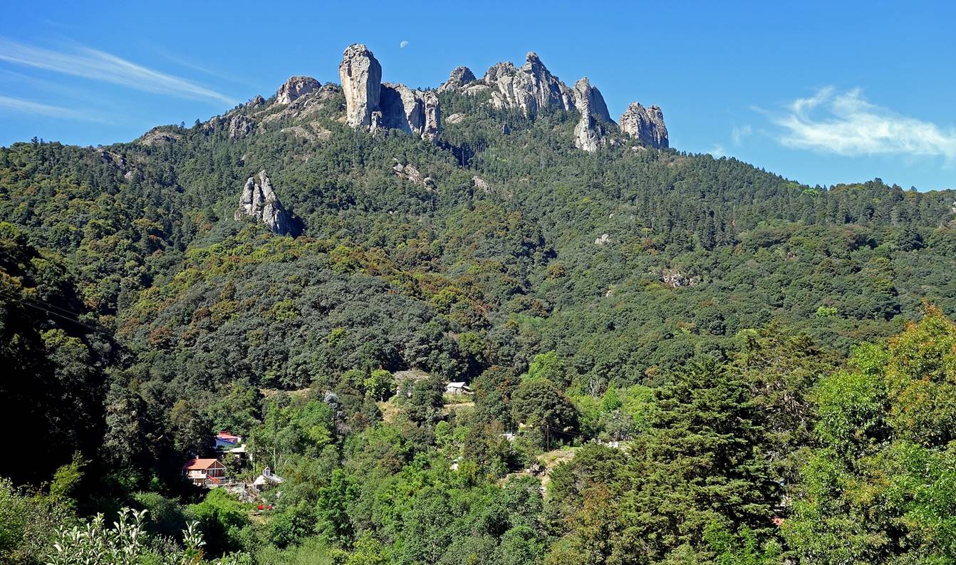
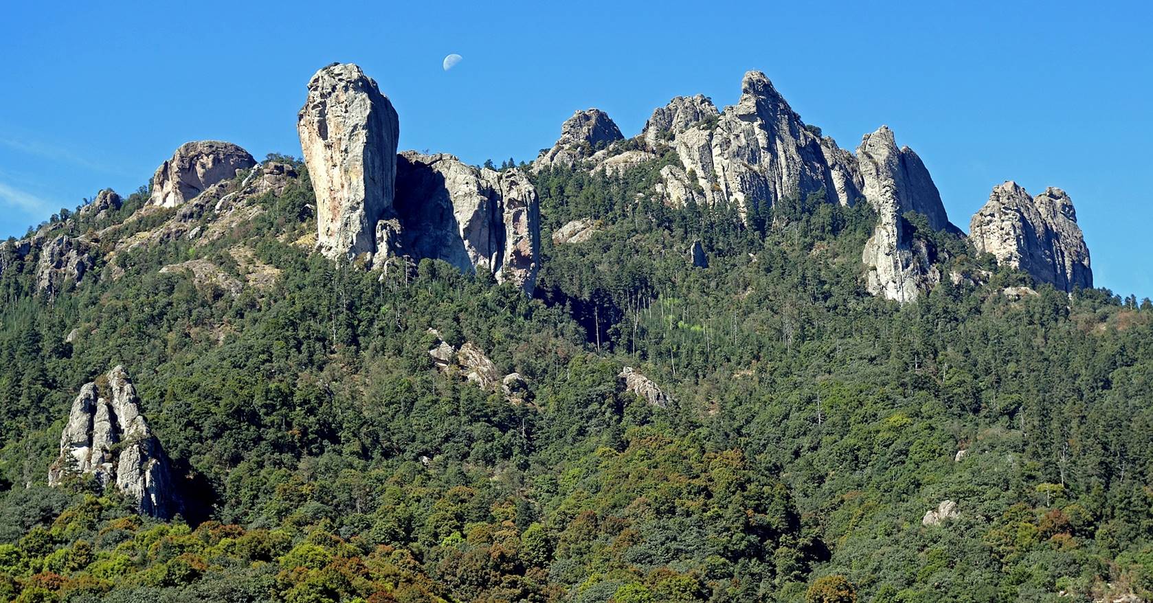
Las Monjas
(The Nuns), a rock formation that overlooks the village,
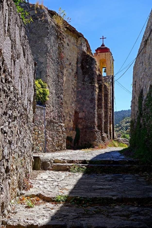
Church of the Inmaculada
Concepcion.
|
|
|

Chapel del Calvario.
|
|
|
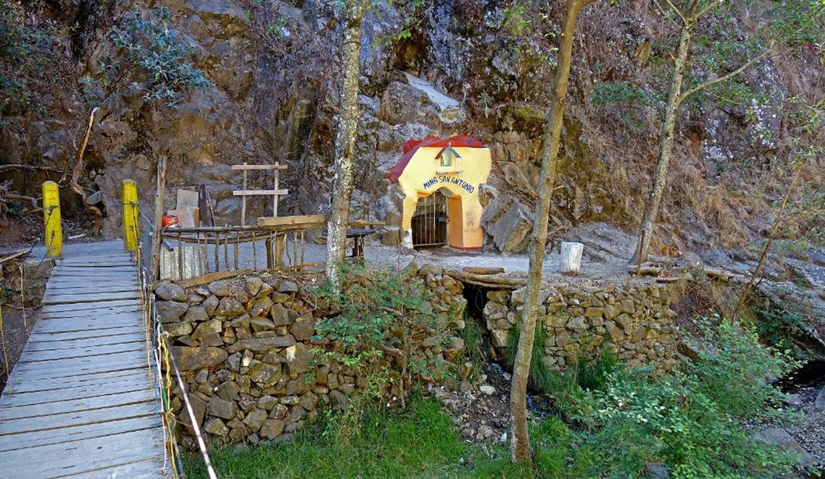
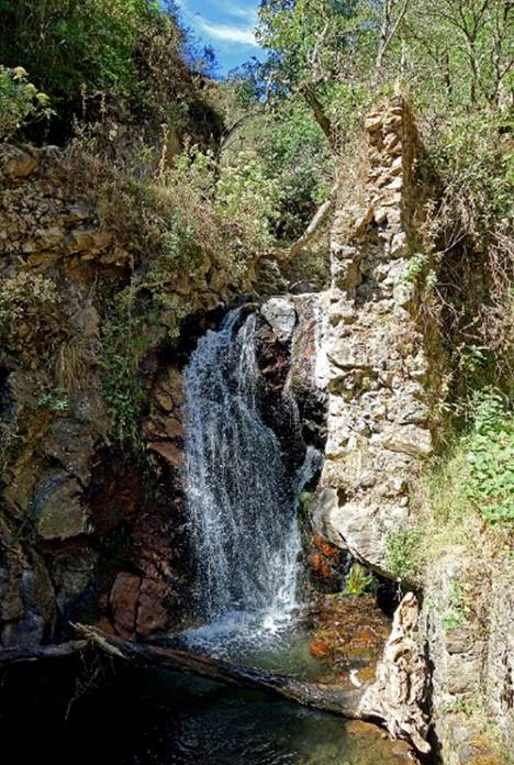
Left: Entrance of the San Antonio mine, one
of the abandoned mines along the Rio del Milagro that
flows beneath the village. Right: Waterfall on the Rio del Milagro
a short distance upstream from the San Antinio mine.
|
|
|
![]()