Mexico: State of Yucatan (2002 &
February-March 2017)

(This banner
shows the glyphs of 9 Maya gods, laid over a photo of stairs from the Pyramid
of the Magician in Uxmal. Maya
glyphs form the writing system of the Maya civilization, which
has been in continuous use throughout Mesoamerica until the Spanish
conquest in the 16th and 17th centuries.)
Return
to main Mexico (2002...) page
The state of
Yucatan is part of the Yucatan Peninsula, along with two other Mexican states
(Campeche and Quintana Roo) and the northern parts of
Guatemala and Belize. The Yucatan Peninsula itself is a (large) portion of the
ancient Maya territories, which also include the Mexican state of Chiapas, all
of Guatemala, and part of Honduras and El Salvador. The Spanish conquest in the
16th century met considerable resistance from the local people. Even much
later, the Maya people continued to engage in revolts, most notably the Caste War in
1847-1901. Efforts over several centuries to eradicate Maya traditions met only
partial success. Today Maya culture remains present everywhere in speech,
dress, traditions, food, and religion.
As the rest
of the peninsula, most of the state of Yucatan is a vast uniform lowland
limestone plain. But it is endowed with stunning archeological Maya sites (some
of which have yet to be excavated or even discovered), beautiful cities and
villages, old-fashioned colonial churches and convents, and crystal-clear
subterranean water pools (cenotes).
I have
traveled twice to the state of Yucatan, in 2002 and February-March 2017. Except when it is indicated otherwise,
the photos below were taken in 2017.
Merida:
Merida is the
administrative capital of the state of Yucatan, as well as the cultural capital
of the Yucatan peninsula and its largest city (pop. about 1,000,000). It is
located some 35km inland south of the coast of the Gulf of Mexico. It is a
thriving city, home of several universities and many theaters, art galleries,
and museums. It retains a pleasant and friendly atmosphere. Although its
inhabitants are in majority of Maya ethnicity, the main sights of the city
(cathedral, churches, plazas, streets...) feel very colonial in style. In fact,
several colonial religious buildings were built on the site of former Maya
temples, using the stones of these temples.
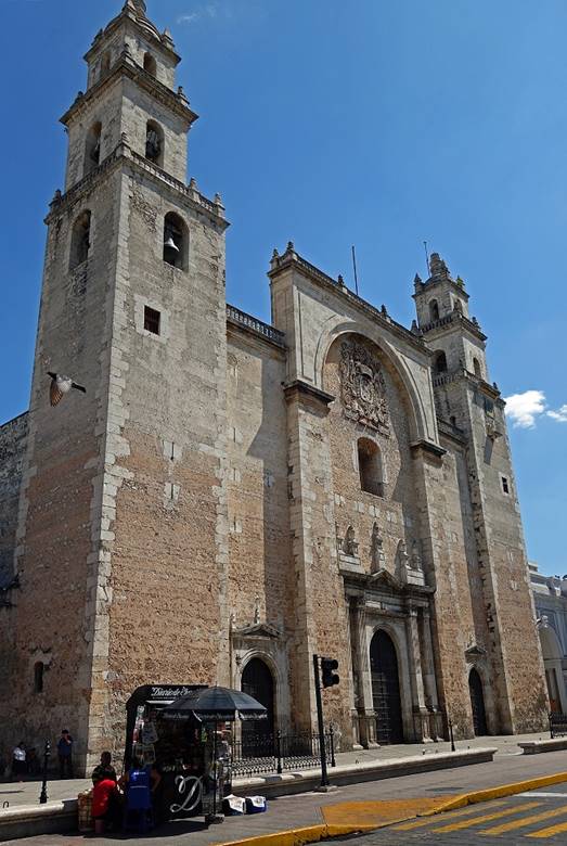
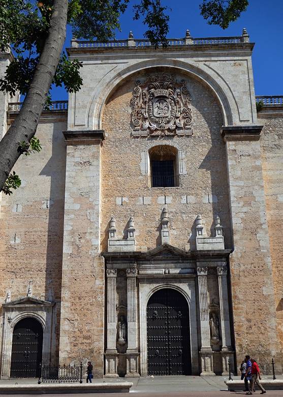
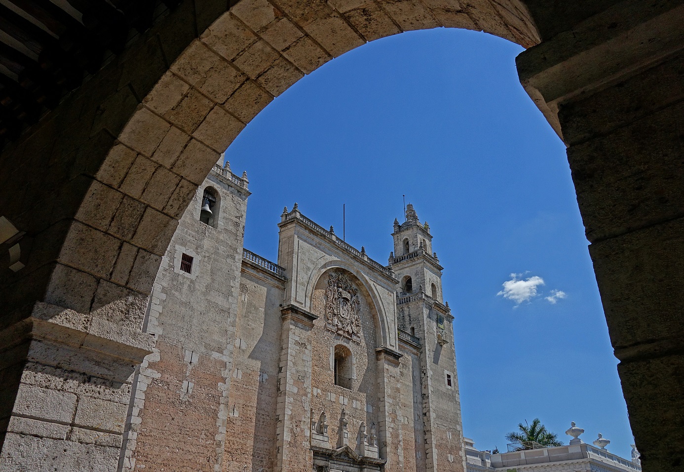
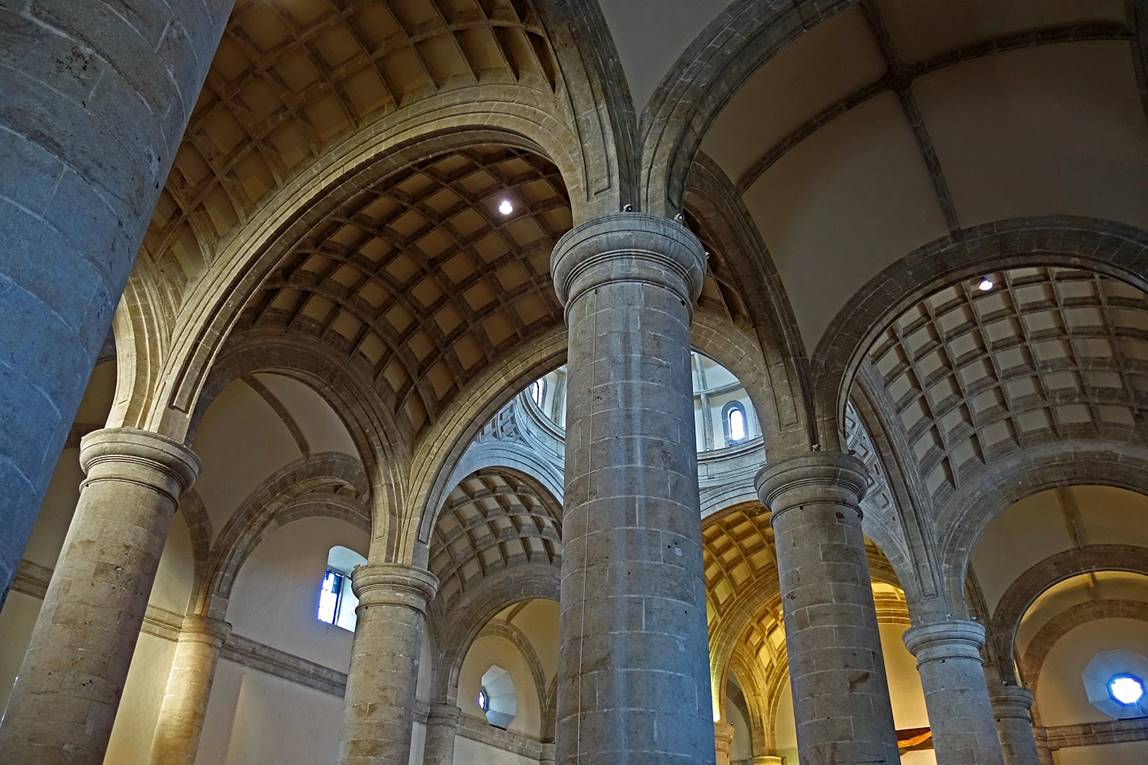
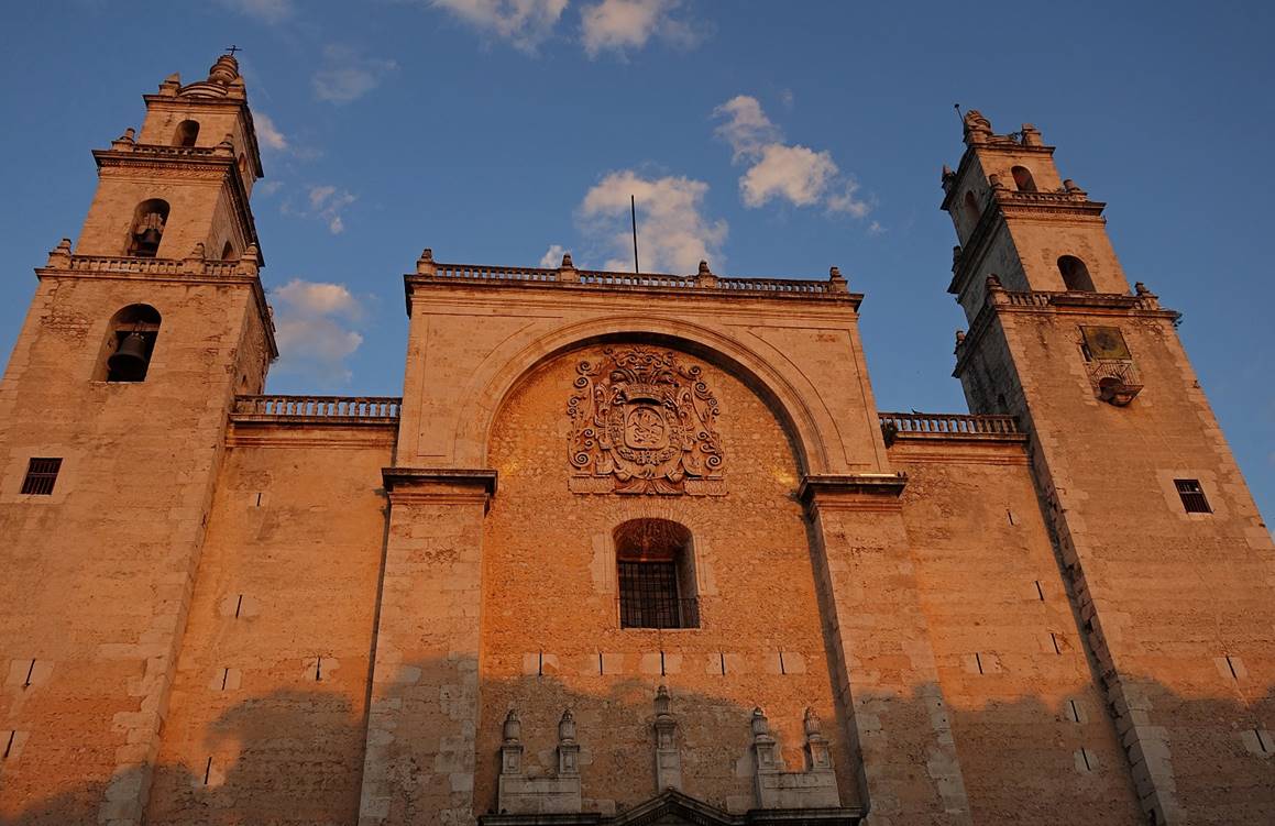
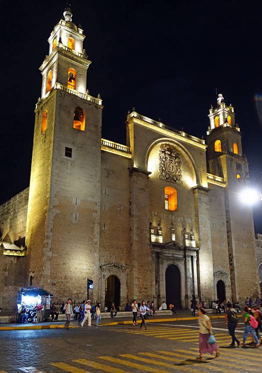
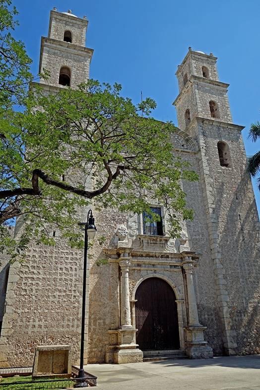
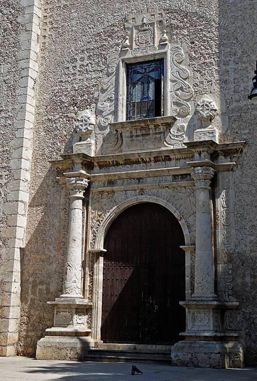
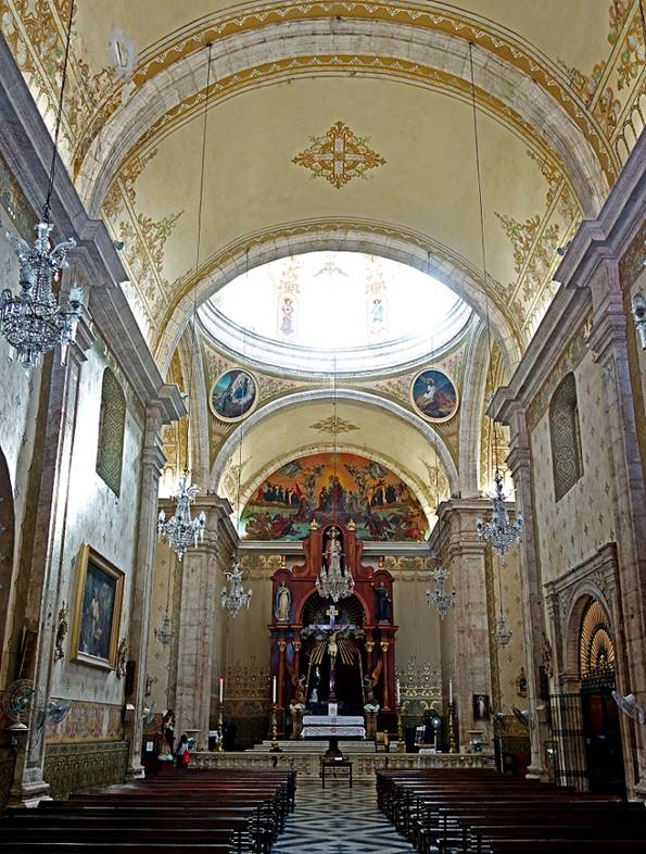
Cathedral of San Idelfonso (16th century) on Plaza Grande.
|
|
|
|

|
|
|

|
|
|
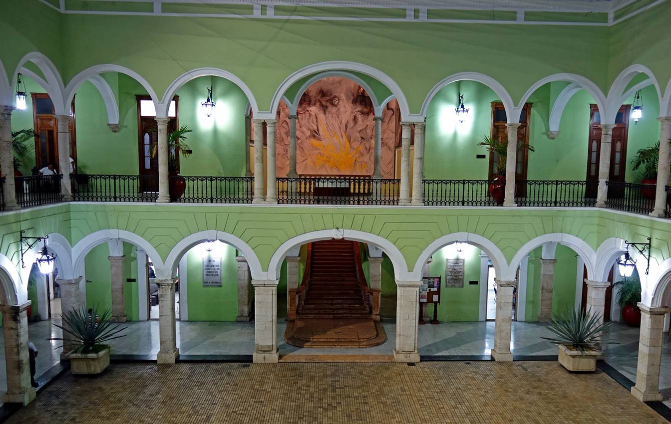
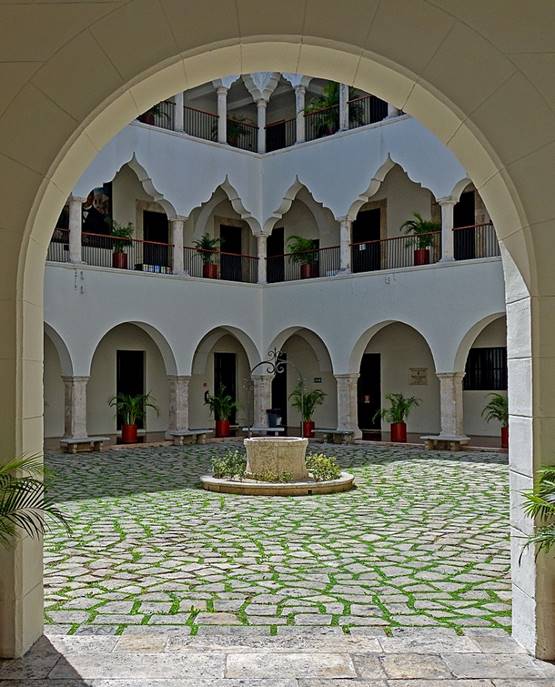
Palacio de Gobierno built in 1892, also located on Plaza Grande:
- Inner courtyard
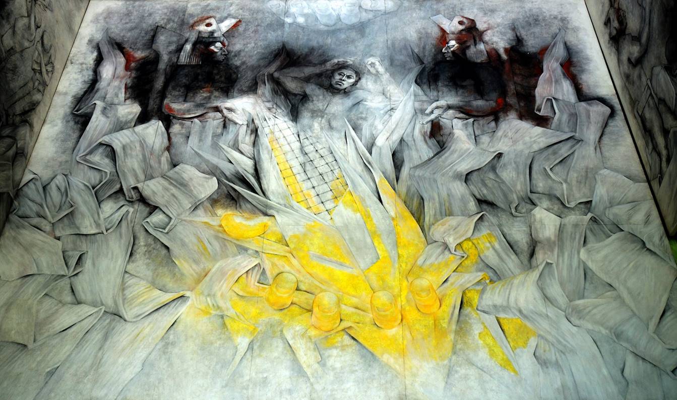
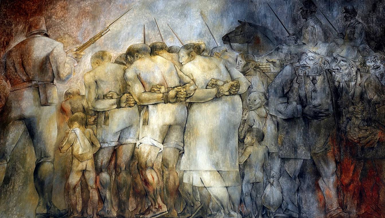
- Mural by Fernando
Castro Pacheco, a Yucatan painter, in the staircase (visible in the previous
photo). It represents gods observing their creation, a Maya man emerging from an
ear of maize.
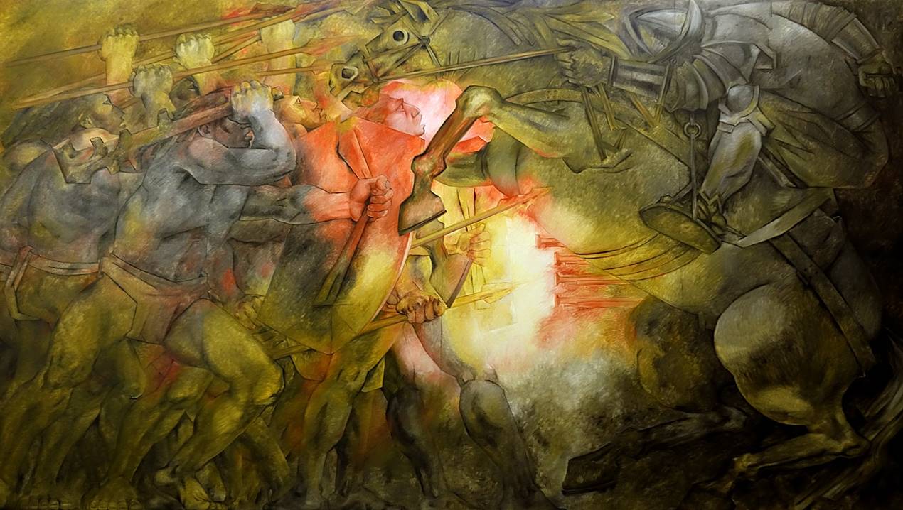
- Paintings by Fernando
Castro Pacheco in the History Room (Sala de la Historia):
trade of Indian slaves, the Conquest (la Conquista), and Franciscan priest
Diego de Landa (who was responsible for the burning
of Maya manuscripts and cult artifacts in Mani on July 12, 1562).
|
|
|

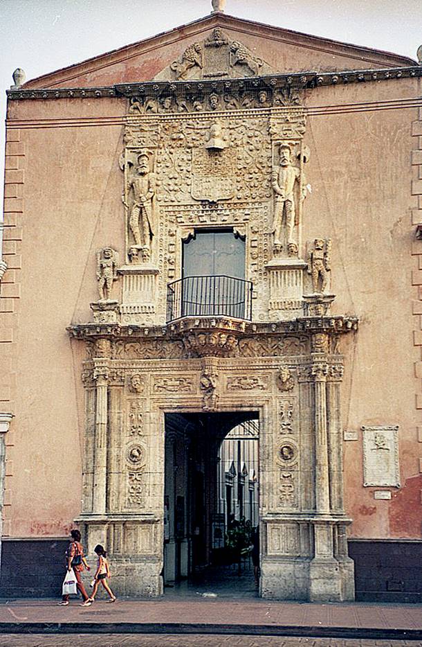
Facade of Casa de Montejo
(16th century), on Plaza Grande. On the sides of the window above the gate, two
conquistadors stand on the heads of barbarians. (Photo
taken in 2002.)
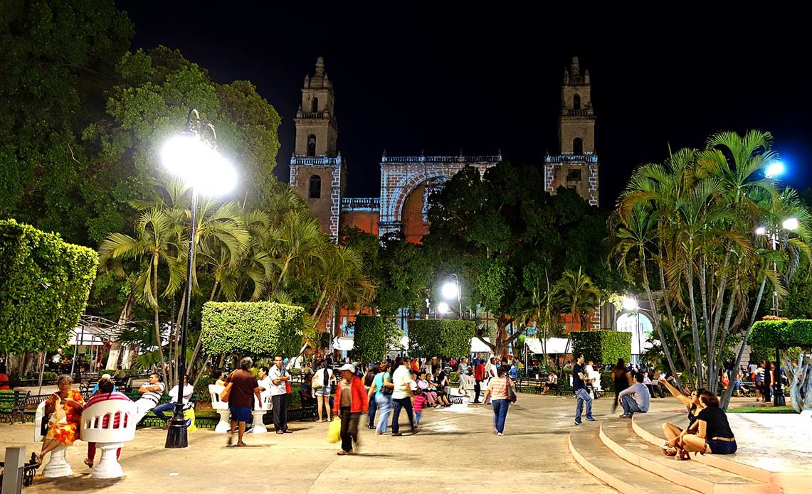
Plaza Grande at night,
with its typical face-to-face dual chairs called ″confidenciales″.
|
|
|

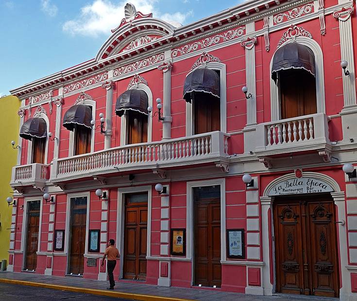
Colorful buildings in the
historic center of Merida.
|
|
|

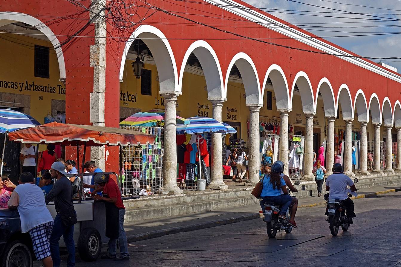
Arcade near the Mercado Lucas de Galvez.
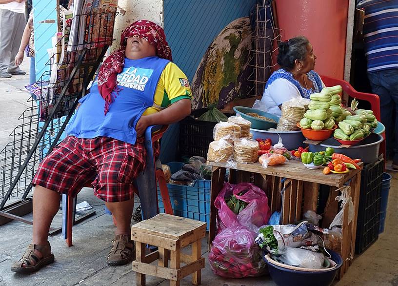
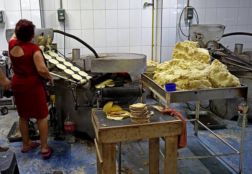
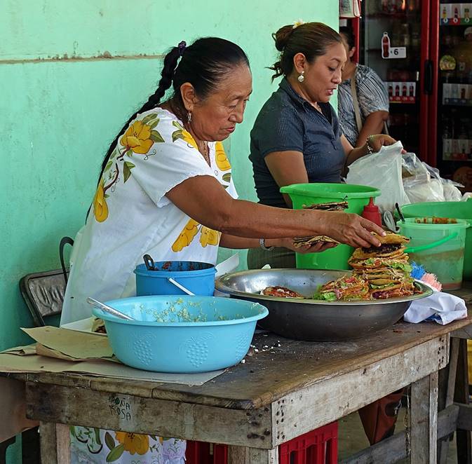
In the Mercado Lucas Galvez.
Left: man taking a nap. Right: woman making tortillas.
|
|
|
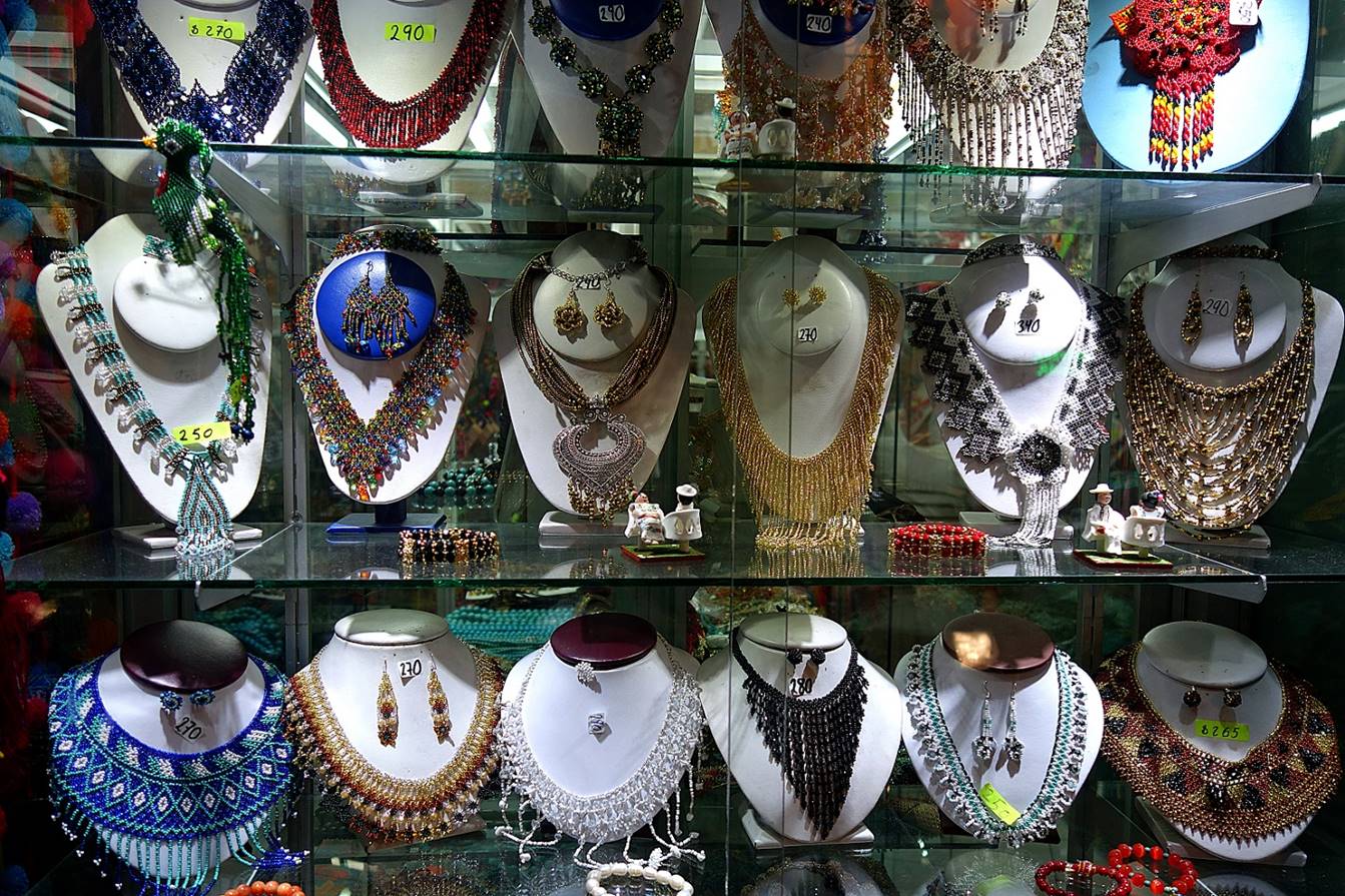
Local jewelry on display
in a window shop.
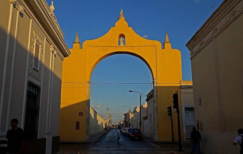
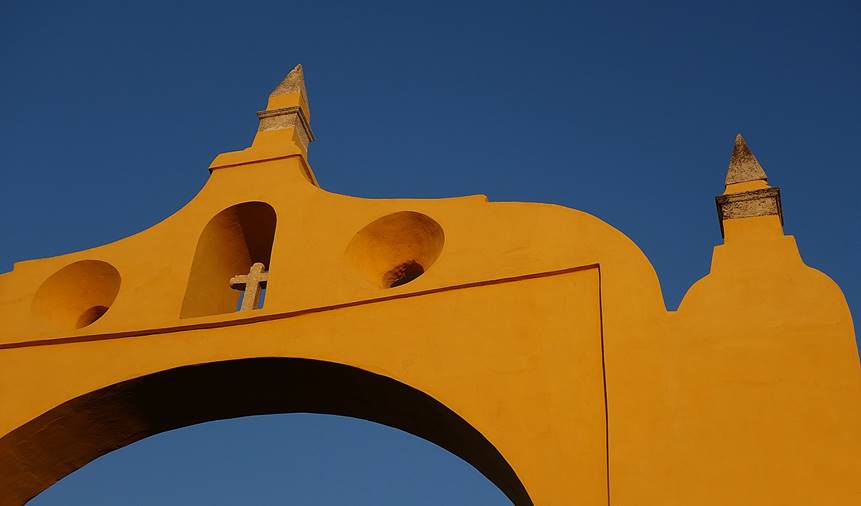
Arches on the eastern
side of the old town. Left:
Arco Dragones. Right: Arco del Puente.
|
|
|
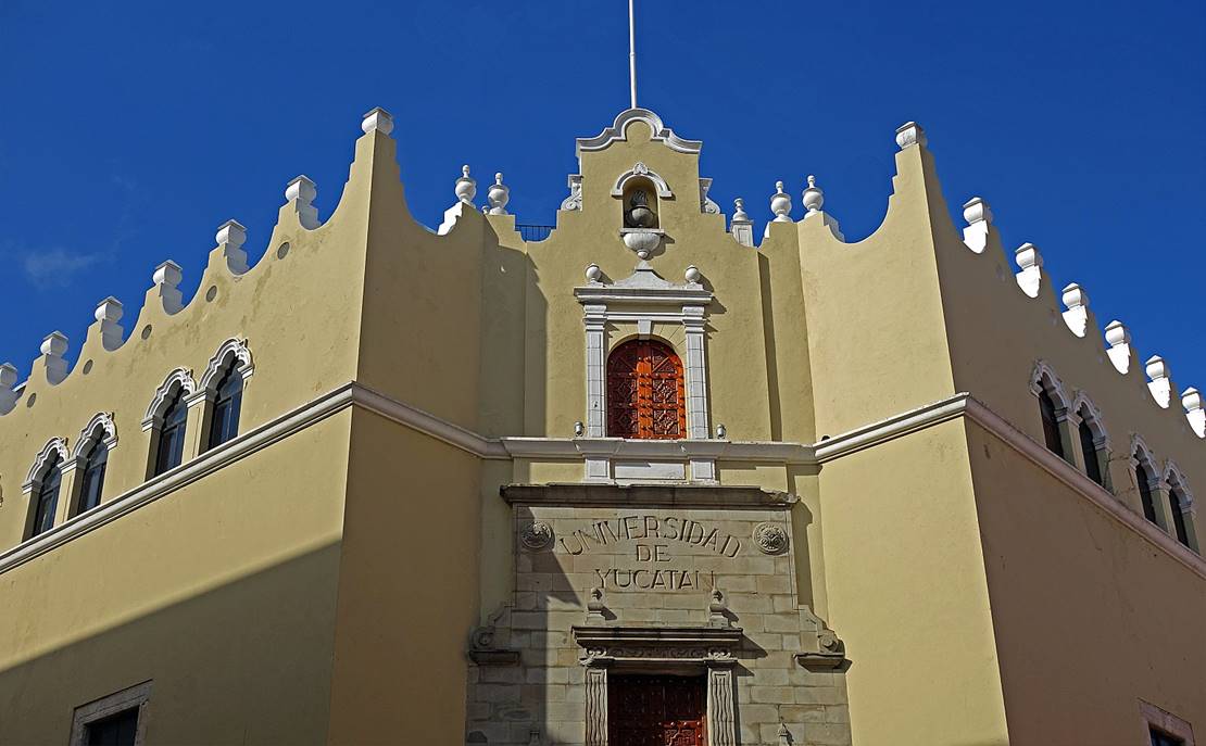
Old building of the
former Universidad de Yucatan (now la Universidad Autonoma
de Yucatan).
|
|
|
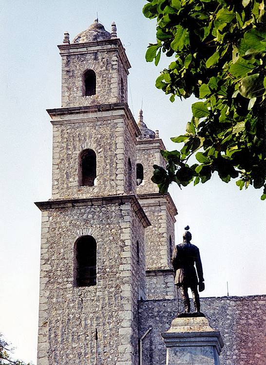
Iglesia de Jesus (17th century). The last (5th)
photo below (taken in 2002) shows a statue of General Manuel Cepeda Peraza, a native of Merida, in the adjacent Parque Hidalgo.
|
|
|
|
|
|
|
Iglesia de Santa Ana (18th century).
|
|
|

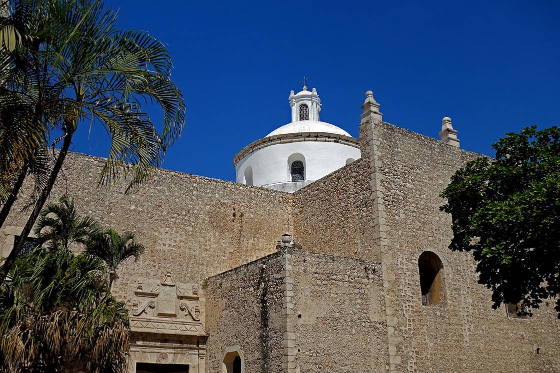
Iglesia de la Mejorada (17th century).
|
|
|
Building of the Gran Museo del Mundo
Maya, the architecture of which is intended to be an expression of the Ceiba tree venerated by the Mayas.

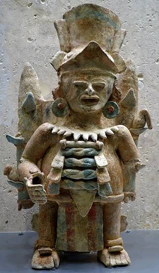
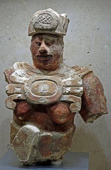
Sculpture and statuettes
in the Gran Museo del Mundo Maya.
|
|
|
|
|


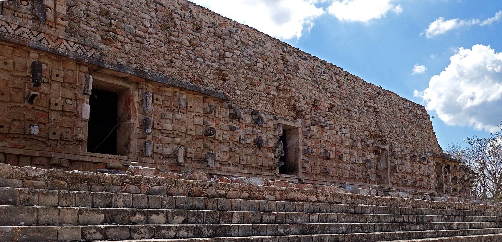
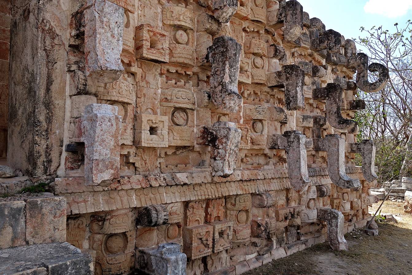
Kabah:
This Maya archeological site is located 80km south of Merida.
View of the
amazing El Palacio de los Mascarones
(Palace of the Masks), which is decorated by hundreds of trunk-nosed masks of Chaac, the Maya rain god. Unfortunately, only a few of the
long noses are intact (see 4th photo below)

Stones carved
with Maya glyphs (remains of the former Altar de los Glifos) lying in front of the Palacio de los Mascarones.

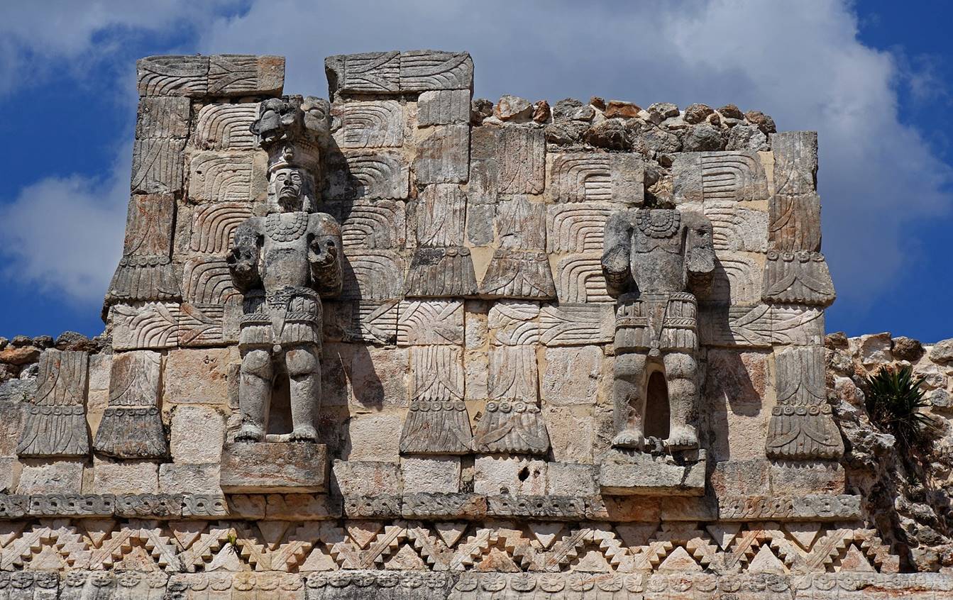
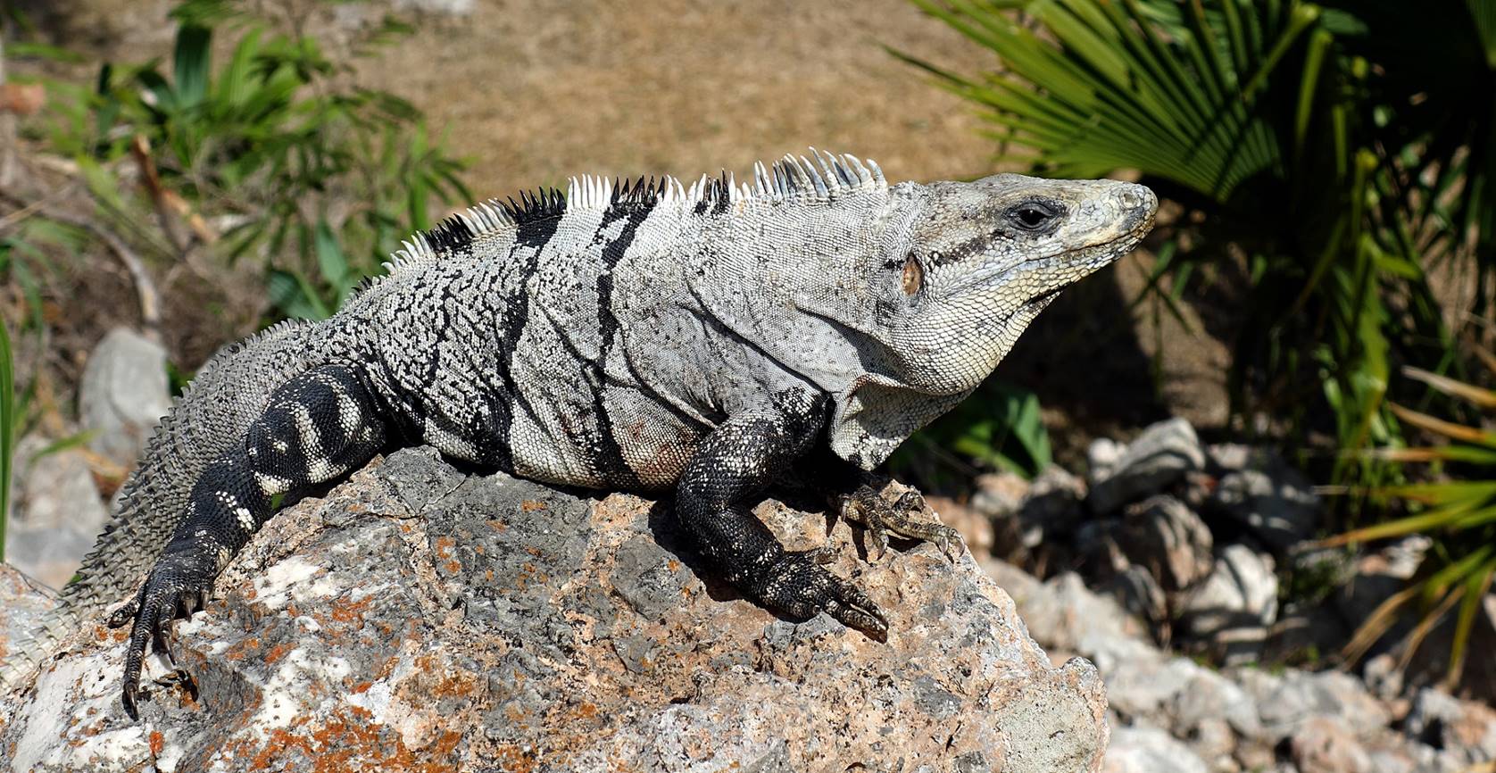
Atlantes on
the backside of the Palacio de los Mascarones. The atlante on the
left wears a jaguar mask on top of his head. (Note the iguana between the two
feet of the atlante on the right!)
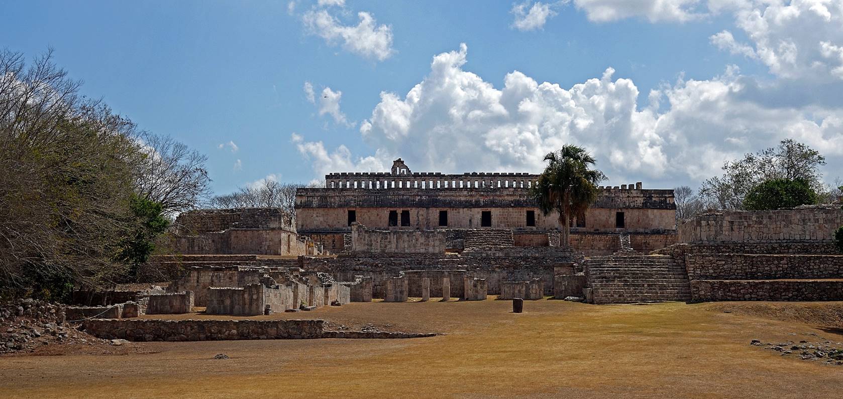
El Palacio (not the same as El Palacio de los Mascarones) and its plaza. The backside of El Palacio de los Mascarones is visible on the right of the second photo
below.
The circular Gran Pyramide seen from
the Palacio de los Mascarones.
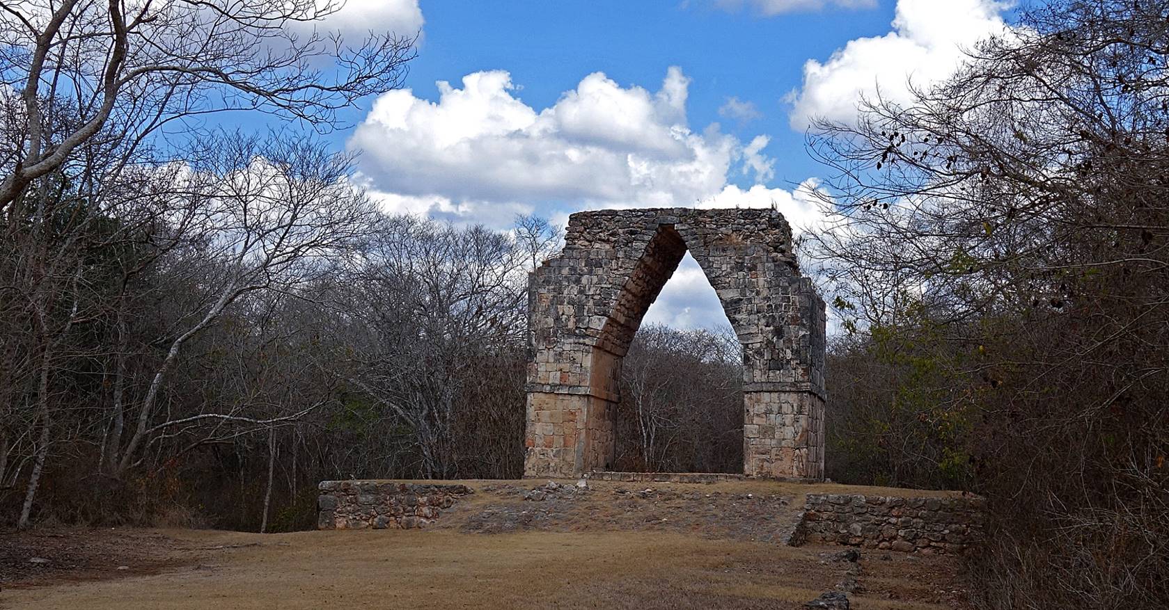
Arch of Kabah that marked the start of the old sacbe
(raised paved road built by the Mayas) connecting Kabah
to Uxmal 19km to the northwest.
Two of the
numerous iguanas that have made the ruins of Kabah
their home.

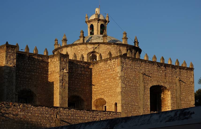
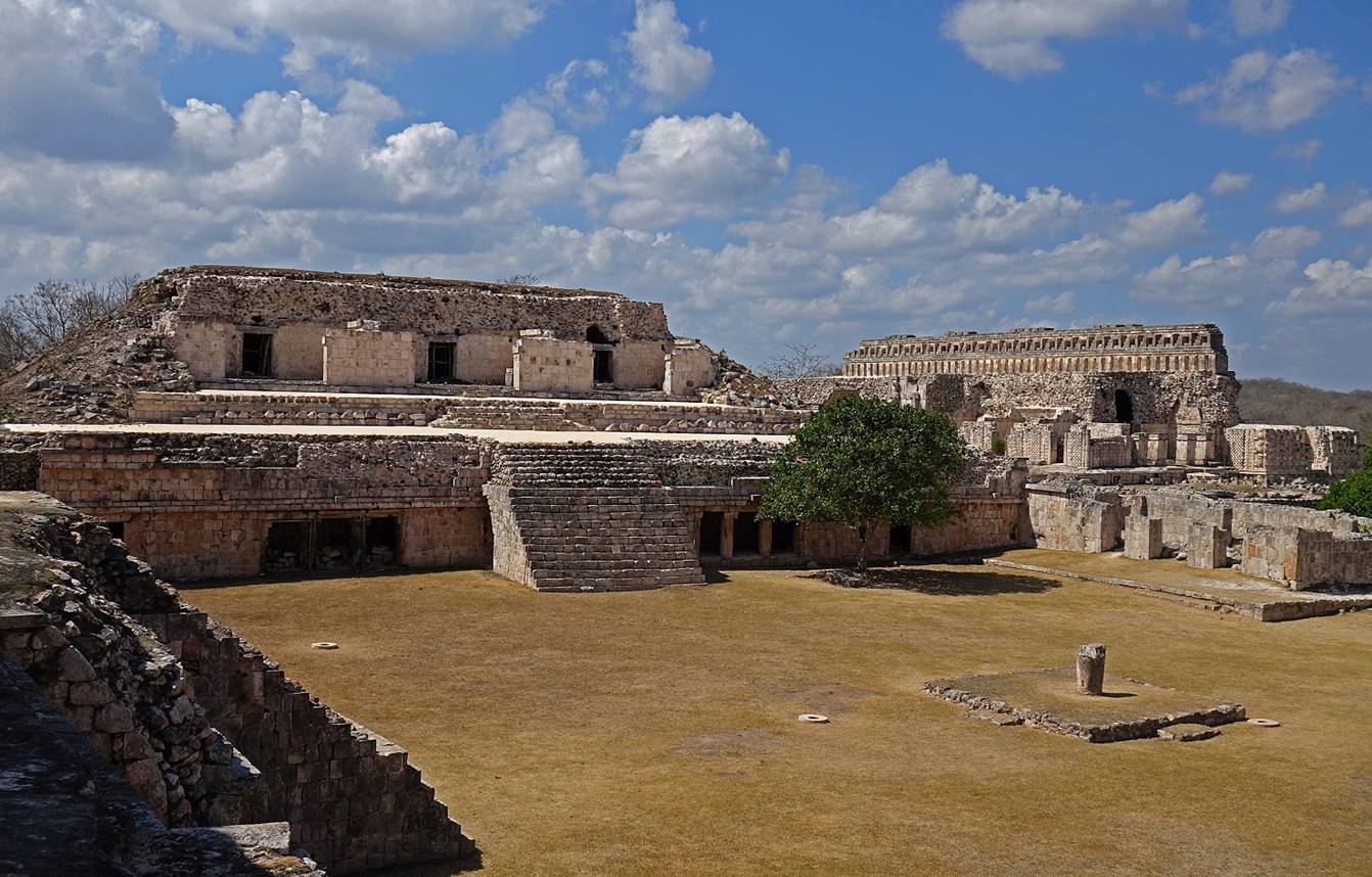
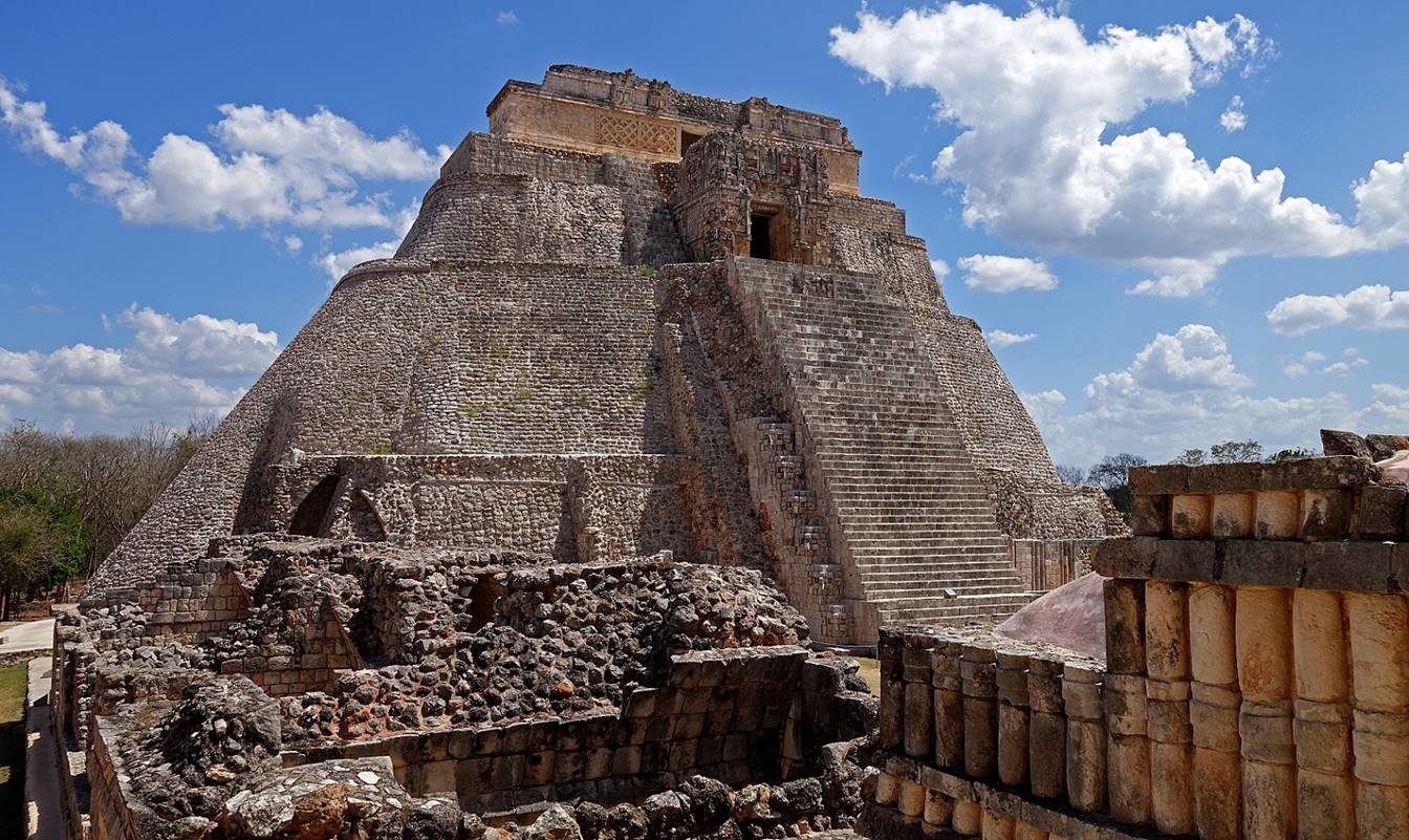
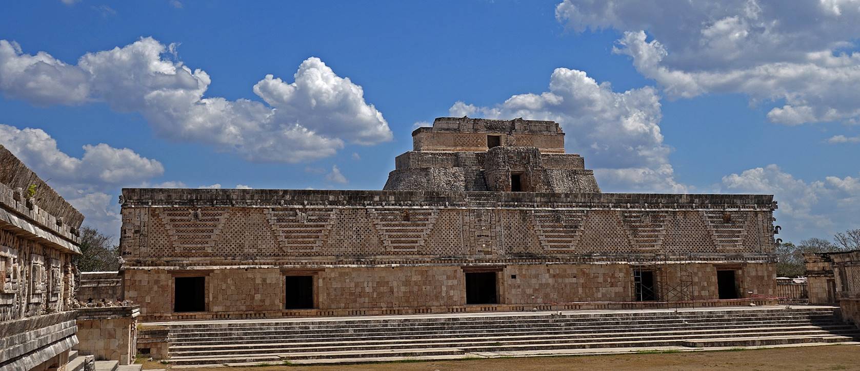
Uxmal:
This archeological site located 70km south of Merida is the second most
heavily restored and visited Maya site in the state of Yucatan, just behind Chichen Itza.
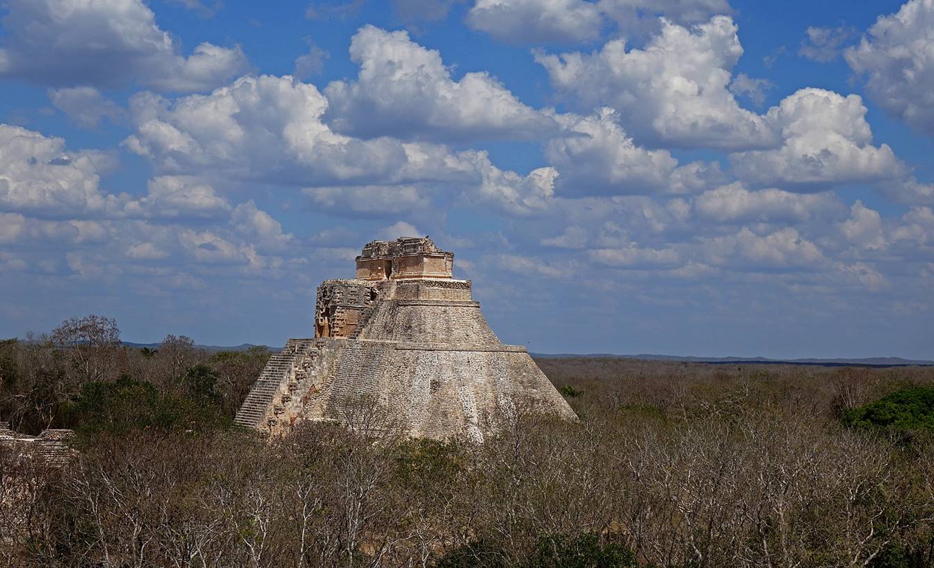
The oval-shaped Piramide del
Adivino (Pyramid of the Magician), around 35m high.


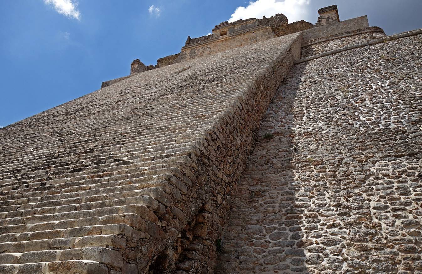
View of the other (western) side of the Piramide
del Adivino and close-up on
its temple at the top.

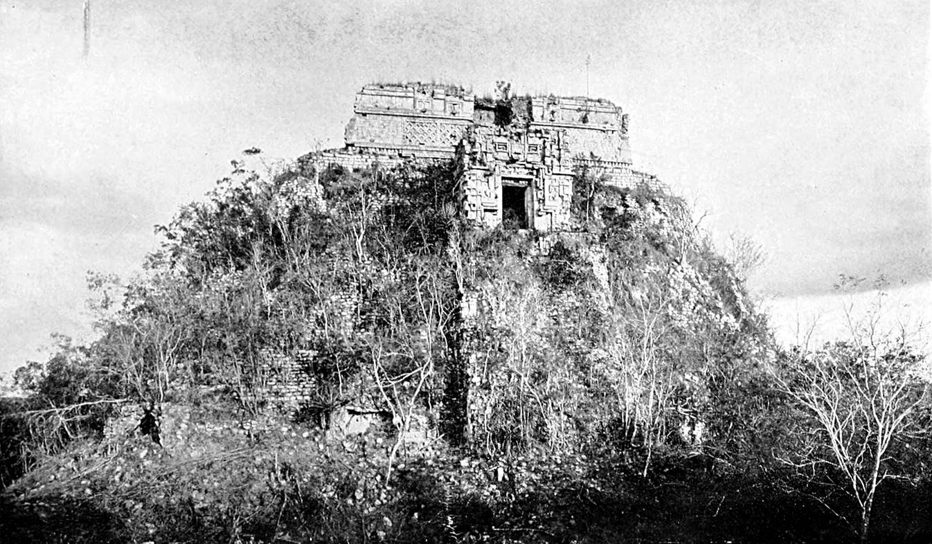
The pyramide in 1913! (Source: https://commons.wikimedia.org/w/index.php?title=File:The_American_Indian.djvu&page=10.)
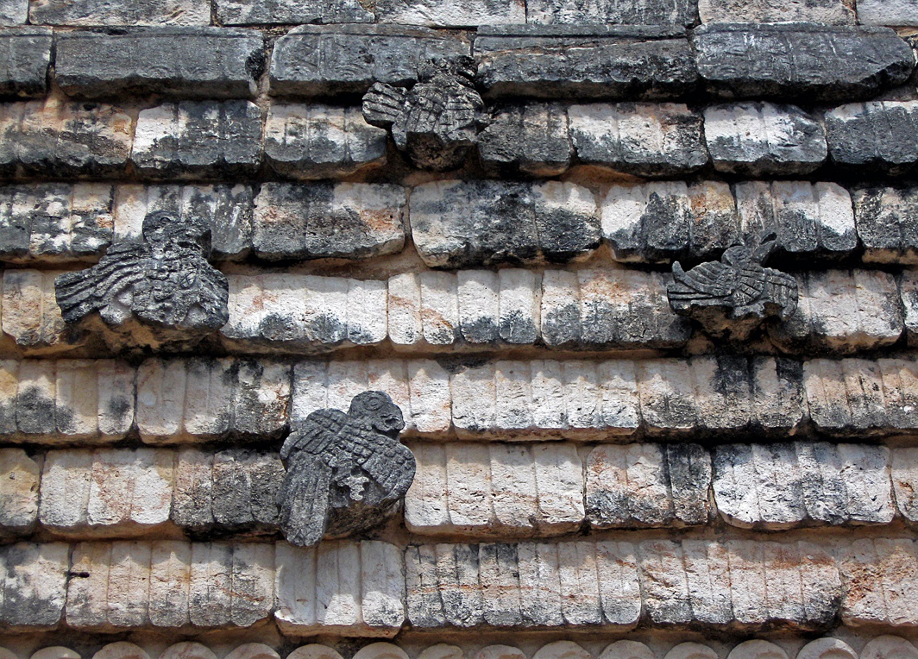
Representation of macaws on the roofline of the Cuadrangulo
de los Pajaros (located on
the western side the Piramide el Adivino).
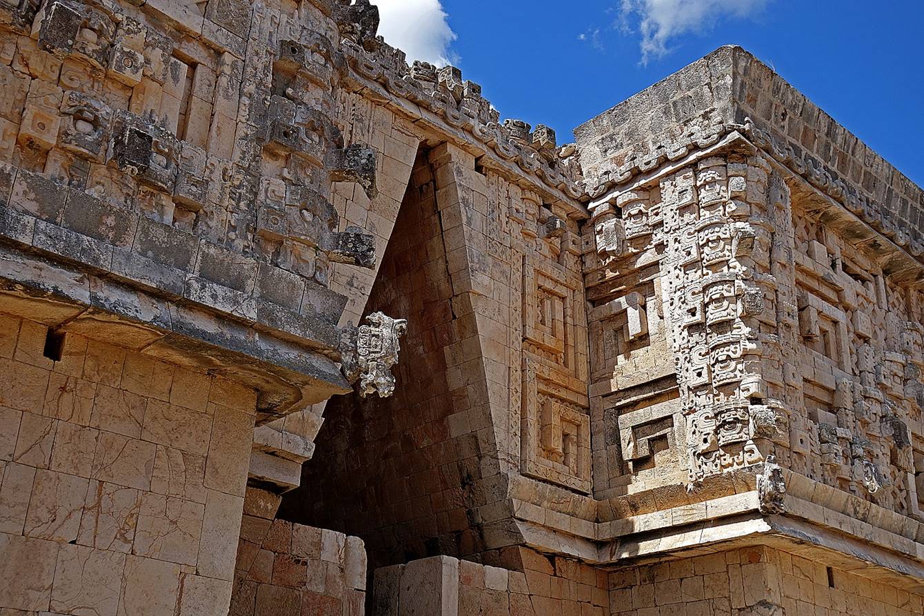
In the Cuadrangulo de
las Monjas (Nuns′ Quadrangle).
Detail of the eastern corner of the building on the north side of the
Cuadrangulos des las Monjas.
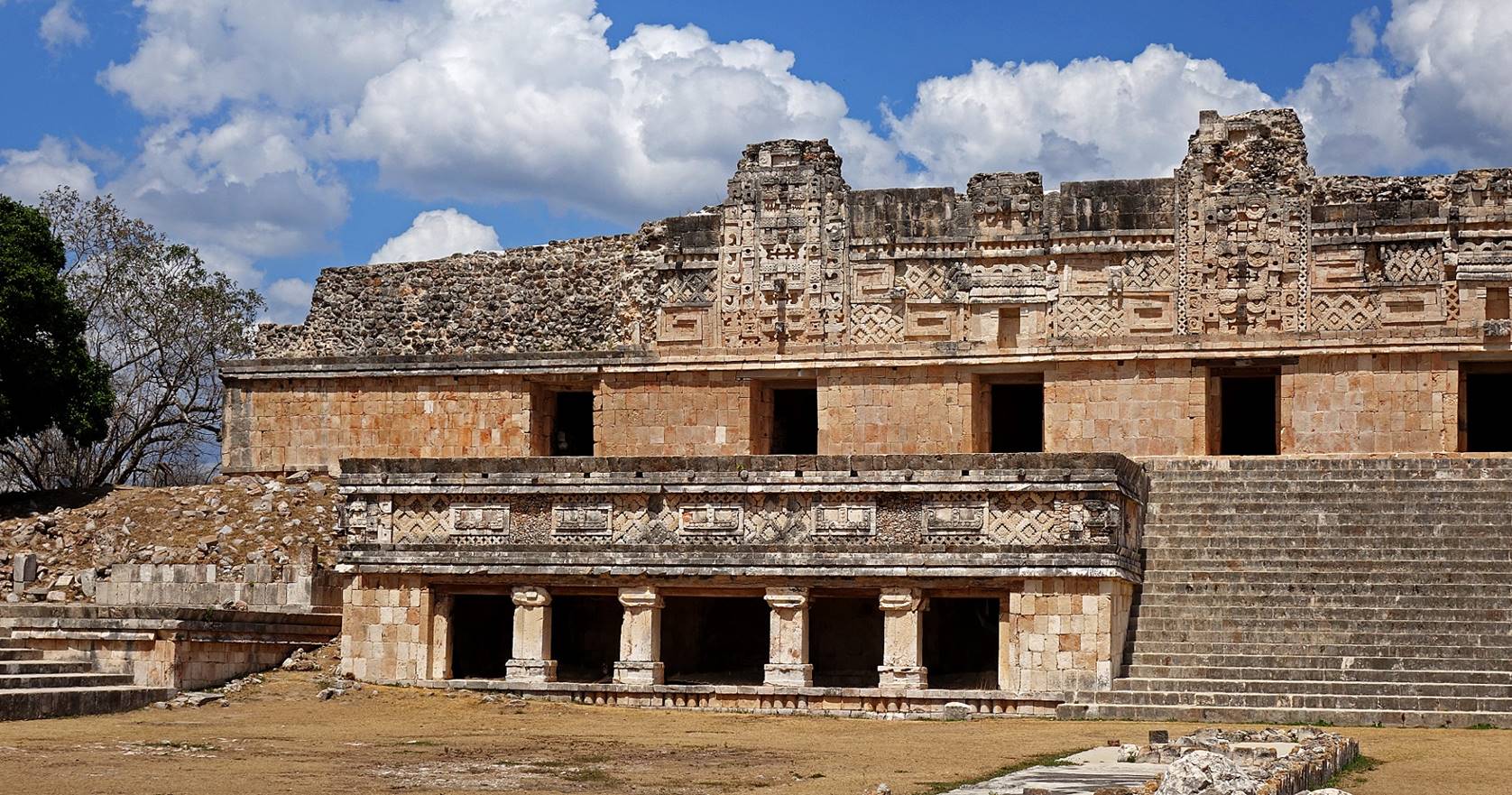
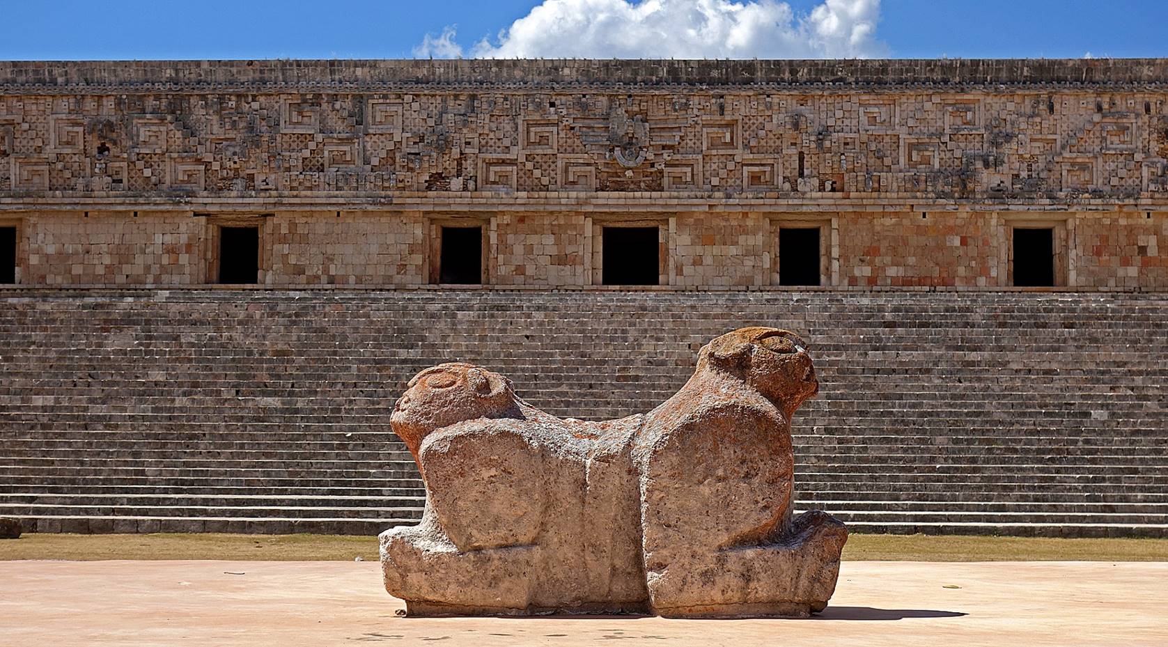
The
two-headed Throno del Jaguar
in front of the nearly 100m-long Palacio del Gobernador
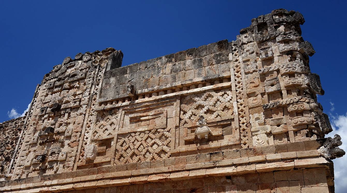
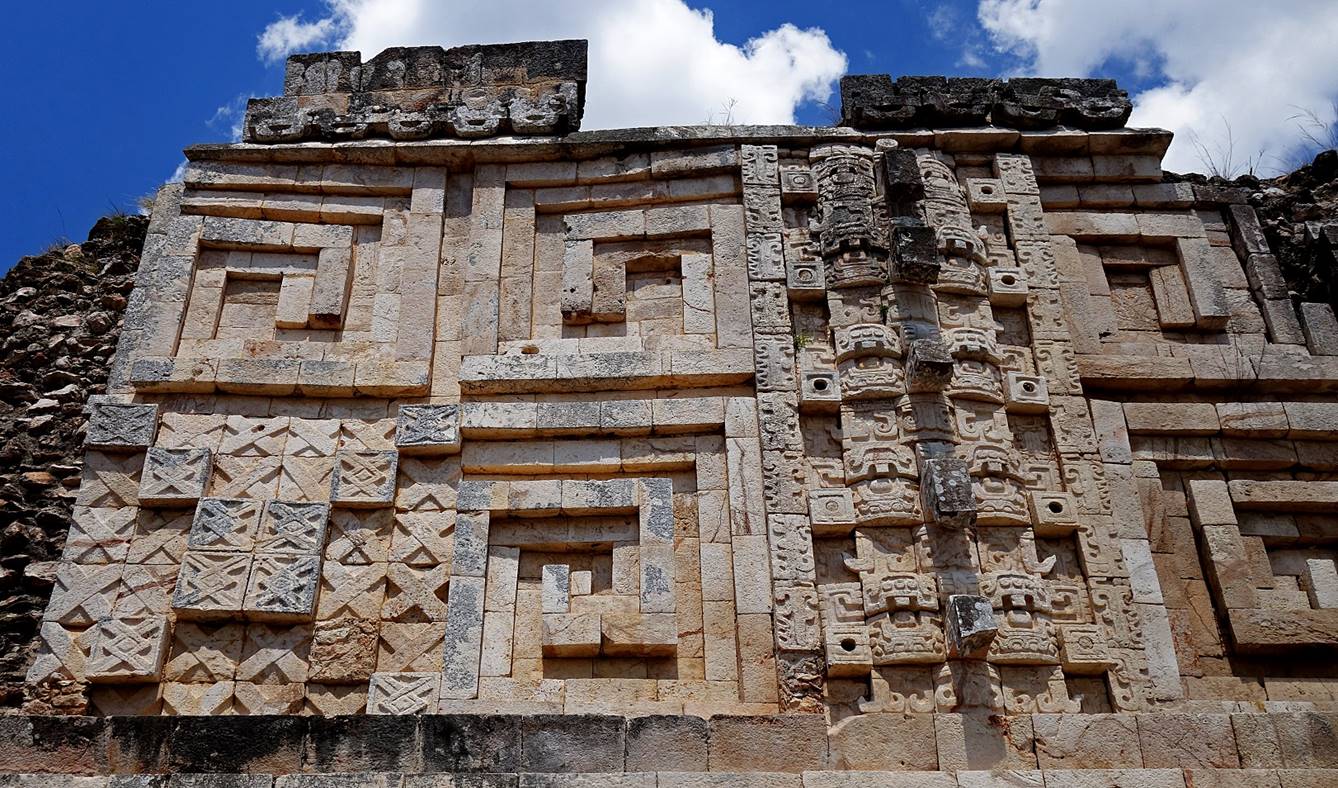
Geometric
patterns and masks of the rain god Chaac on the walls
of the Palacio del Gobernador.
The Piramide del Adivino (again) seen from the northeast corner of the
Palacio del Gobernador.
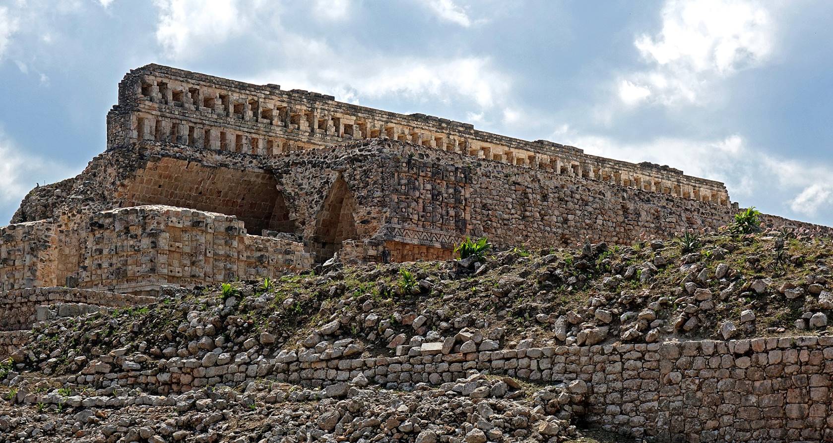
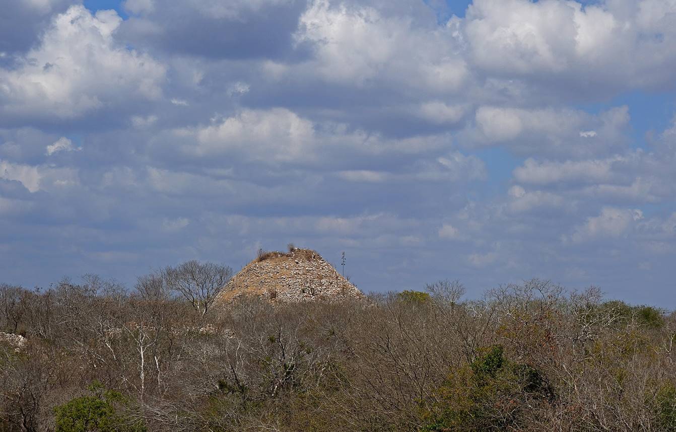
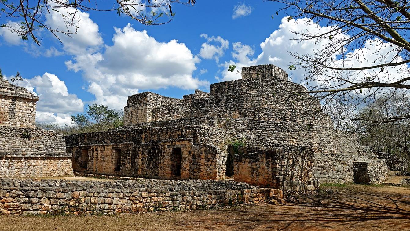
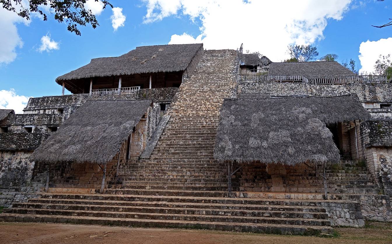
Ek′ Balam:
Ek′ Balam
is a Maya site located some 150km east of Merida and 20km north of Valladolid.
Although it was first explored by archeologists in the late 1800s, its
extensive excavation took place in the 1980s and 1990s. One of its most notable
features is the well-preserved stucco at the entrance of the tomb of King Ukit Kan Lek
Tok′ (located in the main pyramid, called the
Acropolis).
Palacio Oval located near the site′s
entrance.
Northern side of the main pyramid. The
tomb of King Ukit Kan Lek Tok′ is located midway
up on the left.
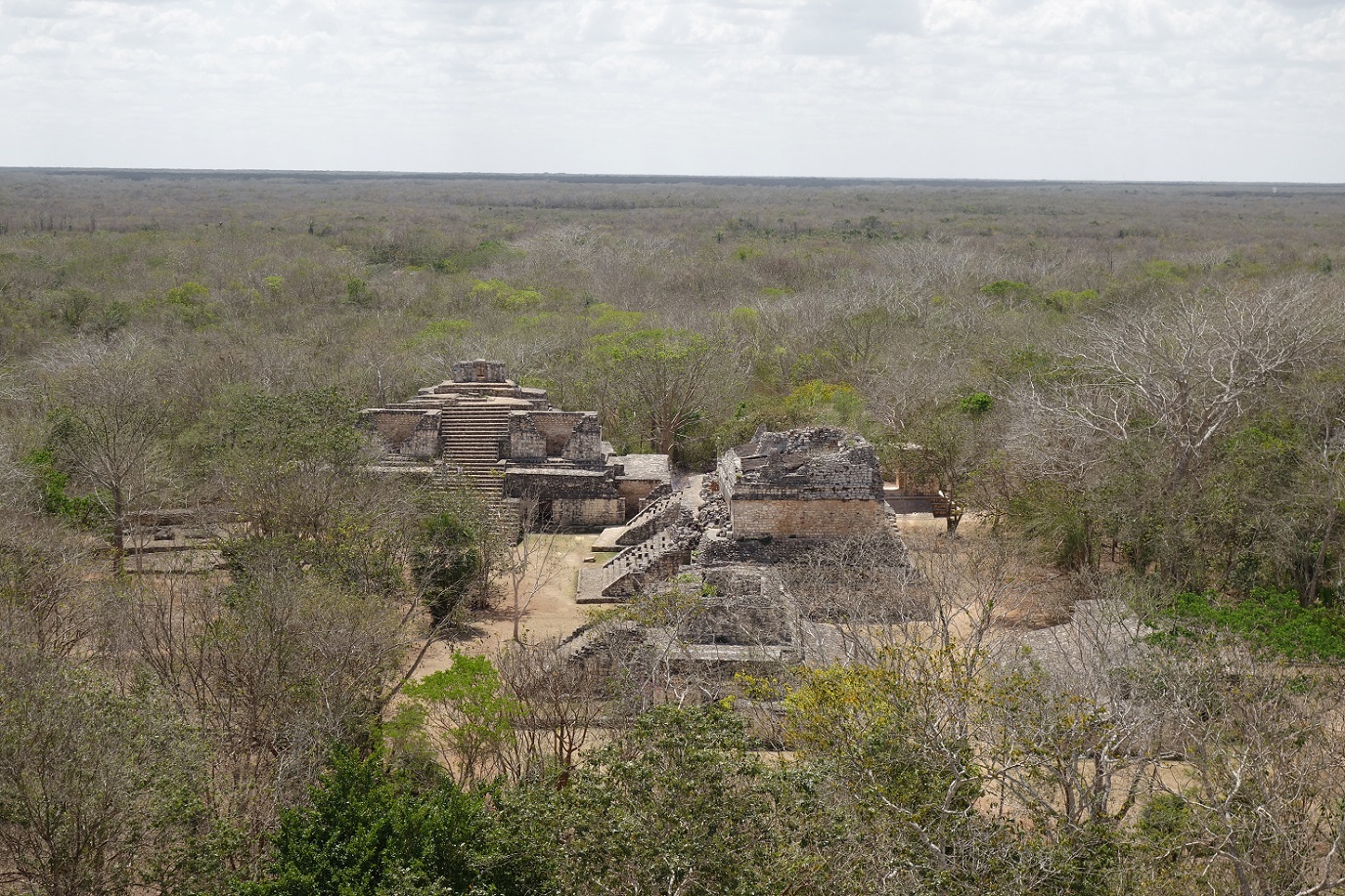
View (toward the south) of the Ek′ Balam site from the top
of the pyramid, with the Palacio Oval in the back at the center-left, the Gemelas (Twins) closer at the center-right, the Arco (Arch)
barely visible behind the Gemelas of their right, and
the Juego de Pelota (Ball Game Court) in front of the
Palacio Oval and on the left of the Gemelas. Note the
surrounding flat uniform Yucatan landscape.
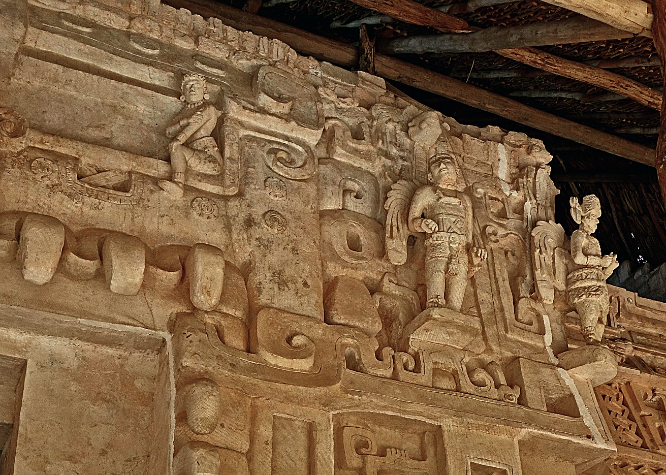
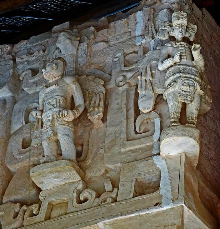
Stucco carvings at the entrance of the
tomb of King Ukit Kan Lek Tok, representing a jaguar
mouth with teeth. These carvings were found almost intact by the archeologists
uncovering the pyramid.

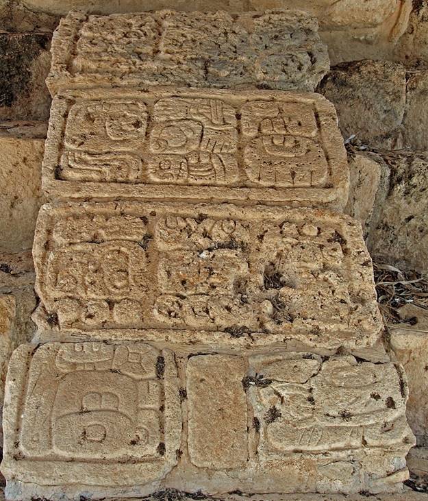
Details of carvings showing Maya
warriors and (in the third photo below) Maya glyphs.
|
|
|
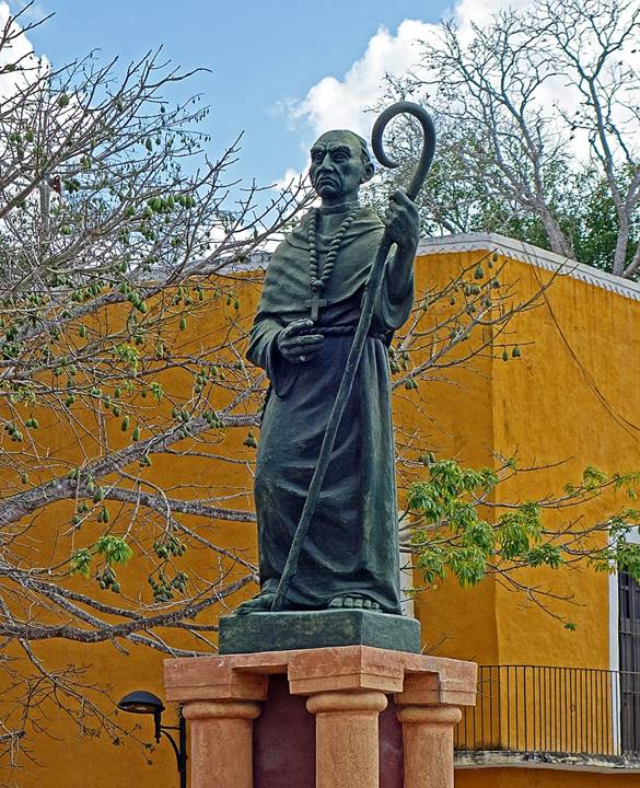
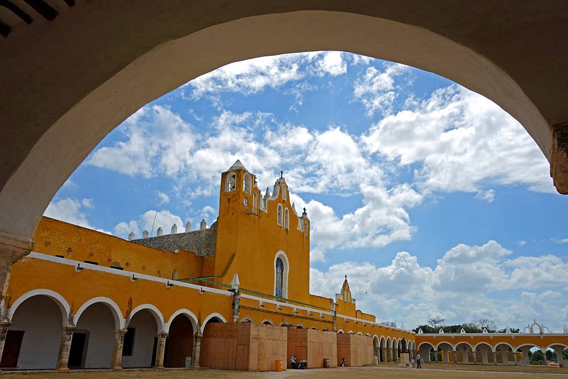
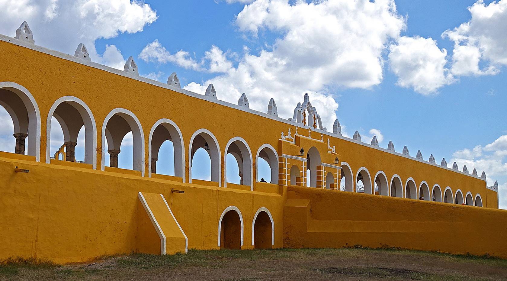
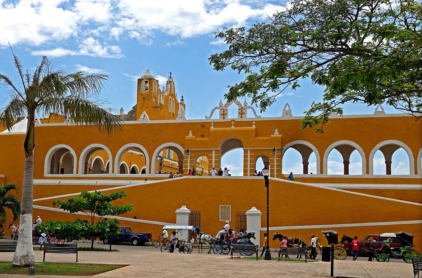
Izamal:
Prior to the Spanish invasion, Izamal, 70km east of Merida, used to be a major Maya
worship center with a dozen pyramid-temples. However, in 1552 Franciscan priest
Diego de Landa erased one of these pyramids to build
the huge convent of San Antonio de Padua that is now the city′s main
attraction. (As mentioned above, a few years later the same priest was also
responsible for the burning of Maya manuscripts in Mani.) The city of Izamal is often called La Ciudad Amarilla,
for the ochre-yellow that covers the convent and the surrounding buildings.
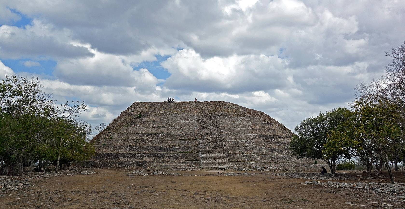
Kinich Kakmo, the
largest surviving pyramid-temple (34m high, partially restored), located a few
blocks north of the convent.
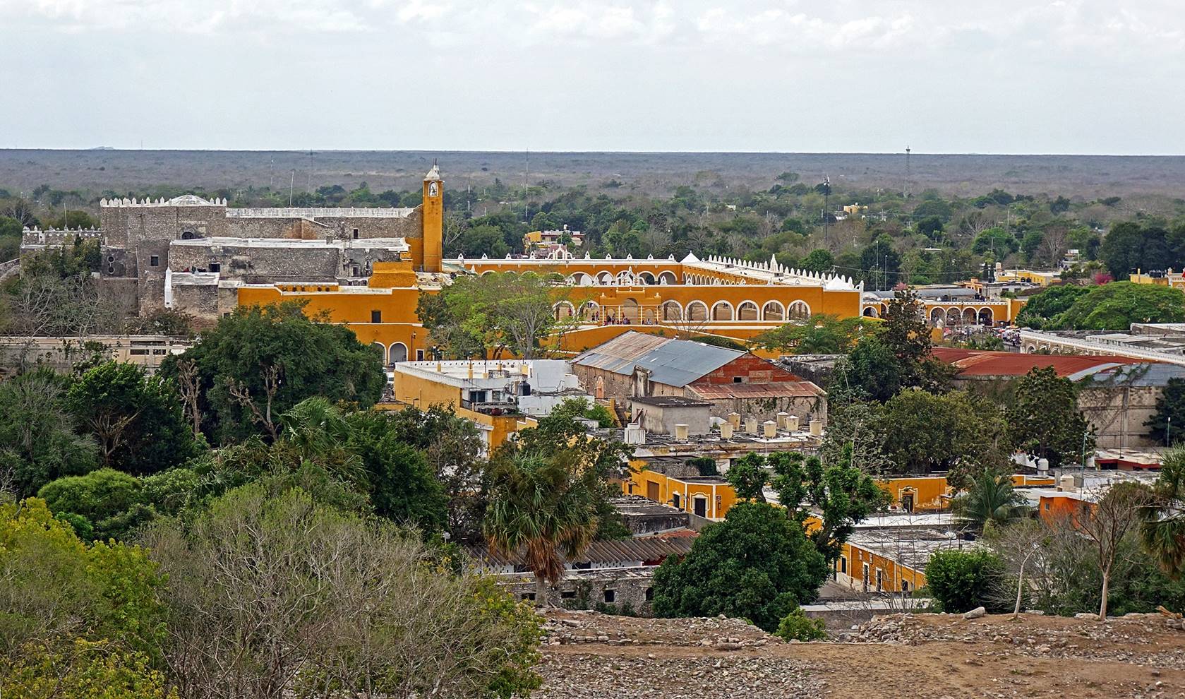
View over the convent from the top of Kinich Kakmo.
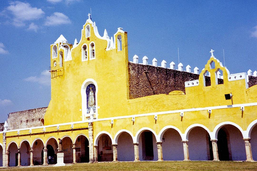
Left: the facade of the church of the
Convent of San Antonio de Padua (photo
taken in 2002). Right:
Statue of Diego de Landa in a small plaza adjacent to
the convent. (It seems that the yellow paint covering the walls of the convent
and the surrounding buildings in 2002 was brighter than the ochre color of
2017.)
|
|
|
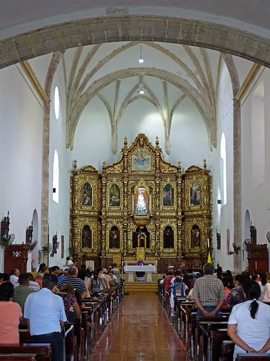
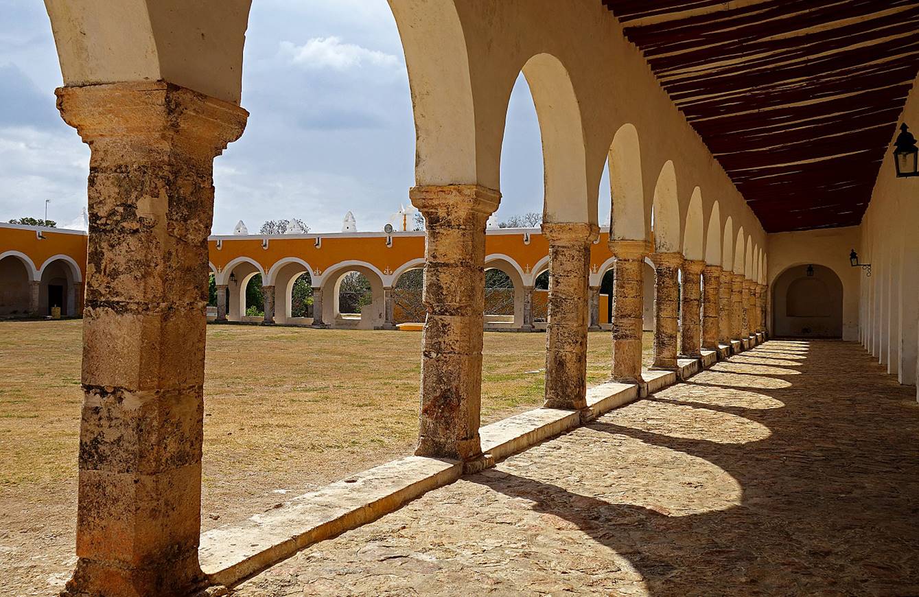
Left: view of the church′s facade
and of a portion of the arcades encircling the convent′s main courtyard
in March 2017. Right: inside the convent′s church.
|
|
|
Views of the arcades encircling the
convent′s main courtyard.
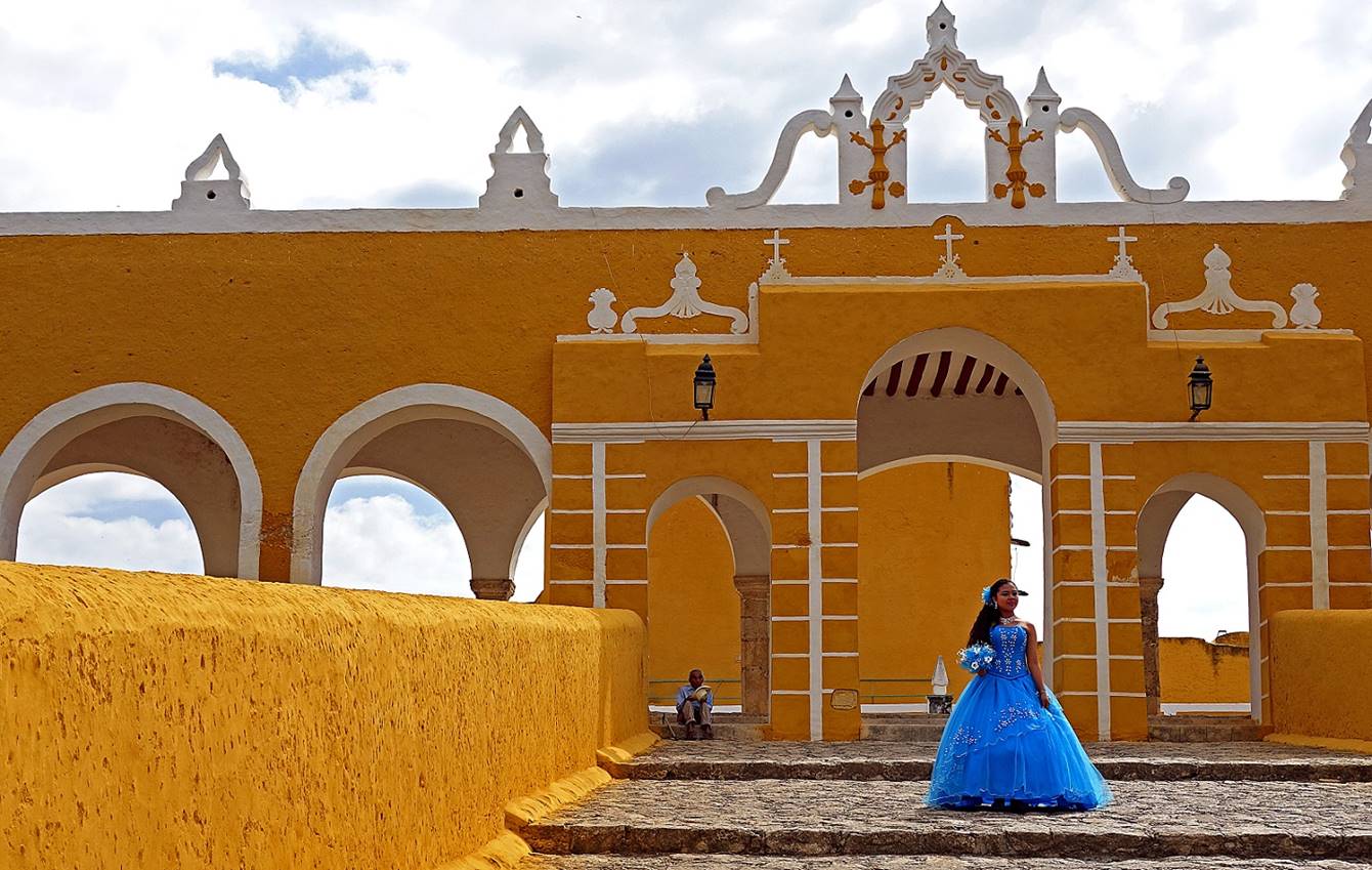
Backside of the convent′s church.
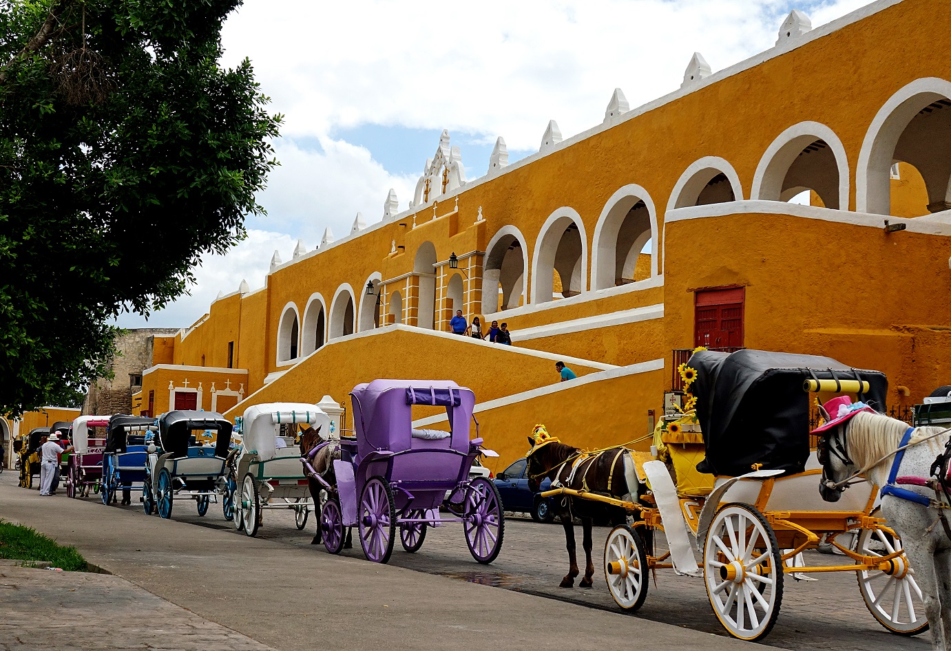
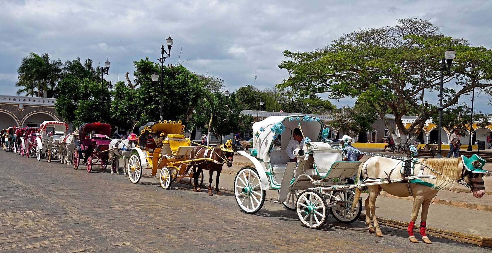
Colorful carriages waiting in line on
the northern side of the convent. Ironically, the name of the adjacent plaza, Parque Itzamna, is the name of a
Maya creator god, to which some of the original temples of Izamal
were dedicated. Is it a revenge of the Mayas or a mark of their tolerance?
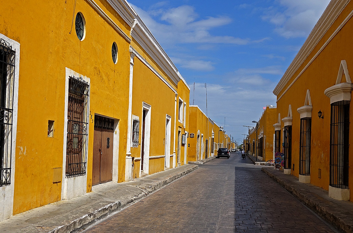
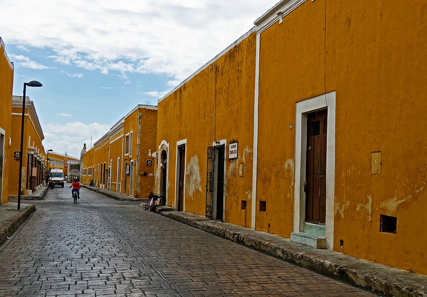
Streets
of Izamal.
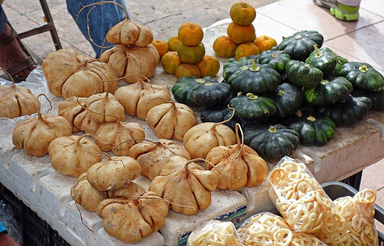
Oddly shaped, but edible, bulbous roots
of jicama, a vine plant (on the left) and dark-green Yucatan squash (on the
right) in the small market near the convent.
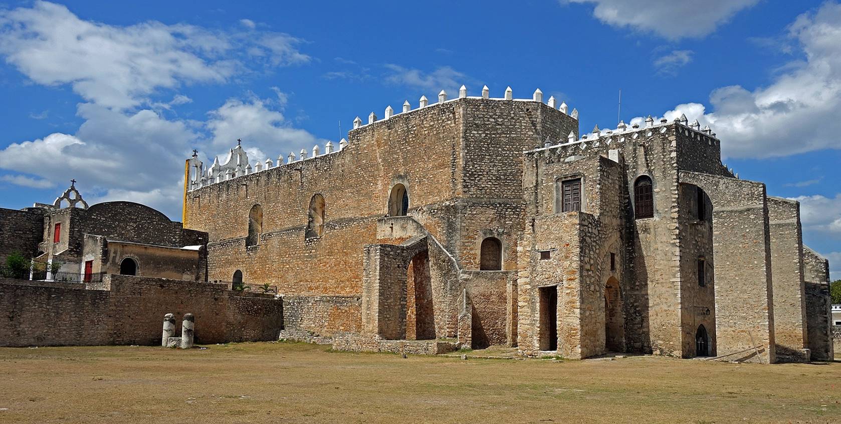
Valladolid:
Valladolid is
a city located in the eastern part of the state of Yucatan, 100km south of the
coast of the Gulf of Mexico and 150km east of Merida. The city and its
surrounding were the scene of intense battle during the Caste War of
Yucatan (1847-1901), between Mayas and population of European descent.
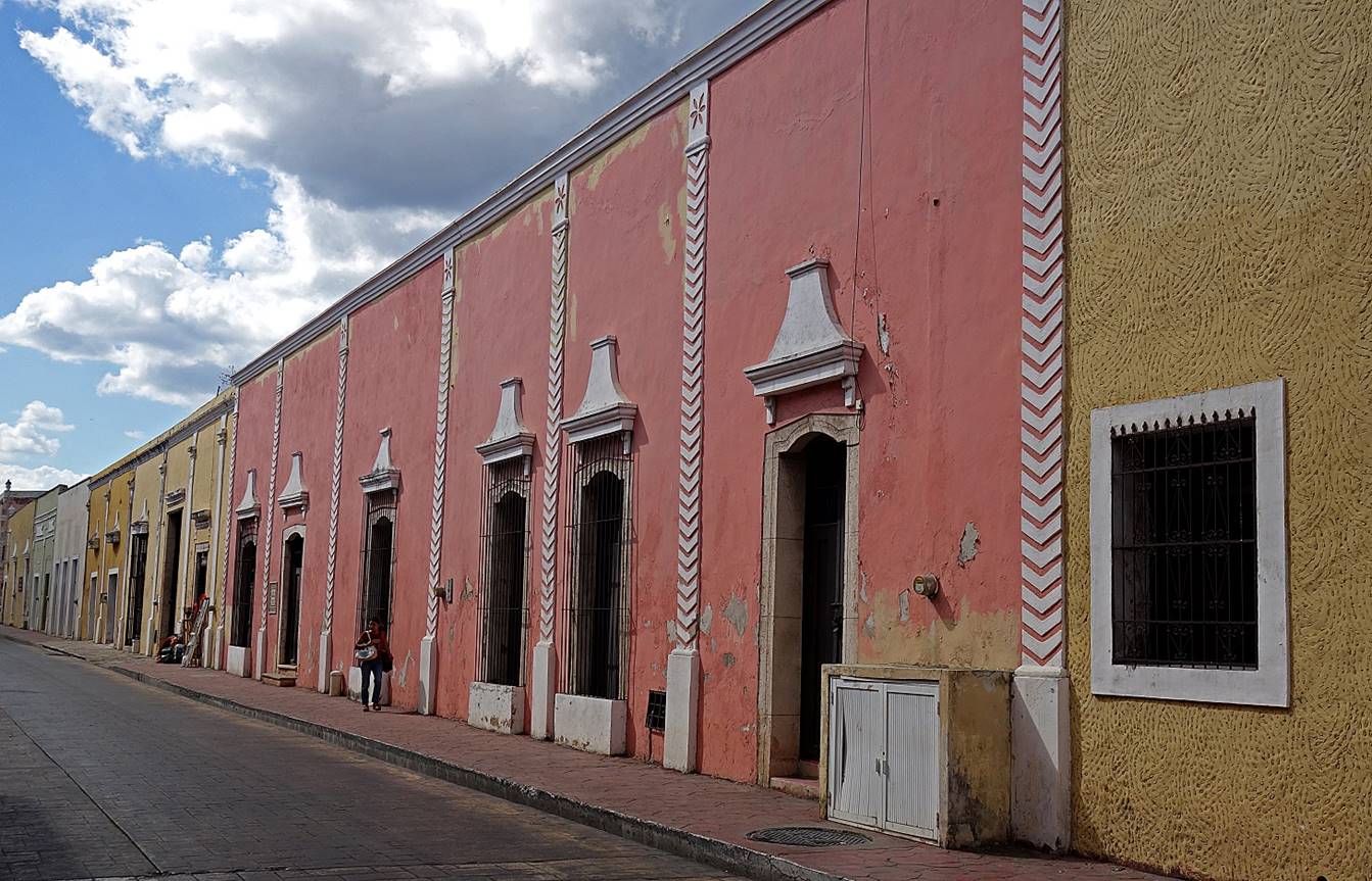
Typical street
with pastel-colored walls.
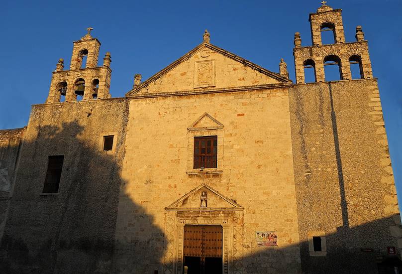
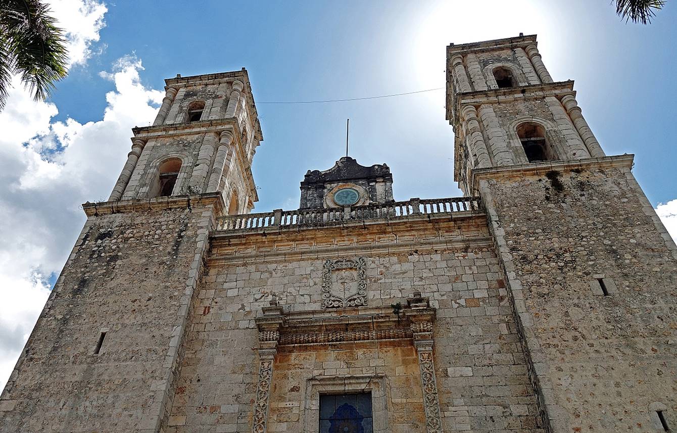
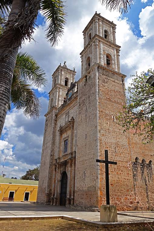
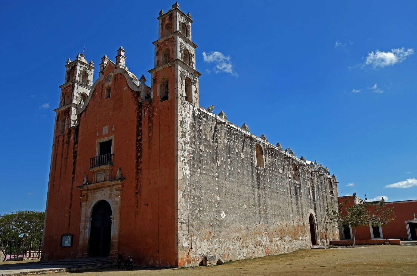
Cathedral of
San Gervacio, first built in the 16th century, then
demolished and rebuilt in the early 18th century.
|
|
|
|

Convent of
Sisal (on the left of the building) and church of San Bernardino de Siena (on
the right).

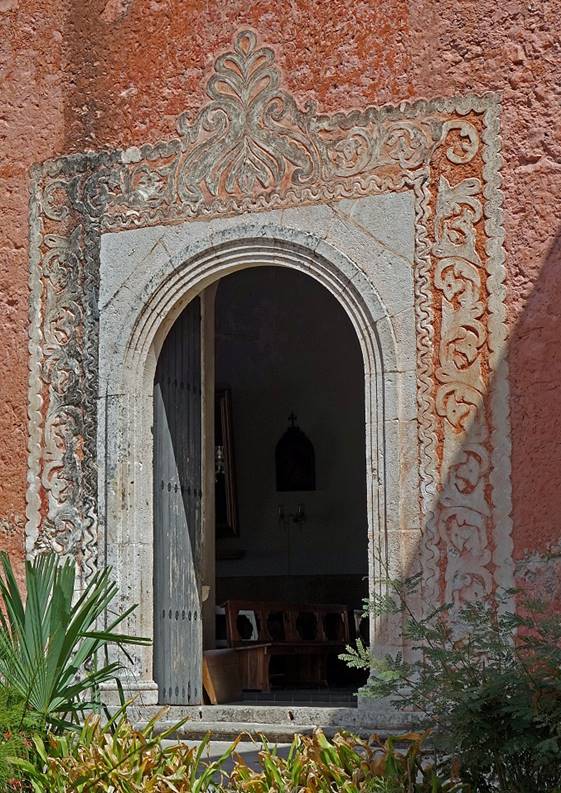
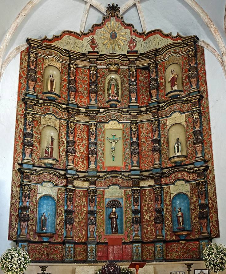
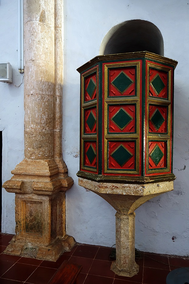
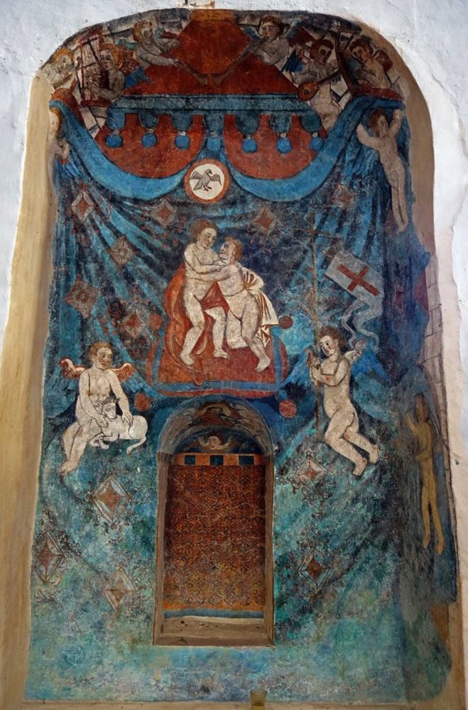
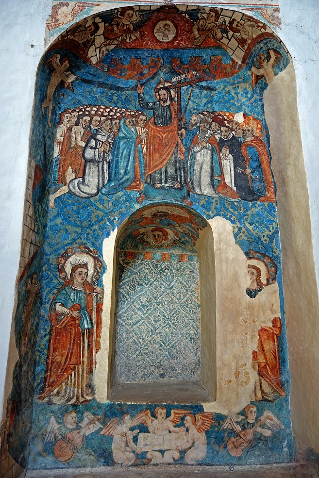
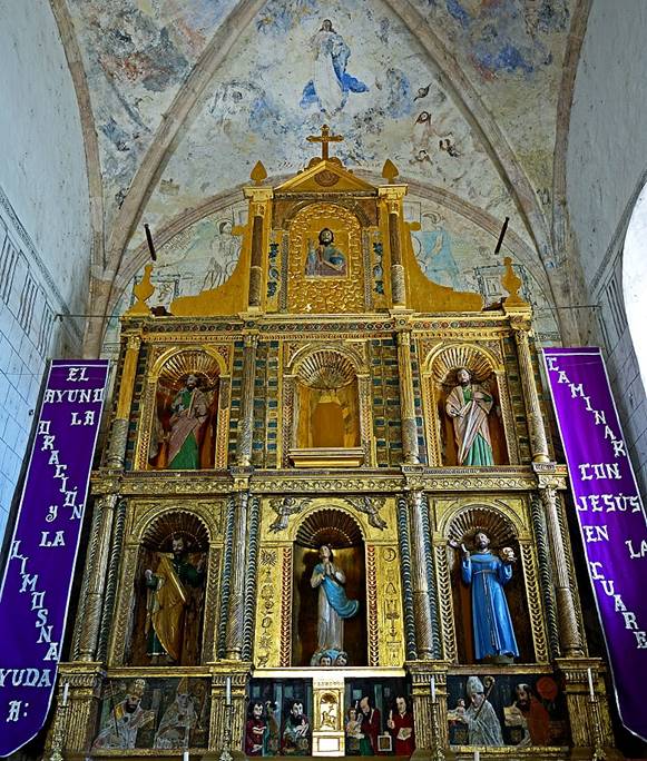
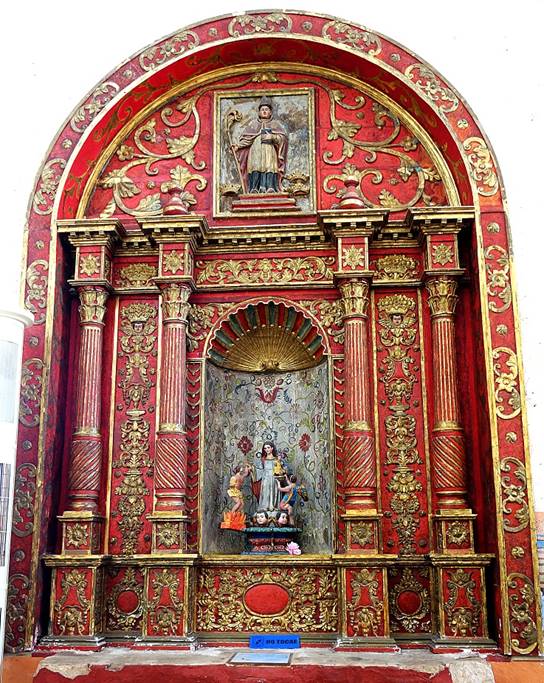
In the church
of San Bernardino de Siena: retable, pulpit, and paintings.
|
|
|
|
|
|
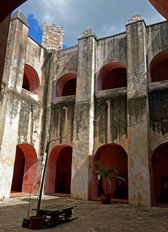
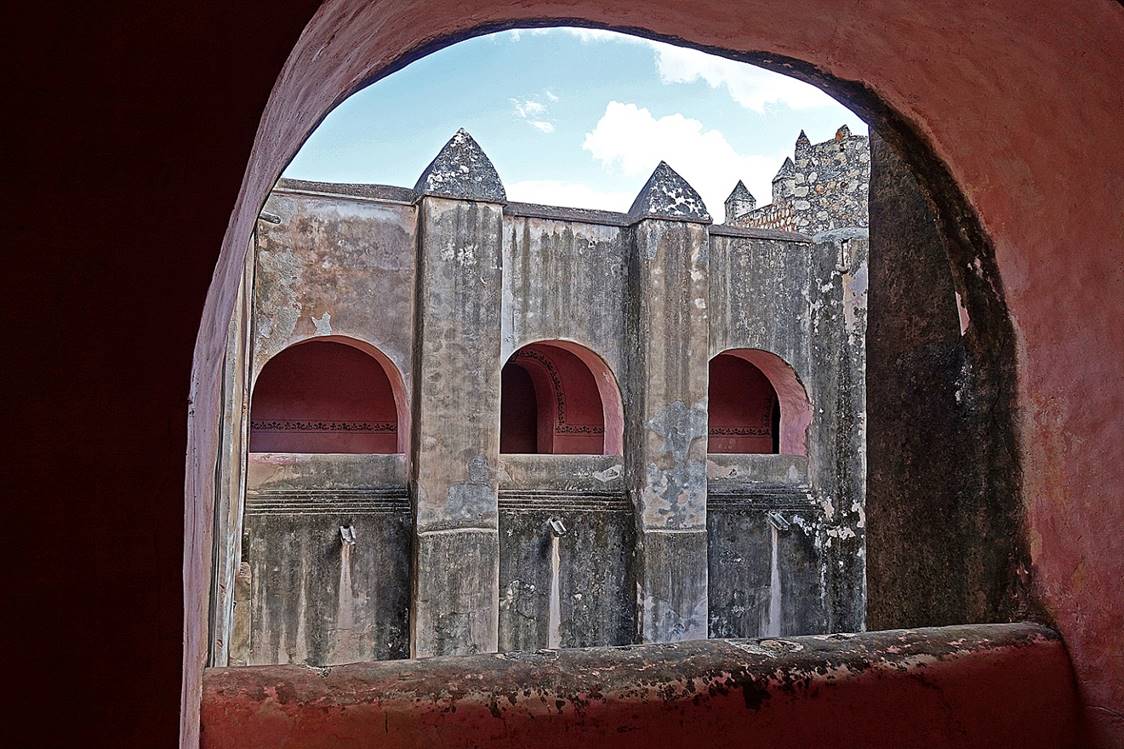
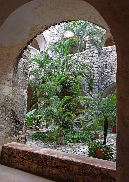
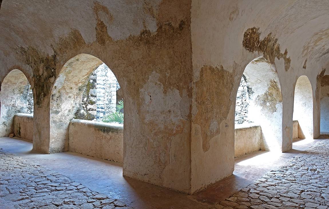
Cloister of
the Convent of Sisal.
|
|
|
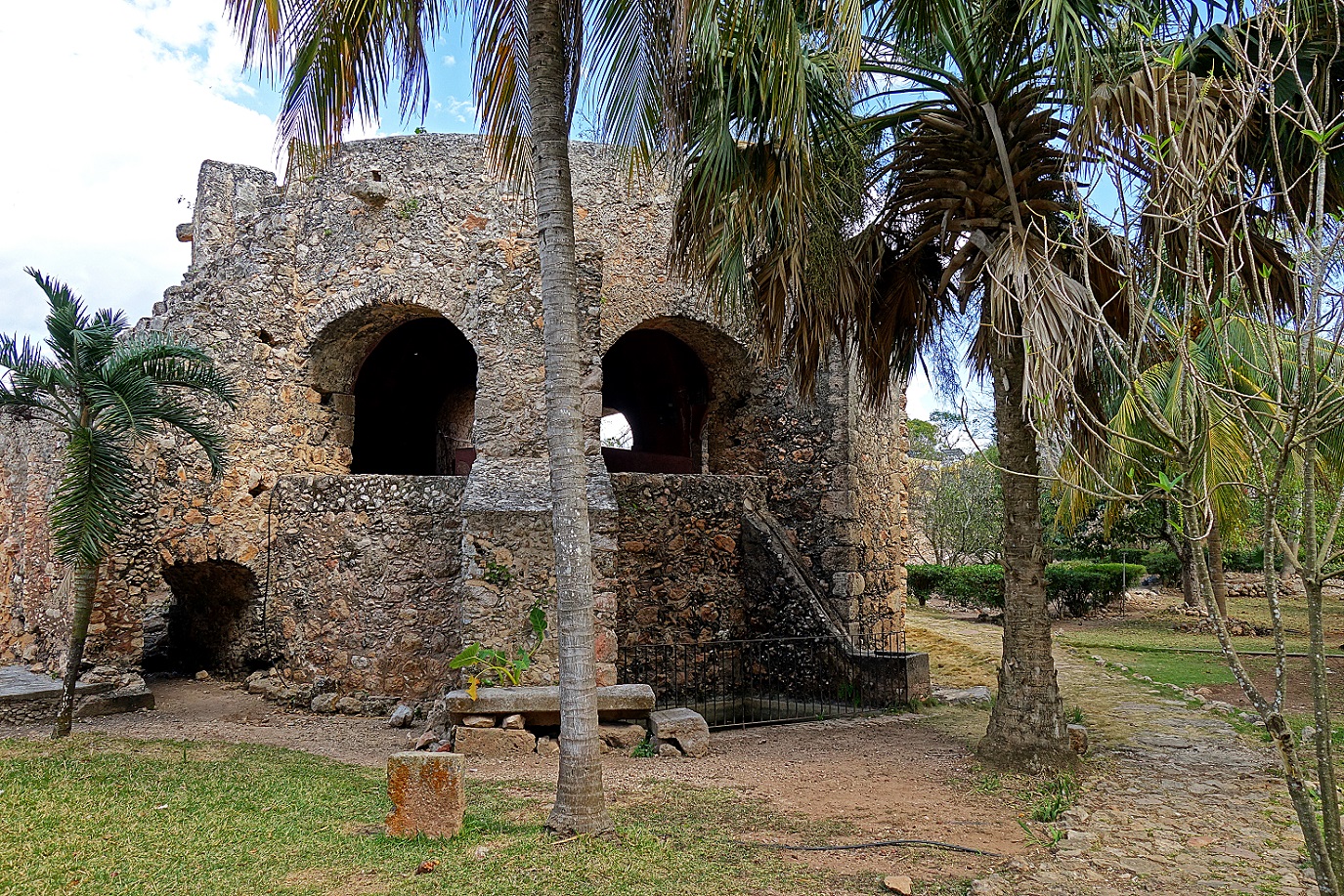
Noria built above the cenote behind the Convent of Sisal. Muskets, bayonets,
and other weapons have been found at the bottom of the cenote. It is believed
that they were thrown there during the Caste War.
Ruta de los Conventos:
This
so-called route meanders on the south-east of Merida through a series of Maya villages
with colonial churches and convents, most of them (all?) built on top of former
Maya structures.
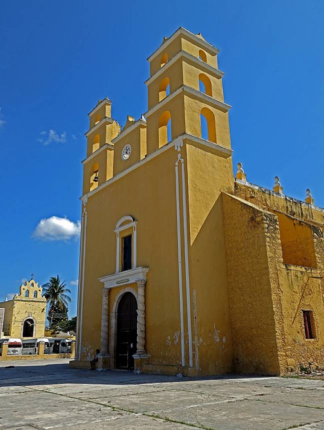
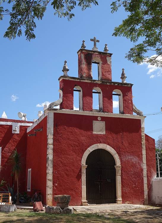
- Acanceh:
Iglesia de Nuestra Senora de la Natividad and Mercado Municipal on the Plaza de las Tres Culturas (so called because
it is bordered by a Maya pyramid, a colonial church, and modern structures).
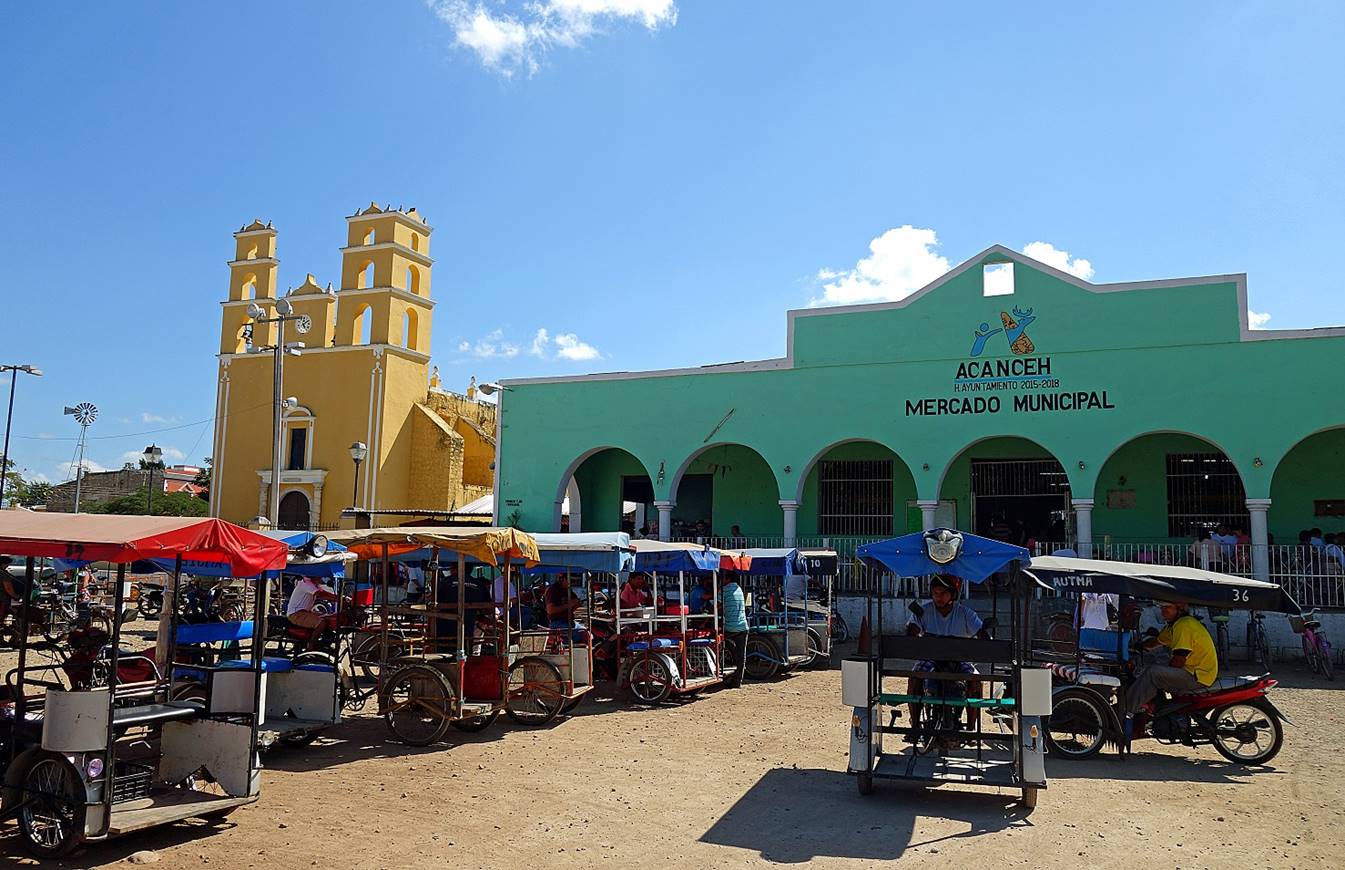
Iglesia de Nuestra Senora de la Natividad and, on the left side of the first photo below, Capilla Virgen Guadalupe (both
from the 16-17th century). Note the twisted columns at the entrance of the
church.
|
|
|

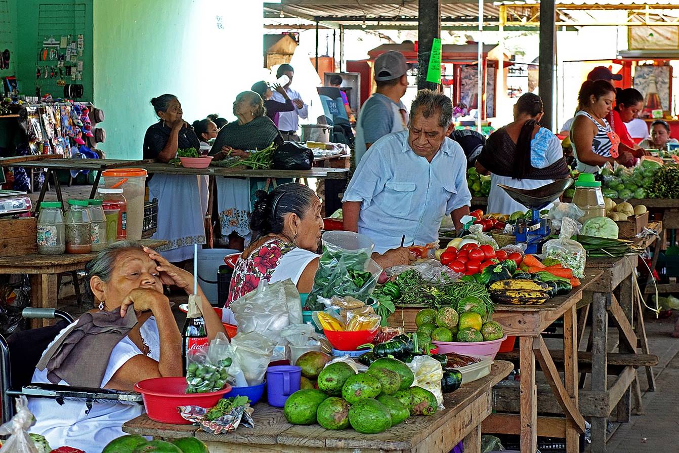
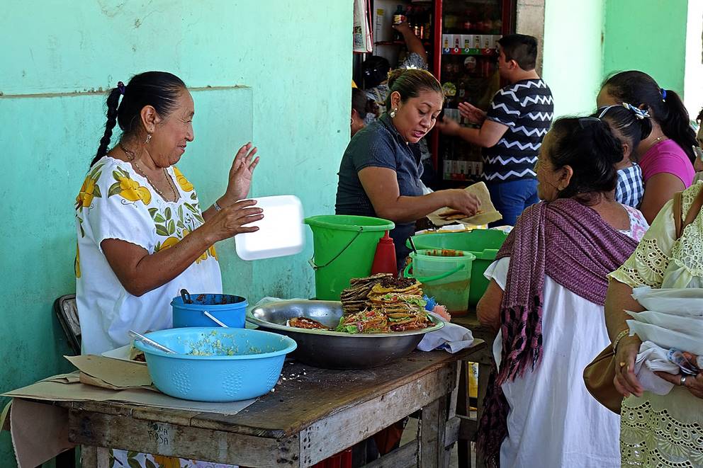
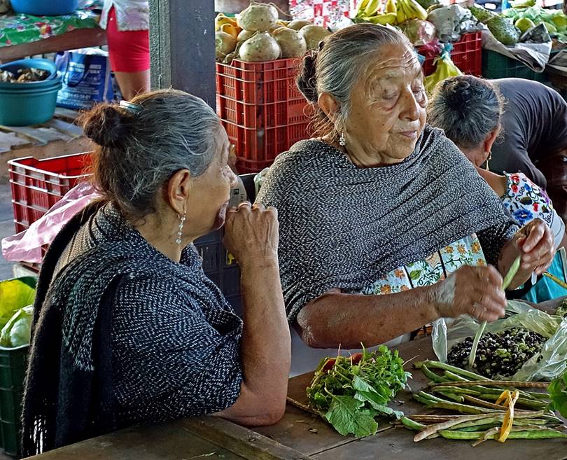
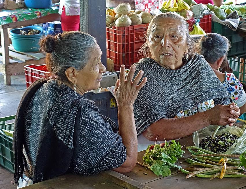
Market
scenes.
|
|
|
|
|
|
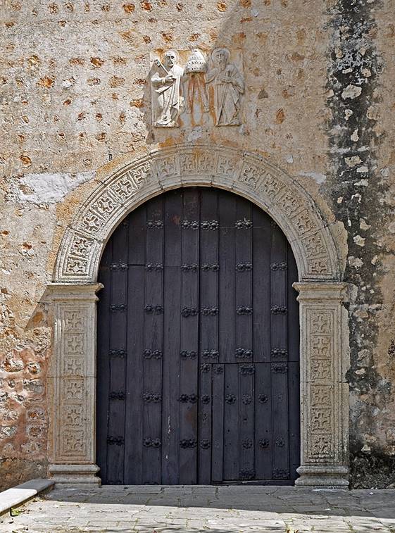
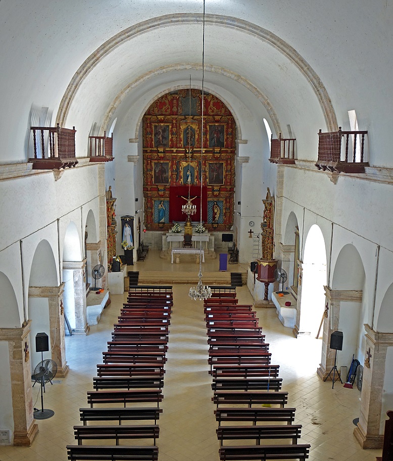
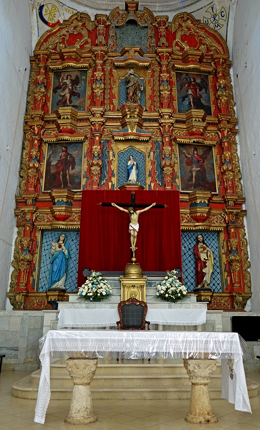
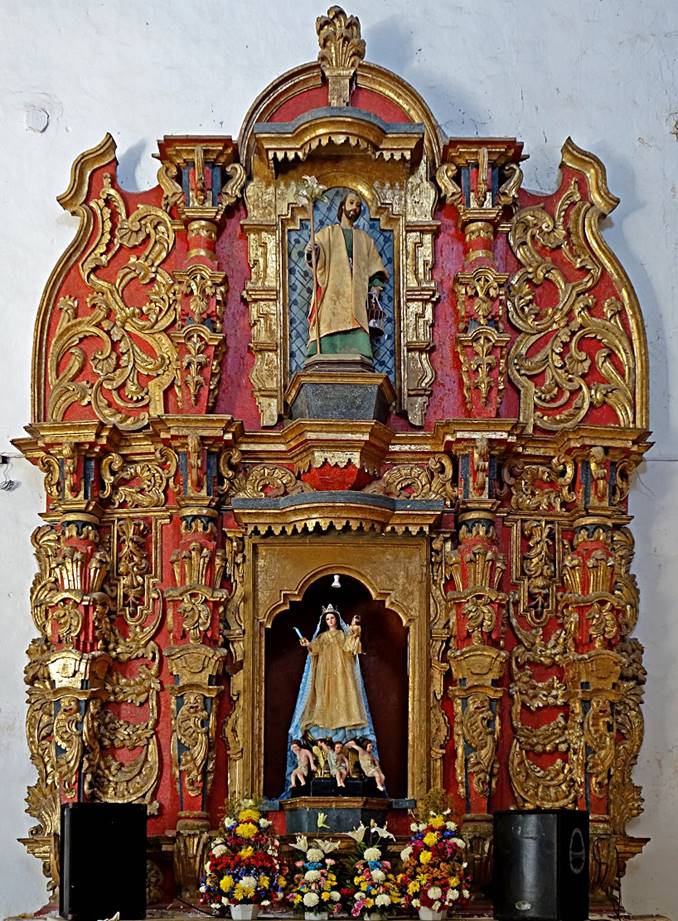
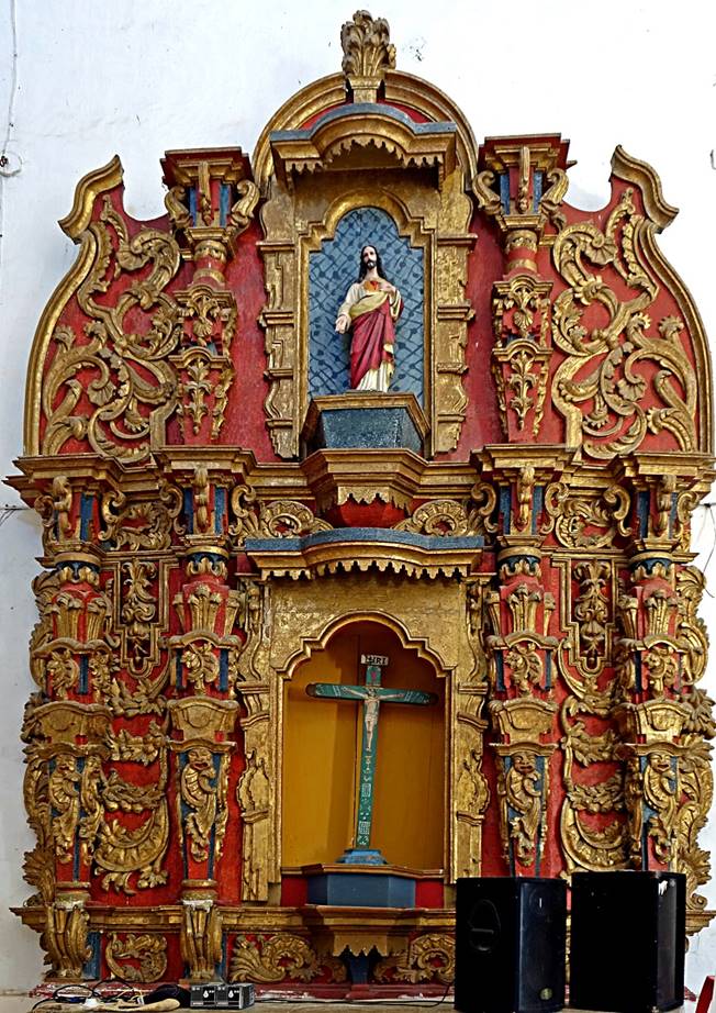
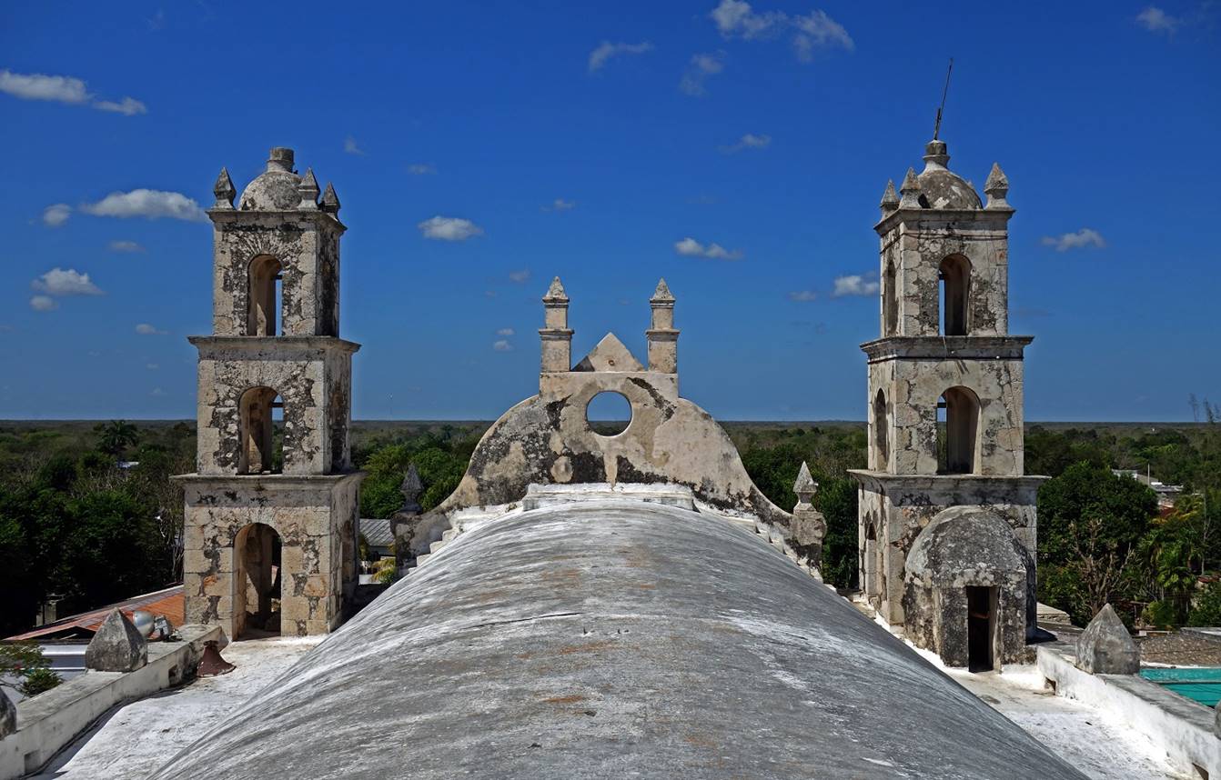
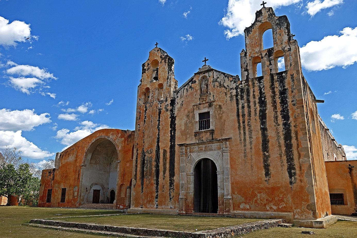
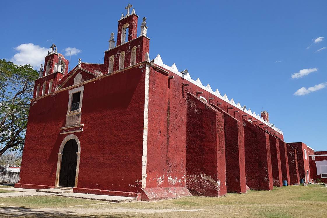
- Tecoh:
Iglesia de la Candelaria (18th
century) built upon the base of a large Maya pyramid.
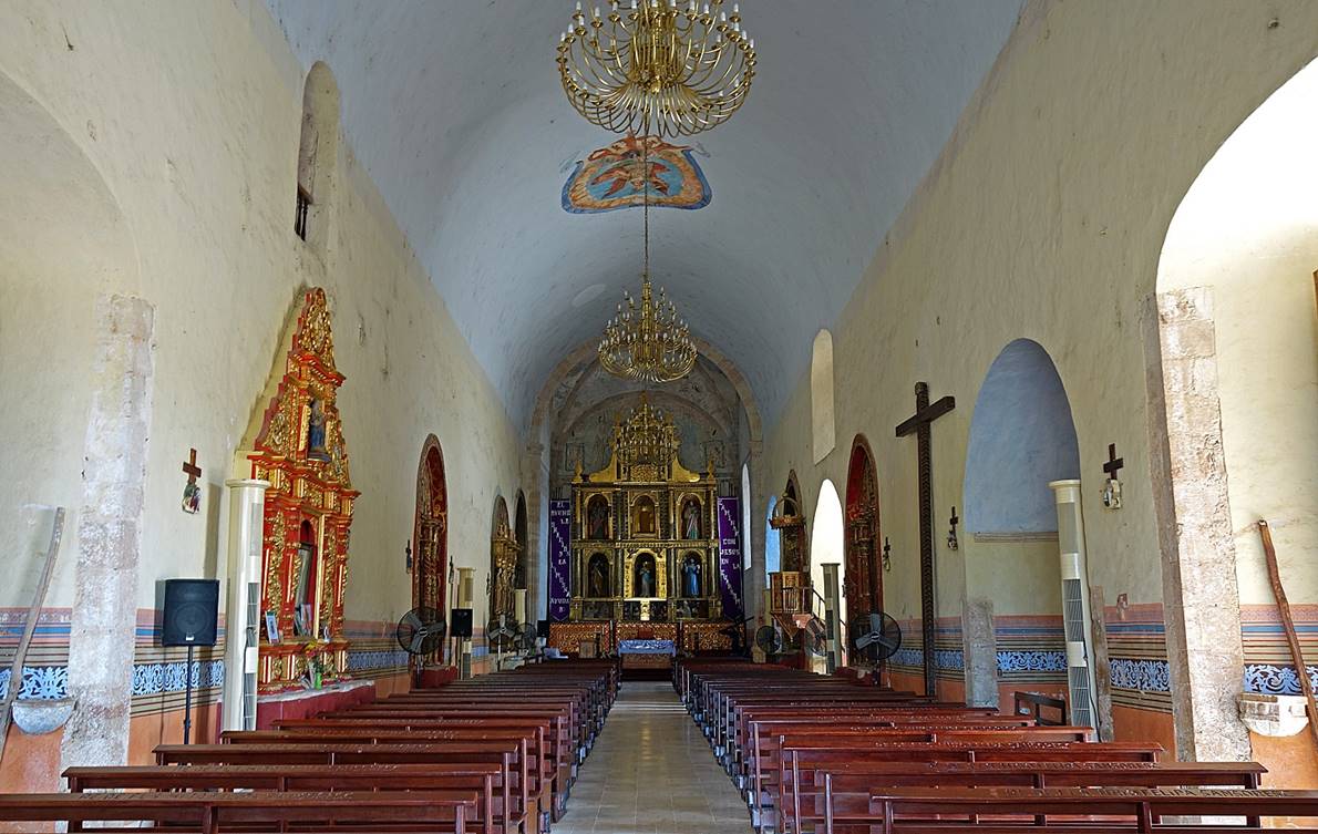
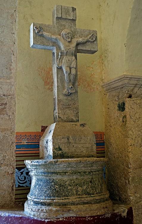
Church′s
nave and retables. Note the curved stones supporting the altar.
|
|
|
|
|
|
On the roof
of the church (again with the flat Yucatan landscape behind it).
- Mani:
Mani was the
largest city encountered by the Spaniards in Yucatan, but almost no trace of
the old Maya structures have survived.
Convento and Iglesia de San Miguel
Arcangel (16th century), one of the earliest and
largest Franciscan monasteries in Yucatan. Maya manuscripts and religious
artifacts were burned here in front of the church in 1562. It is said that
after realizing his error, Diego de Landa, who was
responsible for this auto-da-fe, wrote down everything he could recall about
Maya culture in a document called ″Relacion de
las Cosas de Yucatan″.
|
|
|
|
|
|
|

Cloister of
the convent.
|
|
|
- Teabo:
Iglesia de San Pedro y San Pablo (17th century) and
adjacent chapel.
|
|
|
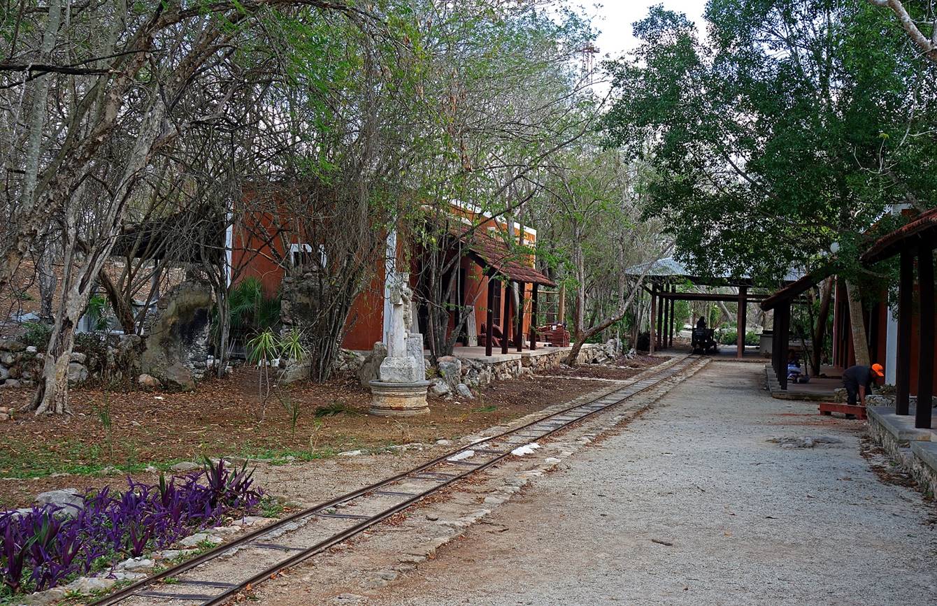
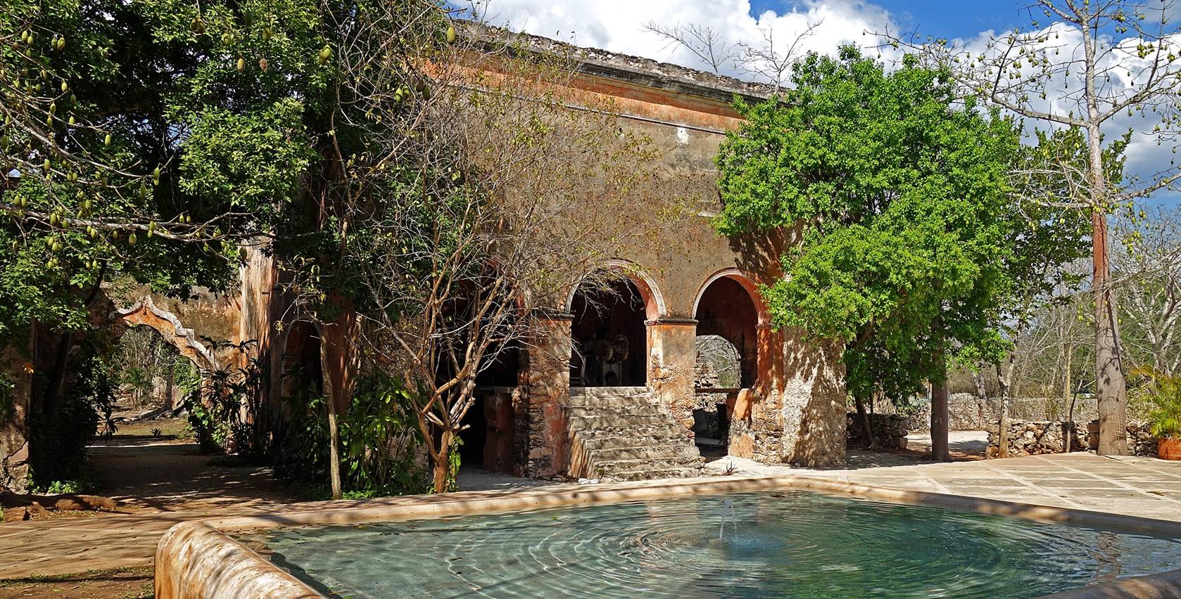
Hacienda San Pedro Ochil:
This
19th-century hacienda is located 43km south of Merida along Highway 261 that leads
to the Maya sites of Uxmal and Kabah. Now a
restaurant and hotel, it used to be a plantation of henequen (a variety of
agave cactus) and a producer of ropes made from henequen fibers. In the 19th
century, these ropes were mainly used in the booming shipping industry. In
fact, during this boom, there were hundreds of henequen plantations in Yucatan.
But in the 1940s the demand for such ropes went down, these haciendas were
slowly abandoned, and today nearly all are in ruins. Since the 1990s some have
been restored into luxurious hotels, but have lost much of their character in
the process. In contrast, the Hacienda San Pedro Ochil
has been minimally restored and has kept a friendly and charming old-fashioned
atmosphere.
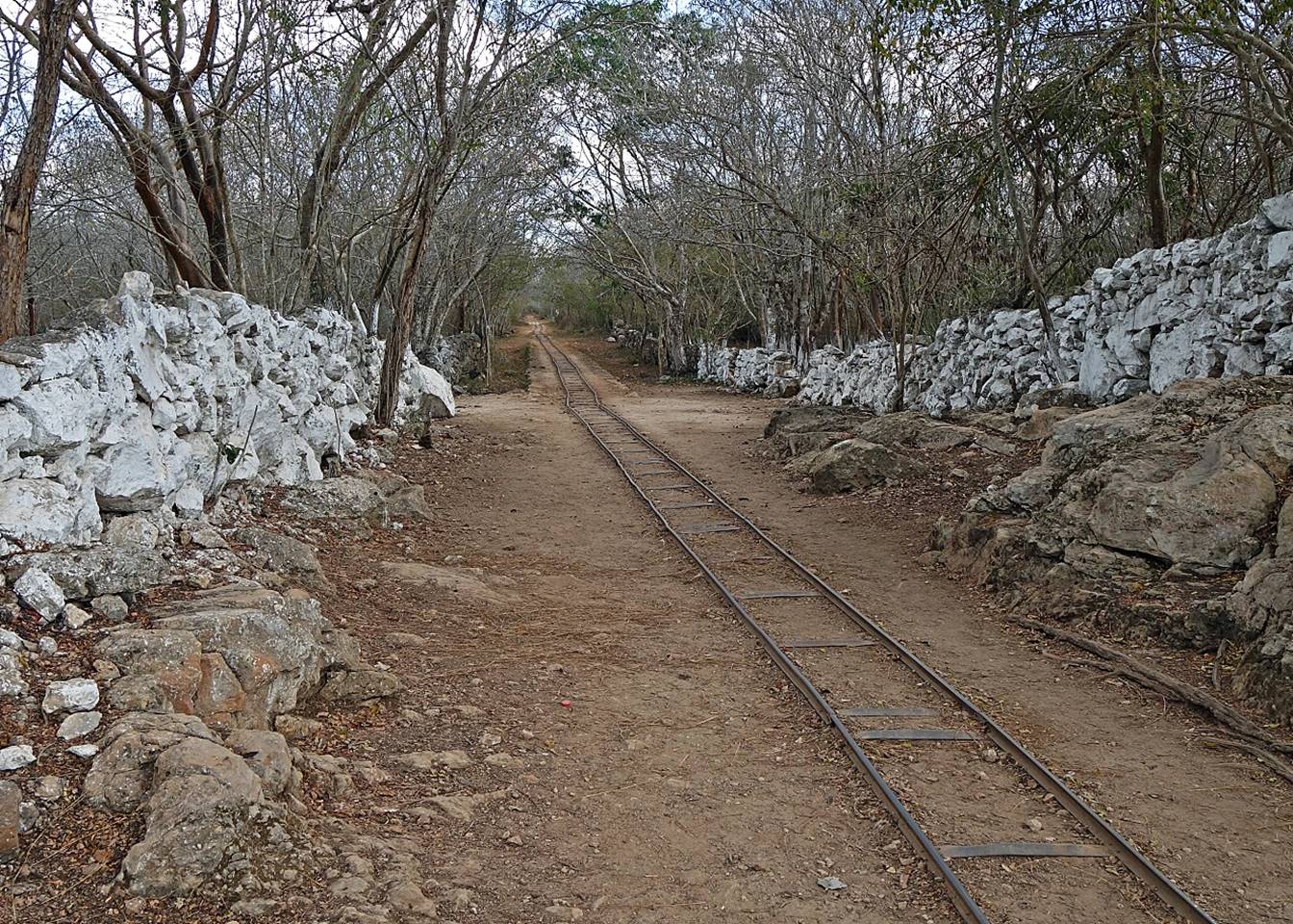
Narrow rail
track (Decauville
railway) leading to the various parts of the hacienda, formerly used
to transport henequen leaves and fibers on wheeled platforms pulled by mules.
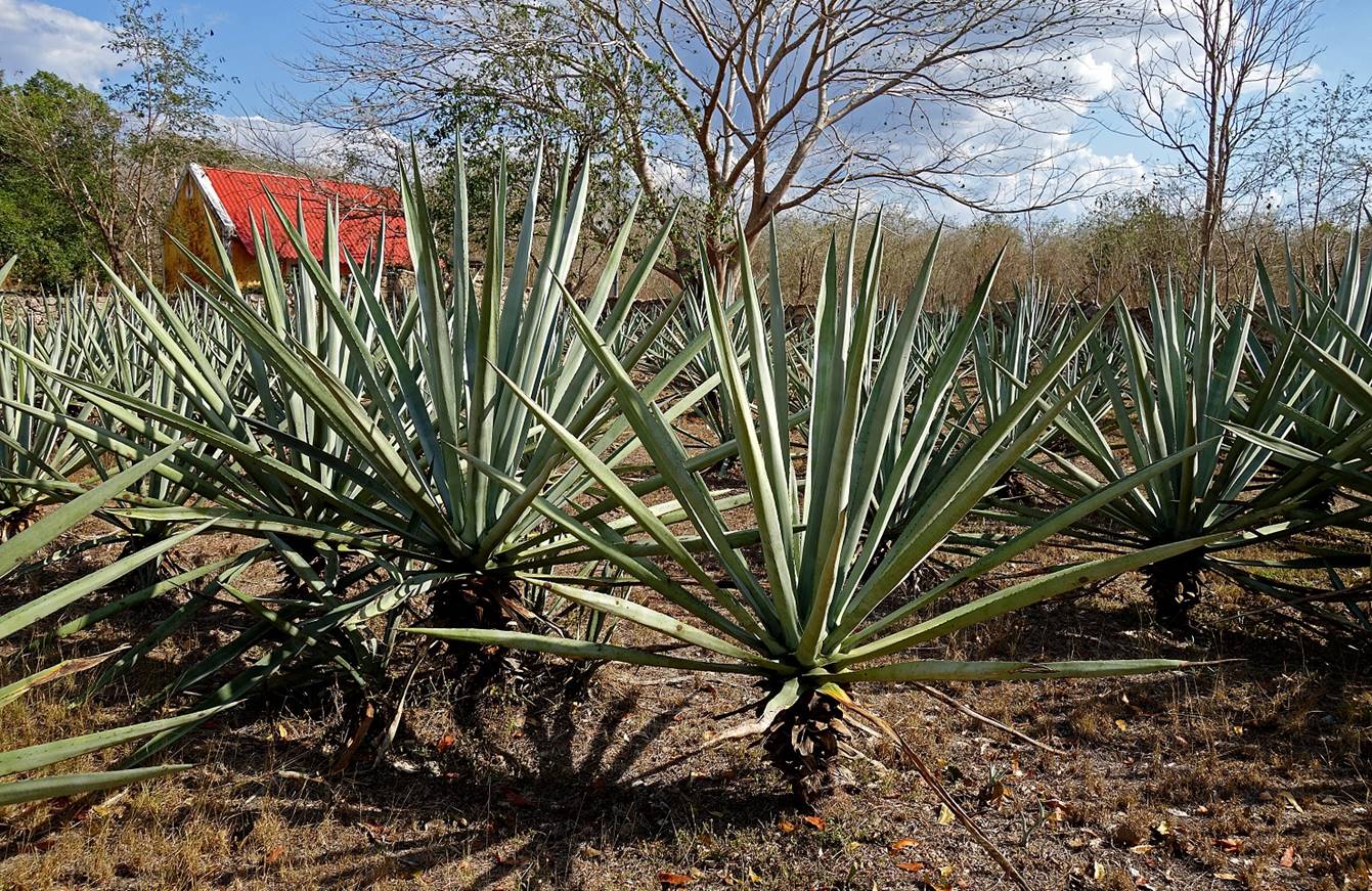
Field of
henequen.
Old carriages
used for transportation on Decauville rails.
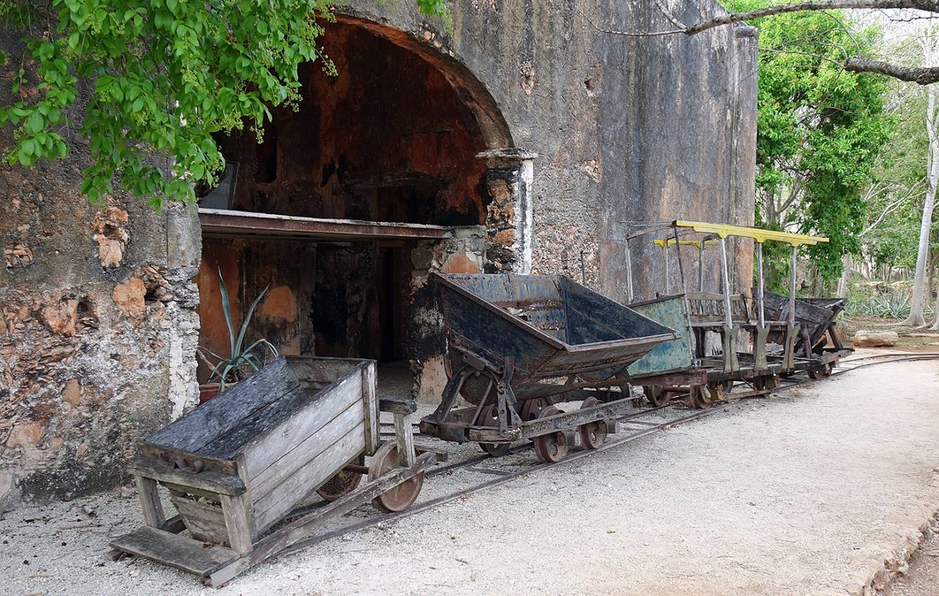
Old rasping machine
used to separate the henequen fibers from the plant′s fleshy leaves.
Prior to these machines, the separation was a tedious hand process that
consisted of beating the leaves against rows of needles.

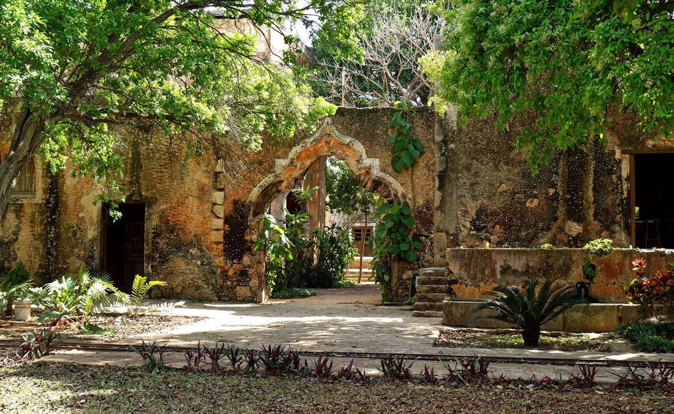
Moorish-style
entrance arch of the main compound of the hacienda.
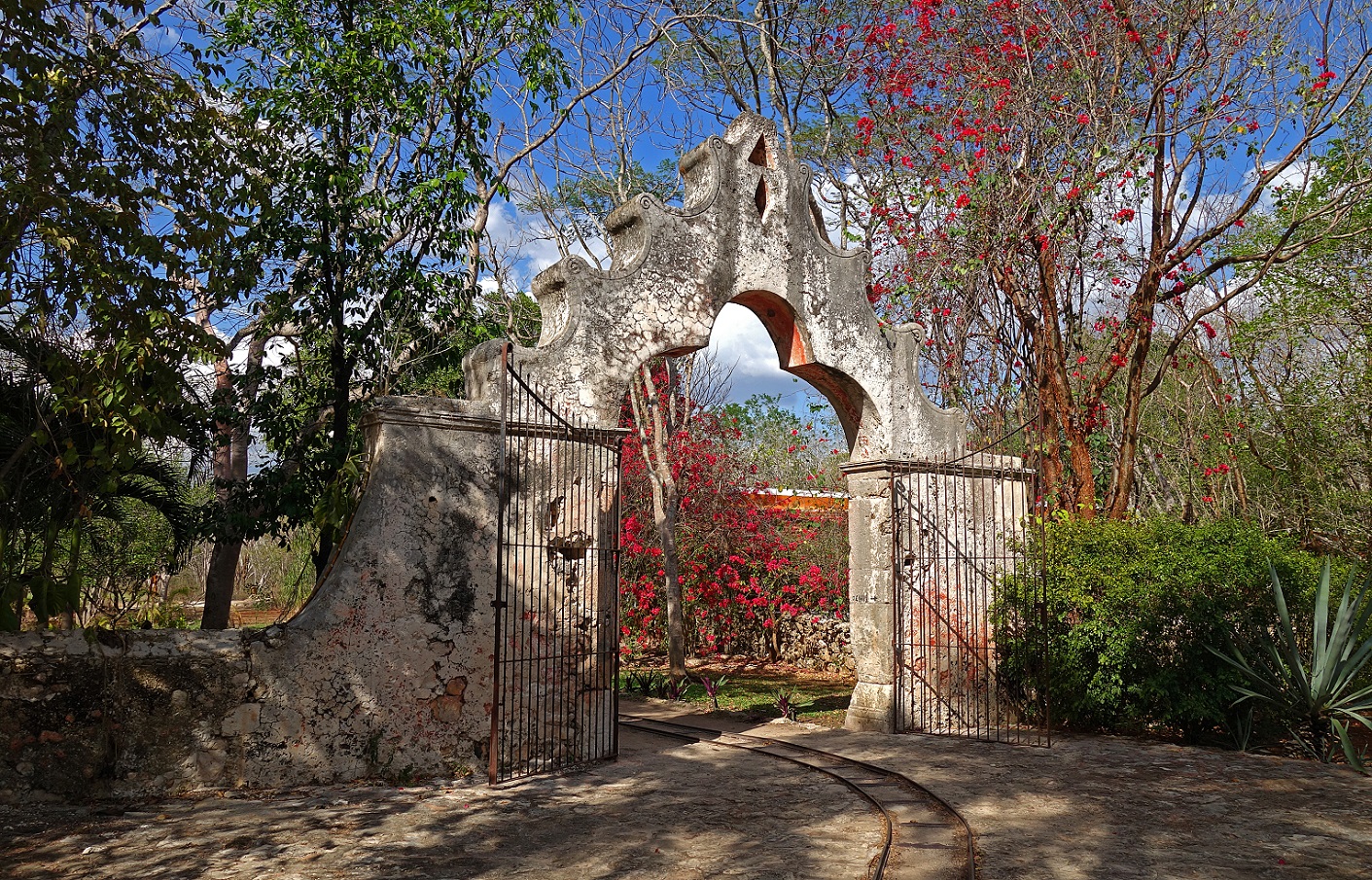
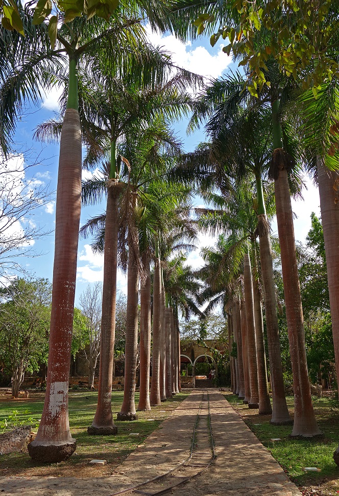
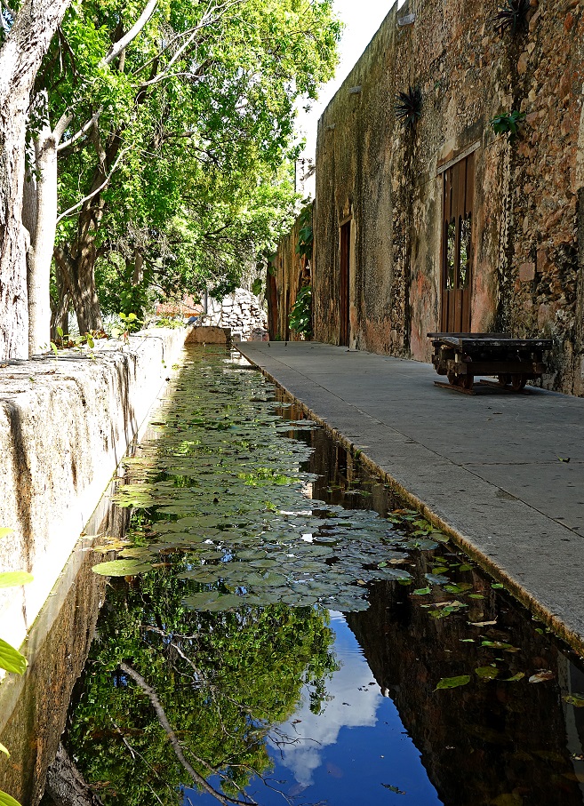
Left:
palm-tree alley between the entrance arch and the main buildings. Right: basin
along the main buildings.
|
|
|
Arch between
two buildings.
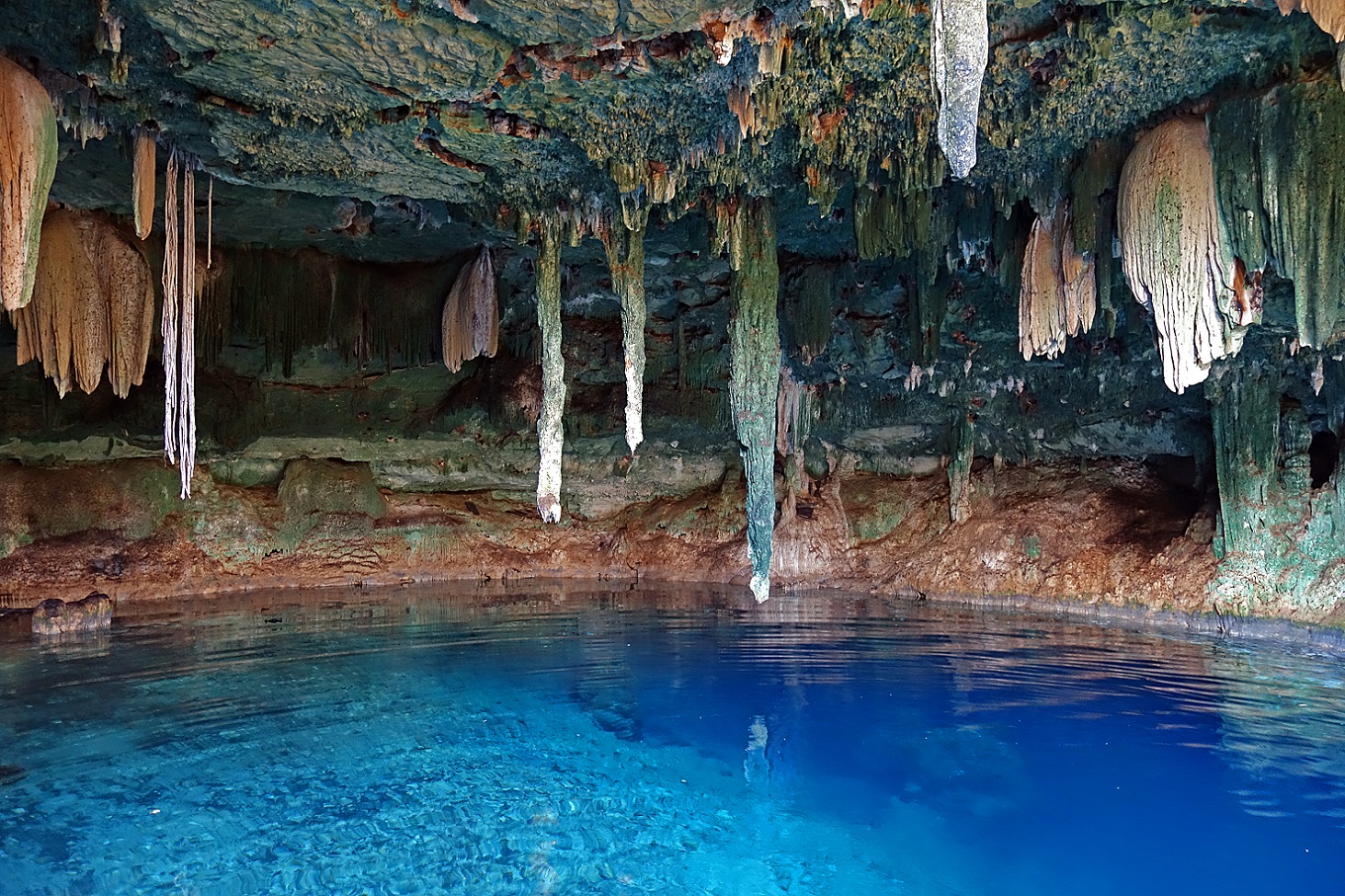
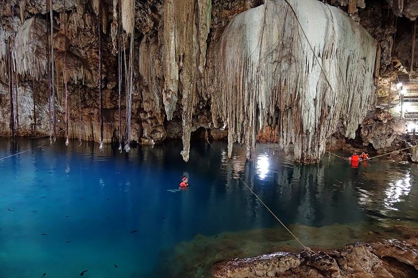
Cenotes:
Cenotes are
natural holes formed by the collapse of limestone bedrock revealing groundwater
pools. There are hundreds of them across the Yucatan peninsula. Most have
crystal clear water.
- Kankirixche is a little-visited cenote 9km east of Highway
261 on the opposite side of the Hacienda San Pedro Ochil.
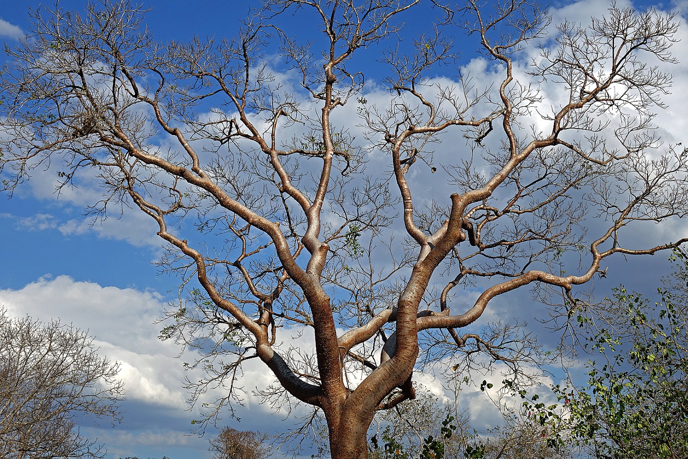
Beautiful Chaca tree near the entrance of the cenote. Its leaves and
glossy copper-colored bark are used in traditional Maya medicine.
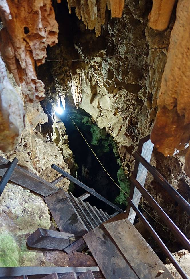
- Tzapakal, Santa Cruz, and Chelentun
are three cenotes in the former Hacienda Chunkanan,
3km south of the village of Cuzama, itself 16km
south-east of Acanceh.
Hacienda′s
old narrow rail track that gives access to the cenotes.
Tzapakal is a relatively small, but deep and dark cenote.
The rope stretched on the water surface is for the safety of the visitors who
wish to swim.
|
|
|

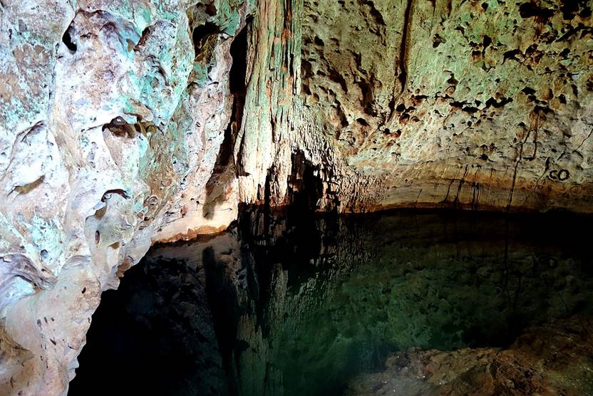
Santa Cruz.
Left: stairs leading to the water pool. Right: the water pool.
|
|
|

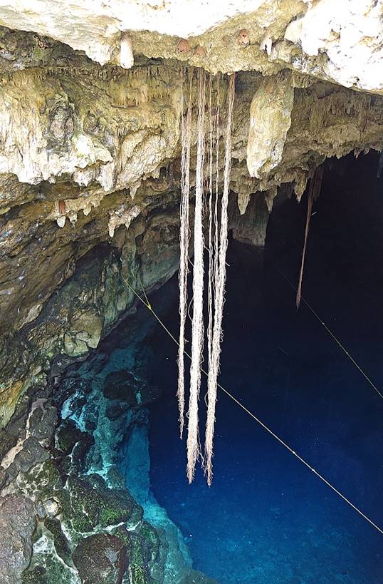
Chelentun, and its incredibly clear
water.
|
|
|
|


- Cenotes of Dzitnup (X′Keken and Samula). Located 5km southwest of Valladolid, they are part
of a commercial complex and are very popular with both locals and tourists
coming from Cancun (who usually combine their visit to the cenotes with a visit
to the nearby Maya site of Chichen Itza). They are
nevertheless extremely beautiful.
Left: X′Keken. Right: Samula.
|
|
|

![]()