Morocco (February 2020): Seven-day trek in the Moroccan desert

Return to my
mountaineering/trekking/travel webpage
On this relatively
short trip my only goal was to trek in the desert of southern Morocco
(northwestern Sahara) with my friend Oumar Oulaidi. I flew
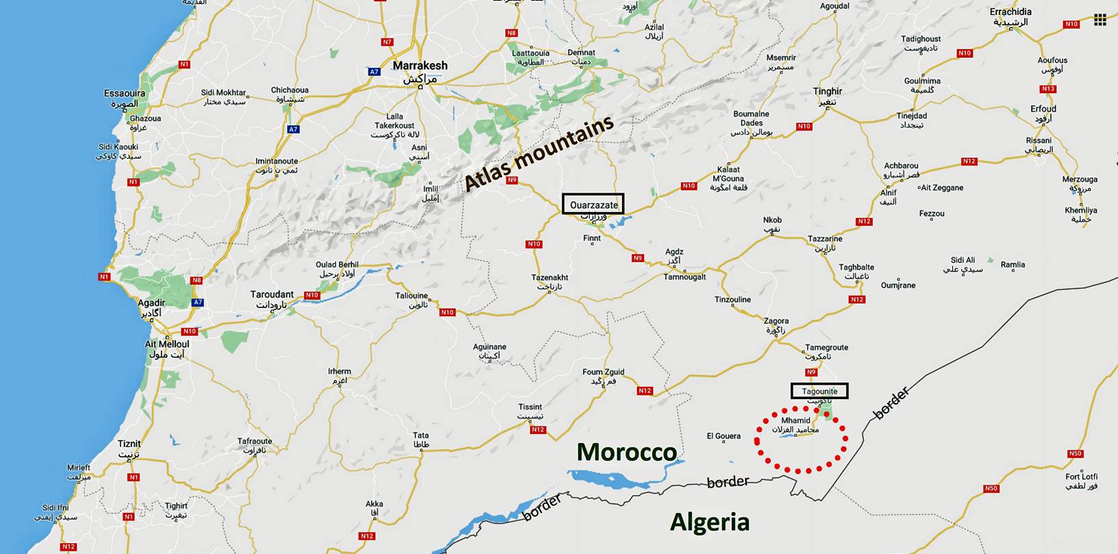
directly from Paris to Ouarzazate, a town located on
the southern side of the High Atlas mountain range, where I met Oumar. Together we drove to the village of Tiraf, a few kilometers south of the small town of Tagounite and 20km from the border with Algeria (see maps
below). Our trek started in the hamlet of Magag, next
to Tiraf, and ended a week later near the N9 road
between Tagounite and M′Hamid.
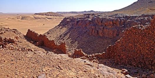
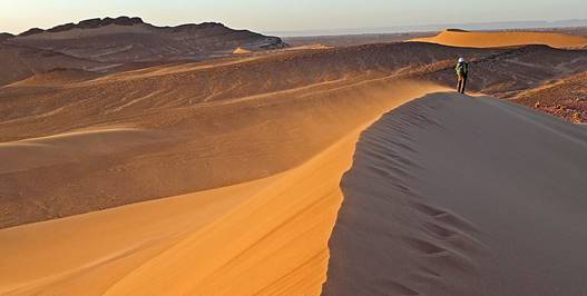
We traversed amazing sand-dune areas (ergs), flat, barren, but still beautiful,
terrain (hamada), and rocky
mountains surrounded by steep escarpments. We also passed by intriguing
old ruins, remnants of a forgotten history when this area of the Sahara was
more densely populated than today and when caravans were carrying gold, ivory,
salt, carpets, slaves... between Tamegroute (a few
kilometers north of Tagounite) and Timbuktu in
present-day Mali. The winter weather during the trek was pleasant, with cool
nights and warmer days.
For many years I had
considered traveling in the Moroccan desert. But I was reluctant to do so
because the area had become increasingly touristic, with large organized
4WD/ATV tours and camel treks, and mediatized sport events such as moto/auto
rally raids and multi-day ultramarathons. In May 2017 in a cafe of Fez, Oumar convinced me that I should give this desert a try.
The Moroccan government had recently restricted the areas where 4WD/ATV are
allowed to go and for logistics reasons camel treks tend to follow the same
routes already equipped with fixed bivouacs. Oumar
told me that we could follow an itinerary that I would like. Indeed, during our
entire trek we only saw one small group of trekkers and one fixed bivouac, both
from a distance, and no 4WD/ATV. The desert was void of foreign noise (except
ours), as it should be.
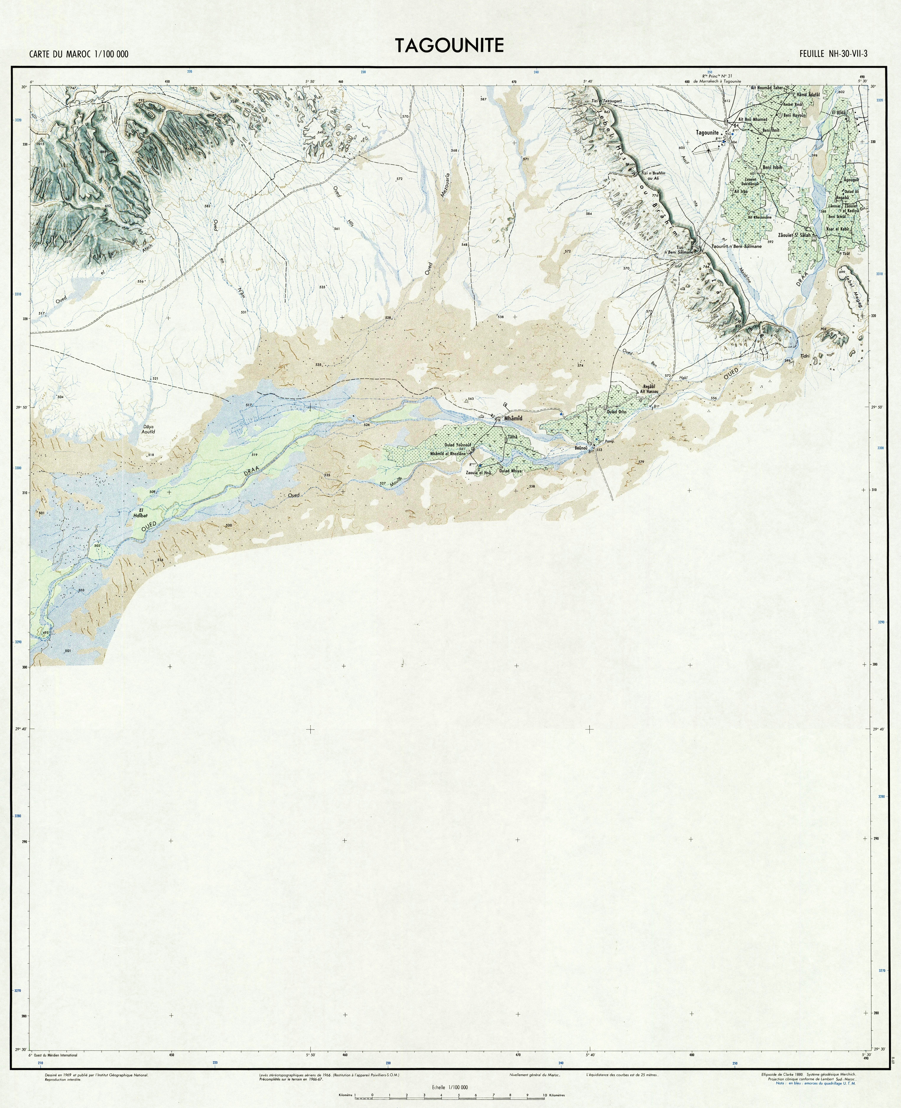
Maps:
Location of the trek area
in southern Morocco (circled in dotted red line).
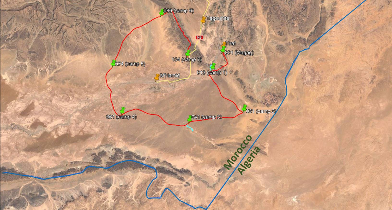
The trek itinerary is
shown below in an aerial view, based on my recorded GPS waypoints. To access
these waypoints first click here
to download the morocco-2020.kmz file and then open this file in Google Earth.
The successive waypoints are numbered 001 (start of the trek in Magag) to 104 (end of the trek near the N9 road between Tagounite and M′Hamid). The
waypoints with green icons are the locations where we spent nights. Those with
yellow icons (not shown in the aerial view below) were recorded between camps
along the main path of the trek, while those with orange icons were recorded
along short side-trips. The main itinerary and two side-trips (made from camps
1 and 3) are drawn in red and light blue lines, respectively. (The darker blue
line is the border between Morocco and Algeria.) Only the waypoints are
accurate; the lines are approximative. The total
length of the trek is 140km.
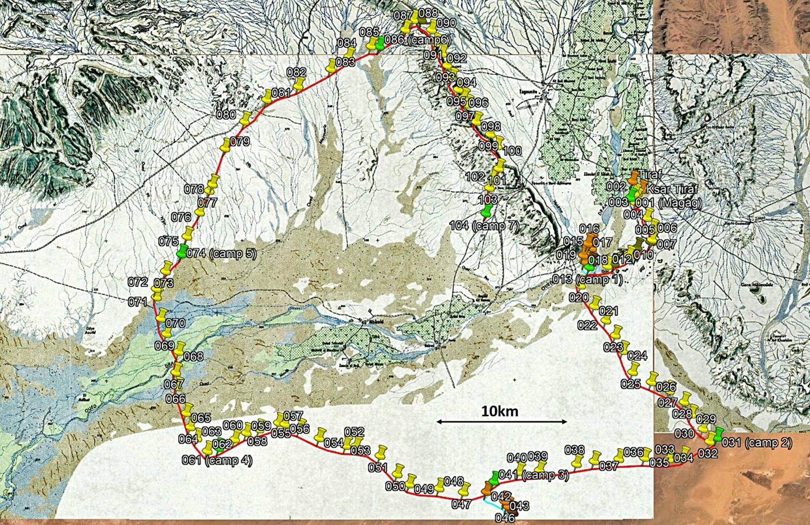
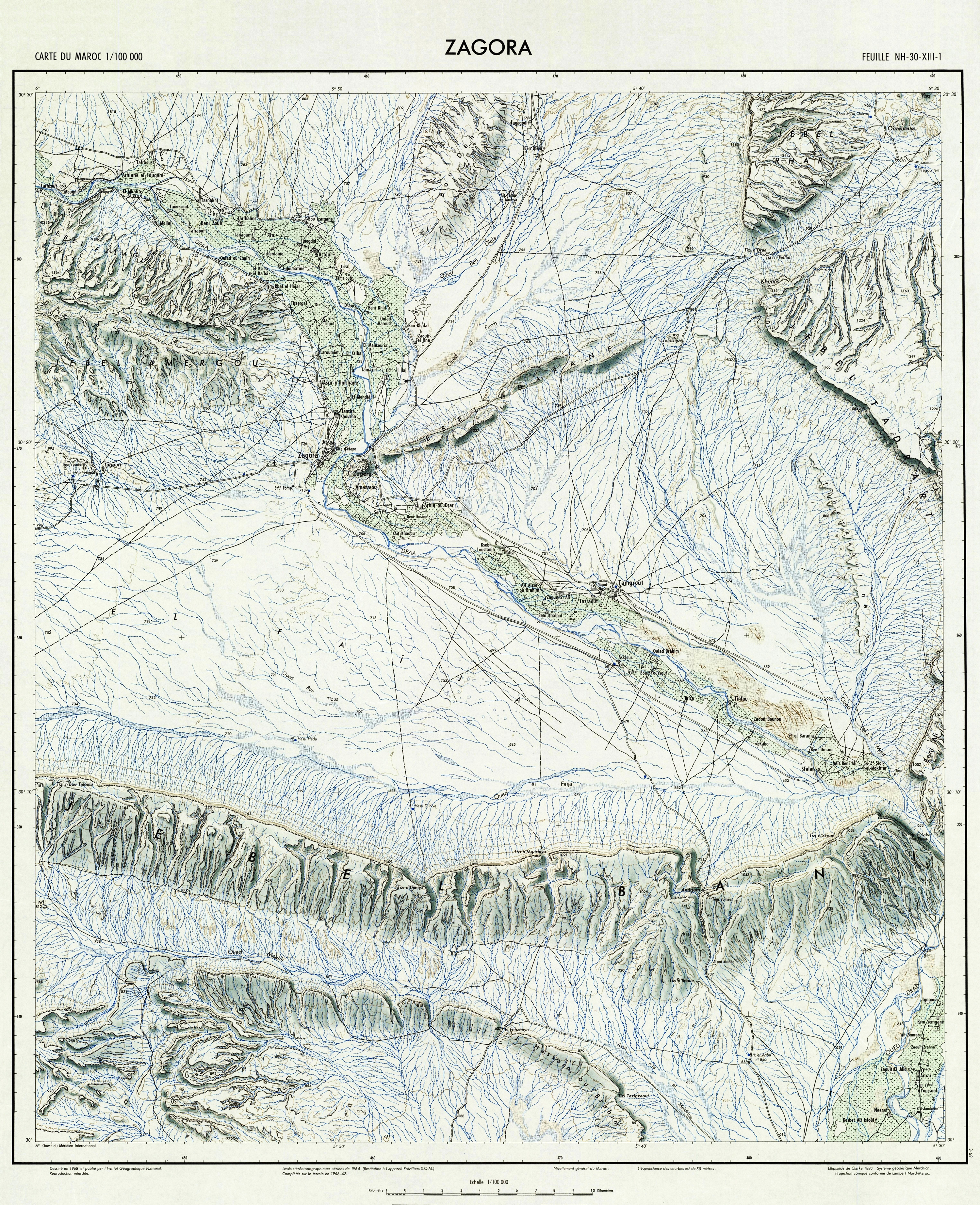
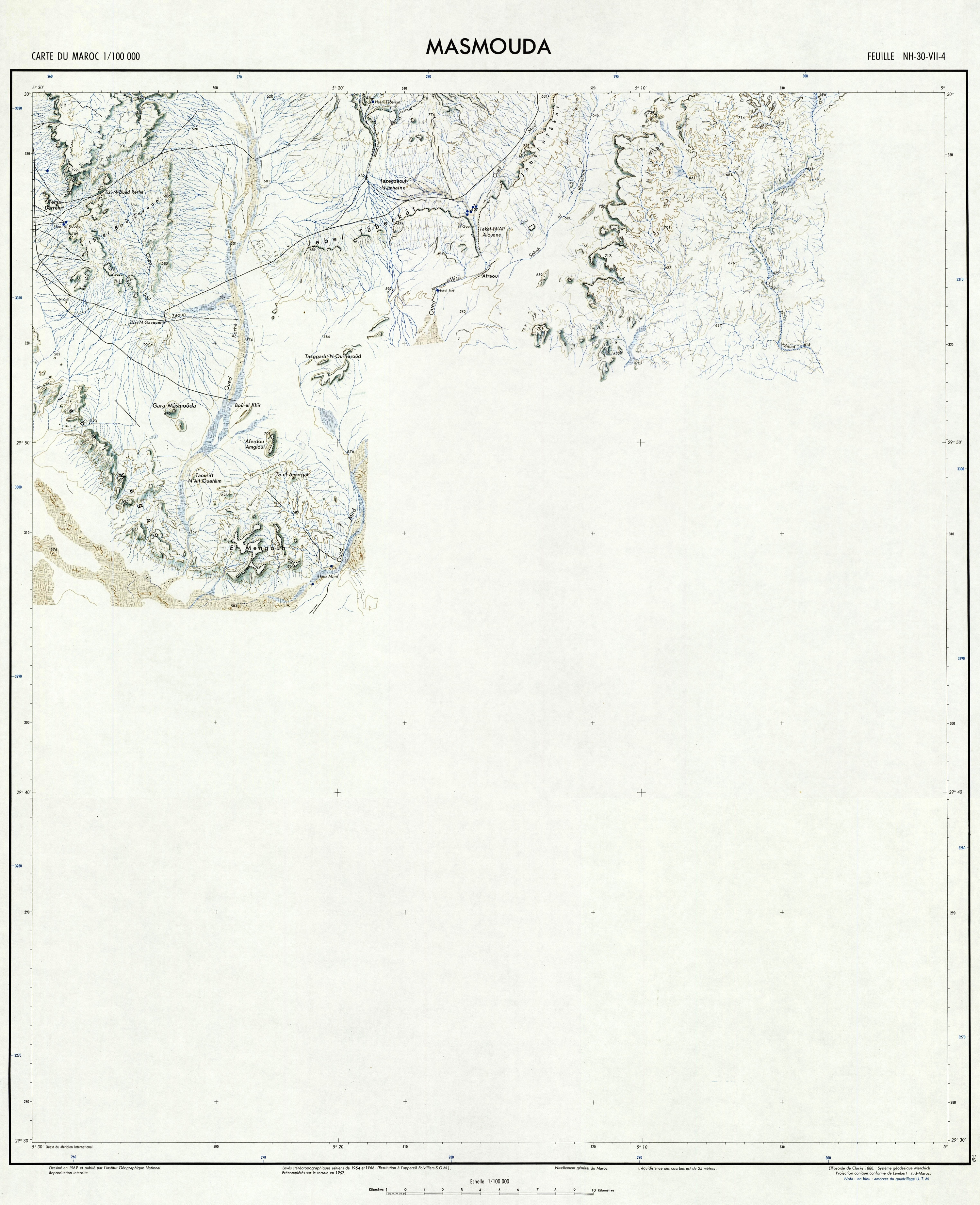
In the image below the
same waypoints and paths are shown over relevant portions of three old
topographic maps. Click on the following links to download the entire three
topographic map sheets: 155
- TAGOUNITE (most of the trek), 144
- ZAGORA (northern tip of the trek), and 156
- MASMOUDA (a piece of the southeastern part of the trek). The overlay
images of the relevant portions of these maps are also included in the
morocco-2020.kmz file (see above), along with the GPS waypoints. The
southernmost portions of the 155 - TAGOUNITE and 156 - MASMOUDA map sheets are
blank, so the section of the trek between waypoints 030 and 064 (slightly more
than 2 full days of trek) is outside their coverage.
[For an extensive source of topographic
maps of Morocco click this link: https://jemecasseausoleil.blogspot.com/2017/06/cartes-du-maroc.html.]
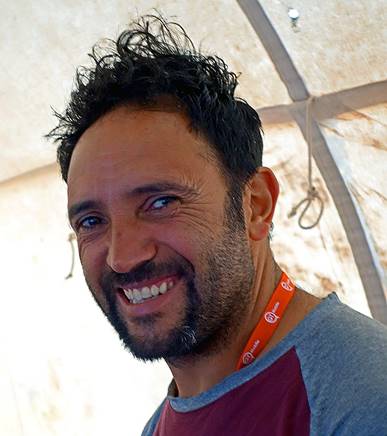
Team
and logistics:
The logistics for
this trek was arranged by Oumar Oulaidi,
a CFAMM certified guide based in Marrakech. Oumar is
originally from the Ait-Bouguemez valley in the High
Atlas, where his family still lives and owns a pleasant ″gite″ (a kind of guesthouse). I have known Oumar for almost 20 years. He arranged many of my treks in
Morocco and we had previously trekked together in 2016. Click here for more information about him and how to
contact him.
We were accompanied
by Mohamed, Bada, and Hada.
Mohamed (an outstanding cook) is also from the Ait-Bouguemez
valley. I had already trekked with him in 2013. Bada
is from the village of Tiraf and Hada
from the town of Tagounite. Both were in charge of
the two dromedaries that carried our food, water, tents, etc... Bada is a formidable living memory of the history of the
region. But his knowledge is based on oral multi-generation transmission, hence
combines facts and events with legends that are difficult to separate. All four
of them are ethnic Berber, who speak Tamazight (Berber language) between them. Oumar and Mohamed also speak excellent French.
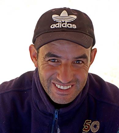
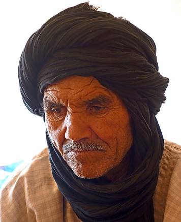
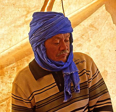
|
Oumar |
Mohamed |
Bada |
Hada |
|
|
|
|
|
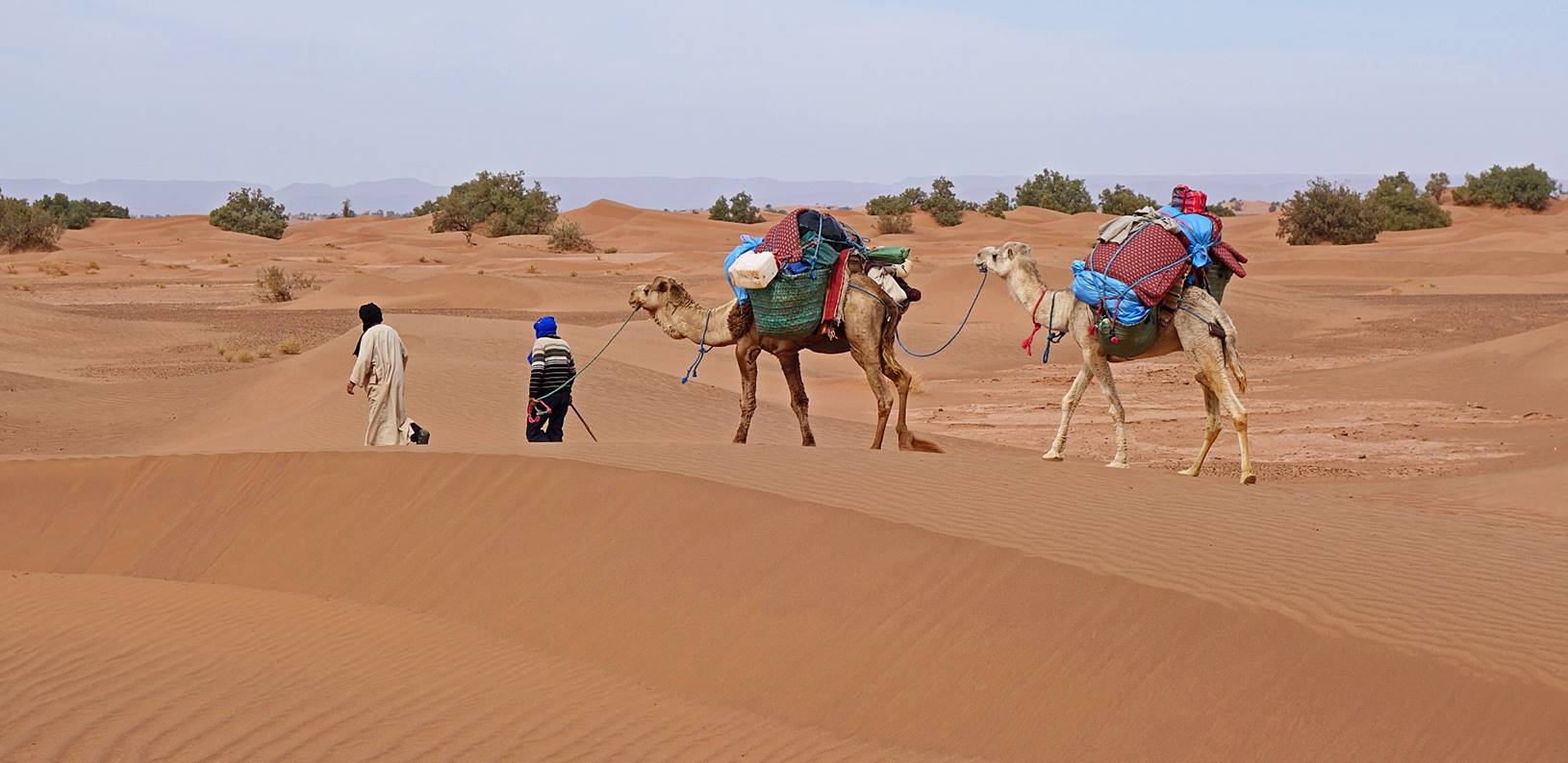
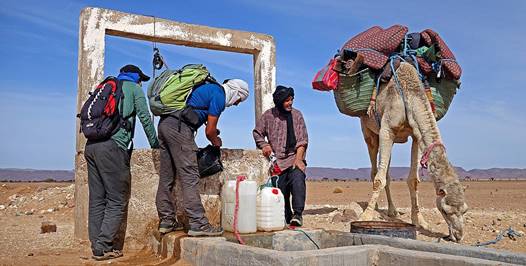
Oumar had arranged two
dromedaries for the trek. They were most likely Mali-born dromedaries, which
are bigger and stronger than the typical Moroccan ones. Each could carry 300 to
350kg. From Day 1 they carried all what we needed for the entire trek,
including all the potable water and food for 7 days. During the trek we passed
by a few wells, but their water was often too salty for direct consumption.
Occasionally we used some of it for cooking and washing.
Our loaded
dromedaries driven by Bada and Hada
in small sand dunes.
Photos:
Click
on the links below to see pictures of this trip. The pictures of the 7 days of
trek are shown in chronological order.
[Note: Names of places are sometimes
difficult to find. Furthermore, the same place may have several different
names, while the same name may be given to different places. When a name is
commonly found on maps (e.g., Tagounite, Tiraf) I use it. Otherwise, I use the name given to me by
local people. But this can still be confusing. This is in particular the case
for the name ″Jbel Bani″.
The last day of the trek follows the crest of a mountain that local people call
Jbel Bani. But the
topographic map 144 - ZAGORA calls it differently and gives the name Jbel Bani to another mountain
range located some 15km further north. On the web, the name Jbel
Bani (or Beni) is used for
other mountains of southern Morocco. So, here I will use the name Jbel Bani given by local people
for the mountain I visited during the 7th day of trek between waypoints 087 and
103 (and more briefly on the 1st day between waypoints 014 and 019).]
|
|
|
|
|
|
|
|
|
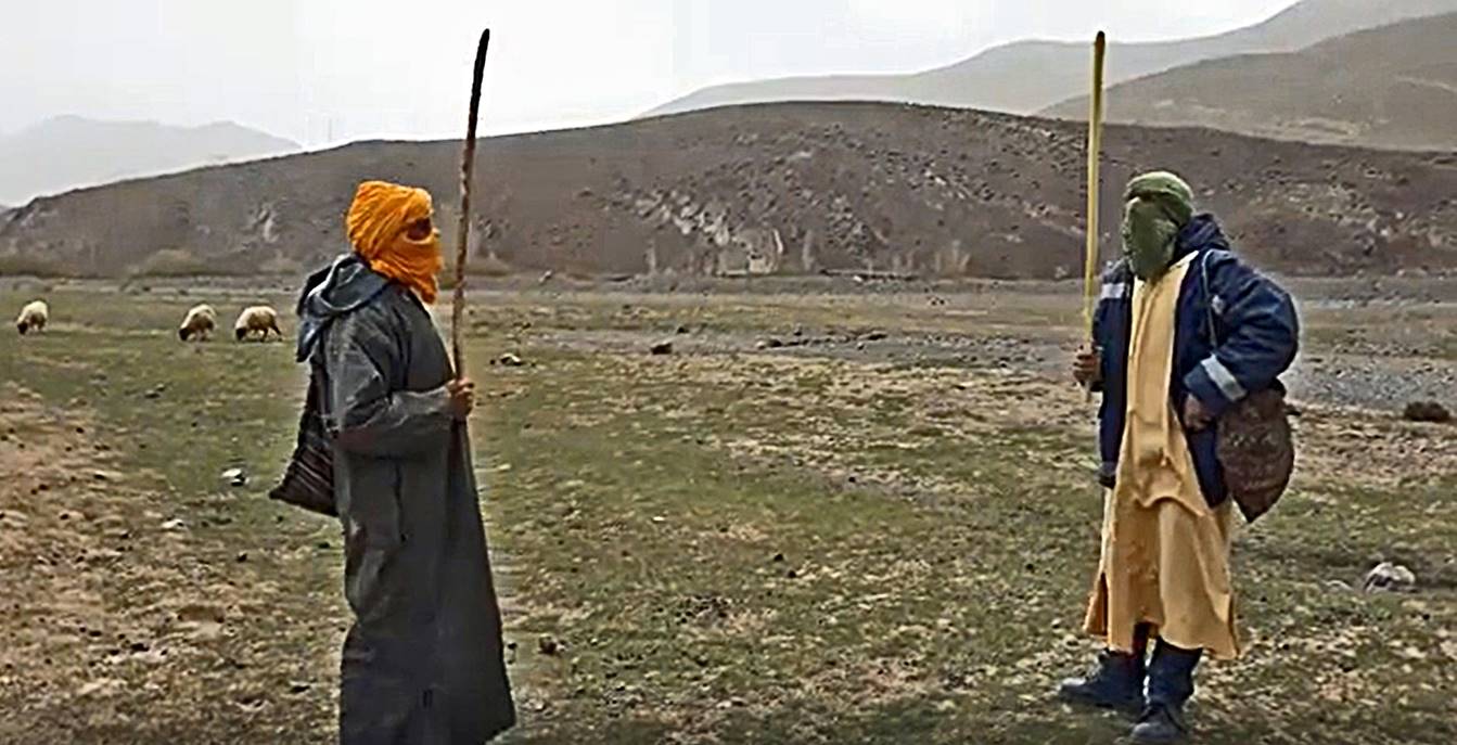
Addendum (March 2020): Berber salute
and distancing in coronavirus time in the High Atlas (click on picture to see
the movie sent to me by Oumar).
![]()
Return to my
mountaineering/trekking/travel webpage