Nepal (April 2016): Valleys of Nepal‛s Northwestern Corner
![]()
Return to my mountaineering/trekking/travel webpage
Map of trek area. Red lines: trek itinerary. Yellow line: border with India. Purple line: border with Tibet.
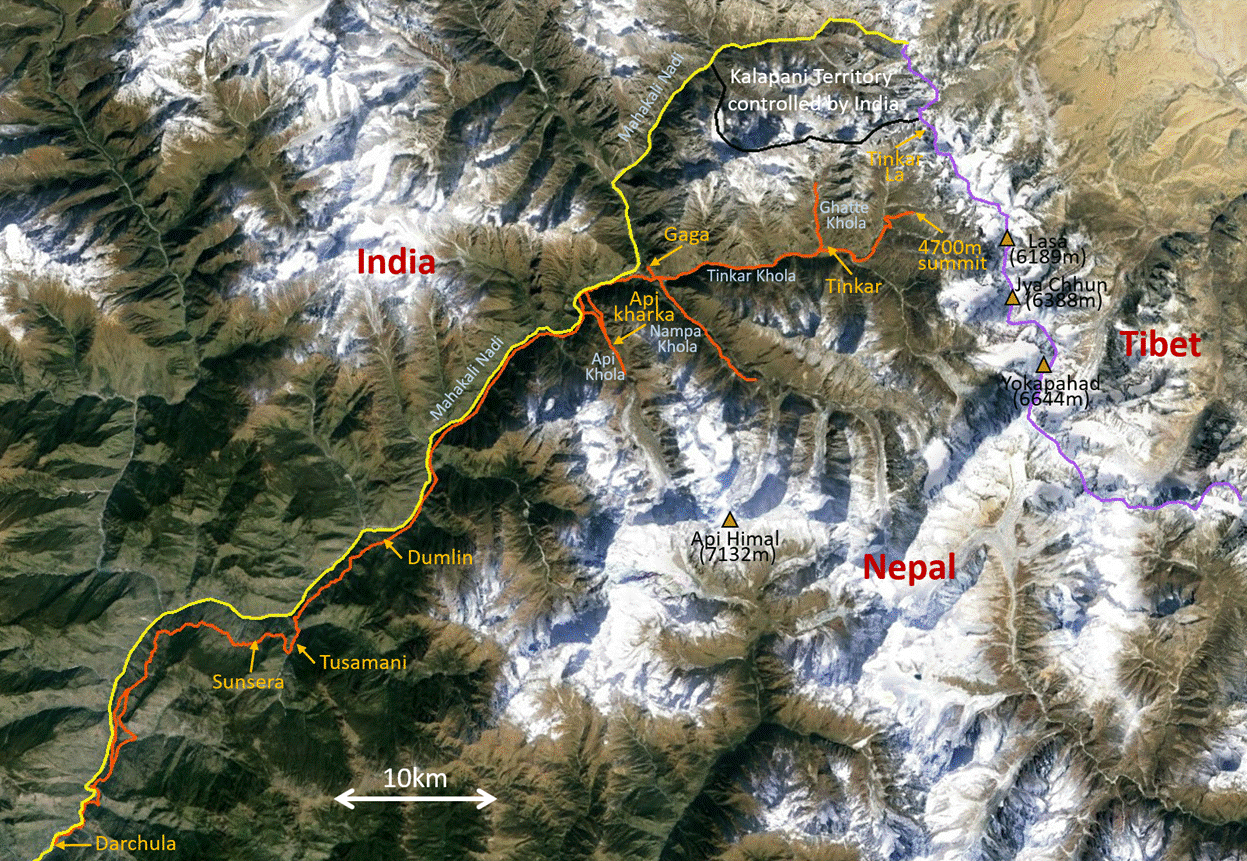
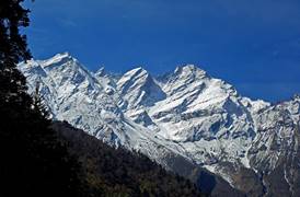
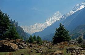
The extreme northwestern region of Nepal forms a north-pointing protrusion wedged between India and Tibet. On the west Mahakali Nadi (river) separates Nepal from the Indian state of Uttarakhand (border shown in yellow in the above map). On the east a chain of high peaks stands between Nepal and Tibet (border shown in purple). On the south a mountain range culminating at Api Himal (7132m), the highest Nepalese peak west of the Dhaulagiri massif, isolates the region from the rest of Nepal. The region contains over 60 peaks rising above 5000m, among which a dozen exceed 6000m. The entire region is sparsely populated with only two villages, Gaga and Tinkar, the northernmost villages of Nepal. In fact, Tinkar is inhabited only during the monsoon/summer months. Access to this region is on foot along the eastern bank of Mahakali Nadi, starting from Darchula, which is reachable by car from Atariya in the southern plain of Terai. Unlike other northern regions of Nepal, this NW corner is prominently Hindu, with limited Buddhist influence.
The northern border of this region is disputed between Nepal and India. In 1962, after losing a war against China, India occupied a region known as the Kalapani Territory (see map above) and now administers this territory as part of its Uttarakhand state. See here for more detail.
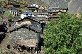
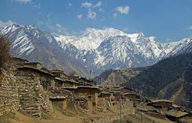
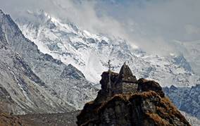
This NW corner of Nepal is traversed by three main valleys created by tributaries of Mahakali Nandi: Tinkar Khola, Nampa Khola, and Api Khola. The valley of Tinkar Khola connects the village of Gaga to Tibet at Tinkar La (a 5258m pass), via the village of Tinkar. This valley used to be a major trade route, but after its occupation of Tibet the Chinese government has closed the crossing of Tinkar La. As a consequence, the former trail is barely maintained and over the years has been damaged in many places. Ironically, local people still provide some minimal maintenance in order to access high-altitude pastures where they can collect yarchagumba, the Himalayan natural Viagra that is in high demand in several Asian countries, especially China! The Nampa and Api valleys only give access to pastures (kharkas); the trails in both valleys have been severely damaged (sometimes completely destroyed) by landslides, avalanches, and floods. Incredibly beautiful old merchant houses in Gaga and Tinkar, and remarkably well-engineered sections of the trail in the Mahakali and Tinkar valleys are testimonies of a time when trade across this region was thriving.
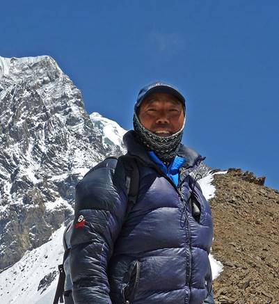
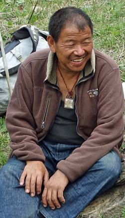
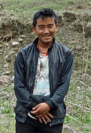
As for all my previous trips to Nepal during the past 17 years, the logistics for this trek was arranged by Windhorse Trekking. Dawa, with whom I had been on several trips before (Dolpo, Humla), was the leader of the support team. Pasang, with whom I had already traveled to Cho Oyu, was the cook. The porters were Tsiring (Dawa‛s son) and Rupak, from Kathmandu, and Uday, from a small village near Darchula.
|
|
|
|
|
|
|
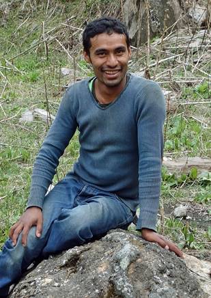
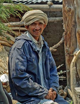
Dawa |
Pasang |
Tsiring |
Rupak |
Uday |
The itinerary of this trek is shown in red lines in the map at the top of this page. A Mahindra Jeep drove us from Atariya in southwest Nepal to Darchula (and back), via the hill town of Dadeldhura. We first hiked from Darchula to Gaga. From there we visited the Tinkar valley, then the Nampa valley, and finally the Api valley, before returning to Darchula. The paths that we followed upward and downward were essentially the same, with only minor differences. The trek itself took 18 days. Progress was often slow due to poor trail conditions (or the absence of trails). Four additional days were necessary to go from Kathmandu to Darchula and back. Few people visit this remote corner of Nepal. In fact, we saw no foreigners during the entire trip between the times when we left and returned to Kathmandu.
Click on the links below to see pictures of the various sections of this trip:
[As we travelled each path twice (first upward, then downward), in all pages (except the Api Valley one) I sorted the pictures as if they had all been taken while hiking upward.]
|
|
|
|
|
|
|
![]()