Nepal (October 2017): Simikot to Kolti via Mount Saipal
5. Ranikharka to Nunekhara Glacier (upper valley of Kawadi Khola)
![]()
Return to main Nepal 2017 webpage
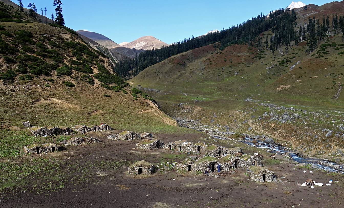
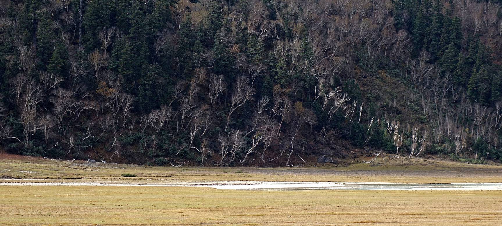
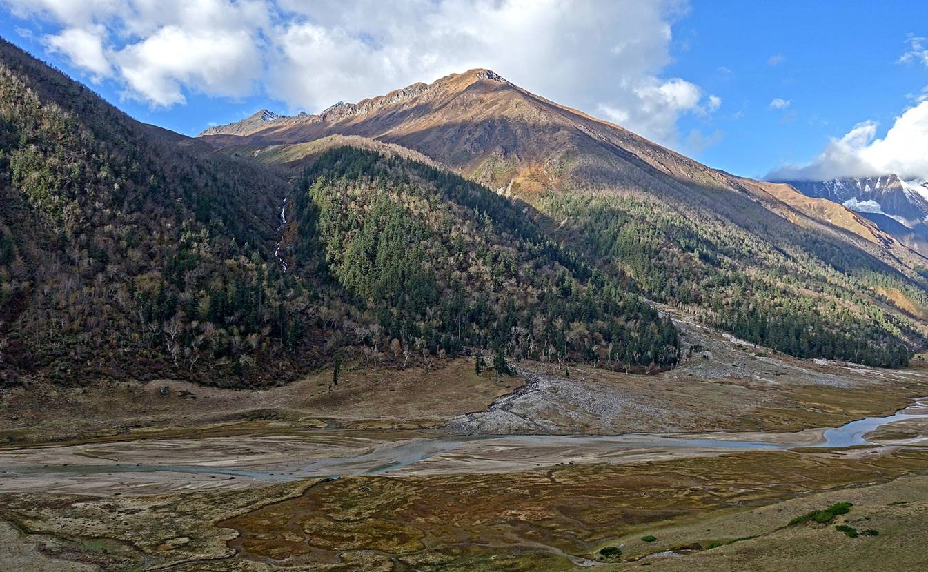
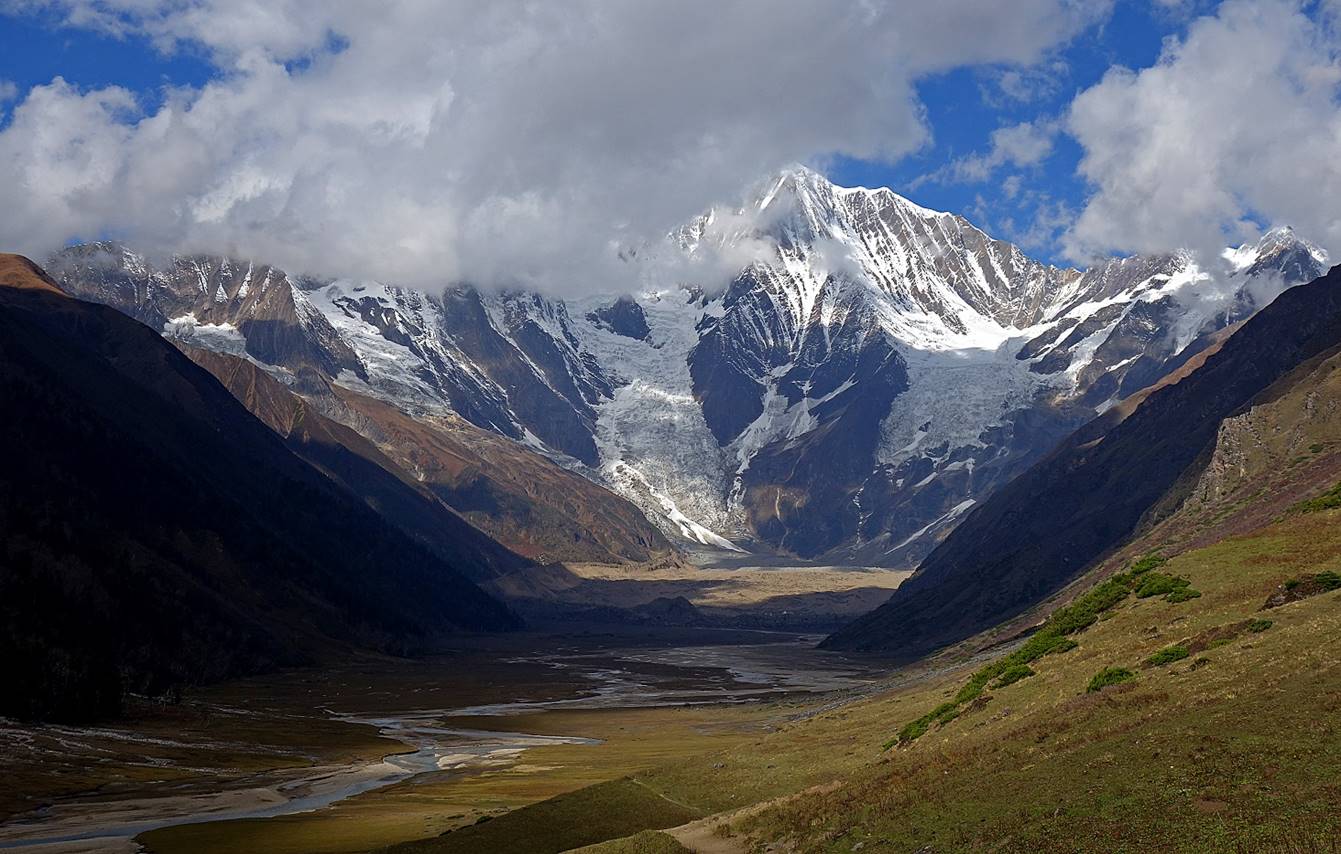
For local people, Ranikharka refers to the entire upper valley of Kawadi Khola, between the Nunekhara glacier (below Mount Saipal) and Lepche Khola. The name Ranikharka, which means ″Pasture of the Queen″, is fully appropriate: this valley is absolutely gorgeous with spectacular views of Mount Saipal and the various streams meandering from the Nunekhara glacier. Moreover, because it is wide and oriented east-to-west, it also enjoys much sunlight. The valley is dotted with several groups of stone huts. The largest and best maintained group is located on the right bank of Lepche Khola near its confluence with Kawadi Khola. We set our camp in this group. The entire valley was empty of people, as all the people and their animals that had lived here during the monsoon season had left a few days earlier. The entire valley lies between 3500m and 3650m.
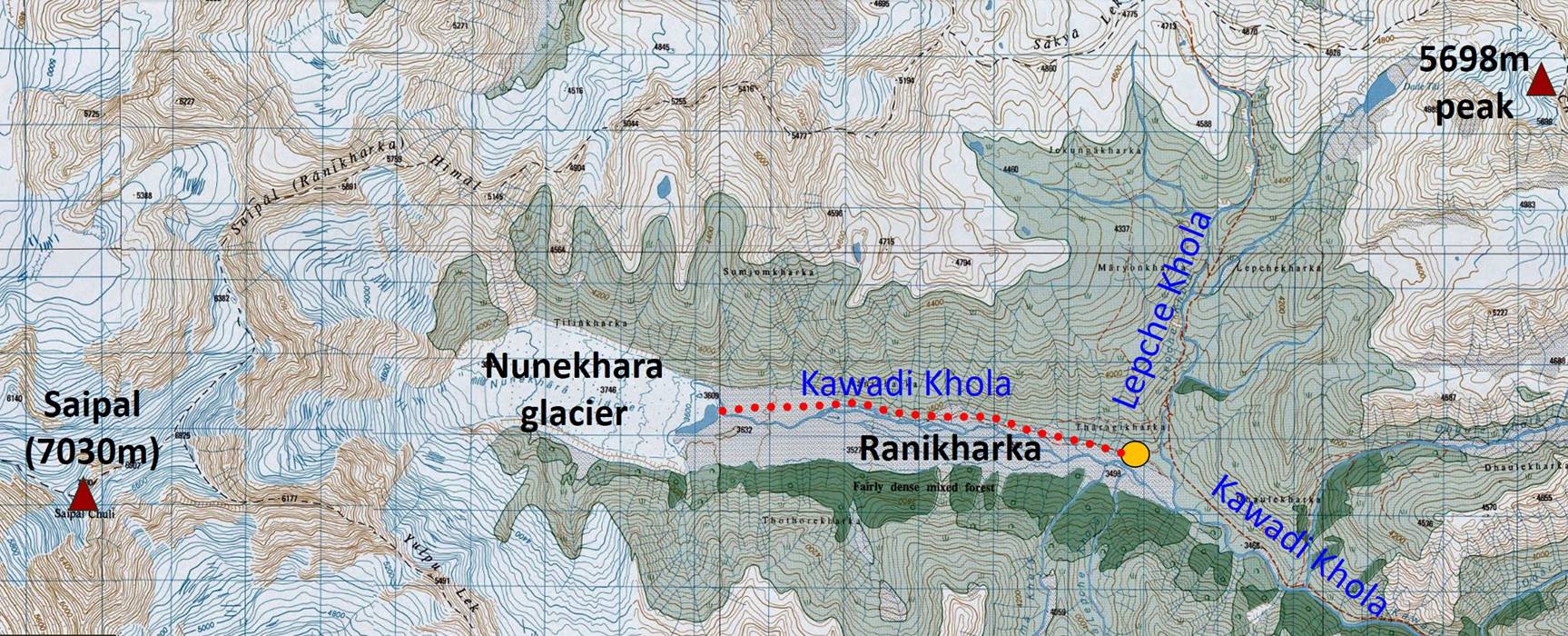
Map: The itinerary of this section of the trek is shown in red dotted line in the topographic map below. Consecutive blue vertical and horizontal lines are spaced by 1km.
(Reminder: These 50K topographic maps are available in their entirety at https://jemecasseausoleil.blogspot.fr/2017/07/cartes-du-nepal.html.)
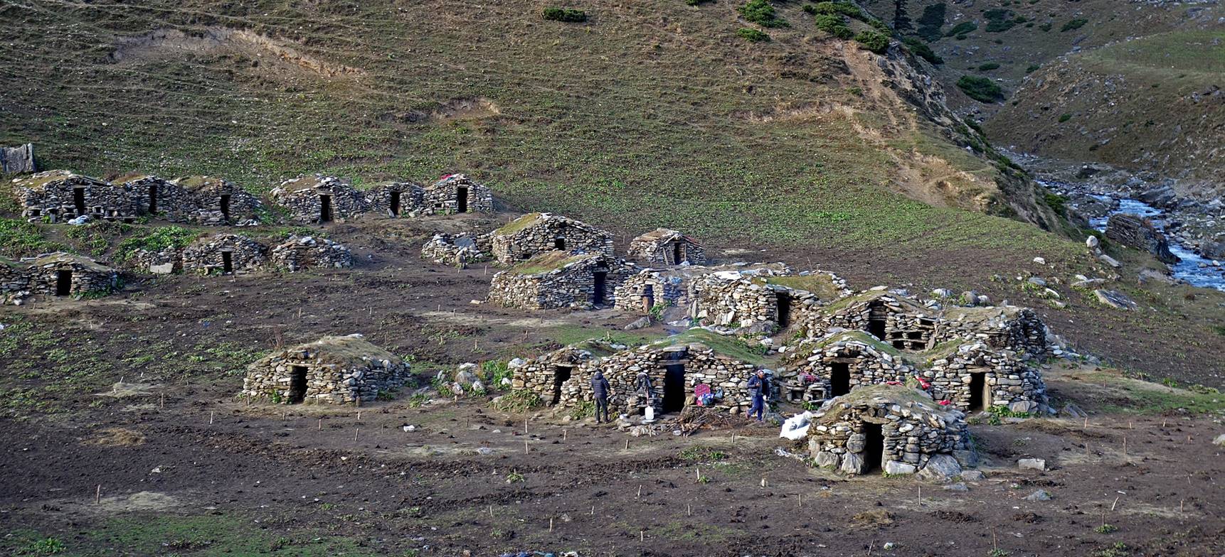
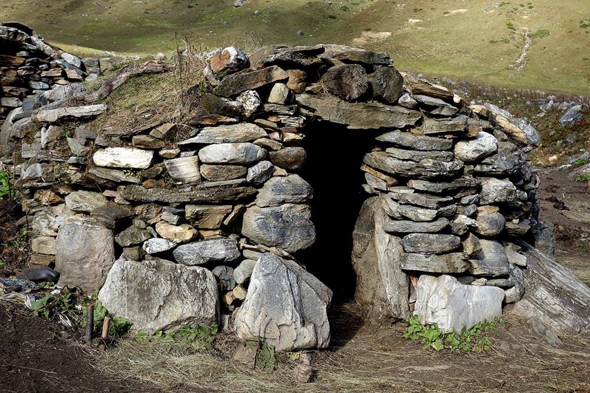
Group of huts where we set our camp for two nights, with Lepche Khola on the right side of the pictures.
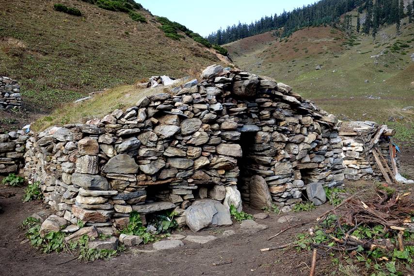
Closer views of two stone huts. Holes in the front of some huts, like those visible in the photo on the left (and in the previous photo), are for nesting chickens.
|
|
|
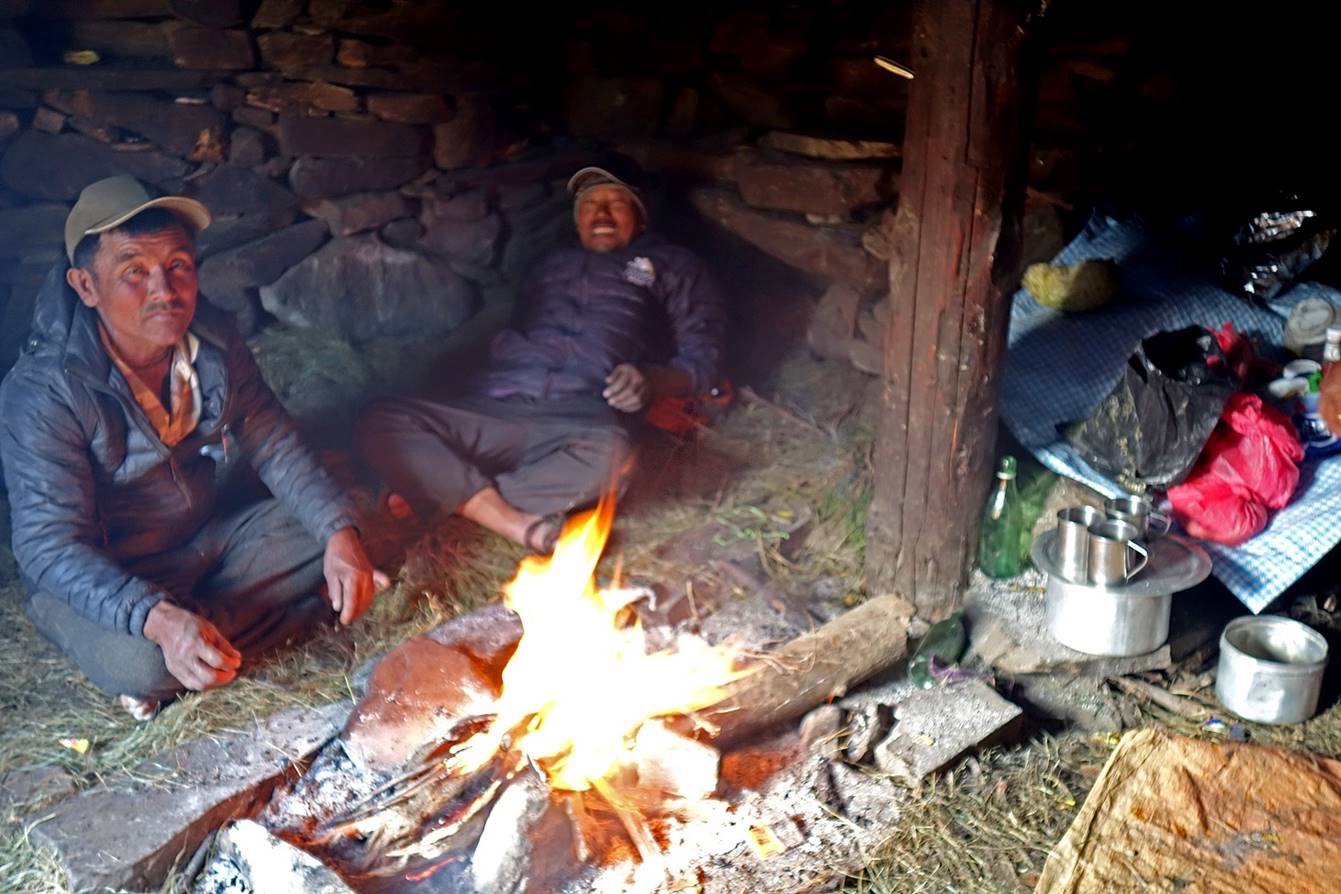
Our muleteer and Dawa#1 getting warm (and breathing much smoke as well) around a fire in one of the huts.
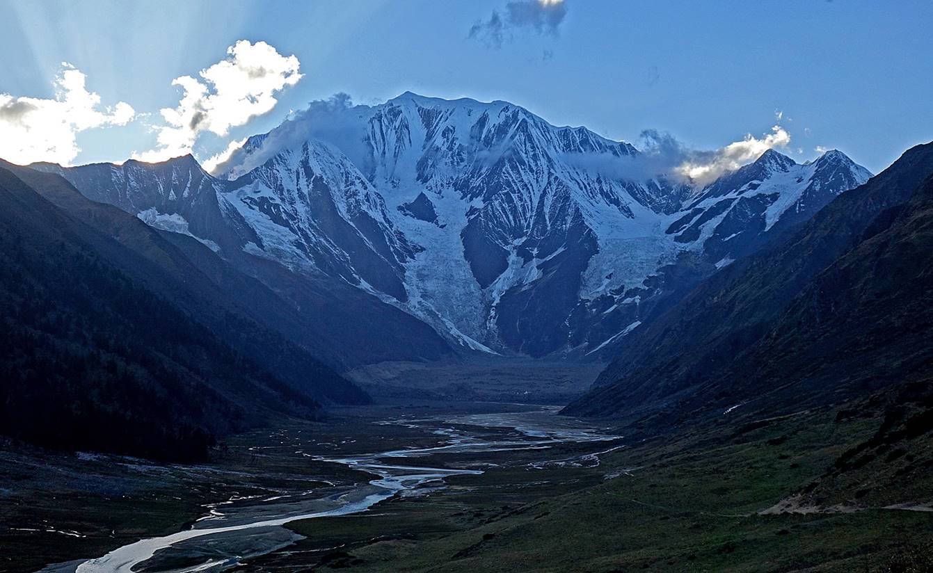
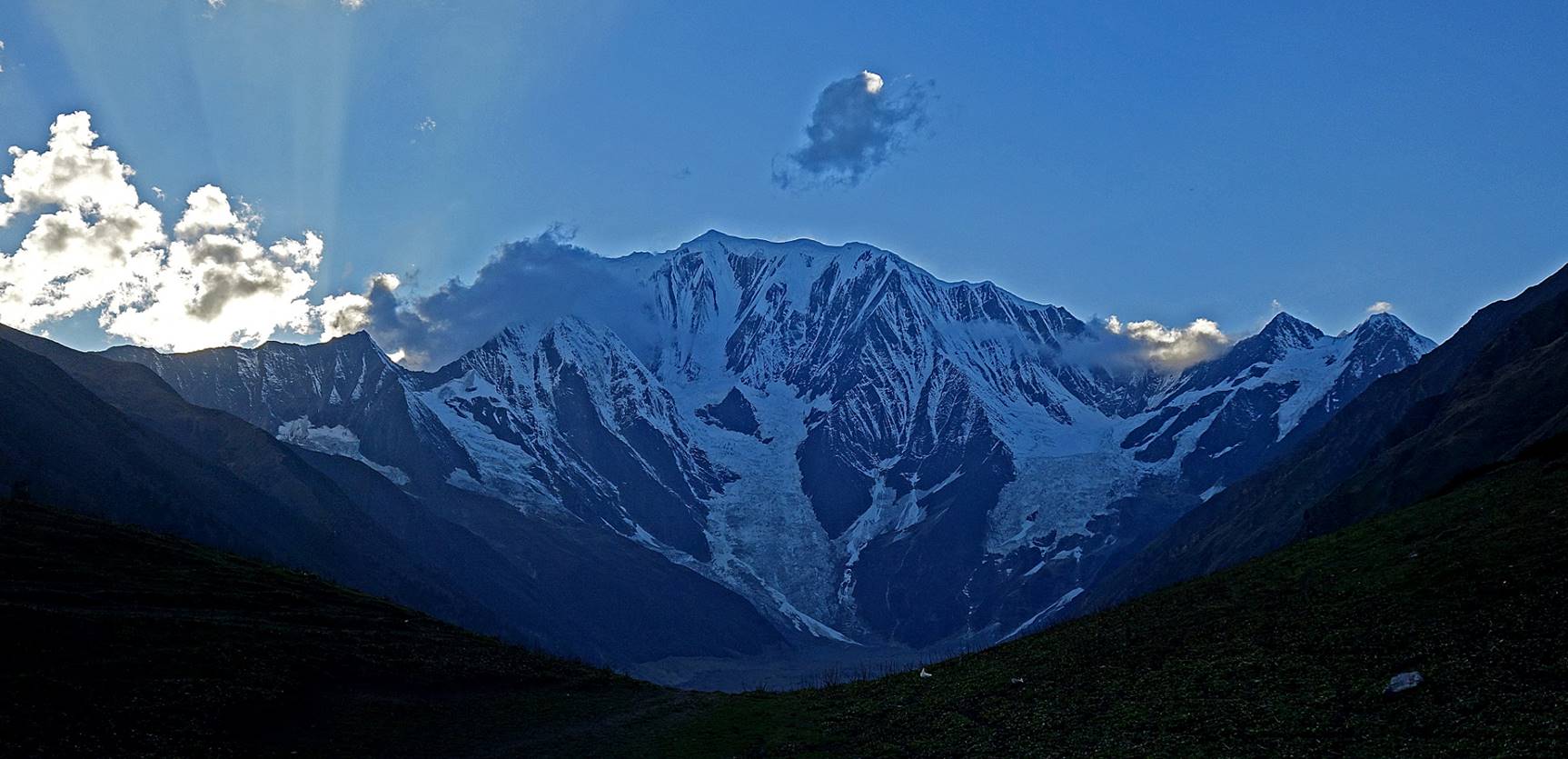
Views of the bottom of the valley near our camp.
|
|
|
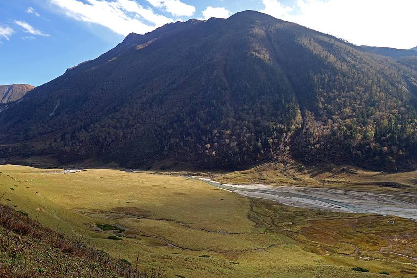
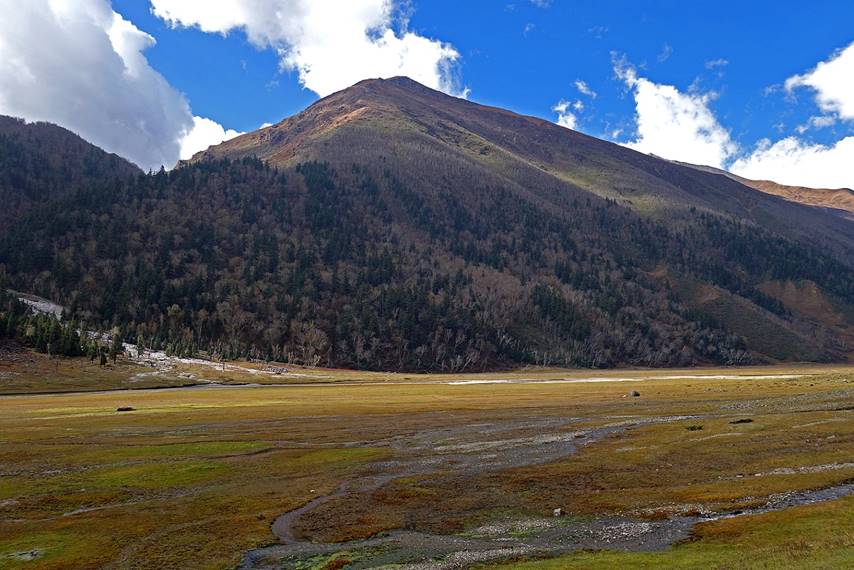
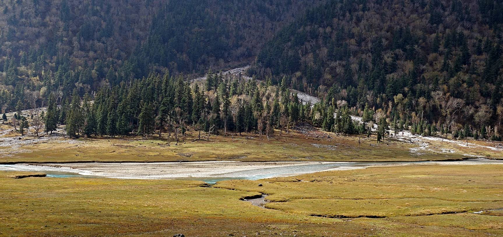
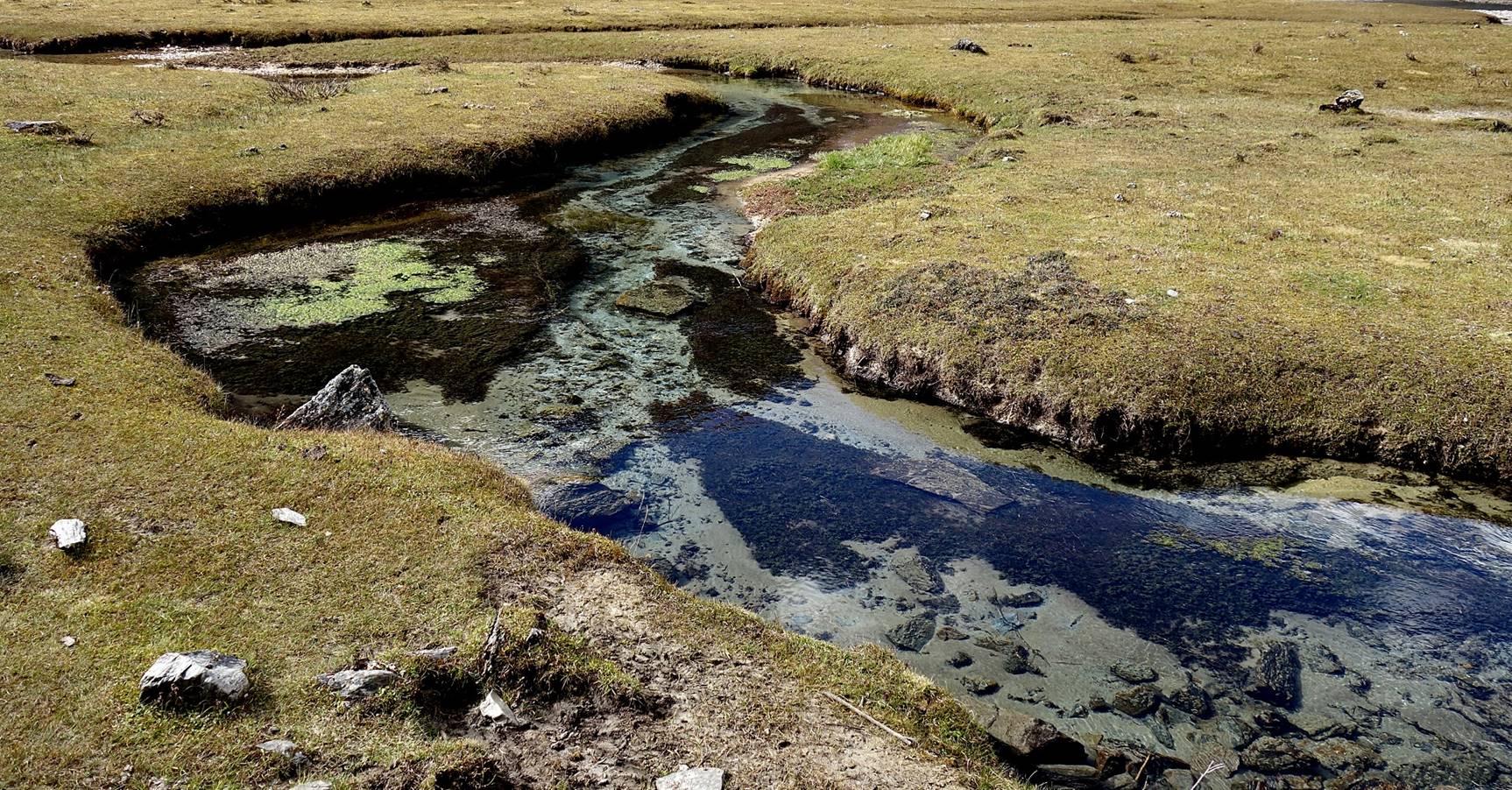
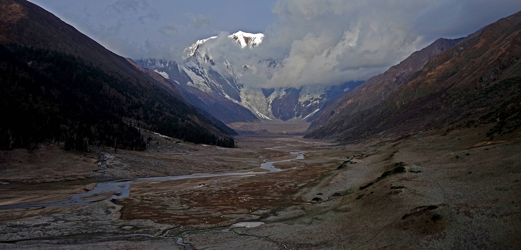
Meanders of Kawadi Khola and its various streams seen:
- in the evening,
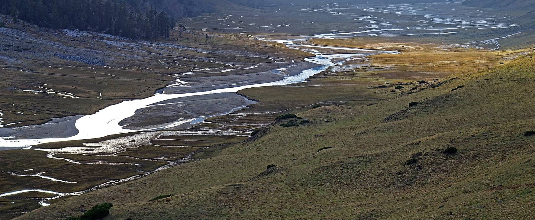
- in the early morning,
- and a bit later in the morning.
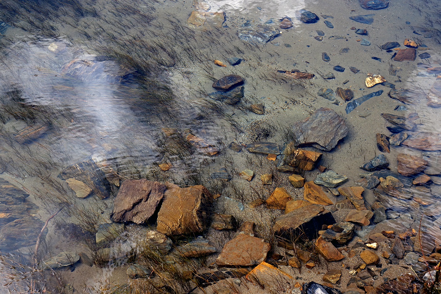
Transparent water of the streams.
Sunrise seen from our camp (photo facing east).
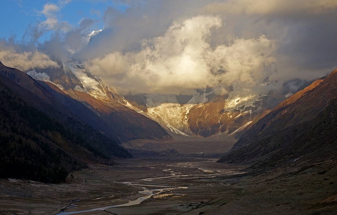
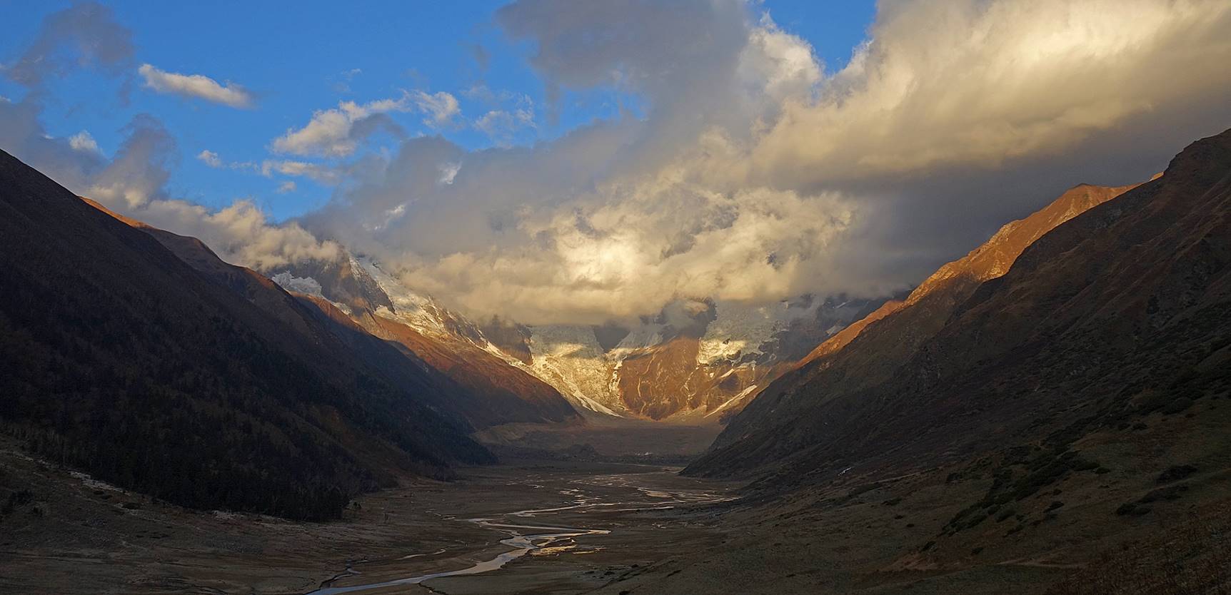
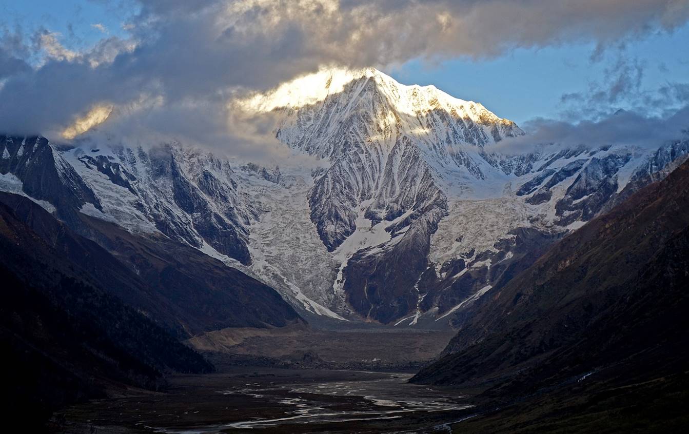
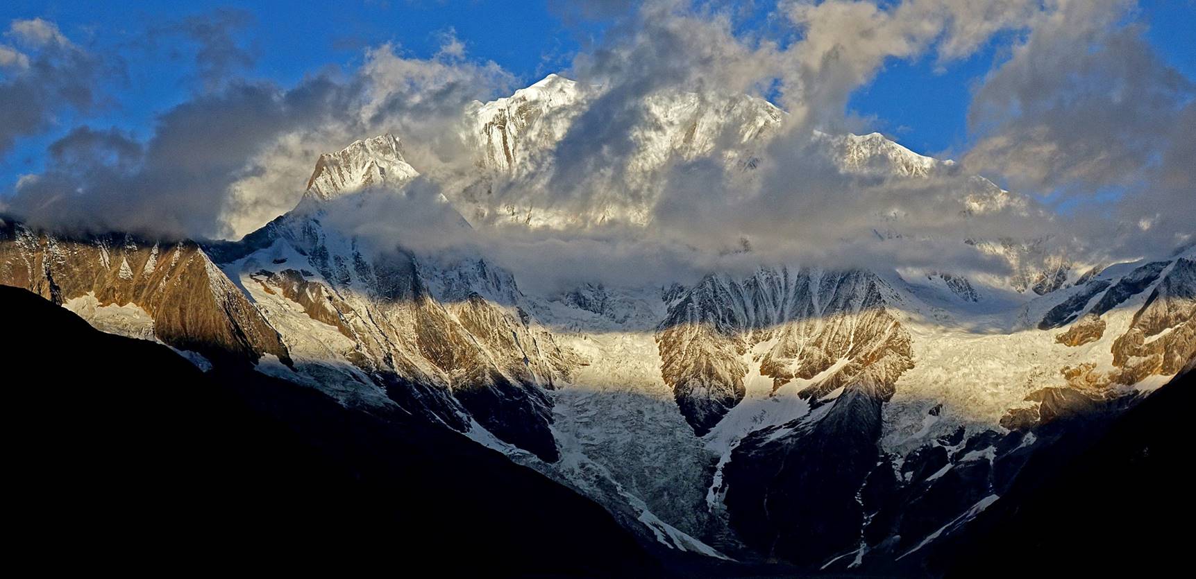
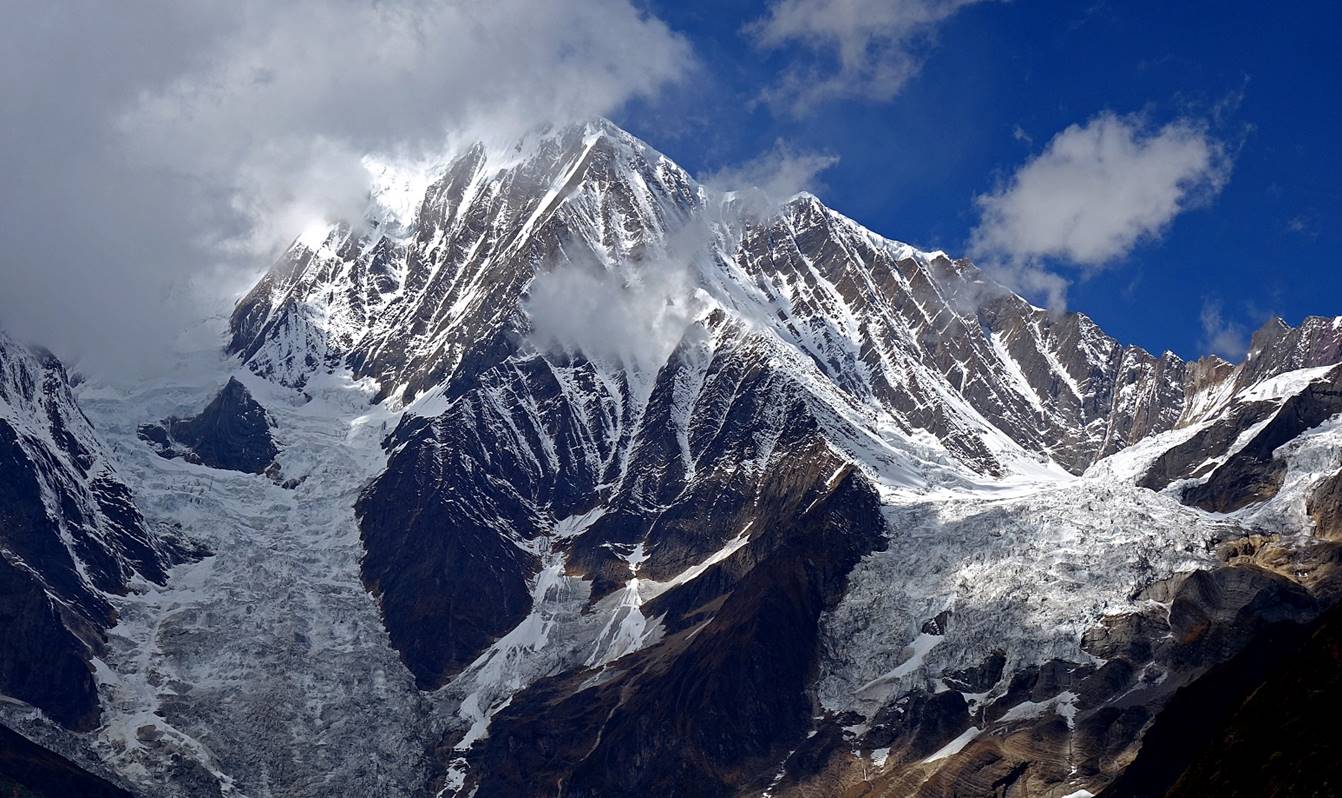
Successive views of Mount Saipal at the western end of Ranikharka before, during and after sunrise. (While we had many cloudless days during the trek, we were less fortunate during our stay in Ranikharka.)
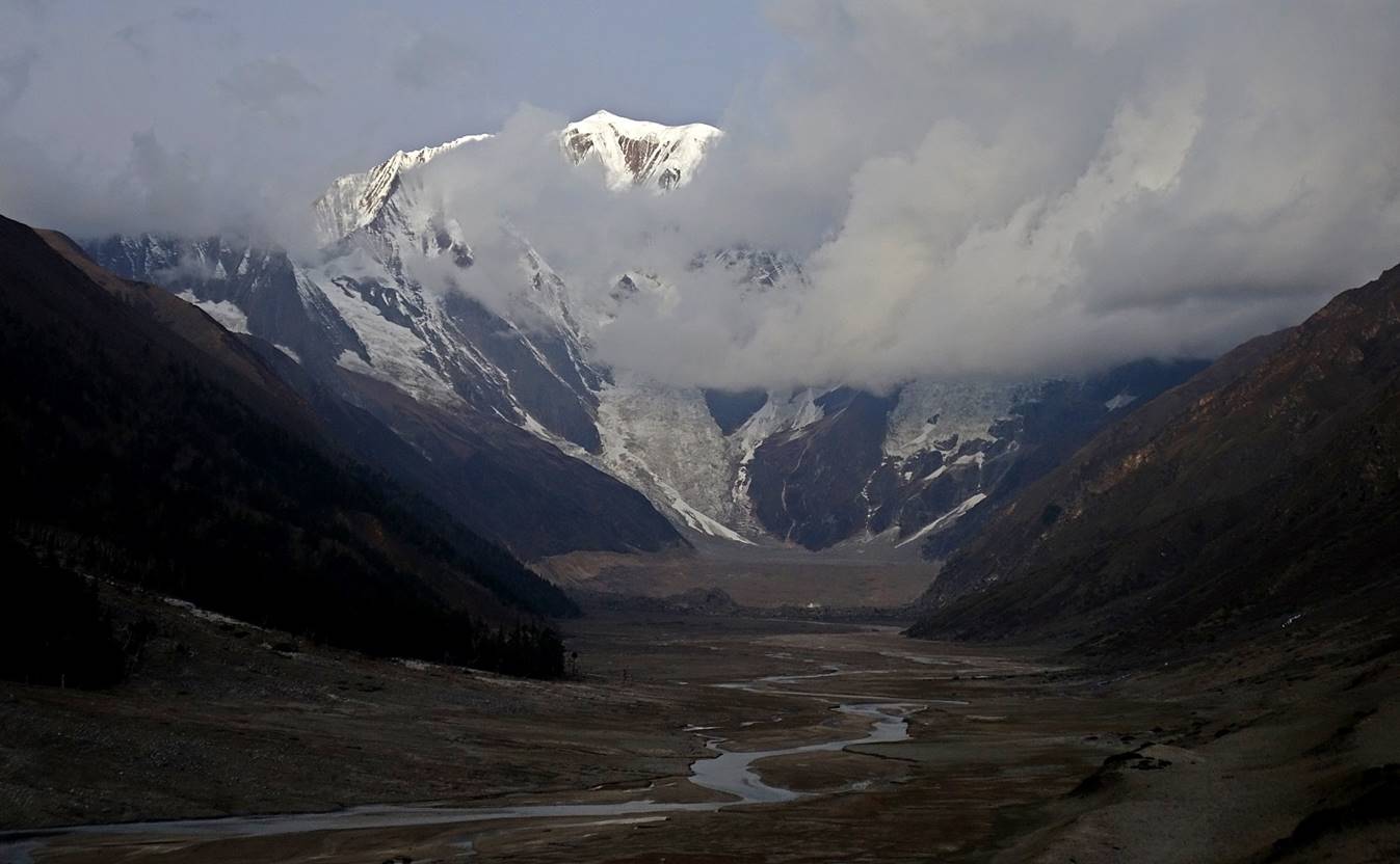
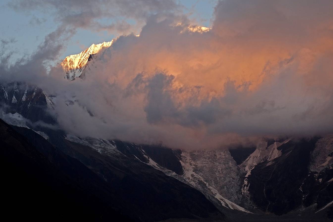
[Here, like in the next photo, the sunlight coming from the east hits the high slopes of Mount Saipal. It is reflected into the surrounding cloud.]
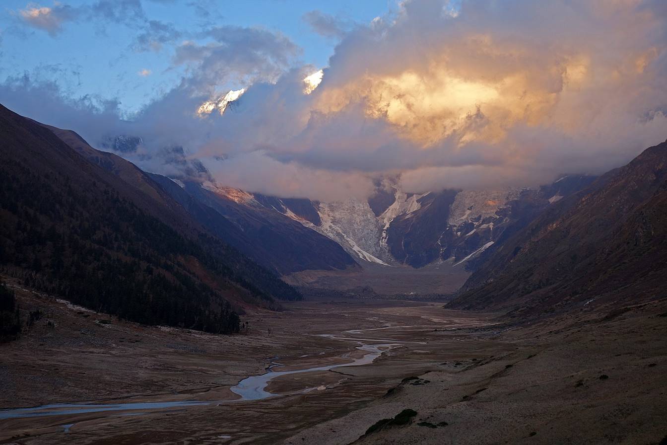
Two more panoramic photos taken on the same morning.
Other photos of Saipal taken on another morning with slightly fewer clouds.
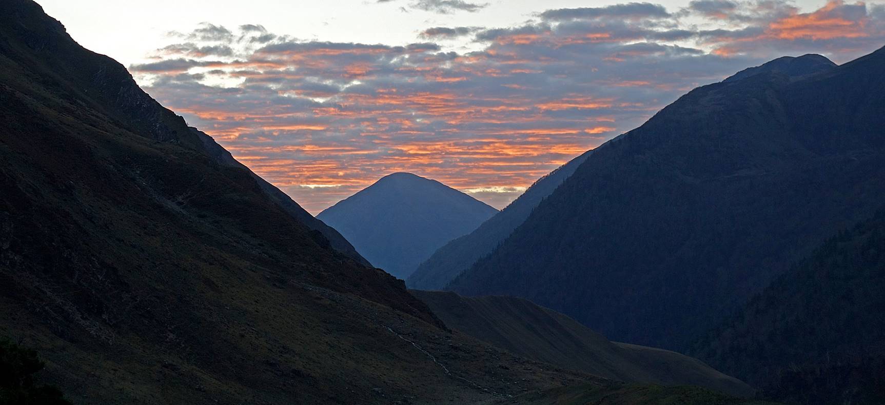
Photos taken during sunset.
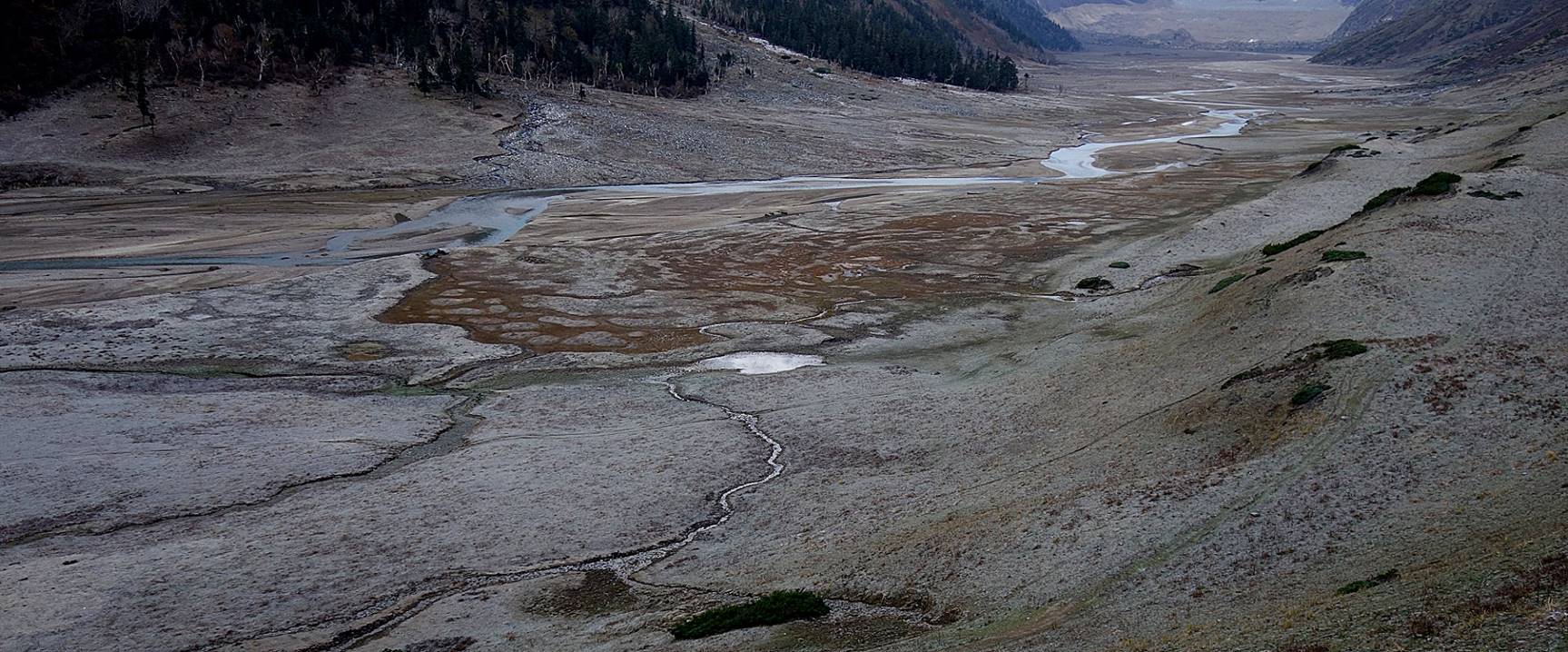
All the photos below were taken while hiking toward Nunekhara glacier.
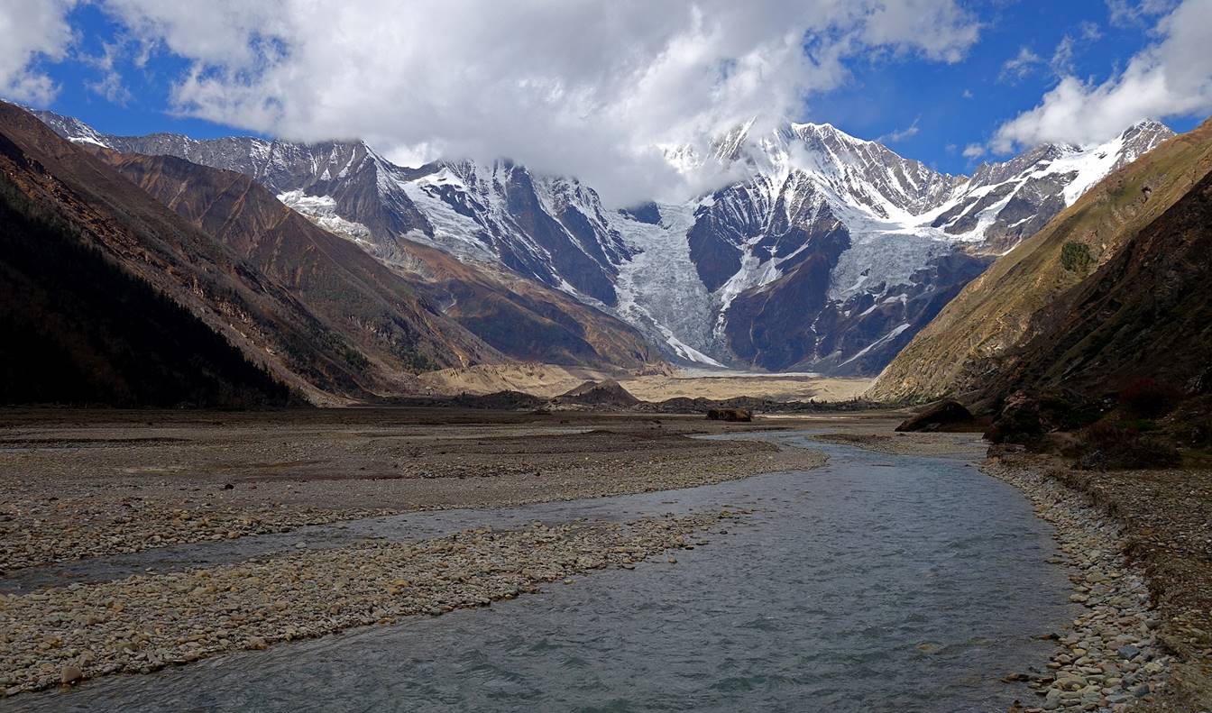
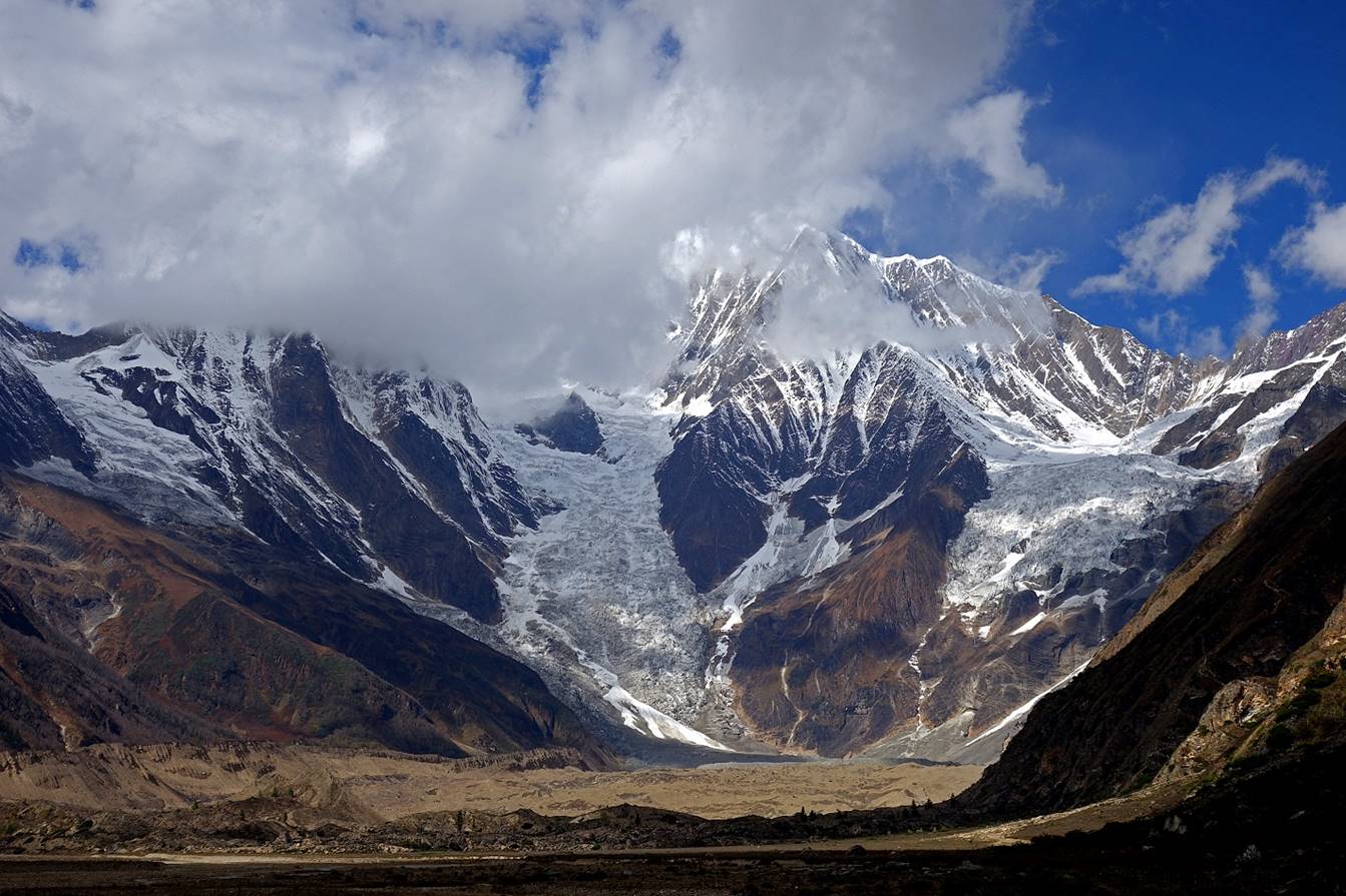
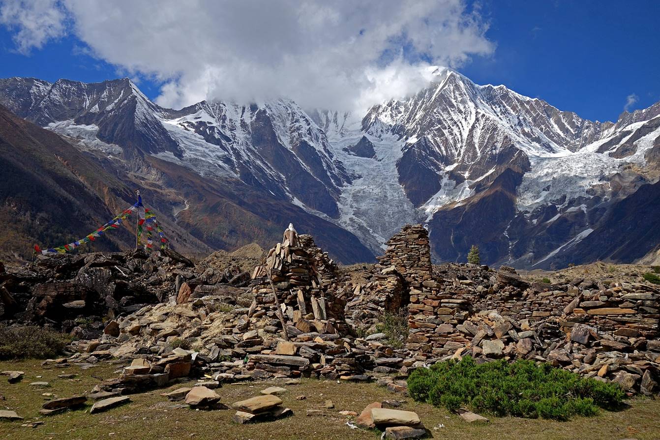
Ruins of the last settlement in the valley, close to the moraine below the glacier. It is probably abandoned, even during the monsoon season.
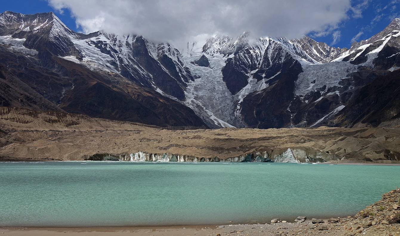
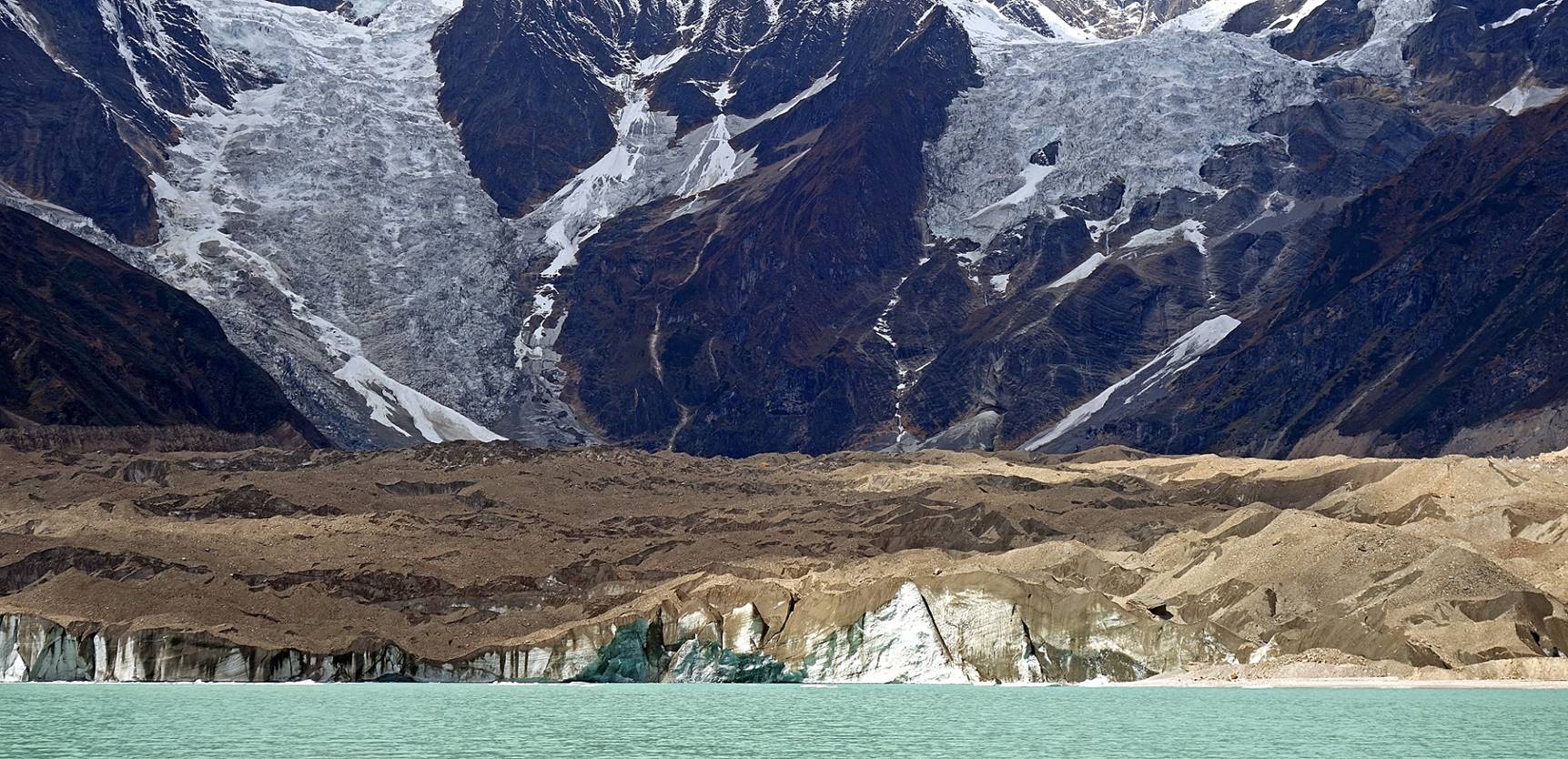
The lake below the glacier seen from a high point on the moraine.
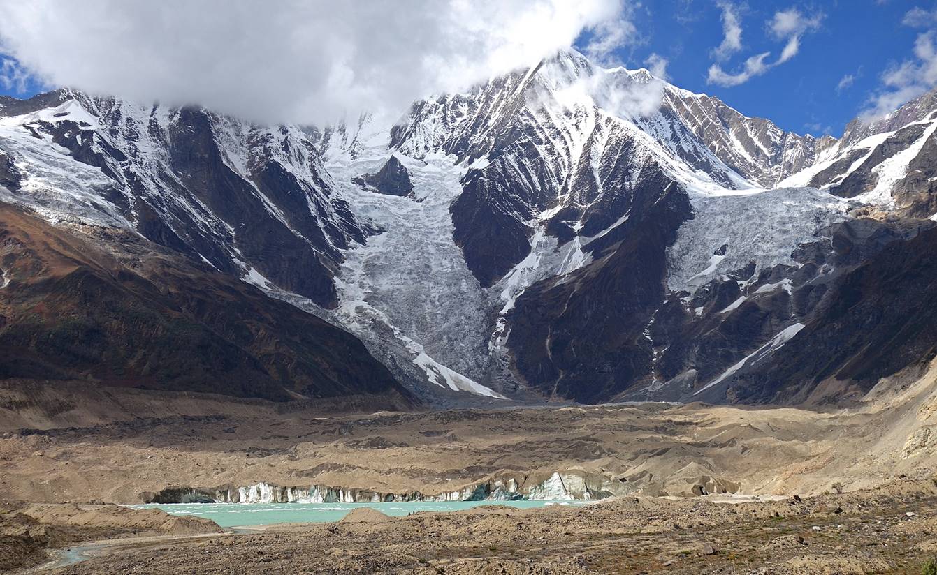
Saipal, Nunekhara glacier, and the lake seen from the ″beach″ on the eastern shore of the lake (made of very thin yellow sand).
|
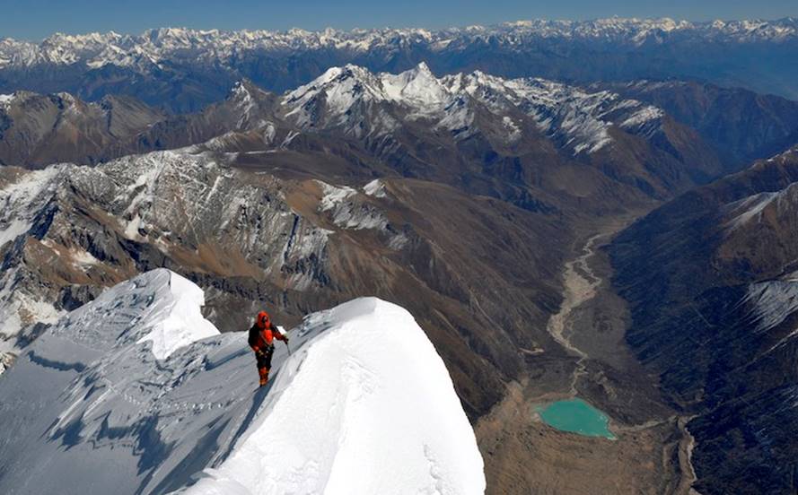
This last picture is a spectacular photo of the upper northeast ridge of Saipal taken by Paulo Grobel. The lake at the base of the Nunekhara glacier and the entire Ranikharka valley are visible on the right. The 5698m peak is visible in the intermediate mountain range on the left of the snowy triangular pyramid.
(Source: American Alpine Club Publication.) |
|
![]()