Nepal (October 2023): An Unplanned Mini-Trek South of Simikot
5. Palsa to Humla Karnali Nadi and return to Kathmandu
![]()
Return to main Nepal 2023 webpage | Return to my mountaineering/trekking/travel webpage
Click here to see the map of the trekking route (yellow dotted
line) in a separate window.
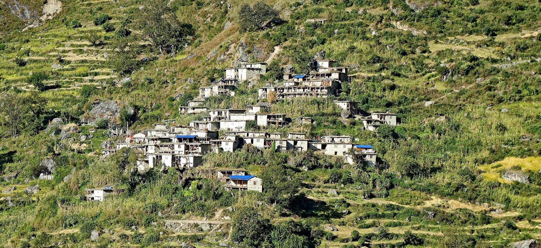
Village
(probably Kargai) lit by the morning sun on the west side of the Galpha Gad
valley seen as we descended from Palsa to the valley floor.
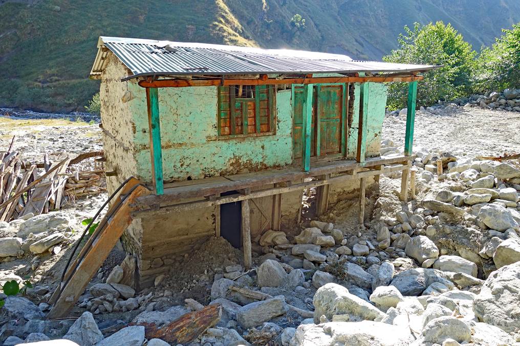
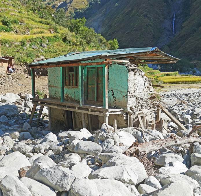
Ruin of a
house at the start of the road. Everything around it had been washed away by
the flood of a small tributary of the Galpha Gad.
|
|
|
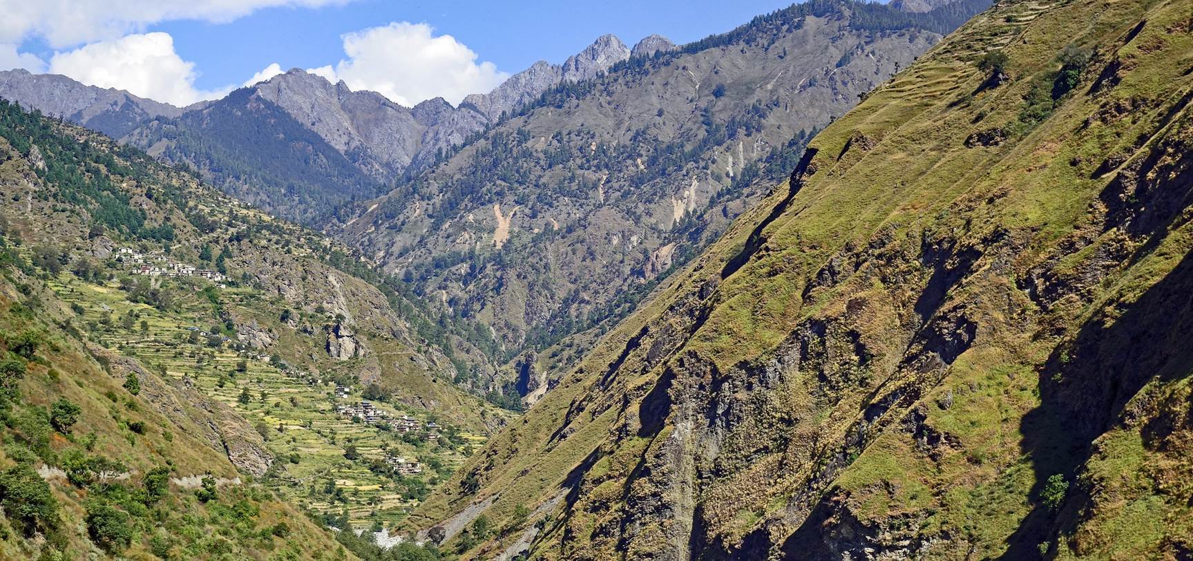
View north
from the road. A section of the trail we hiked the day before is visible near
the center of the photo.
The photo
below was taken shortly before reaching the village of Lauthi. It shows the
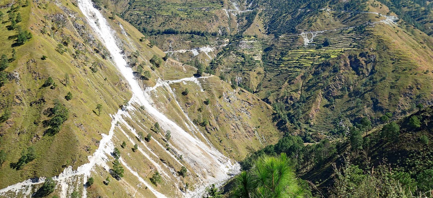
horrific, almost irreversible scars
left by a now non-drivable ˝road˝ on the eastern
slope of the valley. I would not be surprised to learn that the road we were
walking on had been built due to the failure to complete or maintain the
previous road.
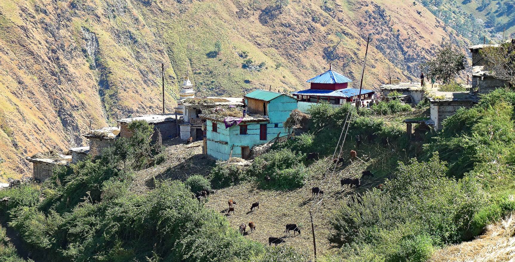
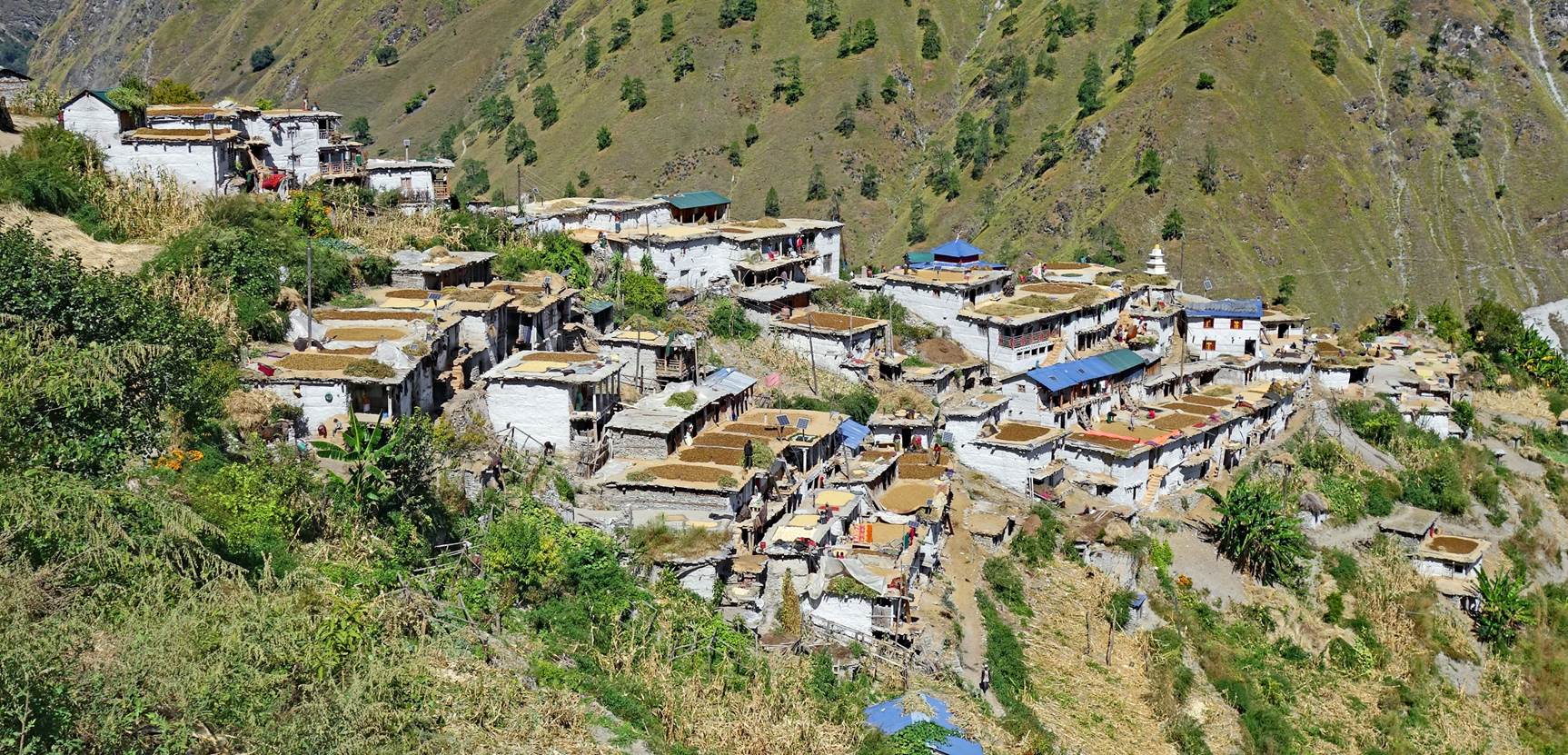
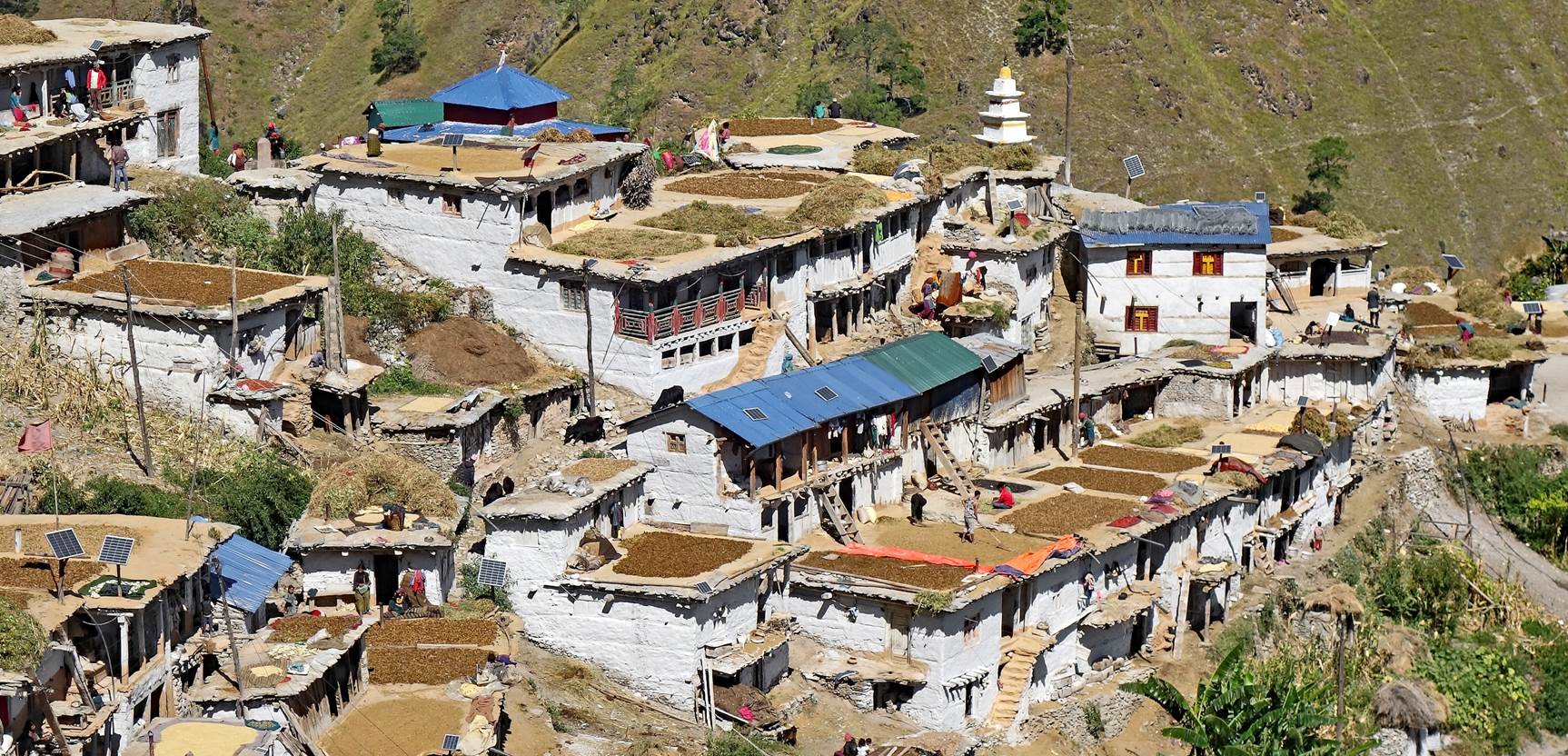
We then
reached the beautiful and very friendly village of Lauthi. The building with
the square pyramidal roof is the village's Hindu temple. The white and yellow
pagoda-shaped tower is where cremation rituals take place.
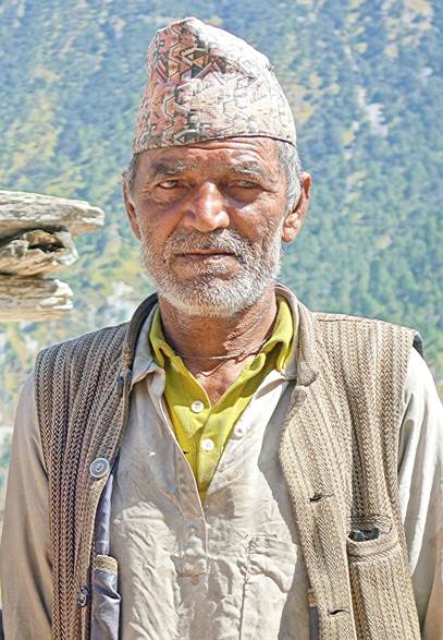
Left: The
village's priest at the entrance of the temple.
|
|
|


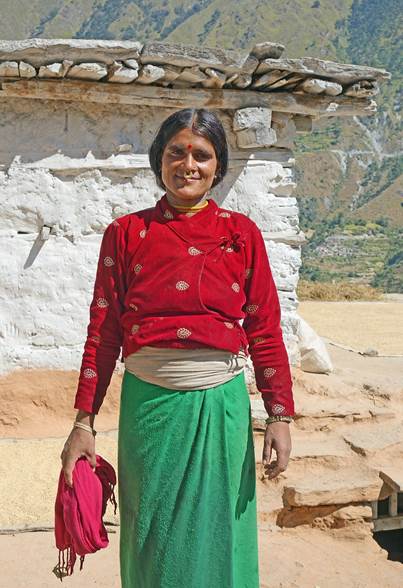
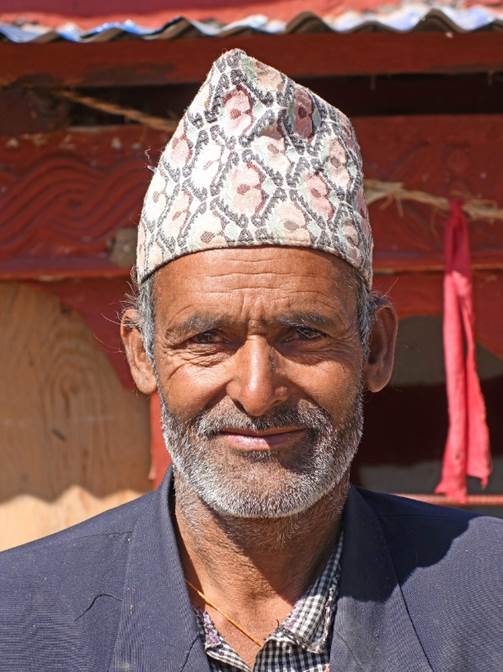
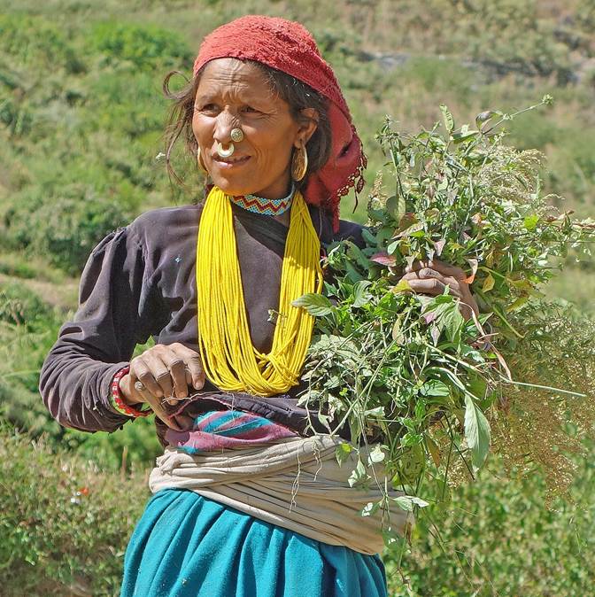
Some people of
Lauthi.
|
|
|
|
|


|
|
|
|

|
|
|


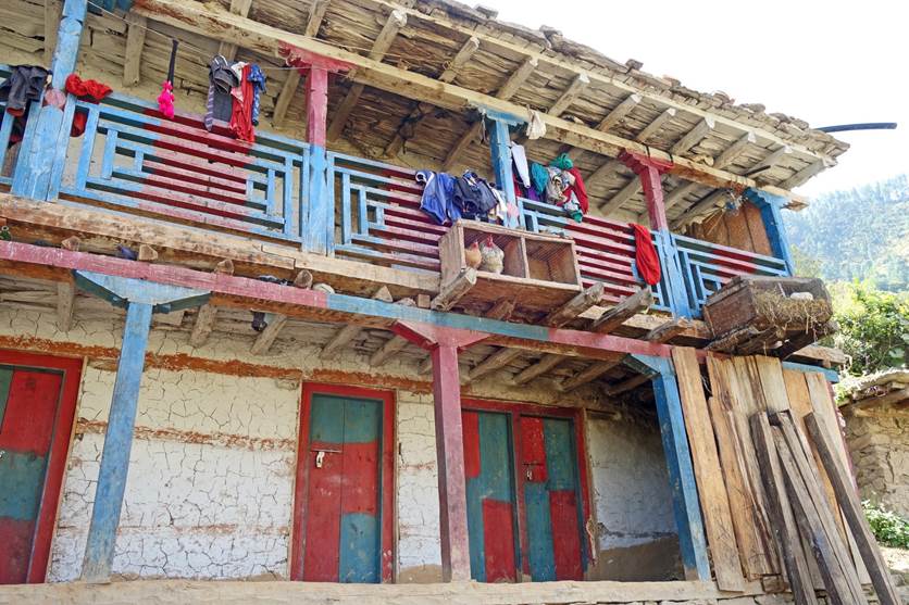
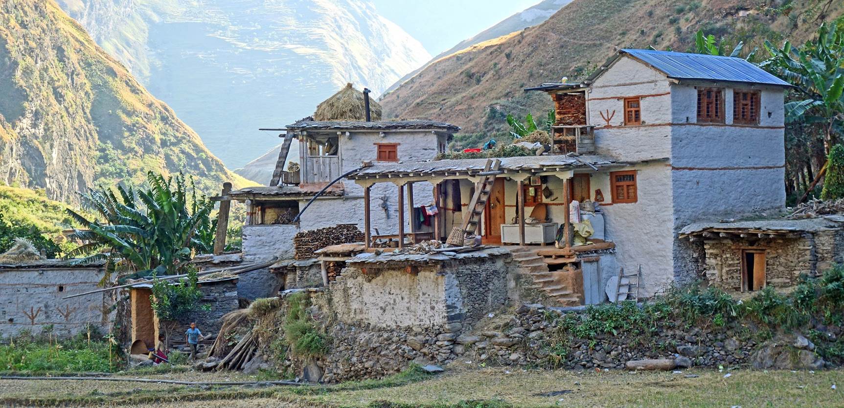
Houses along
the road between Lauthi and Budheli. Note the small chicken coop and rabbit
cage hanging from the balcony of the house on the left, and the steep slope on
which the house on the right is built.
|
|
|
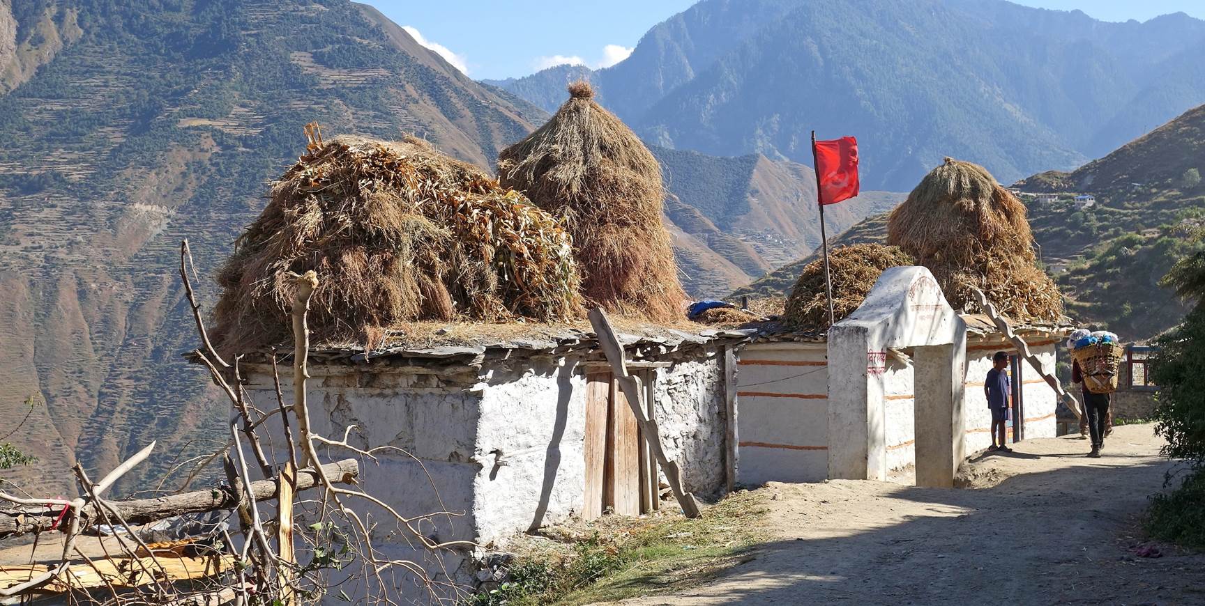
Houses with
hay drying on their roofs. Note the communist flag planted on a roof. Years
ago, this region of Nepal was a hotbed of the Maoist rebellion that led to the
fall of the monarchy.
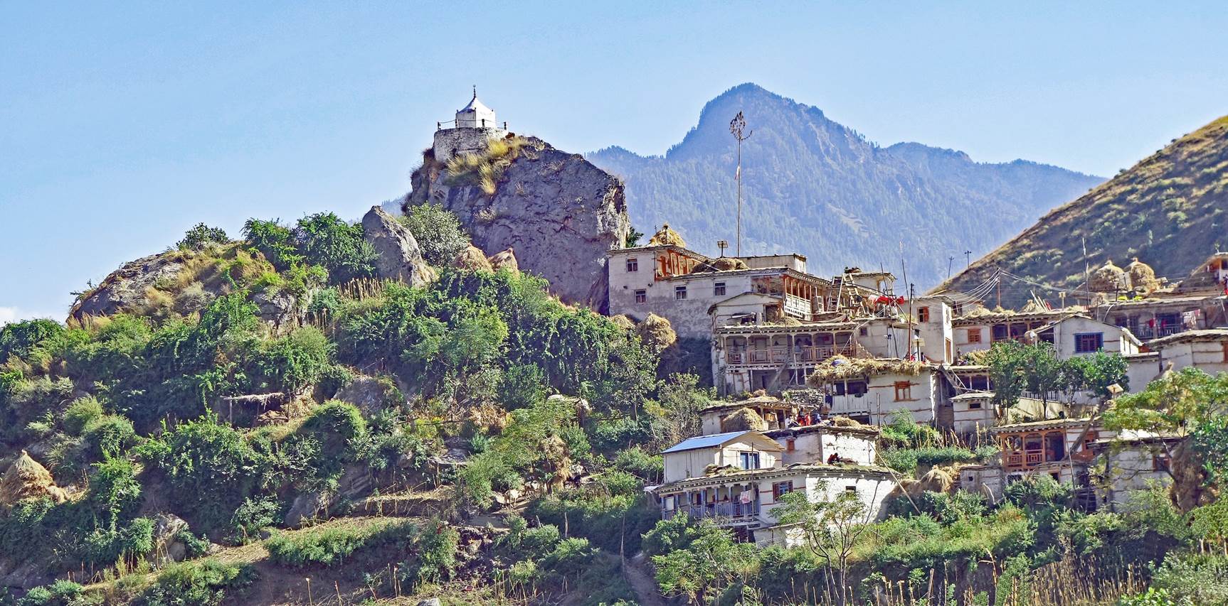
Hindu temple overlooking
Budheli, the last village before the confluence of the Galpha Gad and the Humla
Karnali Nadi.
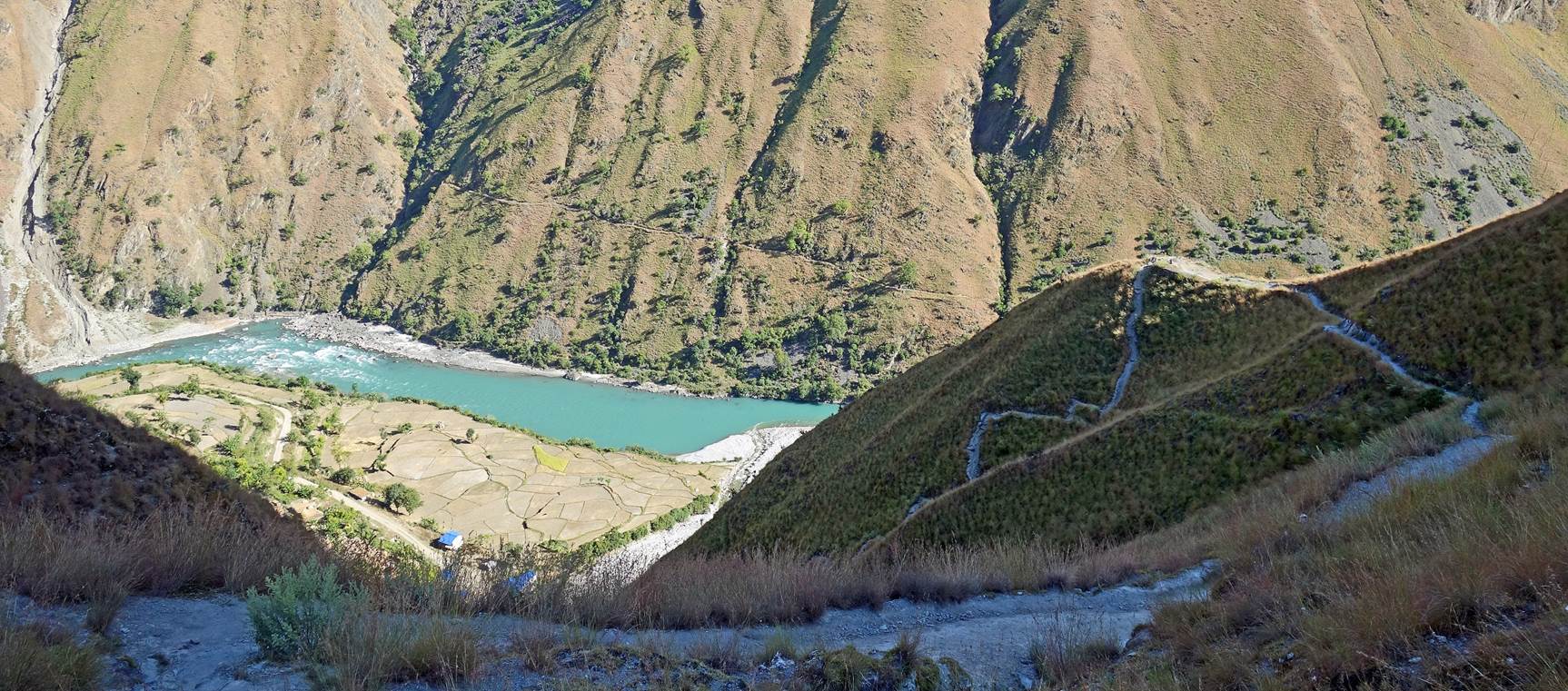
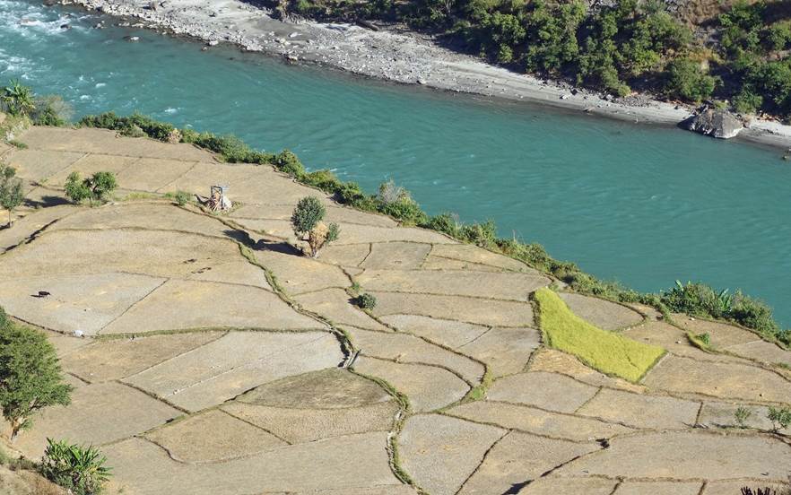
In Budheli, we
took a steep trail much shorter than the road leading to the bottom of the
Humla Karnali Nadi valley.
|
|
|

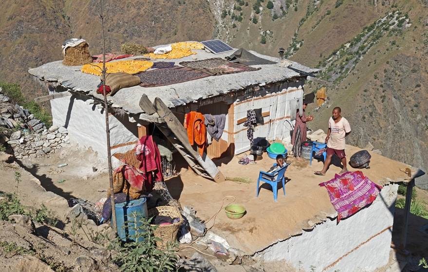
We set up our
last camp in a dry rice field next to the house below.
While walking down
from Budheli, I saw new roads not marked on my map built on the mountain slopes
south of the Humla Karnali Nadi. I had no appetite to continue walking on roads
or on trails close to roads. So, I decided to end my trek here. The next
morning, Dawa and I took a Mahindra jeep to Kolti (a 4-hour ride), where we
hoped to catch a flight back to Kathmandu (via Nepalgunj). We said farewell to
our porters, who returned to Simikot.
Dashain in
Kolti:
This was my
third visit to Kolti. I stopped here briefly in 2008 during my traverse of
Nepal (see here)
and again in 2017 at the end of a trek from Simikot to Kolti via Mount Saipal (see here).
But after two full days of waiting, there were still no flights scheduled for
the next few days. So, we shared a jeep with two locals and went to Dhangadi, a
town in southern Nepal with daily flights to Kathmandu. Local people had told
us that it was quicker to get to Dhangadi than to
Nepalgunj.
Kolti is built
in a pleasant valley, but the town itself is not particularly interesting.
Fortunately, we were there during the 15-day-long Dashain festival, Nepal's
most important Hindu festival, which honors Durga, the Universal Mother
Goddess. This festival is a time for various celebrations, family reunions, and
exchanges of blessings.
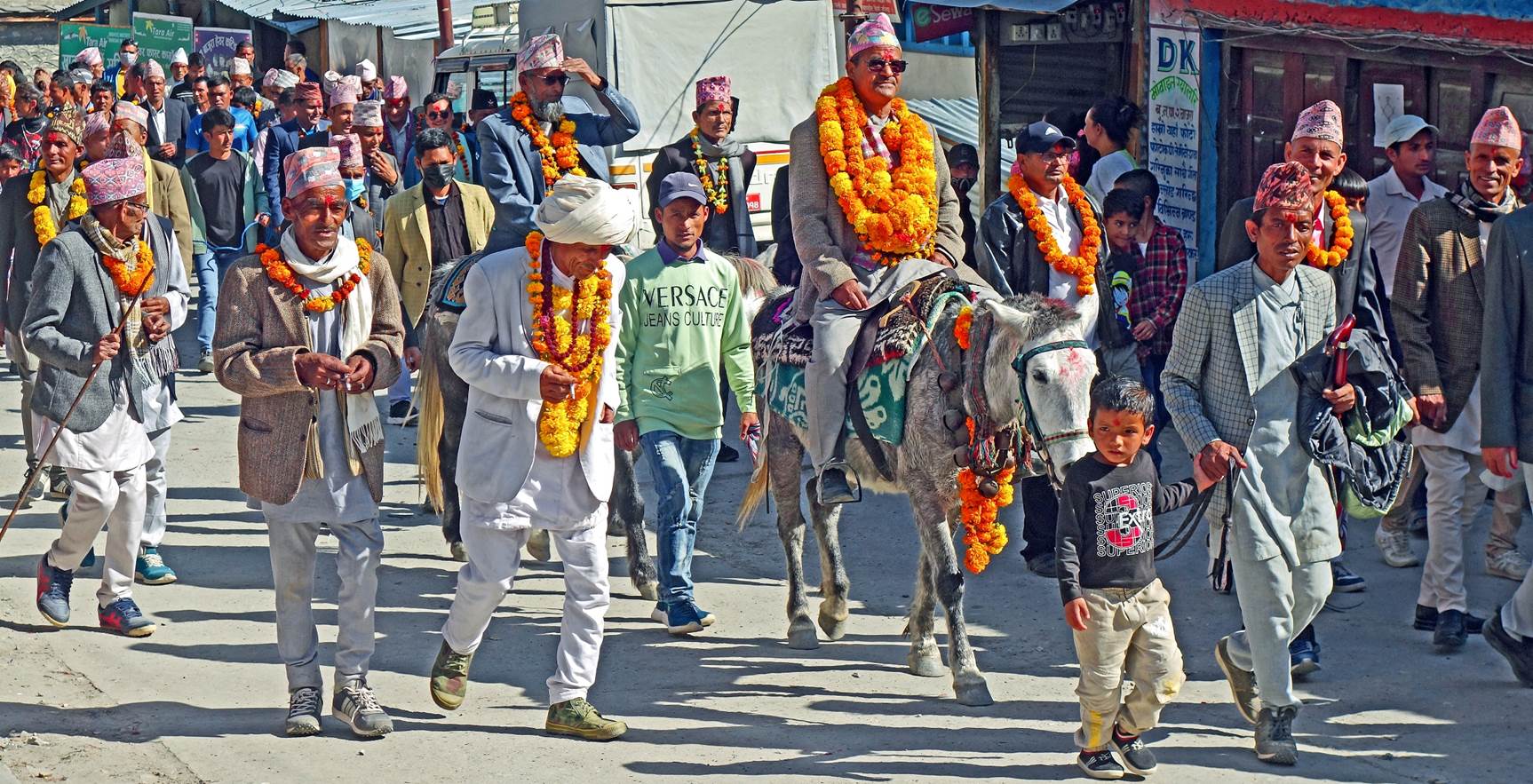
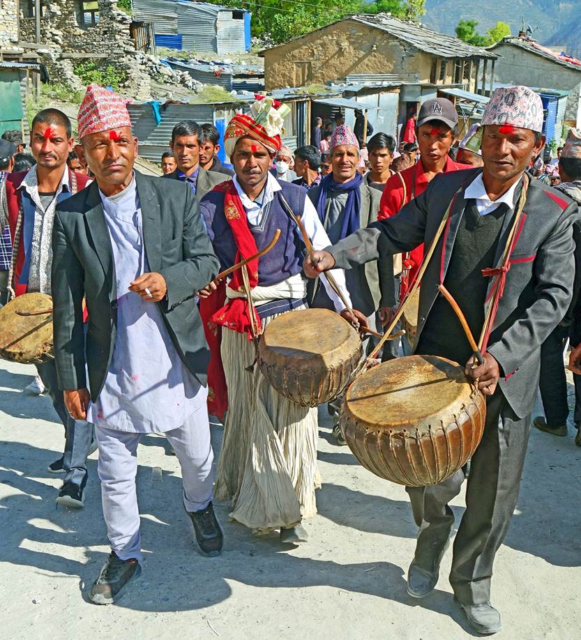
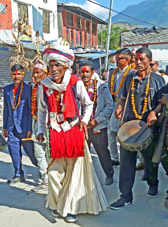
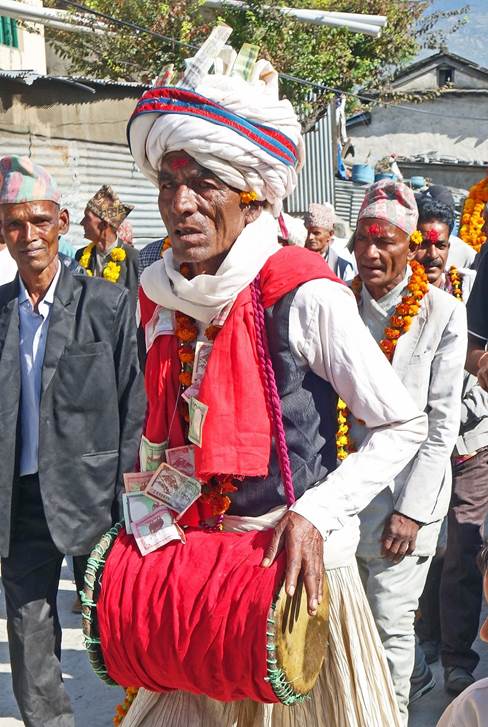
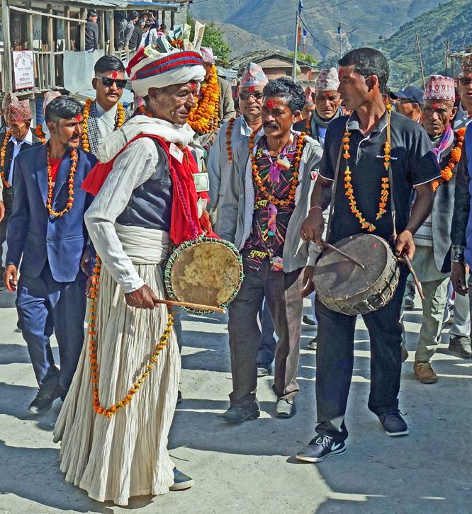
Procession in
the main street of Kolti on the 8th day of the festival. On this day, devotees
walk long distances in the valley on foot or on horseback and bring offerings
to successive temples. (Strangely for me, while Dashain honors the Universal
Mother Goddess, there were only men in the procession.)
|
|
|

|
|
|
|
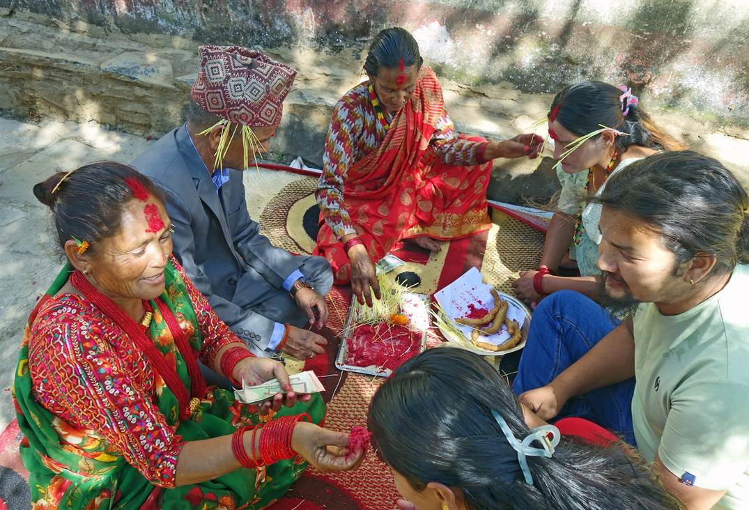
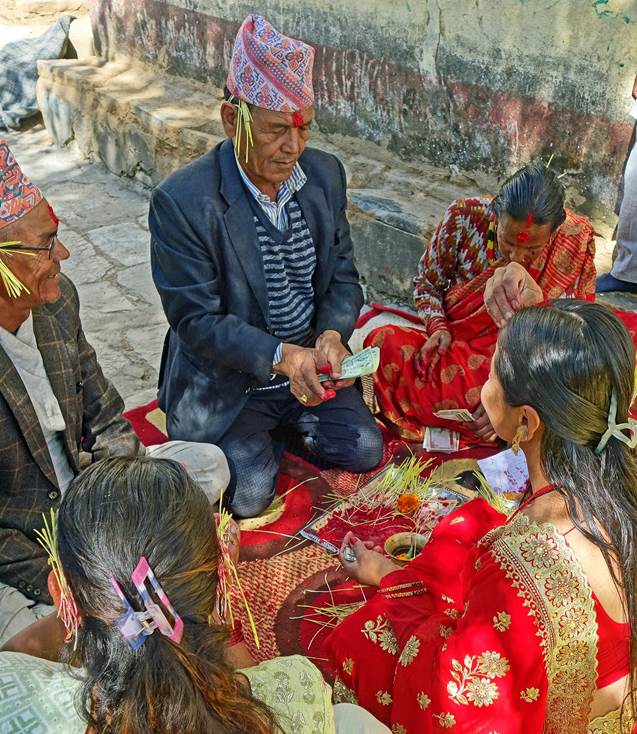
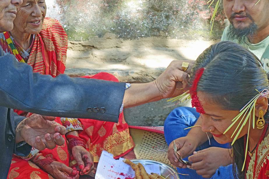
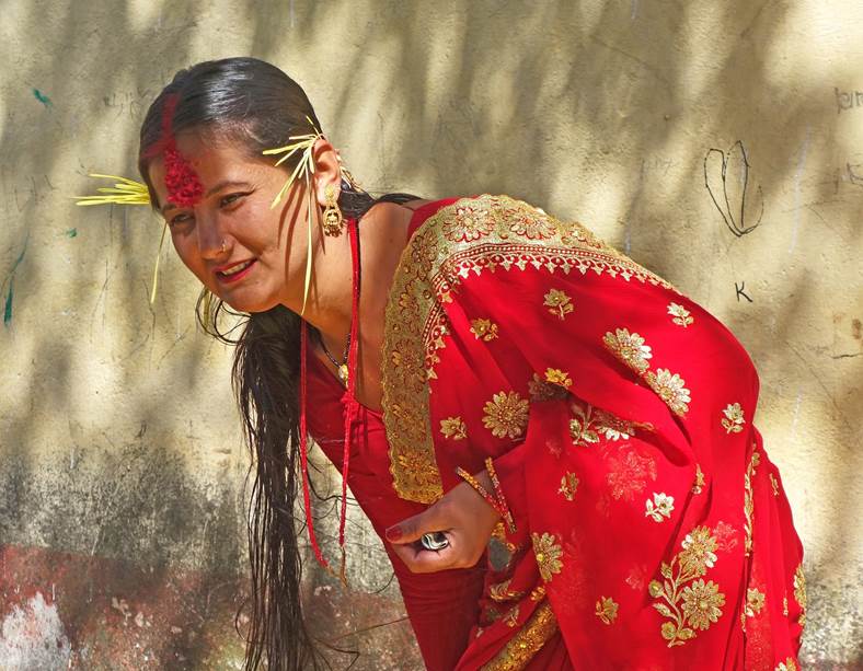
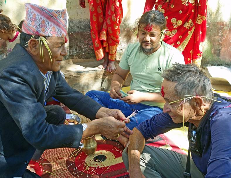
The 10th day
of the festival is the most important. It culminates with family tikka
ceremonies, where elders give their blessings to younger ones, by putting tika
(a mixture of vermilion, curd, and rice) on their foreheads and placing jamara
(barley grass) behind their ears, while giving small amounts of money. As I was
walking around Kolti, a family kindly invited me into their courtyard to join
their ceremony and eat the food they had prepared. Two of the elders gave me
their blessing, even though I was the oldest person around. Young adults were
happy and honored to be blessed by their elders, while children were happy to
receive some money.
|
|
|
|
|
|
|
|
|

Lunch stop
in Martadi:
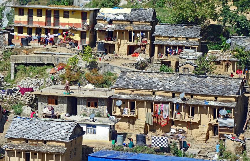
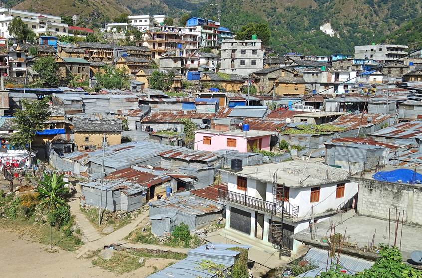
We left Kolti the next morning. We first drove to Martadi, a
medium-sized town where we stopped for lunch. Nestled in a pleasant cirque,
Martadi is probably representative of the transformation underway in the
Nepalese hills: traditional houses (see left photo below) are being replaced by
slum-like neighborhoods of corrugated iron houses surrounded by bland,
multi-storied concrete buildings (pictured right).
|
|
|
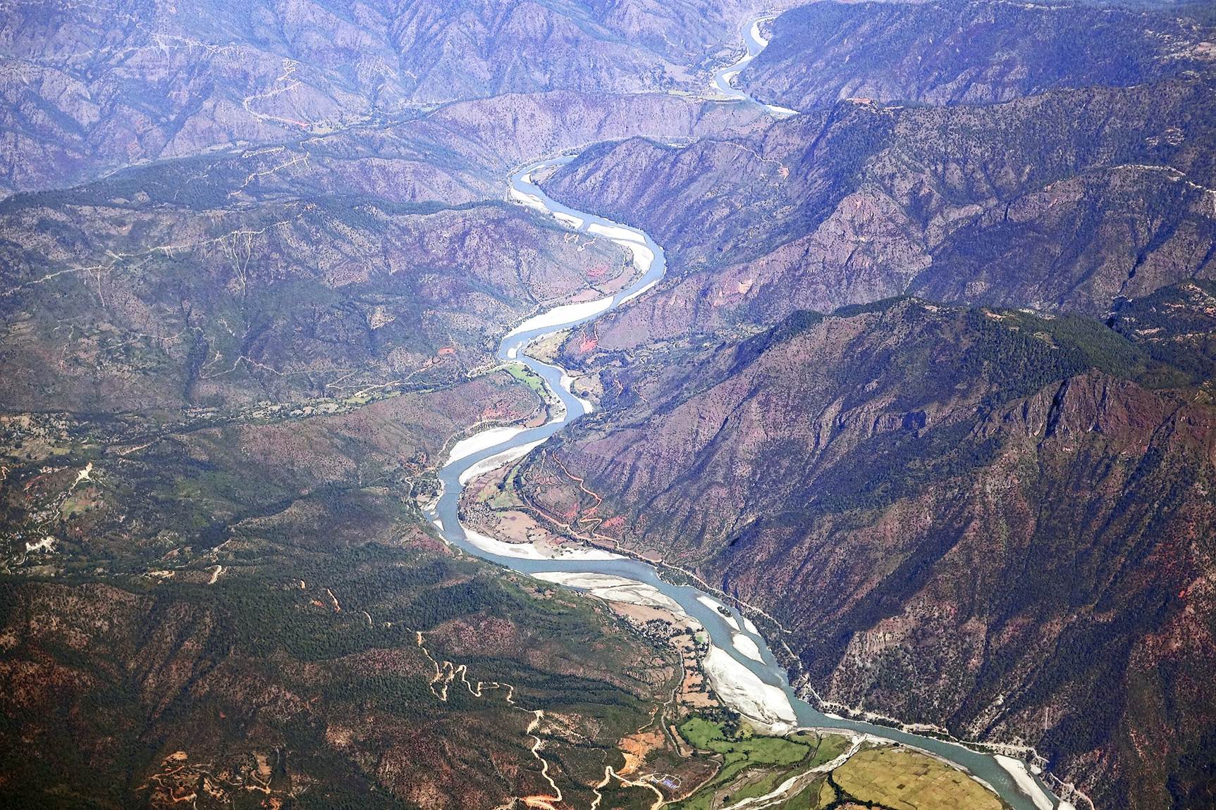
Flight from Dhangadi to Kathmandu:
We reached Dhangadi's airport almost 24
hours after leaving Kosti. Luckily, we were able to fly back to Kathmandu a few
hours later. The photos below were taken during this flight.
- The Karnali Nadi in southern Nepal.
- Peaks of the Himalaya.
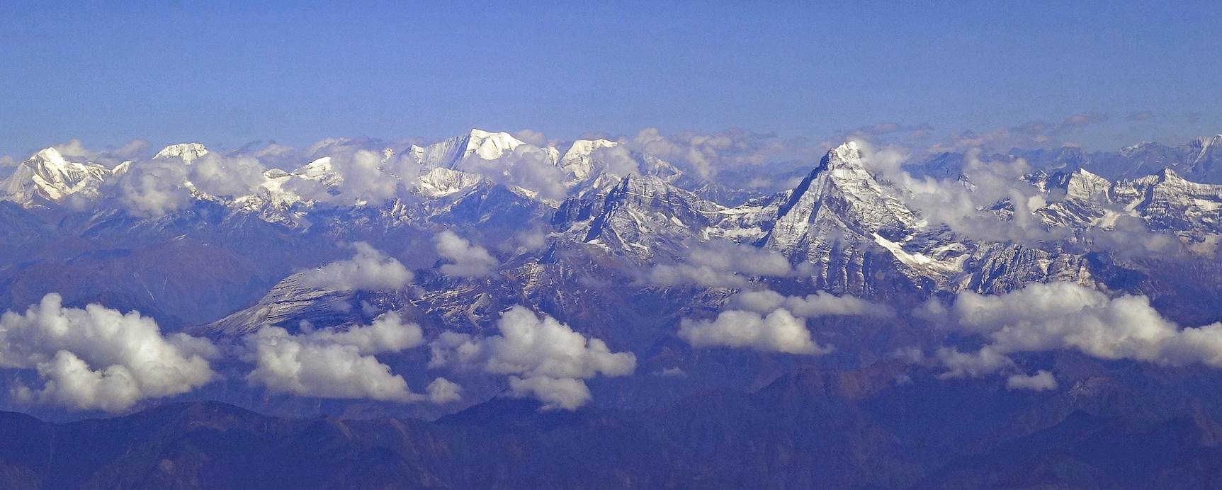
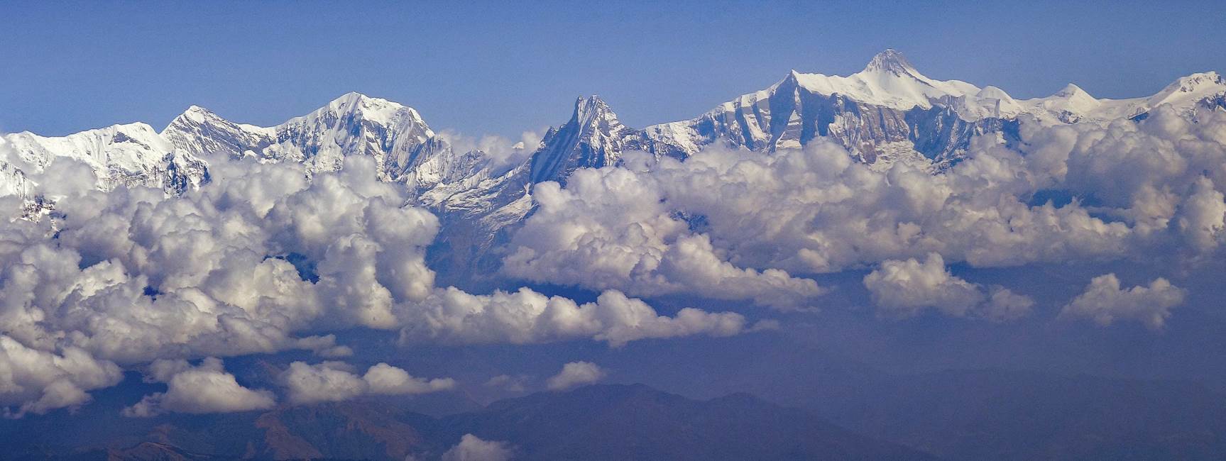
[Machapuchare
(6997m) at the center, with Annapurna III (7555m) on its left and Gangapurna
(7455m) further left, and with Annapurna IV (7525m) on its right and Annapurna
II (7937m) slightly further right.]
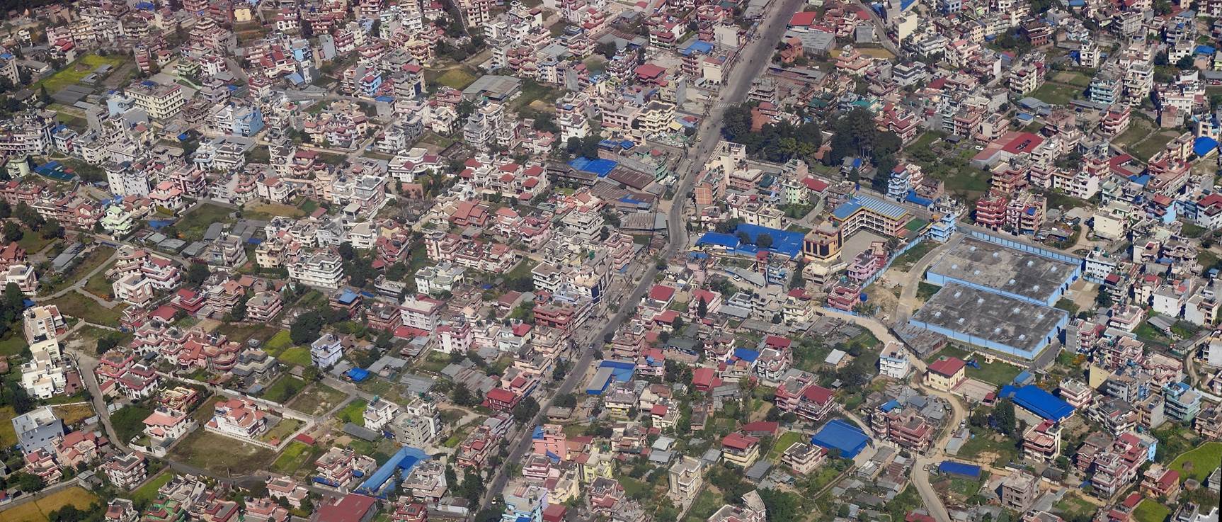
- Modern neighborhood of Kathmandu seen before landing.
![]()
Return to main Nepal 2023 webpage | Return to my mountaineering/trekking/travel webpage