Peru (June-July 1997): Yerupaja and
Salcantay
![]()
In June-July 1997 I returned to Peru to
climb Yerupaja in the Cordillera Huayhuash
and Salkantay in the Cordillera Vilcabamba
with Mark Houston and Kathy Cosley. Unfortunately, the dangerous conditions on both
summits (overhanging seracs on Yerupaja
and badly corniced final ridge on Salcantay) led us to turn back before
reaching them.
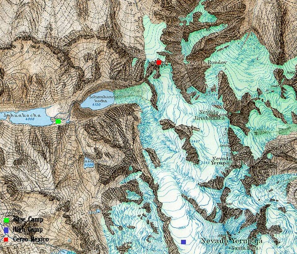
Cordillera Huayhuash and Yerupaja (6635m):
Topographic map of the Northern part of the Cordillera Huayhuash,
with Nevado Yerupaja.
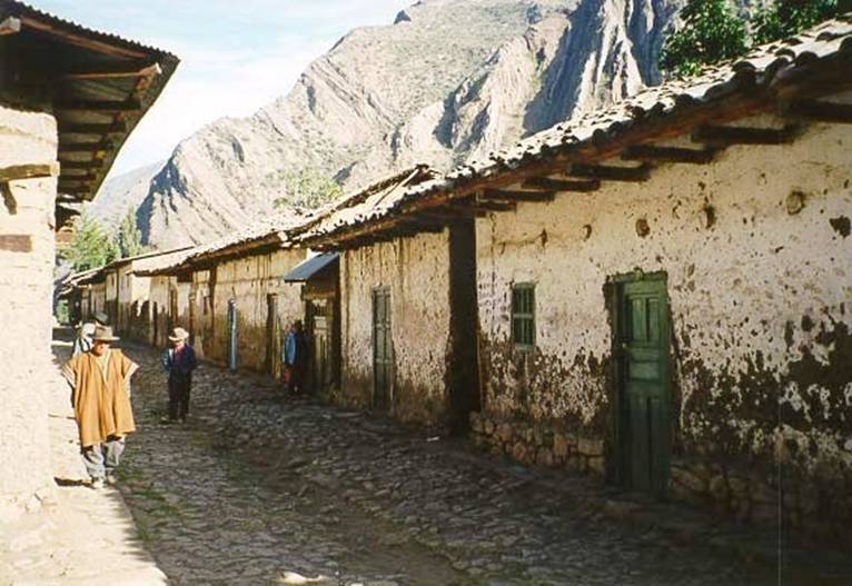
The main street in the village of Llamac at the North end of the Cordillera Huayhuash.
Limestone cliffs in the Cordillera Huayhuash.

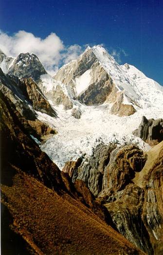
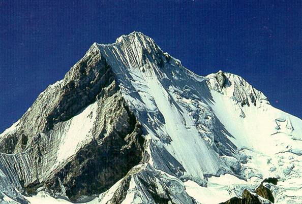
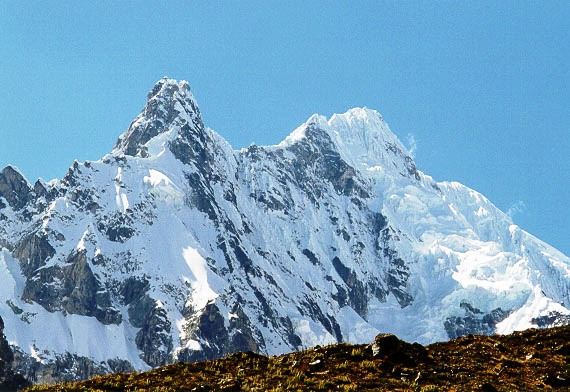
North face (with rock) and West face (with
snow and ice) of Yerupaja.
|
|
|

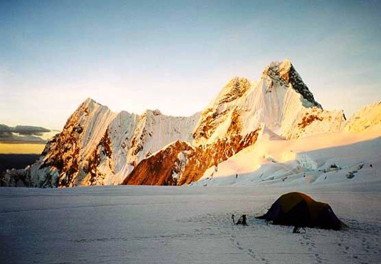
Base camp of Yerupaja near Lake Jahuakocha (our tents are at the bottom-right of the
picture).
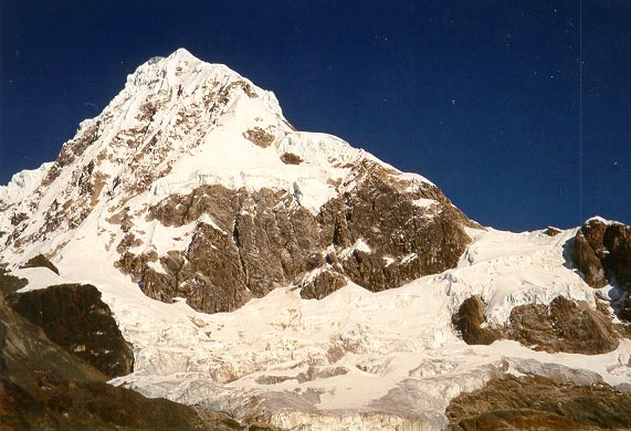
High camp of Yerupaja,
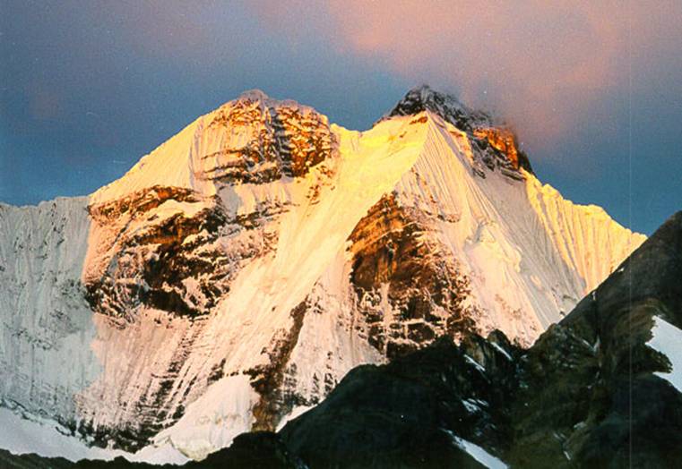
with beautiful Jirishanca (6126m) in the background.
Another view of Jirishanca.
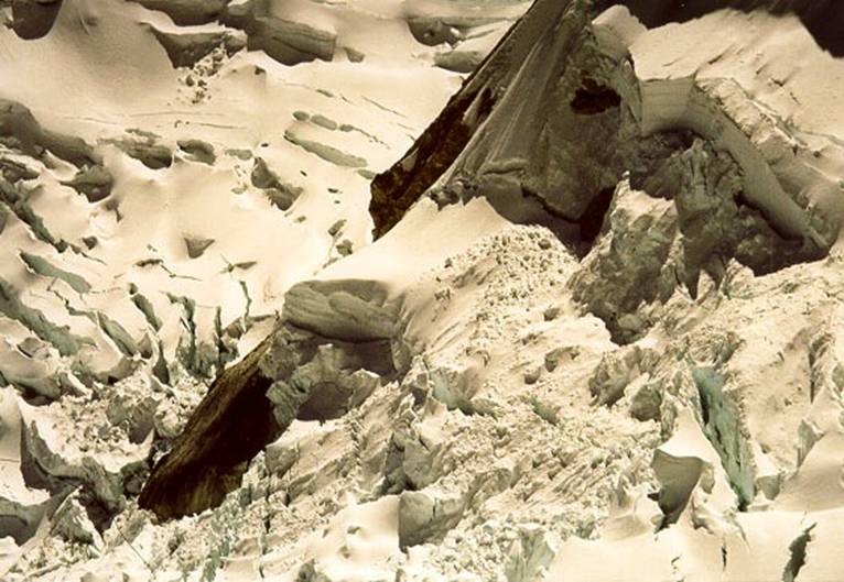
Over the past 20 years, the smooth West face of Yerupaja
has become a broken field of overhanging seracs. The
view on the left is from a postcard taken 15 to 20 years ago. The photo on the
right shows the normal route under the col, in 1997.
|
|
|
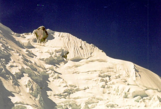
Seracs on Yerupaja.
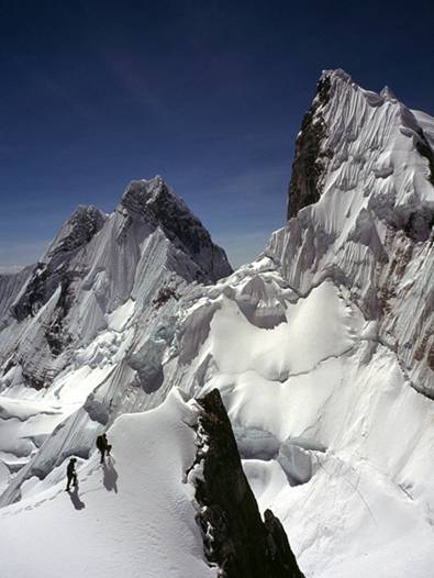
Mark and me on a promontoire
off the North ridge of Yerupaja, with Jirishanca behind us. Yerupaja Chico is on the
right of both images.
|
|
|

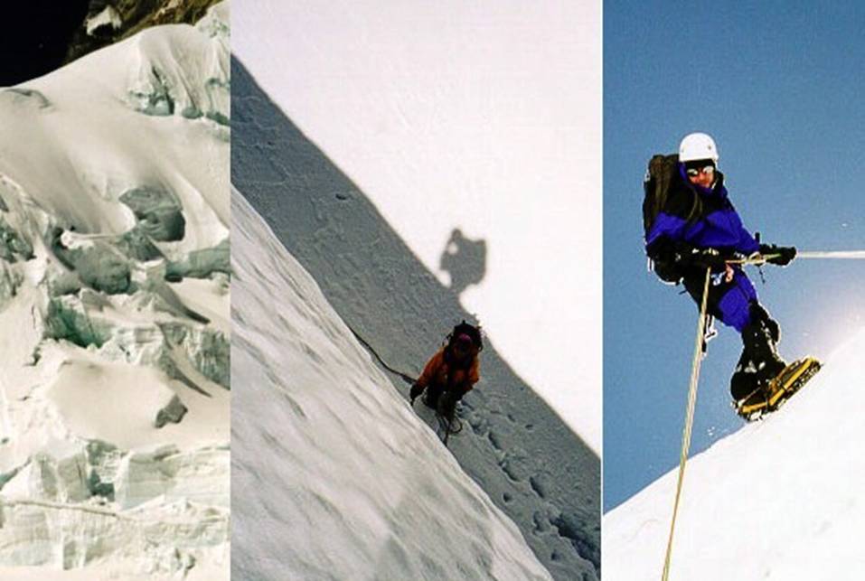
Rappeling down from
the North ridge of Yerupaja. I first took the photo in the middle
(with Kathy waiting at the end of the rope). Then I lowered down the camera to
Kathy who took the picture on the right. The picture on the left was taken
later and shows the face we were descending.
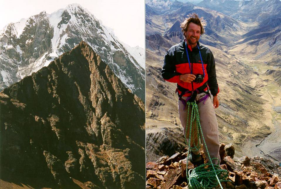
Cerro Mexico is a ~5,000m rock peak north of Yerupaja.
We climbed the north-west ridge (on the left in the photo), a fun, but exposed
class 4 climb with many loose rocks. Mark at the top (right photo).
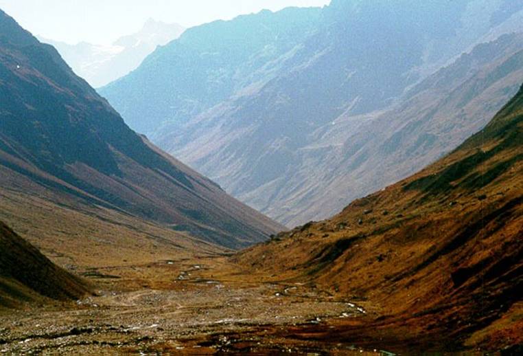
Cordillera Vilcabamba and Salcantay (6271m):
Scenery of the Cordillera Vilcabamba.
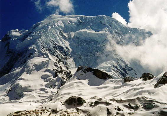
Three faces of Salcantay, from left to right: South-East, South, and West.
|
|
|
|
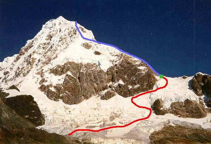
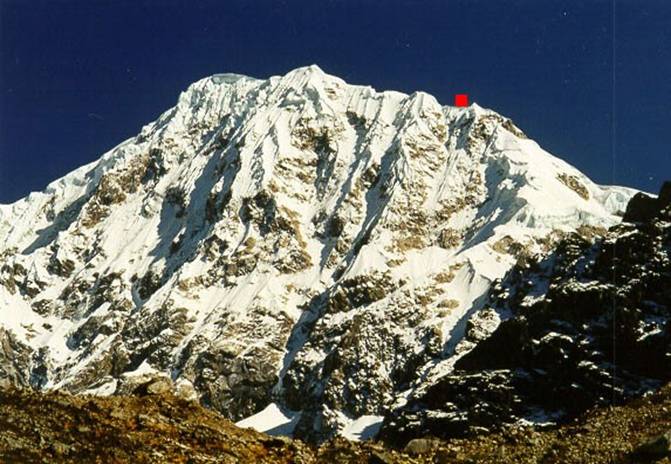
From left
to right: our route on the West face (the green square indicates the high
camp), the ridge where we turned back (at least 500m under the summit), and
this same ridge shown with a red square from the South-West.
|
|
|
|

![]()