Tajikistan (2017): In the Wakhan valley (Panj valley east of Ishkashim)
![]()
Back
to main Tajikistan 2017 webpage
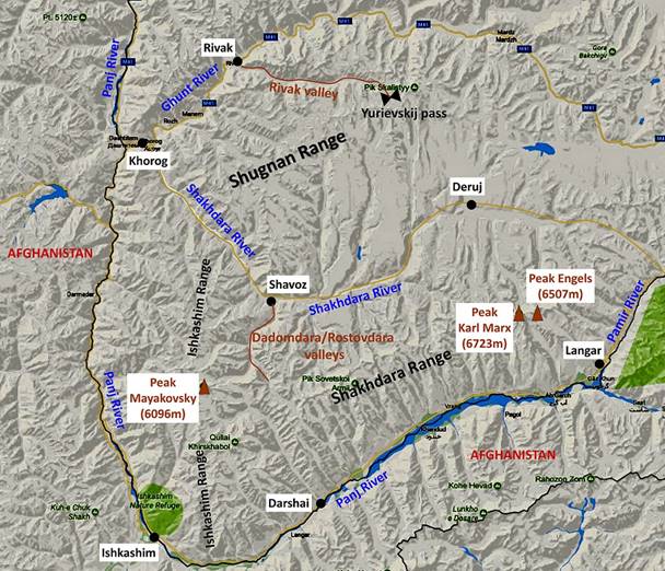
The Wakhan
valley refers to the valley of the Panj river east of the village of Ishkashim
(see maps below). Only the section on the northern side of the Panj river between Ishkashim and
the Pamir river is in Tajikistan. The rest of the
valley is in Afghanistan, where it is called the ″Wakhan
corridor″. This corridor is a political creation from 1873 by the United
Kingdom and Russia to separate their (former) empires. It is a narrow strip of
land that extends Afghanistan to China between Tajikistan (part of the former
Russian empire) and Pakistan (part of the former British empire)
and used to serve as a buffer between the two empires.
Geographically the Wakhan
valley lies between to major mountain ranges: the Pamir to the north and the
Hindukush to the south. For several 1000 years it has been a major passage for
trade and religions (including Zoroastrianism, Buddhism, and later Islam).
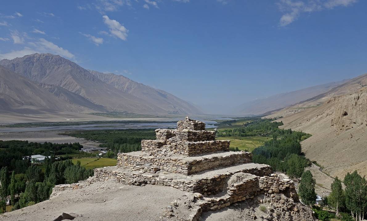
Ruins of old fortresses built to control this valley are still visible today.
Unfortunately, they are in bad shape and lie unprotected. But their locations
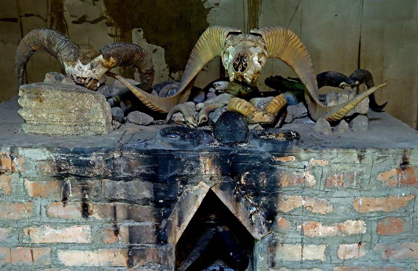
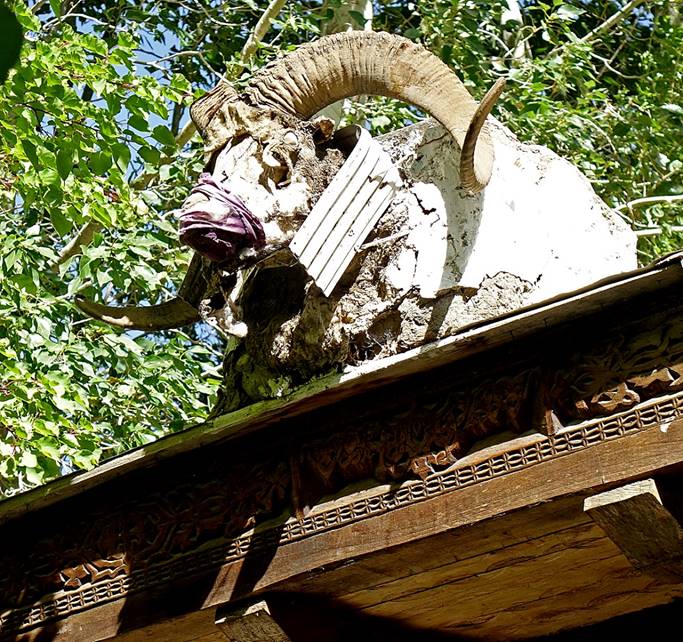
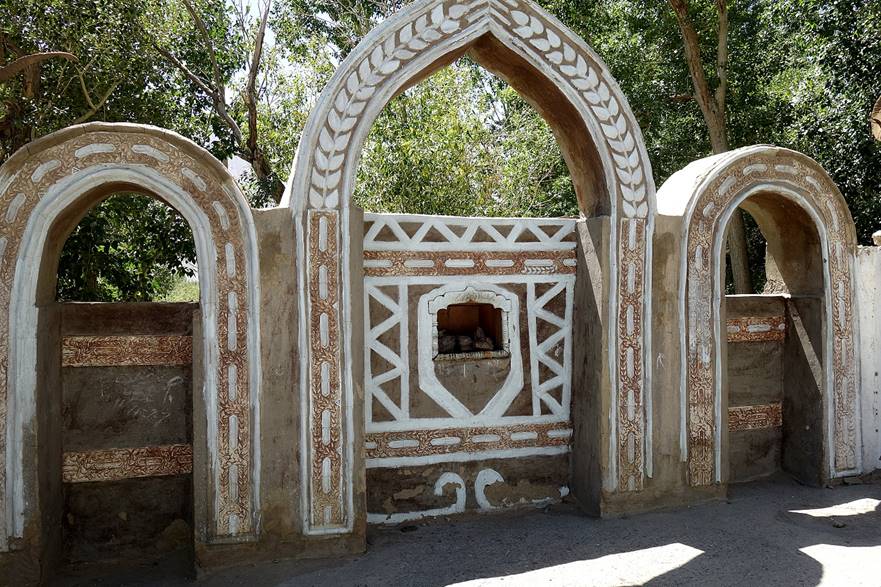
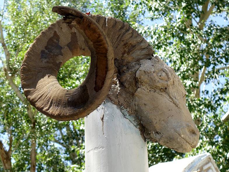
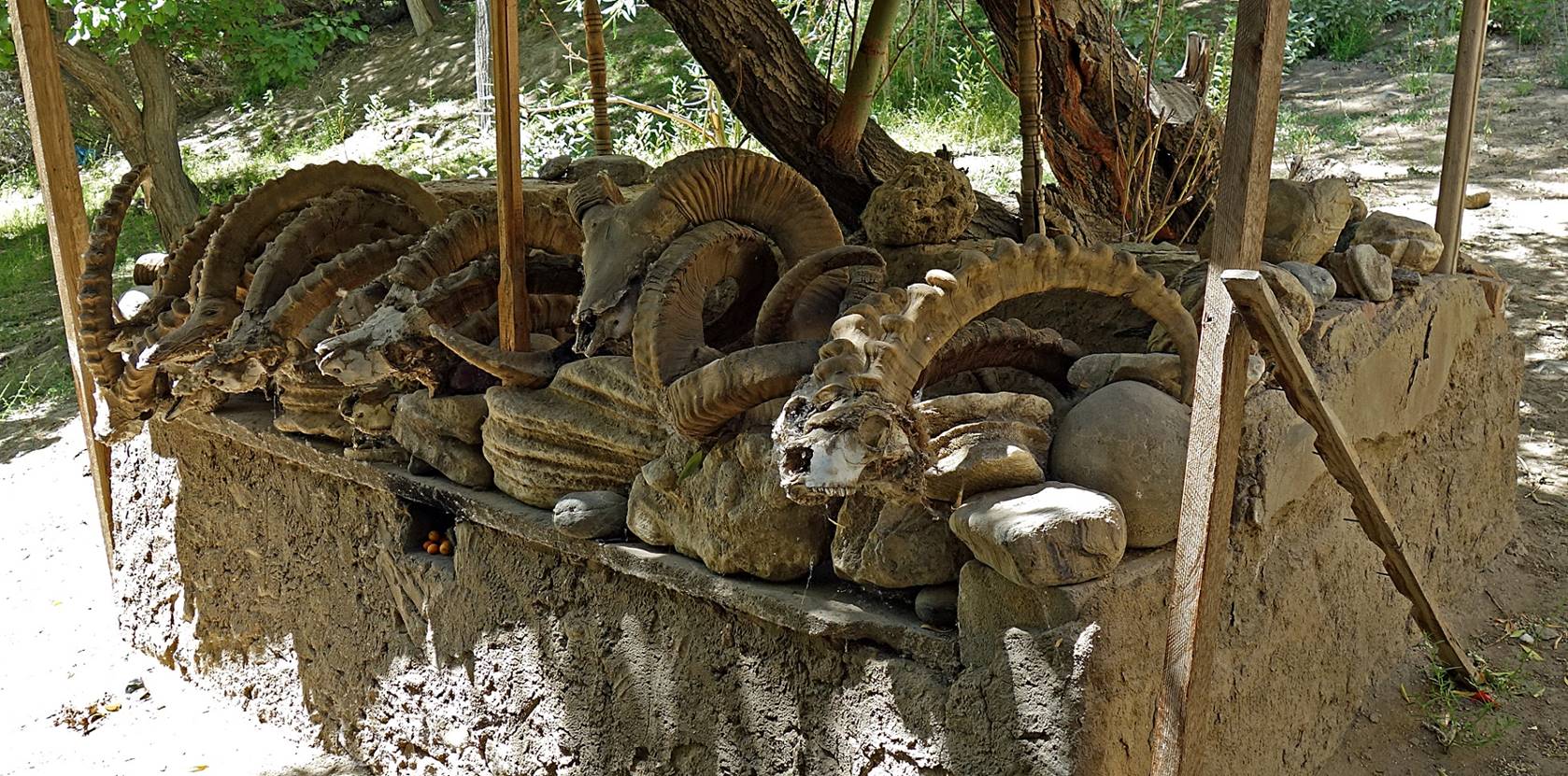
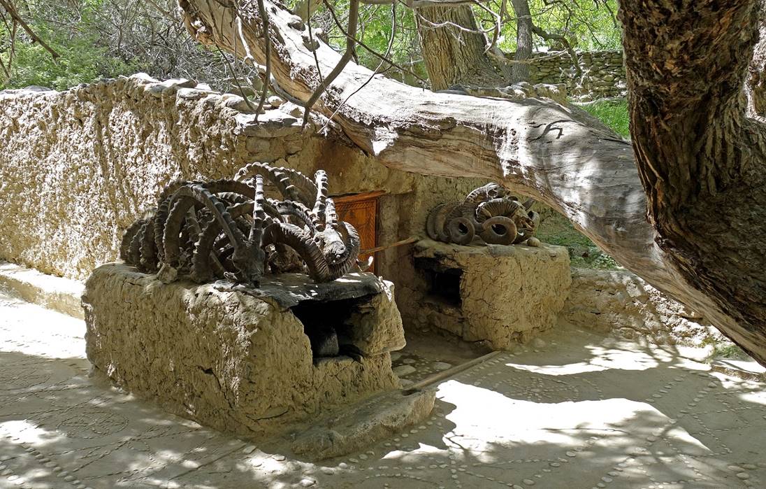
are often stunning. The valley is also dotted with shrines (called Ostoni or Mazor) honoring Muslim
holy men, scholars, and poets. In these shrines fireplaces and horns of Marco
Polo sheep and ibex suggest pre-Islamic influence, especially Zoroastrian.
Several of these places may have been revered before the arrival of Islam.
This was my second visit to the Wakhan valley. In 2009 I did a trek from the Vrang village in the Wakhan
valley to the village of Jelondy in the Ghunt valley across the Shakhdara
mountain range. See here.
However, during this 2009 trip, I had not spent time visiting the valley.
Excellent references for traveling in
Tajikistan, especially in the Tajik part of the Wakhan
valley are the book ″Tajikistan and the High Pamirs″, by Robert
Middleton and Huw Thomas, and the related website http://www.pamirs.org/. I used them a lot
during this part of my trip.
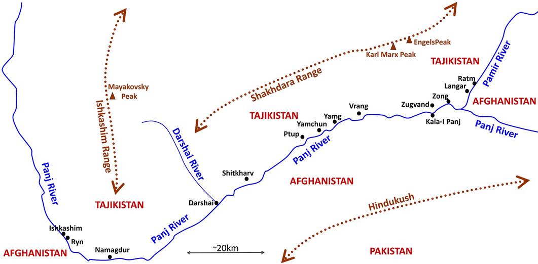
Maps:
|
|
|
Ostoni Zanjiri Kaba (shrine) in Ryn, a short
distance from Ishkashim.
|
|
|
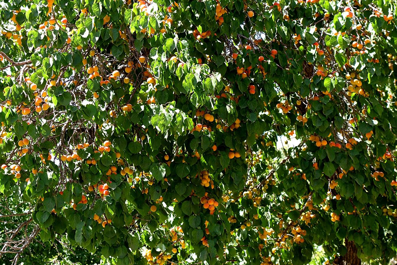
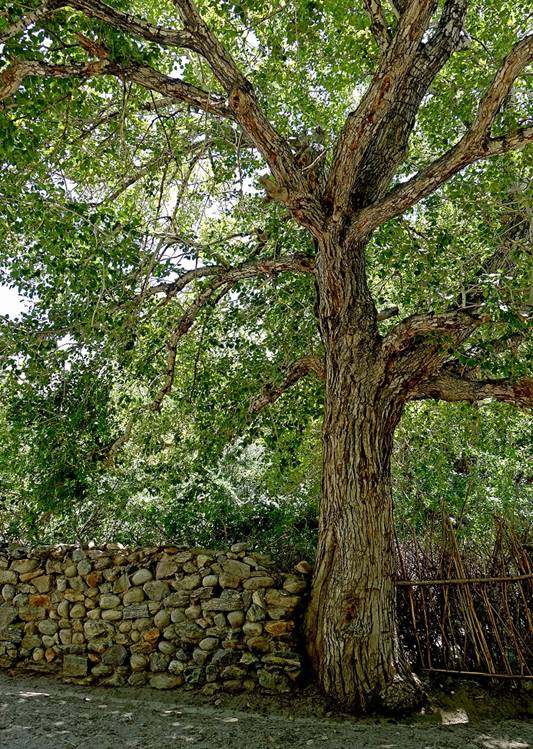
Apricot tree in Ryn.
From eastern Turkey to Ladakh in India, Central Asia
produces some of the most delicious apricots worldwide.
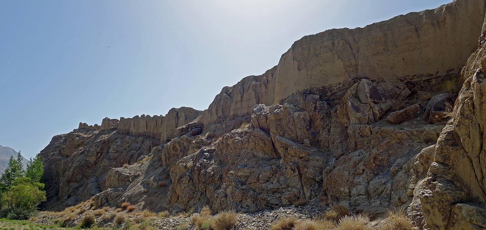
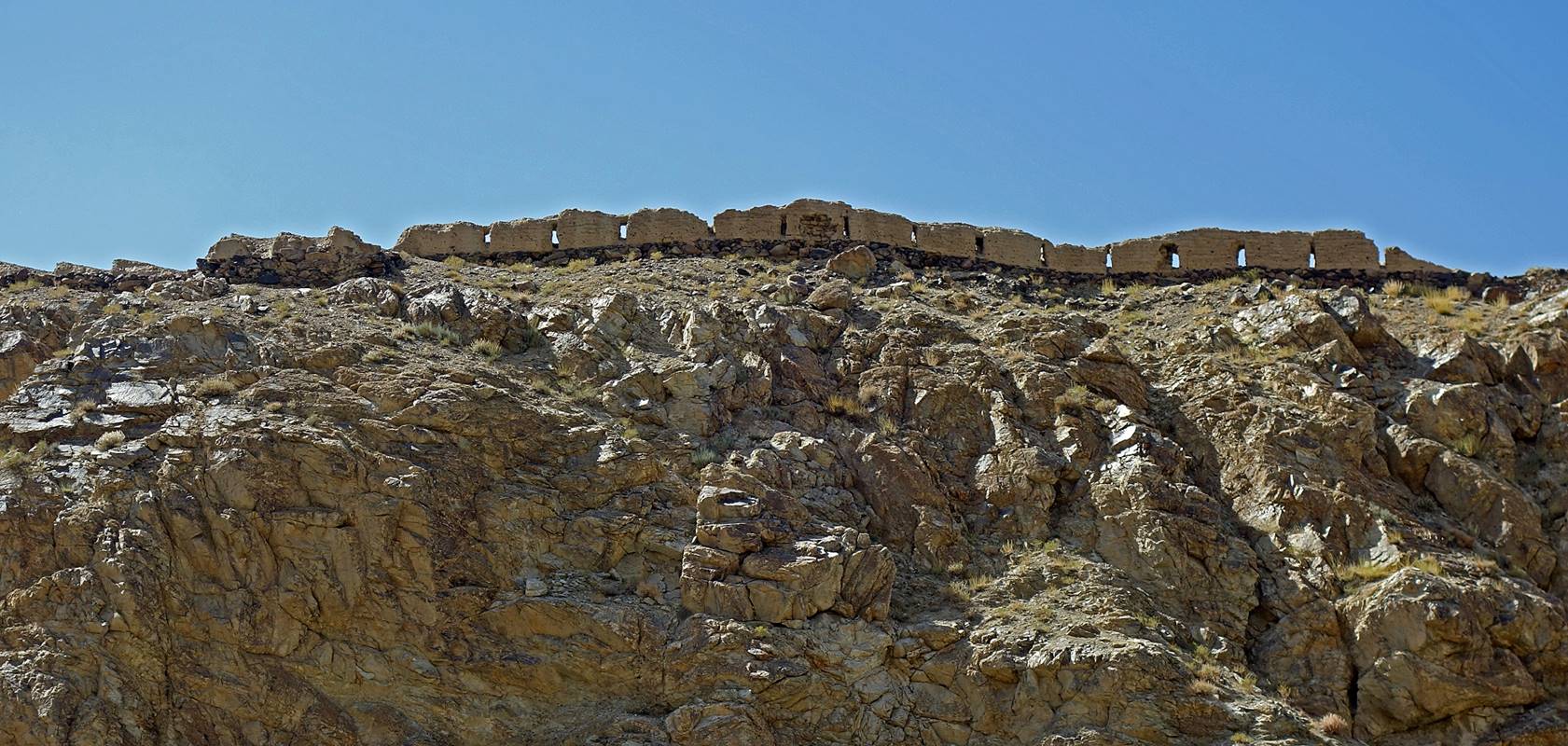
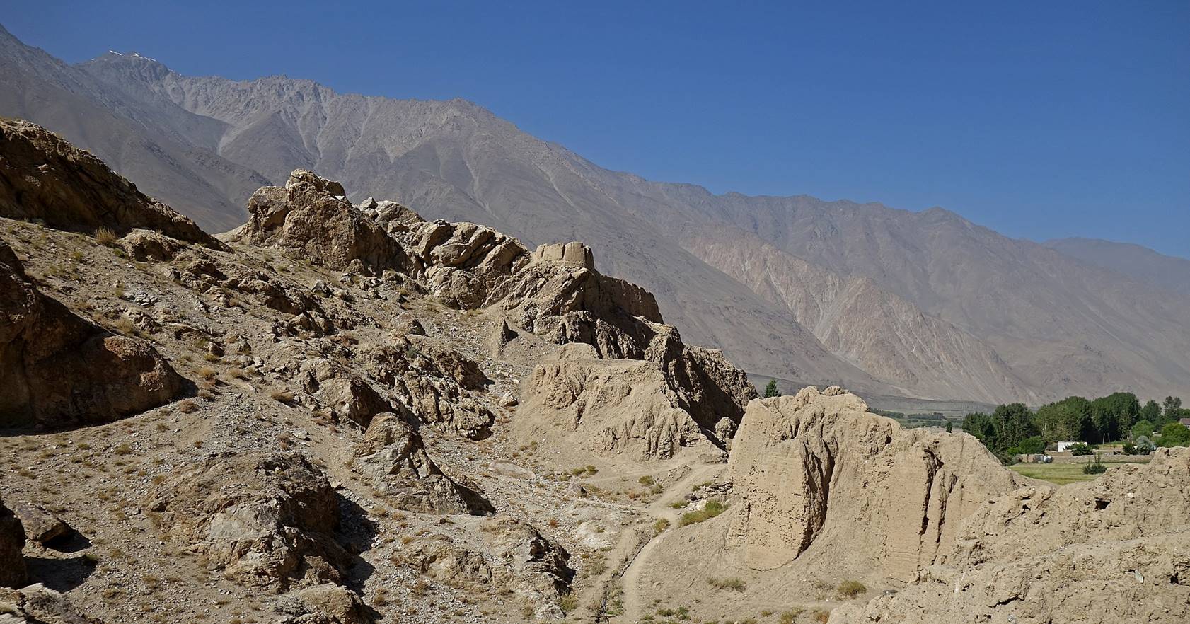
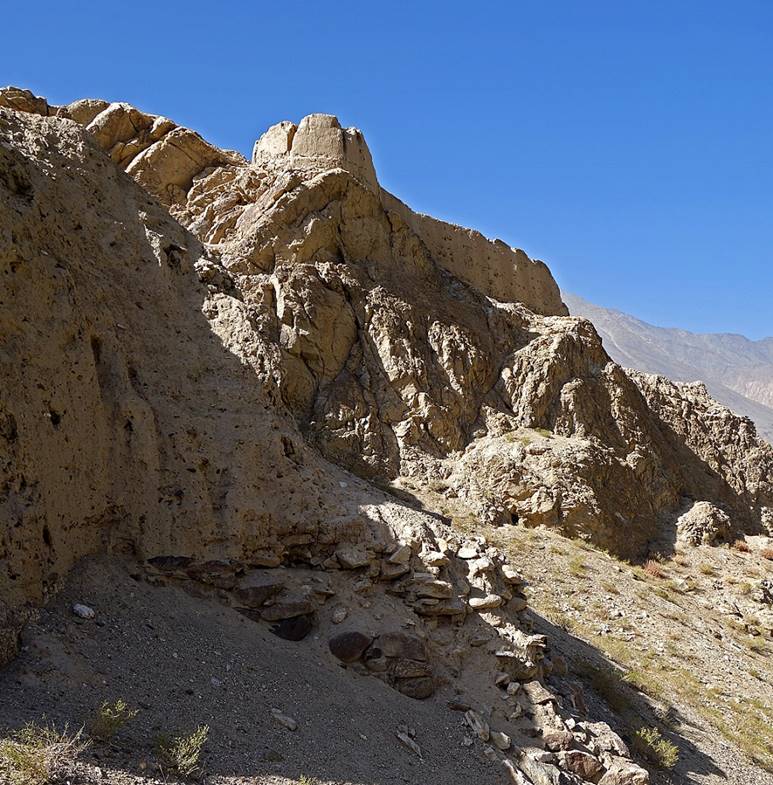
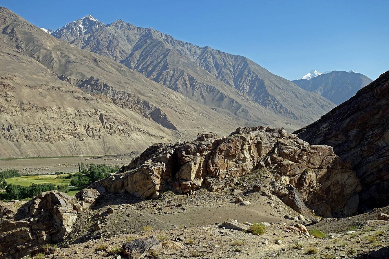
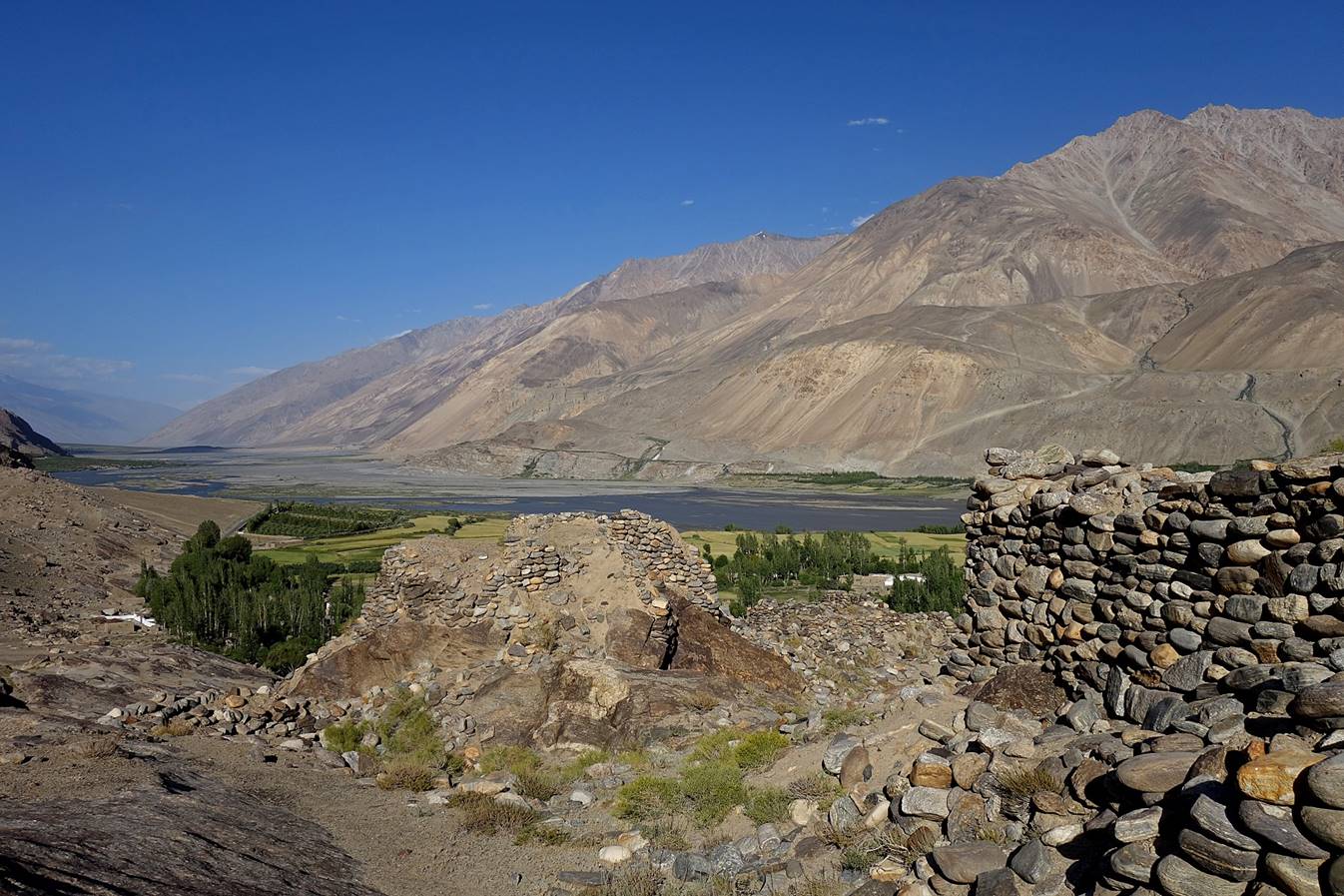
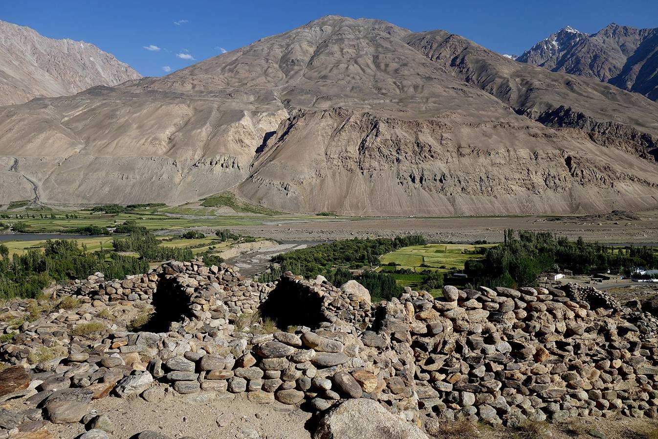
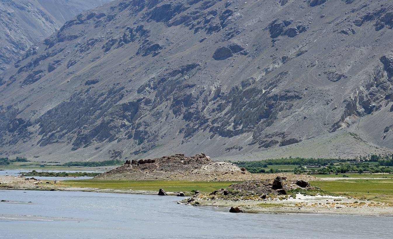
Ruins of the fortress known as Kakh-Kala (3rd century AD) built on a rocky outcrop above
the Panj river near the
village of Namagdur.

|
|
|
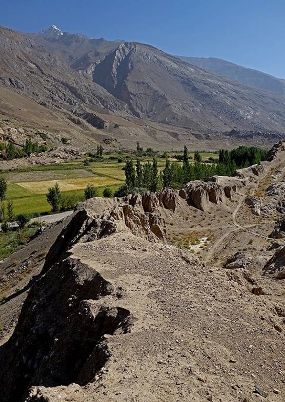
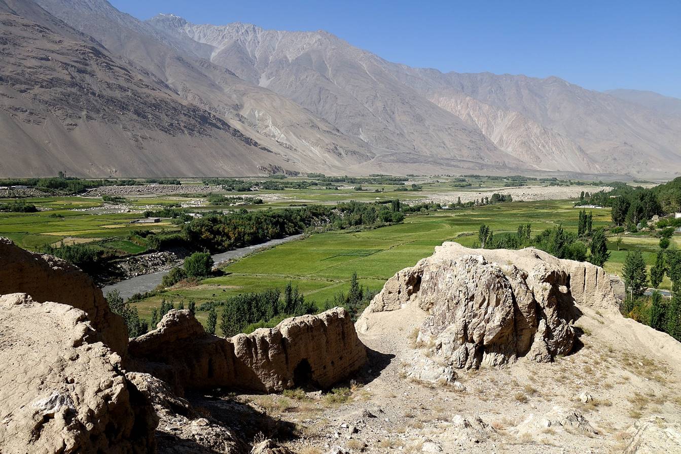
View of the Wakhan
valley from the fortress, with Afghanistan on the left side of the Panj river.
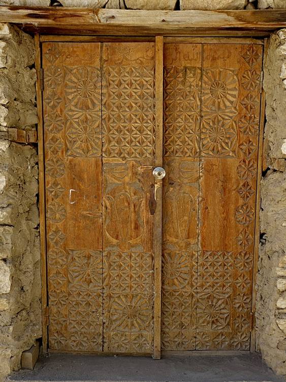
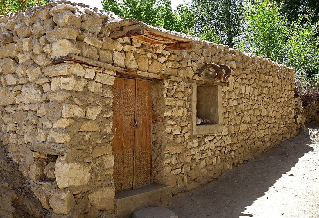
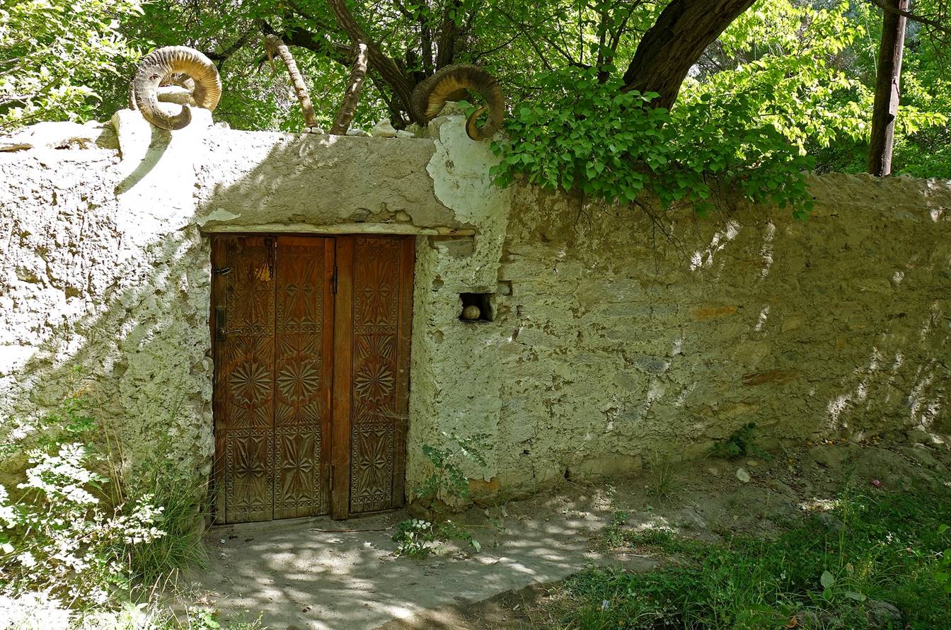
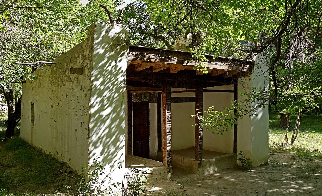
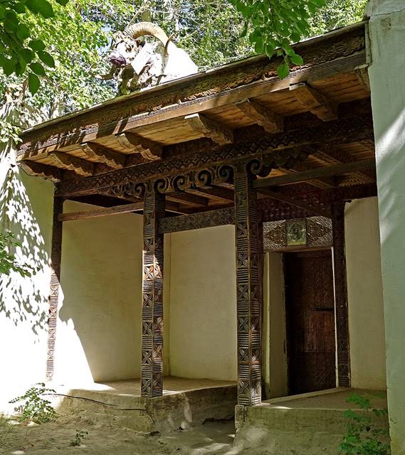
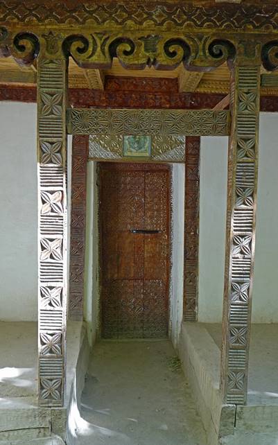
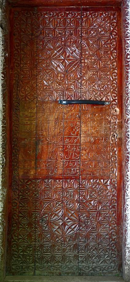
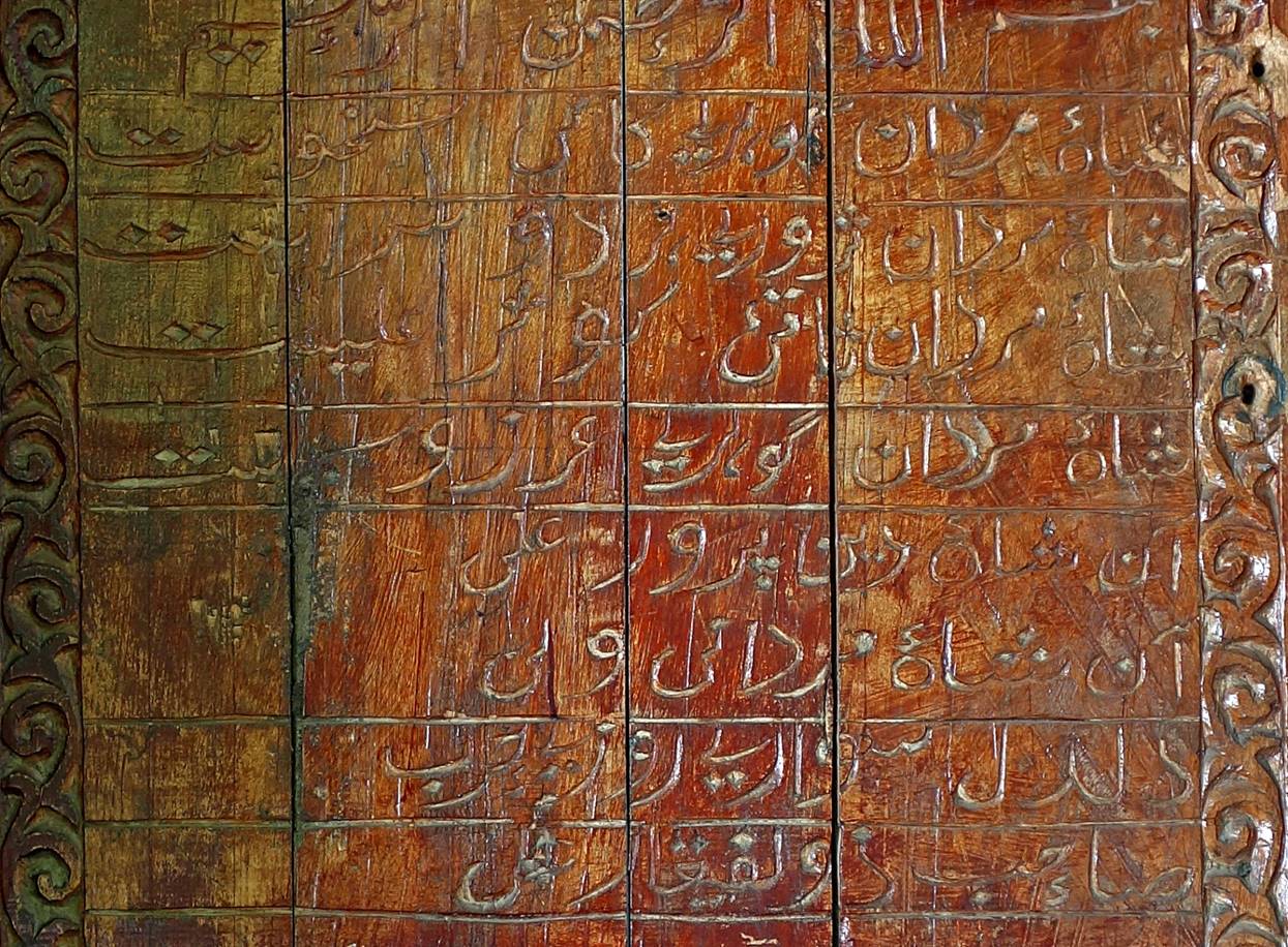
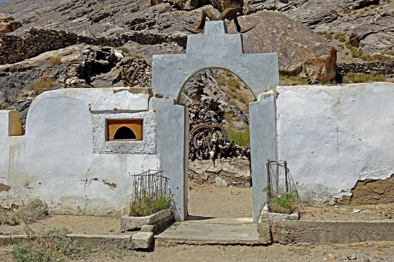
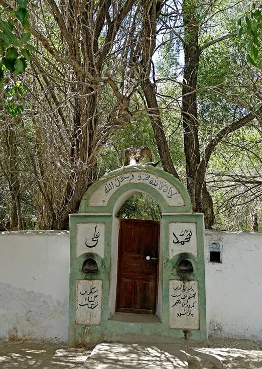
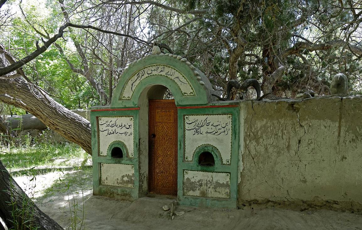
Ostoni Shohimardon,
set in the middle of a shaded a garden facing the fortress. Note the beautiful
wood carvings (including some Arabic scripts) on the doors.
|
|
|
|
|
|
|
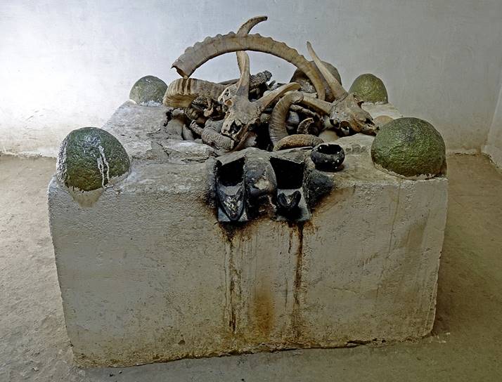
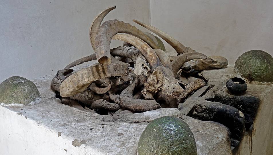
Altar inside the shrine.
|
|
|
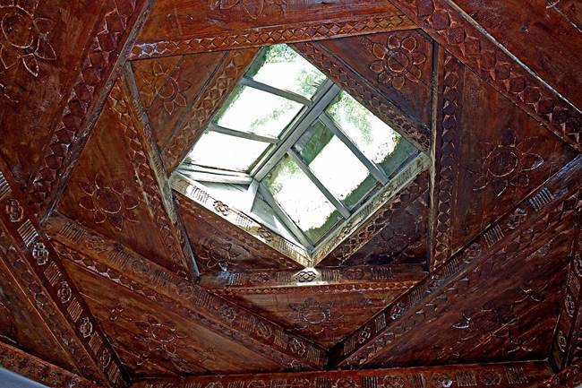
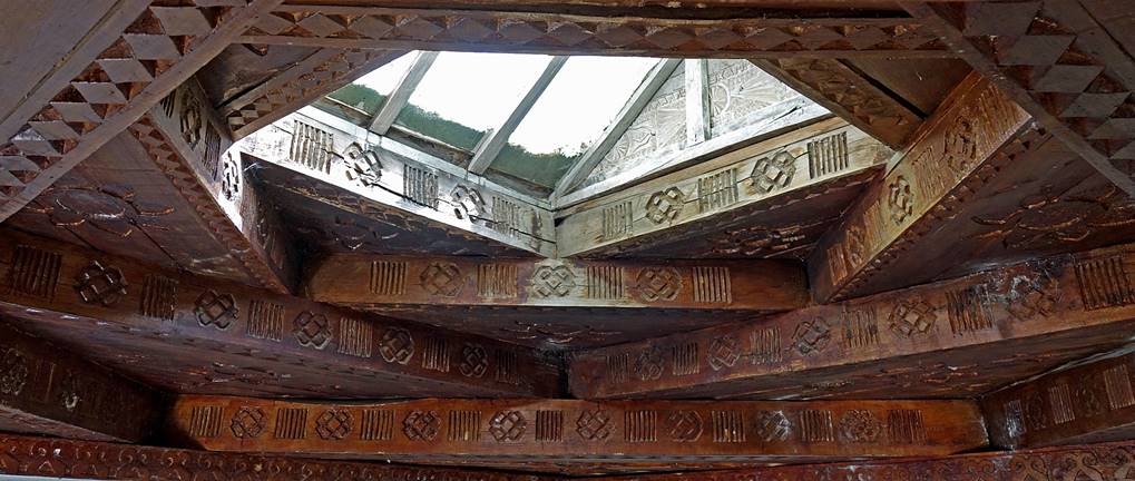
Beautifully carved
Pamiri-style ceiling inside the shrine, with the four square layers symbolizing
the four Zoroastrian elements (earth, water, air and fire)
|
|
|
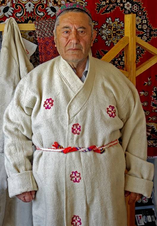
Left: Mr. Odinamamadi
Mirzo wearing traditional Wakhani cloth. Mr. Mirzo is the founder of the
Shohimardon museum (adjacent to the Ostoni Shohimardon shrine) and the author
of the book ″Wakhan (A scientific, historic and ethnographic study)″.
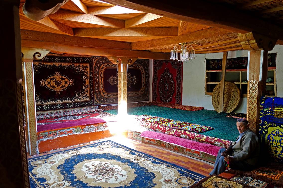
Right: The typical main room of a Pamiri house in the Shohimardon museum, again
with the four-square-layer ceiling and with five supporting wooden pillars
symbolizing the family of Ali (Mohamed′s son-in-law): Mohamed (the pillar
in the dark on the extreme right), Ali (the one on the right), Ali′s wife
(the one in the center hit by sunlight), and Ali′s sons Hassan and
Hussein (only one of the two pillars is visible on the left).
|
|
|
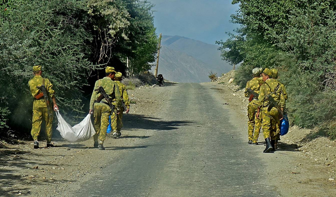
One of the many
military patrols along the Afghan border.
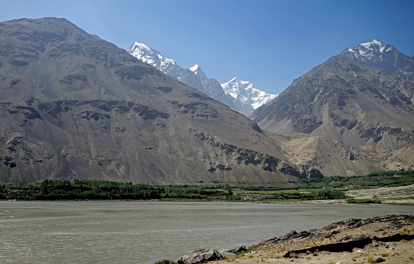
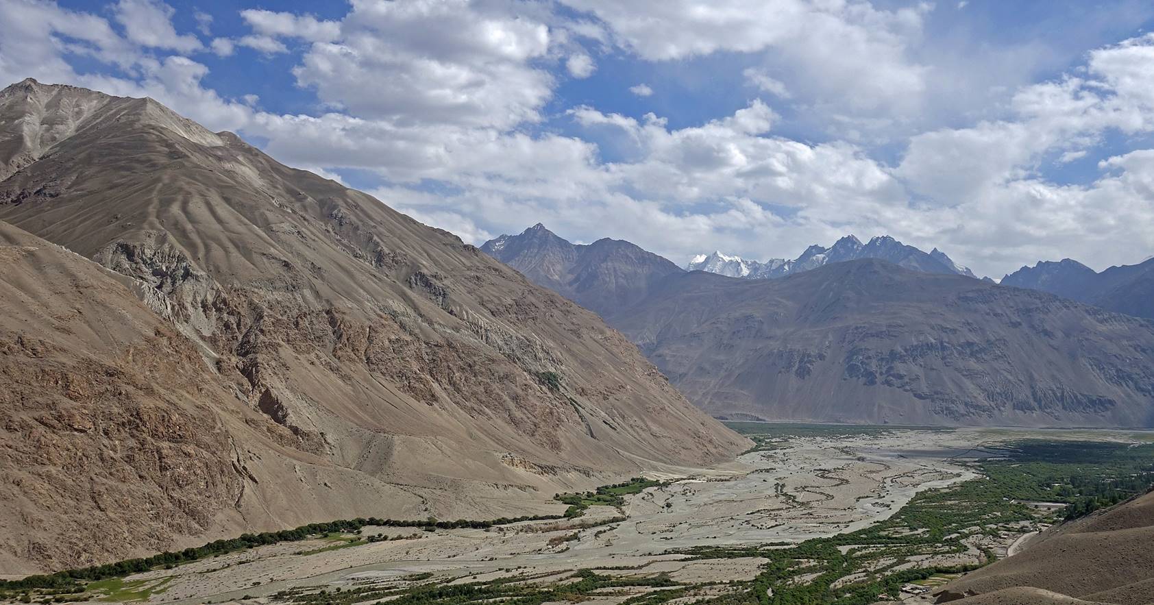
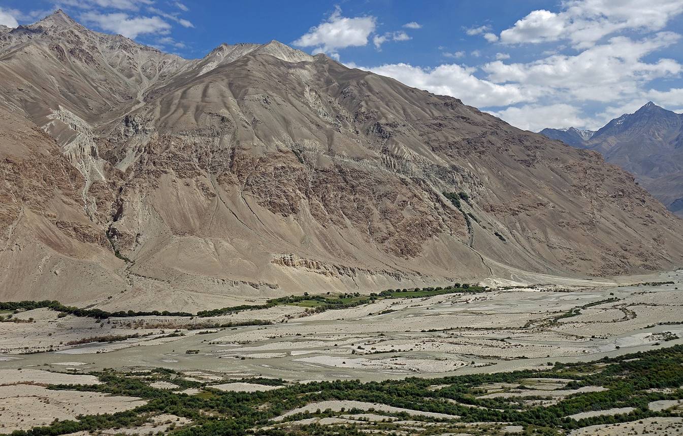
Views of the Wakhan
valley between the villages of Namagdur and Darshai.
Fortress on the Afghan side of the Panj river, seen between Namagdur and Darshai.
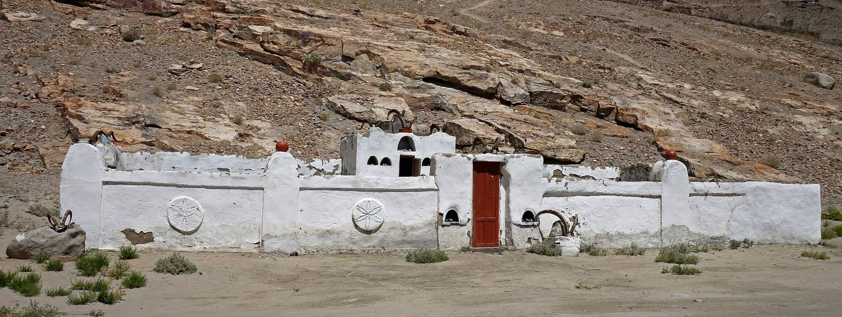
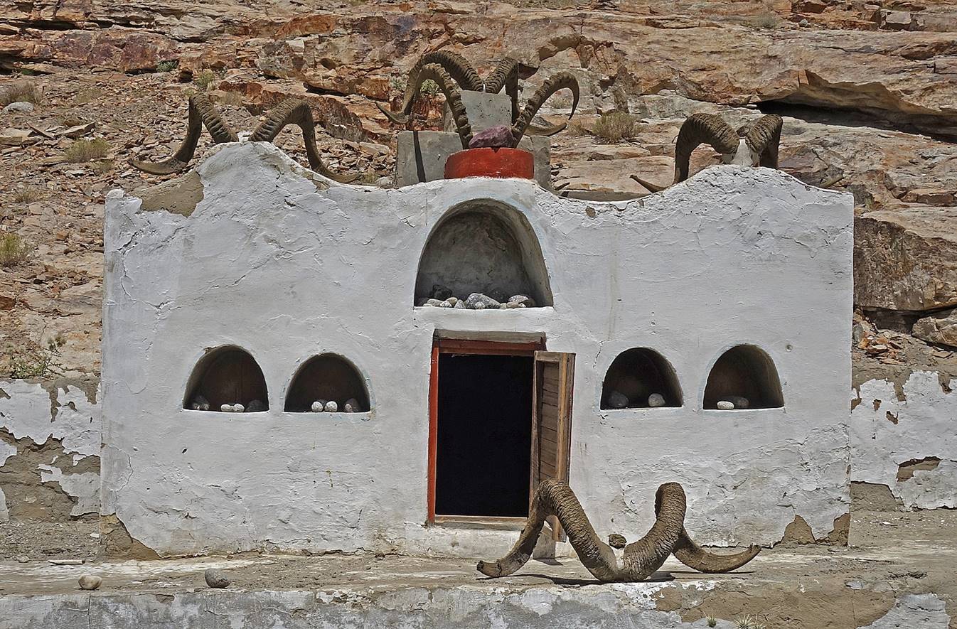
Ostoni Piri Fokhmamad in Darshai.

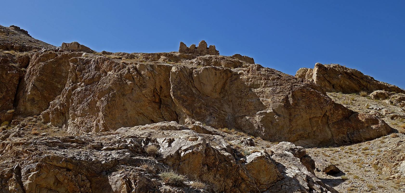
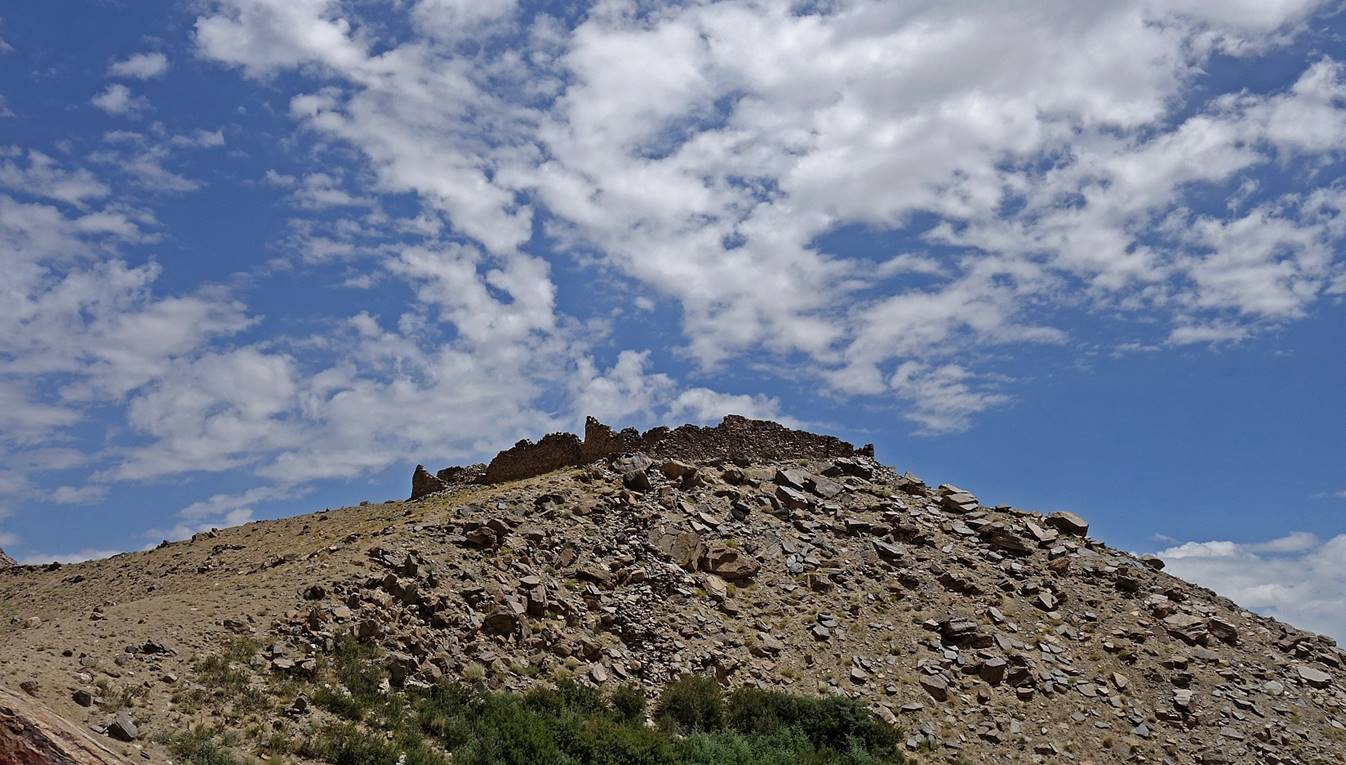
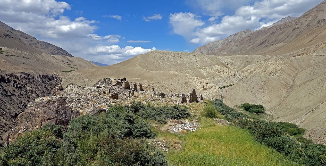
Ruins of fortress (6th-9th century AD)
above Darshai.

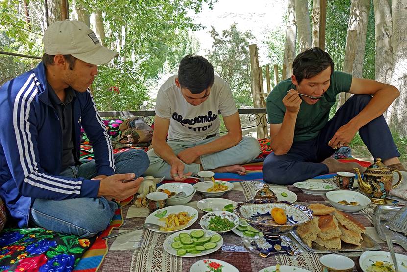
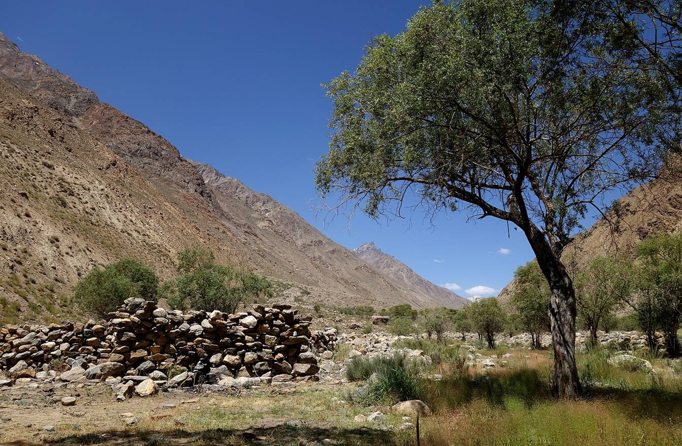
We spent two nights in Darshai in a very nice
homestay. In addition to visiting Darshai′s Ostoni Piri Fokhmamad
and fortress, I did a day hike up along the valley of the Darshai river with Jumach and Siyew. Photos of this hike are included at the
bottom of this page.
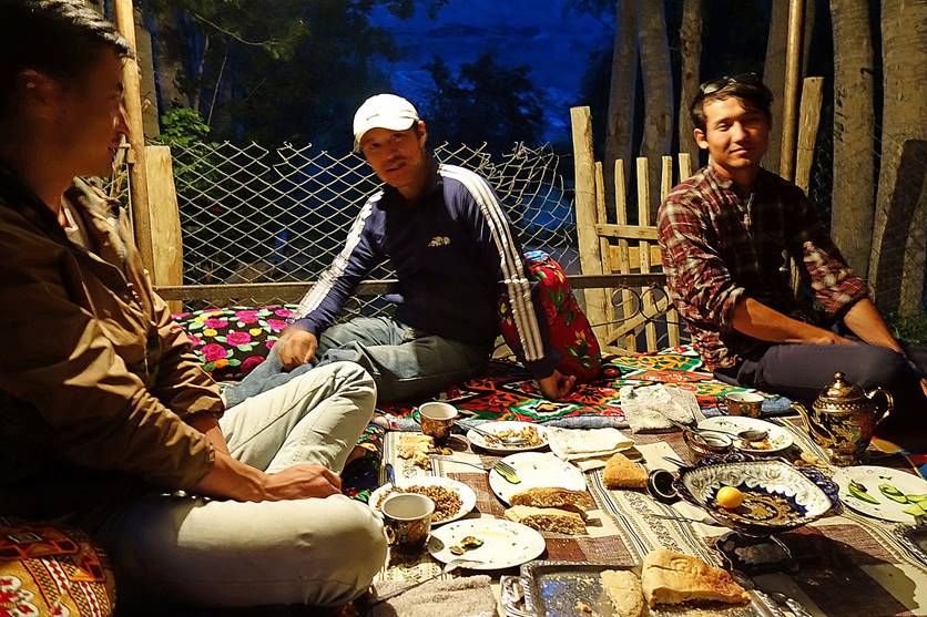
Breakfast and dinner in an outdoor traditional
setting at the homestay, with our driver, Siyew and Jumash
(from left to right in the photo on the right).
|
|
|
Nice shaded area outside our homestay.

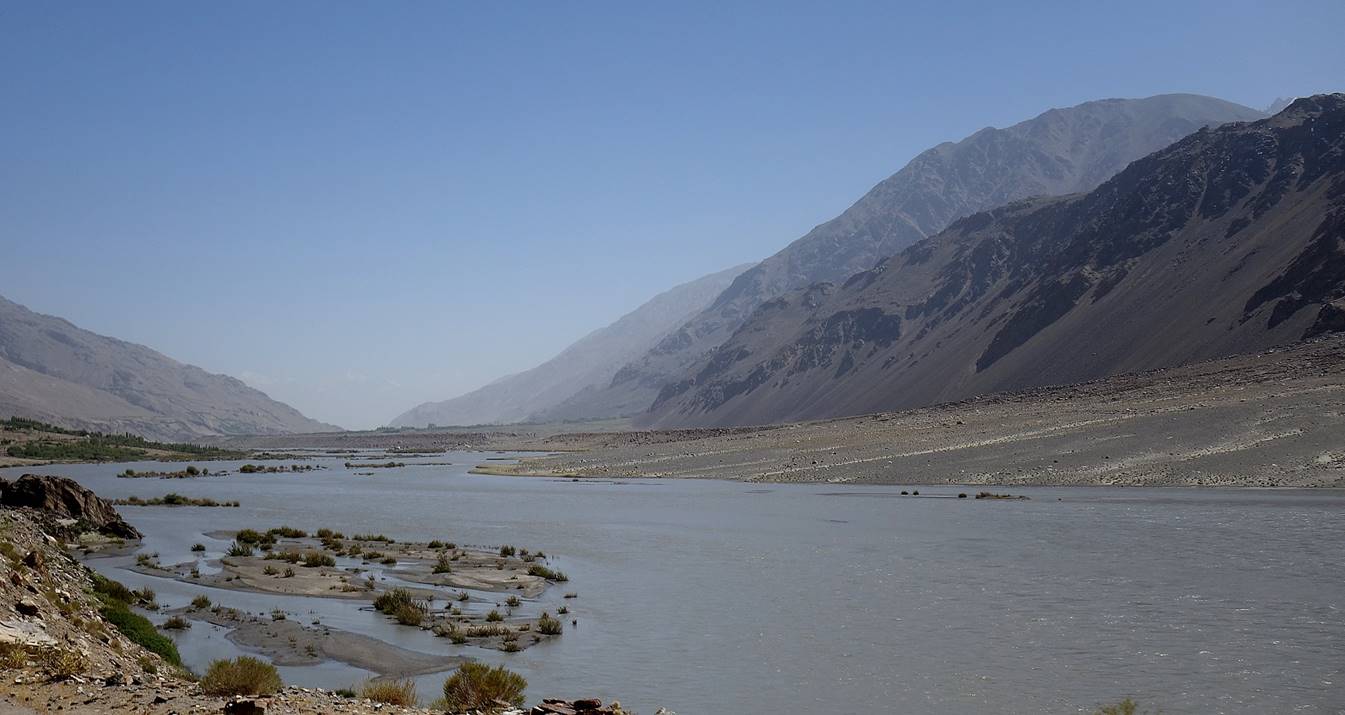
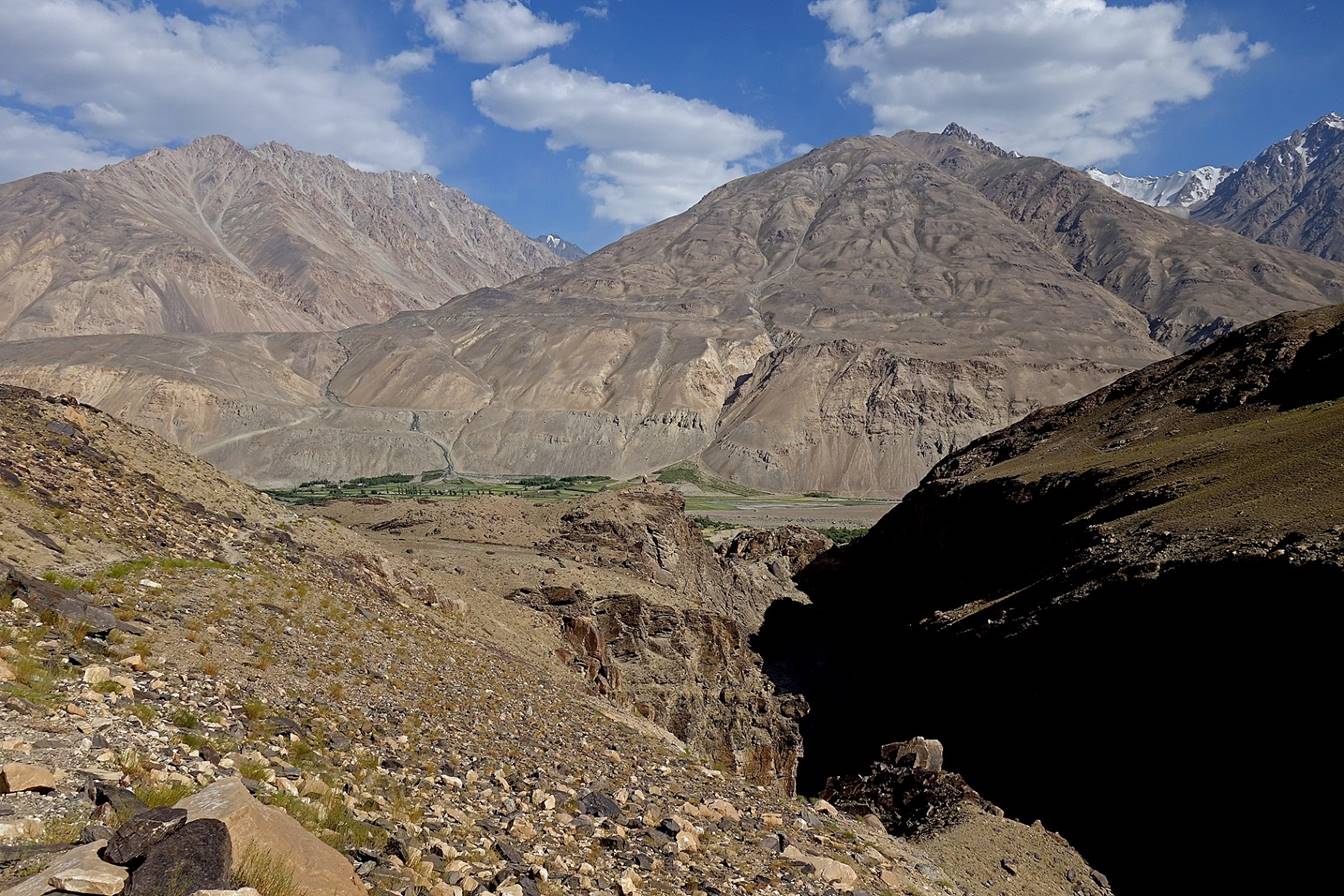
Wakhan valley between Darshai
and Shitkharv.
Ostoni Bobo Khoki in
Shitkharv. According to a legend, the holy man Bobo Khoki was born after the death of his mother and emerged
from her grave (source: ″Tajikistan and the High Pamirs″, by Robert
Middleton and Huw Thomas).
|
|
|
Between Shitkharv
and Ptub.

Shrine dedicated to Shoh
Isomuddin, one of the early Ismaili envoys who
preached to local people, set among old trees in the village of Ptup.
|
|
|
|
|
|

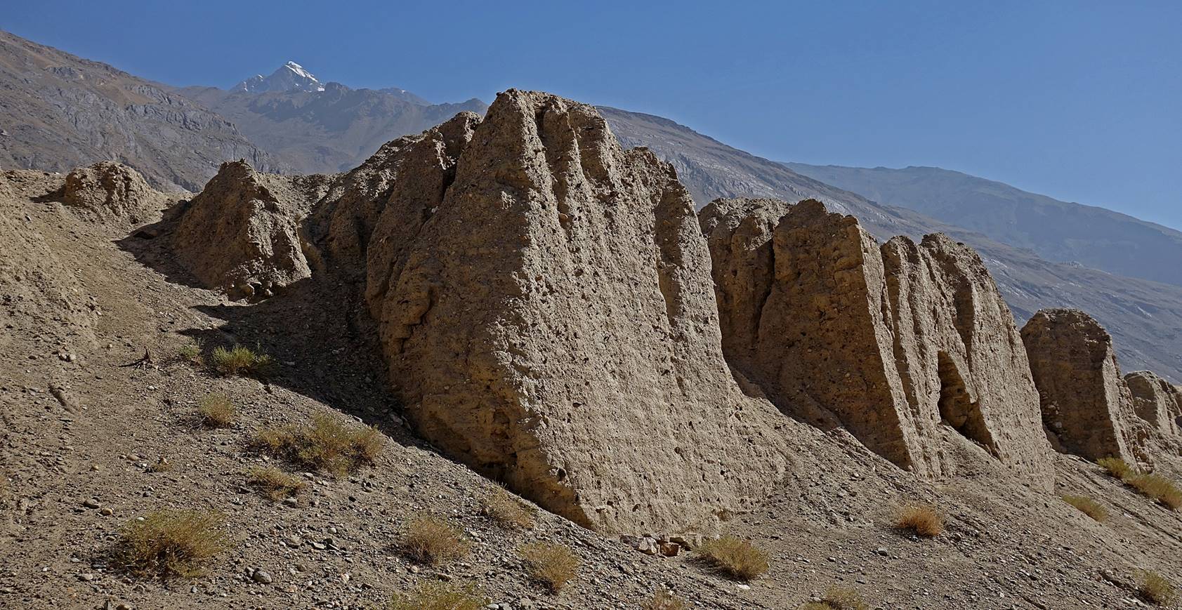
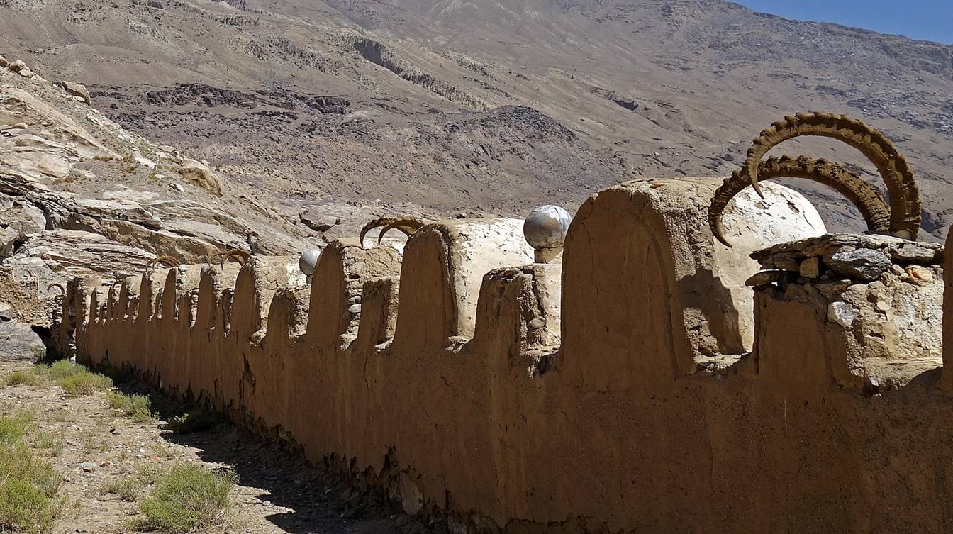
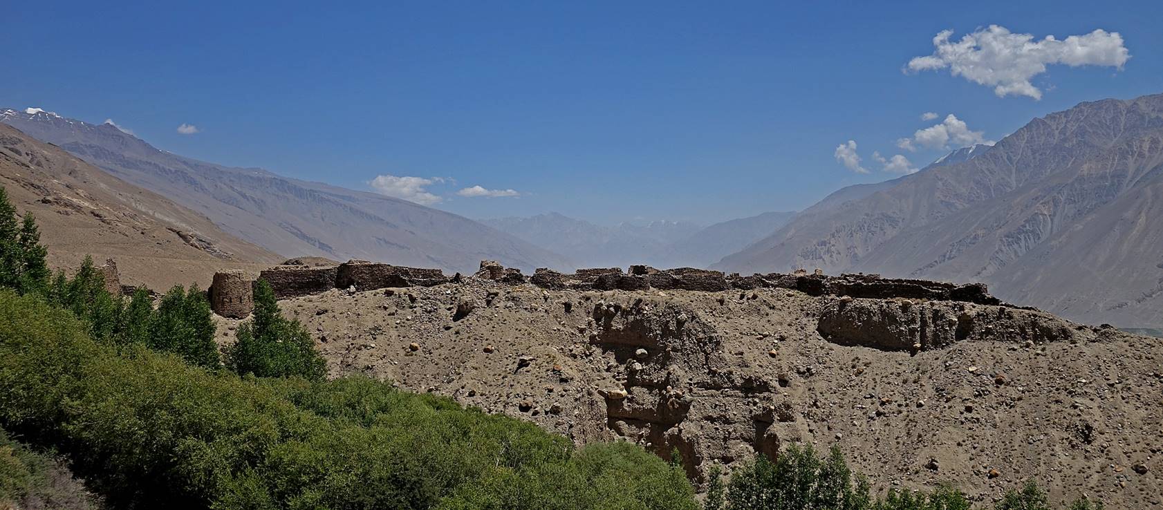
Large fortress above the village of Yamchun originally built in the 3rd century BC. Its local
name, Zamr-i Atash Parast, means ″fortress of fire worshippers″, a
reference to Zoroastrianism.
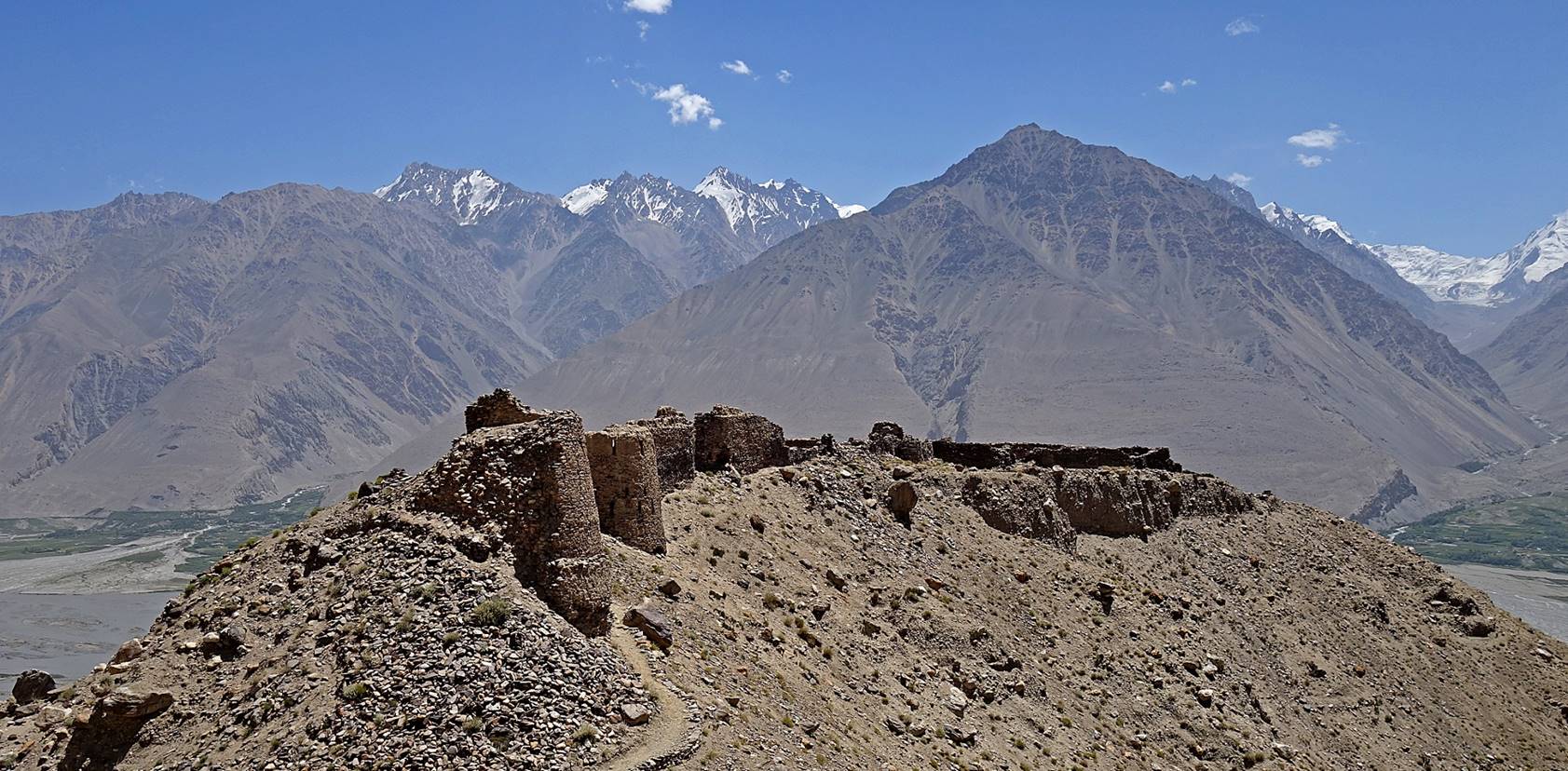


Wakhan valley seen from higher up above the
fortress, near Ostoni Bibi Fatima Zahro
(a sacred hot spring).
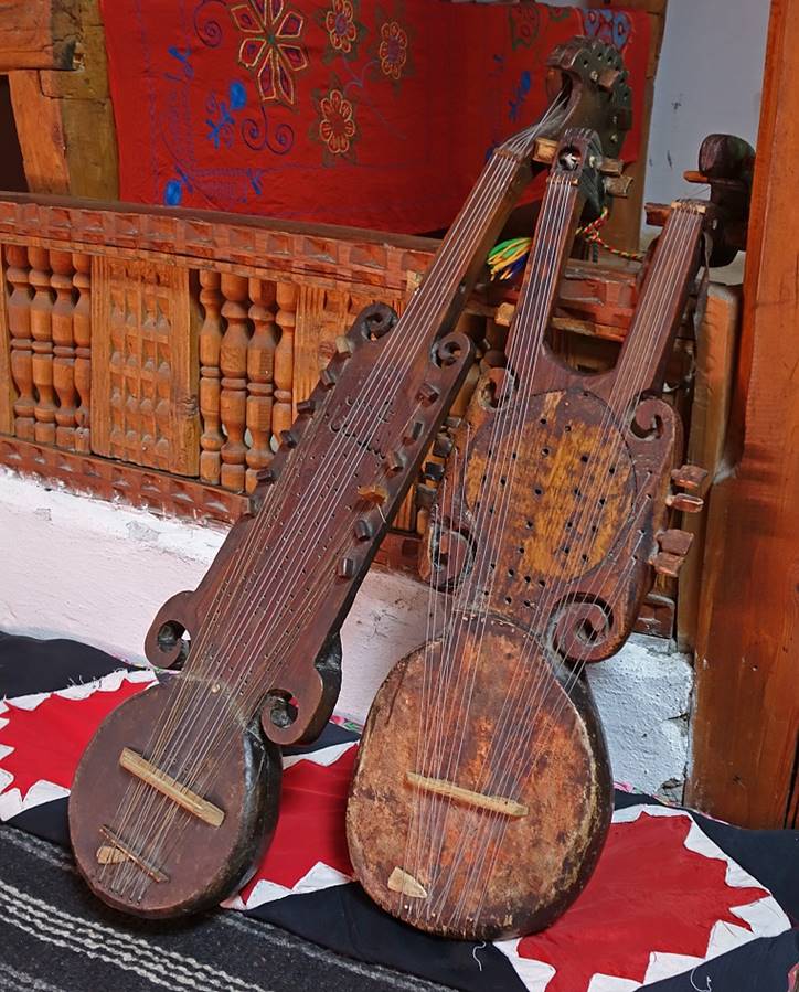
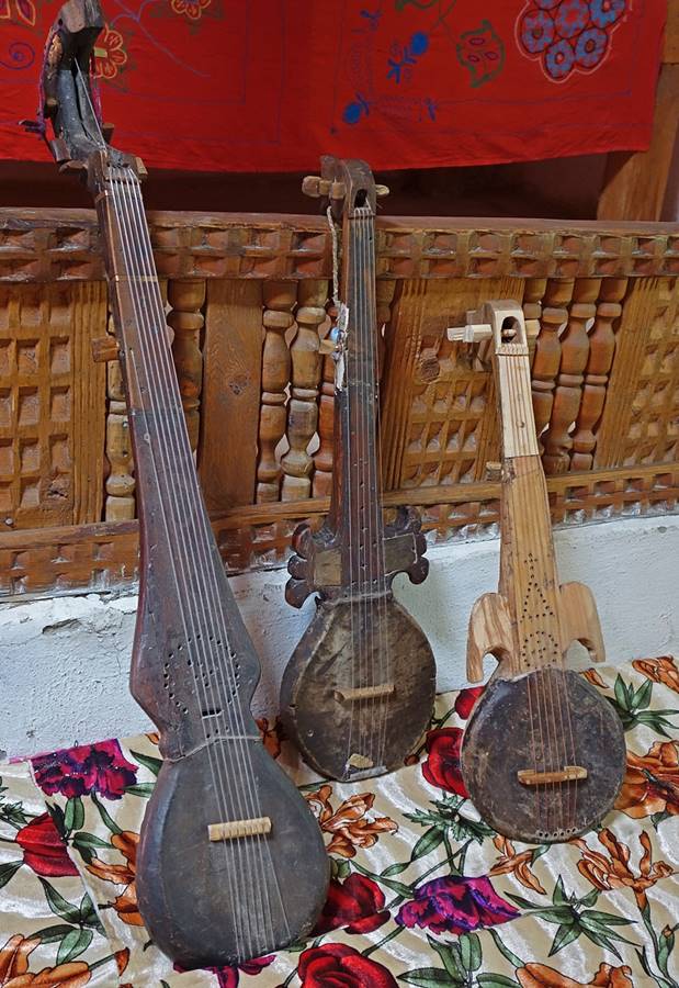
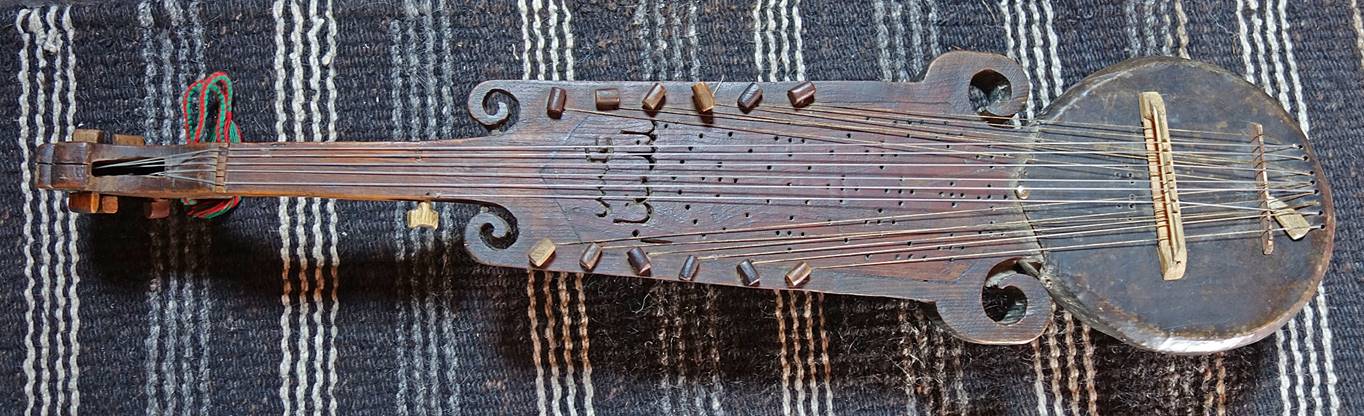
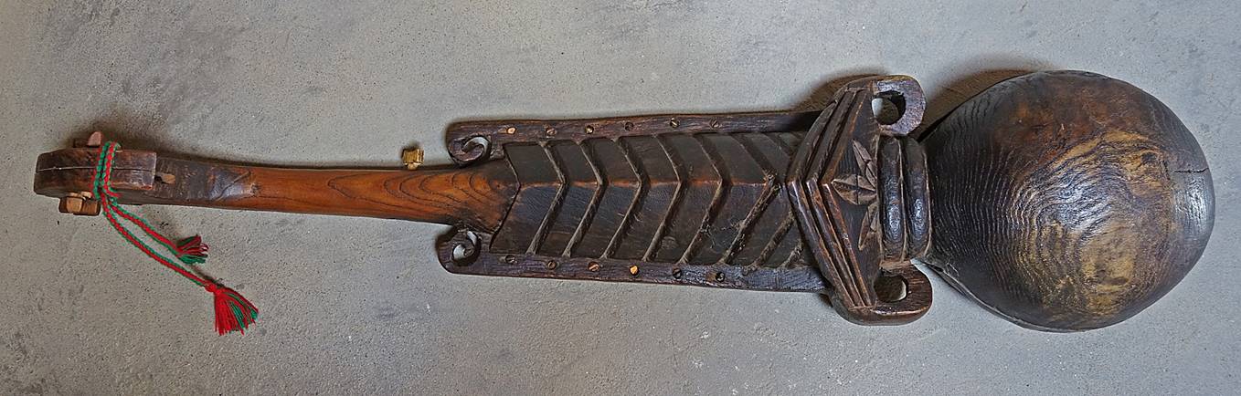
Pamiri rubabs carved
from a single piece of wood with a skin head, in the museum dedicated to
native-born Sufi Mubarak-i Wakhani
(1839-1930) in the village of Yamg.
|
|
|
|
|
|
|
View of the Hindukush mountains from the
village of Yamg.
Buddhist stupa in Vrang
village. This had been the starting point of a trek I did in 2009 across the Shakhdara mountain range. See here.
|
|
|

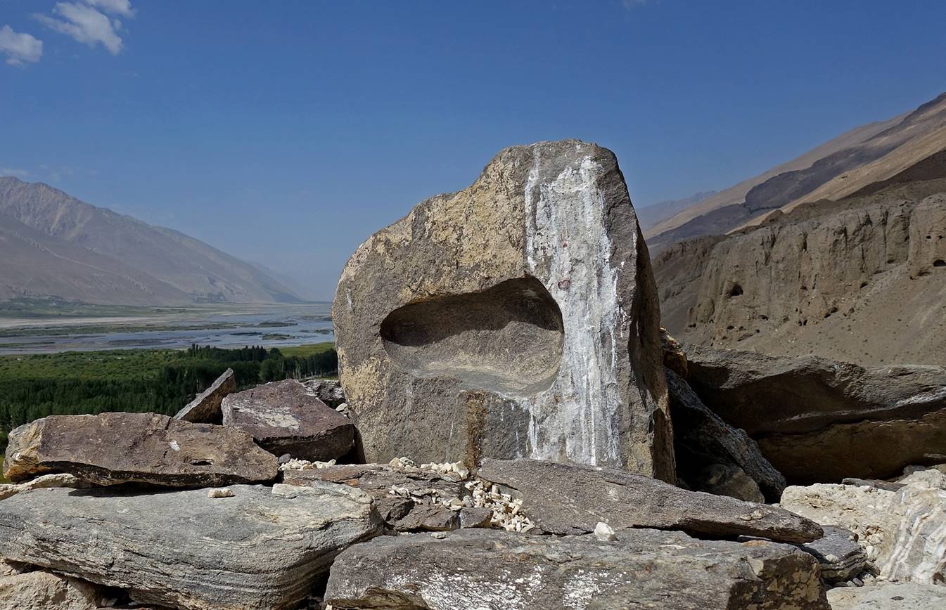
Stone with a footprint-shaped cavity
placed on top of the stupa. A legend has it that it is Buddha′s
footprint.
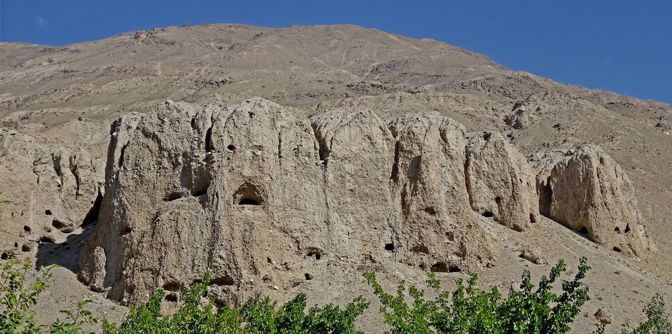
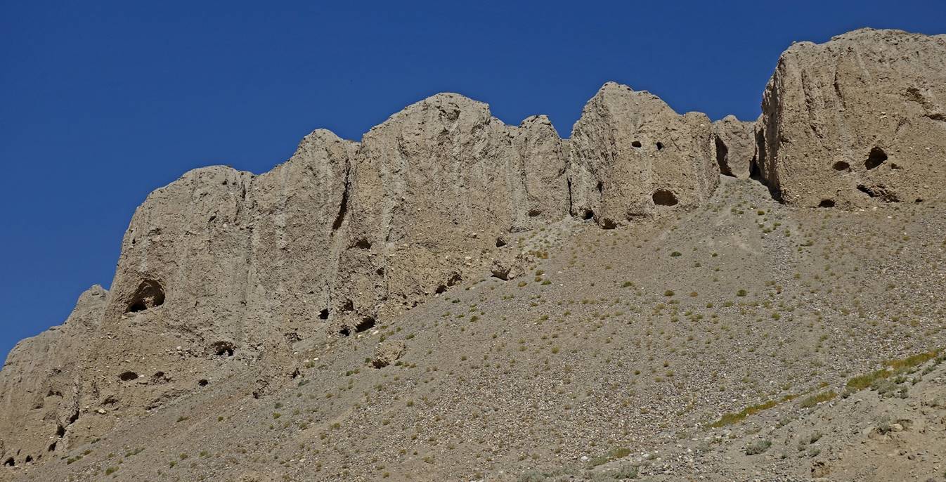
Caves in nearby cliffs that were used as
cells by Buddhist monks around the 7th century AD, when Buddhism was the
prevalent religion in the area.
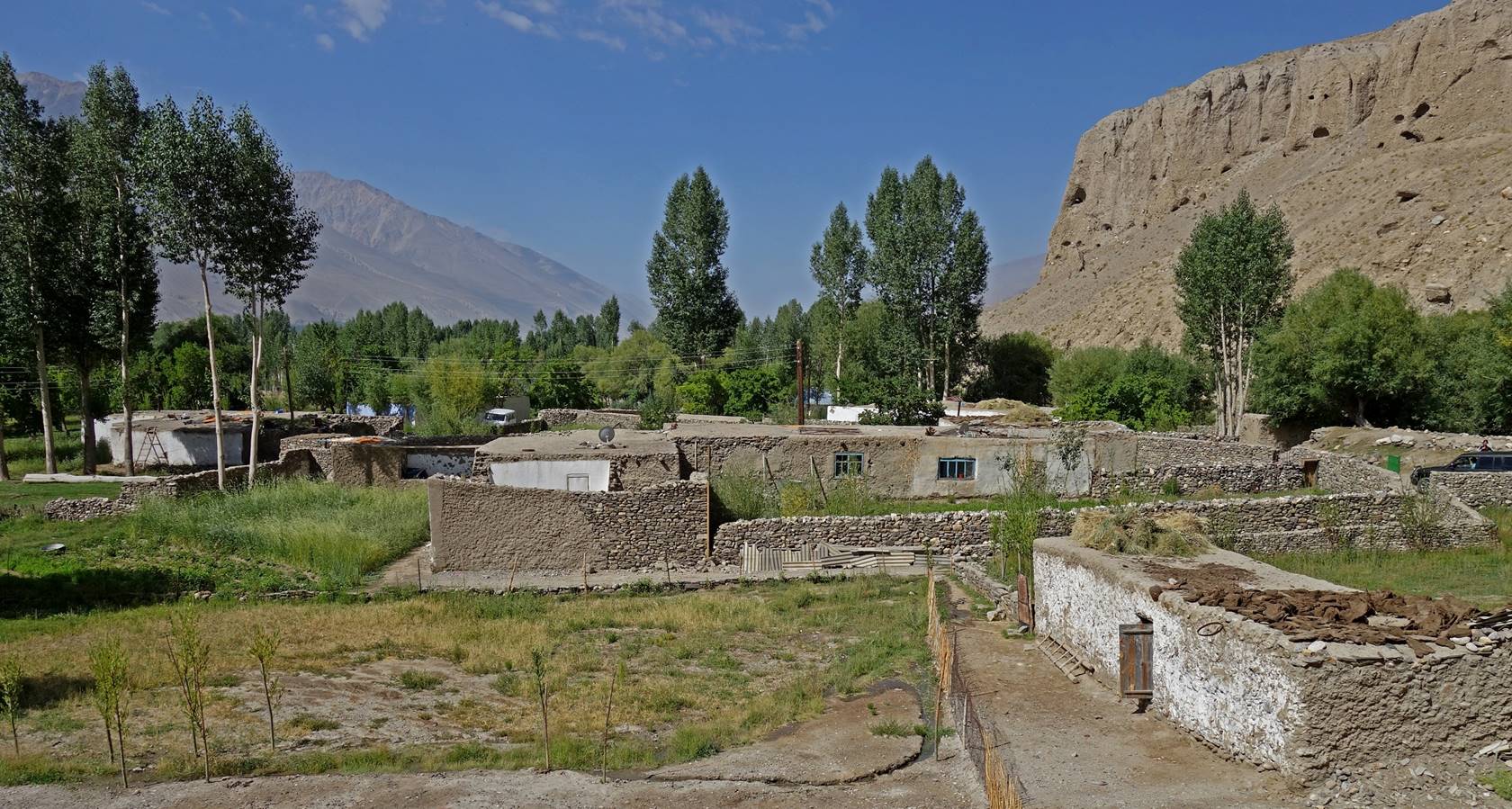
Typical Pamiri
house in Vrang.
Shrine dedicated to the Sufi poet Abdullo Ansori (11th century AD)
below the stupa.

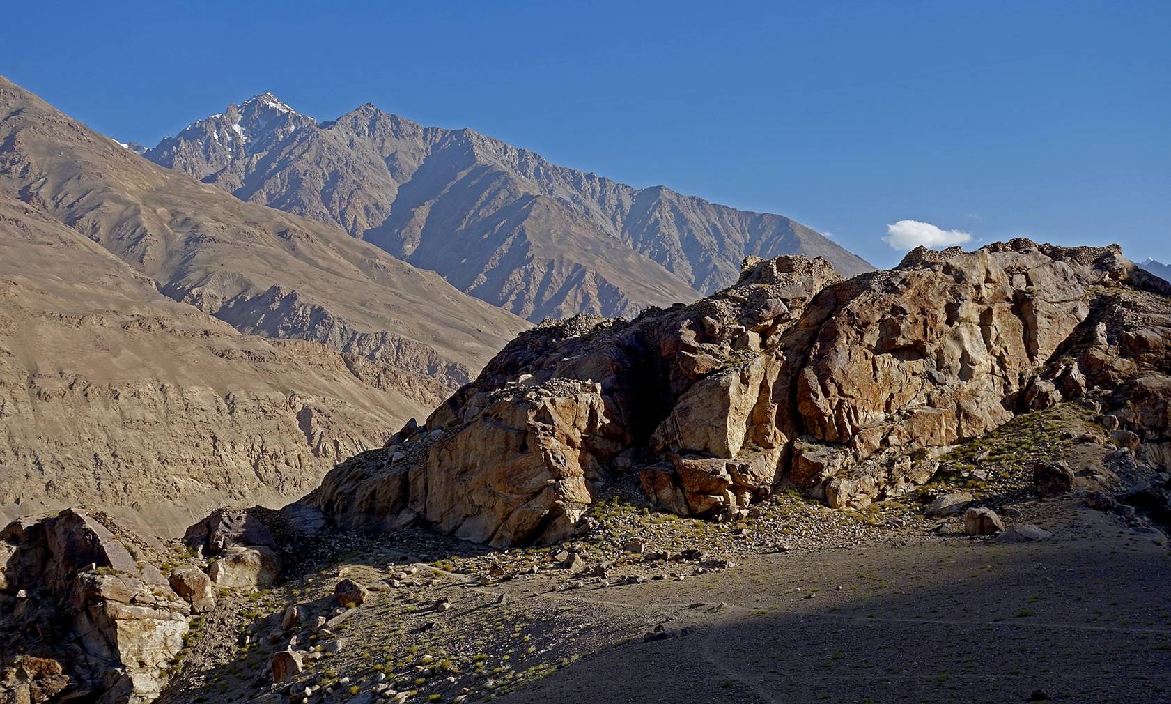
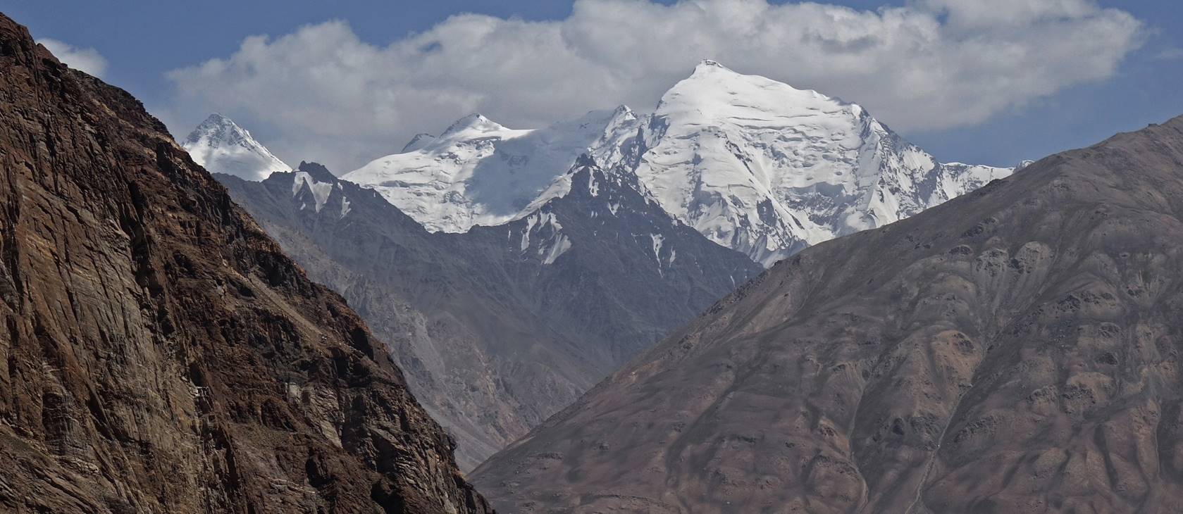
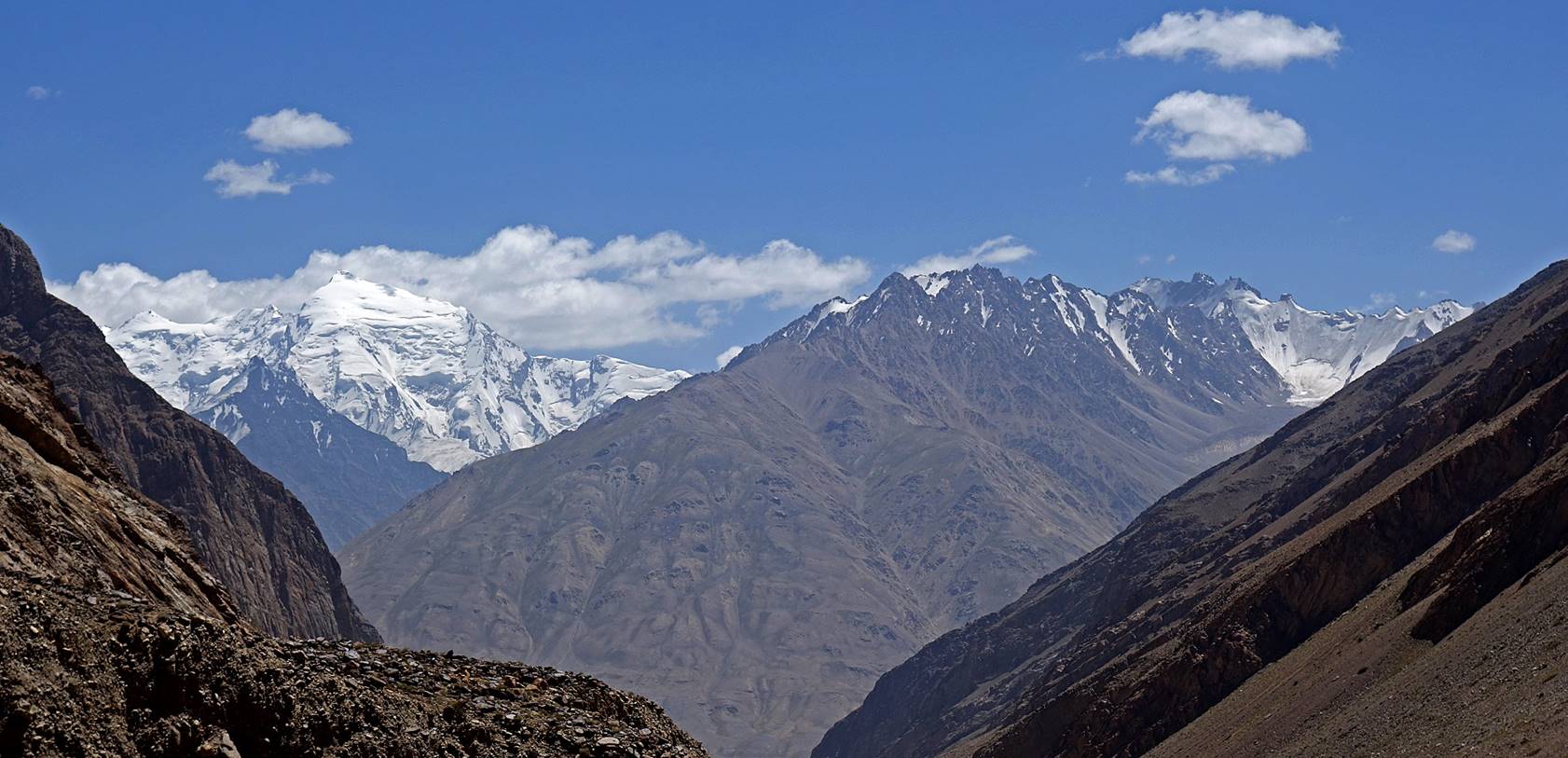
Hindukush mountain
seen before reaching the village of Zugvand.

Kala-I Panj
fortress on the Afghan side of the Panj river, seen just before reaching Zugvand.
Ostoni Panjai Shoh at the entrance of Zugvand
village.
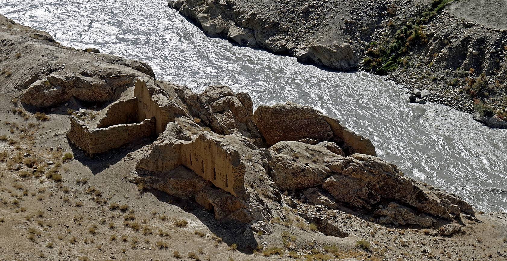
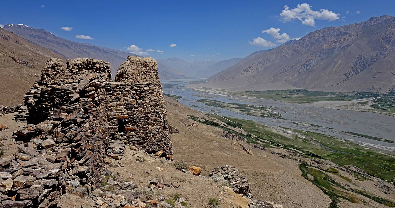
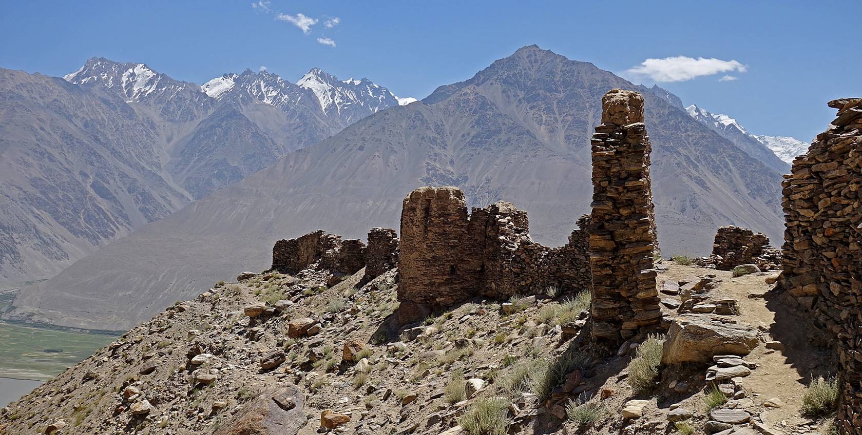
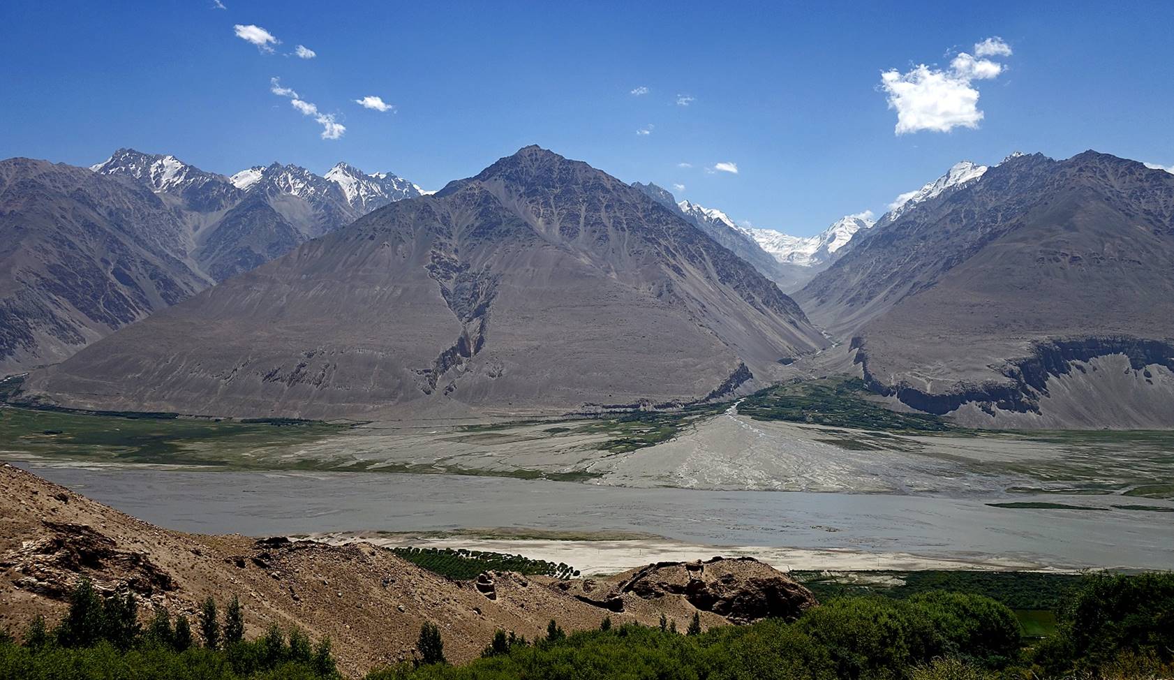
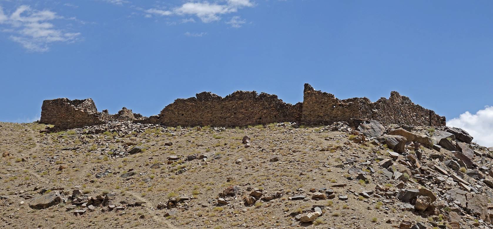
Vishim-Kala fortress above the village of Zong.


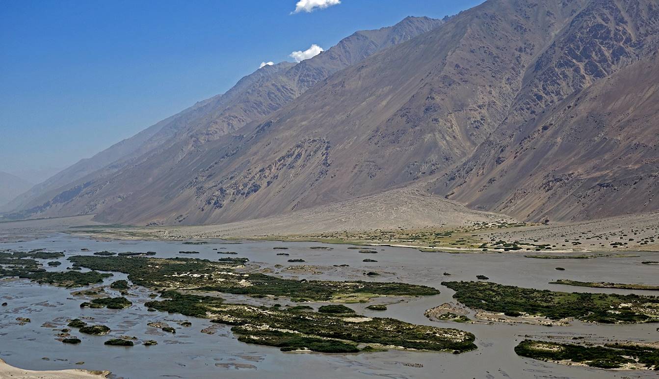
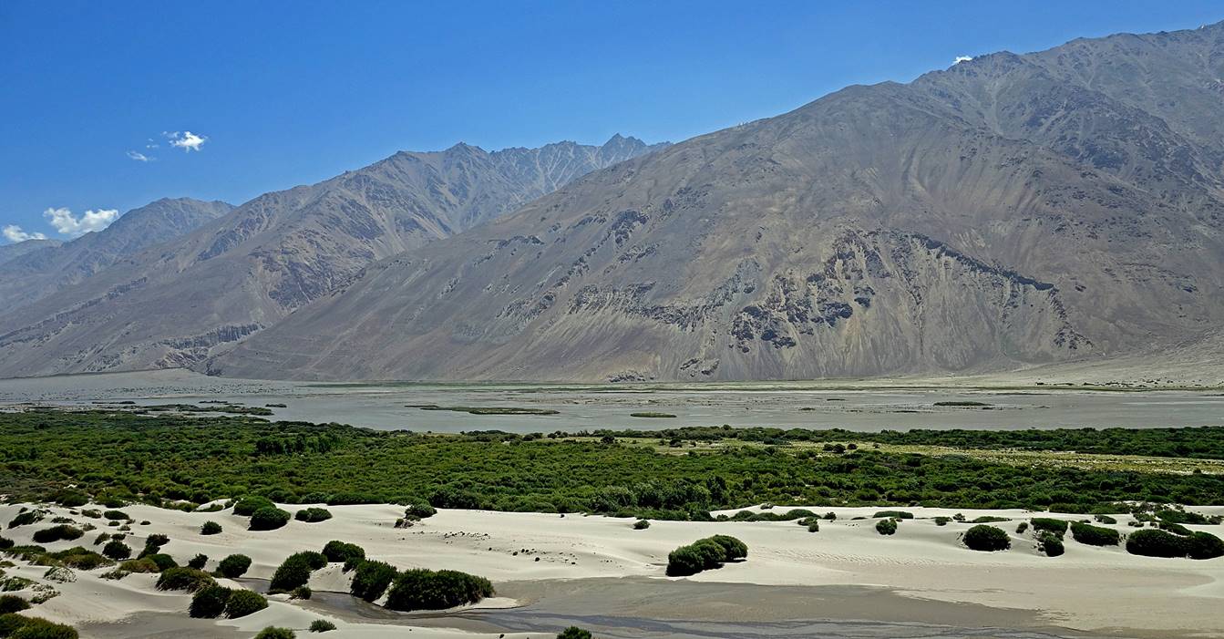
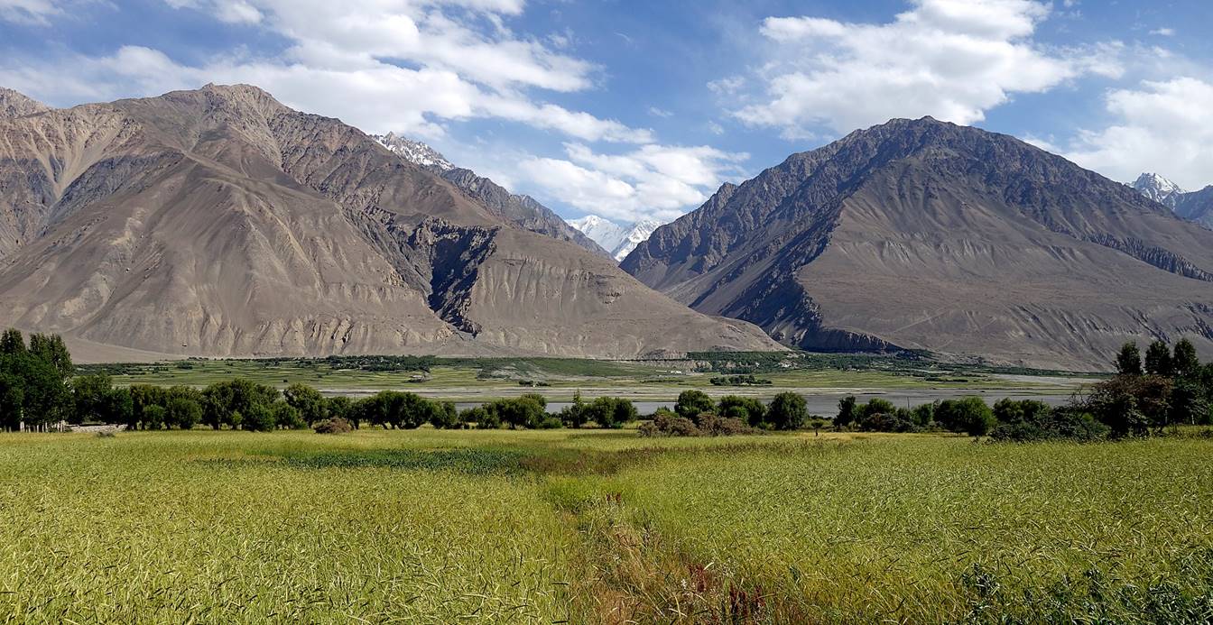
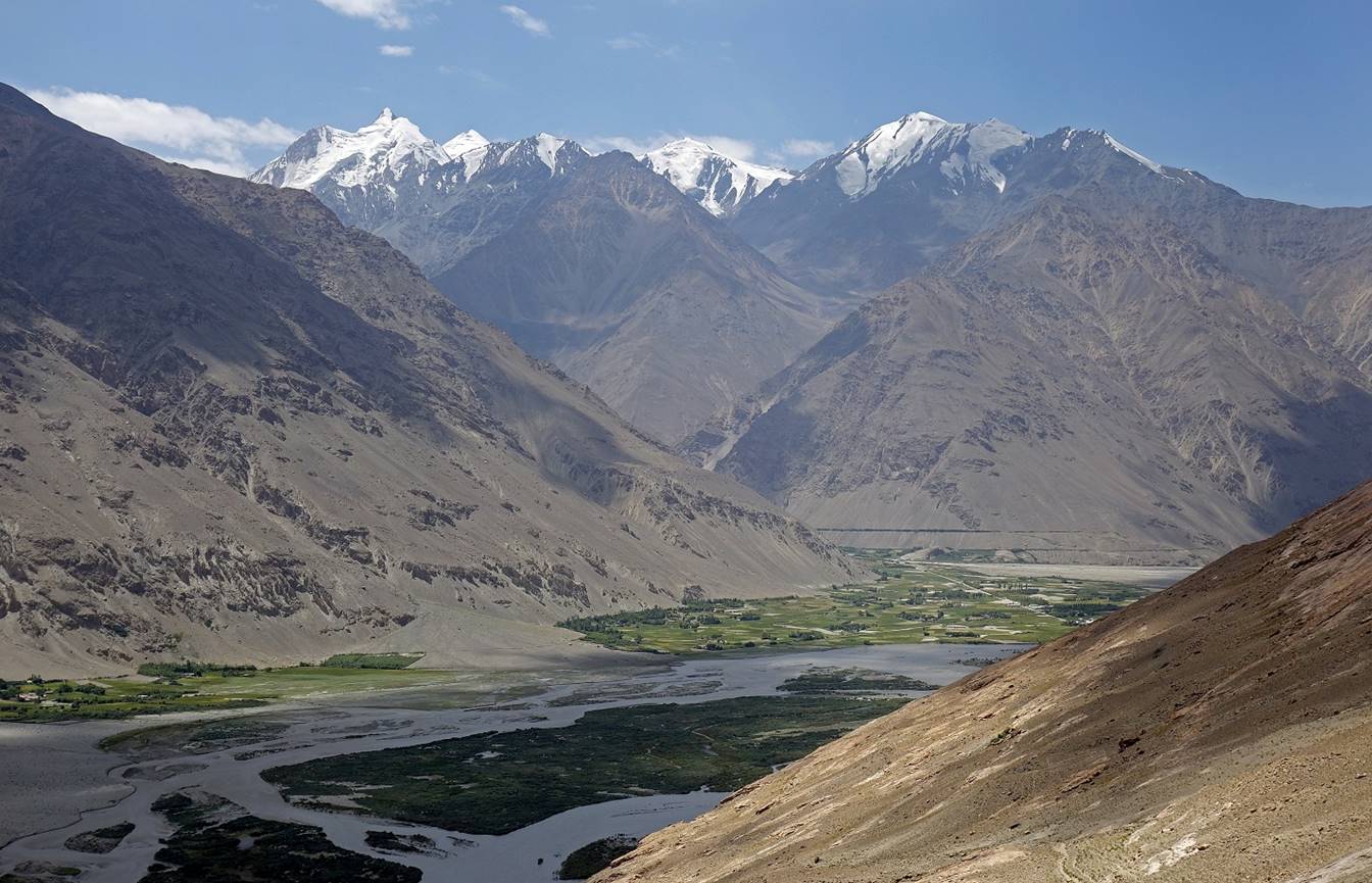
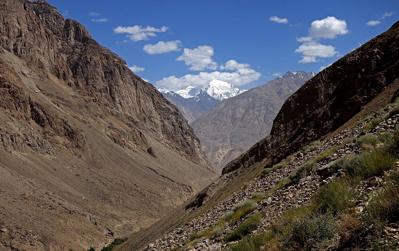
View over the Wakhan
valley and the Hindukush mountains from the fortress, toward the southwest
(first photo) and the southeast (second photo).
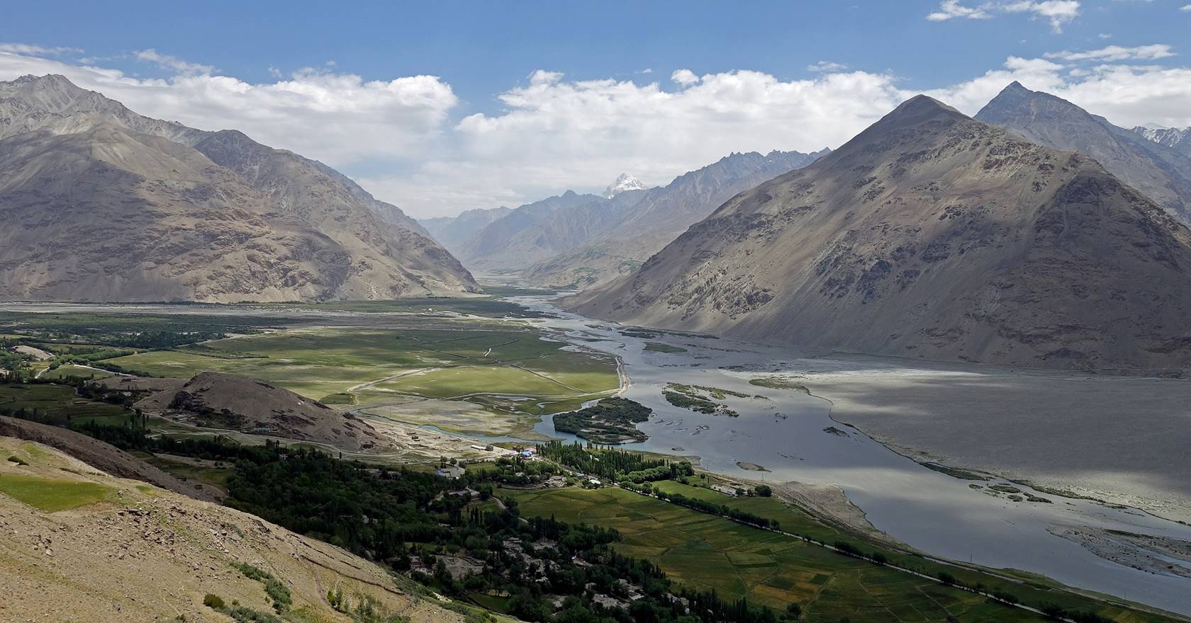
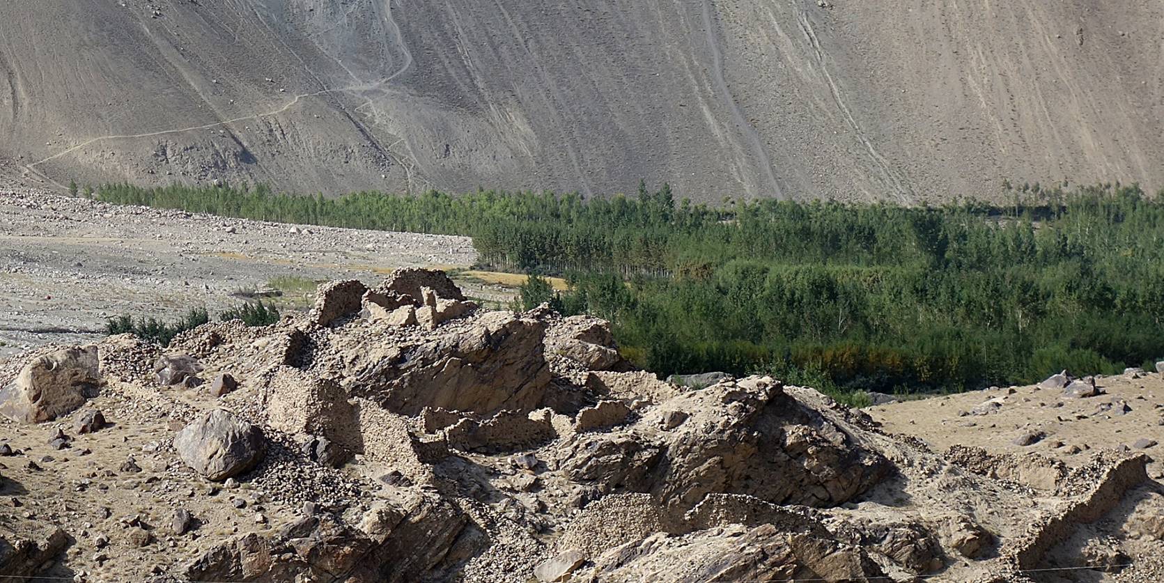
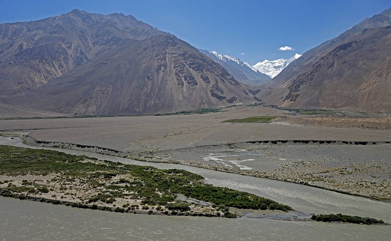
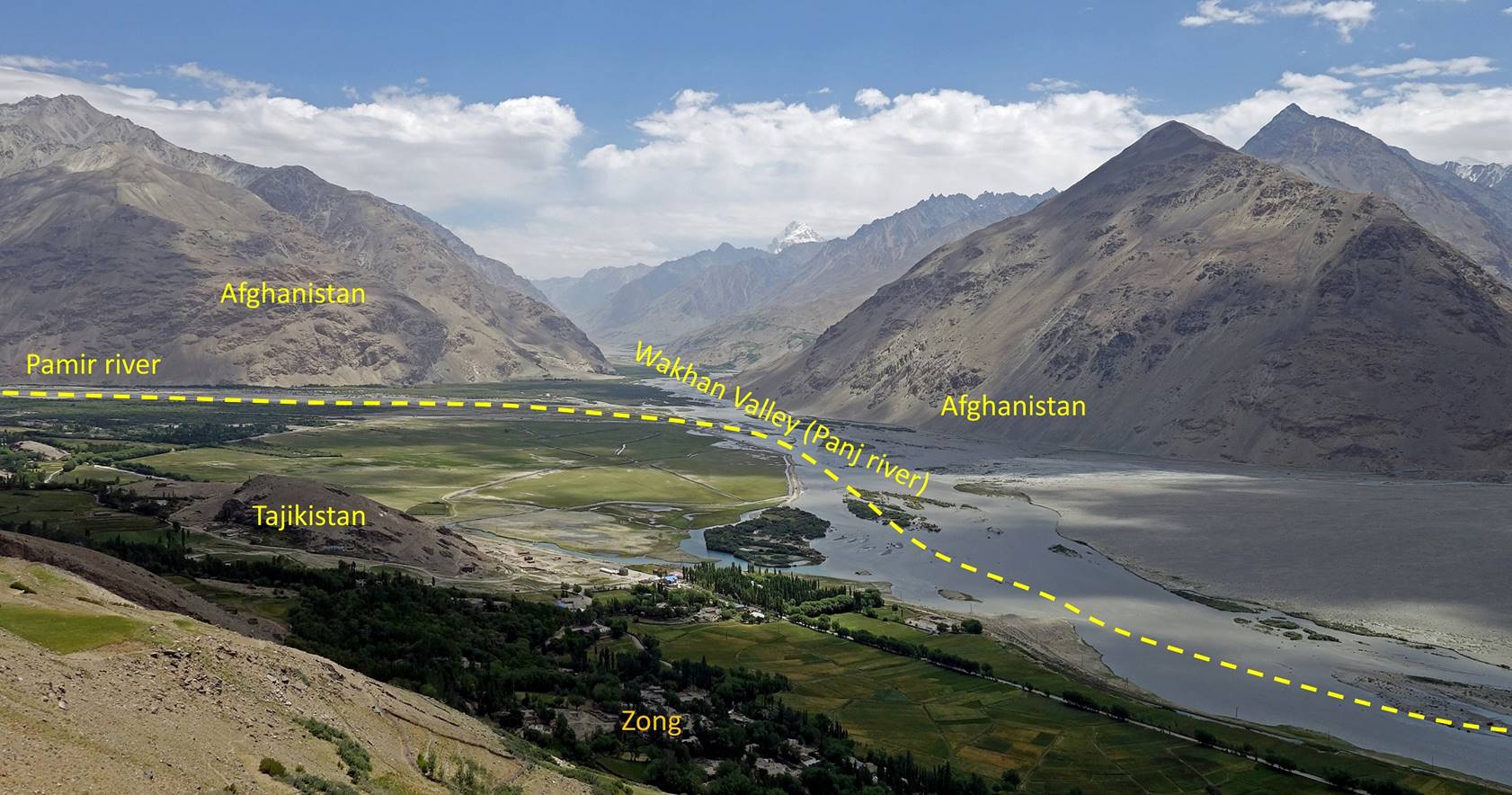
The above photo (reproduced and
annotated below) shows the confluence of the Pamir and Panj
rivers, which marks the end of the Tajik part of the Wakhan
valley. From there the Wakhan valley extends further
toward the east, entirely into Afghan territory. The dashed yellow line
represents approximately the border between Tajikistan and Afghanistan.
Mazor (shrine) Shoh
Kambar-I Oftob in Langar. The name, which means ″Master of the Sun″,
suggests that it was revered in pre-Islamic time (source: ″Tajikistan and
the High Pamirs″, by Robert Middleton and Huw
Thomas).
|
|
|
|
|
|

View of the Pamir river
from the road to the village of Ratm.
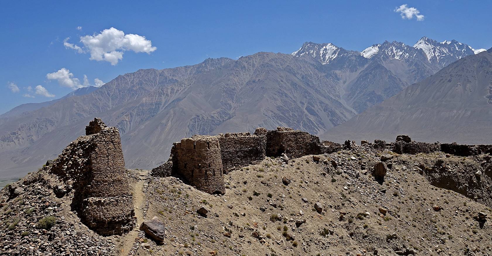
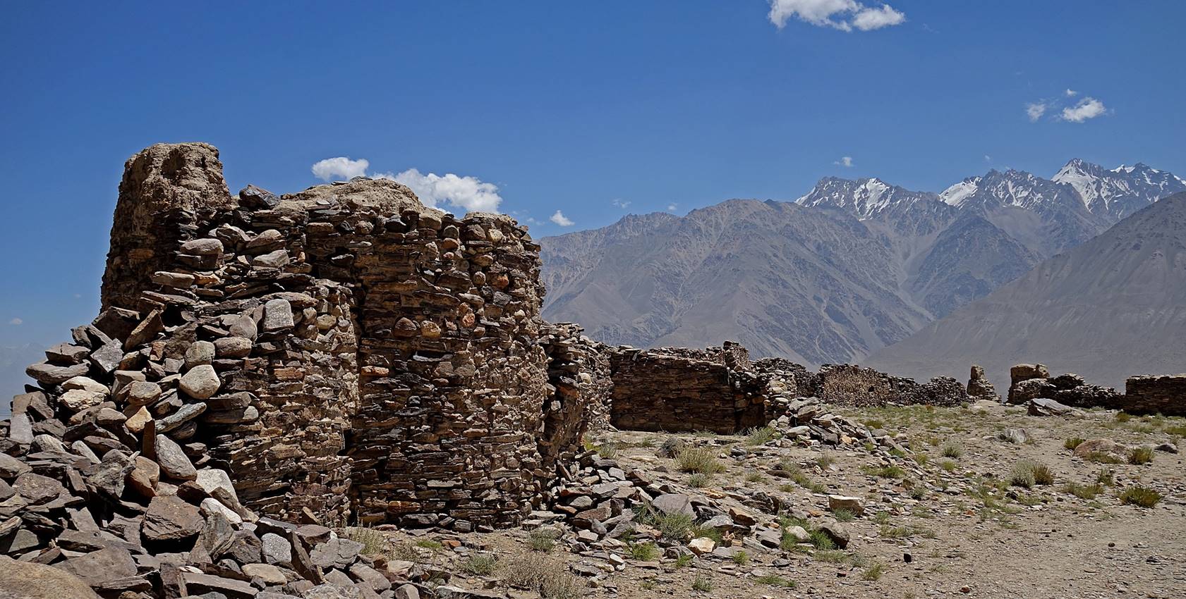
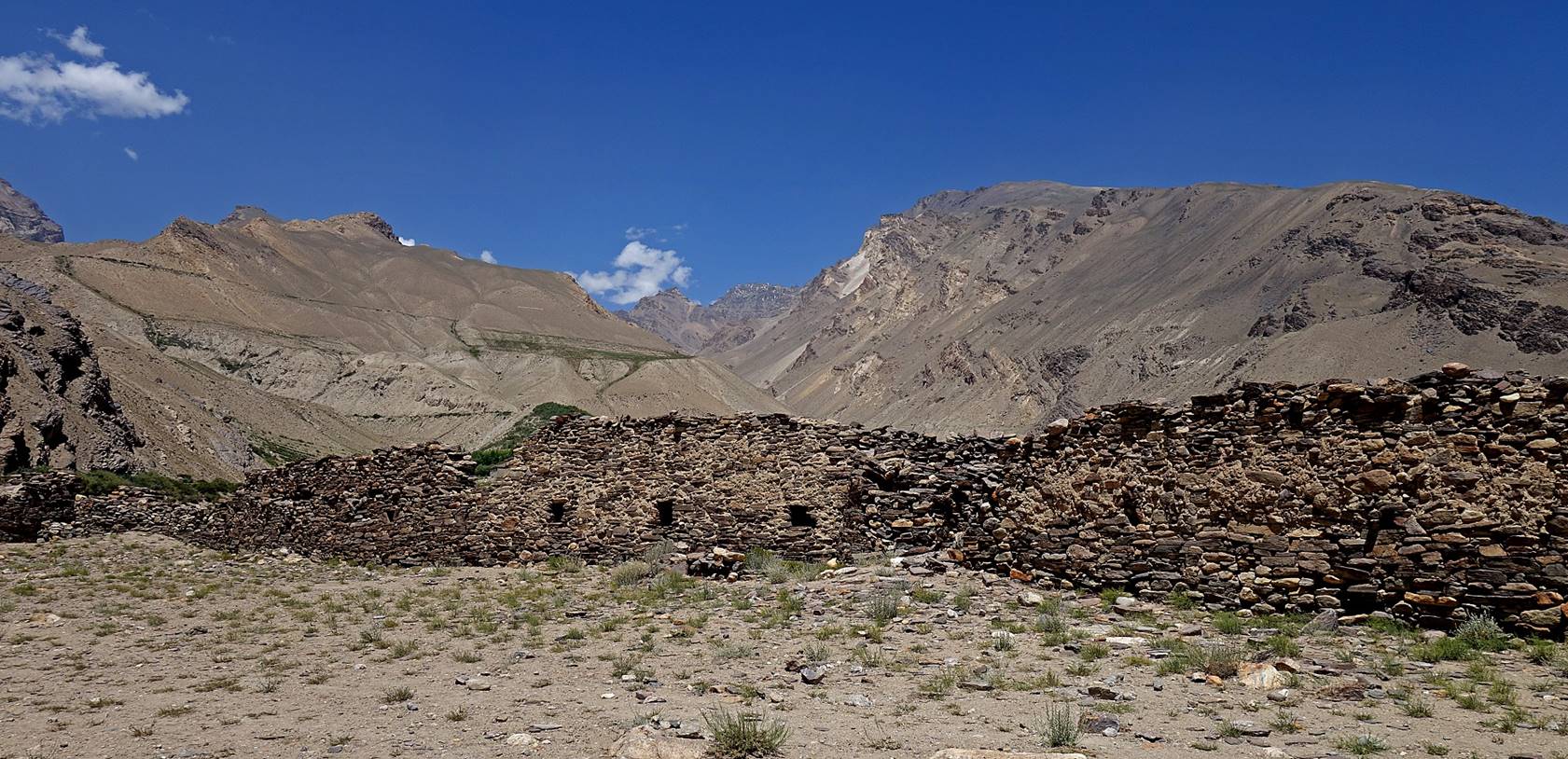
Ratm fortress (2nd-3rd century BC, Kushan empire). It may have been used
in the 8th century AD by Korean-Chinese General Kao Hsien-chih
to attack the Tibetans and oust them from the Pamir (source: ″Tajikistan
and the High Pamirs″, by Robert Middleton and Huw
Thomas).
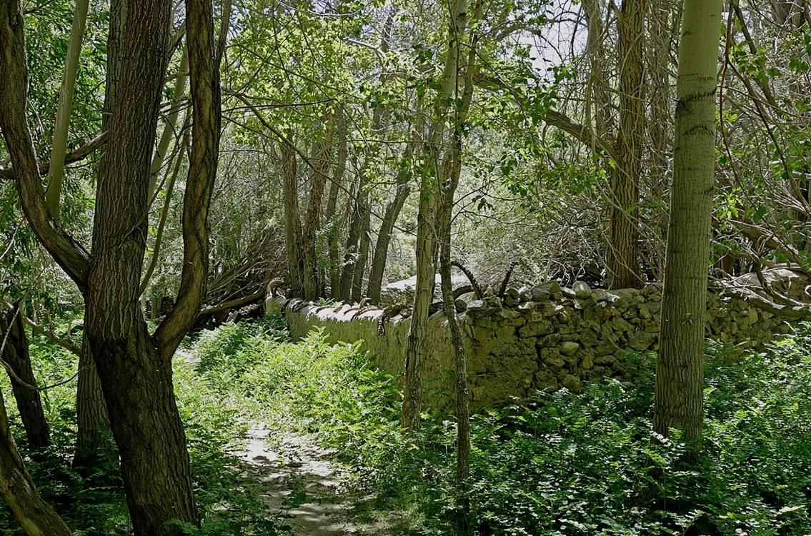
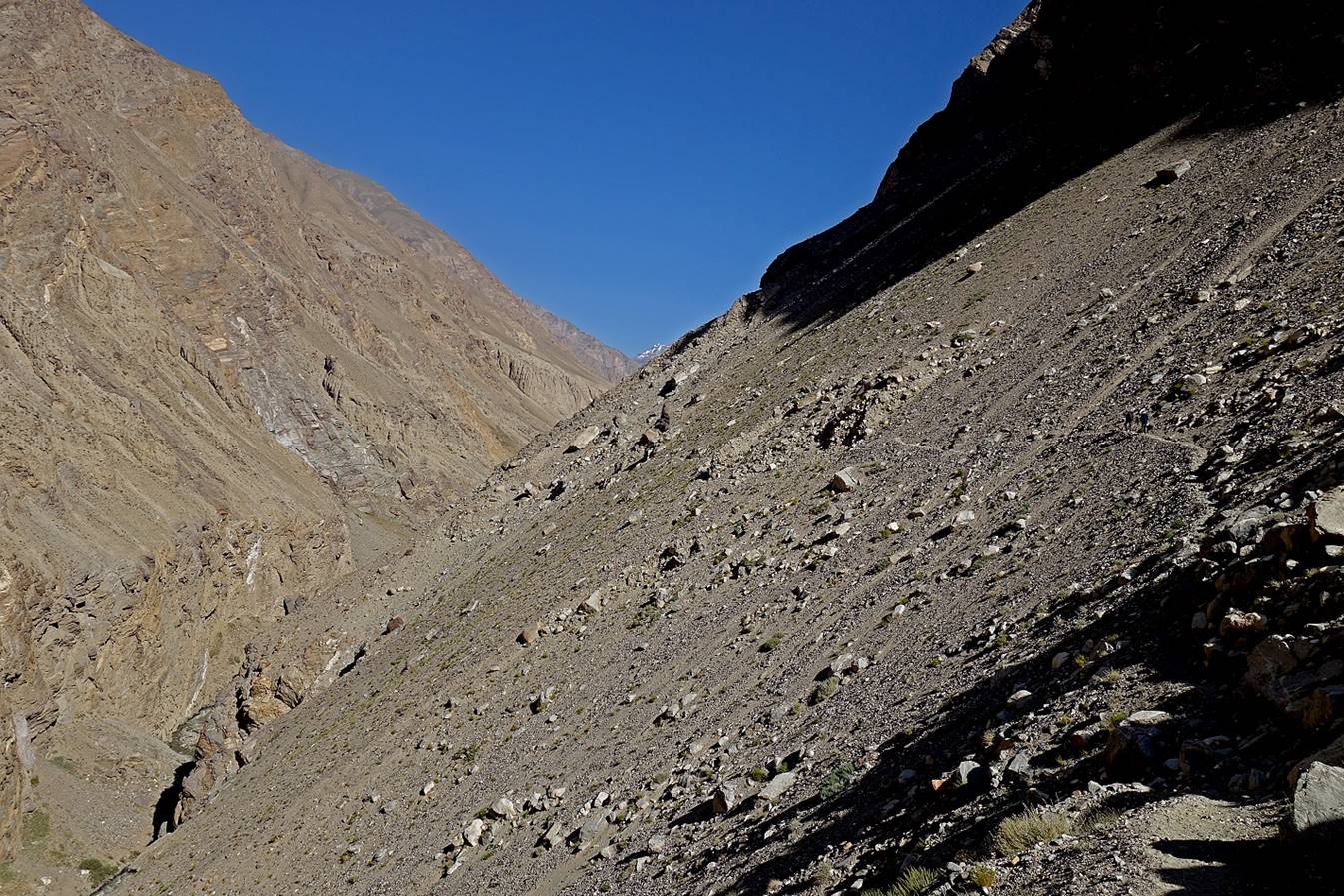
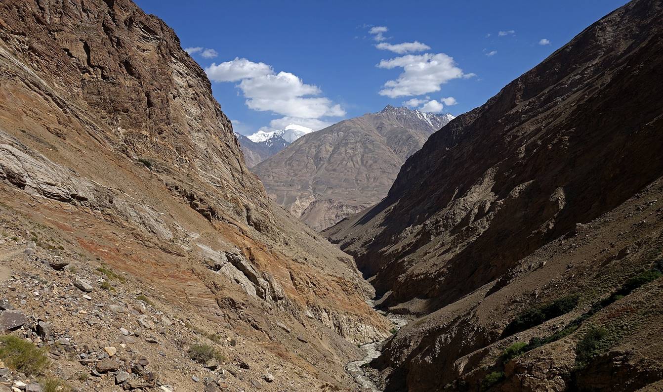
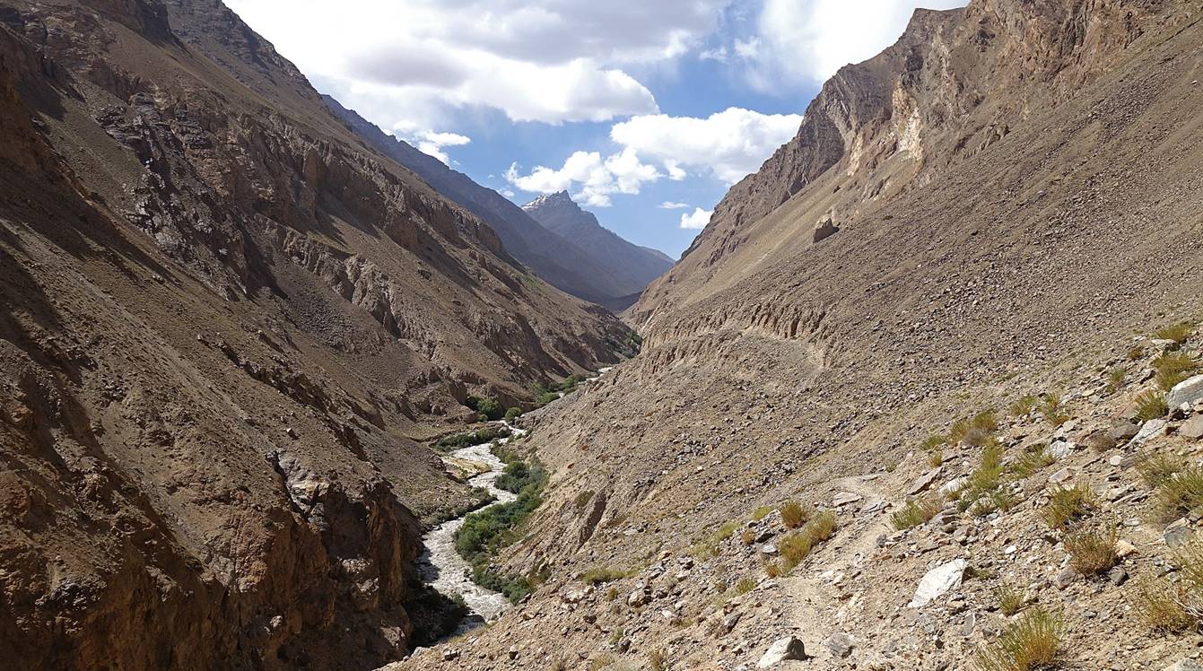
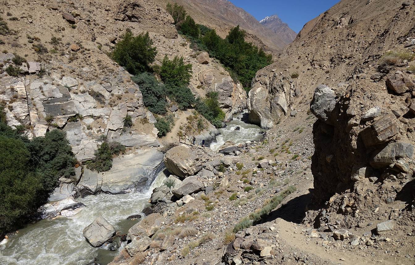
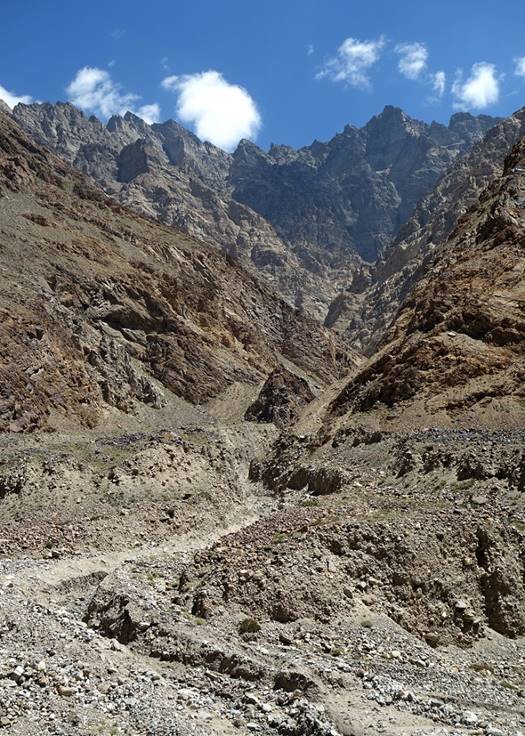
Day hike in the Darshai valley (Darshaidara):
View toward the south over the narrow
canyon of the Darshai river
soon after leaving Darshai village, with Hindukush
mountains in the background.
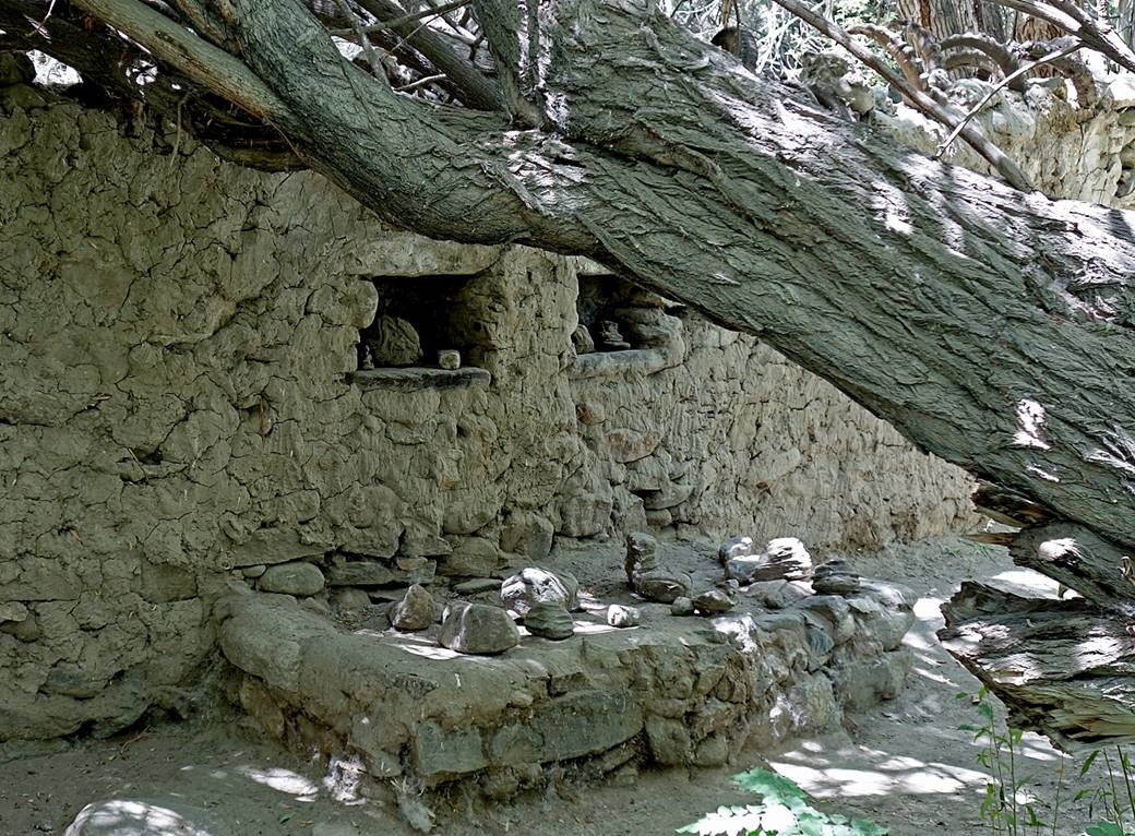
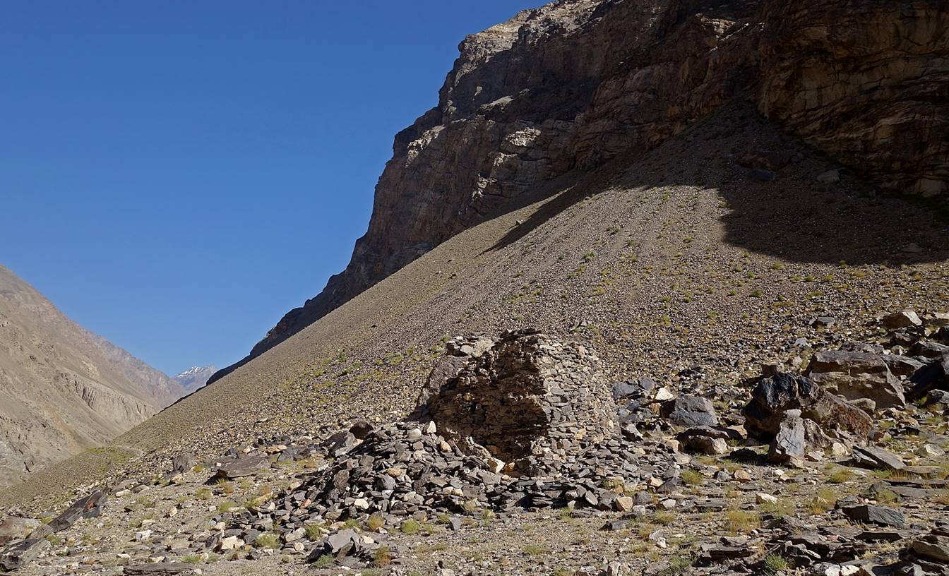
Ruins of an old
watchtower reached 30min after leaving Darshai village. This tower was probably
used in conjunction with the Darshai fortress (6th-9th century).
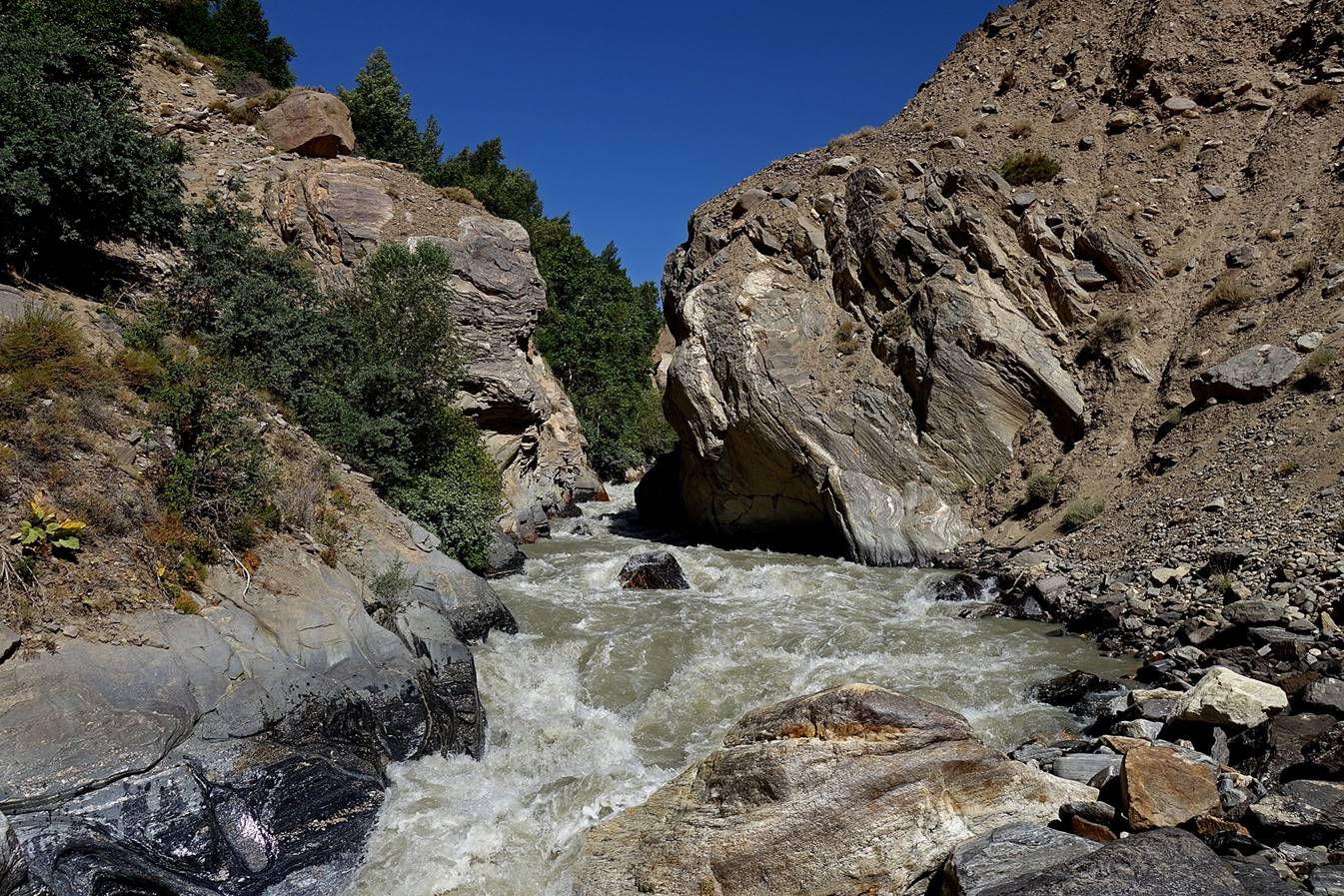
Further up in the narrow valley.


Portion of the trail literally hanging
to a rock face. Note the iron stakes and the cables supporting the trail
(clearly visible in the 3rd and 4th photos below).
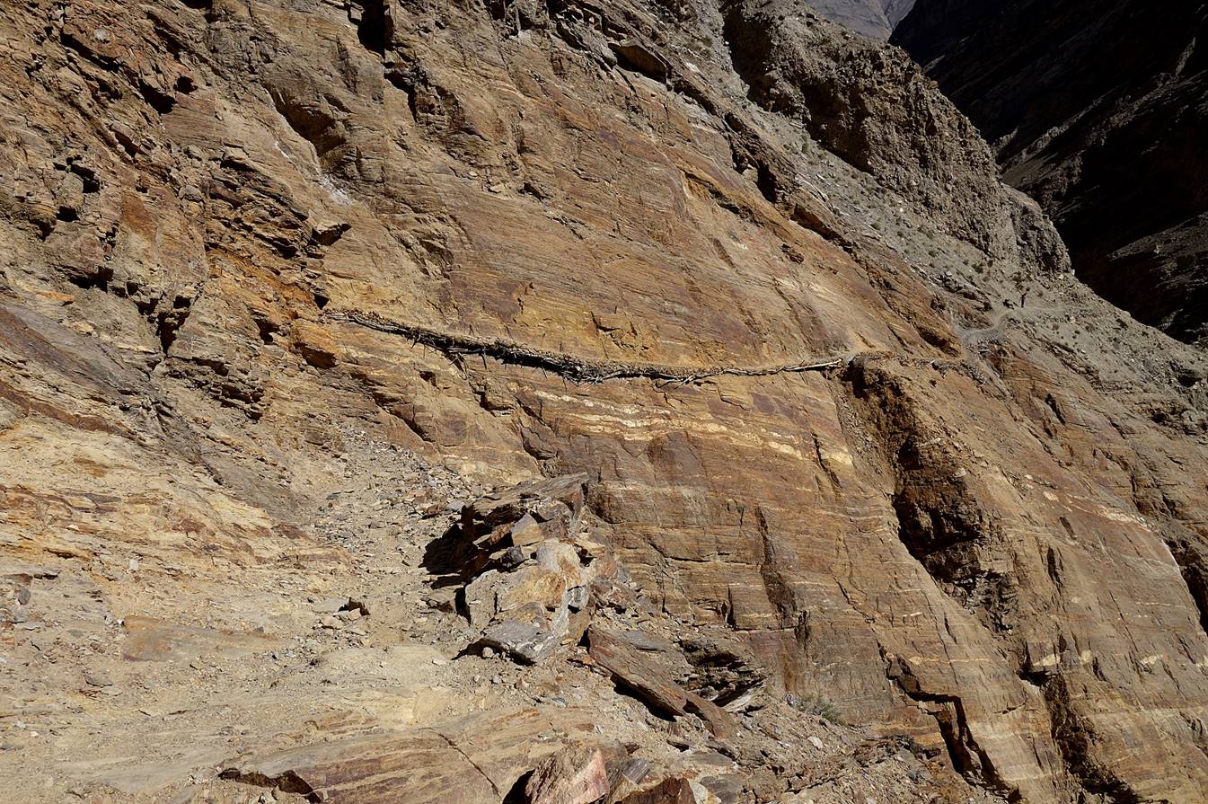
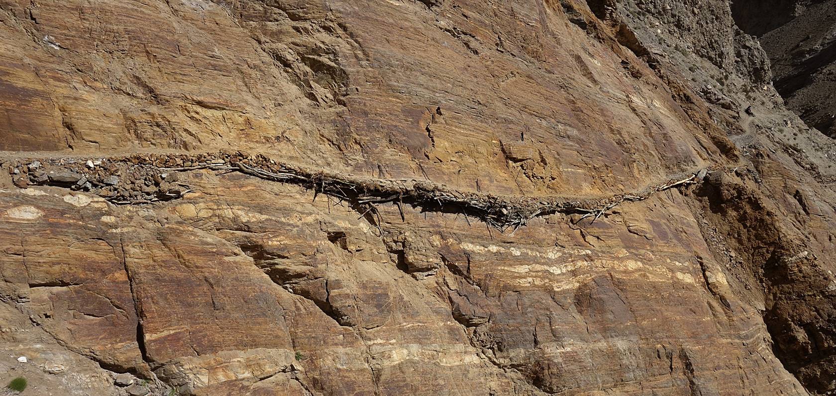
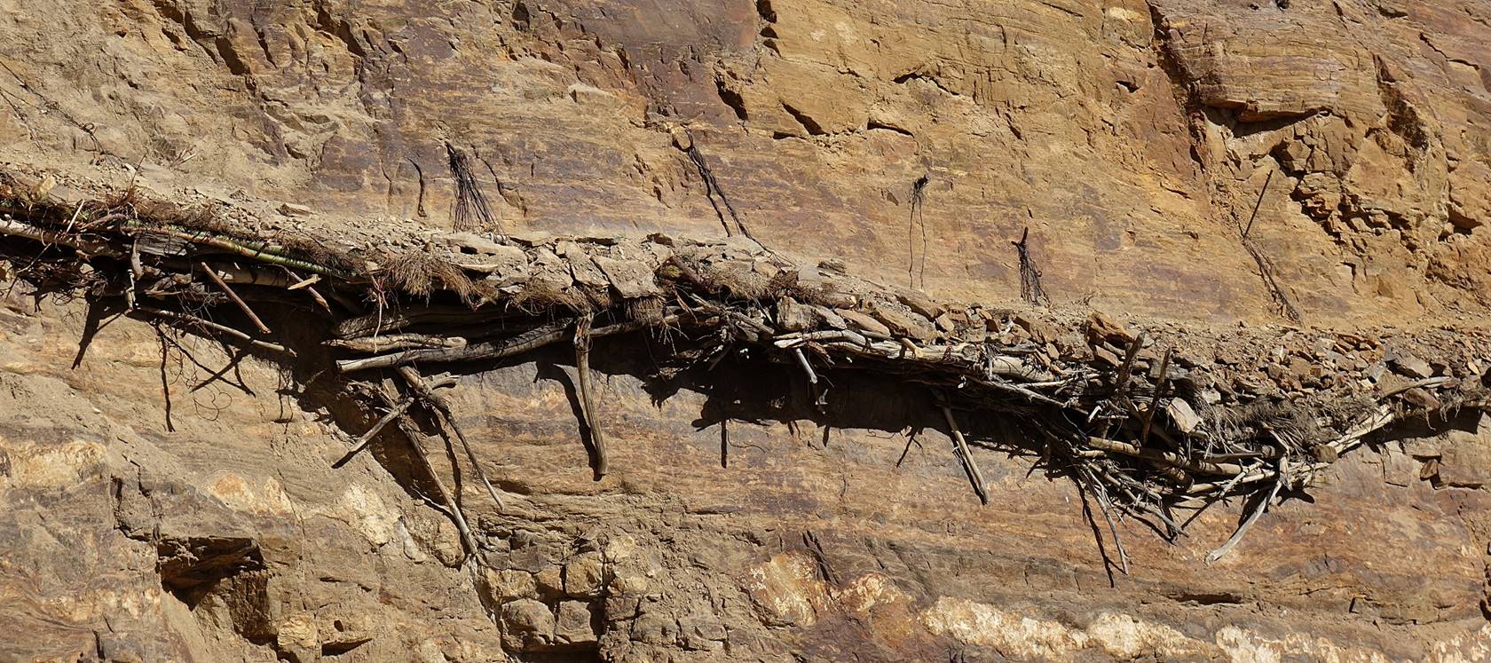
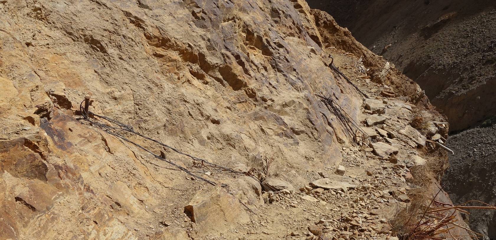
Further up.
Small hot spring.
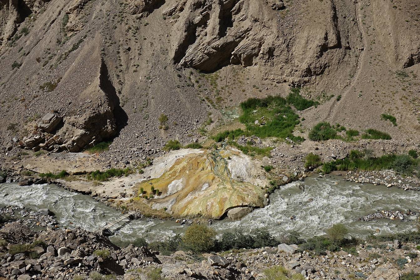
Crossing the Darshai
river.
More views higher up.
|
|
|

Place where we decided to turn back and
return to Darshai village (about 4h from the
village).
![]()
Back
to main Tajikistan 2017 webpage